Leaving Sturgeon Bay, we headed up the Green Bay side of the peninsula on County Highway B, which later merges into County G and takes you into Egg Harbor. It’s a pleasant, two-lane highway, with bayside property on one side, mostly waterfront houses, and less-developed land – sometimes rising bluffs – on the other. All of it was lush. It’s been a rainy year in Wisconsin, too. I was expecting more traffic, this being the high season in Door, but most of the time no one was visible ahead or behind.
Until we got to Egg Harbor, that is. It might be quaint not to have any streetlights in your town, but Egg Harbor needs one at the juncture of County G and Wisconsin 42, the main road through town. The town seemed to be even more touristed than Sturgeon Bay, but with less space to put people. I asked if anyone wanted to get out and look around, but no one did, citing the early-afternoon heat.
We pressed on across the peninsula, via County Highway E, which passes mostly through farmland. The road also comes within sight of Kangaroo Lake, the peninsula’s largest inland lake. Kangaroo? I wondered. That’s the kind of name that makes me wonder. Maybe one of the pioneers of Door County imported kangaroos to see if they could be raised for meat. That failed, but some escaped, and their descendents live around the lake. They’re wily and hard to spot, in case you were wondering.
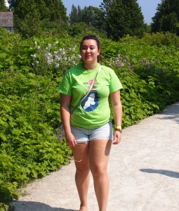
 On the Lake Michigan side of the peninsula, we made a return visit to the Cana Island lighthouse. Most of us were back, anyway. Ann didn’t exist the last time we were there, almost exactly 12 years ago. Lilly of course didn’t remember being there, but in 2001, I took her picture wandering down the path to the lighthouse.
 So I decided to do the same this time around, in roughly the same place along the path leading to the light. As I occasionally tell people I meet with small children, if you keep feeding them, they get bigger.
The grounds and the light are pretty much as I remember them. In his remarkable web site specializing on lighthouses of the western Great Lakes, Terry Pepper writes of the lighthouse: “Cana Island is somewhat a misnomer, since it is only an island when the lake levels are high. The majority of the time, there is an exposed rocky sinew of land which connects to the mainland.
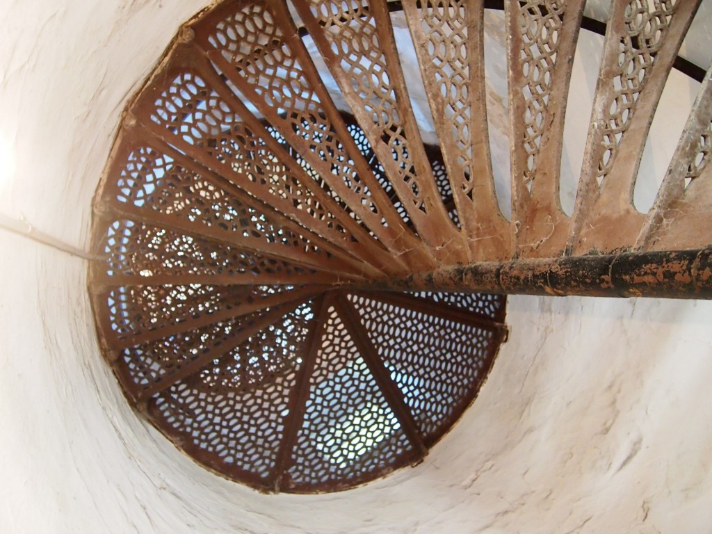
“Congress appropriated funds for construction the spring of 1869 and a crew immediately undertook the task of clearing a three-acre station site. Leveling a rock foundation, a buff-colored cream city brick tower began to take shape. Eighteen feet in diameter at the base, the tower rose 65 feet, gently tapering to a diameter of 16 feet at its uppermost… Spiraling within the tower is a gracefully spiraling set of cast iron stairs, with 102 stairs.
“The cast-iron lantern atop the tower was likely prefabricated at the Milwaukee Lighthouse Depot and transported to the site by Lighthouse tender. Equipped with a Third Order Fresnel lens with the focal center of the lens situated approximately 75 feet above the tower bottom, the lens boasted a focal plane of 82 feet above mean lake level.” (Visible for 16 miles, according to the docent, and lighting the waters near Door to this day.)
Ann wanted to climb to the top of the tower, which was open by extra admission. The top was accessible via the aforementioned 102 steps.
 Her mother and sister didn’t want to go up, so I went with her. Before we went, and even after we’d climbed to the top, I was certain that we hadn’t gone up last time, probably because it was closed. But now I’m not so sure. You’d think I’d remember climbing a spiral of narrow cast-iron steps and taking in a sweeping view of the greens of the peninsula and the blues of Lake Michigan, with a constant wind blowing in my face, but maybe not. Memory’s a trickster.