When planning our recent trip to scenic corners of the Southwest, I determined that we were going to make the move from Page, Arizona, to Moab, Utah, on May 18 by way of Monument Valley. I figured the mid- and late afternoon would be given over to the drive out from Monument Valley.
The most direct route to Moab from there is U.S. 163 through Mexican Hat, Utah, then on to U.S. 191 north through Blanding, Monticello and La Sal Junction, all Utah towns. Of course I examined some road maps as part of the process. (Doesn’t everybody? No? How is that possible?)
I spied an alternate route. Just after Mexican Hat, take Utah 261 north to Utah 95, then west a few miles to Natural Bridges National Monument as a possible stopover. I didn’t know anything about that national monument; there are so many. One hundred twenty-nine in fact, of which I’ve only visited a mere 20 or so, counting those on this trip.
A quick look at the park service map of the monument on line told me that is isn’t very large, and a single road loops through it with places to stop. Perfect for a short visit, I decided, before heading on to Moab. We might be a little more tired when we got to Moab, but it would be worth it. I was right.
I didn’t look into Utah 261 any further. On the Rand McNally road atlas, the small label Moki Dugway is next to the road, with a small arrow pointing from that name to about the mid-point of the road. I don’t remember noticing that. Later, I would. Michelin doesn’t mention the dugway at all.
So we set out from Monument Valley, stopping for a moment roughly where Forrest Gump stopped, but otherwise pushing on through. I expected more at Mexican Hat, which seemed to be a hotel or two overlooking the San Juan River plus a few other buildings. North of Mexican Hat, Utah 261 is an ordinary if remote two-lane highway through the desert. Dead ahead are the cliffs of a plateau, but it’s still off in the distance.
Before long, signs warn drivers that the road ahead will be unpaved for a few miles. No problem unless it’s raining, when reportedly unpaved desert roads gum up even four-wheel drives. It looks like it hasn’t rained here in a while.
The plateau grows closer, filling more of the windshield, and another warning sign about the unpaved segment whizzes by. I found myself thinking: does this road go around the plateau? It’s hard to see its course ahead. The road just seems to vanish into the steep cliffs of the plateau.
The next warning signs announce the road grade ahead: 10%. Also, they mention switchbacks on a narrow gravel road. By this time, you’re in the shadow of the cliffs, and realize the road goes up the side.
“Utah 261 is part of the Trail of Ancients, a National Scenic Byway that stretches across 480 miles through Colorado and Utah,” says Road Travel America. “The highway connects Utah Highway 95 with US Highway 163 by crossing Cedar Mesa and plunging down the dugway at an 10% grade, revealing sweeping views of Valley of the Gods, stripes of color in the rocks of the San Juan River Canyon known as the Navajo Tapestry, and distant Monument Valley.”
Up we went. The climb is about 1,200 feet. The road curves as much as you expect, enough to lose count of the switchbacks, all the while kicking up a little sand and gravel in your wake. There aren’t any rails, though usually there’s a rise in the ground at the edge of the cliff, so it would take more than a casual slip of the wheel to take a plunge. Or would it?
It wasn’t really a hard drive, and I didn’t think it was that dangerous, since I was going only fast enough to outpace the pull of gravity. Of course I had to hyper-focus: every instant on the road ahead, though peripherally I caught twisting and turning glimpses of the sky and the increasingly distant valley below.
I enjoyed the drive. It had a rare intensity. Yuriko was less enthusiastic, there in the passenger seat, where eyes can linger on the increasingly high drops.
Only twice did we encounter vehicles coming the other way, down, and while narrow, the road was wide enough to pass them without stopping. The state of Utah recommends that only vehicles less than 28 feet in length and 10,000 pounds in weight attempt to drive the dugway, which seems reasonable to me, and which I’m sure is routinely ignored.
“Moki is derived from the Spanish word, Moqui, a general term used by explorers in this region to describe Pueblo Indians they encountered as well as the vanished Anasazi culture,” Road Travel America explains. “Dugways are roads chiseled into steep slopes.”
Turns out that the Moki Dugway is a relic of the early atomic age, created in 1958 for trucks to haul uranium ore from the Happy Jack Mine on Cedar Mesa to the mill in Halchita, near Mexican Hat, which left a radioactive legacy of its own.
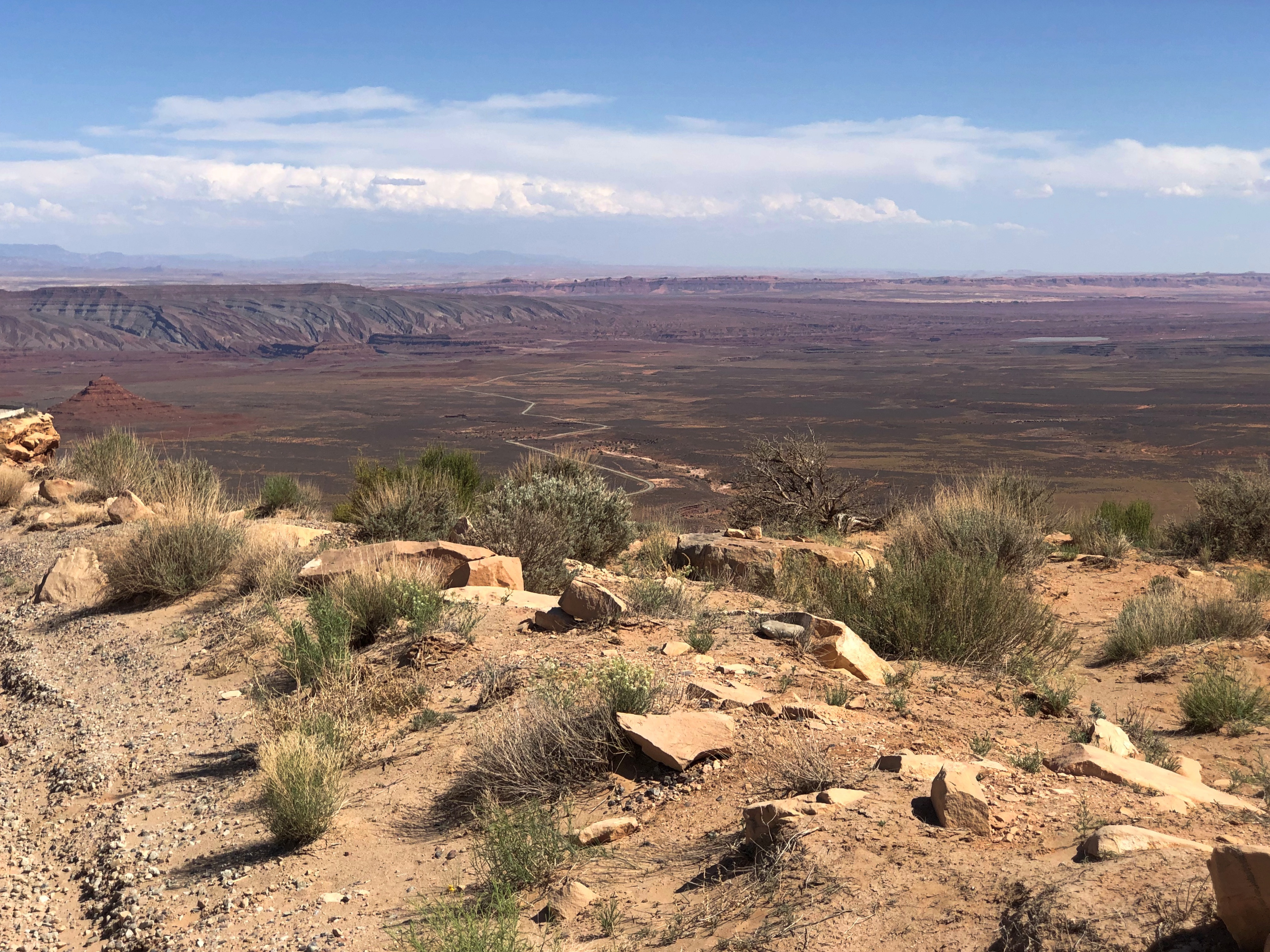
I’d learn about all that later. Of course we made it to the top. The road turned back into an ordinary two-lane blacktop. I paused to take a few pictures of the valley below. Note the lower paved level of Utah 261, snaking toward the cliffs.
Valley of the Gods, eh? Angry, unforgiving gods lording over a desolate realm, I’d say.