Fairly early on the morning of October 8, this sign got my attention.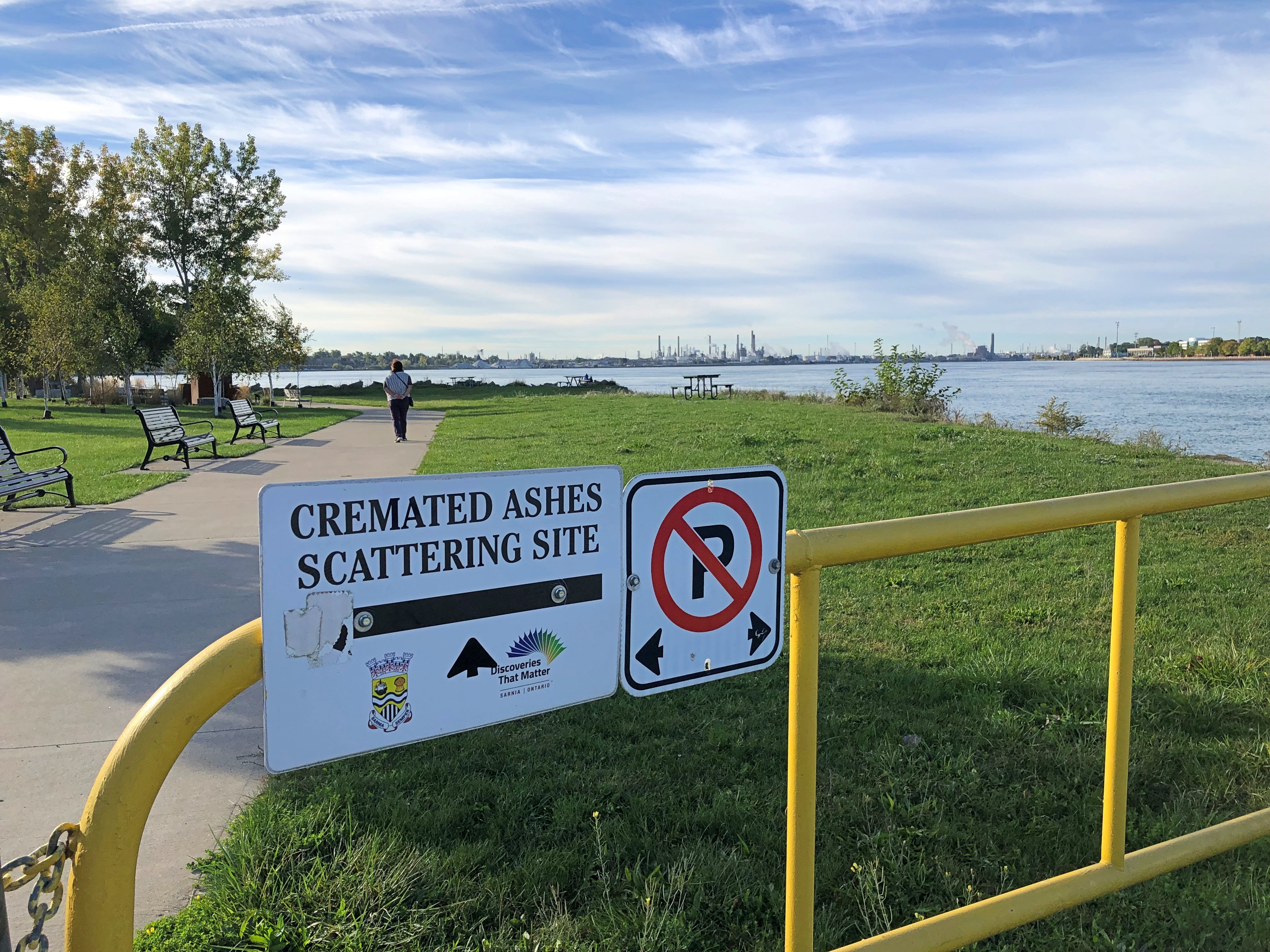
It’s hard to know whether that’s a gracious gesture on the part of the City of Sarnia, Ontario, or a mild example of Northern nanny state-ism — the difference between you’re welcome to scatter here vs. you can only scatter in permitted places. But it was also good to know that we had the option, if we happened to have any ashes with us.
For all I know, people are scattered here often, and it certainty would be harmless compared to a lot of chemicals that have gone into the St. Clair River around Sarnia over the years. After all, this the home of the Sarnia Blob, an example of industrial pollution so epic that it has its own name.
That morning, after a modest breakfast and checking out of our room only a few blocks away, we went to take a look at Point Lands, a Sarnia municipal park on the St. Clair. Beyond the cremation sign is a view of Port Huron, Michigan, U.S. industrial twin of the Canadian industrial town of Sarnia.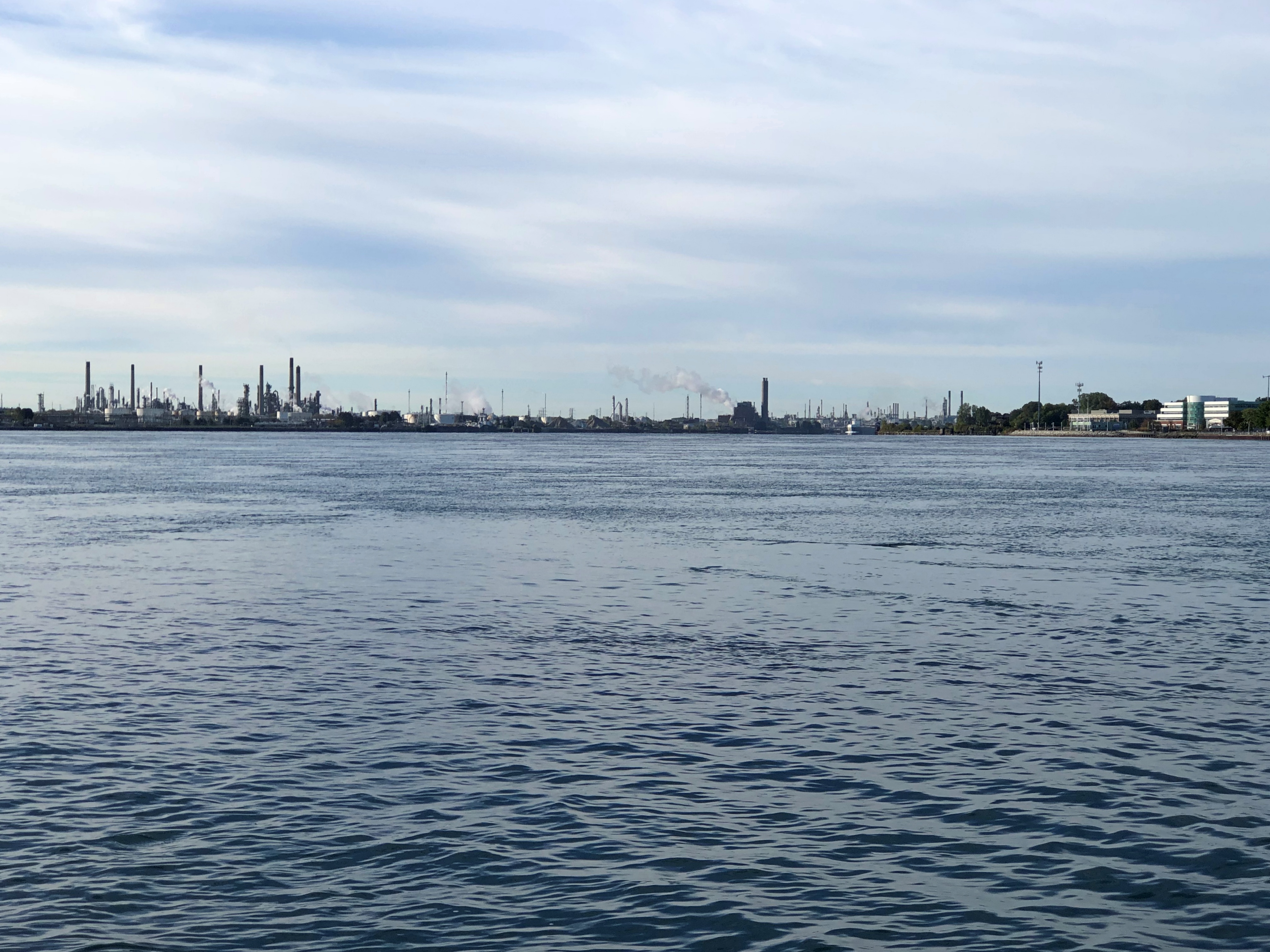
Almost 40 years ago, Dow Chemical managed to spill over 2,900 gallons of perchlorethylene, a dry-cleaning solvent, with more than 520 gallons of that oozing into the St. Clair. That combined with God knows what else to form a massive a tar blob. The river at this point is home to much of Canada’s chemical and petrochemical industry, and let’s say the attitude about chemicals in the water in most decades of the 20th century was a mite lax.
The dark mass settled, submerged on the riverbed. Before long it was found by divers, and eventually its high toxicity became a major environmental news story. Something like the burning of the Cuyahoga River, though with Canadian reserve compared to the brashness of the American fire. They say since then the St. Clair, like the Cuyahoga, has been remediated, but I’m not taking a dip.
If word of the chemical waste blob got to me in far-off Nashville in 1985, I’ve long forgotten. Later Dow Chemical bugged out of Sarna, but not before commissioning a model of the Great Lakes in concrete in this park.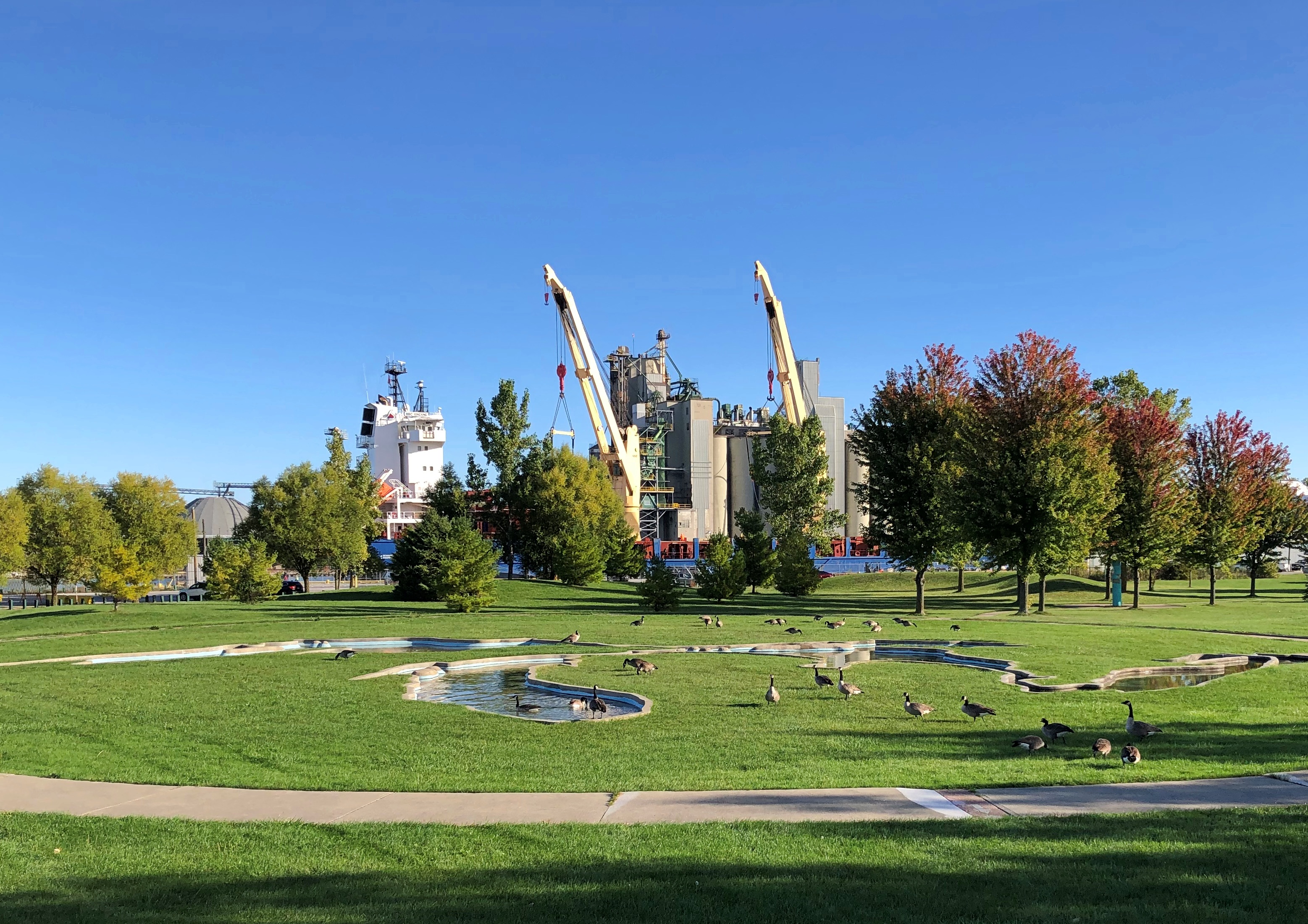
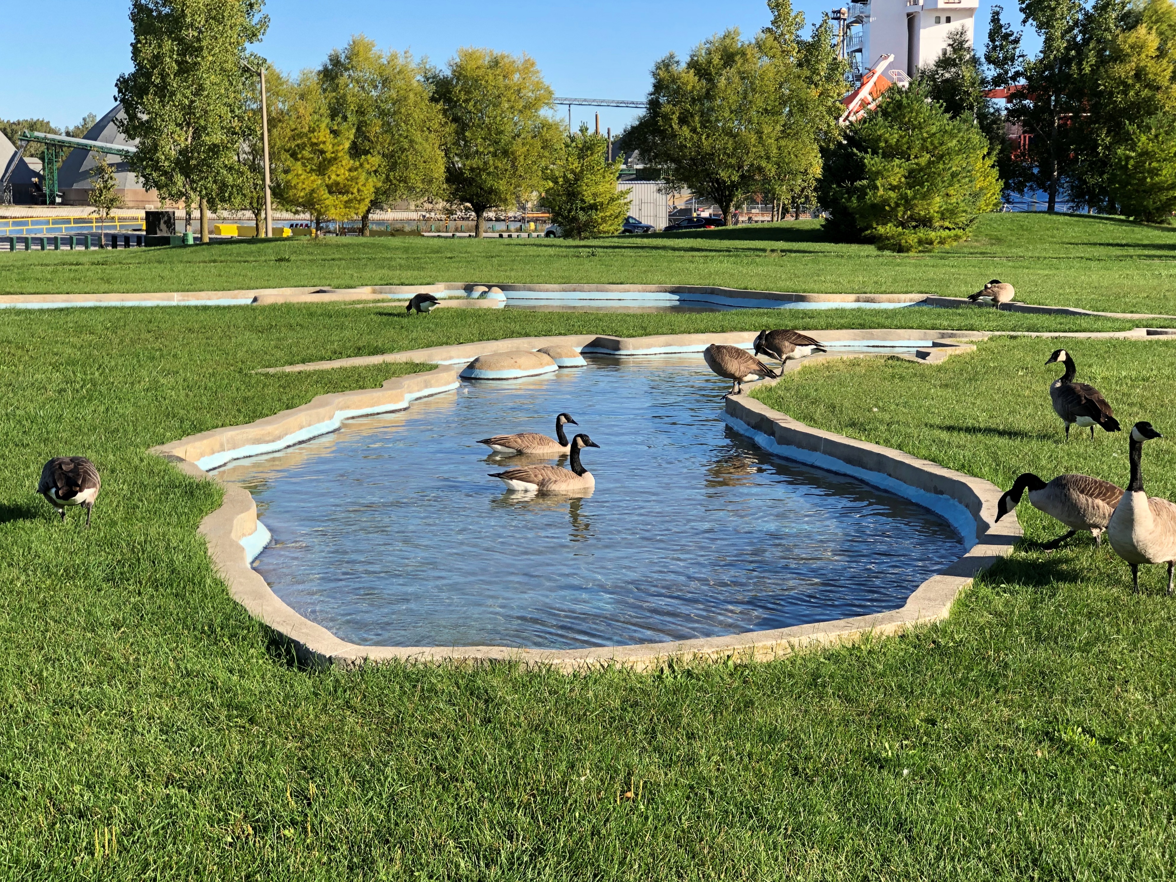
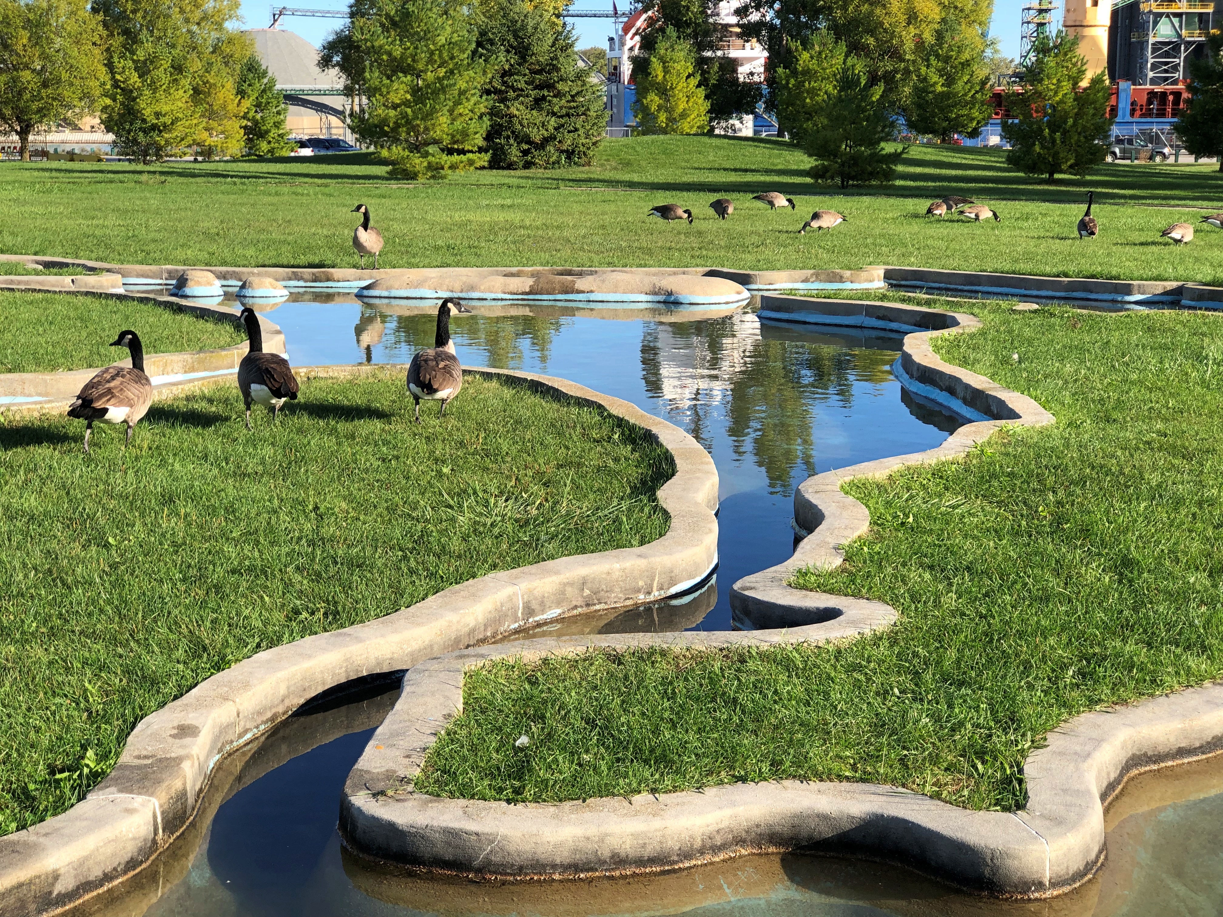
Including a model of Niagara Falls.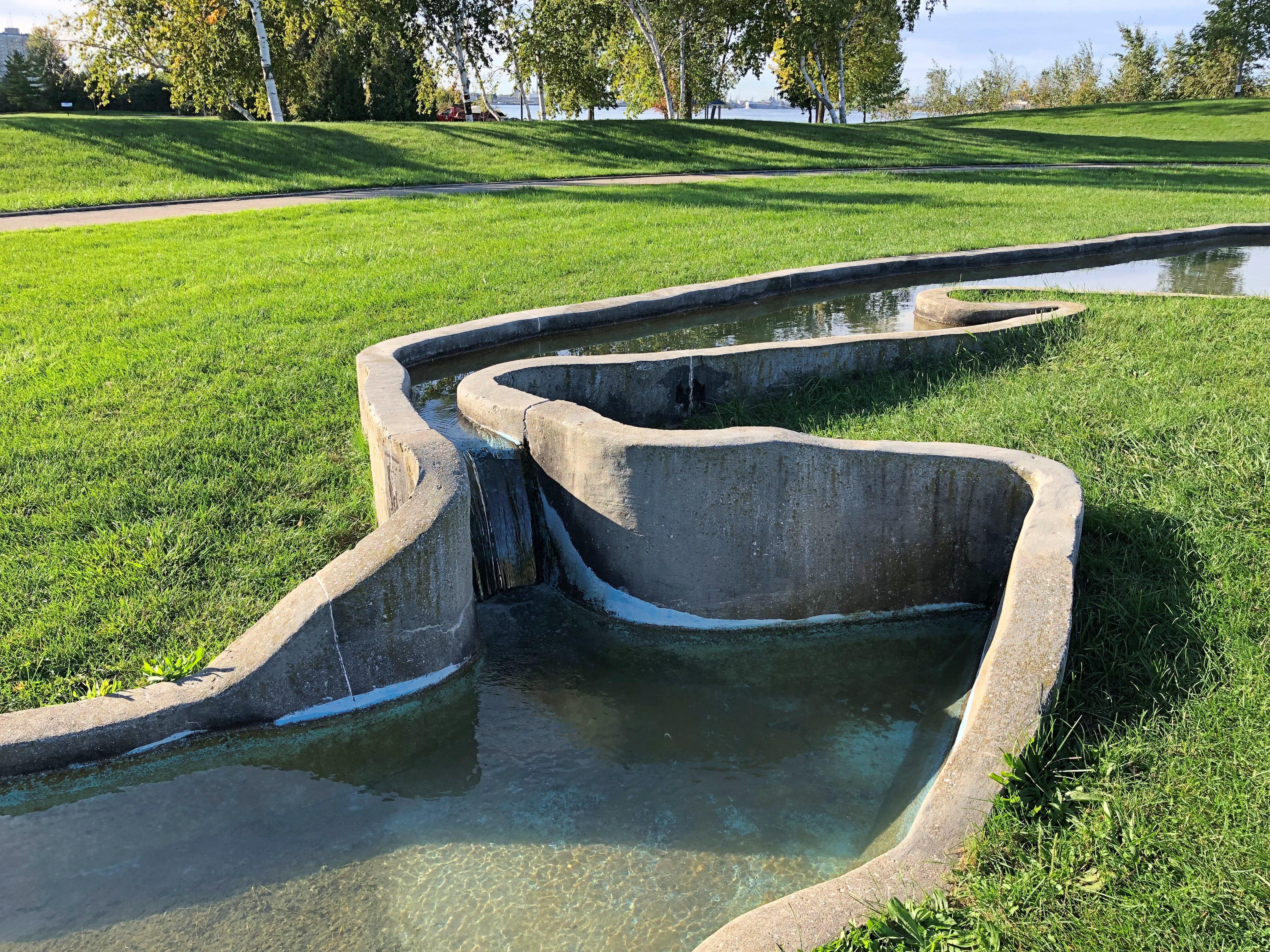
Up the coast from Sarnia, we bought gasoline from the Kettle & Stony Point Gas & Convenience, which I assume is owned and operated by members of the Kettle & Stony Point First Nation. It was a full-service gas station, with a fellow asking how much I wanted and then pumping it in (fill ‘er up). I couldn’t tell you the last time I ran across that, but it’s been decades. Also, its prices were about 10 cents a liter cheaper than other stations around there, making for an all-around good retail experience.
Near the station, the tribal water tower.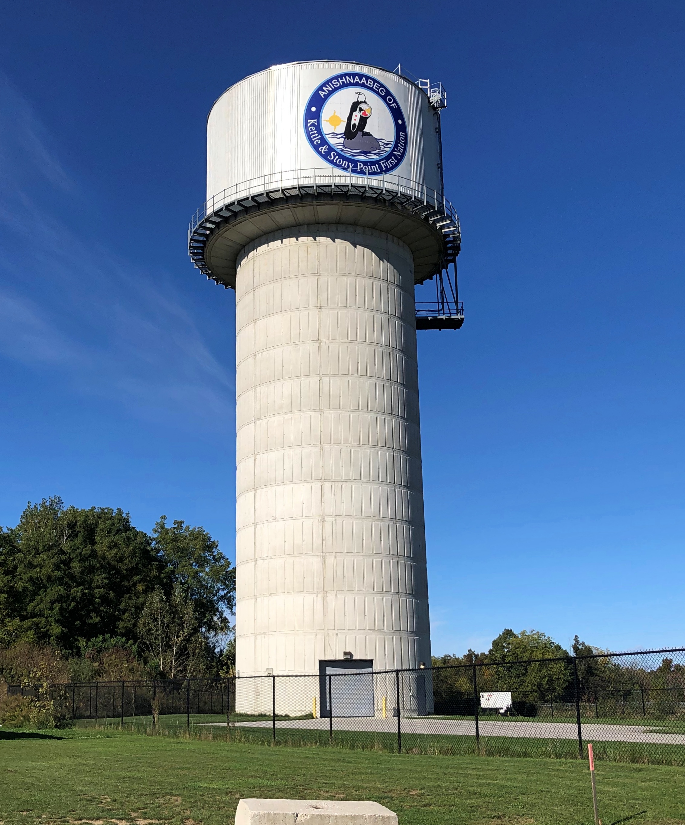
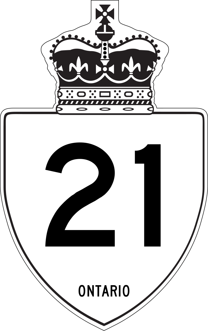 At this point we were traveling on highway King’s Highway 21 (Ontario 21, as far as I’m concerned), a two-lane blacktop that mostly follows the Lake Huron shore. On that shore is Pinery Provincial Park, a 6,260-acre stretch of beach and oak savanna. For us, it meant easy hiking in the forest and walking on the beach, so we spent a few hours there.
That kind of exercise inspired a quest for a latish lunch, which we found at the Out of the Blue Seafood Market in the town of Bayfield, feasting on Lake Huron whitefish fish & chips in the nondescript shop. The road food ideal: delicious, local, inexpensive and found completely by chance.
Ontario 21 was often a pleasant drive, though passing through well-populated areas meant slow going sometimes. The road wasn’t exactly crowded, but busy enough to be a little tiring. Only a little. Mostly we crossed farmland. Grain fields, the likes of barley, sorghum and oats, I understand, eventually gave way to cattle fields and woods and wetlands.
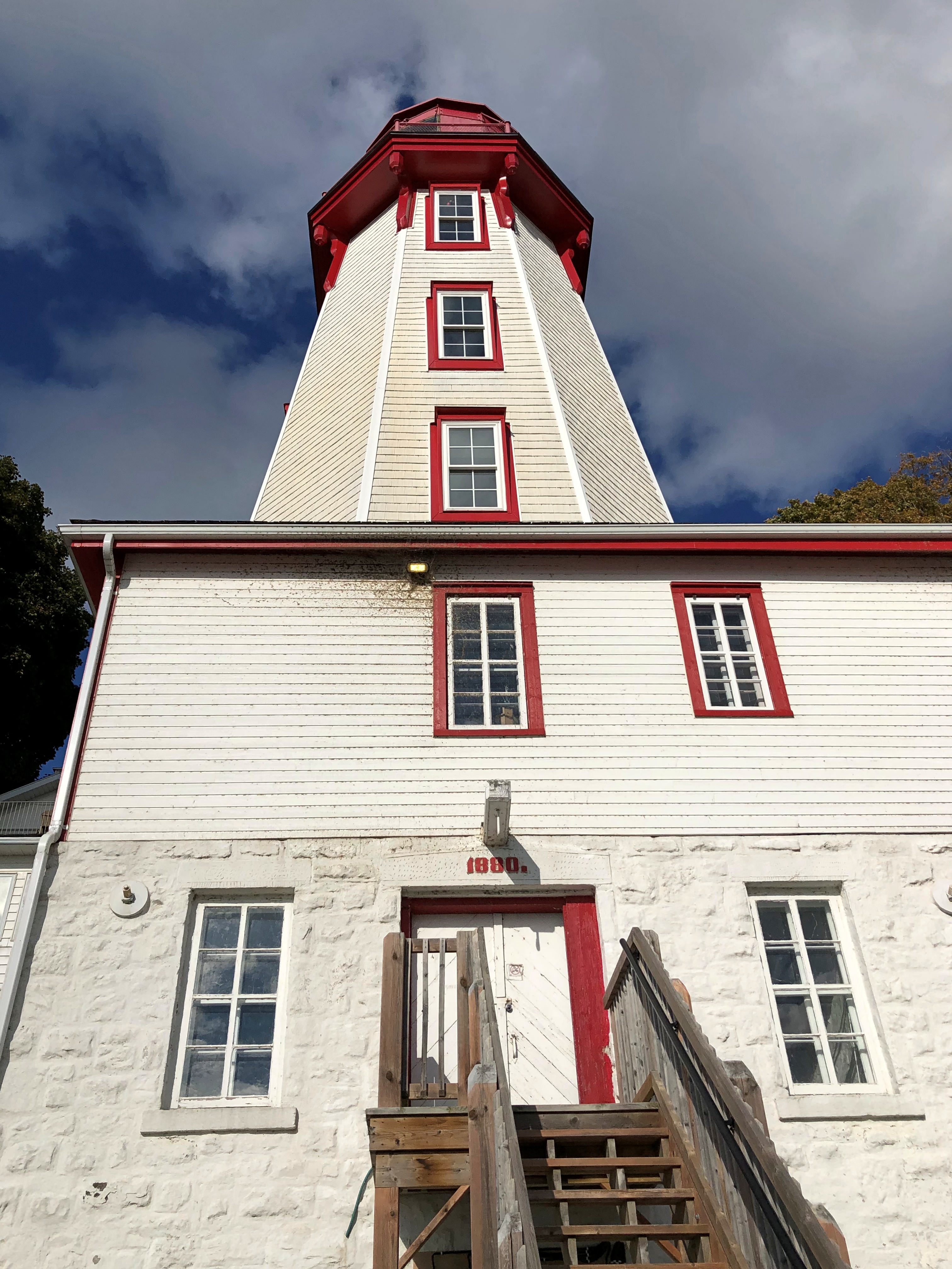
The wind had kicked into high gear by later in the afternoon, when we got to Kincardine. Formerly illuminating the harbor is a lighthouse, a late 19th-century creation.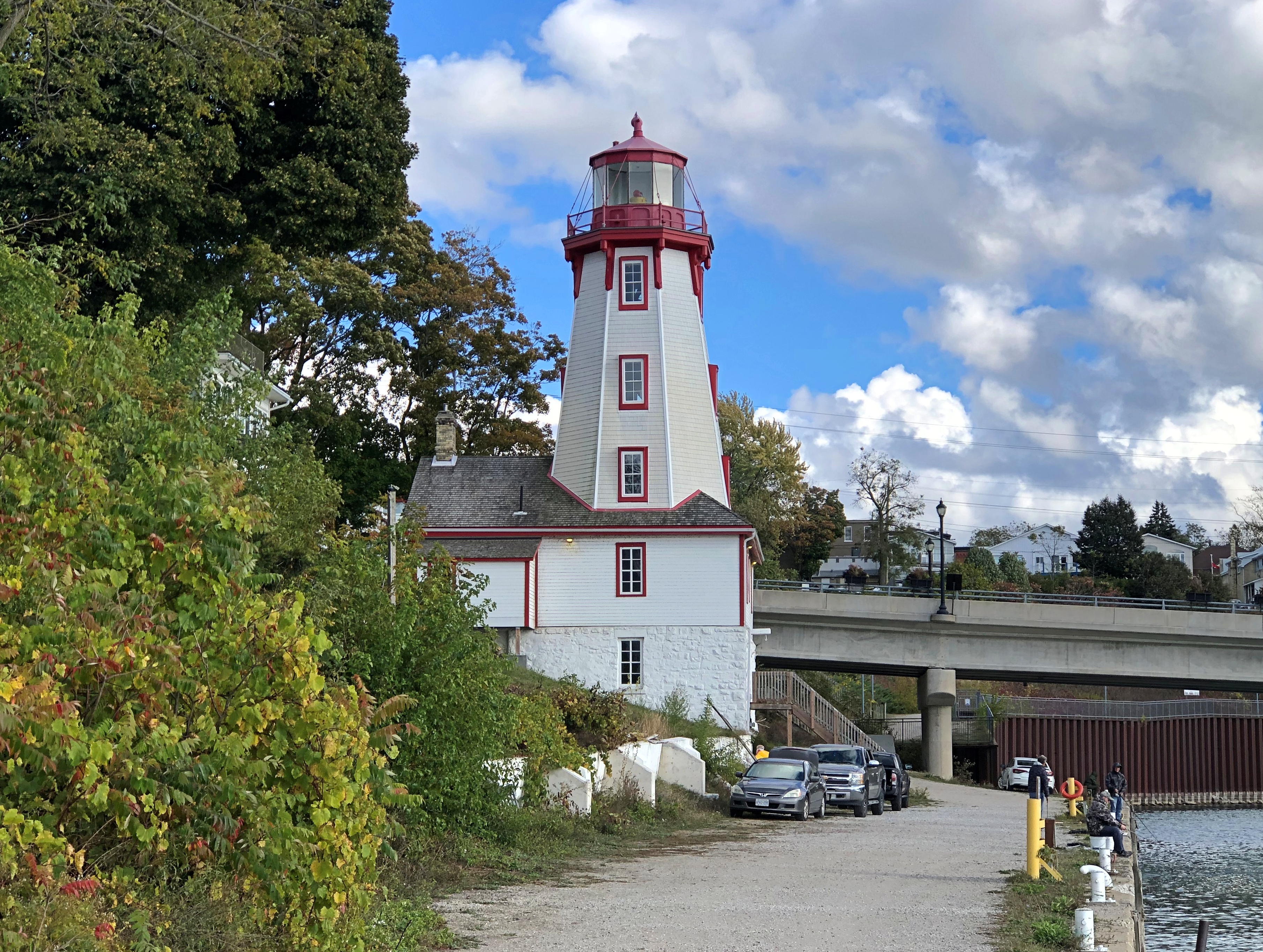
Another story I learned, facing the lake at Kincardine: one about a Canadian member of the First Special Service Force.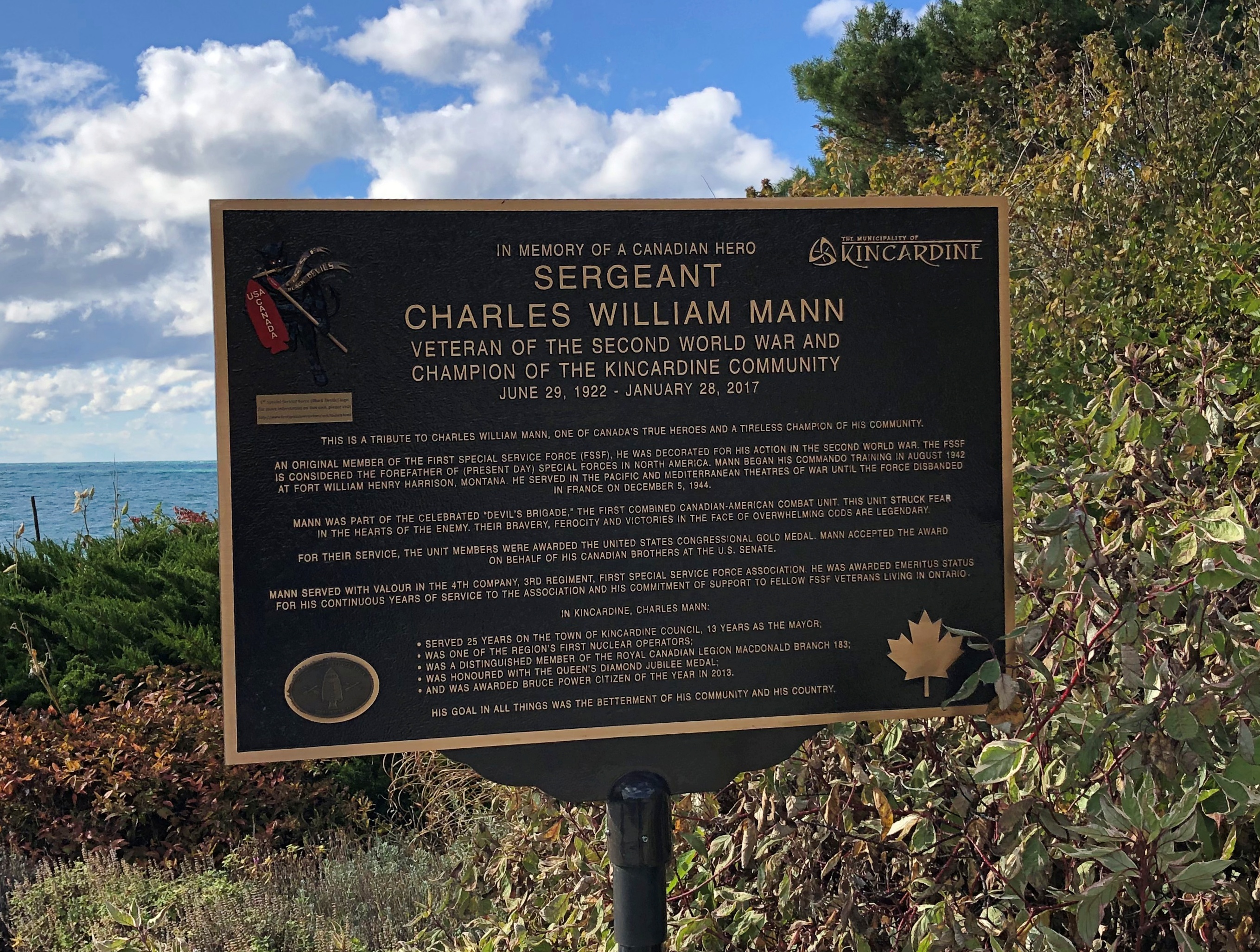

Later, we connected with Ontario 6, which is quite the road, and took it north on the Bruce Peninsula proper to Tobermony. Settlement got sparser and sparser the further north we went.
The northern section of Ontario 6 is connected to the southern section by a large ferry docking at Tobermory; we saw it loading the next morning, which naturally led to musings. On to Manitoulin Island? Up from there to connect on the mainland with the Trans-Canada Highway into Sault St. Marie?
Not this time. But you know how it goes: distant roads are calling me. Except that they’re not actually that distant.