Pacific Northwest Etc.

For once, I happened to be on the right side of the airplane when the pilot pointed something out. Namely, one of the massive forest fires burning on August 21 in the mountains of Washington state. It was an enormously tall, light gray cloud, reaching down toward the irregular ground below. If you looked carefully, you’d notice that very near the ground the cloud was tinged orange. I’d never seen the likes of it before.

Two days later, one of my ambitions on the road was to see Mount St. Helens, that storied volcano whose eruption captured the nation’s attention in the spring of 1980. No dice. When I got to the Mount St. Helens National Volcanic Monument visitors center, the ranger there told me that while I could drive to the lookout points, visibility was nil because of forest fire smoke.

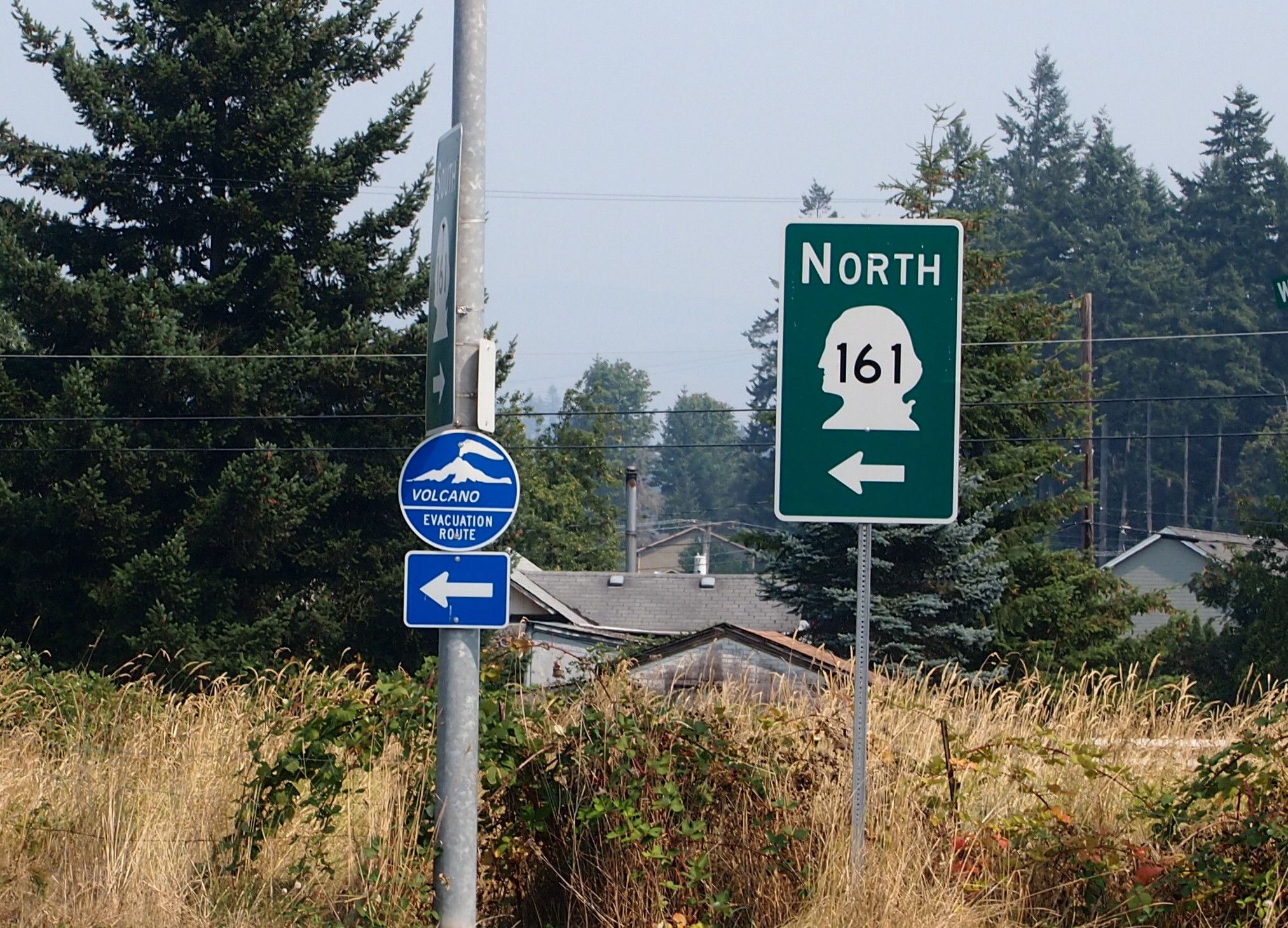
The only volcano I saw on this trip was on a sign not too far from the famed volcano.

Washington state, Aug 2015I consulted my map and picked out something else in the vicinity to see. That turned out to be Mossyrock Dam in Lewis County, Wash.

Mossyrock DamNote the haze in the background. That was everywhere in the distance that day. Mossyrock Dam dates from toward the end of the U.S. dam-building frenzy of the 20th century, being completed in 1968 (the frenzy has moved to China in our time). It dams the Cowlitz River, a tributary of the Columbia, and its main purpose is hydroelectric production. According to a number of sources, Mossyrock is the tallest dam in Washington state. I’d have guessed the Grand Coulee Dam, but maybe it just gets better press.

While I was reading about the dam, I came across an article about some towns that were flooded by the creation of the lake. That’s interesting, but I was also reminded of hearing about the 1940s flooding of the town of Stribling, Tennessee. I’m pretty sure my cousin Cook Wilson of Mississippi told my brother Jay, and Jay told me. Or maybe Cook told both of us at the same time, but I would have been pretty young, eight or so.

I looked it up again, and Stribling is under Kentucky Lake, one of the Between the Rivers lakes created by the TVA. When I was a kid, I imagined that such a town included whole buildings covered with water, and if you dove down, you could open the doors and look inside flooded buildings. It didn’t occur to me that pretty much everything would have been carted away before the inundation, even if only for scrap, leaving only building foundations, if that. Which would soon be silted over.

I also saw some mossy trees near the Mossyrock Dam.
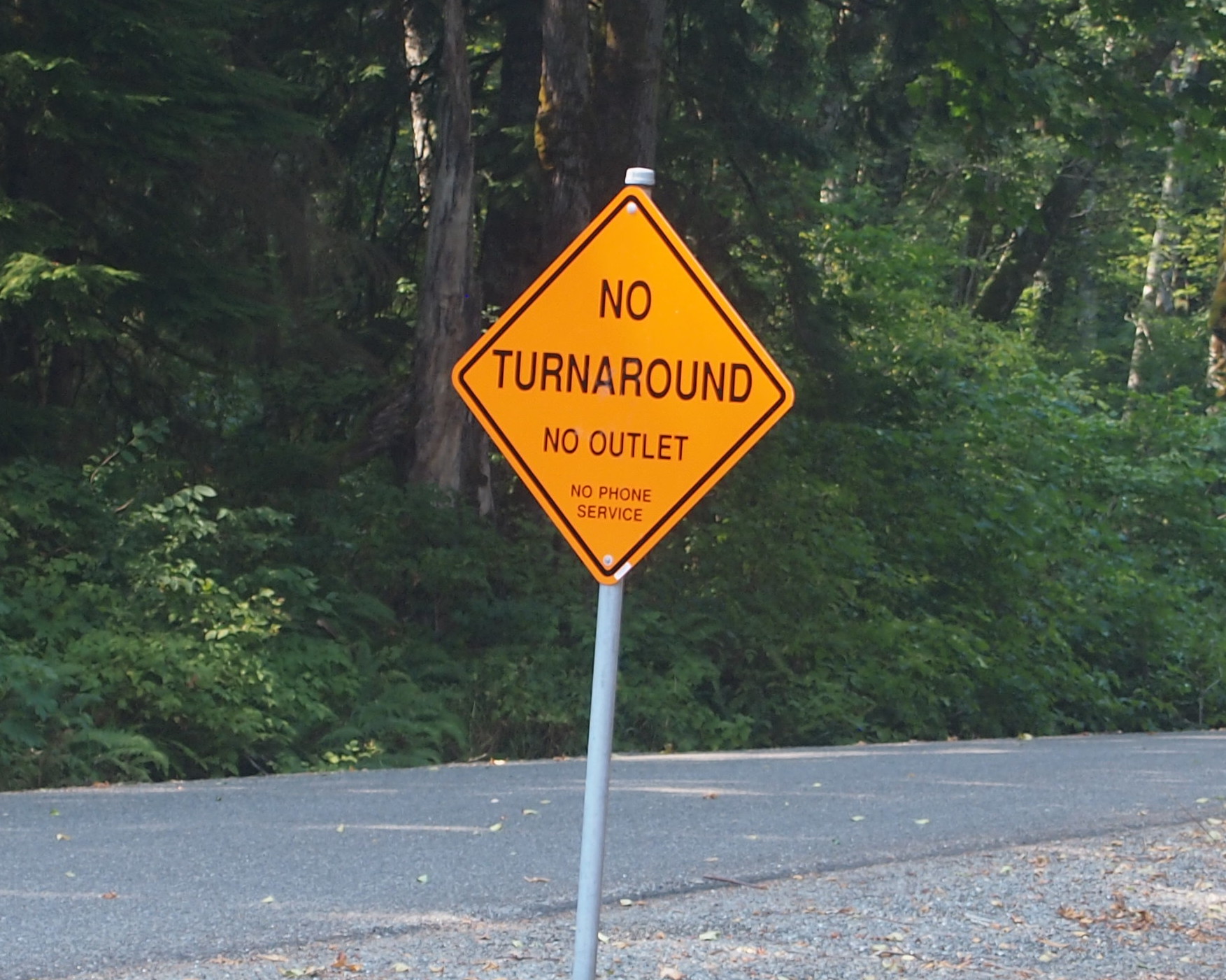
Washington state, Aug 2015And a sign that might as well have said ABANDON ALL HOPE… What’s the point of this road?
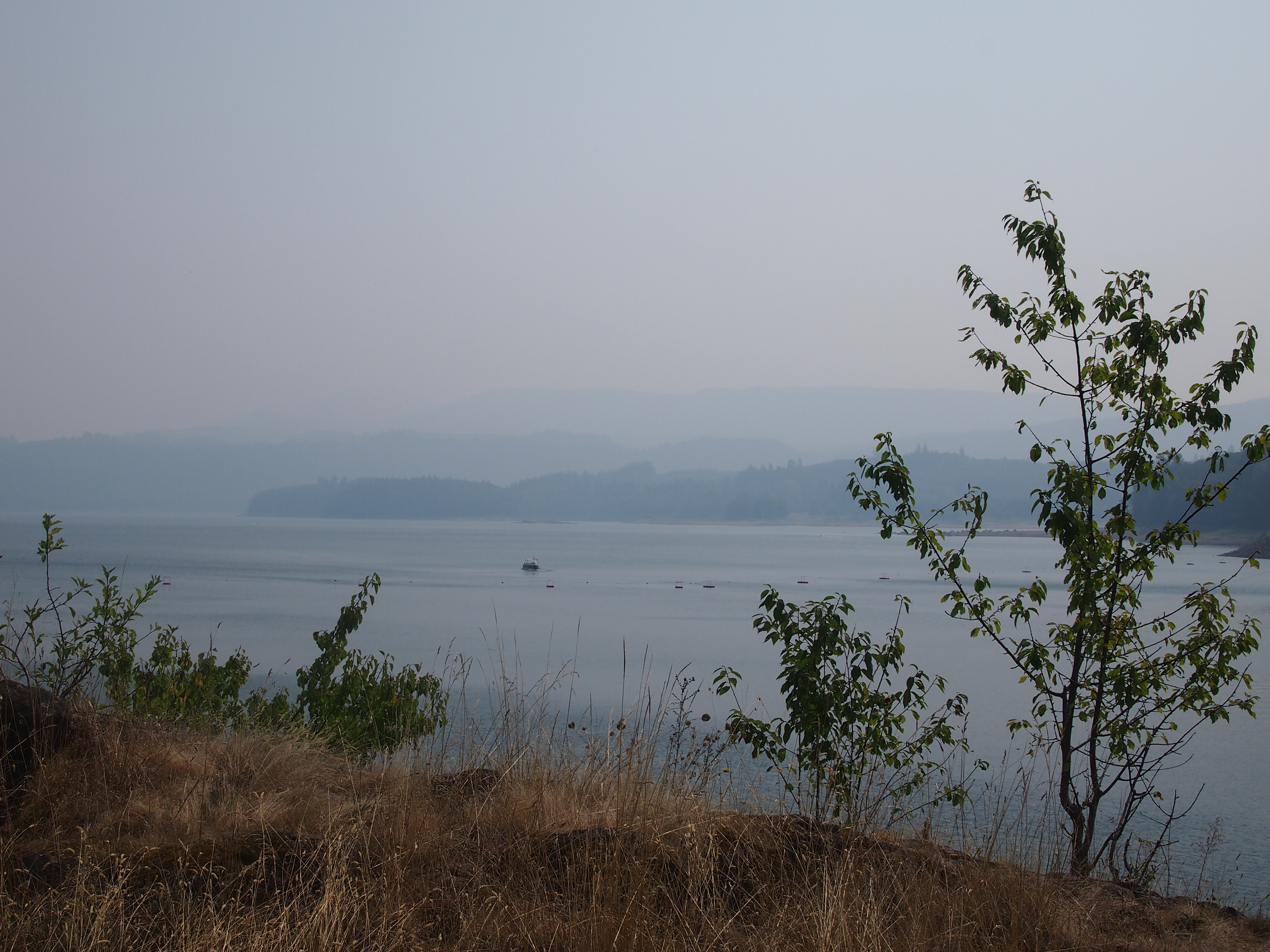
Go the hell awayThis is Riffe Lake, created by the Mossyrock Dam, and just as hazy that day.
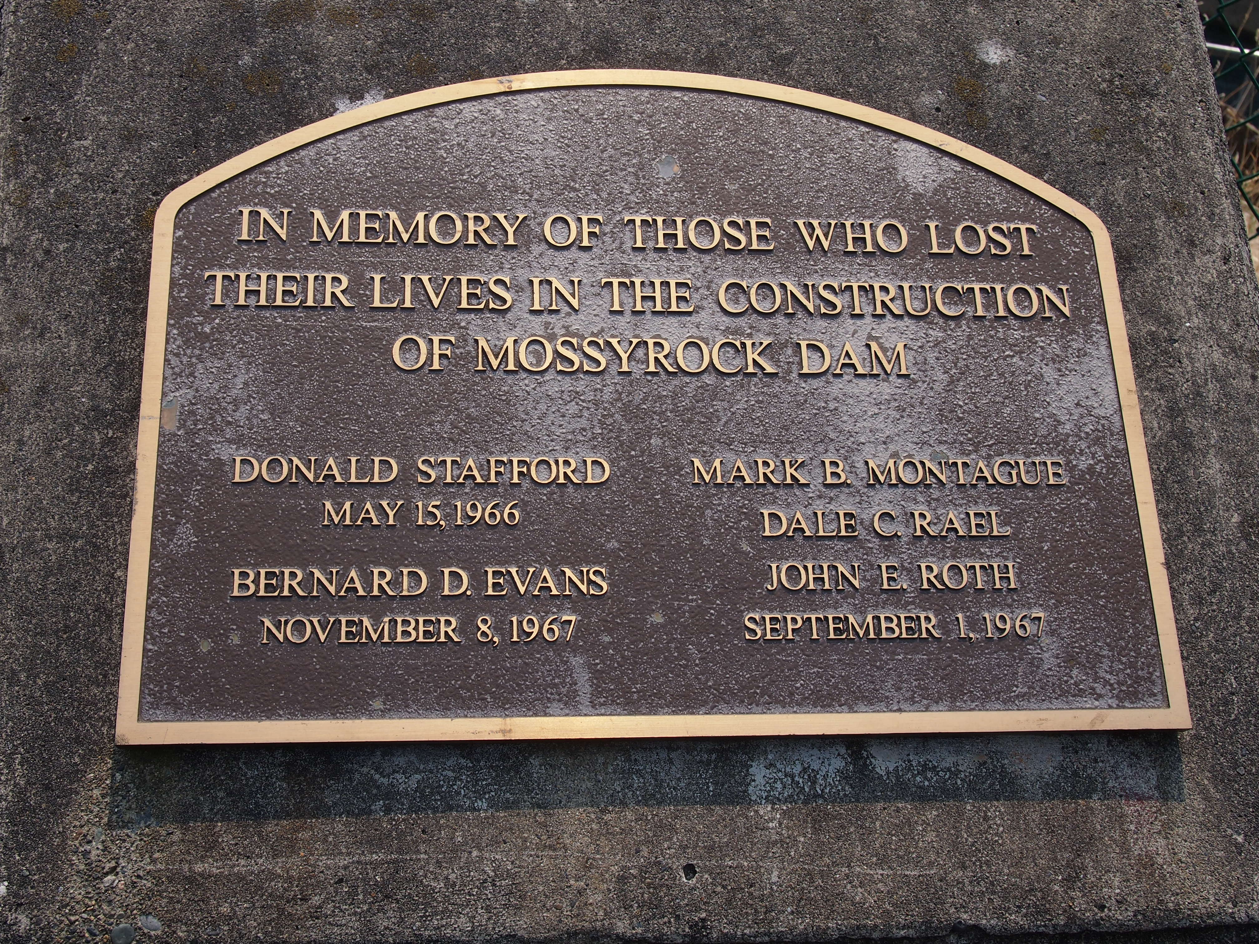
Riffe LakeI noticed this plaque near the dam’s observation point. I’m glad the men have some kind of memorial. More than the many more who died building the Coulee seem to have gotten.
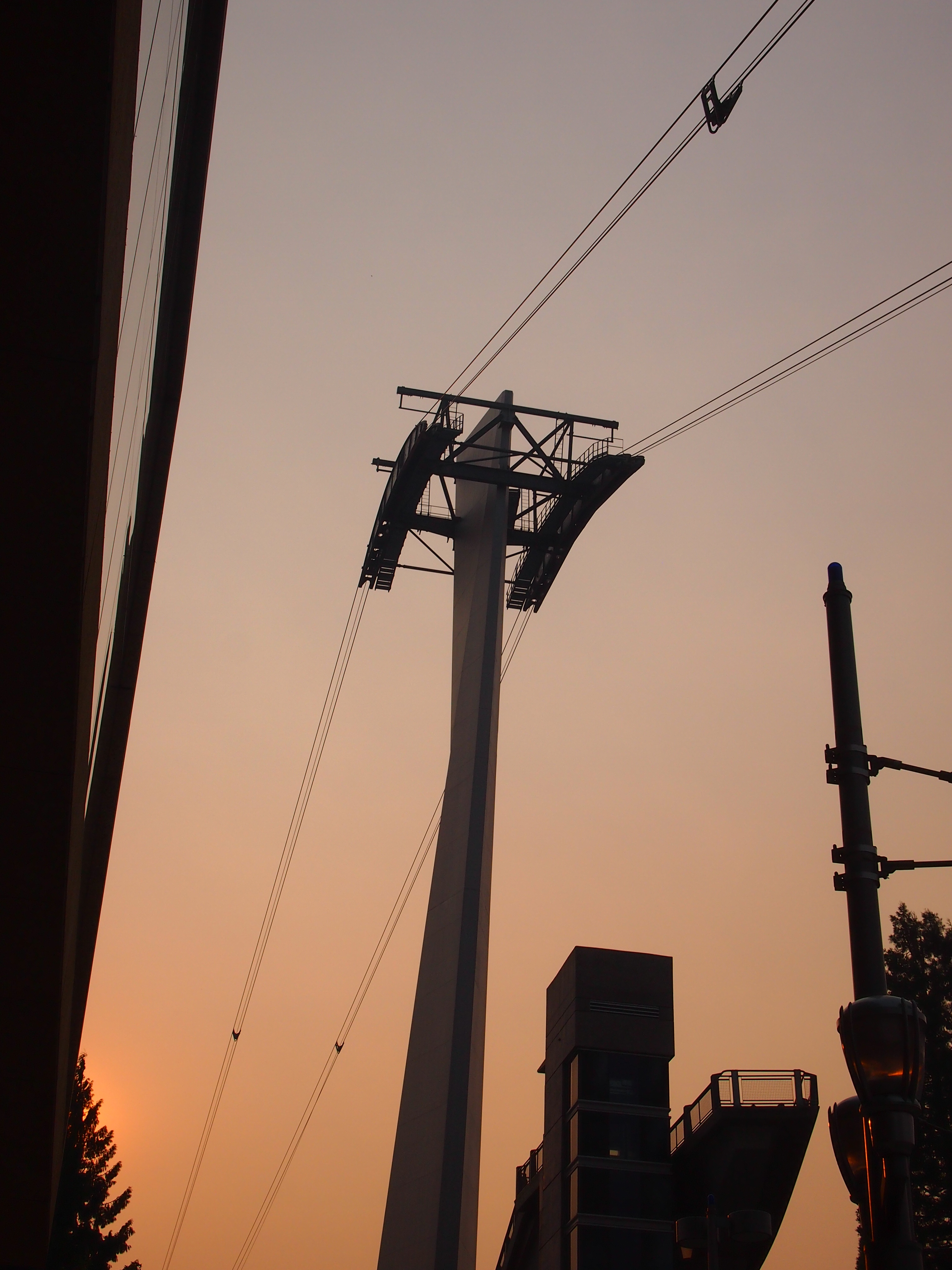
In MemoriamSomething else I didn’t get to do: the Portland Aerial Tram. On the morning I got to Portland, I could see it, but without a more detailed map, I couldn’t get to the damned thing. The part of town that’s home to one of the terminals, which is on the river, is essentially cut off from the rest of town by a freeway, and if you don’t know the exact way to get past that obstacle, you’re out of luck. By the late afternoon, when I had a better map and could find the tram, it was closed. Ah, well.
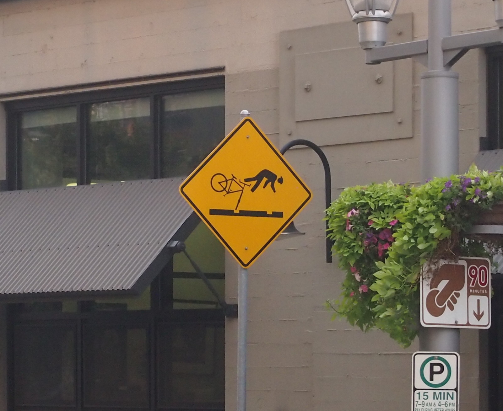
Portland Aerial TramPortland has a number of light rail lines, and I rode those just to ride them. I also noticed these signs near the lines, something I’ve never seen anywhere else.
PortlandUp north, one thing I noticed about major Canadian surface streets — or at least those streets in the Vancouver area — was that there’s no such thing as a double yellow line. BC 99 turns from a limited-access highway into a six-lane major street as you enter the city, and it’s divided by a single yellow line. It’s silly how unnerving that was, because the difference is only a few inches. Even so, all that separates you from a mass of cars and trucks coming at you is a thin yellow line instead of a double thickness of two. Canadian drivers must be used to it.

Know what else Vancouver doesn’t seem to have? Free parking. Not even at Stanley Park.

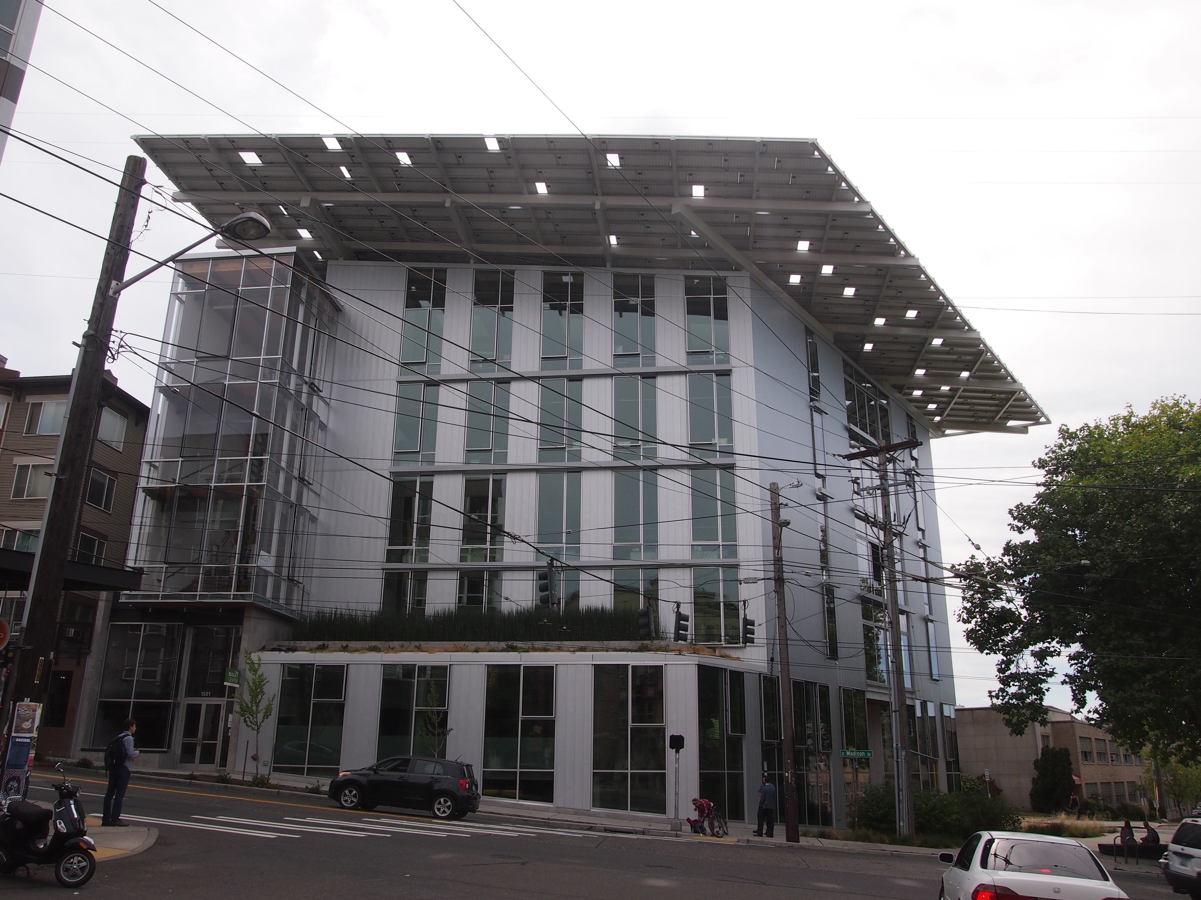
Finally, the Bullitt Center in Seattle, one of the greenest buildings in the nation, and a marvel of a building in that way.

The Bullitt Building, SeattleFor instance, that hat of a roof? An array of solar panels that produces more power than the building uses. As part of my work, I got a tour from the property manager. This is my writeup of the visit.

A Few Fine Portland Buildings

Drive into a large city for the first time, without the benefit of some GPS box advising you, and with few exceptions, it’ll be confusing for a while. The way the streets are connected seems to make little sense. They don’t match your maps, or rather, what you think you remember from looking at your maps. Signage isn’t what it should be (often just an impression, but objectively true in Boston). The route you want to go is under construction. There’s always someone right behind you when you need to make a critical decision about turning, but you’re never in the lane you need to be anyway.

It sounds like I’m complaining, but not really. Once the worst of the drive is over — because you do get where you’re going, usually — you’ve had the satisfaction of navigating through a strange place. You’ve also seen, even fleetingly, some things you wouldn’t have otherwise. GPS is fine if you have a meeting to attend or a plane to catch, but otherwise it obviates the need to guide yourself through new territory with maps, landmarks you know ahead of time, and your own sense of direction.

I plowed through parts all three cities — Portland, Vancouver, and Seattle — on different occasions last week, each causing me temporary location frustration. Each time when it was over, it was worth it. When I found a parking garage in downtown Portland early on the afternoon of August 22 and set out on foot, it was wonderful not to be in that car anymore, and taking in what the streets of Portland had to offer.

The first thing I took in was the air. A light haze and the smell of a not-too-distant fire hung everywhere. It wasn’t a choking haze, or even one that made me cough, but it carried a distinct odor. Smelled like one’s clothes after grilling, especially the burned wood. The source was the vast complex of forest fires then raging in eastern Washington — still raging — and which only a few days before had killed three U.S. Forest Service firefighters near Twisp, Wash., all young men.

Portland is known for a number of things, such as trying to rival Austin for urban weird. More on that later. I want to point out that downtown Portland, and the nearby Pearl District, have some exceptionally fine buildings a century or more old that aren’t remotely weird. Such as the New Market Block (1872).

New Market, PortlandThe Blagen Block (1888).

Blagan Block, PortlandBlagan Block, PortlandThe Postal Building (1900).
Postal Building, PortlandAnd the Pittock Block (1914). Among a good many others, including more modern structures.
Pittock Block, PortlandI have a fondness for buildings with visible fire escapes.

Also worth noting: Portland’s a sizable industrial town. Not something you hear about much either. I spent the night at some distance from the city center at a motel on U.S. 30 near the Willametta River, a major tributary to the Columbia, both of which are working rivers. The motel was in an industrial zone, both for manufacturing and distribution, and I know there are other areas similarly industrial in greater Portland. It isn’t the largest industrial market even in the Northwest, but it’s large enough to have current and projected development of nearly 2 million square feet.

The Menil Collection

On the morning of July 11, Ann and I drove into the heart of greater Houston, starting near Hobby Airport and stopping en route at a doughnut shop (Shipley, which has good doughnuts and is genuinely regional), post office, and Half Price Books, all located previously by using that marvel of the age, Google maps. But not, I want to say, using any GPS gizmo or other cheaters’ device in the car, since we had none. Later generations — people alive now, probably — might marvel at that, since they won’t know how to get from point A to B, C, or D without a machine telling them how.

As an adult visitor, I’ve more-or-less bypassed Houston over the years. It could have easily been a much more familiar city if, say, I’d gone to Rice. Or if family or old friends lived there instead of San Antonio, Austin and Dallas. So driving through was both new and oddly familiar. The neighborhoods and the houses and shops feel like Texas, but the greenery’s different, so I’d find myself walking along noticing bushes I couldn’t quite place or drooping leaves that didn’t look quite right or flowers new to my eye. Something like wandering around in Australia, but not quite as weird.

Around 11, as the sun was high and hot, we arrived at The Menil Collection. Perfect time to spend in an air conditioned building looking at art-stuff. I wanted to see one of Houston’s renowned museums, but not an overwhelmingly large one, since I had other plans for the afternoon. The museum also had a locational advantage, with easy access to the highway I wanted to take out of town. It also has a large collection of surrealists.

Nothing like some surrealists to brighten your day. I’m impressed by the raw weirdness of them. How did they think of that? John and Dominique de Menil, the oil millionaires who founded the museum, seem to have an early and abiding interest in the likes of Giorgio de Chirico, Max Ernst, René Magritte, Man Ray, and Yves Tanguy. Plus a few Dalis and Miros, among others. Oddly enough, but fitting, there’s also a room devoted to objects that various surrealists owned that reportedly inspired the artists. Exotic curiosities, that is. I didn’t make any notes, but I’m pretty sure I saw a shrunken head or two and a spiny suit of pseudo-armor.

According to the museum literature, the de Menils were also taken with Cubism and neoplastic abstraction, but we must have missed most of those. Or maybe most of them were off display, since I understand that the museum rotates its 17,000 objects with some vigor. We did happen on a nice collection of ancient Greek and Roman objects and afterward some African art, housing in a gallery looking out on an enclosed and inaccessible (to us) garden.

The museum itself is a spacious, light-filled space, except for some of the intentionally darkened galleries. Renzo Piano designed the structure. Seems like he gets all sorts of plum jobs. This one dates from the mid-1980s. The Texas State Historical Association describes it well: “The main museum building is on a tract of nine city blocks purchased by the Menils in the Montrose section of Houston. In accord with Mrs. Menil’s desire for a building that was ‘small on the outside and big on the inside…’ At forty feet by 142 feet and a maximum height of forty-five feet, the building dominates the neighborhood without overwhelming it, due in large part to its grey wood siding, white trim, and black canvas awnings.

“Renzo Piano, perhaps best known for his high-tech Pompidou Center project in Paris, produced an equally innovative if less visually startling technical miracle for the Menil Collection. Working with engineer Peter Rice he achieved an interior illuminated by natural light that passes through glass and is deflected by a series of 300 ferro-cement ‘leaves,’ thus protecting the works of art from direct sunlight. A series of glass-enclosed interior gardens enhances the natural ambiance of the galleries.” Some good images of the place are here.

Next, we walked over to the Rothko Chapel, which is part of the Menil Collection as well. It’s a short distance to the east, tucked in among the houses and trees of an otherwise well-established middle-class neighborhood. You expect certain things from a chapel, and the Rothko Chapel, with its enormous black Rothkos staring back at you from all around the interior walls, is a marvel at contradicting your expectations. Even so, its form is still clearly that of chapel, without overt religious symbols. But you can also imagine that these big black shapes are fragments of the Void, or something just as unnerving, staring right back at you. Quite a thing for the artist to pull off.

Ann, being 12, wasn’t quite so impressed. She appreciated the air conditioning. The Rothkos, not so much.

Here’s an example of art-speak. Whoever wrote the Wiki description of the Rothko Chapel said this: “The Chapel is the culmination of six years of Rothko’s life and represents his gradually growing concern for the transcendent. For some, to witness these paintings is to submit one’s self to a spiritual experience, which, through its transcendence of subject matter, approximates that of consciousness itself. It forces one to approach the limits of experience and awakens one to the awareness of one’s own existence. For others, the Chapel houses fourteen large paintings whose dark, nearly impenetrable surfaces represent hermeticism and contemplation.”

Submit one’s self to a spiritual experience, eh? Approximates that of consciousness itself? Abstract expressionism is notorious for evoking the kind of reaction Ann had: Why is this rectangle of color art? Why is it hanging here? Is this a joke? I don’t feel that way. The colors are interesting, especially when you start to eye the texture. You know, color is the subject. Look closely and it’s more than a Pantone monocolor; there’s more than one shade. I’m glad people paint this way. But I don’t see the need to discuss the genre with the artistic equivalent of technobabble.

Further away, but not too far, is the Byzantine Fresco Chapel, also part of the Menil (now, I’ve read, simply called the BFC). Sad to say, there’s no Byzantine fresco there. After some years in place, it’s been returned to its home in Cyprus. Now the building will house temporary installations. The one occupying the space now is “The Infinity Machine.” A pretentious title, maybe, but it was intriguing. That made up for missing the fresco.

The installation was a rotating mobile about two stories high, going all the way up to the high ceiling (the room is large: about 116,000 cubic feet). It consisted of dozens of antique mirrors hanging by cords of varying lengths. Some mirrors were hanging high, some low. Some were large, some hand-held mirrors. A mechanism turned the mobile so that the mirrors rotated around the room about twice a minute. The was room was mostly dim, but changing lights from the side illuminated the whirling mirrors in endlessly alternating patterns.

You sat on a bench along the wall and watched. You could, in theory, go over to the mirrors and maybe be hit by some as they passed by, since there was nothing to separate you from them except an admonition from the sole guard in the room not to do that.

There’s an audio component as well: sound files made by converting data gathered by various spacecraft as they’ve explored the outer planets and their moons. Don’t ask me how that’s done, it’s beyond my understanding. Something NASA calls Spooky Sounds, but that’s not quite right. Anyway, together with the motion of the mirrors and the dance of the light, the installation is quite a show. The artists are a married couple from British Columbia, Janet Cardiff and George Bures. More about it here, include a video that’s better than nothing, but hardly does it justice.

The Astrodome Still Stands

When I was small, maybe six or seven, I saw the Astrodome. Even better, I went inside the Astrodome on a tour. We were visiting Houston in the late ’60s and in those days the domed stadium was a wonder of the world, or so it was called. Arguably so, since represented a modern innovation on an ancient structure.

I was especially impressed by how high the highest seats seemed to be. The stadium was empty during our tour, and I imagined that the people in the highest seats would need to hold on to their arm rests or they’d tumble out toward the field below. That’s the kind of thing a six-year-old might imagine, but my brother Jay, who was in his teens at the time, says the sheer size of the place was impressive even if you weren’t small.

For the record: The Astrodome stands 18 stories tall, covering 9.5 acres. The dome is 710 feet in diameter and the ceiling is 208 feet above the playing surface, which itself sits 25 feet below street level.

Flying into Houston’s Hobby Airport earlier this month, I looked down and saw NRG Stadium. I knew it was NRG Stadium because those three letters, which belong to a three-initial energy company, are emblazoned on the structure in a very visible way. It has a blocky shape. Then I noticed another, rounded stadium not far away.

Could it be — ? Yes, it was the Astrodome. Not used for anything now, but still standing after 50 years. Wankers may yet destroy it, as wankers are known to do (e.g., Penn Station), but I hope it’ll be repurposed here in the 21st century.

The East End Historic District, Galveston

The East End Historic District covers over 50 city blocks in Galveston. In July the time to take a stroll in such a place is early in the morning — not something we did — or late in the afternoon, which we did. It’s a delightful mix of housing styles, or as the East End Historic District Association puts it, offers views of “a towering pillar, shadowed silhouettes of ornate carvings, a splash of stained glass in a window, welcoming porches or a bit of wrought iron fencing.”

It also has trees large enough to move the sidewalks from underneath with their roots. Ann asked about the malformed sidewalks, and I explained that the roots did it slowly over the years.

The Julius Ruhl Residence, at the corner of Sealy and 15th and dating from the 1870s, has a widow’s walk. That’s just not something you see in suburban Chicago.
Galveston, July 2015Many houses sport fine porches. A good thing to have in pre-air conditioned times. Or even after air conditioning was invented.
Galveston, July 2015This is the J.C. Trube Castle.
Galveston, July 2015It dates from the 1890s. Its web site — the place is a commercial enterprise now, available for weddings and other events — says the building is “constructed of bricks covered by stucco mixed with Belgium cement creating a rusticated stone effect. The mansard slate roof with seven gables and the battlement tower give the historic home a castle distinction. The observation deck on the top of the tower offers a view of both the gulf and the harbor.”

The building is also one of the few remaining designs of architect Alfred Muller.  Nicholas J. Clayton didn’t design everything in 19th-century Galveston. The Prussian-born Muller also had the relative good fortune to die a few years before the 1900 hurricane.

More pretty houses.
Galveston July 2015Galveston July 2015Note the plaques to the left of the door on this house.
Galveston July 2015Galveston July 2015The upper one’s a little hard to read, but it says 1900 Storm Survivor. Hurricanes are serious business around here. Lest we forget, Ike slapped Galveston as furiously as Katrina hit New Orleans.

The Strand, Galveston

I can’t pin down the last time I went to Galveston. It was sometime in the early 1970s, probably as an appendix to a visit to Houston from San Antonio. Little memory remains, and for whatever reason we didn’t return when I was older. My brothers remember visits in the 1950s, during the time when my parents lived in Houston, but that’s before my time.

I suspect we never went to the Strand on any family visits to the city, because the area, which is a part of the city near Galveston Bay, didn’t begin its revival until the 1970s. The always-informative Handbook of Texas Online tells me that the Strand — formally called Avenue B in Galveston — was included in the original plat of the city in the late 1830s, with the origins of Avenue B’s nickname unknown.

“While the avenue extends throughout Galveston, the Strand has usually referred to the five-block business district situated between Twentieth and Twenty-fifth streets,” it says. “Throughout the nineteenth century, the area was known as the ‘Wall Street of the Southwest,’ serving as a major commercial center for the region.”

Some of the 19th-century buildings still stand on Avenue B, the Strand. With a 20th-century tower to the south.
The Strand, GalvestonThe Strand, GalvestonThe Strand, GalvestonNaturally, the Hurricane of 1900 put the kibosh on the Strand’s career as the Wall Street of the Southwest. I’ll bet after the storm a common enough sentiment among businessmen was, To hell with this, we’re going to Houston. Galveston didn’t have the space to grow into a megalopolis anyway.

“In the rebuilding process, businesses moved off the Strand and away from the wharfs,” the Handbook continues. “The area became a warehouse district. In the 1960s amidst widespread deterioration of the Strand, the Junior League of Galveston County restored two buildings sparking interest in the area. In 1973 the Galveston Historical Foundation initiated the Strand Revolving Fund, a catalyst in subsequent years for dramatic restoration and adaptive use in the Strand Historic District.”

These days, the Strand is a Galveston tourist zone, populated by ordinary visitors, and when a cruise ship’s docked near the zone, probably even more people, though I didn’t see any ships nearby when we were there. As a tourist zone, it has two distinct advantages. One, the sidewalks are covered, so that strolling along in mid-summer doesn’t mean walking under a hot and copper sky. Also, the clothiers, geegaw shops and other venues are universally air conditioned.

Ann and I did our share of ducking in and out of shops, eventually buying a single key ring and a few postcards. I can report as a matter of historical interest — that is, for future historians of 21st-century minutiae — that Confederate battle flag-themed merchandise hasn’t died out in the souvenir shops of Galveston as of the summer of 2015, though I can’t say its presence was overpowering.

Sad to say, the eccentric Col. Bubbie’s Strand Surplus Senter has closed. The sign is still there.
The Strand“Col. Bubbie’s was the longest-running, single-owner business on the Strand,” the Houston Chronicle reported last December after the shop closed. “Since 1972, it sold military equipment — gas masks, camouflage pants, canteens, mess kits, medals and insignias, you name it — encompassing 60 countries and conflicts from the Civil War to Iraq.

“The shop helped outfit the TV show MASH and war films as diverse as Saving Private Ryan and 1941, among others. Until a few months ago it was the go-to spot for local theater productions to get period uniforms, but that stock has dwindled.”

We also stopped in at La King’s Confectionery on Avenue B. We were glad we did. The place makes excellent ice cream. Ann’s pistachio was particularly good. Ice cream jockeys and soda jerks in white were on hand to serve whatever you wanted.

La King'sA neon sign says Purity Ice Cream, and I thought that meant a product of Tennessee’s Purity Dairies, but no. According to the Austin Chronicle, “Ice cream on an industrial scale arrived in Texas in 1889 when the Purity Ice Cream Company opened in Galveston.” The ice cream that La King’s serves is a direct culinary descendant of that ice cream, and La King’s is the only place it’s served.

In the back, you can watch a fellow making taffy, which the store also sells.

La King'sOne other thing I spied on the Strand: a public chess set.
Ann on the StrandIt was a little too hot to play, but still. That’s what parks need more of, public chess sets.

The Bishop’s Palace, Galveston

Late last year, Congress passed a joint resolution along these lines: “Whereas the United States has conferred honorary citizenship on 7 other occasions during its history, and honorary citizenship is and should remain an extraordinary honor not lightly conferred nor frequently granted;

[In case you’re wondering, I’ll save you a trip to Wiki. The others are Winston Churchill, Raoul Wallenberg, William and Hannah Penn, Mother Teresa, Casimir Pulaski and Lafayette.]

“Whereas Bernardo de Gaalvez y Madrid, Viscount of Galveston and Count of Gaalvez, was a hero of the Revolutionary War who risked his life for the freedom of the United States people and provided supplies, intelligence, and strong military support to the war effort…

“Resolved by the Senate and House of Representatives of the United States of America in Congress assembled, That Bernardo de Gaalvez y Madrid, Viscount of Galveston and Count of Gaalvez, is proclaimed posthumously to be an honorary citizen of the United States.”

I didn’t know about that resolution until after Ann and I went to Galveston earlier this month, and I looked up Bernardo de Gaalvez y Madrid, Viceroy of New Spain, to add to my vague knowledge of the man for whom Galveston is named.

To my way of thinking, the first place to go in Galveston (after lunch, if you happen to arrive at lunchtime), is the Bishop’s Palace. That’s just what we did.

Ann, Galveston, July 10, 2015The name is a spot of Texas hyperbole. Palace, it isn’t. But it is a excellent example of a large (19,000 SF) Victorian mansion, built in the 1890s for a successful attorney and his wife, Walter and Josephine Gresham, who tapped local architect Nicholas J. Clayton to design it. (Clayton seems to have been very busy in the pre-1900 heyday of Galveston, but things were never the same after that.)
Bishop's Palace July 2015The Handbook of Texas Online describes Clayton’s work as “exuberant in shape, color, texture, and detail. He excelled at decorative brick and iron work… What made Clayton’s architecture so distinctive in late nineteenth-century Texas was the underlying compositional and proportional order with which he structured the display of picturesque shapes and rich ornament.”

That’s a fitting description for the Bishop’s Palace, which was a sturdy mansion too. It survived the Hurricane of 1900, one of the few structures in the area to do so, and sheltered a lot of survivors. The bishop in the name is Bishop Christopher E. Byrne, who lived there in 20th century, after the Roman Catholic Diocese of Galveston bought the mansion in 1923. Only in 2013 did the Church sell the structure to the Galveston Historical Foundation.

The interior has more stained glass than most Victorian mansions I’ve seen. Many of those were added by the bishop, who insisted that one of the rooms be converted into a chapel, which it remains. For instance, a stained-glass St. Peter’s there to greet you.

Bishop's PalaceAs usual, a house like this has some interesting period detail, such as the fact that the lights were built for gas as well as for that new light source, electricity, in case it worked out. Or the bathtub in the main second-floor bathroom.
Bishop's PalaceNote the three faucets. Our guide, an informative woman whose main job is teaching Texas History — everyone in the state takes it in 7th grade, or at least used to — told us that one was for hot water, one for cold, and one for rainwater from a cistern. It was thought to be good for one’s hair.

The Greshams had the means to be international travelers in the days before Europe on $5 a Day, and that meant steamer trunks. I don’t think I’d ever seen trunks of the time plastered with luggage labels, but Bishop’s Palace had some on display.
Bishop's PalaceNext door to the Bishop’s Palace is Sacred Heart Catholic Church. This building dates from the early 1900s, because the 1900 hurricane knocked down the original.

Sacred Heart, GalvestonThe church wasn’t open for a look inside. But the next-door location must have been convenient for the bishop. You know, in case he ever needed to tune up his crosier or something.

The 300 S. Wacker Map

Last week in downtown Chicago, I also got a look at the 300 S. Wacker map, which was unveiled late last year and is easily visible from the west side of the Chicago River near Union Station. That’s because it’s a map as tall as a skyscraper, and who couldn’t like that?
300 S. Wacker 2015A close up.
300 S. Wacker 2015The giant map depicts the Chicago River and nearby streets, from Cermak to Chicago and LaSalle to Jefferson. The 300 S. Wacker building itself appears on the map as a three-dimensional red block.

Previously, 300 S. Wacker had little to distinguish it as a building, and little to catch the eye. Beacon Capital bought it last year and commissioned Elmhurst, Ill.-based South Water Signs to do the work. I’ve read that there are more art maps in the building’s lobby, backlit by LED lights; I’ll have to take a look sometime.

Two Chicago River Bridgehouses

More rain over the weekend and again today. Are we turning into Seattle? Except that Seattle really isn’t the rainiest place in the nation, according to various sources. It turns out most cities in the Southeast U.S. get more rain every year.

But who would understand you if you said, it sure has been rainy lately. Are we turning into Mobile? Information age, my foot. Even easily available data has a hard time killing received notions.

That reminds me of something else I encountered in the Pacific Northwest all those years ago: Slug Death. Or, to be more exactly, Corry’s Slug & Snail Death in the bright yellow box. (It seems to be Corry’s Slug & Snail Killer these days, as if that matters to dying gastropods.) I think we were visiting people on Bainbridge Is., and that’s what they had in their garden. I’d never heard of such a thing. It was one of those ordinary details of a new place that stick with you.

En route to Union Station to catch my train to the suburbs last week, I spent a few minutes looking at some of the bridgehouses on the South Branch of the Chicago River. There’s a museum in one of the bridgehouses of the Michigan Ave. bridge that opened only last month — the McCormick Bridgehouse & Chicago River Museum — but I didn’t have time for that.

Here’s the Monroe St. bridgehouse on the east side of the structure. The bridge dates from 1919 and was built by the Ketler Elliott Co., a name I’ve encountered before.
Monroe St. bridge 2015Looks like it’s been cleaned lately, maybe even since the bridge’s 2000s rehabilitation. The site HistoricBridges.org tells me that “the bridge’s operating and control panels inside the bridgetender buildings were reportedly the first in the United States to have completely enclosed circuitry so that no exposed copper connections were available for bridgetenders to mistakenly electrocute themselves on.”

This is the bridgehouse on the west side of the Adams St. bridge, which was built a little later, 1927, but still during a time when aesthetics was a consideration in a public building project (it might be again, but for quite a spell in the last century, the idea seems to have been on hold).
Adams St. bridge house, 2015The bridge was rehabbed in the mid-1990s. The bridgehouse is dingy, so I guess that’s 20 years of urban air at work. More about the Adams St. bridge is here.

Original Dairy Queen Sign 1955: So Says The Plaque

Lombard, Ill. May 2015How many Dairy Queens have metal plaques on their side? I couldn’t say, but I did notice that the Dairy Queen across the street from the Maple Street Chapel, there at Maple St. and Main St. in Lombard, Ill., has one.

A fairly new plaque, by the looks of it. Someone on the Lombard Historical Commission, or maybe a committee of someones, decided that the Dairy Queen sign, vintage 1955, was worthy of note. I wasn’t in the mood to find just the right angle at which to get a full picture of the sign, especially since it meant crossing and recrossing a fairly busy street, or maybe standing in the street. But I did stand under the sign and snap the neon cone.

OLYMPUS DIGITAL CAMERABesides, the Internet can be counted on to provide pictures of original Dairy Queen signs in various parts of the North America, and sure enough here they are. Including the Lombard sign.

There’s a pair of benches next to the shop. We sat there and ate some ice cream.