Bruce Peninsula National Park: The Rocks

A few years ago, Parks Canada, which oversees Bruce Peninsula National Park in Ontario, made noises about changing the name of the park to Saugeen Peninsula NP, after the place name used by the Saugeen Ojibway Nation for the peninsula. The agency started calling the peninsula that, at least internally, and promised a review about the park name. I’d think an actual change would require an act of parliament, but the ways of Canada are mysterious, so I can’t say for sure.

We were merely passing through, but I have a hunch that residents might be attached to “Bruce,” at least for the peninsula itself, so the idea of a name change hasn’t moved forward. Or maybe the process is slow by design. But anyway this was a common sign on the Bruce.Bruce Peninsula

Also, one of the few radio stations receivable on the peninsula is 97.9 FM, The Bruce. If you drive through Port Elgin, as we did twice, you’ll pass the station’s well-marked HQ. If your listen enough, you’ll hear the slogan: Respect the Rock.

In any case, the name remains for now.Bruce Peninsula National Park

In his time – the 19th century – James Bruce, Eighth Earl of Elgin (d. 1863), was a governor of Jamaica, governor general of the province of Canada, and viceroy of India, among other things. Safe to say, then, that he was an imperialist. Pretty much a textbook example. Also, at another point in his career, he ordered the destruction of the Old Summer Palace in Beijing. Oops.

On the other hand, Bruce is a pretty solid name. Maybe the relevant board or committee can declare the peninsula to be named in honor of the entire Clan Bruce, who were so important in the history of Scotland, and whose doughty descendants can be found throughout Canada. That’s a pretty good example of lateral thinking, if I say so myself.

We came to BPNP last week on Wednesday morning (October 9), because this ship wasn’t sailing.

We’d booked round-trip passage to a place called Flowerpot Island, one of the peninsula’s picturesque offshore islands and part of Fathom Five National Marine Park, intending to stay much of the day. But the wind was up, and early that morning, the tour company sent a cancellation notice via email (and we got a refund).

Then we went through a minor amount of rigmarole to change our parking permit at BPNP, because while admission to the park isn’t timed, parking at the park is. We’d planned on visiting the next morning (October 10), before leaving for London. As it turned out, hiking around the Bruce took a fair amount of energy, so best to do it the day before a longish drive, not the same day as a longish drive. Sometimes adjustments on the road work out better.

Our first hike in the national park was simple enough, in theory – out to Georgian Bay, along the edge of Georgian Bay, back from Georgian Bay to the parking lot we’d finagled an early spot in.

The path to Georgian Bay, most of the way along a shallow lake.Bruce Peninsula NP Bruce Peninsula NP

Soon you come to the rocky shores of the bay. This place has some centuries (millennia?) to go before it’s a sandy beach. For our part, we’d never seen Georgian Bay before. But for a low place in the Niagara Escarpment, it could have been an entire other great lake, so large is it — 5,800 square miles, or only somewhat smaller than Lake Ontario.Bruce Peninsula NP Bruce Peninsula NP

More rocks than you can shake a stick at. And we had our sticks – poles, anyway – and good thing, because the trail crossed the lakeside rock field. It took a little while to eye the course of the trail across the rocks.Bruce Peninsula NP Bruce Peninsula NP Bruce Peninsula NP

I’m not suggesting it was a technically difficult hike. Tricky is more like it, and at my partly advanced age, slow going. But after a few minutes you get the knack for it, or at least enough to position your steps to avoid a tumble.Bruce Peninsula National Park

The trail eventually led back into the woods, which was just as slow.Bruce Peninsula NP

But worth it, as the trail soon to us back to the wind-swept coast.Bruce Peninsula NP Bruce Peninsula NP

With its cliffs.Bruce Peninsula National Park Bruce Peninsula National Park

Winds would have made a bad day on a boat. On the shore, it was a fortuitous ingredient of a good day.

Pinery & Sauble Falls Provincial Parks

One provincial park on the way north last Tuesday, one more on the way south a two days later: Pinery and Sauble Falls, respectively.

Pinery Provincial Park hugs the shore of Lake Huron far south of the Bruce Peninsula and includes wooded areas with trails and a wide beach.Pinery PP

Park literature says the woodlands are an oak savanna, the largest remaining patch in Ontario. Still mostly green when we passed thorough, with touches of fall.Pinery PP Pinery PP Pinery PP

The woodland trails pass by the Old Ausable Channel. Still and punctuated by lily pads and green algae.Pinery PP Pinery PP Pinery PP

The Ausable River once ran here, and then on into Lake Huron, but irrigation and other civil engineering projects, back when this part of Canada was being developed for agriculture, changed the course of the river, isolating this stretch. As its recreational value became apparent by the time the park was created in the 1950s, further engineering adjustments were made to ensure it doesn’t dry up all together.

The beach was easy to reach and nearly (but not quite) empty. That’s October for you, but if you asked me, that’s a good time to visit a beach.Pinery PP Pinery PP Pinery PP

Ah.Pinery PP

Soon we notice ladybugs everywhere on the beach.Pinery PP

As insect hordes go, that’s a pretty agreeable one. Still, I’ve been on a lot of beaches and never encountered that. Though not cold, it wasn’t exactly warm, and the bugs barely moved, preferring to cluster together. Later, at the visitor center, I mentioned the bug horde (not using that word) to one of the workers, who had never heard of such a thing either. So maybe it’s just a freak at Pinery, not the beginning of a movement of coccinellidae famed among entomologists, or something.

Much further north, in fact at the southern edge of the Bruce Peninsula, is Sauble Falls Provincial Park.Sauble Falls PP

It wasn’t busy, mostly occupied by a few retiree fishermen looking for a catch in the Sauble River below the falls. The trails in the park are short, mostly providing views of the low falls.Sauble Falls PP

Once upon a time, the river supported a lumber mill, and a small town grew around it. Only small traces of any of that remain, such as part of a concrete raceway.Sauble Falls PP

I expected a little more color on the Bruce Peninsula, but we were a little ahead of peak. At Sauble Falls, peak was closer.Sauble Falls PP Sauble Falls PP Sauble Falls PP

You’d think that fall colors would get old. We see it every year. But it never does.

Sarnia to Tobermory

Fairly early on the morning of October 8, this sign got my attention.Sarnia

It’s hard to know whether that’s a gracious gesture on the part of the City of Sarnia, Ontario, or a mild example of Northern nanny state-ism — the difference between you’re welcome to scatter here vs. you can only scatter in permitted places. But it was also good to know that we had the option, if we happened to have any ashes with us.

For all I know, people are scattered here often, and it certainty would be harmless compared to a lot of chemicals that have gone into the St. Clair River around Sarnia over the years. After all, this the home of the Sarnia Blob, an example of industrial pollution so epic that it has its own name.

That morning, after a modest breakfast and checking out of our room only a few blocks away, we went to take a look at Point Lands, a Sarnia municipal park on the St. Clair. Beyond the cremation sign is a view of Port Huron, Michigan, U.S. industrial twin of the Canadian industrial town of Sarnia.Sarnia

Almost 40 years ago, Dow Chemical managed to spill over 2,900 gallons of perchlorethylene, a dry-cleaning solvent, with more than 520 gallons of that oozing into the St. Clair. That combined with God knows what else to form a massive a tar blob. The river at this point is home to much of Canada’s chemical and petrochemical industry, and let’s say the attitude about chemicals in the water in most decades of the 20th century was a mite lax.

The dark mass settled, submerged on the riverbed. Before long it was found by divers, and eventually its high toxicity became a major environmental news story. Something like the burning of the Cuyahoga River, though with Canadian reserve compared to the brashness of the American fire. They say since then the St. Clair, like the Cuyahoga, has been remediated, but I’m not taking a dip.

If word of the chemical waste blob got to me in far-off Nashville in 1985, I’ve long forgotten. Later Dow Chemical bugged out of Sarna, but not before commissioning a model of the Great Lakes in concrete in this park.Sarnia Sarnia Sarnia

Including a model of Niagara Falls.Sarnia

Up the coast from Sarnia, we bought gasoline from the Kettle & Stony Point Gas & Convenience, which I assume is owned and operated by members of the Kettle & Stony Point First Nation. It was a full-service gas station, with a fellow asking how much I wanted and then pumping it in (fill ‘er up). I couldn’t tell you the last time I ran across that, but it’s been decades. Also, its prices were about 10 cents a liter cheaper than other stations around there, making for an all-around good retail experience.

Near the station, the tribal water tower.Ontario 21

At this point we were traveling on highway King’s Highway 21 (Ontario 21, as far as I’m concerned), a two-lane blacktop that mostly follows the Lake Huron shore. On that shore is Pinery Provincial Park, a 6,260-acre stretch of beach and oak savanna. For us, it meant easy hiking in the forest and walking on the beach, so we spent a few hours there.

That kind of exercise inspired a quest for a latish lunch, which we found at the Out of the Blue Seafood Market in the town of Bayfield, feasting on Lake Huron whitefish fish & chips in the nondescript shop. The road food ideal: delicious, local, inexpensive and found completely by chance.

Ontario 21 was often a pleasant drive, though passing through well-populated areas meant slow going sometimes. The road wasn’t exactly crowded, but busy enough to be a little tiring. Only a little. Mostly we crossed farmland. Grain fields, the likes of barley, sorghum and oats, I understand, eventually gave way to cattle fields and woods and wetlands.

The wind had kicked into high gear by later in the afternoon, when we got to Kincardine. Formerly illuminating the harbor is a lighthouse, a late 19th-century creation.Kincardine. Kincardine.

Another story I learned, facing the lake at Kincardine: one about a Canadian member of the First Special Service Force.1st Special Service Force 1st Special Service Force

Later, we connected with Ontario 6, which is quite the road, and took it north on the Bruce Peninsula proper to Tobermony. Settlement got sparser and sparser the further north we went.

The northern section of Ontario 6 is connected to the southern section by a large ferry  docking at Tobermory; we saw it loading the next morning, which naturally led to musings. On to Manitoulin Island? Up from there to connect on the mainland with the Trans-Canada Highway into Sault St. Marie?

Not this time. But you know how it goes: distant roads are calling me. Except that they’re not actually that distant.
Bruce Peninsula ’24

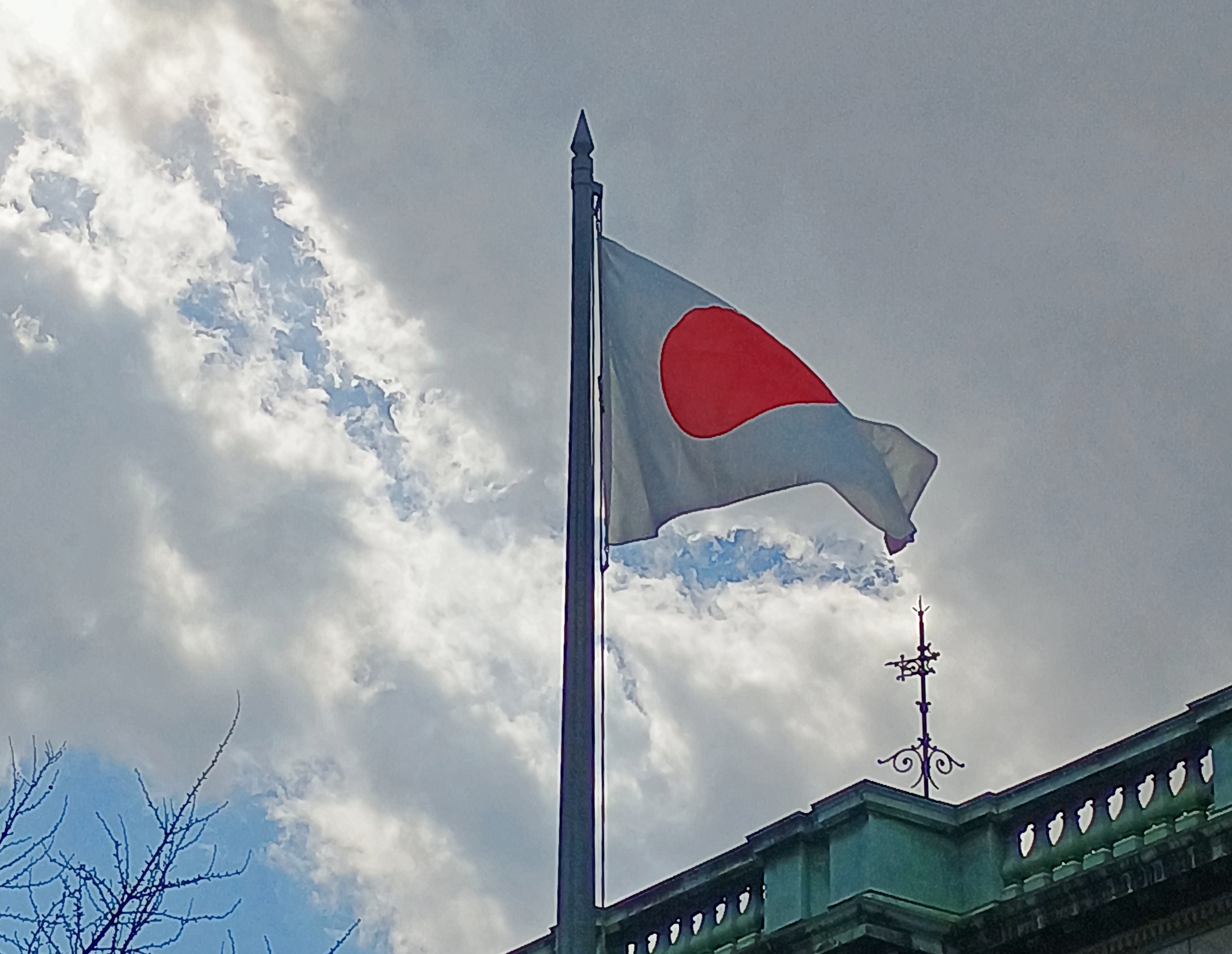
We visited the Bruce Peninsula of Ontario last week in time for some windy weather, but otherwise not inclement. The wind would ultimately require us to change our travel plans somewhat, more about which later, but it also kept flags in a spirited motion. This one snapped over a small lakeside park in Kincardine, Ontario, within sight of Lake Huron.Maple Leaf Flag, west Ontario

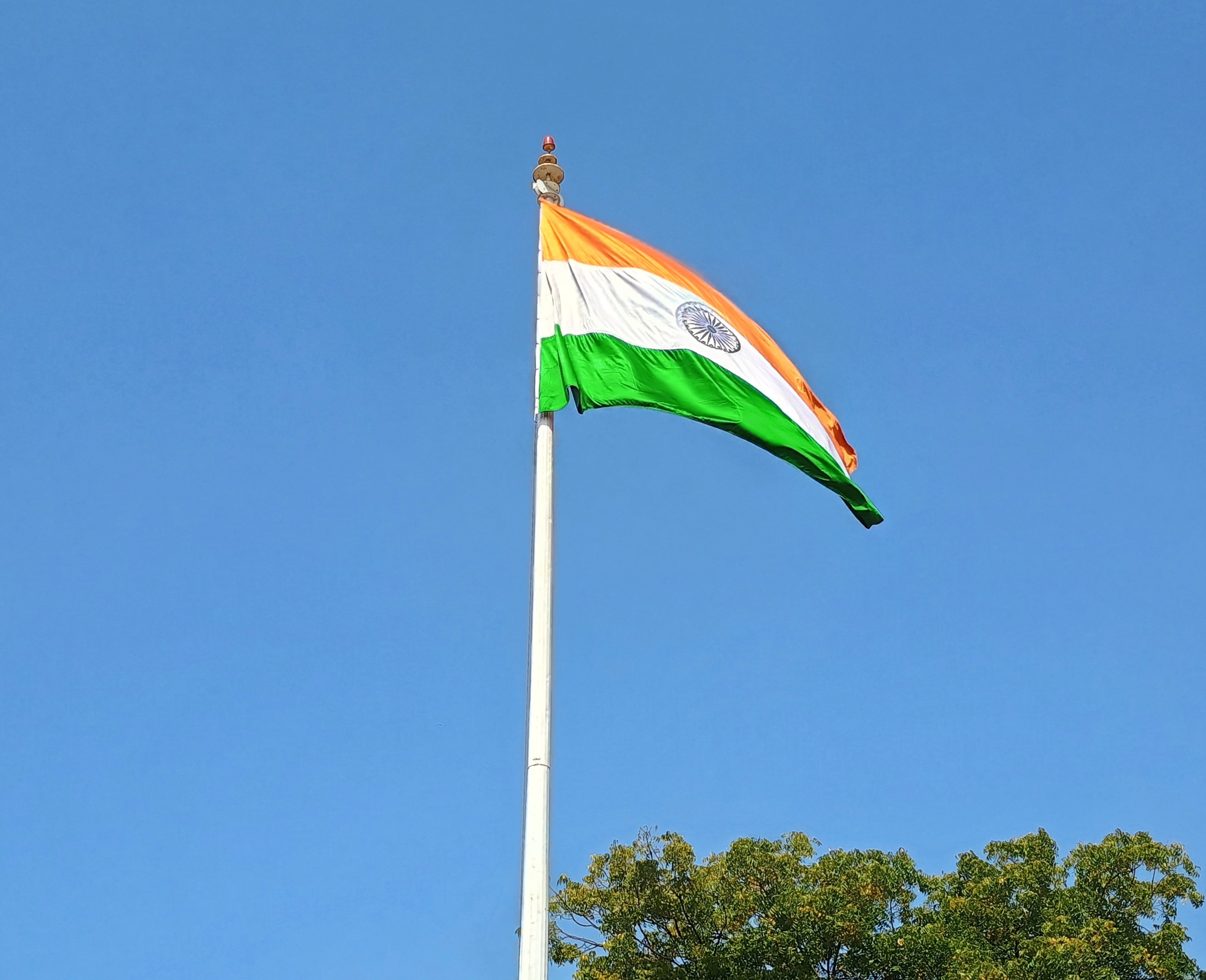
That was on Tuesday as we headed north along the eastern side of the lake, and by then I’d already formed the impression that Canadians fly more national flags than they used to. Just an impression from visiting on and off for nearly 40 years, spending maybe a month in country all together, but in no way based on anything more than my feeling. There have always been flags flying during my visits to Canada, of course. It’s just that there seemed to be more this time, though not as many as generally flag-happy Americans hoist.

The first day of the trip, Monday, October 7, we crossed Michigan to made it to Sarnia, Ontario, arriving at after dark, so there were few Canadian flags visible. The next day took us to the tip of the Bruce Peninsula, to a town called Tobermory, where we spent two nights. I started taking note of Canadian flags along that route, such as the one vigorously catching the wind in Kincardine.

A flag flies at Little Tub Harbour in Tobermory.Maple Leaf Flag, west Ontario

At the entrance of our motel in that town. Stands out pretty well. On the whole, that’s true of this particular flag in most any setting. Maple Leaf Flag, west Ontario

On the fourth day, October 10, we drove south much of the way we’d come, though ended up (by plan) near London, Ontario for the night. We stopped in places we’d bypassed on the way up, such as Wiarton. It wasn’t as windy that day.Maple Leaf Flag

A flag I didn’t see that often was the flag of the province of Ontario. I spotted one at Haley Hall, home of the Royal Legion of Canada, branch #208. hanging in front of Haley Hall on Wiarton's main street,

There seem to be grumblings about a redesign of that flag, but not much movement toward it now. Could be that many Ontarians’ attitude toward the question is eh, with a sizable number who care a lot for the current flag, but what do I know.

Flags on commercial structures.Maple Leaf flag Maple Leaf flag Maple Leaf flag

Note the red spot on the Golden Arches. The image doesn’t capture it well, but that’s the Canadian Maple Leaf. You’re not fooling anyone, McDonald’s.

Along our drives I also noticed that pasting a Maple Leaf on a wall or sign was very common as well: a business declaring its Canadian bone fides, even if they run no deeper than having a Canadian franchisee. Using the Maple Leaf as a shorthand for Canada has a long history, and in fact came long before the Maple Leaf flag, as detailed by a Canadian government web site.

The current national flag was the work of a committee in parliament in the 1960s. Usually committee-made implies substandard work, but I’d say they hit it out of park in the case of creating the immensely popular Maple Leaf flag.

I also have to say that the three-leaf design’s pretty cool, too. It was in the running to be Canada’s flag. But maybe the symbolism isn’t right; Canada isn’t like Gaul or a giant Tennessee, with three distinct parts.

Or maybe it is. Everything west of Quebec, everything east of Quebec, and that Francophone province all by its lonesome. I’m not enough of a Canadian — not one at all — to know if that division makes any sense, but I might as well throw it out there.
Our trip to the Bruce Peninsula snapped into place only the week before we went, an unusually short time for planning (at least for me), but it turned out well. Up to the tip of the peninsula and back: four nights and five days. A longer trip would be Around Lake Huron, but it was not to be. We decided on short. That was a good decision, I think. Short but we saw a lot, and enjoyed the Bruce and other places along the way a lot.
Small roads near Ontario’s Lake Huron shore take you to small towns, long lakeshores and modest rises; vistas that can offer great beauty; and expansive farmland, well-watered woods, provincial parks and Bruce National Park, a unit of Parks Canada. Except for the Canadian flags and a few other details (such as km/h speed limits, which Canadians mostly ignored), the vibe was Door County – the counterpart peninsula on the Niagara Escarpment, jutting into Lake Michigan, the counterpart of Lake Huron.

To my way of thinking, after you’ve been to Door County and the UP – the U.S. parts of the escarpment, that is – the next logical thing to do is visit some of the Canadian parts. I’ve found that other Americans I’ve spoken to about the destination have little to no knowledge of it.

Since there is a well-developed tourist infrastructure in those parts, clearly the Canadians have heard of the Bruce, and visit in droves in the summer. That was another reason to go in shoulder-season October. Those droves were gone, and sometimes it felt like we had the place to ourselves, though that was far from literally true. Which you wouldn’t want anyway, since that would be like finding yourself in a Canadian version of The Last Man on Earth.

An added bonus: the U.S. dollar is still unaccountably strong against the Canadian dollar, which fetches about 75 U.S. cents, like it did last year (but not in 2006, when it was close to parity). Pay your bill and with no effort, get a 25 percent discount. None of those cash-back schemes so widely advertised can hold a candle to that.

Speaking of money, and national symbols, receiving this coin was a first for me, namely getting Charles in change. Minted in 2023.  Got it along with some Elizabeth coins, obviously still the vast majority.

King Charles taking his place on coinage, hewing to a custom as ancient as King Croesus, yet in a remote part of his realm that’s not really his realm that much any more. I don’t have strong feelings about him as sovereign, but it is nice to see something new on a coin, like the recent redesigns of the obverses of the U.S. Washington quarter and Jefferson nickel.

Grand Teton National Park

Time for a fall break, though it hasn’t been much like fall lately. Cool nights, but warm and almost hot days. This weekend, the nights weren’t even that cool. On Saturday evening we sat on the deck and ate our pizza dinner. The wind was a bit brisk, and willing to carry away unanchored napkins, but other than that it was a wonderful time for dining al fresco. Here in October.

Back to posting on October 13 or so. Or maybe October 15, to honor Italian Food Day, as Ann calls it. Still technically a holiday in most states.

For a North American mountain range, the Tetons are pups, with current scientific assessment putting their age at 6 million to 9 million years. The likes of the Sierra Nevada and the Cascades come in between 40 million and 45 million years old; the Sierra Madre at 60 million years; the Great Smoky Mountains from 200 million to 300 million, just to cite North American examples.Grand Teton National Park

The Tetons’ ongoing formation has something to do with one plate subducting under another and vast crack in the Earth. I don’t have a deep understanding of geology, but I can get a sense of a slow motion crash – really slow motion, from a human perspective – and enormous volumes of rock being pushed upward.

The wider geology of this part of the West is just as strange and interesting. Deep down under the crust is a hot spot, an imponderable heat bulge that brought volcanism to the surface in Idaho and later Wyoming, as the big North American plate passed over the spot over the last few million years. An eruption of the Yellowstone Caldera is due. Could be tomorrow, could be 1,000 or 10,000 years from now, I understand.

Then there’s the matter, very recent on a geological scale, of the freezing and thawing of ice ages, creator and destroyer of ancient lakes in the area, as illustrated by the unstable ice dams on the Columbia and the cubic miles of water unleased on the gorge not only once, but many times.

Geologically speaking, this part of North America’s having a rumble. What’s really remarkable is that we humans, with our firefly lifespans, have figured all that out. Mostly in my lifetime. You can’t tell that just looking at the grandeur. But knowing all that adds to the view.

Day one. Our first day at the park was driving and some hiking.Grand Teton National Park Grand Teton National Park Grand Teton National Park

Jenny Lake. A scenic drive skirts its shore.Grand Teton National Park Grand Teton National Park

A roadside view of the mountains, but also a river.Grand Teton National Park

The trees line the Snake River. I had little appreciation for the Snake before taking this trip and looking at fine maps like this, which not only details the mighty Columbia but the serpentine Snake, though both of them wind around. We saw the Snake at Grand Teton NP near its origin, but also crossed it where it forms the Oregon-Idaho border, and at Idaho Falls.

Our second day was hiking and some driving.Grand Teton National Park Grand Teton National Park

The trail to Taggert Lake.Grand Teton National Park Grand Teton National Park Grand Teton National Park

When we passed these boulders, the thought popped into my head: What’s the difference, really, between these chunks of rock in the foreground and the peaks in the background? Just mass.Grand Teton National Park

The lake. Wow.Grand Teton National Park Grand Teton National Park

Not a solitary experience.Grand Teton National Park Grand Teton National Park Grand Teton National Park

Father and daughter, I assume. They spent quite a while looking at the many tadpole-like fish in the shallows.

More solitary away from the lake, on the long looping trail back to the parking lot.Grand Teton National Park Grand Teton National Park Grand Teton National Park

We did make the nodding acquaintance of a family. Probably grandparents and their two university-aged grandsons (or maybe one with a friend), probably from a metro in the Northeast. The grandmother, maybe 10 years my senior, looked particularly exhausted by the trail, grayish hair frazzled, face a little pink.

We passed them, though they passed us later as we relaxed in a shady spot. Later, we passed them again as they rested, the grandsons clearly worried about grandma, though I don’t think she was in any real danger, unless she had a health problem I didn’t know about. Still, she was making the effort at however many thousands of feet we were in elevation, with its thinner air.

Again I ask – and always wonder – what is it about mountains? I don’t have the urge to climb, but I do want to get close enough to see their majesty.Grand Teton National Park Grand Teton National Park Grand Teton National Park Grand Teton National Park

Once the hiking is over —Victor, Idaho

Waiting are the comforts of a rented room. Ahh.

Chapel of the Transfiguration

The place to contemplate the great outdoors is usually outdoors. But not quite always.Chapel of the Transfiguration, Wyoming

About a month ago, we entered Grand Teton National Park at the Moose Entrance. Not far inside the park is the Chapel of the Transfiguration.Chapel of the Transfiguration, Wyoming Chapel of the Transfiguration, Wyoming

Rustic, the style is called. A picture window behind the altar, looking toward the Cathedral Group of mountains, was clearly no accident. Liturgical east in this case points to the grandeur of Creation.

The chapel has stood in this spot in Wyoming for nearly 100 years, built to serve guests at the various dude ranches that existed in the area before it was a national park. Grand Teton became a national park in 1929, with President Coolidge inking the bill at the tail end of his administration, but even then the chapel wasn’t in the park, which didn’t expand down to Moose until 1950.

Transfiguration is an Episcopal chapel, associated with St. John’s Episcopal Church in Jackson, Wyoming. St John’s, a large log structure over 100 years old, is just off the busy main street in that town, a little apart from the many shops and restaurants and attractions. We spent a while in Jackson before entering the Grand Teton NP, including a visit to St. John’s.St John's Episcopal, Jackson, Wyoming St John's Episcopal, Jackson, Wyoming St John's Episcopal, Jackson, Wyoming St John's Episcopal, Jackson, Wyoming

The church was open, but no one else was there. If any place qualifies as the beaten path, Jackson, Wyoming is it. And as usual, it took about a minute to get off the beaten path.

Craters of the Moon National Monument

Among the western states, Idaho’s got one of the more interesting shapes, the result of decades of negotiations, schemes and the arcane doings of Congress in the 19th century, which are summarized nicely in an article in Idaho magazine, though it could use a few more maps. Not every is happy with the current Oregon-Idaho border, though I’m not holding my breath waiting for a change.

Idaho’s flag is less interesting; another state seal.Idaho flag

At least the seal has some Latin: Esto perpetua, let it be forever; it is forever. I assume that’s a wish for the existence of Idaho, or Idaho’s status as a state, not the seal or flag itself. New state flag designs for Idaho are kicking around on the likes of Reddit, but nothing official seems to be in the works yet. Pocatello has had a new flag since 2017, however, and it did need one.

We headed east from Boise on September 3. The easy way is on I-84. We drove to Mountain Home and then turned off on US 20, as previously mentioned. Go that way and you’ll eventually come to Craters of the Moon National Monument and Preserve. It’s a big blob on the map (753,000 acres) that has long intrigued me.Craters of the Moon National Monument

The monument was originally created in 1924 by President Coolidge partly due to the publicizing efforts of an interesting Idahoan, Bob Limbert, who explored the area, previously ignored as a wasteland, and wrote about it. President Clinton expanded Craters of the Moon greatly in 2000 and I’ve read that the Idaho legislature has asked Congress to make it a national park.

I’d be against it. Not that anyone has asked me, but it’s time to stop national park bloat. Sixty-three is more than enough. Sixty is fine, for that matter, a nice round number with ancient resonance. There’s nothing wrong with a place being a national monument. It’s an honorable old designation, the brainchild that most conservation-minded president, TR. I need to visit more of them myself: only 21 out of 134 so far, counting Craters of the Moon and Devils Tower.

The part of Craters of the Moon accessible to casual tourists is only a sliver, but quite a sliver. One trail leads over the aftermath of ancient lava flows, and a road leads to cones.Craters of the Moon National Monument Craters of the Moon National Monument Craters of the Moon National Monument Craters of the Moon National Monument

The terrain just cries out for a monochromatic treatment.Craters of the Moon National Monument Craters of the Moon National Monument

The day was warm enough to wear a hat and carry water, but not blazing hot. A scattering of other tourists were around, but nothing like the more popular trails of the national parks.

The place looks barren, but it isn’t so, since life adapts.Craters of the Moon National Monument Craters of the Moon National Monument Craters of the Moon National Monument

Except where it doesn’t. Yet.Craters of the Moon National Monument Craters of the Moon National Monument Craters of the Moon National Monument Craters of the Moon National Monument

We decided not to climb the enormous black cone, but if you look carefully, you can see a fellow who did. Note the trail on one of the smaller cones. That we did climb, reaching a view of the maw of the cone, though it has a grate blocking the way, to limit the erosive effect of a constant trickle of people clambering down.

More monochrome.Craters of the Moon NM Craters of the Moon NM

“The craters of Craters of the Moon… are definitely of volcanic origin,” explains the NPS paper guide, noting also that the name dates from long before anyone knew what the actual craters of the Moon looked like, at least up close. I don’t think any of the Apollo astronauts were reminded of Idaho. No matter, the name’s got some panache.

“But where is the volcano? These vast volumes of lava issued not from one volcano but from a series of deep fissures – known collectively as the Great Rift – that crosses the Snake River Plain. Beginning 15,000 years ago, lava welled up from the Great Rift to produce this vast ocean of rock. The most recent eruption occurred a mere 2,000 years ago, and geologists believe that future events are likely.”

Not to be confused with the Great Rift Valley, over in East Africa. The Digital Atlas of Idaho calls it the Great Rift system, “a series of north-northwest trending fractures… The total rift system is 62 miles long and may be the longest known rift zone in the conterminous United States.”

In other places, life has returned more robustly. There’s an easy trail through that as well.Craters of the Moon National Monument Craters of the Moon National Monument

A difficult place for trees, looks like.Craters of the Moon National Monument Craters of the Moon National Monument

We spent longer than planned at Craters of the Moon, which meant that we didn’t get to Victor, Idaho, our next destination, until well after dark. No big deal, it was worth it, and the nighttime winding road was a smaller version of the twisty drive near Sheridan, Wyo., so not bad either.

The Idaho State Capitol & Bits of Boise

Boise is a growth town. I know that because the Census Bureau reported a population of about 235,600 in 2020, compared with 205,600 in 2010. Not only that, driving in downtown Boise was a pain in the ass last month, considering how many streets were closed for construction. That’s usually a growth indicator. Boise Idaho

Adding to the irritation is the fact that many of downtown’s one-way streets (that are still open) go opposite of the way you want to go. But when you’ve found a place to park, and arrive at a restaurant like Bacon in downtown Boise, you forget all that. Nice tip before we left Seattle from Dan, who has spent some time in the area.Boise Idaho Bacon

Maybe not good to eat in the long run, but in the short run, it makes you glad you spent the night in Boise and headed out for breakfast the next day. Also, downtown Boise looked interesting, especially on foot.Boise Idaho Boise Idaho Boise Idaho

The former Idanha Hotel, which opened exactly at the turn of the 20th century – January 1, 1901 – and is now a multifamily residential property. Its architect, a Scotsman named W.S. Campbell, founded a firm in the late 19th century in Boise that’s still around: CSHQA.Idaho State Capitol

Everywhere has one of these murals, though usually they say, Welcome to…Idaho State Capitol

Eventually, by way of Boise’s unpredictable streets, we made our way to the Idaho State Capitol. I saw it briefly in ’89, but only from the outside. A grand edifice.Idaho State Capitol Idaho State Capitol Idaho State Capitol

Grand inside as well.Idaho State Capitol Idaho State Capitol Idaho State Capitol

John E. Tourtellotte & Co. designed the capitol, completing much of it in 1912, though the House and Senate wings came a few years later. Tourtellotte is another one of those architects of yore who did a lot of work.

The Idaho State Capitol has a gilded Washington on a gilded horse.Idaho State Capitol

“Austrian immigrant [Charles Ostner] carved George Washington from a single pine tree,” the capitol web site says. “With a postage stamp to guide him, Ostner took four years to create his masterpiece. His young son was said to have frequently held a candle to light his workroom after darkness fell.

“Once completed, Ostner gave his rendition of our first president to the Territory in 1869. In return, Idaho’s leadership paid him $2,500.” Later, it was gilded and much later, restored.

Any capitol can have an image of George Washington. But how many have a Benjamin Harrison?Idaho State Capitol

Idaho is, of course, another of the six Benjamin Harrison states, entering the union with his signature in 1890 as number 43, just days ahead of Wyoming. A nearby sign says the Harrison bust was carved in 2009 by one Steve Ussing using wood from a red oak planted by the president himself.

The Columbia River Gorge

A happy birthday to Jimmy Carter, president of my adolescence, who some years ago outlasted every other holder of that high office, now reaching 100. I can’t presume to know the secret of his longevity, but can speculate that lasting long enough to vote against you-know-who might have been an inspiration to hang on.

While reading about President Carter today, I came across the conclusion of a speech at the dedication of the Carter Presidential Library in Atlanta on October 1, 1986.

I must tell you, Mr. President, that your countrymen have vivid memories of your time in the White House still. They see you working in the Oval Office at your desk with an air of intense concentration, repairing to a quiet place to receive the latest word on the hostages you did so much to free, or studying in your hideaway office for the meeting at Camp David that would mark such a breakthrough for peace in the Middle East. Others will speak today, Mr. President, of all phases of your political career and your policies. For myself, I can pay you no higher honor than to say simply this: You gave of yourself to this country, gracing the White House with your passion and intellect and commitment. And now you have become a permanent part of that grand old house, so rich in tradition, that belongs to us all. For that, Mr. President, I thank you, and your country thanks you.

Who said that? Ronald Reagan.

A month ago today we headed east from Portland on US 30, which soon becomes the Historic Columbia River Highway, beginning at the sizable town of Troutdale, an intriguing place that seems to count as exurban Portland. As highways go, the road is antediluvian, first surveyed in the 1910s, partly following a 19th-century wagon route. Old, but well maintained, it’s a smooth drive in our time, though fairly busy.

The highway’s engineer, Samuel C. Lancaster, got himself a plaque along the way, which calls the road a highway of “poetry and drama.” He collaborated with business tycoon and good roads promoter Sam Hill to get the road built.Columbia River Gorge

That is, he left a legacy of vistas. One could do a lot worse.

At Chanticleer Point.Columbia River Gorge

Further east is Crown Point, a promontory more than 700 feet high, with an even more sweeping view of the mighty Columbia. The builders of the highway knew this too, and included an observation tower: Vista House.Columbia River Gorge Columbia River Gorge

Designed by Edgar M. Lazarus and completed in 1918. Elegant stonework, and an expensive development, I’ve read. I’d say worth it, for providing more than a century of vistas.Columbia River Gorge Columbia River Gorge

Inside Vista House is a small museum, gift shop, and an information kiosk where we got helpful information from the person at the desk. She said that the highway (US 30) was closed for construction a few miles to the east, and that if we wanted to visit Multnomah Falls, we’d need to backtrack a few miles and then take I-84, the modern road that also passes through the Columbia River Gorge.

That we did.Columbia River Gorge

To see the falls, at least on September 1, you needed to book a slot, and we did that as well. Tall falls near a highway draws a crowd, though that isn’t apparent at a distance.Multnomah Falls

If you edit just so, that isn’t apparent closer up either.Multnomah Falls Multnomah Falls

But on a visit to the falls, which drop 635 feet in two plunges, you won’t be alone.Multnomah Falls Multnomah Falls Multnomah Falls

A stone footbridge 100 feet above the lower pool is the place to climb to and point your camera.Multnomah Falls

“Formed by the cataclysmic Missoula Floods beginning 15,000 years ago and fed mainly by underground springs, Multnomah Falls drops… in two major tiers down basalt cliffs,” says the office of the Oregon Secretary of State. “It ranks as the tallest waterfall in Oregon and is one of the most visited tourism sites in the state.”

Two million visits a year, to quantify that statement. As I’ve noticed in a fair number of other places, that’s not much of an issue, since the crowd is in a pretty good mood.

Missoula Floods?

“After millennia of relative calm, the colossal Missoula Floods crashed through the [Columbia River] gorge several times between 12,000 and 18,000 years ago,” wrote science writer Richard Hill in the Oregonian. “The source of the floods was the 2,000-foot-deep, 200-mile-wide Glacial Lake Missoula. Until the last ice age started to thaw, an ice sheet at the mouth of the Clark Fork River in northern Idaho and Montana blocked it.

“But slowly, melted water cut a channel into or under the ice, collapsing the dam and unleashing the lake’s 500 cubic miles of water. It sped into the narrower confines of the gorge at 75 mph and submerged Crown Point. The ice dam repeatedly would reform, and the flood process would start again.

“Recent studies… found evidence of at least 25 massive floods. They calculated the largest flood discharged roughly 2.6 billion gallons a second — about 2,000 times larger than the Columbia’s 1996 flood.”

1996 flood?

Another one of those things I’m sure I heard about, but memory of it has evaporated as surely as the flood waters. Epic, the Oregonian calls it.

The International Test Rose Garden

I was expecting to see roses at the International Test Rose Garden in Washington Park in Portland. I wasn’t expecting a bronze Royal Rosarian.International Test Rose Garden

Mainly because I’d never heard of the Royal Rosarians. Reading a bit about them – including on a plaque near the statue – I found that they’re one of those local civic organizations composed of prominent businessmen who dress up for events. Something like the Texas Cavaliers in San Antonio, whose head cheese King Antonio passed out aluminum tokens each year to schoolchildren once upon a time, including me.
“The Royal Rosarians are the official greeters and goodwill Ambassadors for the City of Portland promoting the best interests of the City of Portland and the Portland Rose Festival,” the org’s web site says.

“Royal Rosarians welcome visiting dignitaries from around the world, host hundreds of out-of-town visitors, march in parades throughout the region, and perform ceremonial rose plantings in honor of worthy individuals both in Portland and during Rosarian ambassadorial trips to distant cities throughout the world. Organized in 1912, the Royal Rosarians are a non-profit, civic organization.”

In hilly Washington Park, which occupies more than 450 acres, the seven-acre International Test Rose Garden is directly downhill from the Portland Japanese Garden and, unlike that garden, free to visit. Some 10,000+ rose bushes grow there, representing 650+ varieties. If I hadn’t visited the Tyler Rose Garden earlier this year, I would have been flabbergasted by the profusion. Still, the garden is impressive.International Test Rose Garden International Test Rose Garden International Test Rose Garden

The fact that it is a test garden means that rose growers far and wide send their cultivars for evaluation.

“Test beds are planted with new varieties evaluated on several characteristics, including disease resistance, bloom form, color and fragrance,” says the Spokesman-Review. “ A Gold Medal Garden features previous years’ best selections, and the Shakespeare Garden features roses named after characters in the bard’s works.”

The idea of a test garden in Portland goes back to World War I, when it was seen as a way to preserve cultivars that might otherwise be lost because of the fighting. Portland was already known for its roses by the early 20th century, as illustrated in this article in Oregon Live.
The thing to do at the International Test Garden is wander around, taking in the varieties.International Test Rose Garden International Test Rose Garden International Test Rose Garden International Test Rose Garden

Or –International Test Rose Garden

Create rose-themed art.