Joliet Iron Works Historic Site

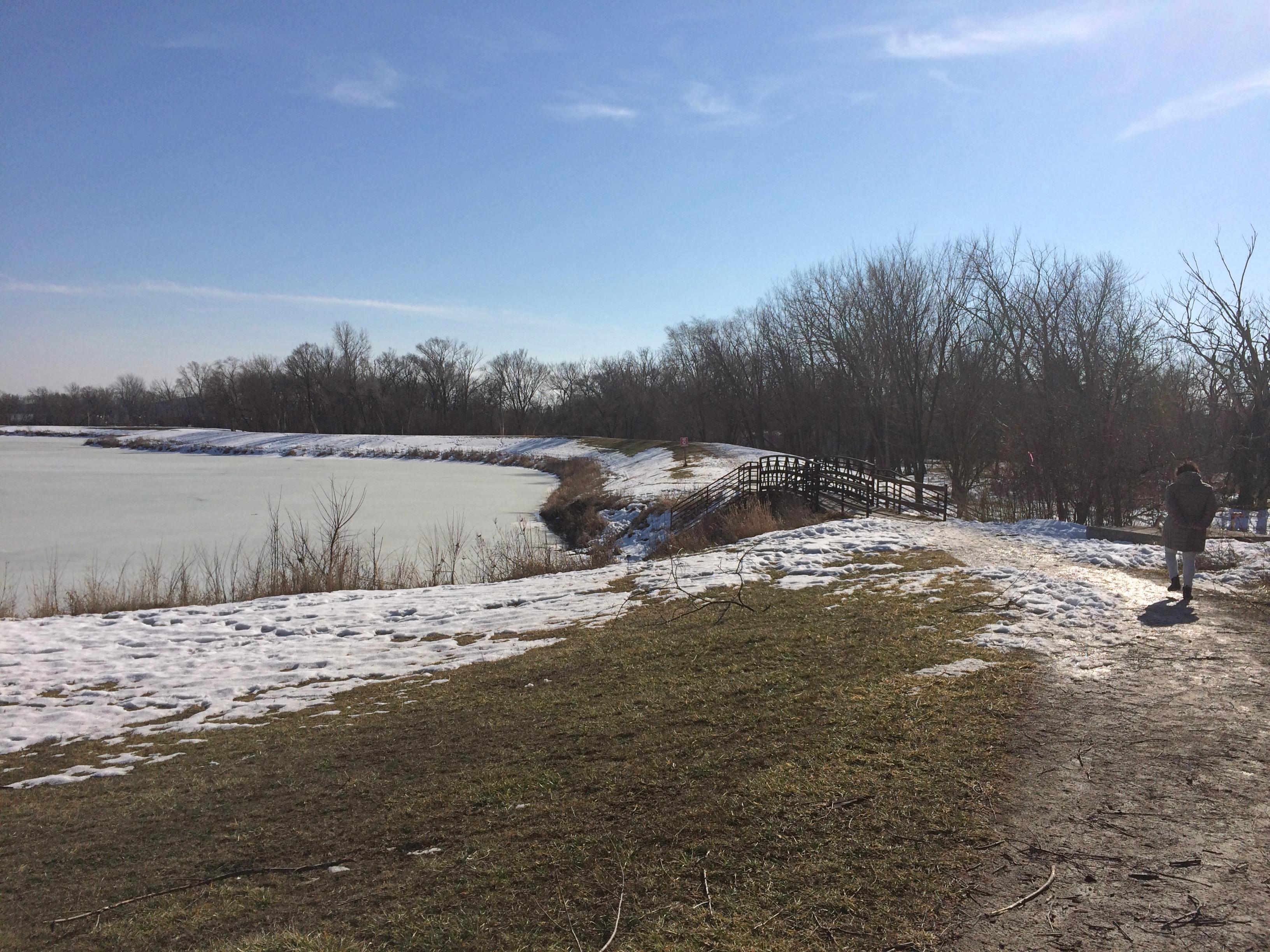
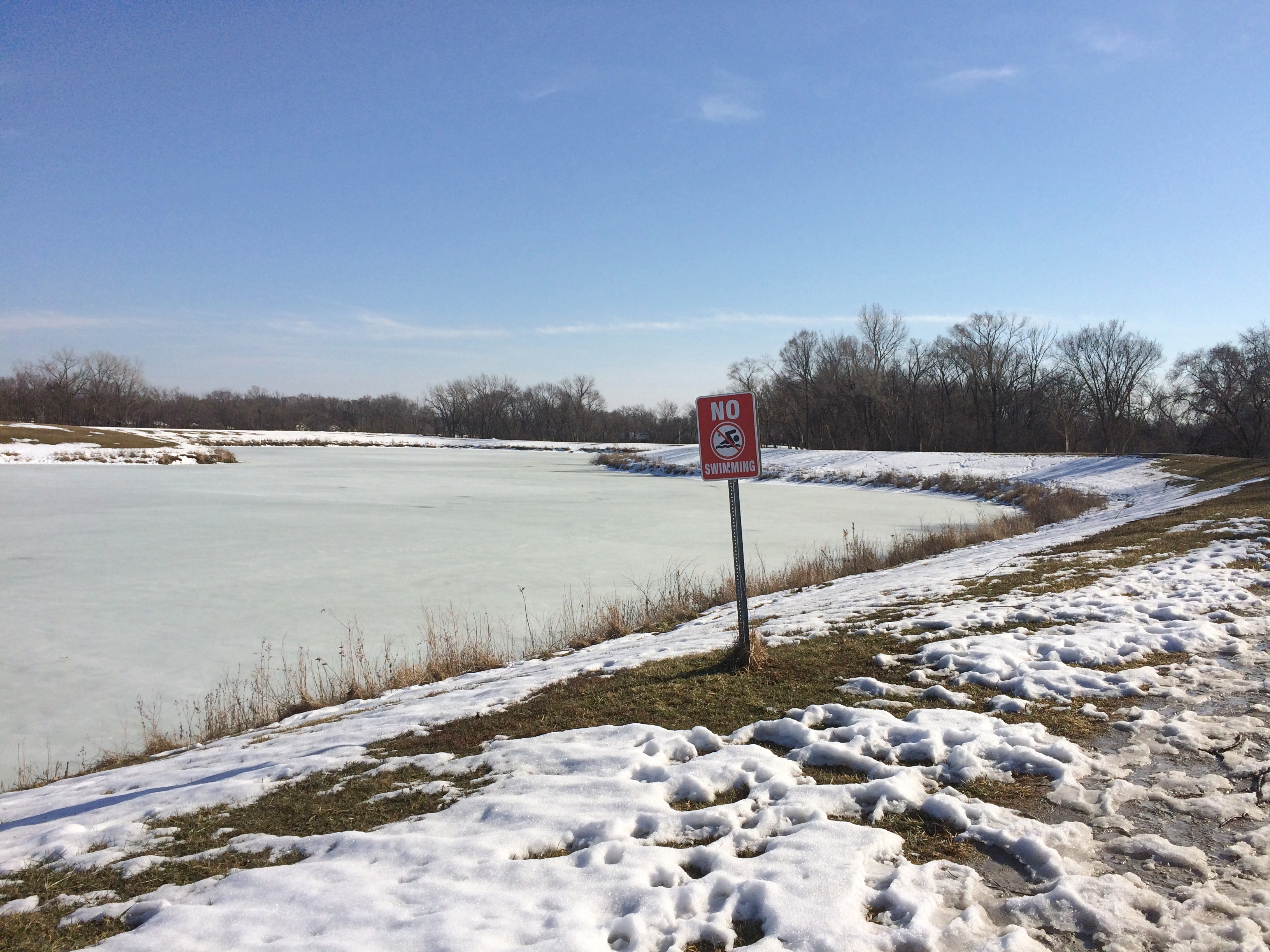
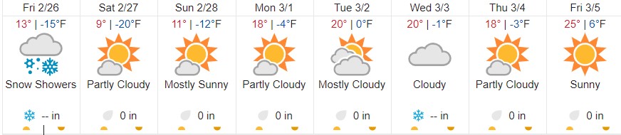
For early March, and especially considering the snows and bitter days of February, Sunday felt gloriously warm. Temps were in the mid-50s by the early afternoon, and we needed no further encouragement to go find a place to walk, though it took some driving to get there.

We went south. There are lots of places to see in southern metro Chicago, including the Joliet Iron Works Historic Site.
Joliet Iron Works Historic Site
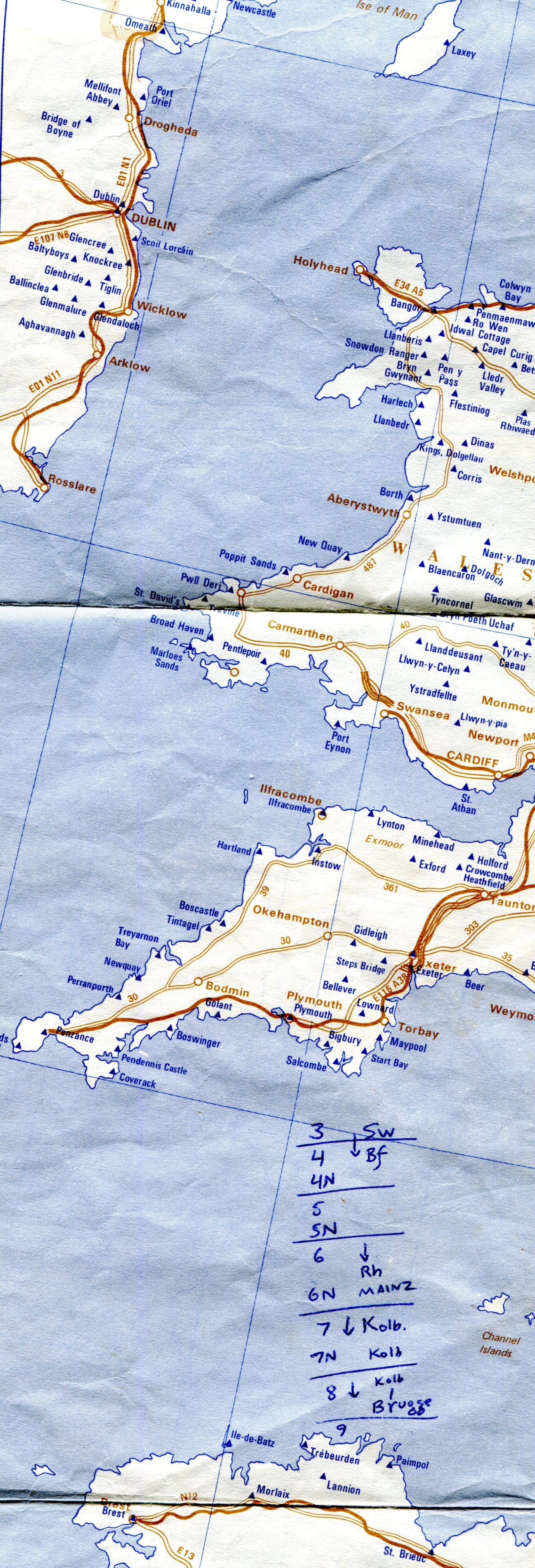
Industrial ruins, that is. Unfortunately not the towering metal husks you might see in Pittsburgh or Birmingham, Alabama, but worth a look all the same.

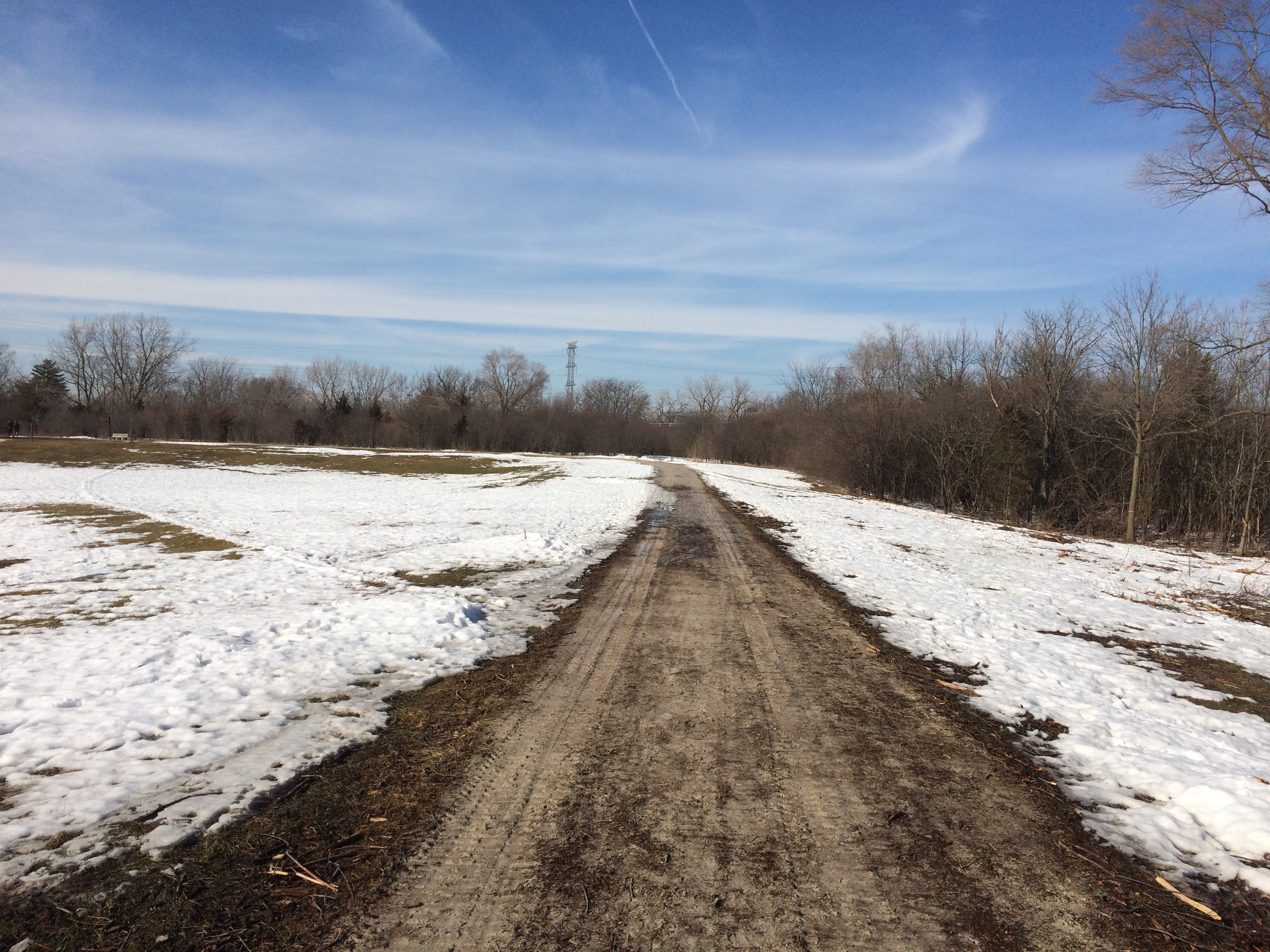
A path runs through the ruins about a half mile, roughly parallel to RR tracks to the east, and the Illinois & Michigan Canal to the west, though those aren’t always visible.
Joliet Iron Works Historic Site
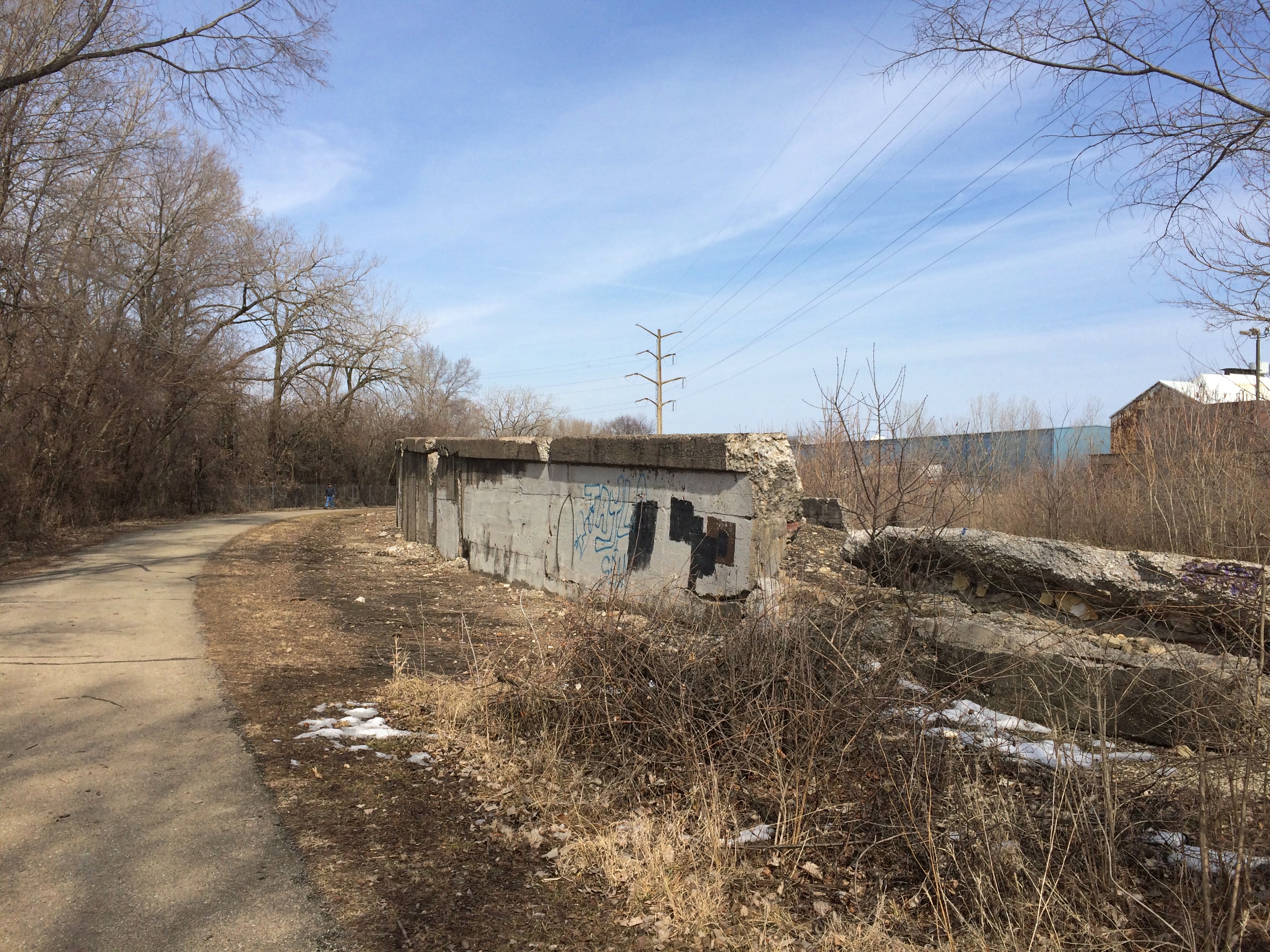
Toward the southern end of the site, it’s mostly rubble, and not always much at that.Joliet Iron Works Historic Site Joliet Iron Works Historic Site Joliet Iron Works Historic Site
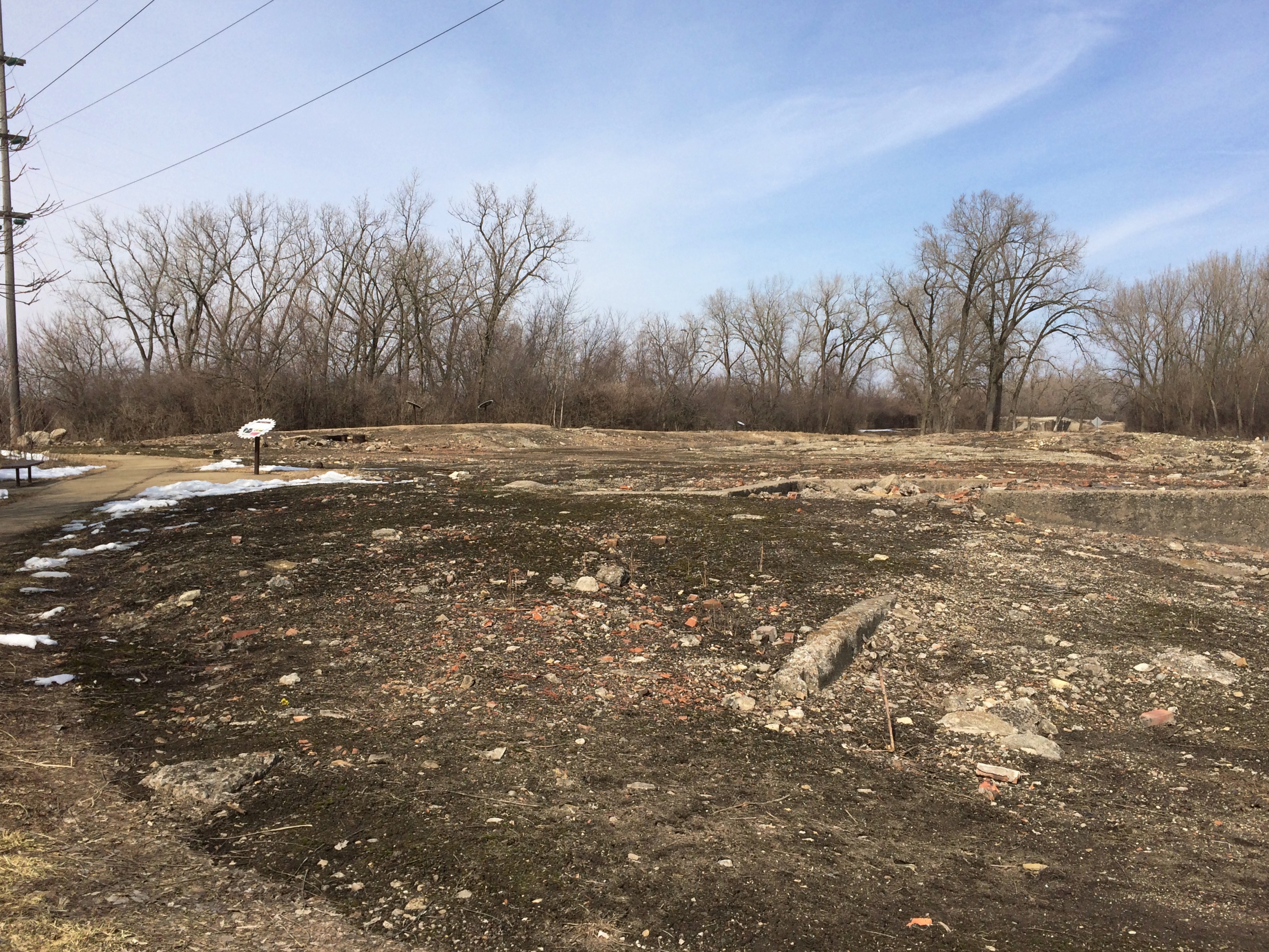
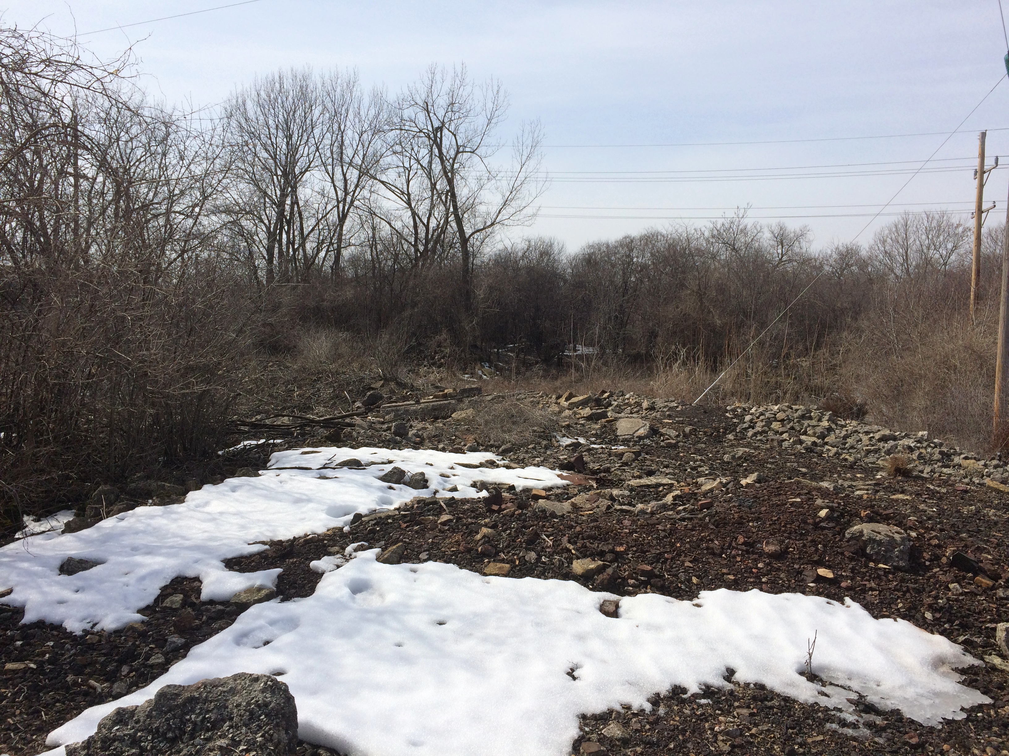
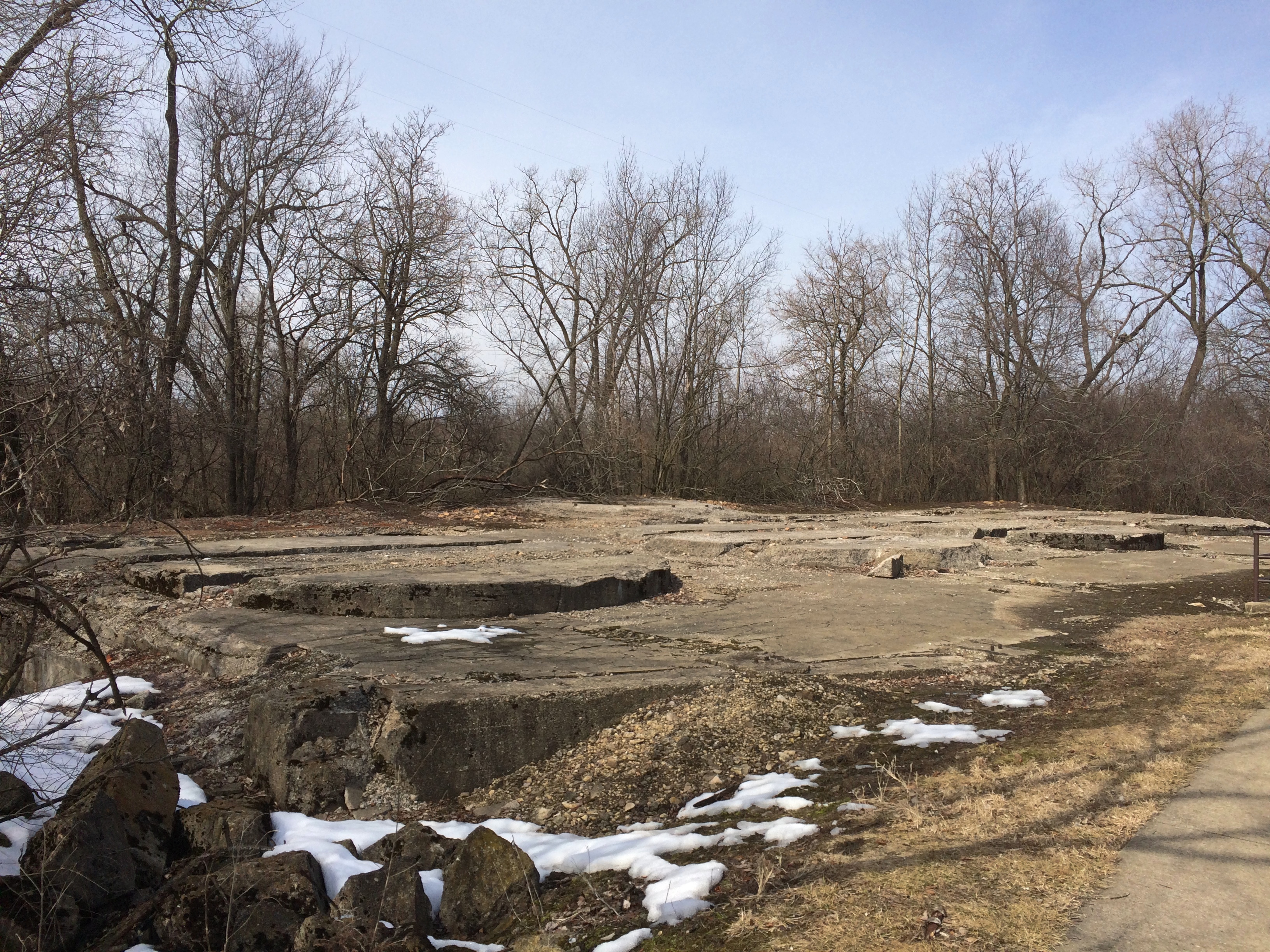
Further north, there are the stubs of the sizable structures that used to be there.Joliet Iron Works Historic Site Joliet Iron Works Historic Site Joliet Iron Works Historic Site

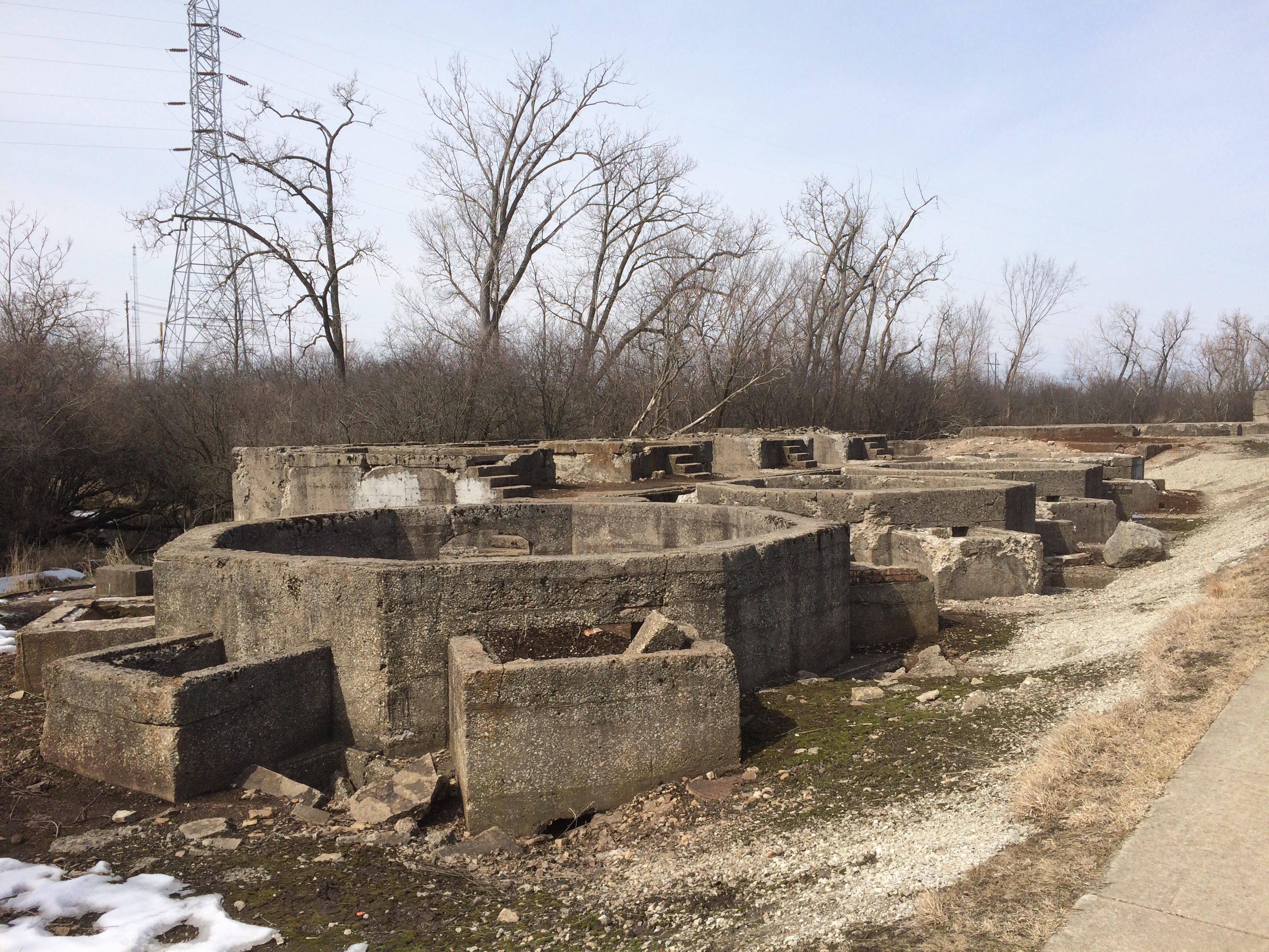
Including some dark holes.
Joliet Iron Works Historic Site
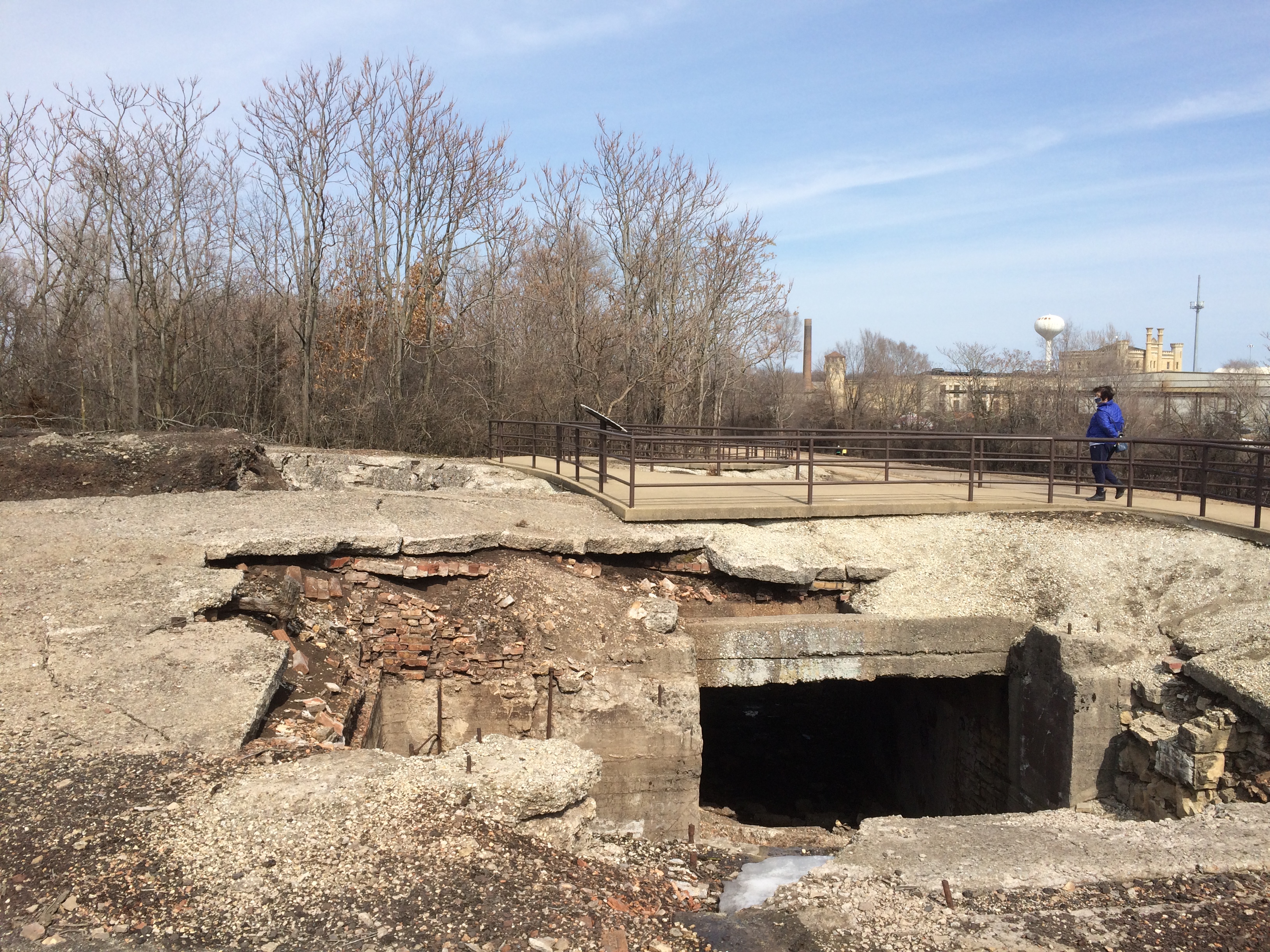
This pit is the foundation of a once mighty, and mighty dangerous, blast furnace.
Joliet Iron Works Historic Site
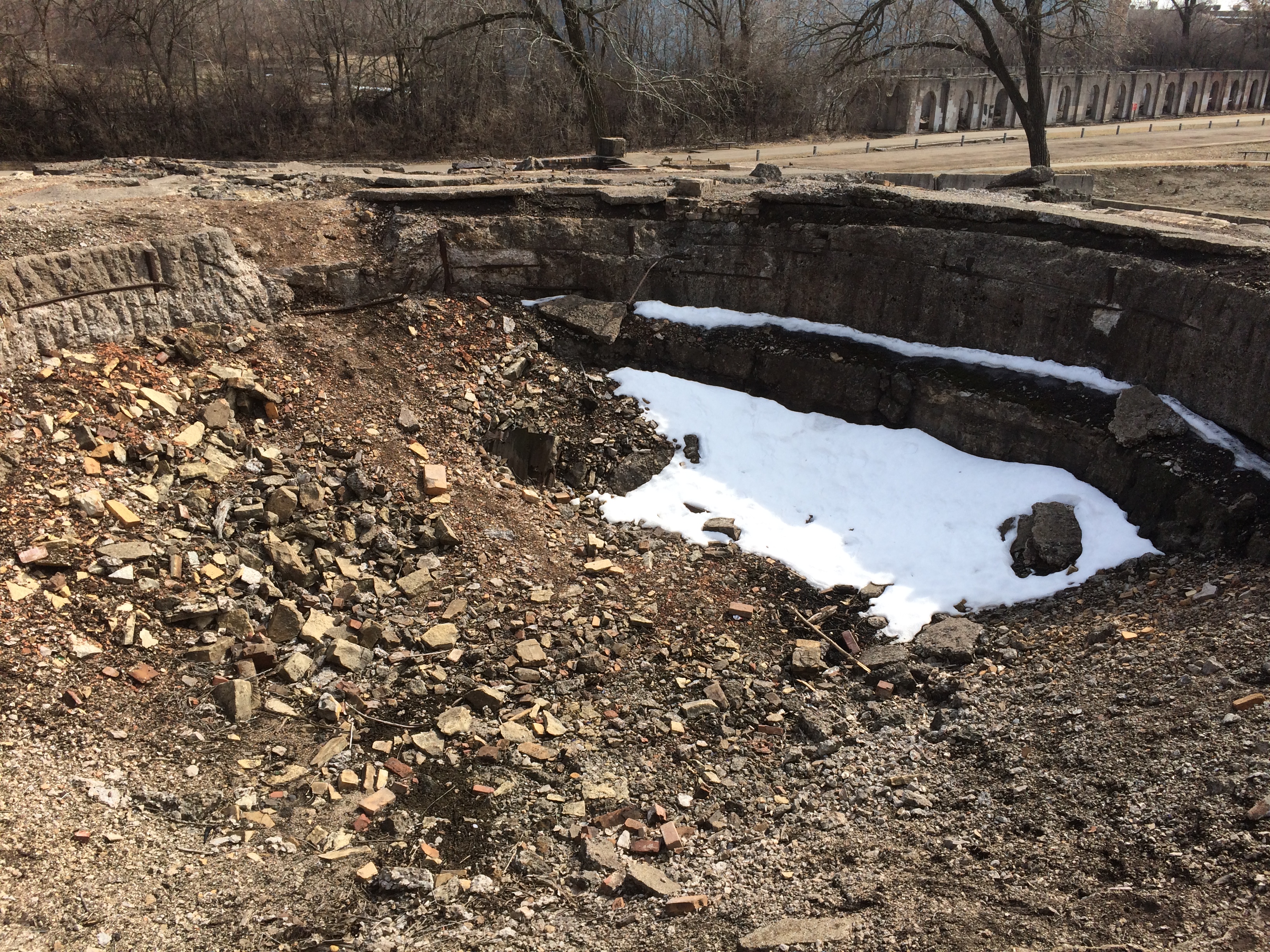
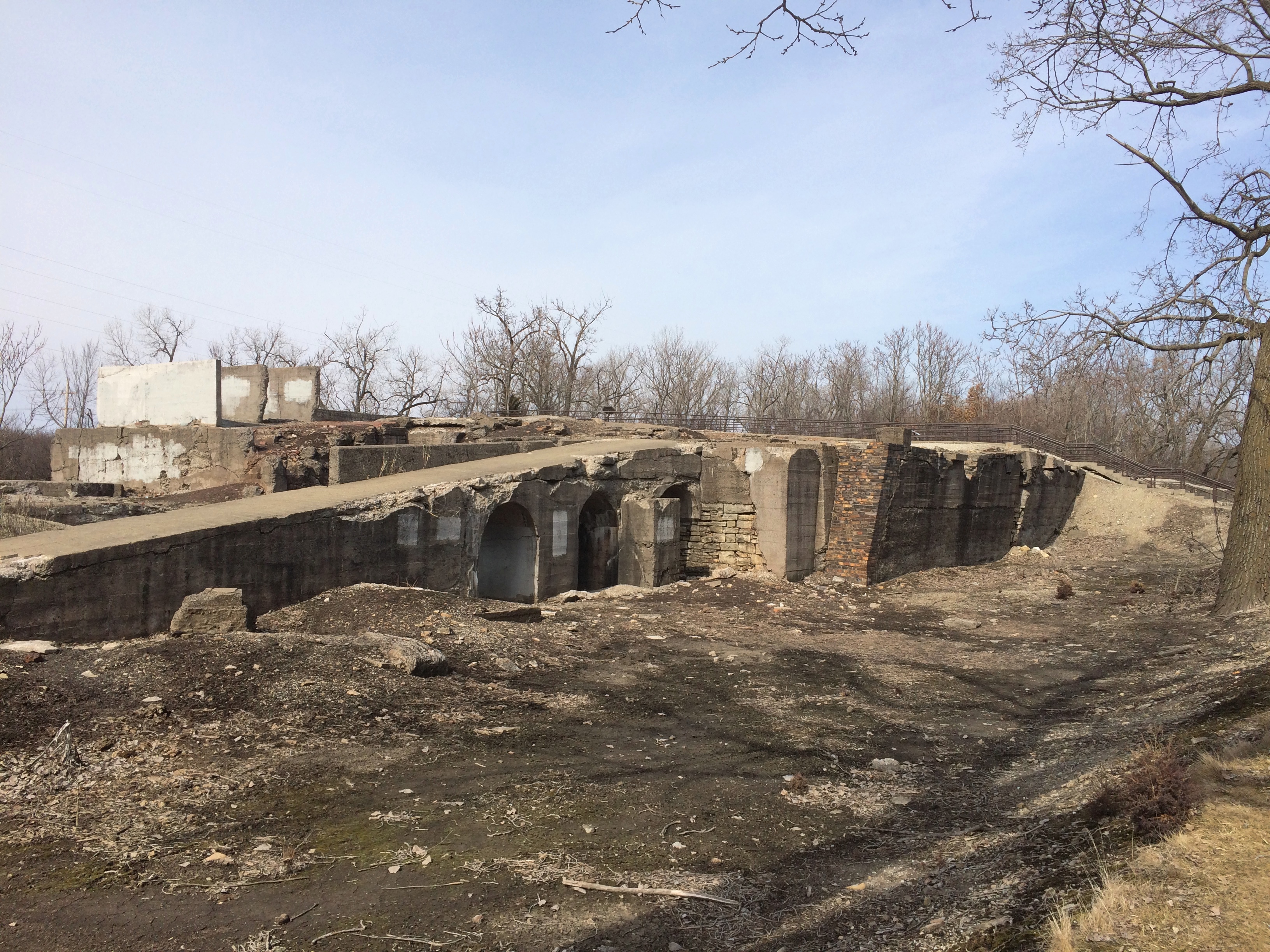
Once I was reminded of some of the images of Knossos that I’ve seen. Like this one.Joliet Iron Works Historic Site
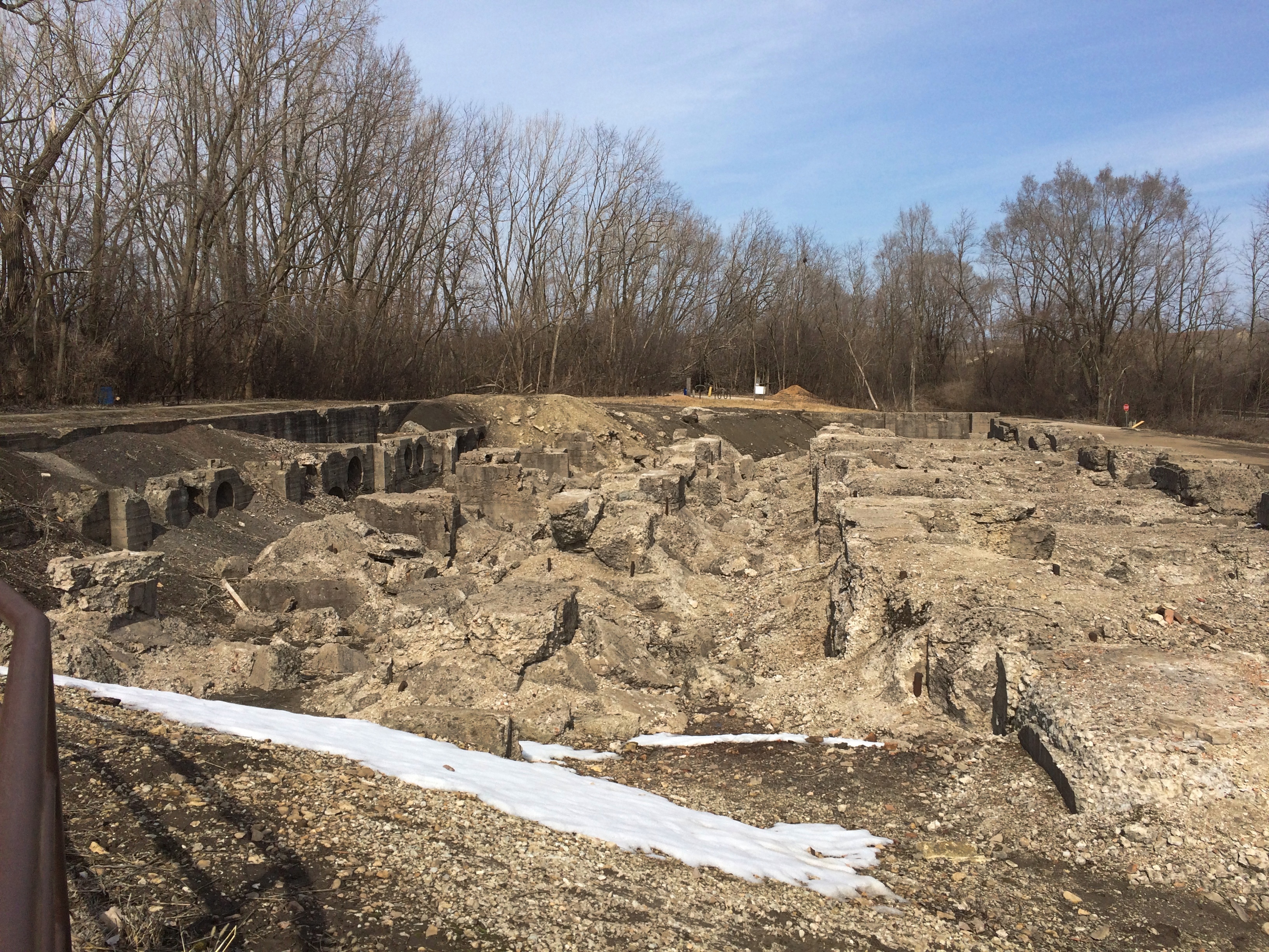
“The factory opened in 1869 and was a massive facility for the time….” notes Atlas Obscura. “Employing four huge blast furnaces and a few thousand employees, the metal works produced around 2,000 tons of raw pig iron each day.”

Not sure where that figure came from. On site, one of the signs said that soon after the plant opened, the total was 50 tons of pig iron a day. By 1910, production was 400 tons a day.

“The plant kept putting out metals until 1936 when it closed for a short time before being reopened [for the war effort]. However, its new life was not to last that long either, as the works became unprofitable and were abandoned in the 1980s.”

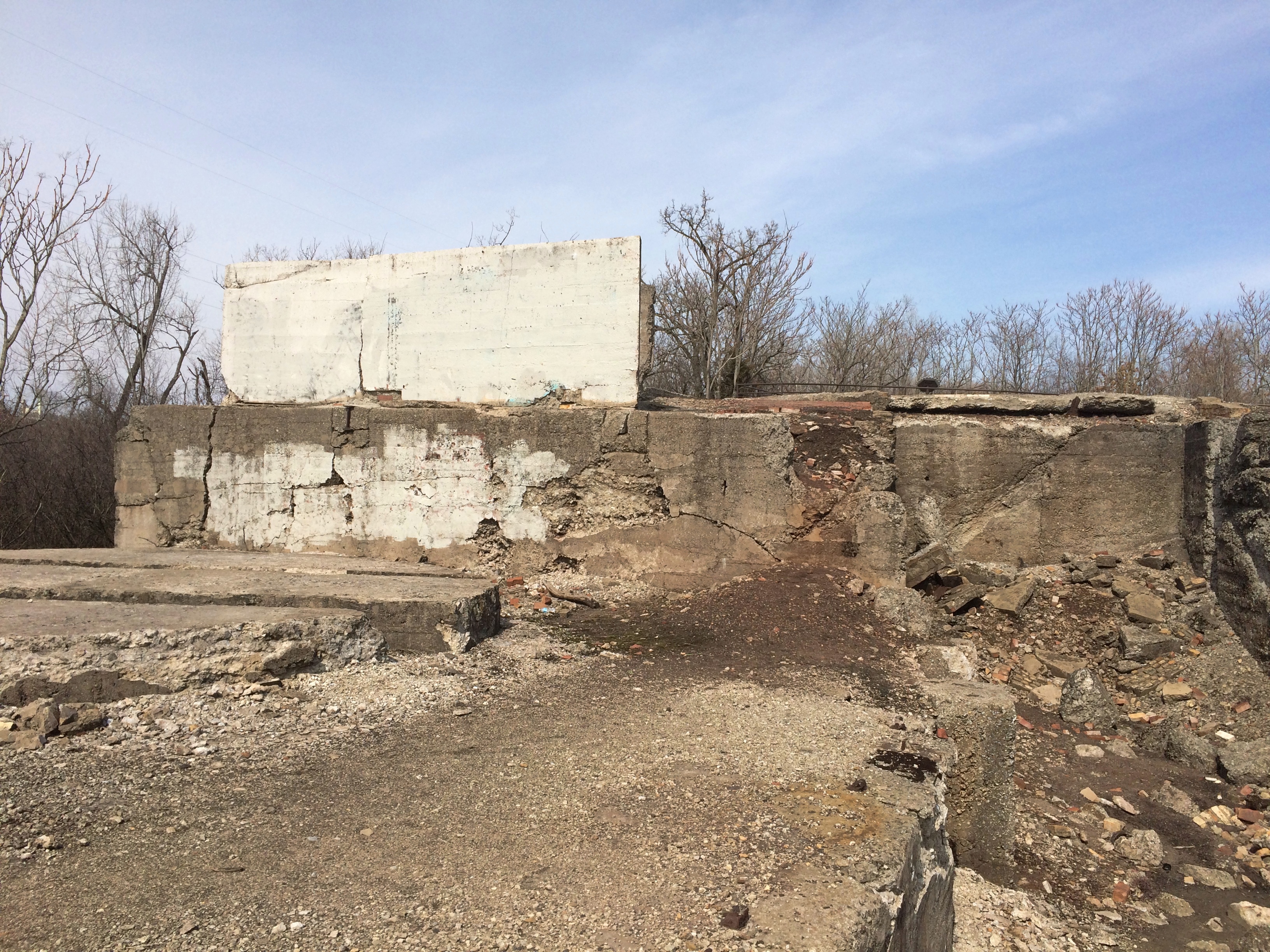
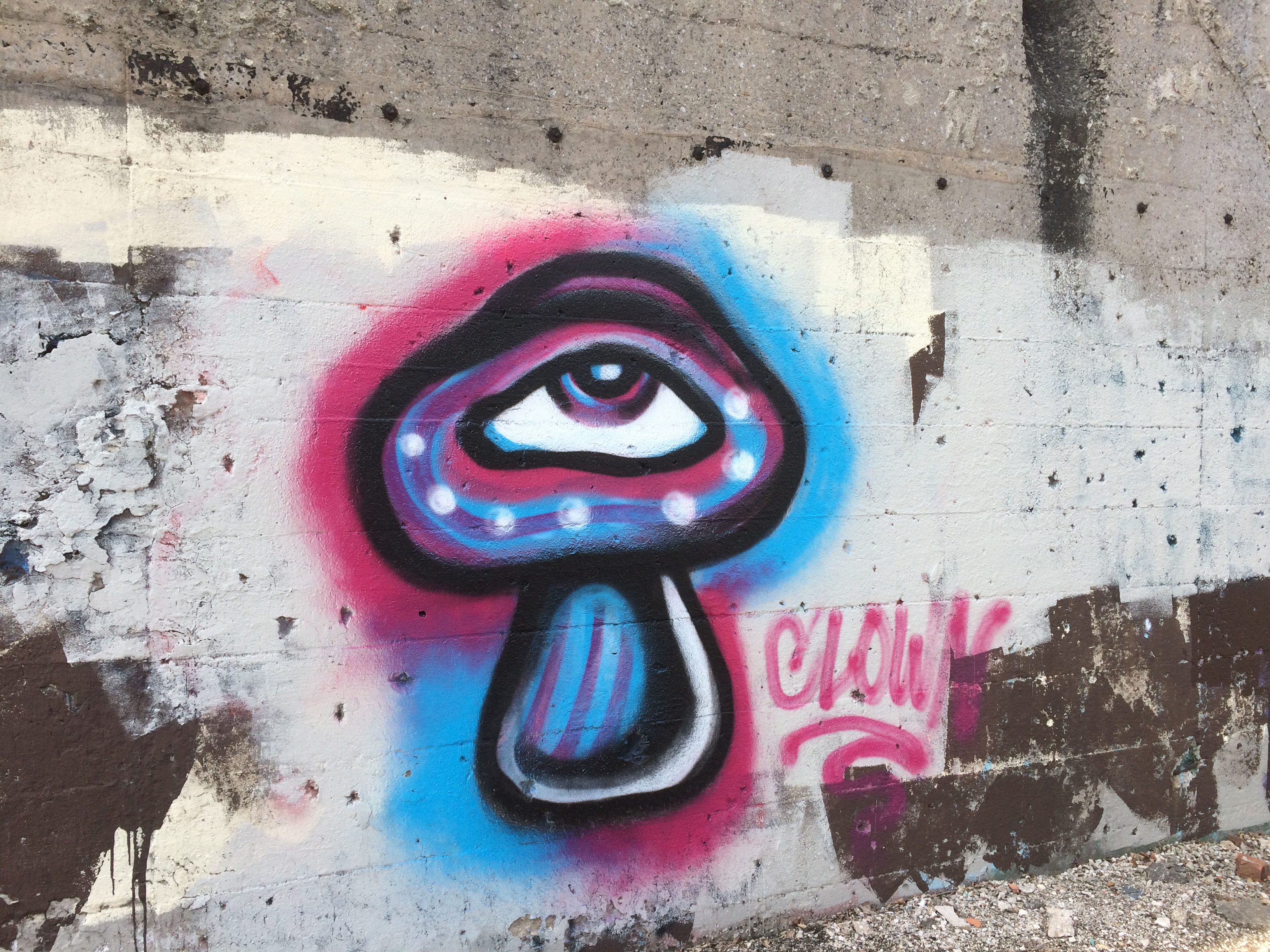
Surprisingly little graffiti marks the ruins, though there are places where it’s clear it has been painted over. Such as here.
Joliet Iron Works Historic Site
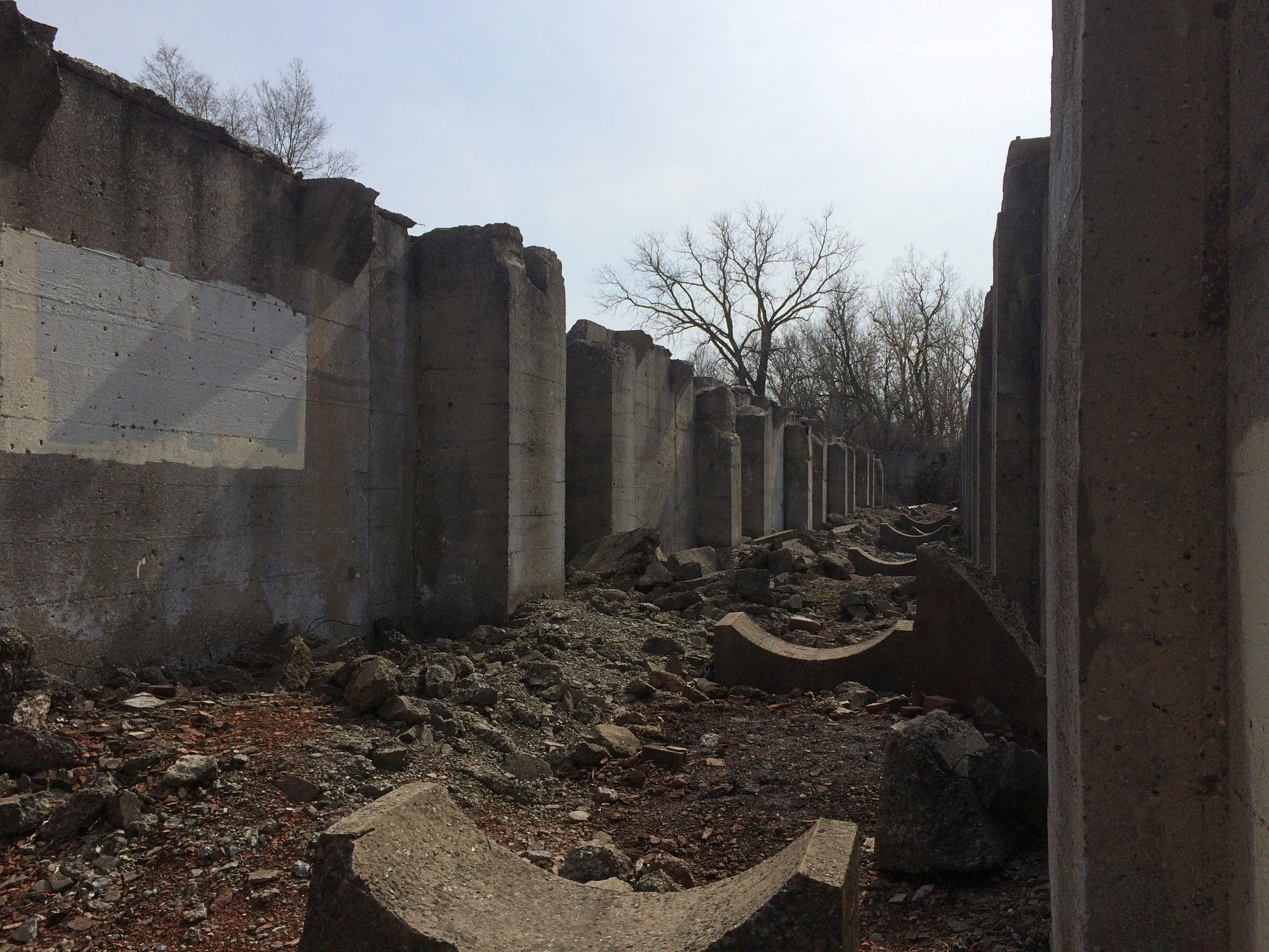
But new graffiti is probably added regularly.
Joliet Iron Works Historic Site
The Forest Preserve District of Will County acquired the site in the 1990s, and stabilization efforts have been enough to allow it to be open to the public. Parts of the site, anyway.
Joliet Iron Works Historic Site
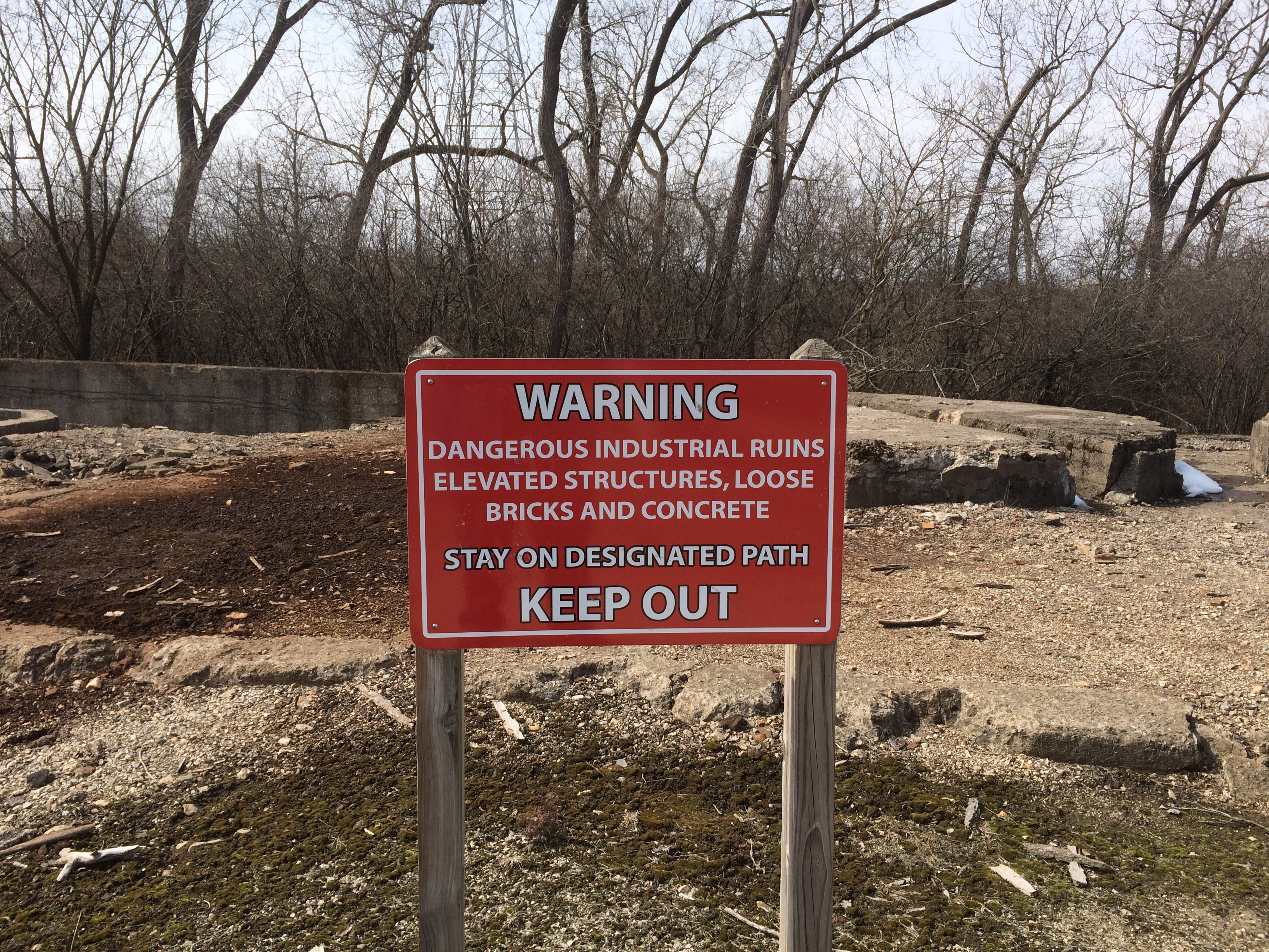
You can’t say you haven’t been warned.

Tottori Sand Dunes, 1992

Pleasant spring-ish weekend. Sour old man winter will return again sometime soon, of course, but probably not in full force as spring slowly gains the upper hand.

Referring to the Tottori Sand Dunes, Wikipedia has this to say, among other things: “Each year, around two million visitors — mostly from within Japan and East Asia — visit the dunes.[citation needed]”

Maybe so. When we went there in March 1992, the place was pretty popular.Tottori Sand Dunes Tottori Sand Dunes Tottori Sand Dunes

The dunes aren’t that far from the heavily populated Kansai region — Osaka-Kyoto-Kobe — and they count as a novelty draw since Japan doesn’t a lot in the way of epic sand dunes. If that’s what you want to see, Tottori is the place to go. The dunes stretch nine miles from east to west, and are a little more than a mile wide. At their highest, they rise about 165 feet over the Sea of Japan.

“The Sendai River carries sediment from the nearby Chugoku Mountains that eventually washes out into the Sea of Japan,” JNTO says, along with images of the area wider than anything I have. “Strong sea currents and winds work together to push these sediments back onto the shore to form the sand dunes. These same intense winds continuously move and re-shape the dunes.”

The dunes supposedly inspired Kobo Abe’s novel, The Woman in the Dunes (砂の女 Suna no Onna, “Sand Woman”), which I haven’t read. Years ago I did see the 1964 movie based on the novel, which is a well known avant-garde film and, I thought, relentlessly grim. Fitting for a retelling of the Sisyphus myth.

Arlington Cemetery & Elm Lawn Memorial Park

Due south of Mount Emblem Cemetery are twin burial grounds, Arlington Cemetery and Elm Lawn Memorial Park, also in Elmhurst, Illinois. On Saturday I headed south from Mount Emblem along County Line Road, fully intending to find an entrance to I-290 and proceed home, but I noticed the two cemeteries before I got that far.

I’ve been driving by those cemeteries for years, seeing them from the highway, not realizing they were distinct and never getting around to seeing them any closer. Though the afternoon was getting chillier and patches of snow still covered the ground, I figured I’d take a look.

These images are of Arlington Cemetery, which is to the east.
Arlington Cemetery Elmhurst Illinois
These are of Elm Lawn, to the west.
Elm Lawn Cemetery Elmhurst Illinois
A better aesthetic than Mount Emblem, which is say more standing stones, and the cemeteries ought to be nice in the spring and summer. It’s hard to tell in the winter whether these concerns, of some years ago, have been addressed.

As a casual visitor, there was no difference between the two. No fence or other demarcation. I noticed that the Arlington office building was permanently closed, with a sign referring visitors to go to the Elm Lawn office a few hundred feet away. Indeed, according to the cemetery’s web site, the two have been combined under single ownership for more than 25 years.

The permanent residents probably don’t care about any of that. If they do, they’re keeping quiet.
Elm Lawn Cemetery Elmhurst Illinois
A small section of Elm Lawn (I think) that I drove by is designated the Valley of Peace Shia Cemetery, which must be fairly new. Considering the demographics of the northwest suburbs, that’s thinking ahead on the part of cemetery ownership.

Mount Emblem Cemetery

A cemetery with most of its memorials flush to the ground — a mid-century notion that hopefully has faded — looks like a snow-covered field in winter. That can be nice, but it doesn’t say cemetery, and the added beauty of stones in the snow, rather than under it, is missing.

There were stones in the snow at the Elk Grove Cemetery in January 2010.
Elk Grove Cemetery 2010
Mount Emblem Cemetery in Elmhurst, Illinois, has all the ingredients to be a striking cemetery except standing stones. So on Saturday, I saw mainly this kind of scene.
Mount Emblem Cemetery
With a few reminders that loved ones are memorized somewhere under there.
Mount Emblem Cemetery
There are a few structures that won’t be denied their place in the pale winter sun.
Mount Emblem Cemetery
Mount Emblem has, however, one thing unique in any cemetery I’ve been to, or know about: a Dutch-style windmill.
Mount Emblem Cemetery
It’s the Fischer Windmill, built in the mid-19th century, long before the cemetery was established.

“The windmill was built sometime between 1849 and 1865 by Henry Fischer, after he inherited part of the family farm from his father, Frederick L. Fischer, one of the original settlers in the county,” the Chicago Tribune reported in 1995. “It took two hired millwrights about three years to build it, including six months to fashion the main cogwheel.

“The main framework of the windmill is cypress, and it rests on a stone foundation. It features hand-hewn shafts and gearing of white oak and hickory… The mill ground wheat and corn for local farmers until the demand declined after the turn of the century.”

The cemetery association bought it in 1925 and, according to the Trib, installed chimes. I didn’t hear any chimes, but I did notice two loudspeakers mounted on the structure.

Cricket Creek Forest Preserve

Saturday wasn’t exactly warm, but it was above freezing, sunny and mostly windless, which had been true for some days before that. So we figured forest preserve paths might be clear of ice at least. We were mostly right, but not completely.
Cricket Creek Forest Preserve
That’s at the north entrance of Cricket Creek Forest Preserve in Addison, which generally follows Salt Creek as it meanders through DuPage County. The Salt Creek Trail runs through the 208-acre forest preserve.

The map depicts only the northern section of Cricket Creek. Further south are two more ponds, including one reserved for model boat sailing.

“The land was prairie until the late 1930s, when it started to transform into agricultural fields dotted with homes,” the DuPage County FPD says. “The Forest Preserve District acquired the first 40 acres in 1974 and made subsequent purchases through 2016, eventually transforming a flood-prone housing development into a beautiful forest preserve.”

The trails are crushed limestone.
Cricket Creek Forest Preserve
The photos don’t really show it, but underfoot on the path was a crushed limestone slush, making for occasionally sicky mud. Better than ice, I’d say.
Cricket Creek Forest Preserve
We made it most of the way around the pond, until we came to patches of unmelted snow and ice.
Cricket Creek Forest Preserve
So we turned around and went to the other side of the pond, essentially doing a U-shape partly around the pond. Not the most idyllic walk, but walking ought to be an all-season activity, including winter — mild winter days, that is.

NC 40 Yrs Ago

March 3, 1981

As I write, each moment takes me further east that I’ve ever been. It’s noon and we’re on NC state highway 64, a rural route to the coast, which is about an hour away. Writing from the front passenger seat, mostly between the fairly few bumps and potholes.

Temps high 50s, so windows up. On a warmer day, this would be a great road to roll down your windows and crank the radio.

We pass on either side of us stands of thick pine alternating with open farmland. To our front, an open two-lane road all the way to a pinpoint on the horizon; a straight-razor cut all the way ahead. Behind me is Stuart, who is napping in the back seat with a silly grin on his face.

Normally, I’d say the day began too early, that is, 6:30 am, but it was worth it. After a breakfast composed of those mammoth Shredded Wheat biscuits, which I hadn’t seen in years, we left Durham.

2:15 Nag’s Head. Saw the Atlantic Ocean proper for the first time just below the Joe Justice fishing pier, which was closed.

3:30 The Bodie Island lighthouse is to my left. In the time it’s taking me to write, we’ve started crossing the enormous bridge to Hatteras Is. Fleetwood Mac is on the radio.

Today’s mostly been a day of travel, with Neal driving his parents’ 13-year-old station wagon, me in front navigating, and Stuart in back among some of the provisions. Once we got to the coast early in the afternoon, heading through Nag’s Head and north to the Wright Brothers National Monument to see where their plane memorably hopped x feet that day in 1903.

We climbed to the top of Kill Devil Hill, from which the Wrights tested their gliders. We then wandered south to Jockey’s Ridge, a titanic sand dune, and climbed to the top. We watched hang gliders launching from the dune and befriended a big black dog, who was chasing hang gliders when he wasn’t playing with us. Must have belonged to one of the people hang gliding, since he didn’t look ragged enough to be a dog living on its own.

As we left, he followed us part of the way toward the parking lot, but then turned around. We were sorry to see him go, but he couldn’t have come with us even if he wanted to. We headed south to where we are now, Hatteras.

Jana Seta Tallinn

This looks like a promising way to ease into proto-spring. Or, as you notice the crunch of snow under your feet give way to squishing sounds, the Mud Season.

That’s just the near-term weather forecast for where I live, and thus a very narrow focus. I am glad — for any number of reasons, including Siberian weather — I don’t live in Irkutsk. The days ahead for that place:

Which pretty much looks like here during February until a few days ago, except we had more snow. Another difference is that I expect the rest of the spring is going be much colder in Irkutsk than here.

Then again, for year-round pleasant weather, I hear the place you want to be is Medellín:

That does look pleasant, just keep a sweater around for the evening. Reminds me of Mexico City in December, except there wasn’t a bit of rain.

One more map (for now): Tallinn. Nice town, Tallinn, at least in 1994, and I expect it’s done well for itself in the generation since casting off the Soviet yoke.

The map front is simple enough, and reminds everyone where Estonia is in the greater scheme of Europe. Guess some people need to be reminded of that kind of thing.

The map is the product of Jana Seta, “publishing house, maps and art gallery” in Riga. I’m happy to report that it’s still around, and has a web site that tells me that the company had just started business the same year we visited Riga, which was just after we were in Tallinn. Unfortunately, we didn’t visit the map store.

“We started on the 19th of April 1994 when the specialized map and travel literature outlet — Jana Seta Map shop — opened its doors to the first customers in the newly renovated Berg’s Bazaar building in Riga,” the site says. “At that time it was the first and only specialized map shop in the Baltics.

“Together with the constant in-going and out-going tourism development in Latvia, our shop has grown to become one of the leading map shops in the whole of Eastern Europe. Many trips around Latvia and abroad have started at the shelves of our map and tourism literature.

“The former USSR army general staff topographic map and city plans (published 1949-1991) have a special place in our assortment.” Hm.

One side of the map is a wider view of the city, while the other has a detailed map of the historic center, plus an index and advertisements for the kinds of things that tourists and business travelers might want, mostly in English. Looks like Jana Seta was quick to pick up the ways of private enterprise. The map key and other information are in English, Russian and (I assume) Latvian.

This is the inset for the historic center of Tallinn.

A fine old place to visit, though we stayed in cheaper accommodations out from the center, in a Soviet-era block of flats, and rode the convenient trolley into the old town. I see that I marked a few places of interest in purple ink, including one I labeled “puppet theater.” As much as I’d like to say that we went to a puppet theater in Tallinn, I’m afraid we didn’t.

“The Historic Centre (Old Town) of Tallinn is an exceptionally complete and well-preserved medieval northern European trading city on the coast of the Baltic Sea,” says UNESCO, which put it on the World Heritage list in 1997. “The city developed as a significant centre of the Hanseatic League during the major period of activity of this great trading organization in the 13th-16th centuries.

“The upper town (Toompea) with the castle and the cathedral has always been the administrative centre of the country, whereas the lower town preserves to a remarkable extent the medieval urban fabric of narrow winding streets, many of which retain their medieval names, and fine public and burgher buildings, including town wall, Town Hall, pharmacy, churches, monasteries, merchants’ and craftsmen’ guilds, and the domestic architecture of the merchants’ houses, which have survived to a remarkable degree. The distribution of building plots survives virtually intact from the 13th-14th centuries.”

One more thing I learned just now from Jana Seta’s site: “Mars has three craters named for places in Latvia: Auce, Rauna and Talsi. Now you know.”

Nelles Bangkok

Bangkok is one of those cities hard to navigate even with a map. But I guess the challenge and the thrill of finding your way around in a place where most of the signs aren’t in a roman script is a thing of the past. Even if I ever went back there, I’d take my box, with its connection to nifty electronic maps and transliterations.

We had a good map: Nelles. It wasn’t the only place where we used that brand.

Craenen, a European map distributor, says of Nelles: “Nelles Verlag is a German publisher of maps and guidebooks. The Nelles maps are well known and appreciated for their reference precision and quality…


“Places of interest, including historical sites, beaches, national parks or protected area, etc. are highlighted both on the main map and on the accompanying street plans or enlargements…. The extensive range consists of a large number of destinations for which it is difficult to find other good maps. Asian destinations in particular are very well represented, and in recent years, more coverage has been given to both South America and Africa.”

Tourist Map of Japan

Another yellowing old map in my collection — accumulation — random stash — is one of Japan published by the Japan National Tourist Organization in 1988. I picked it up in 1990 during my early days in the country, and for a while it was thumbtacked to a wall in my flat.Tourist Map of JapanLook closely and you’ll see the thumbtack holes. Along with tears and other damage. Part of the front panel, not far from Tokyo-Yokohama, is missing for some reason.
Tourist Map of Japan
I also seem to have used it for note-taking, at least briefly. Something I learned very early on: the price of a postcard and a first-class letter to the U.S. (¥70 and ¥100, respectively). Not bad, $1 fetched about ¥130 during my first year there. I’m not sure what “Y-779 8361 MCA – Osaka” refers to.
Tourist Map of Japan
Featuring cities, towns, rail lines and roads, spas (very important in Japan; onsen (温泉), perhaps hot spring is a better translation), rivers, lakes, major mountains, national parks and prefecture names. The kanji for larger cities and towns is also included.
Tourist Map of Japan
It wasn’t a map I carried around much, since the scale was too large (1:2,000,000 as it happens) to be useful as a guide. Still, it had a good run on my wall, helping inspire me to get out and about.

Jugendherbergen in Europa und im Mittelmeergebiet

Folded away in my collection of maps is a well-folded and slightly yellow youth hostel guide map of Europe, vintage 1983. Even if I hadn’t carried that map around Europe in the summer of ’83, I would know the date.youth hostel map 1983 youth hostel map 1983

It’s fairly large, 24 x 34 inches, and a little cumbersome to use except in your room, as you planned a future stay. We had guidebooks that might (or might not) mention a particular youth hostel, but there were no websites to tell you what you were getting into, though I never did stay in a bad one, just some mediocre ones. You also never knew whether it had a vacancy, unless you figured out how to call ahead, which could be an involved process. Even in the high season of summer, however, I remember that being an issue maybe only twice, and in those cases the hostel staff recommended somewhere else to stay.

One side includes most of northern Europe, including insets for Ireland and West Germany, where youth hostels were thick on the ground. But not in East Germany in those days. Guess the DDR didn’t take kindly to youth traveling around.youth hostel map 1983Interestingly, most of the other communist countries, at least those that weren’t the Soviet Union, had a system of youth hostels. Bulgaria seemed to have been especially fond of them. Maybe they still are.

The other side features southern Europe and northern Africa, including a fair number in Tunisia and a scattering in Morocco, Egypt and Libya, of all places.
youth hostel map 1983
The map is relatively simple, noting national borders, some of the larger cities and roads and rivers, and each IYHF-affiliated property as a blue triangle to stand out against the browns of the rest of the map.youth hostel map 1983

The German inset.youth hostel map 1983

I took a few notes on the map, such as these between Devon and Brittany.youth hostel map 1983

Looks like I was working out my travel schedule from August 3 to 9, as we headed north from Switzerland to the coast at Oostende. I wrote “Brugge” at the end, but for reasons I don’t remember, and can’t fathom now, we didn’t stop there.

We stayed at hostels in the UK, West Germany, Austria, Switzerland and Denmark. All the more expensive countries, in other words. In Italy, which had any number of cheap guesthouses, we didn’t bother, and sometimes the hostels we stayed at in northern Europe weren’t affiliated with the IYHF.