SoCal Driving

Remarkable how quickly last week’s political mail becomes obsolete.

Then again, if he follows through with his promises, we’ll continue to get mail from his organization until election day. The message will just be a little different. Namely, Kick the SOB Out, or words to that effect.

Before I visited Southern California last month, I was slightly apprehensive about driving there, which was in no way rational. I’ve driven in most major U.S. metro areas, including Los Angeles, without major incident. I’ve been jammed up in traffic and had near accidents and gotten lost, but those things can happen anywhere.

Driving around SoCal wasn’t bad at all. As mentioned before, I opted out of GPS. Don’t need a box telling me where to go, especially when its advice tends to be: find the nearest freeway. I used maps — electronic maps, in this case. That’s about the best thing my phone does for me, as I discovered walking around in New York a couple of years ago.

(One strange thing that first happened during that trip was people asking me for directions, with a phone in their hands. They pointed to the Google Maps display and asked, how can I get to x from here? Dunno, man, read the map, maybe.)

You can’t — at least certainly shouldn’t — call up Google Maps while driving, and I didn’t do that, but usually it was easy enough to find a place to stop to consult a map. Also, here’s a tip for getting a light to change: start fiddling with your phone to look up a map, and it is sure to change.

Often enough I didn’t need to consult a map. Los Angeles street theory isn’t perfectly grid-like, but it has strong elements of a grid. Up one major street for miles, over another for more miles.

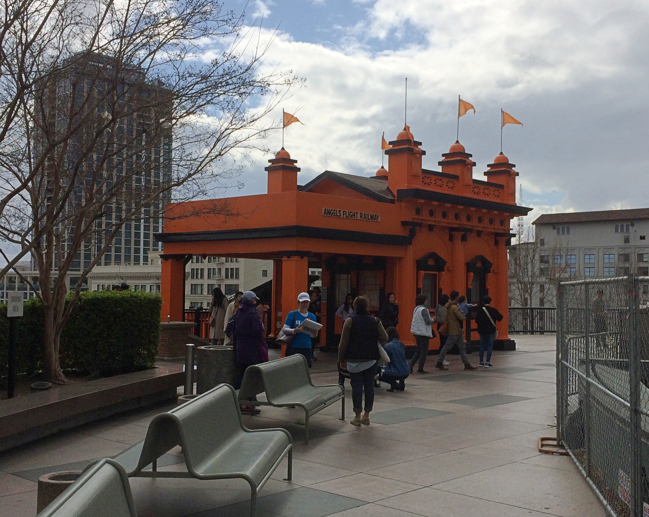
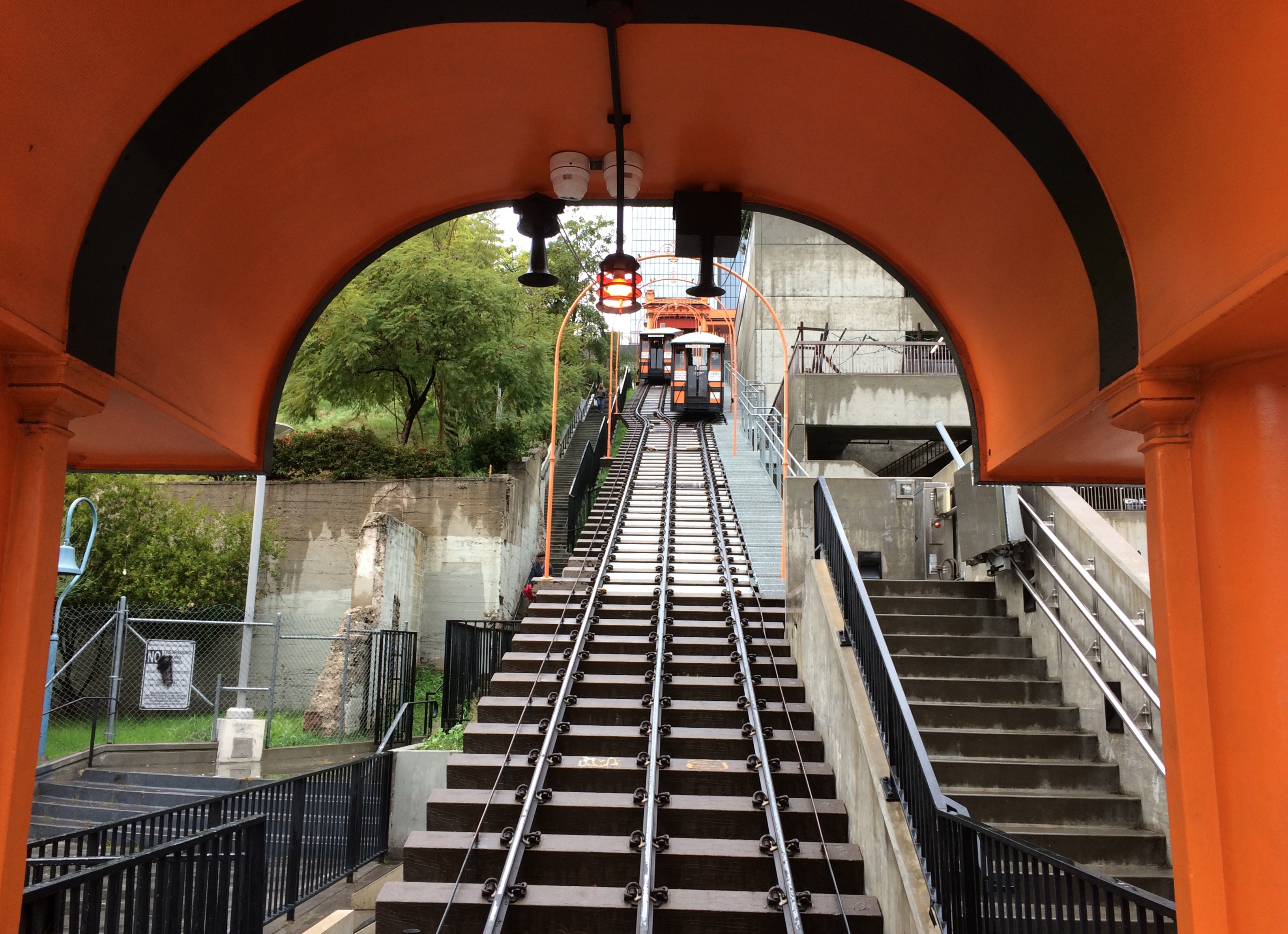
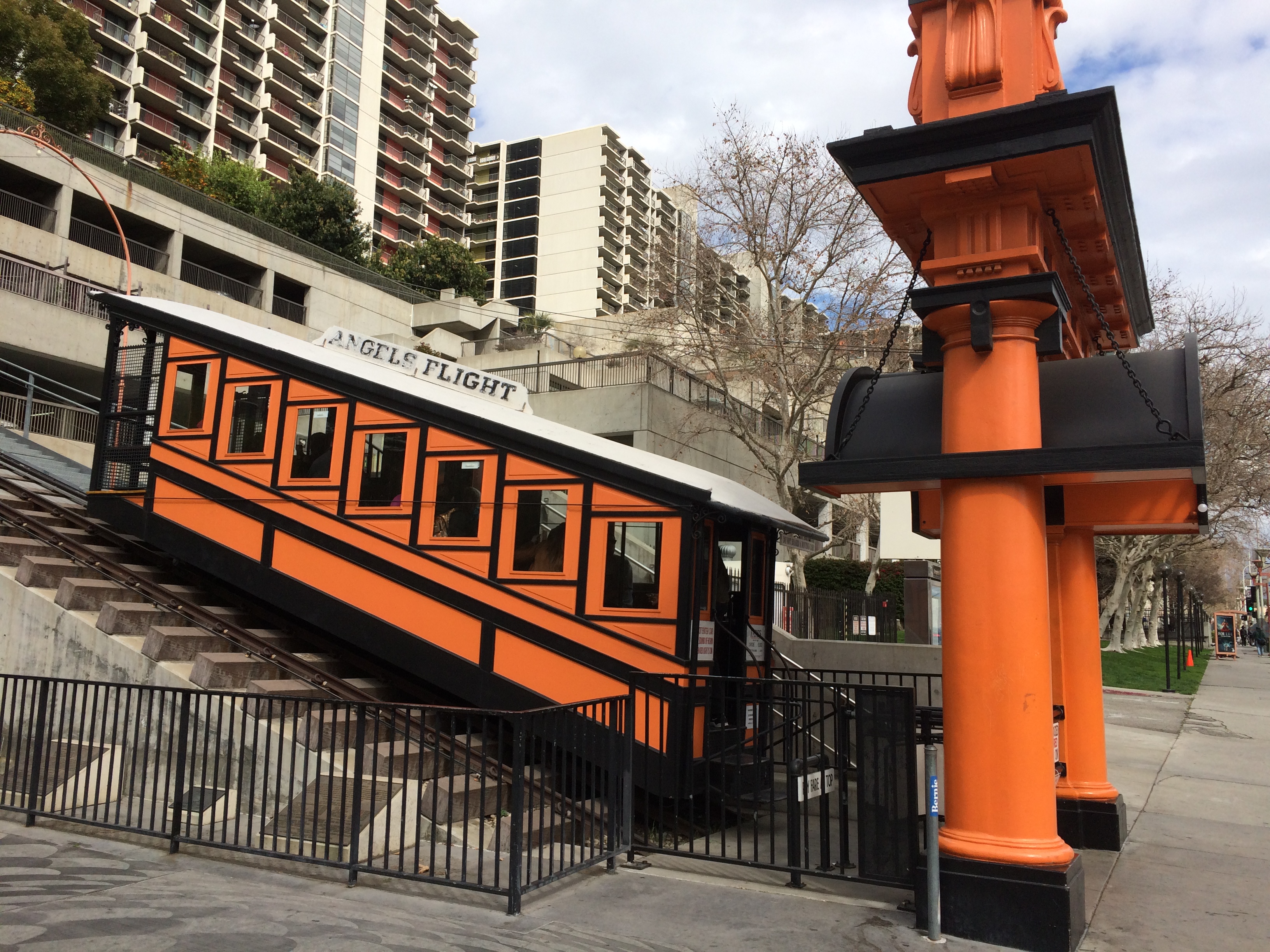
Not that I wanted to drive everywhere. The first morning in town, a Saturday, I drove only as far as a station on the relatively new Expo Line, which goes from Santa Monica to downtown LA, or vice verse.

I rode it downtown from the Expo/La Cienega station, through miles of the city I’d never seen before, including the edge of the University of Southern California. Good old USC — how persistent that school was in sending me mail in the late ’70s and early ’80s, inviting me to apply, even after I was attending VU.

On my second day in town, a Sunday, I got up early, strategy in mind. I was staying fairly near I-405, the 405 as it’s called locally, so I took that freeway north to I-10, the 10, and headed east from there to Western Ave. I’d read that the 405 was one of LA’s worst freeways in terms of congestion, and maybe it is.

But just before 8 on Sunday morning, I encountered smooth driving on the 405, as well as the 10, where traffic was also light. Getting off the highway, I headed north and soon found myself in Koreatown. Easy to know you’re there, because of the Hangul signs. Soon I began to wonder, just how large is Los Angeles’ Koreatown? I passed block after block after block after block of Hangul-marked buildings. How big? Really big.

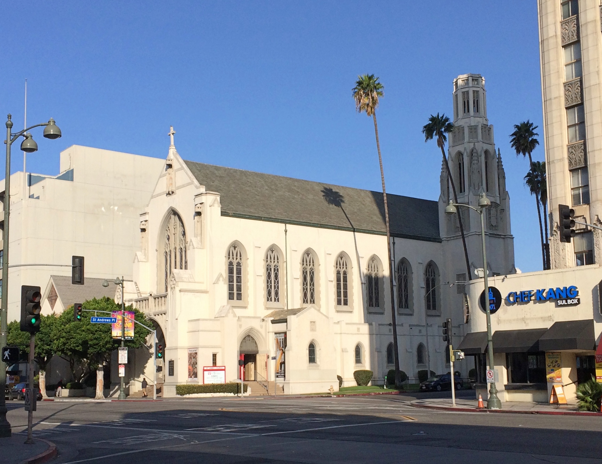
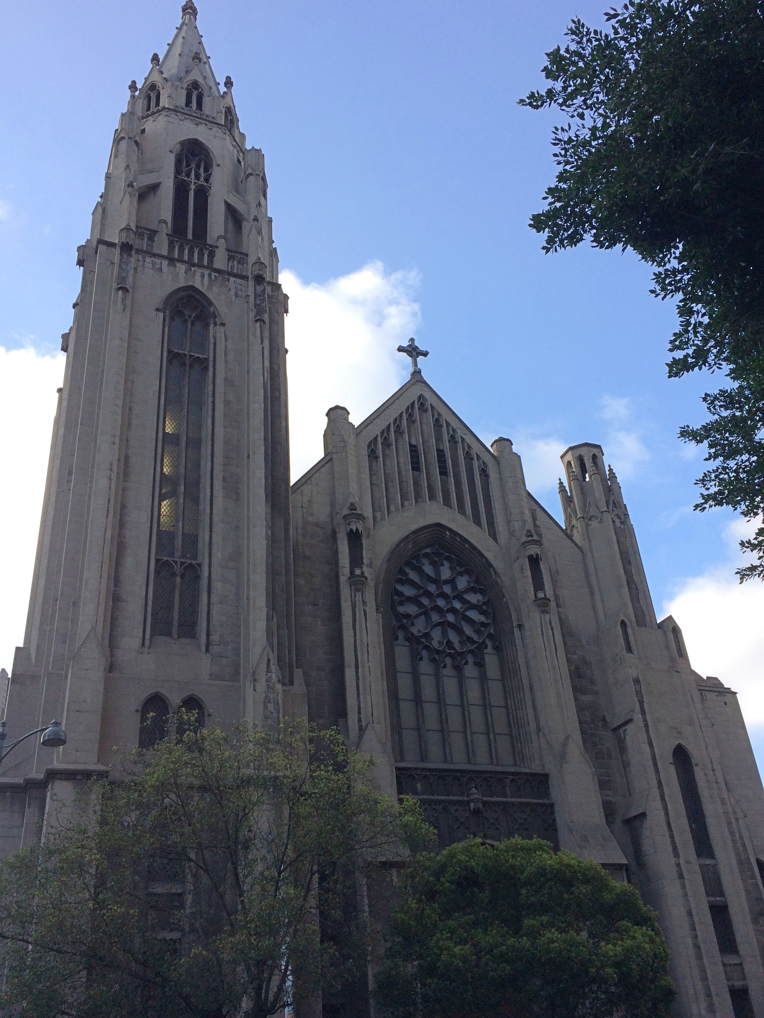
Eventually, I turned west on Santa Monica Blvd. to reach the Hollywood Forever Cemetery, but also to begin the longest drive of the day, west from there to Santa Monica itself, through (among other places) West Hollywood and Beverly Hills.

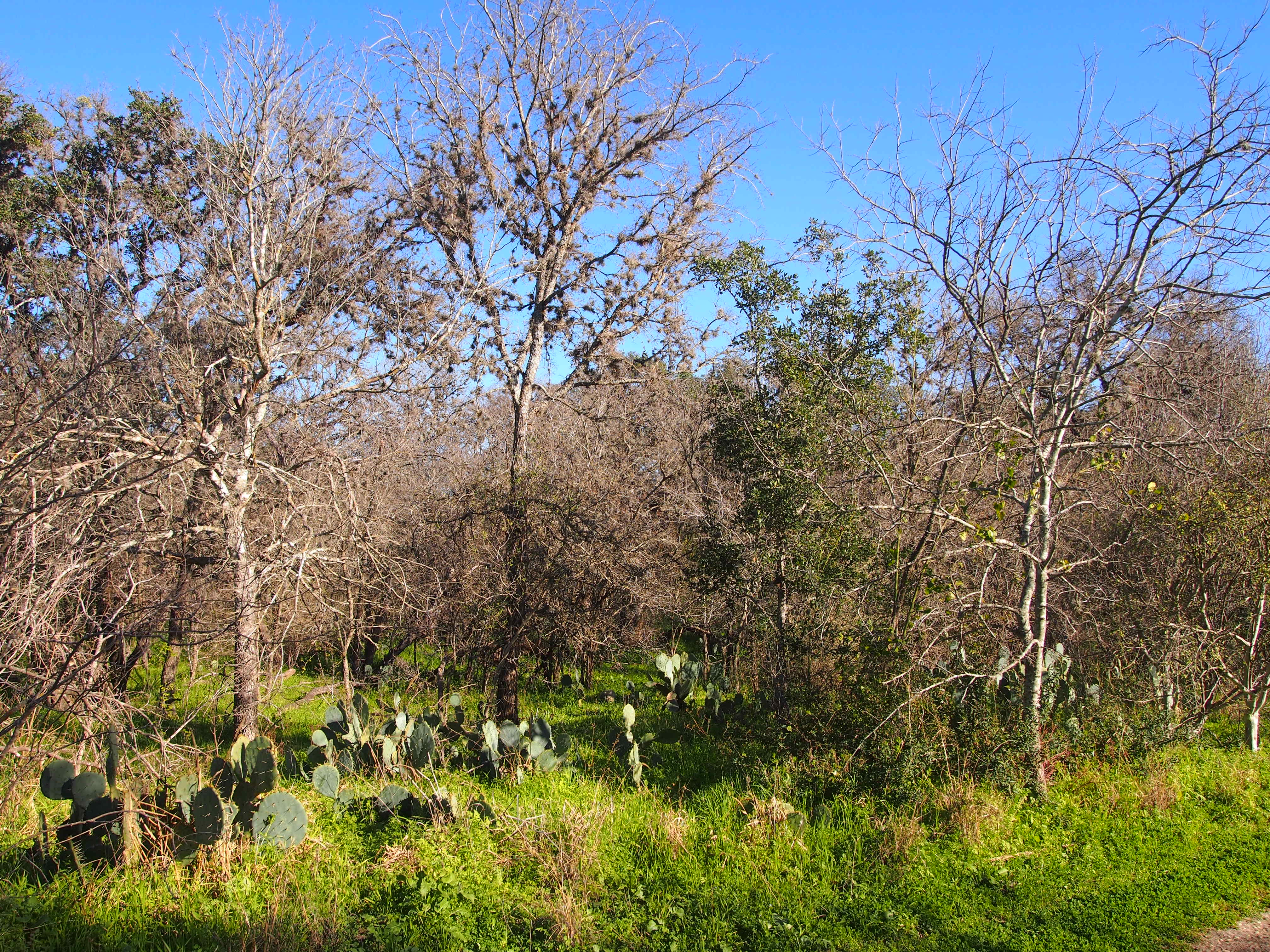
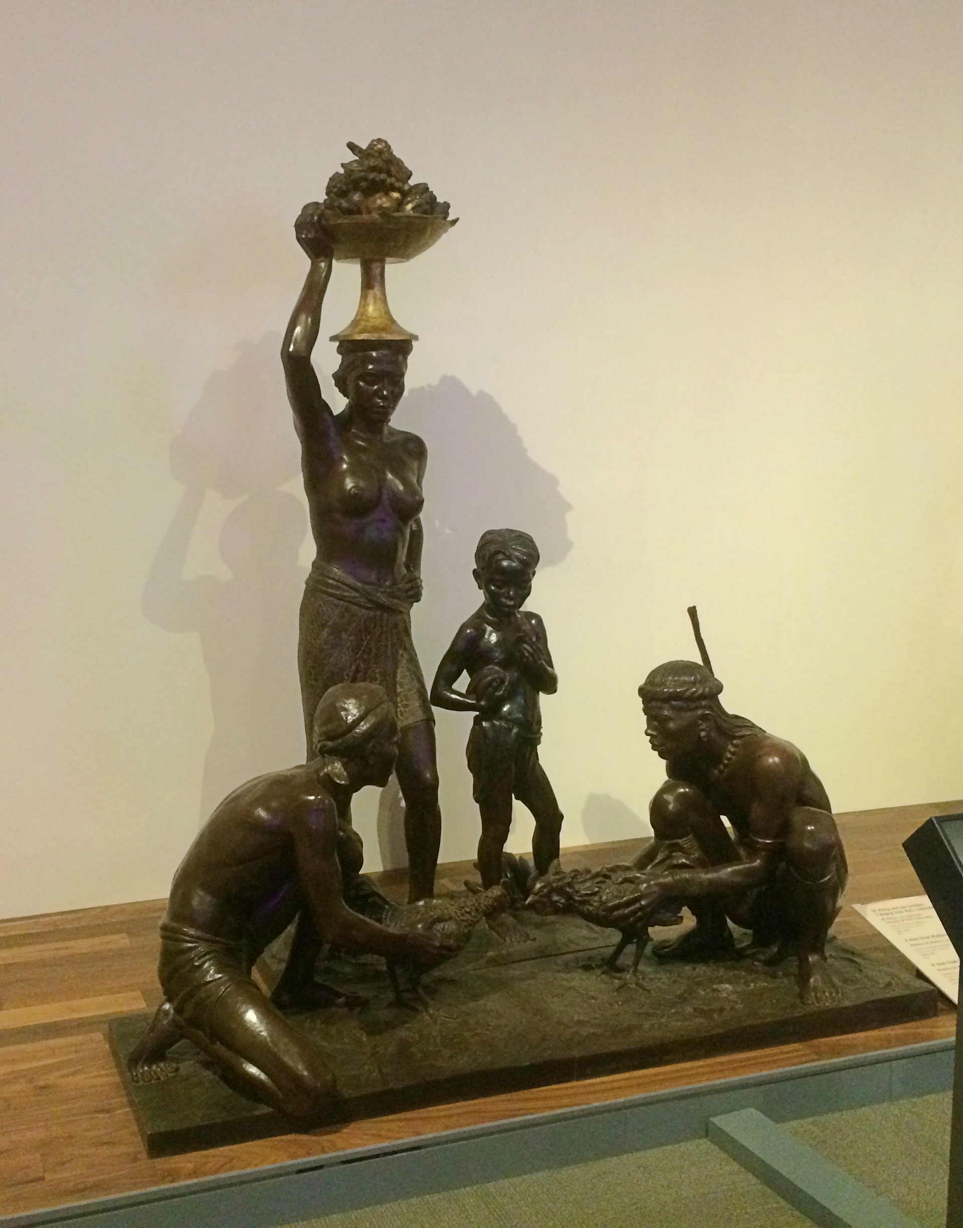
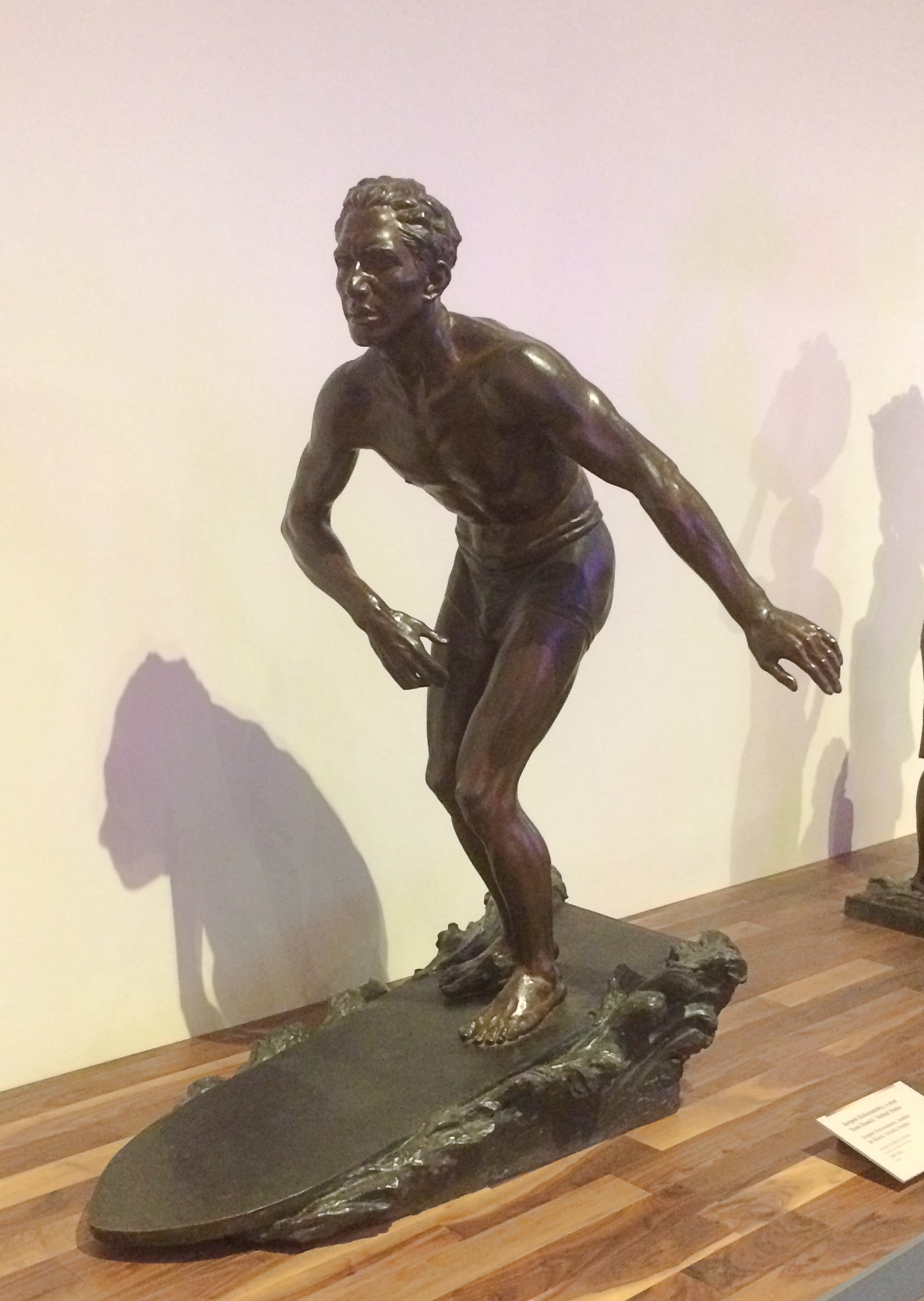
A virtual stage, it seemed to me — a carnival of sights to see, a spectacle of wealth and poverty, even at driving speed. Urban texture that you experience in any North American city, and yet with its own flavor. You see only glimpses, but even so you pass distinct cars and trucks, but not as many trucks as some places (because LA tends to have alleys for delivery), more pedestrians than you’d think but fewer bicyclists, chain shops and independents in strip centers, apartments, houses, office buildings, churches, schools, bars, restaurants, vacant lots, buildings under construction, parking lots, car washes — a lot of them — tall palms and short bushes, cannabis dispensaries, gas stations, graffiti’d walls, mural’d walls, billboards, parking meters, neon signs, showrooms, construction zones (but not as many as I expected), lamp posts and telephone poles, self-storage and payday loan offices, parks, playgrounds and even a cactus patch.

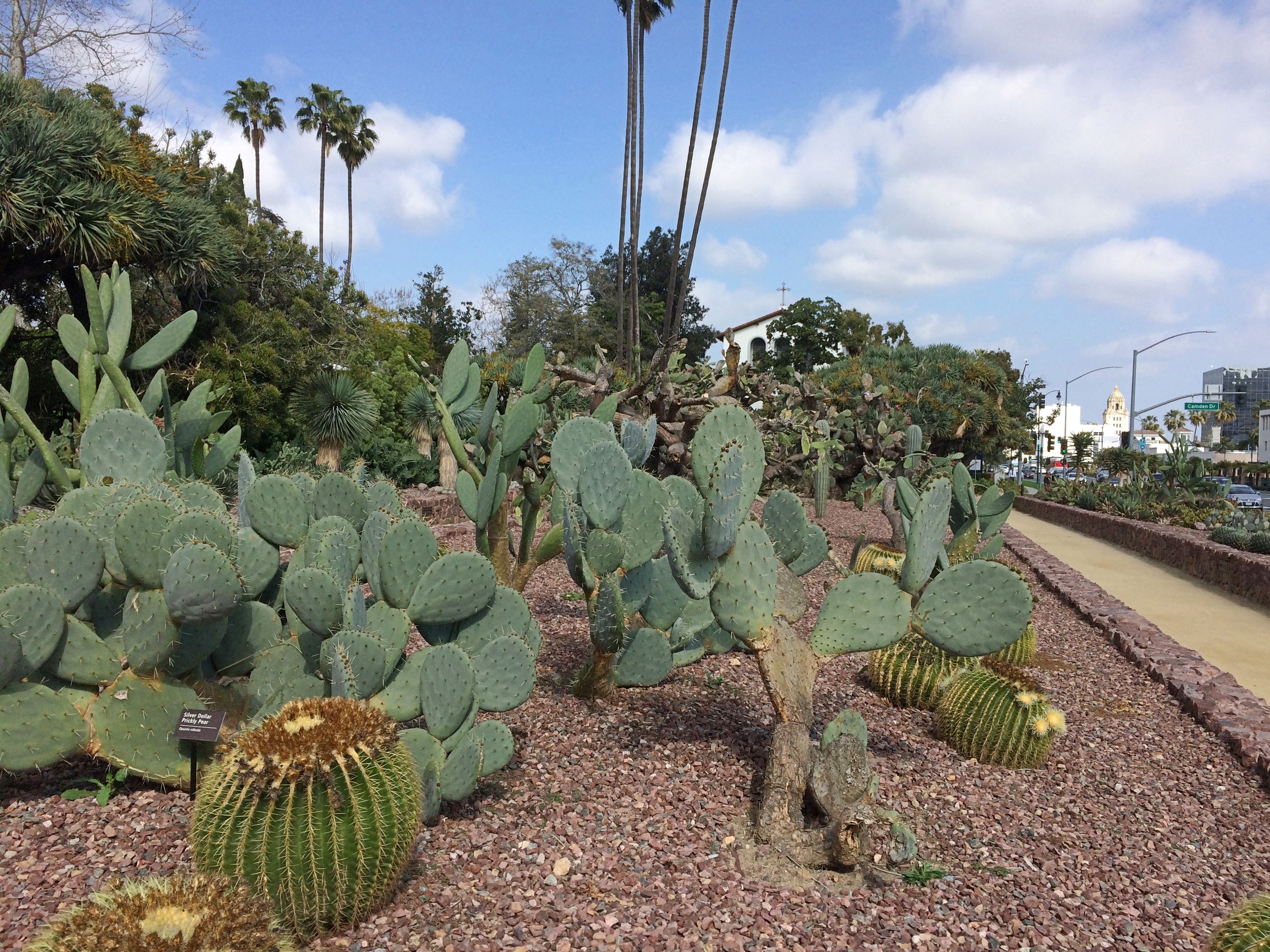
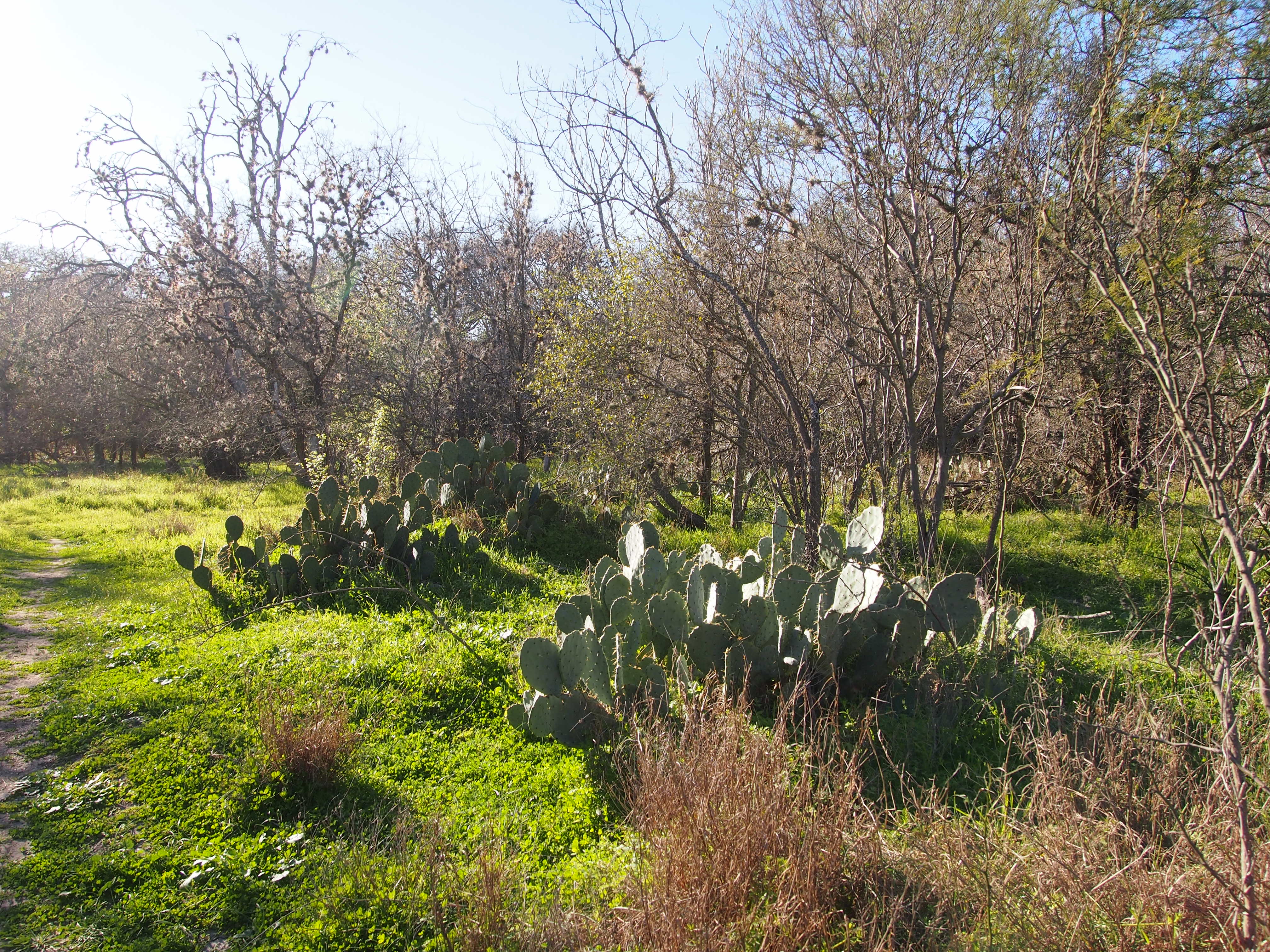
The Cactus Garden in Beverly Gardens Park, recently renovated. I stopped for a look at the cacti and the churches next to the park.

Santa Monica’s traffic is pretty thick, so driving was less pleasant there. To get to the Getty Villa in Pacific Palisades, you head north on the Pacific Coast Highway. That too was crowded. The road is probably more scenic and less crowded further north, but Pacific Palisades isn’t that far, so I didn’t see much of the highway (we saw part of it up that way in 2001, driving to Santa Barbara, though mostly we took U.S. 101).

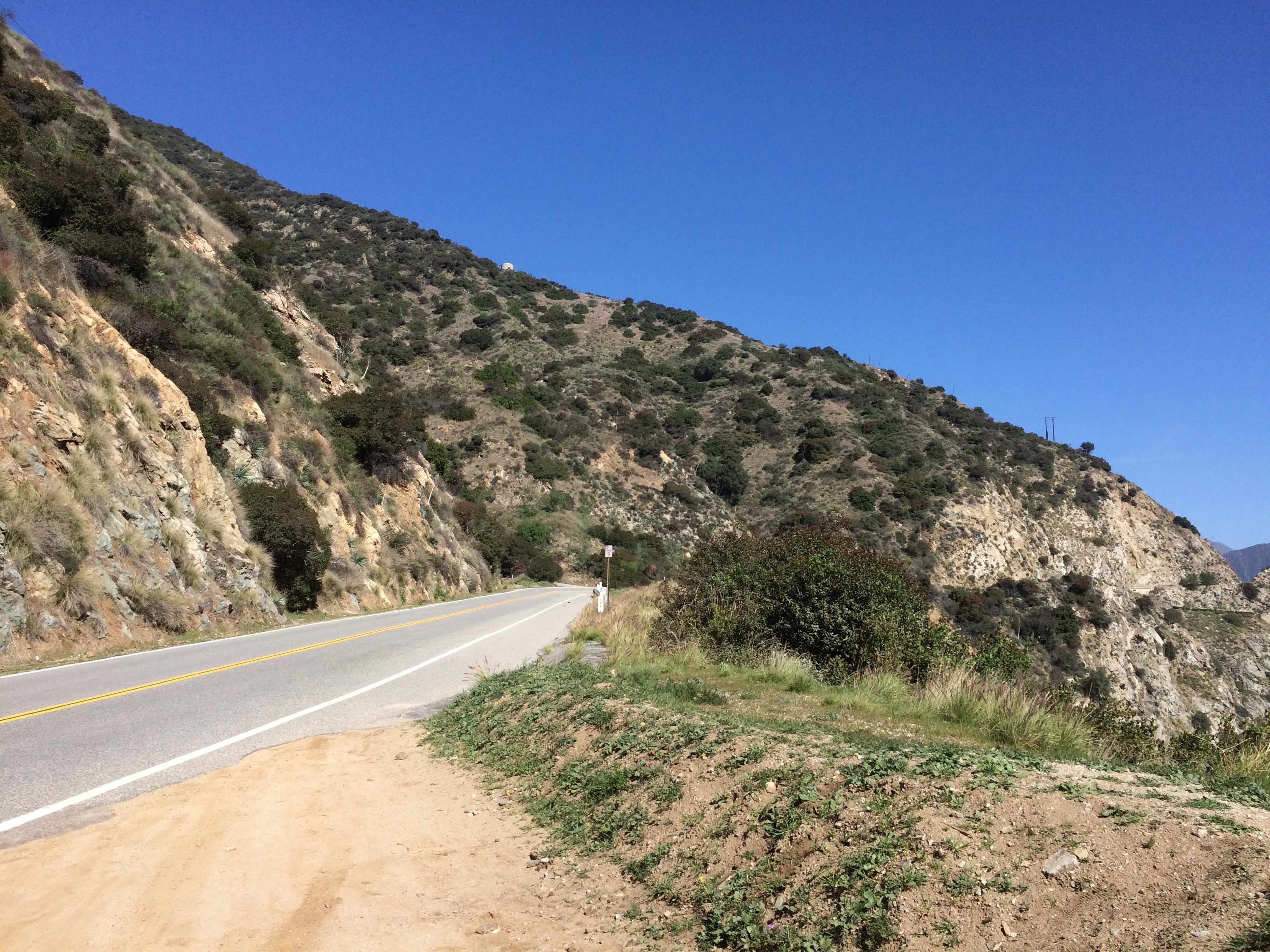
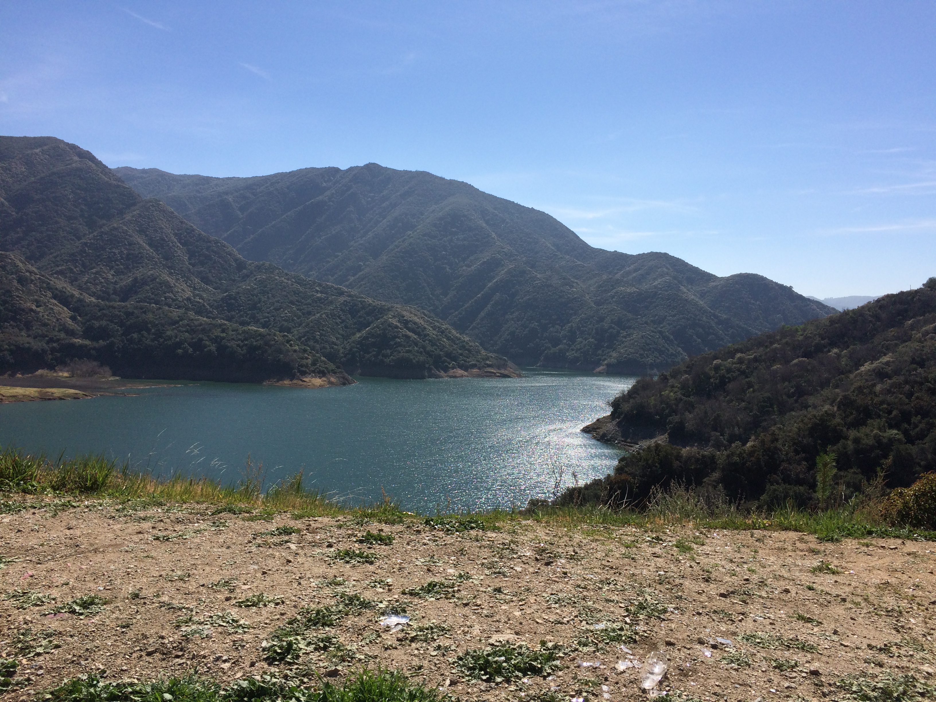
On Monday, the plan was to reach Palm Springs by way of freeways and then San Gabriel Canyon Road (California 39) through San Gabriel Mountains National Monument to California 2 and 138. Looked good on the map.

First, though, I had to get out of Los Angeles via freeway. I knew I didn’t want to drive anywhere near downtown, because February 24 was the day of Kobe Bryant’s memorial service at the Staples Center. So I went around downtown, and avoided the 405 too.

First, Sepulveda Blvd. south, which passes through a tunnel under LAX. I didn’t know that till I looked at the map. Then I drove it. I don’t think I’ve ever driven under an airport. I’m not sure any other airport has a tunnel under it.

From south of the airport, I took the 105 east to the 605 north to the 210, the Foothill Freeway. There were some minor snarls along the way, but nothing too bad.

Radio coverage of the memorial followed me all the way along the route. Reminded me of when Princess Diana died. It was a horrible accident, but still. Radio jocks can be counted on for maudlin twaddle at times like that.

When I got to the entrance of the monument, near Azusa, a sign said that California 2 was closed in x and y places. What did that mean? I stopped to look them up. That meant that I’d have to double back if I went as far as where 2 and 39 met, way up in the mountains. Still blocked by snow, I figured.

So I drove about 10 miles into the mountains and then drove back. Scenic territory, and not much traffic in February.
Evidence of an unfortunate accident.
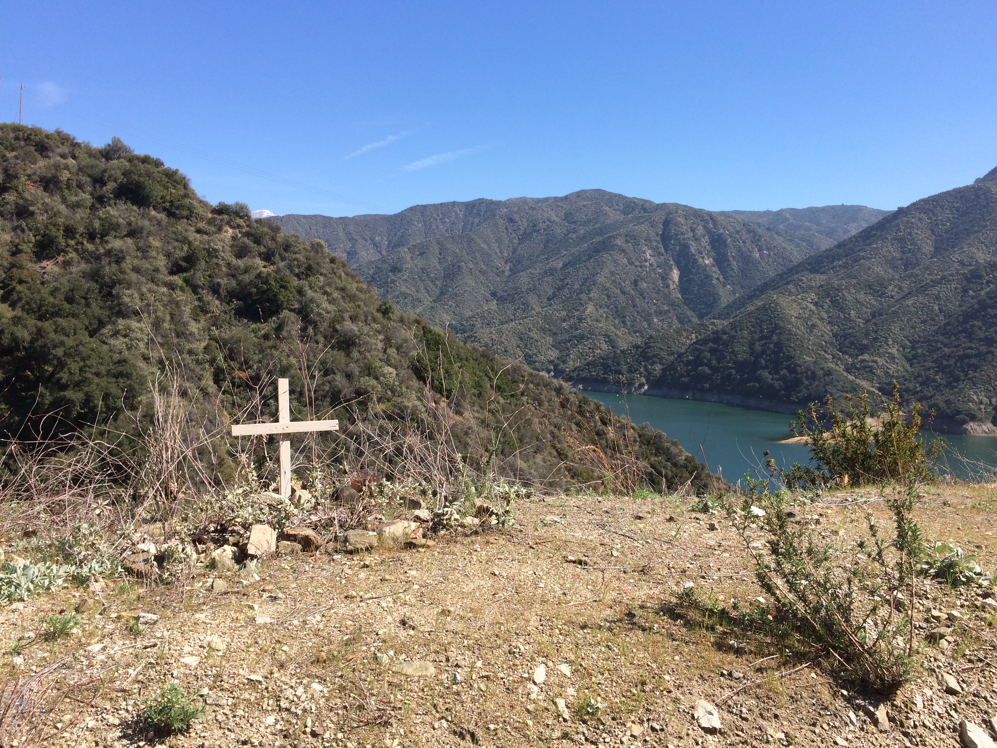
No name or date, though. No maudlin twaddle on the airwaves, either. The world is quiet when most people die.

I spent the next hour or so driving east through the Foothill communities, including Rancho Cucamonga, along the former US 66. Of course I wanted to drive through Rancho Cucamonga.

The Foothills are naturally more suburban in character than Santa Monica Blvd. Except for the mountains looming off to the left, in fact, and the palm trees, not so different than my usual suburban haunts. I even stopped for gas at a Costco before getting back on the freeway to Palm Springs.

Didn’t drive in Palm Springs on Tuesday; Steve took me around. On Wednesday, I left town and drove to Joshua Tree National Park, whose roads are either small and paved, or small and unpaved. I drove on both kinds. On the unpaved version, through a Joshua tree forest, traffic was extremely light. I was it. Just like driving in a car commercial. Happens occasionally.

Cathedral of Our Lady of the Angels &c

Another place that still under construction the last time I visited Los Angeles, in 2001: the Cathedral of Our Lady of the Angels, the seat of the Roman Catholic Archbishop of Los Angeles.

The 1994 Northridge earthquake so badly damaged the previous seat, the 1870s Cathedral of Saint Vibiana, that the archdiocese wanted to tear it down and build another cathedral on the site. Preservationists, led by the Los Angeles Conservancy, fought against that, and so eventually a deal was struck allowing the city to take possession of the former cathedral, and the archdiocese to build a new building on downtown land given to it by the city.

These days the former cathedral is an event center — which I didn’t see — and the new cathedral, completed in 2002, looks like this.Not everyone loves the design by Rafael Moneo, which I’ve seen called deconstructivist or postmodern, but which looks pretty brutal to me. I wasn’t all that fond of it myself, though it is interesting.

Does it say sacred space to me? Not particularly. You could argue that most of us have been conditioned by traditional forms to feel that way. Or you could argue that of course sacred space should be beautiful, not brutal. Take your pick. My goal when I’m somewhere is to see what’s there.

Besides, the interior is less brutal somehow.
The light fixtures and the natural light help soften the space, I think. Also note that people use the space. While I lurked around the back of the cathedral, a couple named George and Florence were getting married up front. People probably get married there every Saturday except during lent.

At the back is the Ezcaray Reredos, an intricate work of carved black walnut.
It dates from 17th-century Spain. More information about how it came to be in modern California is here, though I will say it left Spain during an impoverished period in the 20th century. The sign in front of the reredos is incorrect, however, when it says that the chapel attached to Saint Philip Neri at Ezcaray, original home of the work, “was dismantled in 1925 after being damaged in the Spanish Civil War…”

On the cathedral’s lower level is a mausoleum.
Most of the spaces are yet to be occupied. I later read that Gregory Peck is interred there, but I didn’t see him. I did spot California Chief Justice Malcom Millar Lucas (d. 2016), who had the distinction earlier in his judicial career of presiding over the trial of Charles Manson.

The relics of Saint Vibiana are in the mausoleum as well. She was a 3rd-century martyr.
Atlas Obscura: “Her time in the public eye began in 1853 when her tomb was excavated from the catacombs of San Sisto in Rome. Unlike many of the so-called ‘catacomb saints’ who didn’t even have names, the inscription on Vibiana’s tomb gave her name, the day of her death (August 31), the symbolic laurel wreath of martyrdom, and indicated she was ‘innocent and pure.’

“The following year Bl. Pope Pius IX gave her relics — blood, tomb inscription, and body — to Thaddeus Amat, the newly appointed Bishop of Monterrey, California….”

After a time in Santa Barbara, and then many years at the former cathedral in Los Angeles, Vibiana eventually came to where she is now. Interesting that a saint migrated to California like everyone else.

The cathedral isn’t the only church I managed to visit in Los Angeles. Not far away is Our Lady Queen of Angels Catholic Church, an historic parish church.
I rested a while inside. The name really should be rendered as La Iglesia de Nuestra Señora la Reina de los Ángeles, since all of its masses are in Spanish. The historic marker outside, in English and Spanish, says (in English) that the church “was dedicated on December 8, 1822 during California’s Mexican era. Originally known as La Iglesia de Nuestra Senora de Los Angeles, the church was the only Catholic church for the pueblo. Today it primarily serves the Hispanic population of Los Angeles.”

On Sunday morning, as I headed through Koreatown, I spotted St. James’ Episcopal Church, or St. James’ in-the-City, on Wilshire Blvd.
I attended part of the service that was going on at the time. The church dates from the 1920s, done in a more traditional Gothic Revival by a San Francisco architect, Benjamin McDougall. Most notable about the design: a lot of fine stained glass.

Immanuel Presbyterian Church isn’t far away on Wilshire Blvd.
Unlike St. James’, it wasn’t open when I came by. Still, I got a good look from the across the street.

The Walt Disney Concert Hall and The Broad

The last time I was in Los Angeles, the Walt Disney Concert Hall looked like this — still more than two years from its completion in 2003. I paid no attention to it then.

On February 22, 2020, the 2,265-seat hall looked like this from across Hope St.
Whatever else you can say about Frank Gehry, his designs aren’t like their surroundings. They’re going to stand out. Also, they’re interesting to stand under.
I’d read that self-guided tours of the venue were free, and that’s true. You get an MP3 player at a table just inside the Hope St. entrance, and off you go. The audio snippets about the development of the building, along with various design elements, are narrated by John Lithgow, with some additional commentary by those who worked on the project, including Gehry.

I was keen to see the auditorium. It was not to be. Musical careers were hanging in the balance in there.

Still, the rest of the interior was worth a look.

Though it’s invisible from the street, the hall has some outside space at mid-level, including greenery. A pleasant interlude among the twists of metal and vaulting ceilings.


At one point, the outdoor space practically becomes a box canyon made of metal.

Later that day, I visited The Broad, which is next door to Disney, though much newer, completed less than five years ago.
Interesting texture for a 120,000-square-foot box. It looks good, but how long will it be until its gleaming exterior begins to turn gray and streaky? Eventually, but I won’t worry about it. That will be on designer Diller Scofidio + Renfro, who did The Broad in collaboration with Gensler.

Even at 6 p.m. — the museum is open till 8 on Saturdays — the standby line was fairly long. But not as long as the more popular rides at Disneyland. It took about 20 minutes to get in.

Once in, you see works by the likes of Christopher Wool, Jean‐Michel Basquiat, Andy Warhol, Jeff Koons, Kerry James Marshall, Barbara Kruger, Roy Lichtenstein, Jasper Johns and others. Always something interesting to see, even if not everything on the walls is that compelling.

Somehow I managed to miss the Infinity Mirrored Room by Yoyoi Kusama, which I chalk up to being pretty tired after taking more than 20,000 steps that day. So it goes.

One more thing about The Broad, something other museums with sizable endowments could take their cue from: admission is free. Among others, that means you, Met.

Downtown LA Walkabout, Including a Light Brush with Insane Clown Posse

Pershing Square in downtown Los Angeles looks like a pleasant public space, but on the morning of February 22, I only got the barest glimpse. Entry to the park had been blocked all the way around by temporary barricades. This was a concern, since according to the receipt for the walking tour of downtown LA that I’d booked for that morning, the group was supposed to meet at Pershing Square.

Soon I found that we were meeting at the corner of W. 6th St. and S. Olive St., at the edge of the park, with the tour proceeding from there. I wasn’t the only one who asked the guide what was going on at Pershing Square. Turns out the city had rented it for the weekend for a couple of Insane Clown Posse concerts, the second of which would be that evening. Sounded like a must-miss to me.

The tour took us on foot past, and sometimes through, 12 different historic structures in downtown Los Angeles, beginning with the Millennium Biltmore Hotel. This is the central wing of the building.
Originally the Los Angeles Biltmore Hotel when completed in 1923, the property has 683 rooms, down from about 1,500 at its opening. People didn’t mind smaller rooms in those days.

The south wing.
Design by Schultze & Weaver, a New York firm best known for the Waldorf-Astoria in Manhattan, though that would come later.

The north wing. Why fly the Singapore flag, I don’t know. Owner Millennium & Copthorne Hotels plc is based in London.

Not far away is the CalEdison Building, one of LA’s grand art deco exercises, designed by Allison & Allison and finished in 1931.
The allegory above the entrance holds a torch. Not a torch of fire, but capped with a light bulb, though the electric utility that used to anchor the building left nearly 50 years ago.
The exterior is grand, but the main lobby is the real wow.
More CalEdison pictures are here.

Speaking of wow, the Los Angeles Central Library came a little further on the tour. Along with the U.S. and California flags flying there is the flag of the city of Los Angeles. The library is capped with an ornate pyramid. Originally it was supposed to be a dome, but 1920s Egyptmania had its influence on the building.

Completed in 1926 with a design by Bertram Goodhue and Carlton Winslow, what nearly happened to the library about 50 years later? Demolition. The Los Angeles Conservancy was organized at that time in response, and the building was saved.

Only to nearly burn down in April 1986. The cause remains a mystery. Our guide asked those of us old enough — which was most of the group — whether we remembered the fire. I drew a blank. Even living in Nashville at the time, I must have heard about it, but I couldn’t remember.

“It happened three days after the Chernobyl disaster, so it didn’t get as much coverage as it might have otherwise,” she said. Such is the news cycle.

The citizens of LA insisted that the library be rebuilt, and it was. Such places as the splendid central rotunda were thus saved again.

Looking up in the rotunda.
On the rotunda walls are fine California history murals, finished in 1933 by artist Dean Cornwell.

Across the street from the library are the Bunker Hill Steps, designed by landscape architect Lawrence Halprin and completed in 1990.
If I knew downtown Los Angeles had a topographical feature called Bunker Hill, I’d forgotten it. The place has quite a history: a posh neighborhood in the late 19th century, a run-down one by the mid-20th century, and then the victim of urban renewal. These days, office towers and other commercial buildings developed during or after the 1980s occupy most of Bunker Hill.

Once you go up a hill, you have to go back down again, or at least we did to reach the next destinations on the tour. So we took Angels Flight Railway down the side of Bunker Hill. This is the terminal at the top.

The original funicular, which opened in 1901, closed in 1969, lost temporarily to urban renewal. The line was revived in 1996 a block south of the original location, though it has spent much of the last quarter-century closed because of safety problems. With any luck, those are resolved now.

Looking up the track, which is nearly 300 feet long.

The terminal at the bottom.
The last place on the tour: The Bradbury Building. I knew it by reputation. A lot of people know it that way. If it were in, say, Des Moines, that wouldn’t be true. But it’s in Los Angeles.
The exterior is nice, but it’s the striking interior that makes it a favorite of location scouts and tourists. An almost exact contemporary of the 1890s Monadnock Building in Chicago, the Bradbury’s superb ironwork reminded me of that building.
One George Wyman, a draftsman without formal architectural training, designed the building, at least according to most sources. He was inspired by the description of a building in Looking Backwards by Edward Bellamy, again according to most sources. I like to believe the stories are true, since they argue against credentialism.

Back to Insane Clown Posse. I didn’t actually have a brush with them or any Juggalos closer than a few blocks away. That evening, as I headed for the Metro station to leave downtown, I heard the concert off in the distance. It was probably one of the opening acts, but no matter. I could hear that it was loud.

Cal-Tex ’20

The clerk at the rental car desk asked, as they always do, whether I wanted GPS for my car. For a small fee.

“Where’s the adventure in that?” I said.

So my whole time in a mostly unfamiliar part of the country last week, I didn’t have GPS. I had a better trip for it.

Before visiting Texas recently – I got home today – I went slightly out of the way to spend a few days in Southern California, flying from the chill of metro Chicago to the mild warmth of Los Angeles on February 21, though basking in better weather wasn’t the main consideration. I wanted a new sampling of Los Angeles, which I hadn’t visited since 2001, and to take a trip out to Palm Springs, where I’d never been.

Like any vast urban area, Los Angeles is visually rich. Plenty to see at eye level, but also above your head.

Also beneath your feet.

Arriving late that Friday afternoon, and after leaving LAX behind in my rental car, I went Ladera Heights, a little-known but well-to-do neighborhood in Los Angeles where I’d rented a room through a peer-to-peer hospitality platform, as they say in the real estate biz. The room was part of an exceptionally pleasant condo unit: clean, well appointed, quiet at night, and not particularly expensive for short-term renters. Everything you need in an arrangement like that. Also, there was free parking on a side street that actually had available parking even late in the evening.

On Saturday, I drove to a Los Angeles Metro station on the Blue Line, parked – at a reasonable $3 for the day; you start paying close attention to parking right away in LA – rode downtown and took a walking tour offered by the Los Angeles Conservancy. That included a look at many fine downtown structures, but especially the Bradbury Building and the Angel Flight.

After lunch at Grand Central Market, I did a self-guided tour of Walt Disney Concert Hall, and then wandered down to the Cathedral of Our Lady of the Angels for a look. A wedding was in progress during my visit, but the place is so large non-guests could easily sit way back. I needed the rest anyway. Downtown LA isn’t that large, but on foot the distance adds up. Still, I had enough energy to visit Union Station after the cathedral, take a walk through Olvera Street, and then return (via subway) to The Broad, LA’s most recent major museum, opening only in 2015.

Sunday was a driving day. By mid-morning, I’d made it to the lush, picturesque Hollywood Forever Cemetery in, of course, Hollywood, spending longer than I’d planned there. Then I drove all the way down Santa Monica Boulevard, famed in song and maybe story, to Santa Monica itself, then up the Pacific Coast Highway a short distance to the Getty Villa, an astonishing place the likes of which I’d never seen before, except in Pompeii — where, as Getty pointed out, everything is old. I returned to Santa Monica in the evening for dinner near the Third Street Promenade.

The next day, February 24, I drove into San Gabriel National Monument a few miles, but the roads were blocked further in – lingering piles of snow at higher elevations, I guess. So I made my way via the Foothill towns to Palm Springs, where I stayed with old friends Steve and Jack for two nights. I spent the first day in town, including a stop at Shields Date Garden. I played no golf.

After leaving Palm Springs on February 26, I drove through and walked around the high and dry Joshua Tree National Park, where you see two kinds of desert for a single entry fee. Which, at $30, I object to. Especially since you pay only $25 to get into Big Bend NP. Sure, the JTNP landscape is remarkable, but that fee just means that Congress is underfunding the National Park Service. Ah, well. If I ever want to see Joshua tree forests again, the Mojave National Preserve is also a good place for it, I’ve read, less crowded and with no admission fee.

The next day I flew to San Antonio, where I had a pleasant visit with family and friends, and even met a few new people, the cherry on the sundae of the trip.

Winterlude ’20

Though it hasn’t been a harsh winter, it has been winter, so time for a short hiatus. Back posting around March 1.

It turned out to be a good idea to know as little as possible about Parasite before seeing that movie, which we did last weekend, weeks after we’d originally considered going. All that time, I did my best not to read about it. Not knowing the arc of the story helped maintain the suspense, which was as riveting as anything Hitchcock did, especially after the midway twist.

I did know that the movie came highly recommended, and by sources I respect more than the Academy of Motion Picture Arts and Sciences. Could it, I wondered, be better than 1917? It was. That’s a remarkable achievement all by itself. One of those rare movies that is as good as people say.

I’ve updated my vanity North American map again.
The key to the colors is here. The color scheme is wholly idiosyncratic, so I do have certain ideas about certain places. For instance, if I spent some time in following places, I’d color the respective states blue: the Northwoods of Minnesota; Norfolk and vicinity in Virginia; Mobile, Alabama; and Tuscon, Arizona. If I spent a night in West Virginia or Delaware or Rhode Island or Manitoba, they’d be orange. Just means I need to get out more.

Though cold today, the sun was out. Time to take my new garden gnome outside.

Gnomish Stalin was a Christmas president from my brother Jay, shipped to me from the UK. Cornwall, specifically. For all I know, Cornwall might be the world hub of eccentric garden gnomes.
This year, I got Jay a Russian nesting doll — a political matryoshka doll, made in Russia. He sent me a picture. Nice set, though you’d think there would be room for Khrushchev at least, whom I’d pick for inclusion over Yeltsin.
Coincidence that we both sent Russian gifts — political Russian-themed gifts, no less? Or synchronicity? Who knows, I’m just glad to have a new conversation piece for my summertime visitors.

Salado Creek Greenway, February 2015

Late February’s a good time to visit South Texas. Five years ago, during a trip to San Antonio, I was even able to enjoy some outdoor greenery. Just budding, but there.

I took a walk along part of the Salado Creek Greenway.

Salado Creek Greenway San Antonio

Any day in February when you can wander out in the non-freezing air is a good one. At least for us Northern Hemisphere, Temperate Zone dwellers. Roughly above the 40th parallel, that is. How’s that for overqualifying? Never mind, it was a good walk.

Salado Creek Greenway San AntonioSalado Creek Greenway San Antonio

Salado Creek Greenway San Antonio

Speaking of latitude, the Tobin Trailhead of the Salado Creek Greenway is —

Salado Creek Greenway San Antonio

— at exactly 29.51512 N (and 98.42812 W).

More Skulls and Bones and Things

Here’s one reason the Field Museum might have jacked up its admission in recent years: it spent $8.3 million in 1997 to acquire the fossilized remains of the T. rex nicknamed Sue. Or at least part of that hefty figure, since other organizations, corporations and HNWIs also chipped in, I understand.

From 2000 to 2018, Sue stood in Stanley Field Hall. Mostly bones, but also a number of replacement replicas for a few missing ones. Even so, the museum and other sources call Sue the most complete T. rex ever discovered, at about 90 percent.

These days, Sue has her — his — gender actually uncertain, so its — own room in the Griffin Halls of Evolving Planet, a multi-room exhibit about the evolution of life on Earth, complete with various fossils to illustrate various periods. Naturally, most of the crowds gravitate to the dinosaur bones, and not just Sue, but the creatures in the large Elizabeth Morse Genius Hall of Dinosaurs, which you reach before you get to the T. rex room.

Lots of impressive fossils there. Such as a triceratops. Can’t very well have a dinosaur collection without one of those.
Or an apatosaurus.
Or a stegosaurus.
Sue not only has its own room, there’s narration and a minor light show as the narrator describes different parts of the beast, the better for the audience to ooh and aah.
The head mounted on the rest of the skeleton is actually a replica. Sue’s head is kept in a separate box.
If I remember right, that’s the way it was when Sue was in Stanley Field Hall.

Sue isn’t the last of the fossil parade. Time marches on, a meteor kills the dinosaurs, and mammals increase in size. This fellow looks pretty large, even for a bear.
Known as Arctodus, or a short-face bear, it lived in Pleistocene North America but vanished about 11,600 years ago.

An Irish Elk.
How did they hold their heads up? Strong neck muscles, I guess. More subtle minds than mine have taken up that very question. Amusingly, Stephen Jay Gould wrote, “The Irish Elk, like the Holy Roman Empire, is misnamed in all its attributes: it is neither exclusively Irish nor an elk.”

A mastodon.
They are all examples of animals that didn’t survive the most recent Ice Age unless, as Gould mentions, Irish Elk survived into historic times. Just goes to show that no matter how tough you are, along comes a little climate change or hunters with pointy sticks and soon all that’s left is your bones, if that.

Field Museum ’20

Our main destination on Saturday was the Field Museum. Been awhile since we’ve been there. Looks as sturdy as ever.An important consideration was that the museum charges no admission for Illinois residents during the entire month of February, representing a $69 savings for us. A savings in theory, because it’s unlikely we would have ever paid full price. Maybe half that. I don’t have the numbers at handy, but I strongly suspect that ticket prices have significantly outpaced inflation over recent decades, and that sticks in my craw.
Not that you don’t get a high-quality natural history museum for that price.

Something I didn’t know before: the main hall, the grand, sweeping main hall of the Field Museum, which measures about 21,000 square feet, and whose ceiling reaches up 76 feet, actually has a formal name: Stanley Field Hall. He was Marshall Field’s nephew, but more than that, president of the museum for a long time, from 1908 to 1964.
T. rex Sue, the museum’s most famed — and marketed — artifact, isn’t in the hall any more. Those bones occupy their own room these days, more about which later.

Rather, an exhibit called Máximo now lords over the hall, at 122 feet across and 28 feet tall at the head. Not actual bones, but a model cast from a titanosaur discovered in Patagonia, and considered its own species, Patagotitan mayorum, only since 2018.

Still, it’s impressive.
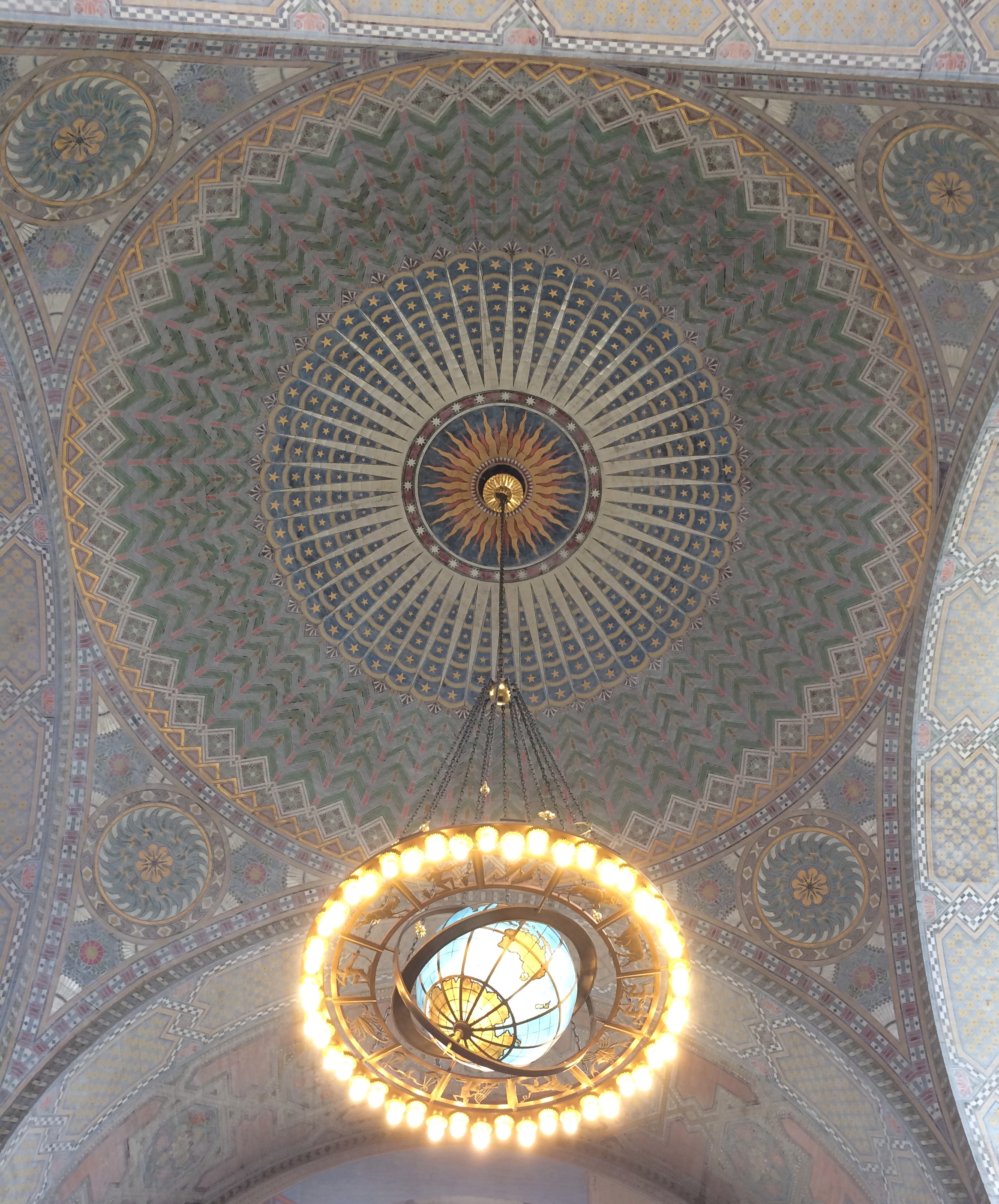
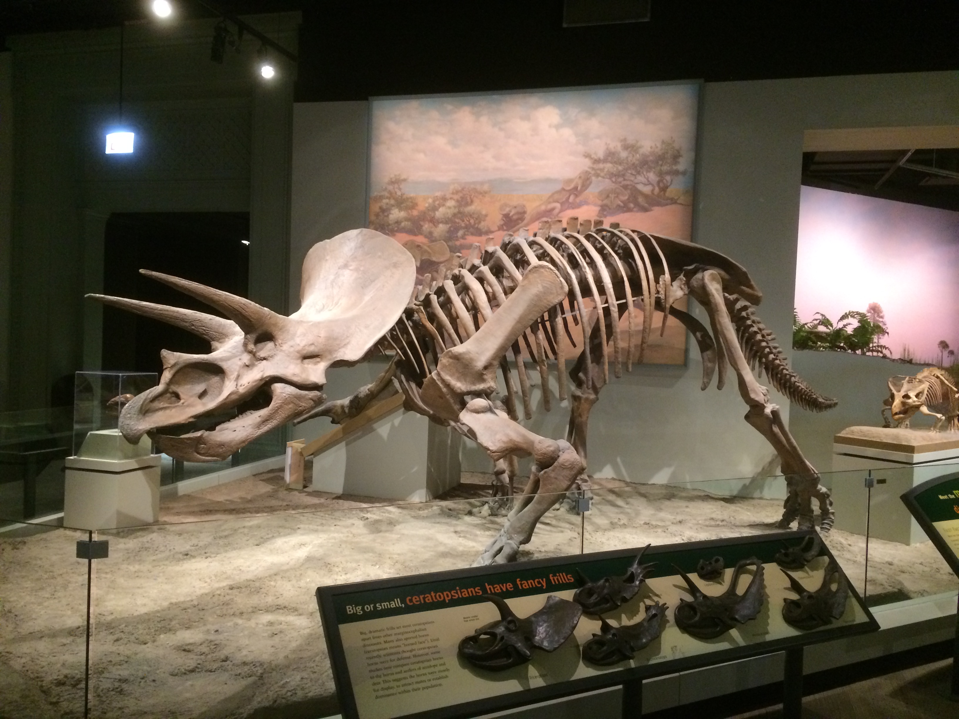
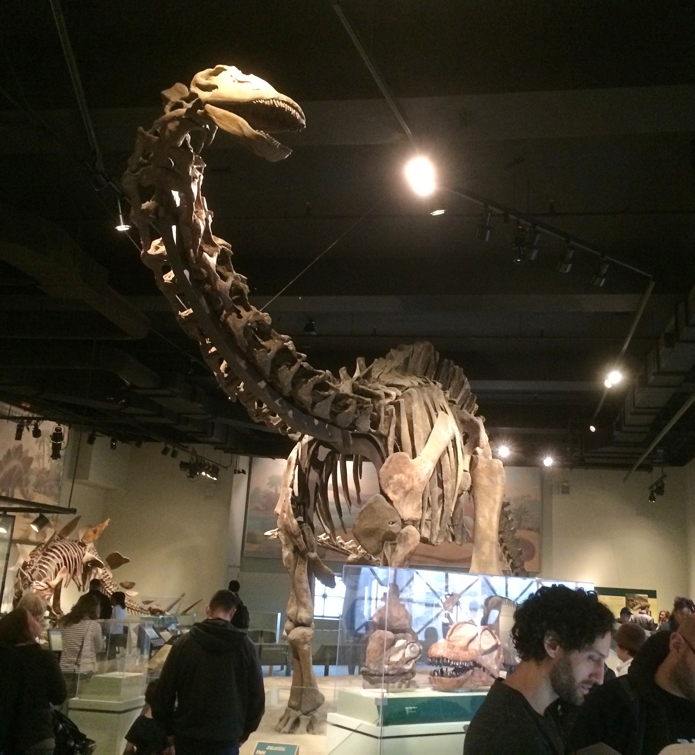
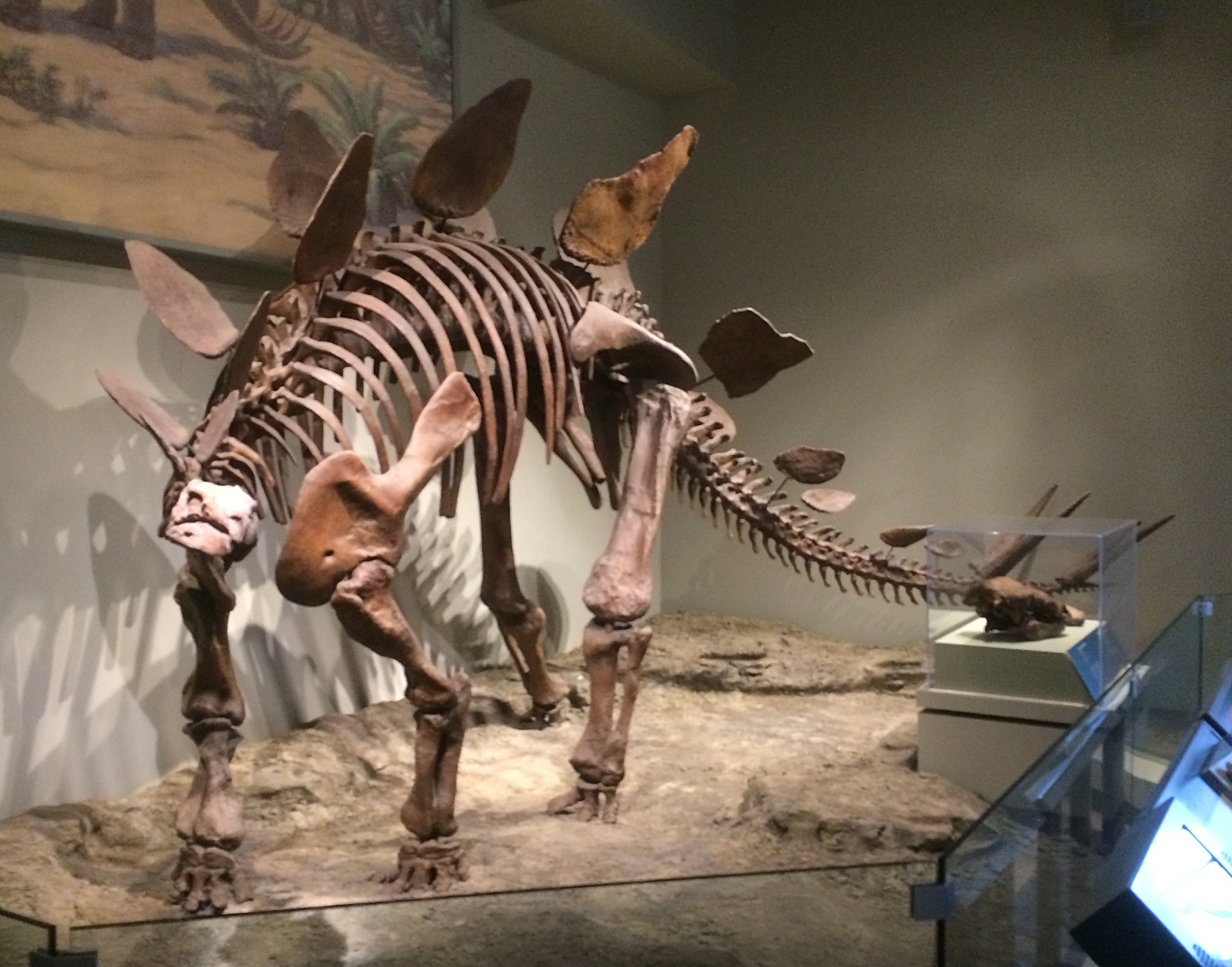
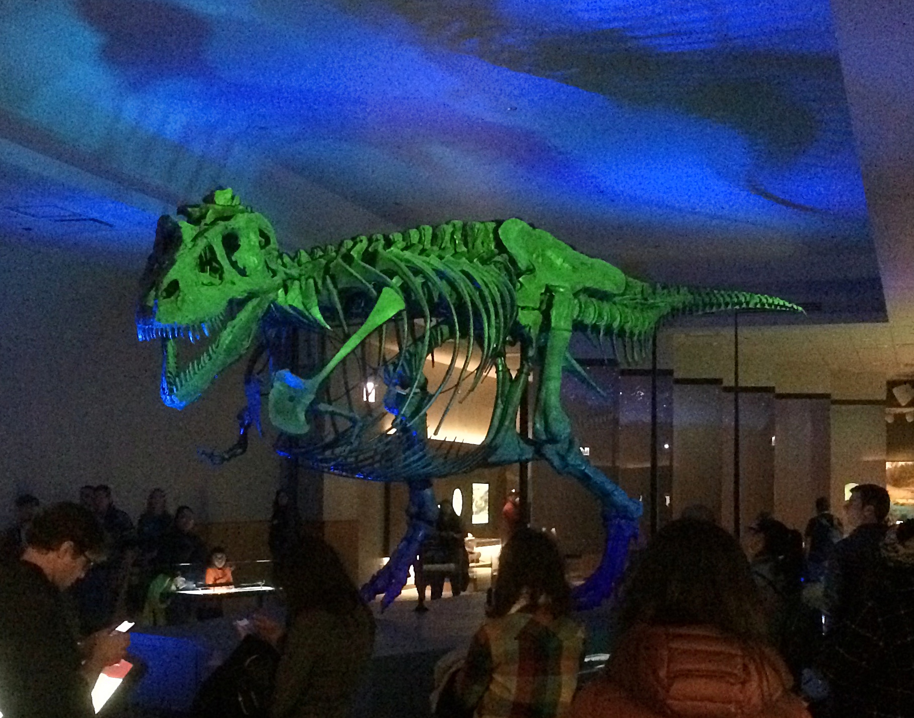
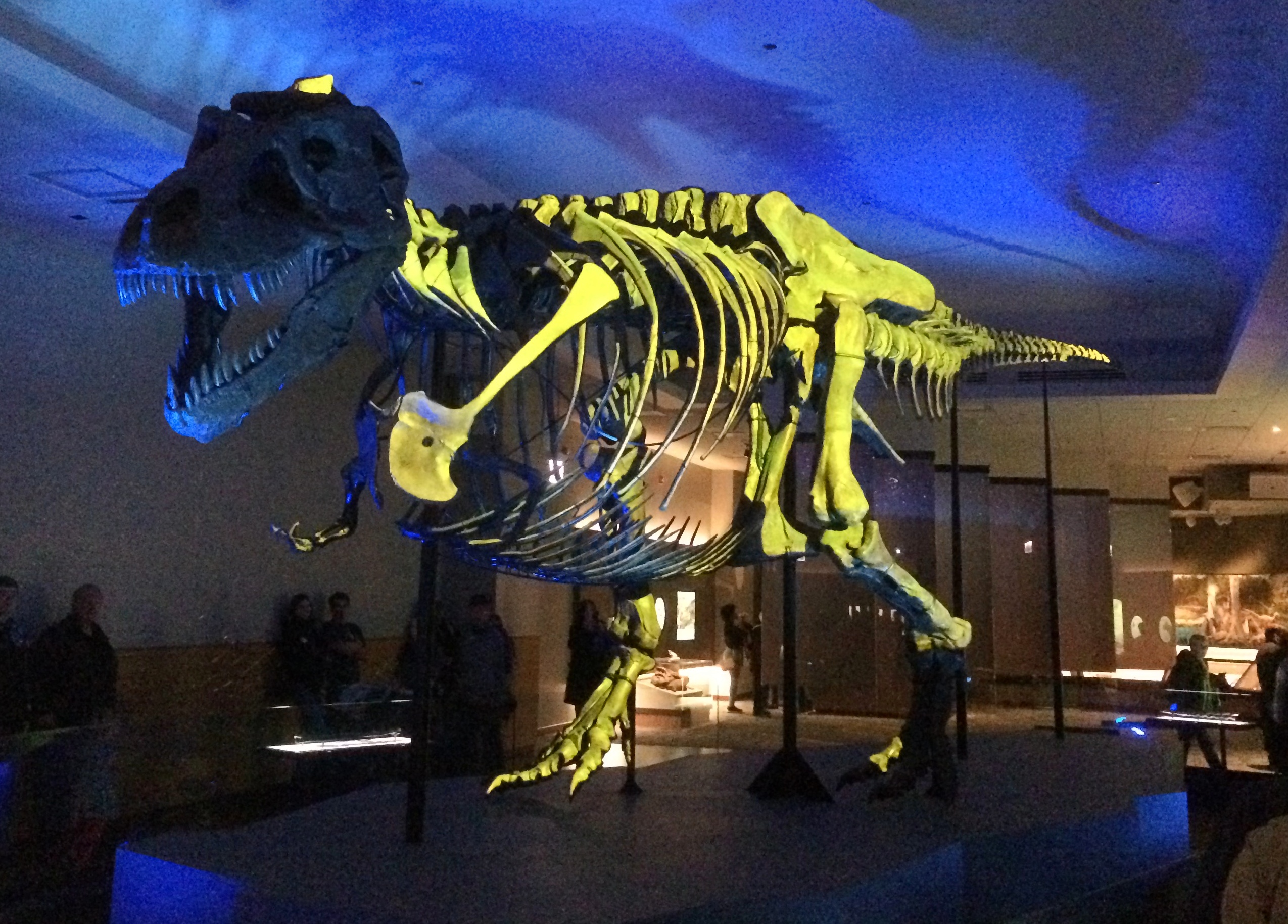
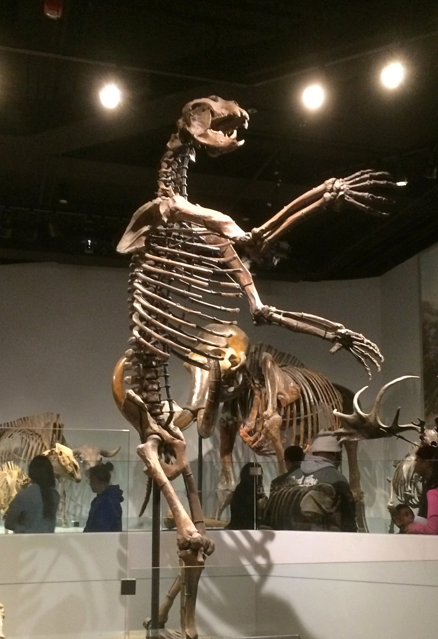
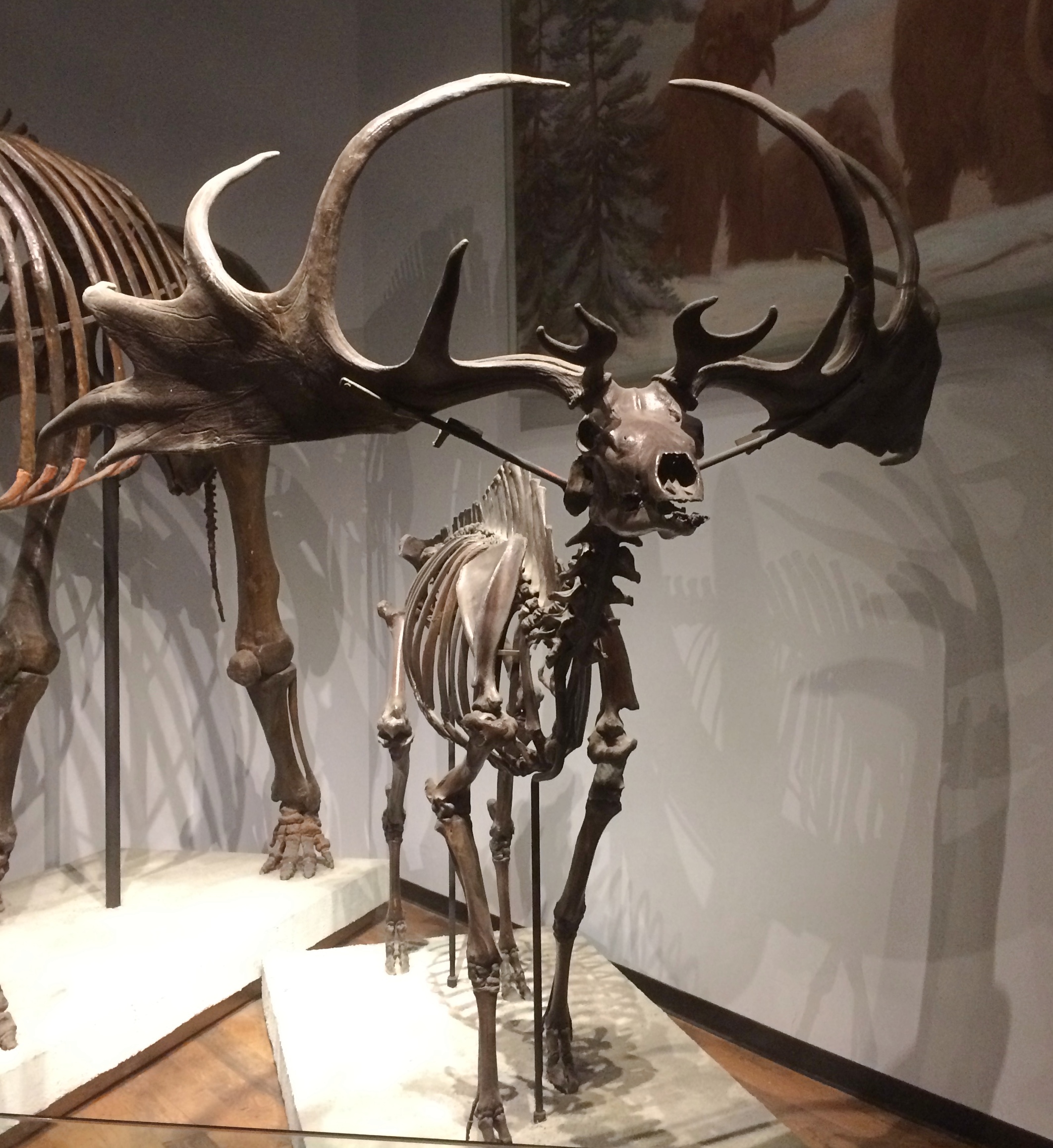
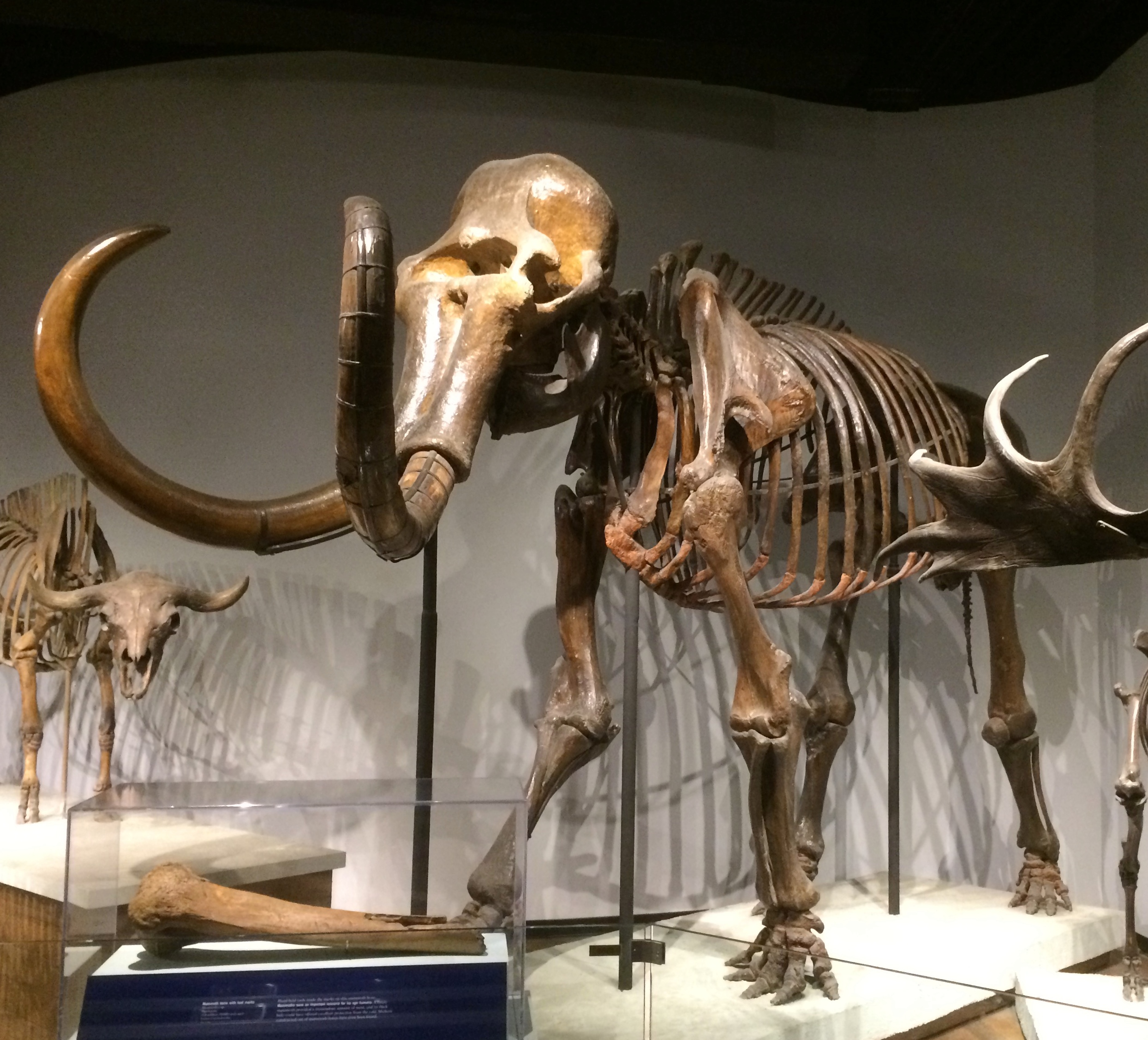
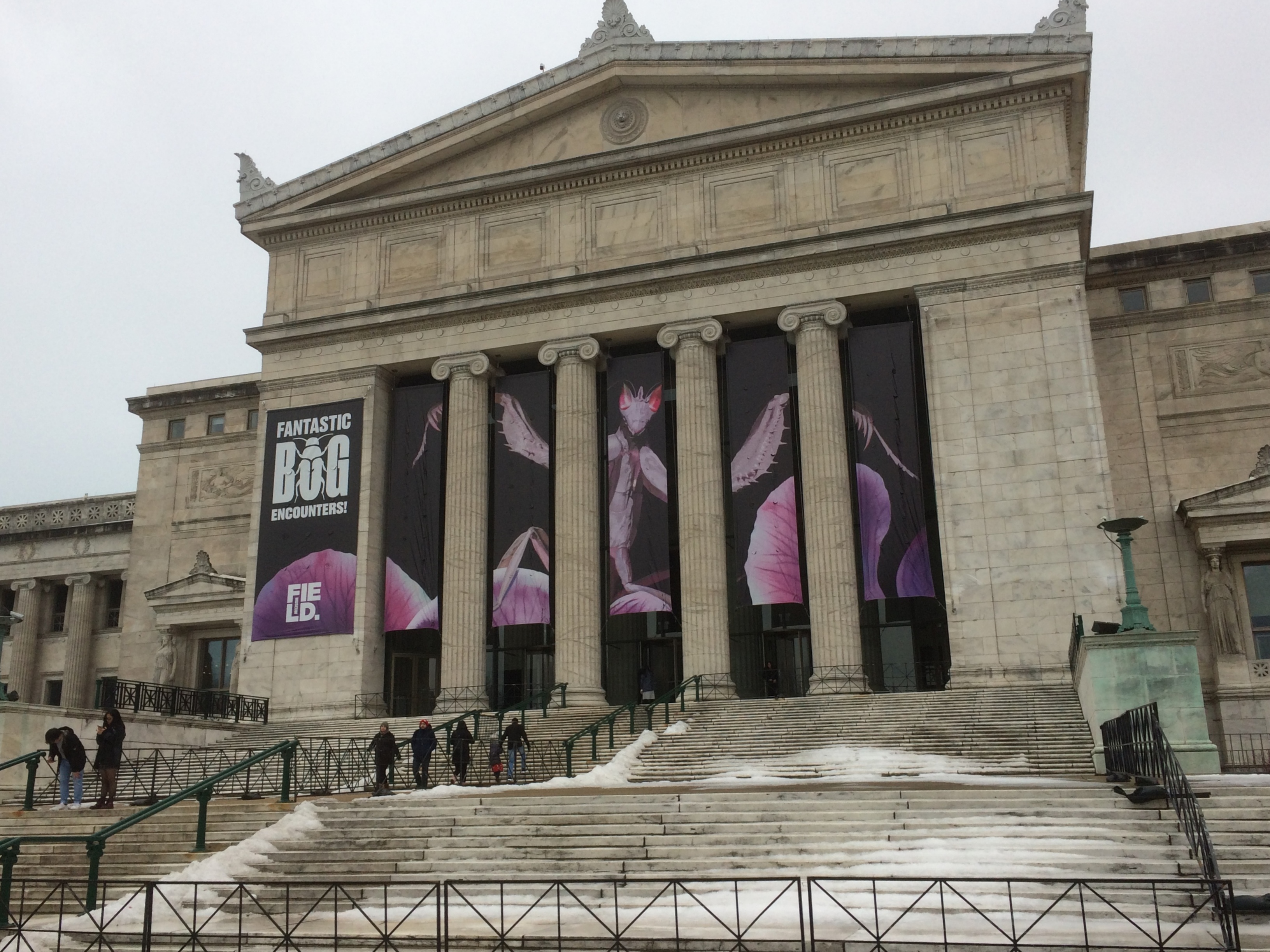
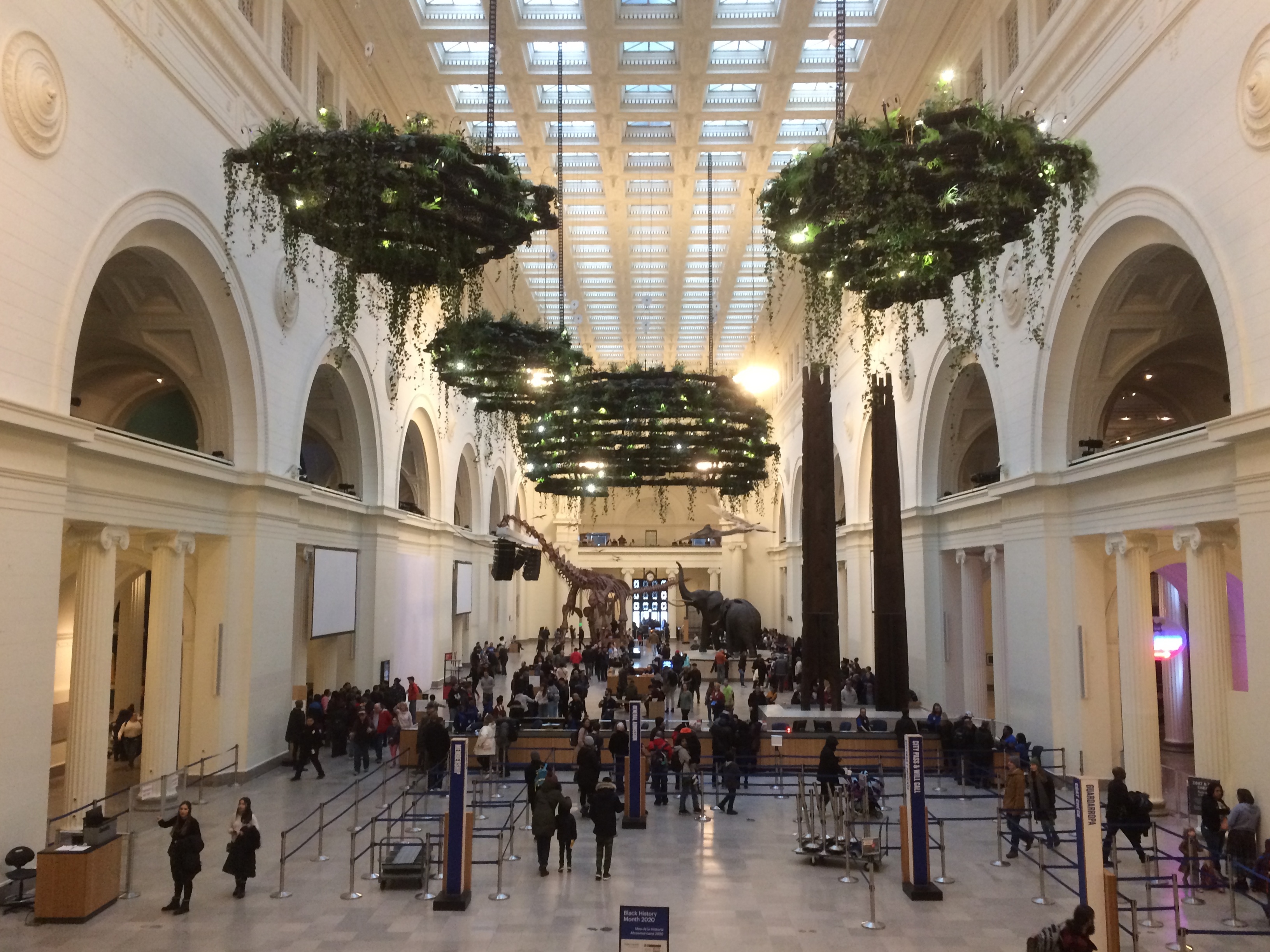
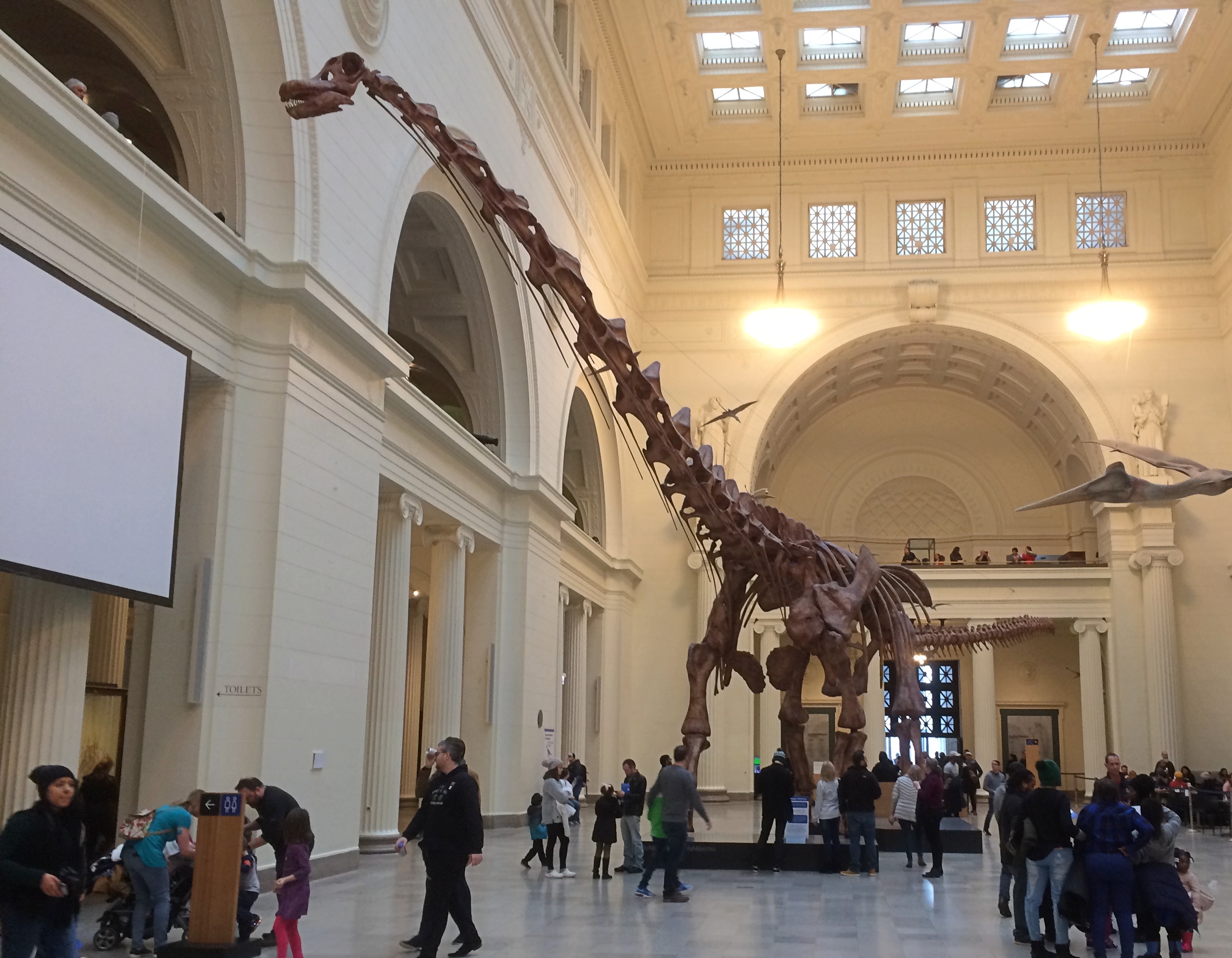
After the main hall, we spent time at the Granger Hall of Gems, the Malott Hall of Jades and at a display of meteorites. Last time I visited the museum, we were promised that there would soon be a permanent exhibit of pieces of the Chelyabinsk Meteor,
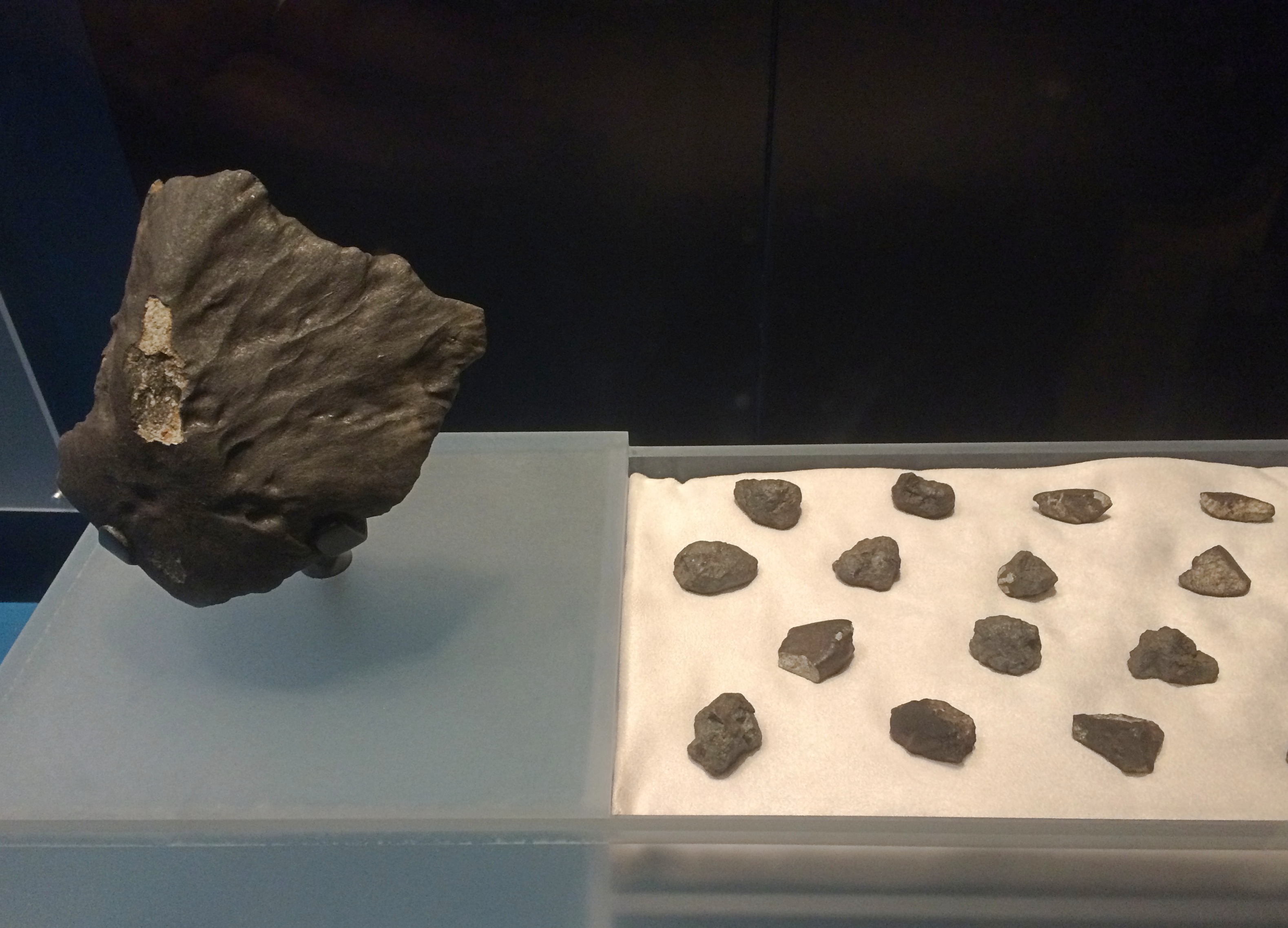
 which fell to Earth in Russia in 2013.

Here they are.
Not that large, but I think every bit as interesting as the dinosaurs. I’ve always had more fondness for astronomy than paleontology.

Here’s something you don’t see every day, which is pretty much the reason you go to a place like the Field.
Sculptures of Malvina HoffmanWe’d happened onto an exhibit called Looking at Ourselves: Rethinking the Sculptures of Malvina Hoffman. It’s a remarkable group of sculptures.

“In the early 1930s, the Field Museum commissioned sculptor Malvina Hoffman to create bronze sculptures for an exhibition called The Races of Mankind,” the museum says. “Hoffman, who trained under Auguste Rodin, traveled to many parts of the world for an up-close look at the ‘racial types’ her sculptures were meant to portray.

“By the time the exhibition was deinstalled more than 30 years later, more than 10 million people had seen it — as well as its misguided message that human physical differences could be categorized into distinct ‘races.’

“Today, 50 of Hoffman’s sculptures are back on display — with a new narrative.”

Namely, that Hoffman did some remarkable sculptures of individuals, not illustrations of racial typologies. There’s some indication that Hoffman herself considered the whole typology idea as malarkey, even as she was creating the artwork.

“In her letters from the field, Hoffman told museum curators that she wanted to illustrate the dignity and individuality of each of her subjects,” the museum says.

“The Looking at Ourselves exhibition team believed that naming Hoffman’s previously unnamed subjects was an important way of illustrating that individuality. They spent months poring over Hoffman’s and her husband’s letters and journals, and consulting the work of others who have researched the Hoffman collection over the years, to find the subjects’ given names.

“For subjects whose specific identities remain unknown, the team worked with anthropologists to correctly pinpoint the names of their ethnic groups.”

The figure above, climbing a tree, is a Tamil man from southeast India, identity unknown. This is a Nuer man from Sudan, also unknown.
A group from various parts of Indonesia, put together by the artist. The two standing figures were modeled on Ni Polog and I Regog, a sister and brother from Bali. The others are a man from Madura and one from Borneo, identities unknown.
A Hawaiian: Sargent Kahanamoku, an aquatic athlete and member of a well-known Hawaiian family.
Glad we got to see Hoffman’s work. Ann and I spent a fair amount of time looking at them and discussing them. An idea for those who would destroy discredited statues: re-contexturalize instead.

Chicago Chinatown ’20

One of these days, I might pop into the Dr. Sun Yat-Sen Museum on S. Wentworth Ave. in Chinatown. It has to count as one of the more obscure museums in metro Chicago, and that adds some interest right there.

But when we went to Chinatown on Saturday, we took a pass on Sun Yat-Sen and had lunch next door instead, at a newish-looking place called Slurp-Slurp. Had some tasty noodle soups there.
Chinatown wasn’t the main destination that day, but it was more-or-less on the way, and always a dependable place to find something good to eat, and things to see. Even if there isn’t a parade.

We arrived at the Cermak-Chinatown El Station and saw something fairly new, visible from the stairs leading to the ground.
Done in hand-made ceramic tile by Indira Freitas Johnson, installed in 2015.

“The centerpiece of the upper panel features Fook (Fú in Mandarin), the symbol of good fortune or happiness,” the CTA says. “According to custom, the symbol is placed upside down and against a diamond-shaped background. Within the context of the stairway Fook (Fú) may be translated as ‘good fortune arrives.’ ”

Not far from the station is a screen wall.

It looks like there had once been a small sign in front of the wall to explain it, but that’s now completely blank. Not to worry, a very short amount of Googling tells me that it’s a Nine-Dragon Wall, a miniature version of such a wall in Beihai Park, Beijing (the Winter Palace).

Wiki tells us that there are various other walls of this style, including one at the Forbidden City that I have no recollection of seeing. Then again, it’s a large place. There’s also one at the Mississauga Chinese Centre in the Toronto suburb of that name.

Besides lunch, we did a short walk on Wentworth Ave., since the weather wasn’t too bad for the pit of winter. Not pit of winter-ish at all, with temps above freezing, though sometimes winds would kick up. Wentworth is the original hub of Chicago’s Chinatown.

Chicago Chinatown Wentworth AveThere’s evidence of continuing cross-cultural pollination.

About a half block off Wentworth is St. Therese Chinese Catholic Church. Unfortunately, the sanctuary was closed.
St Therese Chinese Catholic Church ChicagoSome distinctive Chinese features are visible outside.
St Therese Chinese Catholic Church ChicagoLater I learned that the church had been built just after the turn of the 20th century as Santa Maria Incoronata, to serve an Italian congregation. By the 1960s, the demographics of the neighborhood had changed enough for it to become St. Therese, serving a Chinese congregation.