Roosevelt Island & the Queensboro Bridge

I’d seen Roosevelt Island on maps before, even knew that before it honored the 32nd President of the United States, it was known as Welfare Island (and Blackwell’s Island before that.) But I didn’t give it much thought until earlier this year when I wrote in passing about a development on the island. People do live there, and they even blog about its charms. Or used to.

Roosevelt Island is a skinny piece of land in the East River, about two miles long but only 800 feet wide at most. All together, that’s about 147 acres, with a population of 12,000 or so, and politically part of the borough of Manhattan. Residential use is relatively new in the history of the island, unless you count a long line of hospitals and prisons and the like as residential properties. Recently I read a bit more about it, and found out intriguing things, so I decided to visit on October 12 (arriving by aerial tram, as mentioned yesterday).

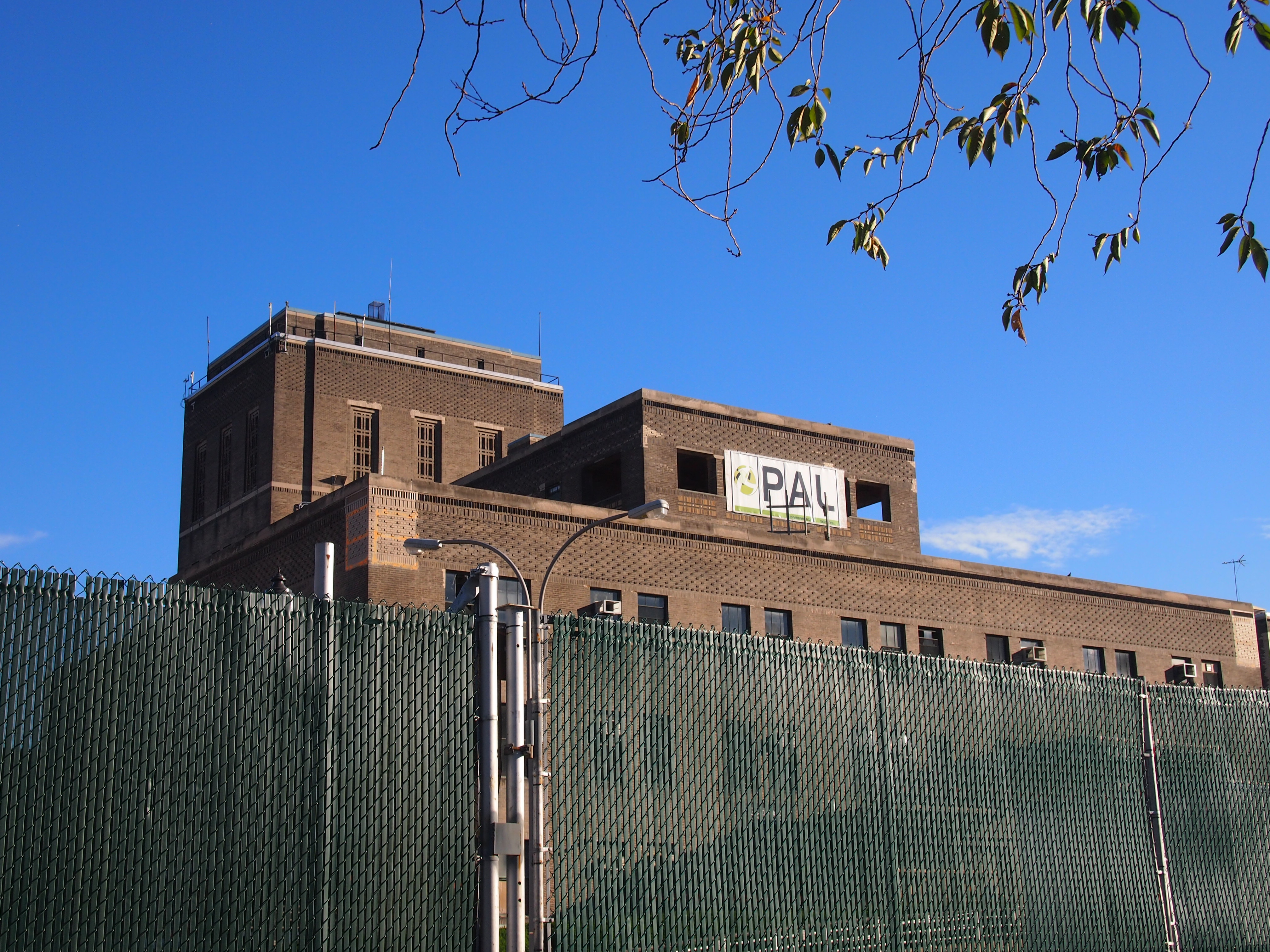
After leaving the tram, I headed south, soon finding a relic of earlier time, namely the south campus of the Coler-Goldwater Specialty Hospital and Nursing Facility, which is currently surrounded by a fence and being demolished.

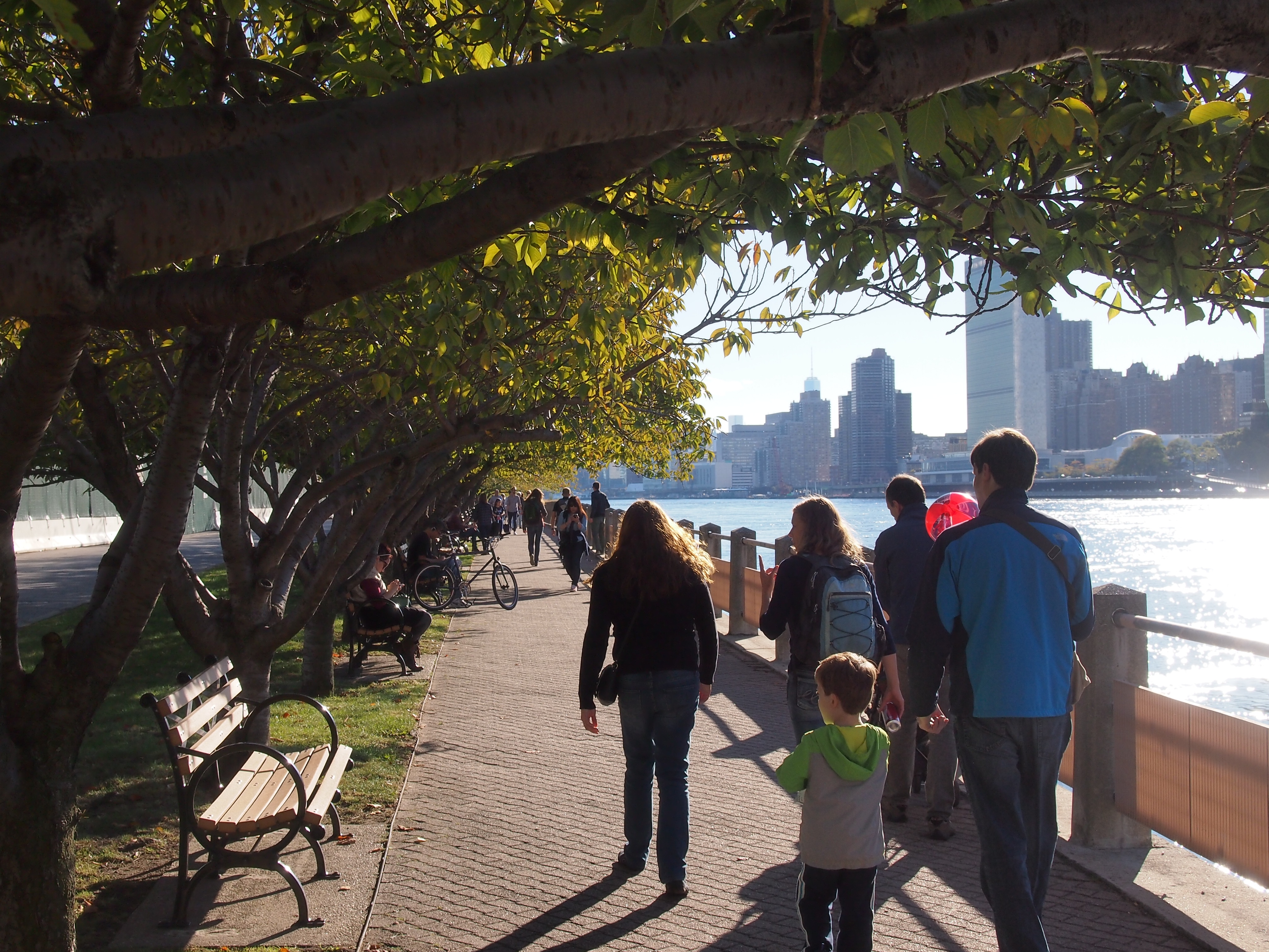
Roosevelt Is Oct 12, 2014The walkway to the southern tip of the island is still open, and on a warm October afternoon, offered walkers a nice view of Manhattan on one side and cherry trees on the other.

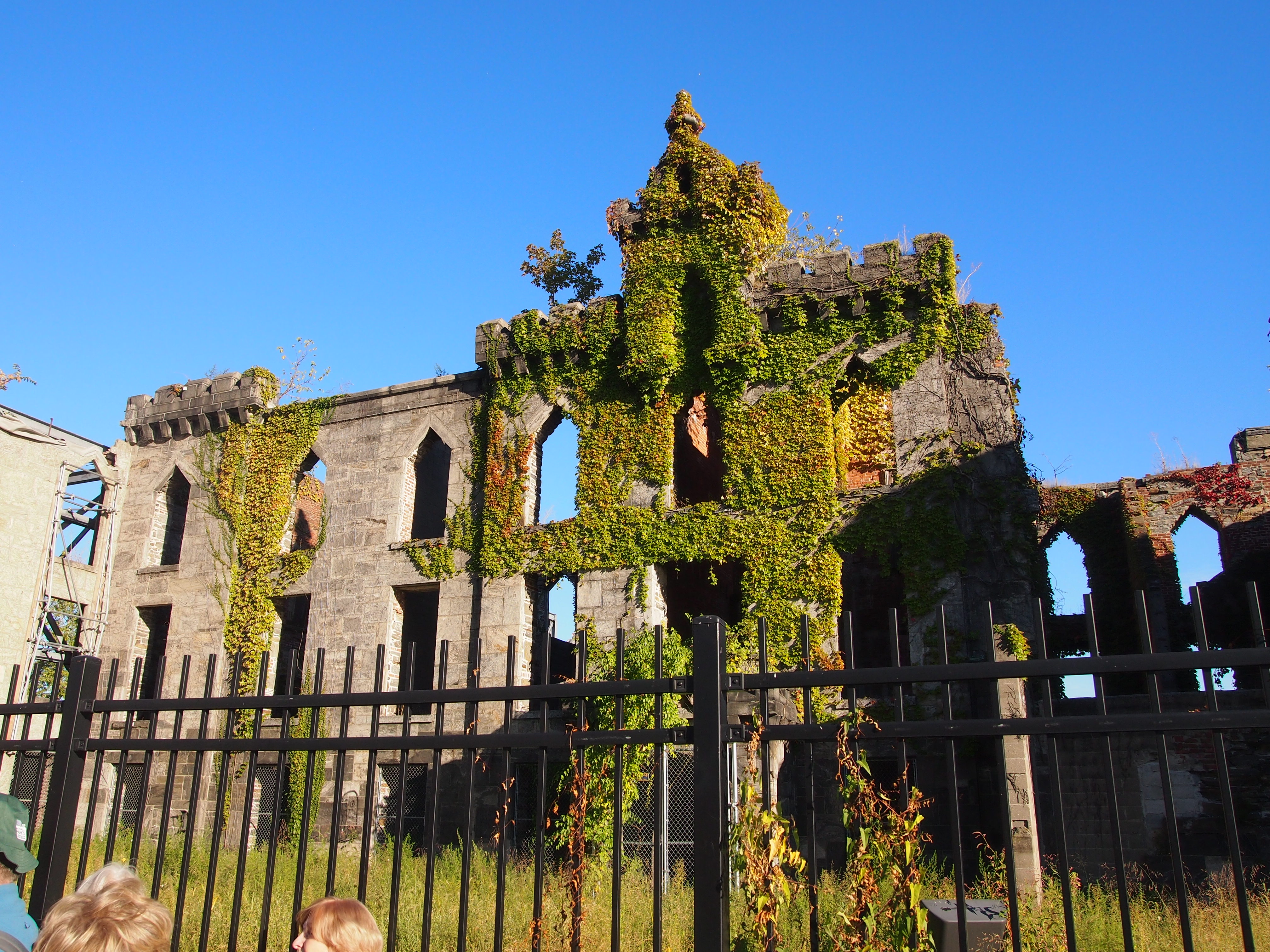
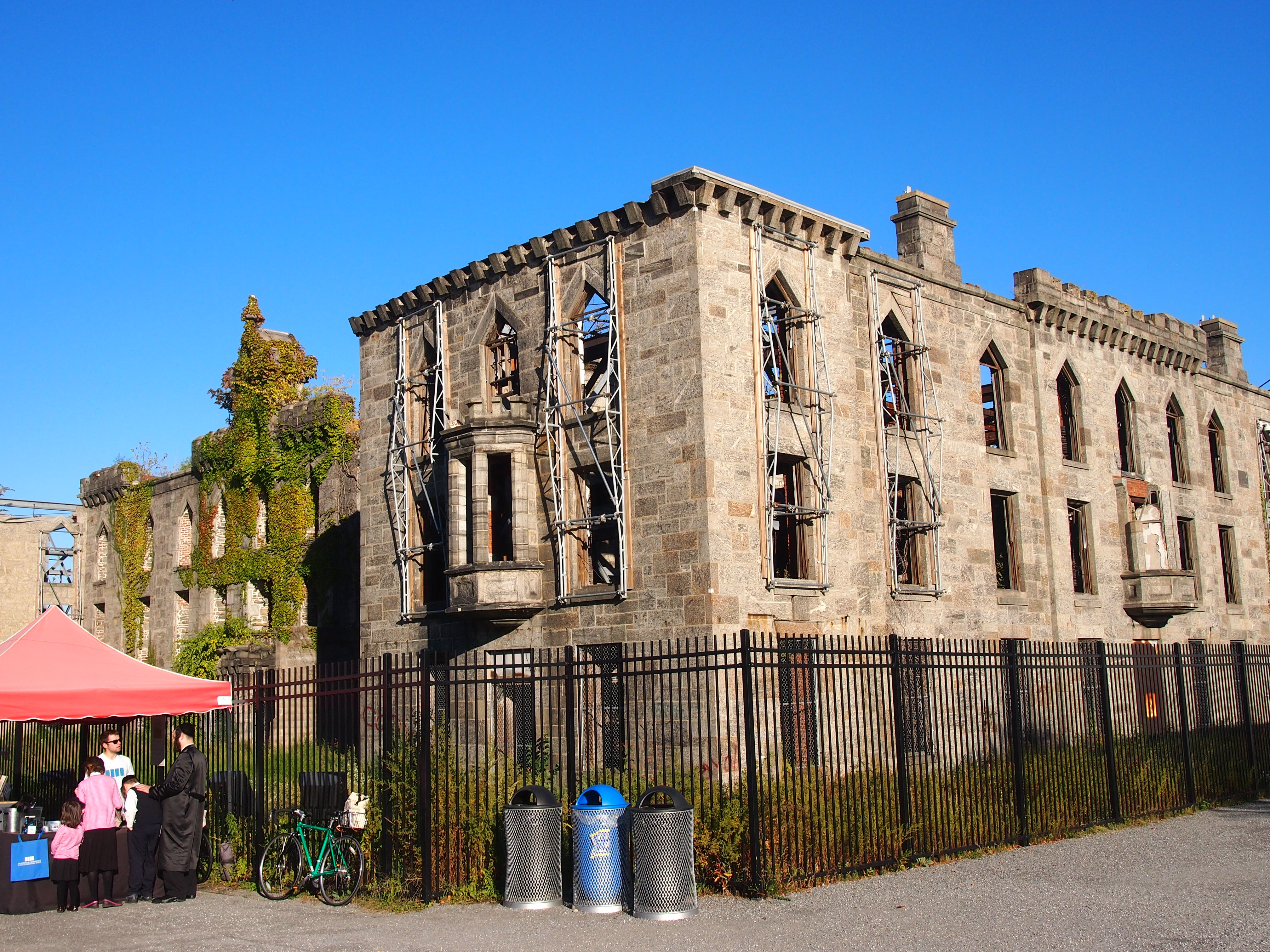
Roosevelt Is Oct 12, 2014Further south are the ruins of the Smallpox Hospital. That’s really what I came to see. There aren’t many ruins to see in New York, even fewer that that are landmarks. This is the only one, in fact.

Roosevelt Is Oct 12, 2014

Roosevelt Is Oct 12, 2014The sign at the site says: “The Smallpox Hospital, also known as the Renwick Ruin, was designed by James Renwick Jr (1818-1895) and built between 1854 and 1856. James Renwick was the architect of Grace Church and St. Patrick’s Cathedral. The hospital is designed in the Gothic Revival style and is faced with locally quarried grey gneiss.

“The hospital opened in 1856, with room for 100 smallpox patients, on what was then known as Blackwell’s Island. It was converted in 1875 into a training school for nurses. The building was abandoned in the 1950s. In the late 1960s, the NYC Landmarks Preservation Committee deemed it worthy of preservation… as ‘a picturesque ruin.’ ”

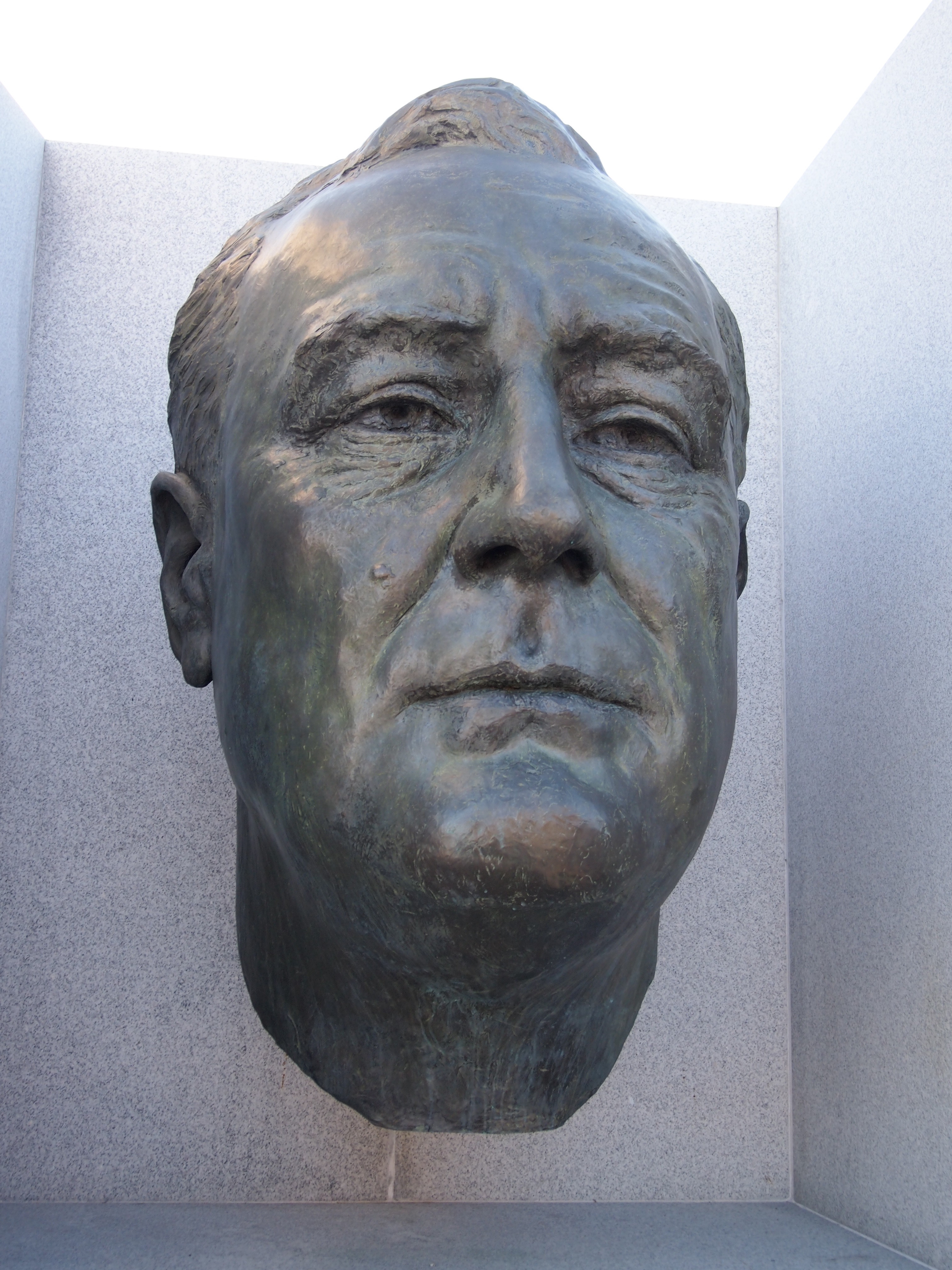
Roosevelt Is Oct 12, 2014At the southern tip of the island is the four-acre Franklin D. Roosevelt Four Freedoms Park, opened only in 2012 after years of some kind of wrangling between the city and donors that I don’t feel like investigating further. Anyway, the park is there now, designed four decades ago by Louis Kahn. A large floating FDR head greets visitors to the park. I later found out that it dates from the 1930s, done by sculptor Jo Davidson (who did Emma Goldman’s gravestone portrait, among many other things). For a sense of scale, I took a picture of a man and boy at the statue; maybe he was telling the lad who this enormous head was.

http://dees2.blogspot.com/2011/11/commie-plots.htmlBeyond the FDR bust is a triangular patch of land planted with rows of trees on either side, and other features, leading to a space that I’ve read is called The Room, which is partly but not completely enclosed by granite walls. There you can find the Four Freedoms carved in stone. The Room is at the very tip of the park, and the island, and the view from there is one of rocks, bridges, and the shores of NYC. An AIA article about the park is here.

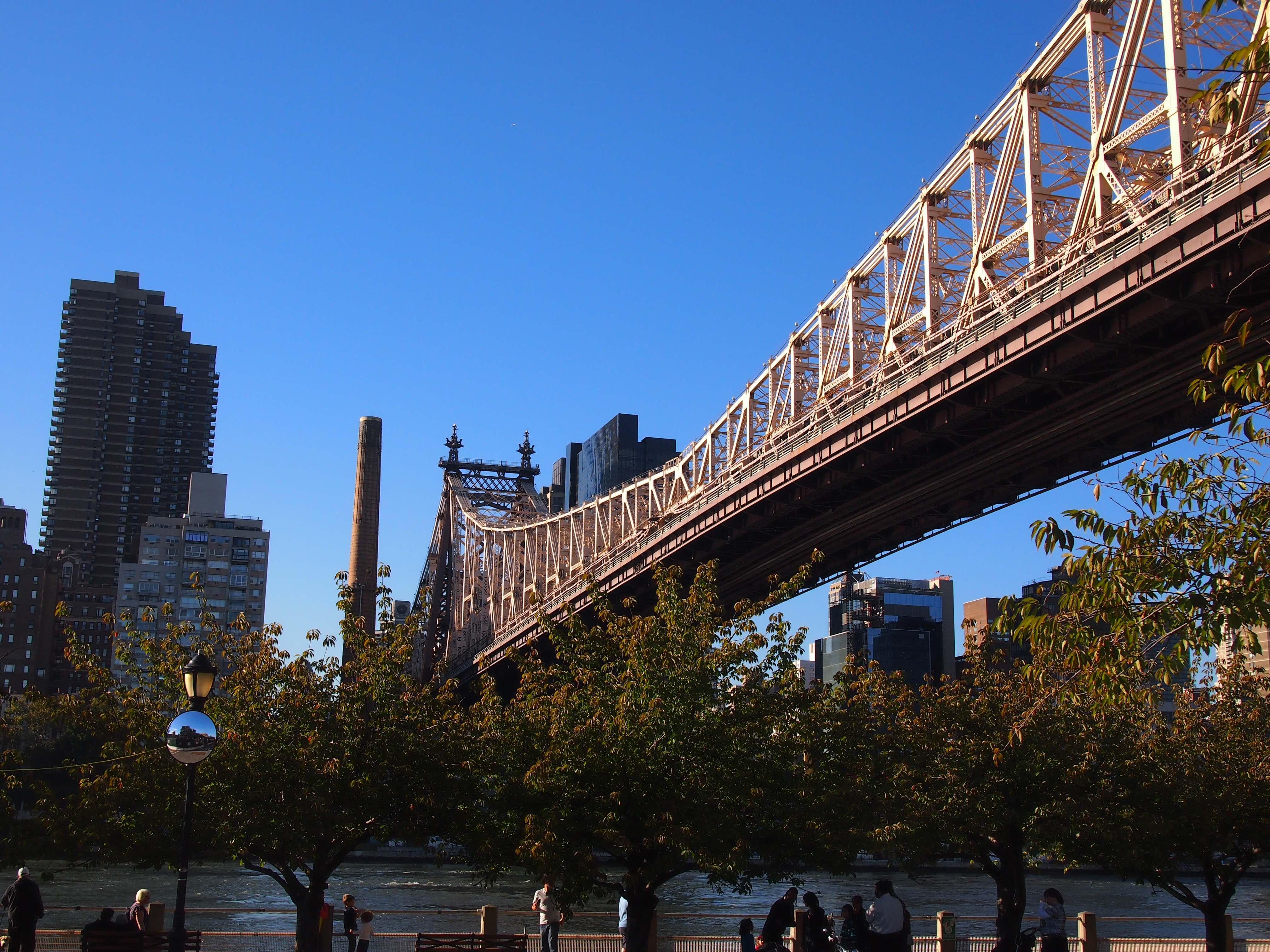
The island also offers fine views of the Queensboro Bridge, standing now for more than a century. Co-designed by Henry Hornbostel and Gustav Lindenthal and overshadowed in the popular imagination by the prettier Brooklyn Bridge, it’s still worth a good look. This is the bridge going to Manhattan.

Queensboro Bridge, Oct 12, 2014And going to Long Island City in Queens.

Queensboro Bridge, Oct 12, 2014For the centennial of the bridge in 2009, the NYT did an item that noted, “Hornbostel and Lindenthal, who was the city’s bridge commissioner in the early years of the 20th century, are no longer household names. [Hornbostel might be better known in Pittsburgh.] For a while this month, the Web site of the city’s Bridge Centennial Commission referred to Hornbostel as ‘Henry Hornblower.’ By Friday, his name had been corrected. Besides the Queensboro, the two men also designed the Hell Gate Bridge, which links Queens and the Bronx.”

The Roosevelt Island Tramway

Who doesn’t like a good aerial tram ride? I know I do. New Yorkers also seem to like a good aerial tram ride. At least the Roosevelt Island tram was packed full when I rode it on October 12, a clear Sunday afternoon. Since it was Sunday, I knew they were pleasure-seekers, not commuters.

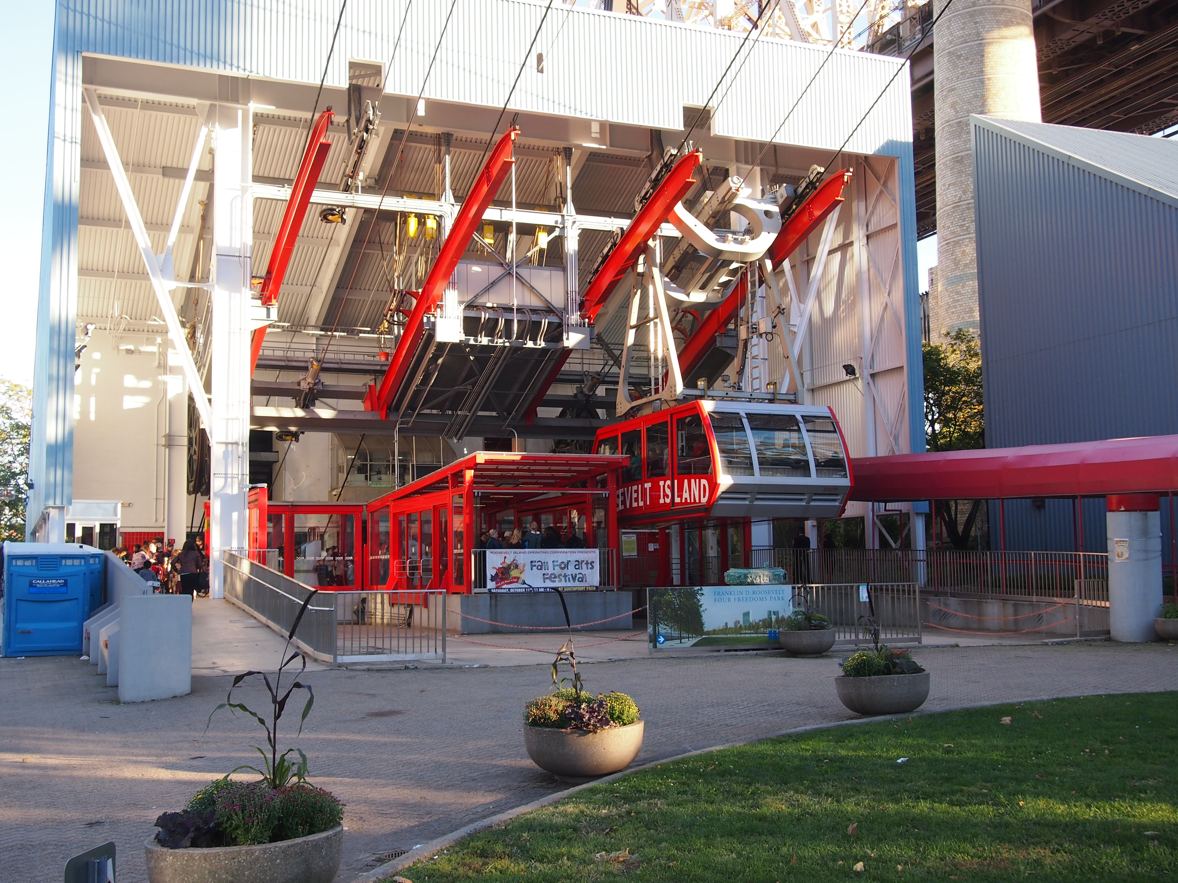
To ride the Roosevelt Island tram, you either have to go to 60th St. and Second Ave. in Manhattan, or the station on Roosevelt Island itself, which is accessible by subway and road. I wanted the experience of riding from Manhattan to Roosevelt Island, so I took the subway to Lexington Ave. & 59th St. and walked the short distance to the tram station, which is at the top of its own tower.

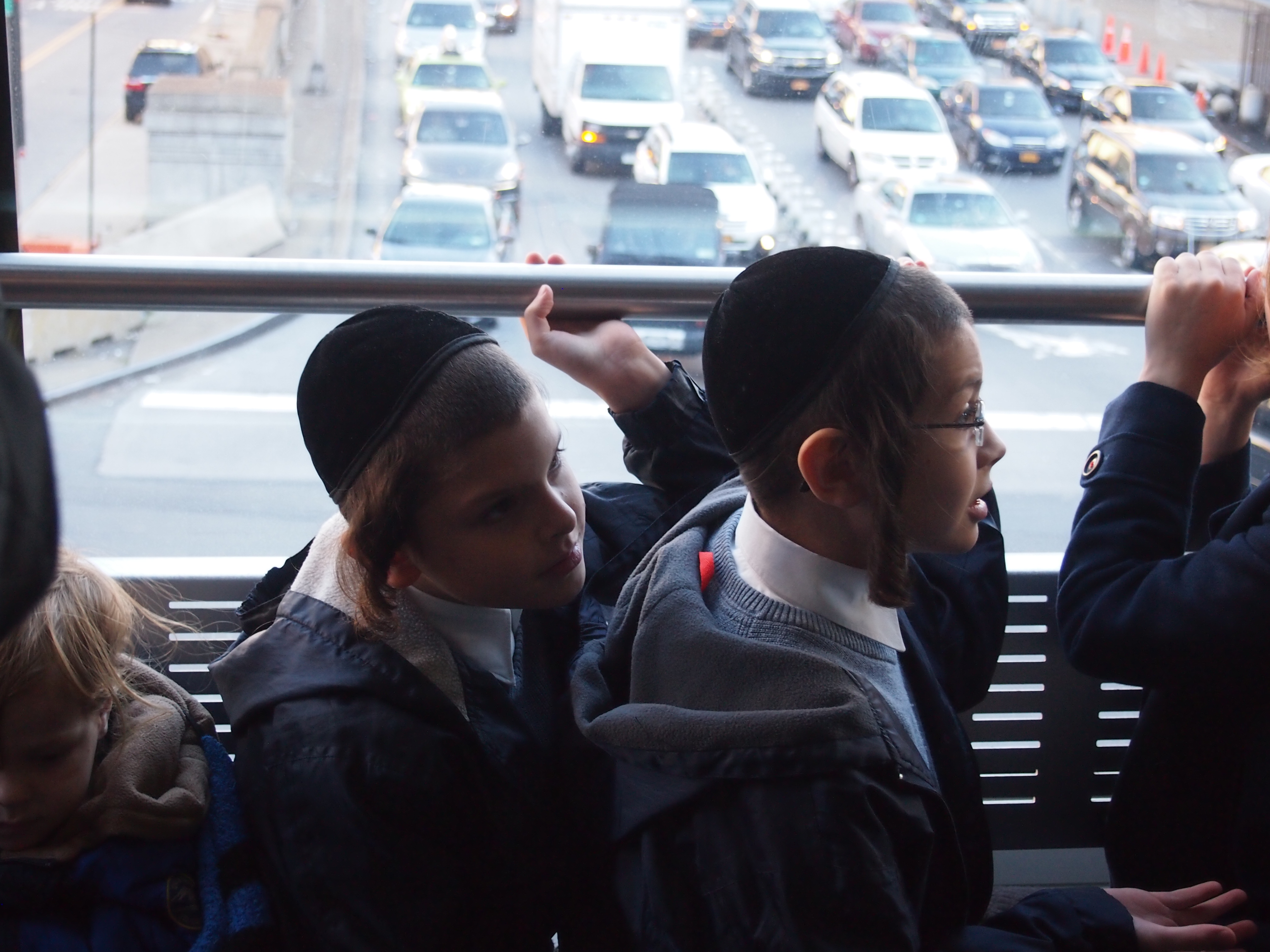
As I mentioned, the car was full. Excited kids were up front for the view, which starts in above a major street, then goes up over the East River, with the Queensboro Bridge to the right (officially named after Ed Koch, but I don’t think anyone calls it that) before dropping down to the tram station on the island.

Roosevelt Is Tram

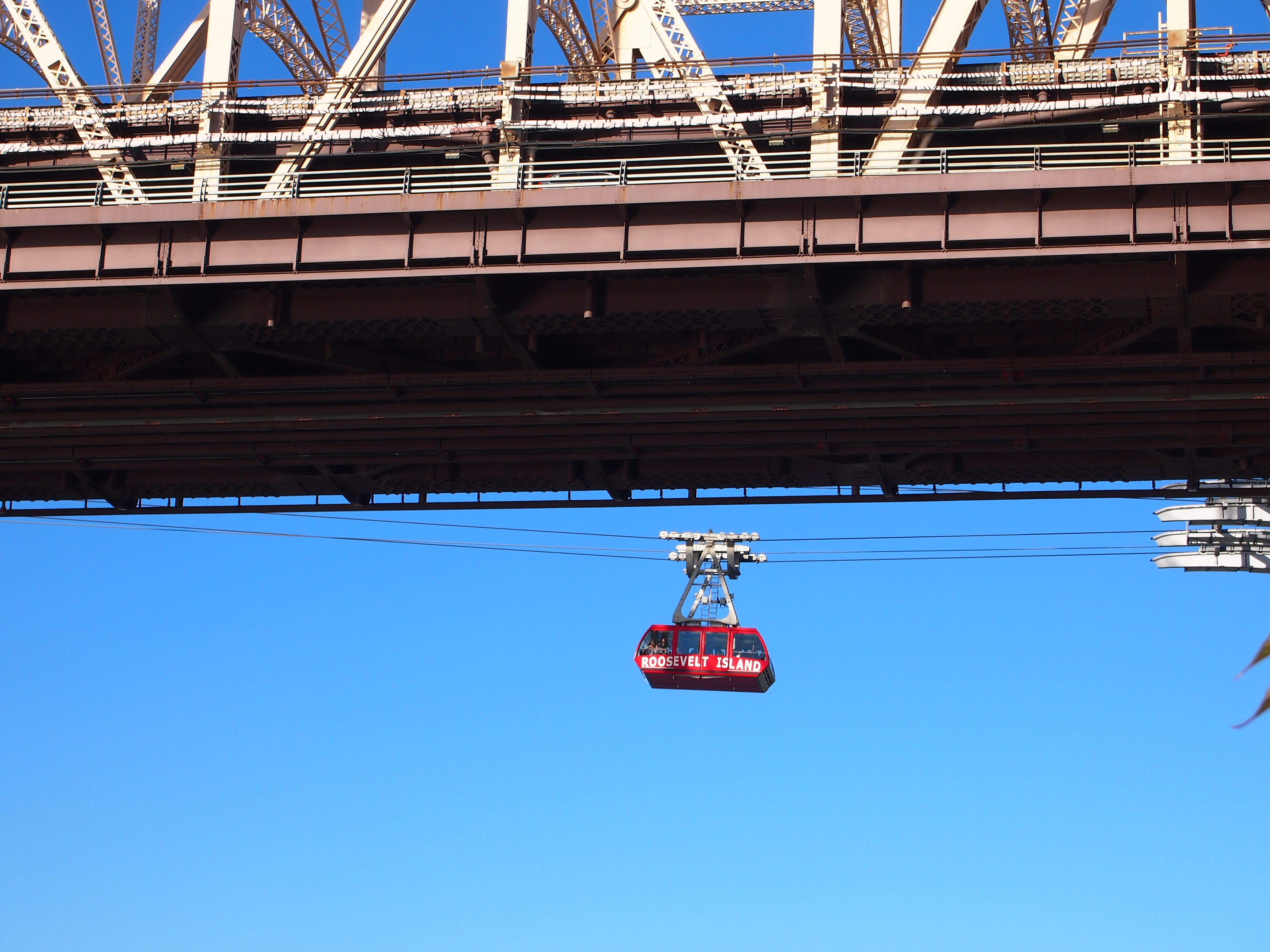
It’s a short, smooth ride to the island. Unlike some of the skyrides I’ve been on, there was very little bumping as you roll over the wheels on the towers holding the thing up. A little later, I took a picture of one of the cars coming over, appearing to glide under the bridge, but in fact on the other side.

Roosevelt Is Tram + Queensboro BridgeOne of the cars as it leaves the station on Roosevelt Island. I’ve read they they aren’t the original cars, but newer ones acquired for the renovation of the system a few years ago.

Roosevelt Is Tram Oct 12, 2014Tram basics, as provided by Billie Cohen in a NYT series about commuting in the region: “Until Portland, Ore., opened its aerial commuter tram in 2006, the Roosevelt Island tram was the only commuting one in America… Well, our tram was first, and it has swooshed across the East River since 1976. It travels 16 miles per hour, completing its crossing of the river in four and a half minutes and reaching a height of 250 feet, which is higher than the Queensboro Bridge at certain points.

“The tram runs every seven and a half minutes during rush hour and fits a maximum of 125 people… The tram was originally conceived to be a temporary solution to the island’s lack of subway service. Prior to its inception in 1976, anyone traveling to Roosevelt Island rode a trolley across the Queensboro Bridge, which was equipped with an elevator to take people down to the island. A restored trolley kiosk now serves as a visitor center and is located on the site of the elevator building. The F-train station on Roosevelt Island opened October 29, 1989.”

Brooklyn Ramble

There’s a stone in Brooklyn Bridge Park, near the edge of the water at the place once called the Fulton Ferry Landing, with a plaque on it. Naturally, I had to look at it.

THIS TABLET MARKS THE BROOKLAND FERRY LANDING FROM WHICH POINT THE AMERICAN ARMY EMBARKED DURING THE NIGHT OF AUGUST 29TH 1776 UNDER THE DIRECTION OF GENERAL GEORGE WASHINGTON ABLY ASSISTED BY COLONEL JOHN GLOVER OF MARBLEHEAD, MASSACHUSETTS. Erected by the Brooklyn Bridge Plaza Association 1929.

Washington’s famed escape, helped by the weather as well as Col. Glover and his men, happened right there, back before the 19th- and 20th-century docks occupied the area, back before it was in the shadow of the Brooklyn Bridge, back before the redevelopment of the area into a public amenity for 21st-century New Yorkers. It was good to find a presidential site on my walkabout in Brooklyn on October 11.

By the time I got to Brooklyn Bridge Park, I’d been walking much of the afternoon, and was also glad find the many benches available at the park, among the greenery and other amenities. From that vantage, the Brooklyn Bridge looms large, gracefully taking up the sky, its great stone towers hung with the familiar web of steel cables. Hard to believe something so hard and massive can give the impression of floating, but it does. I was reminded of the time I sat under that other late Victorian metal marvel, the Eiffel Tower, gawking up at it. One horizontal, one vertical, both gargantuan works of sculpture, besides being engineering feats that I can’t pretend to understand (and in the case of the Brooklyn Bridge, critical infrastructure).

A constant stream of pedestrians, silhouettes of walking figures, crossed the bridge as I watched. I didn’t remember the foot traffic on bridge being so heavy, but my hazy memories of walking across the bridge in 1983 involve a hazy summer day. I don’t remember my exact route then, but after crossing from Manhattan to Brooklyn – the first time I’d been to the borough — I made my way to the Brooklyn Heights Promenade, famous for its view of Manhattan, and sat around there for a while. I found, or bought, a newspaper, and I read about the assassination of Benigno Aquino on the promenade. I’d never heard of him before.

Behind the Brooklyn Bridge, at least from the vantage of the park, is the Manhattan Bridge, which is overshadowed by its neighbor. But it too has its aesthetic charms. One of these days, I ought to walk across it as well. The Manhattan Bridge is the newer of the two, designed (in part) by Leon Moisseiff and opened in 1909. Moisseiff’s better known for consulting on the Golden Gate Bridge design and, infamously, the original Tacoma Narrows Bridge.

Brooklyn Bridge Park is a fine new public space. Brooklynbridgepark.org says it “extends 1.3 miles along the East River on a defunct cargo shipping and storage complex. The ambitious park design sought to transform this environmentally hostile site into a thriving civic landscape while preserving the dramatic experience of the industrial waterfront. This site also presented excellent opportunities including its adjacency to two thriving residential communities and its unparalleled viewsheds to the fabled Lower Manhattan skyline.” Viewshed, there’s an urban planning word you (I) don’t see much.

“Brooklyn Bridge Park’s lush lawns, young trees and beautiful flowers have created a robust landscape and brought nature to this former industrial site. Public access to the long, narrow site was enabled by ‘urban junctions,’ neighborhood parks at key entry points that transition between the park and adjacent residential communities. These entry parks host program such as dog runs, civic lawns and playgrounds, which foster community stewardship and the safety that comes with constant occupation.”

I’d come to Brooklyn Bridge Park after spending the afternoon in Downtown Brooklyn and then the Brooklyn Museum, which is near Prospect Park. Then I took the subway to the High Street station, which actually deposited me at a large street called Camden Plaza West. From there I crossed through a small section of Brooklyn Heights notable for the Fruit Streets: Cranberry, Pineapple, and Orange, which each feature a few blocks of brownstones, former carriage houses, wood frame structures, small restaurants and shops, and a few churches (including Plymouth Church, whose first pastor was Henry Ward Beecher; I didn’t know it was there until later). Enormous trees shelter the neighborhood, and in some spots, roots push up parts of the ancient sidewalk. It was easily the most handsome neighborhood I encountered during my visit, and probably one of the more expensive in Brooklyn these days. Much more about the area around Middagh St. (which parallels the Fruit Streets) is here.

Walk far enough down a Fruit Street and you reach the Fruit Street Sitting Area, a small park – near but apparently not part of the Promenade — with a large view of Lower Manhattan. I arrived just as the sun was setting. Complete serendipity, and I sat down to enjoy it. A number of other people were there to watch the glow off in the west.
As I left the area, I noticed that the playground across the street from the Sitting Area is named for Harry Chapin, who was from Brooklyn Heights. I hadn’t thought about him in a long while. I wondered how long it had been since he died in an accident on the Long Island Expressway – 10? 15 years ago? Later, I looked it up. He died in 1981. This kind of memory disconnect happens sometimes.

Proceeding down a steep hill – and there aren’t many of those in New York – on a street called Columbia Heights, I came to Brooklyn Bridge Park, and a bit of the area lately known as Dumbo — Down Under the Manhattan Bridge Overpass, supposedly. I wandered around there as it grew dark, though I didn’t make it as far as the Manhattan Bridge on foot that evening. I’d written about the district before, since it’s the kind of place where former industrial buildings become residential properties. Eventually I cooled my heels on a bench at Pier 1 in Brooklyn Bridge Park and watched the city and the bridges light up.

Brooklyn ’14

So that explains it. New York ComicCon was at the Javits Center in Manhattan from October 9-12. Normally this would concern me not at all, but when riding the subway in Manhattan last week, sometimes I noticed youth in costumes, some elaborate, that seemed to evoke comic book characters, though none I recognized. Being too early for Halloween, despite marketers’ best efforts to pull that event forward, I figured it was something else.

But the oddest thing I saw in the subway was a normally dressed young woman waiting for a train going Uptown. She looked a little bored. Then I noticed the unloaded crossbow that she was holding, pointing down. Where does one practice crossbow on this teeming, crowded island? There must be an indoor range somewhere. Still, it was something you don’t see every day, not even in New York.

I left for New York on October 9 and returned on the 17th. I had business to attend to, but also made an effort to see things I hadn’t before. No matter how many times you visit – and I’ve lost count now – there’s always more, since New York is just that kind of place. I spent time in Manhattan, of course, but the focus this time around was Brooklyn. Over the years, my visits to the borough have been only sporadic, and now they say it’s the place to be in New York. My nephew and his flatmates in Bed-Stuy, who are passing their young manhood there, were good enough to put me up.

So I walked the streets and rode the trains, and a few buses. I ate barbecue, supposedly Texas style, Southern-style chicken (though not quite spiced in any Southern style I know), a Turkish gyro, a Cuban sandwich, slices of pizza standing up, some pretzels, food at diners – surprisingly common in the city – and visited a few tiny grocery stores, the kind large boxes have killed in most places, because Ye Shall Know Them by Their Grocery Stores. Almost everything is overpriced, but what isn’t in that part of the country? I marvel that the non-wealthy can live there at all.

In Manhattan, I made it to the High Line, a truly remarkable new public space, and the September 11 Memorial and Museum, besides a few moments at familiar old places, such as Grand Central and the streets of Midtown. In Brooklyn, I wandered around parts of Bed-Stuy, Downtown, Brooklyn Heights, and Dumbo. Every now and then, I would see a development, usually an apartment building, that I’d written about at one time or other.

Brooklyn Bridge Park, besides being up close under that highly aesthetic feat of bridge engineering, is also a truly remarkable new public space. One morning I got up early and made my way to the bucolic and vast Green-Wood Cemetery, south of Prospect Park. One afternoon I spent a few footsore hours in the Brooklyn Museum, an institution overshadowed by the big-box museums on Manhattan, but a palace of art in its own right.

Years ago, I took a Circle Line tour, which involves taking a boat all the way around Manhattan while a guide makes bad jokes on the intercom. Or at least it did then. This time, I opted for the much cheaper East River Ferry, for a view of the city by night, and no narration. Also, I took a walk on Roosevelt Island, taking the aerial tram to get there, in the company of other tourists, but also a fair contingent of Hasidim on an afternoon excursion.

On the whole, the place made me tired. It’s crowded, noisy, dirty and expensive. Who would have it any other way? I’m glad I was able to make it this year.

Main Street, St. Charles

St. Charles, Illinois, is on the Fox River southwest of where I live, about a 30 minute drive, partly on the two-lane roads near the river. Though quite a ways from Chicago, I suppose it counts as an outer mid-sized suburb, with about 33,000 inhabitants.

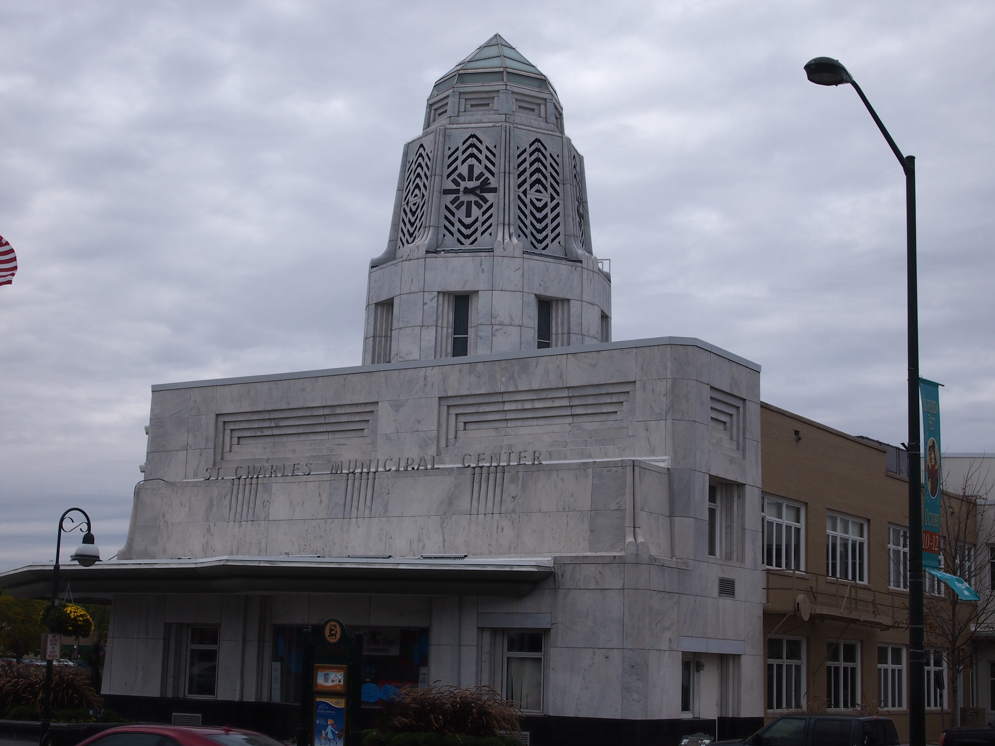
It’s got an interesting municipal building on Main Street, overlooking the Fox. Not too many Art Moderne municipal buildings around, at least in metro Chicago.

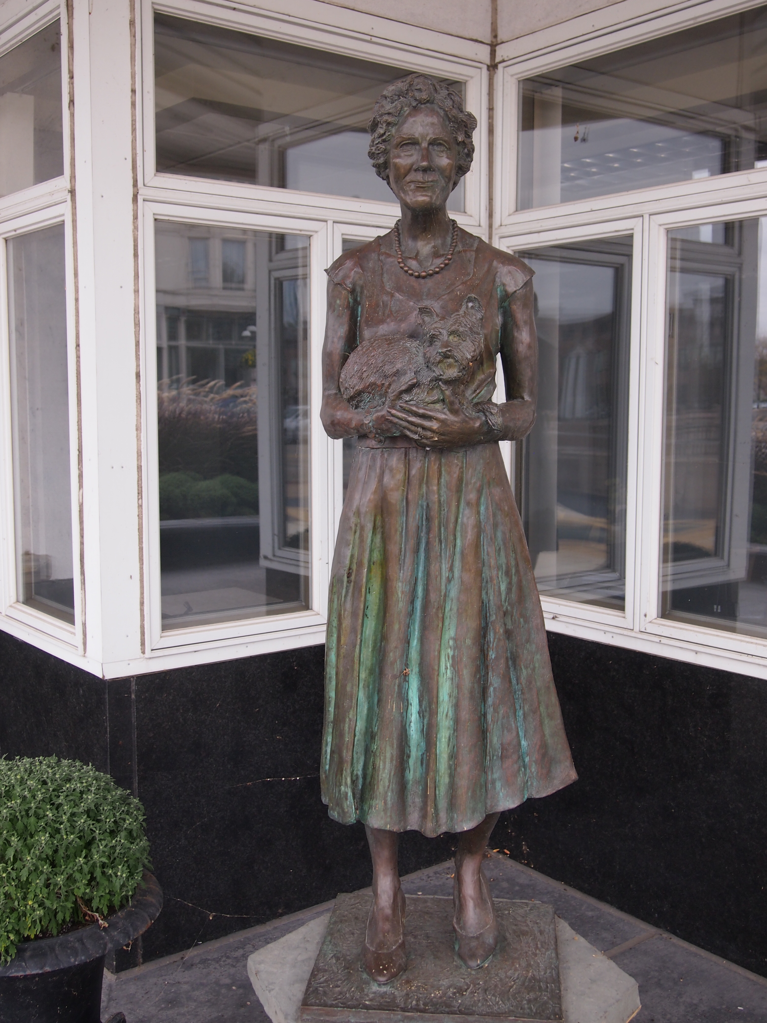
St Charles, Ill. Oct 5, 2014Vintage 1940, and it sure looks like it. Designed by R. Harold Zook, early 20th century architect noted for his work in the area, and for a fun name, at least by me. Get a little closer, and you’ll find Dellora standing in from of the edifice.

St Chas, Ill. Oct 5, 2014And her dog Toto? Her plaque doesn’t say. It does tell us that this is a representation of Dellora Angell Norris (1902-1979): “Her vision and generosity shaped our community for generations to come.” Not to quibble, but shouldn’t that be will shape? Ah, well. It’s in bronze, no editing now. Dedicated June 8, 2006. The sculptor is Ray Kobald.

Mr. Kobald is local to St. Charles. Think globally, sculpt locally.

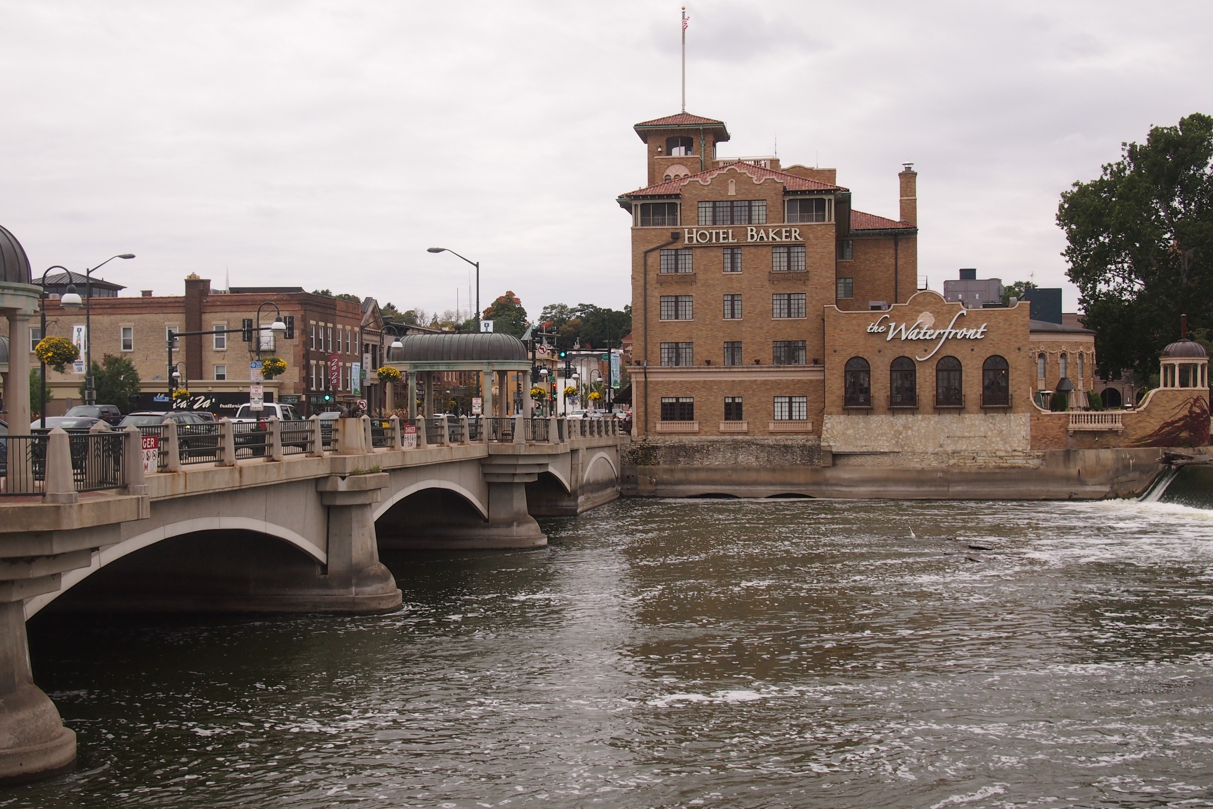
On the west side of the Main Street bridge in St. Charles is the Hotel Baker.

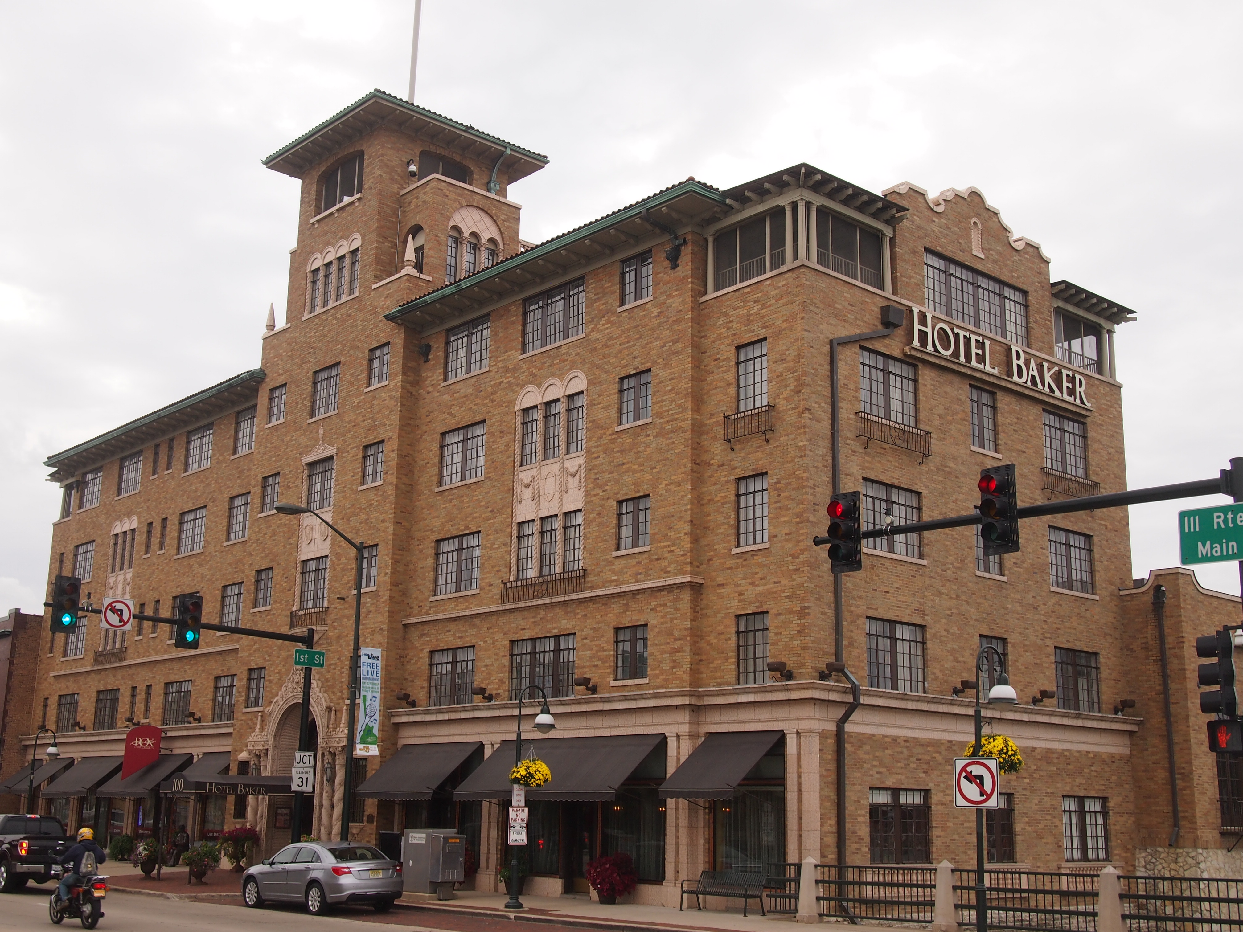
Hotel Baker, St Charles, Ill. Oct 2014A closer view.

Hotel Baker, Oct 2014Local millionaire Edward J. Baker, one of the heirs to John “Bet-a-Million” Gates barbed wire and oil fortune, developed the property in 1927 (Dellora Norris was another heir). Over the years it was a hotel, then a retirement home, now a hotel again. Actually, he was Col. Baker — a Kentucky colonel, somehow or other. More about him here.

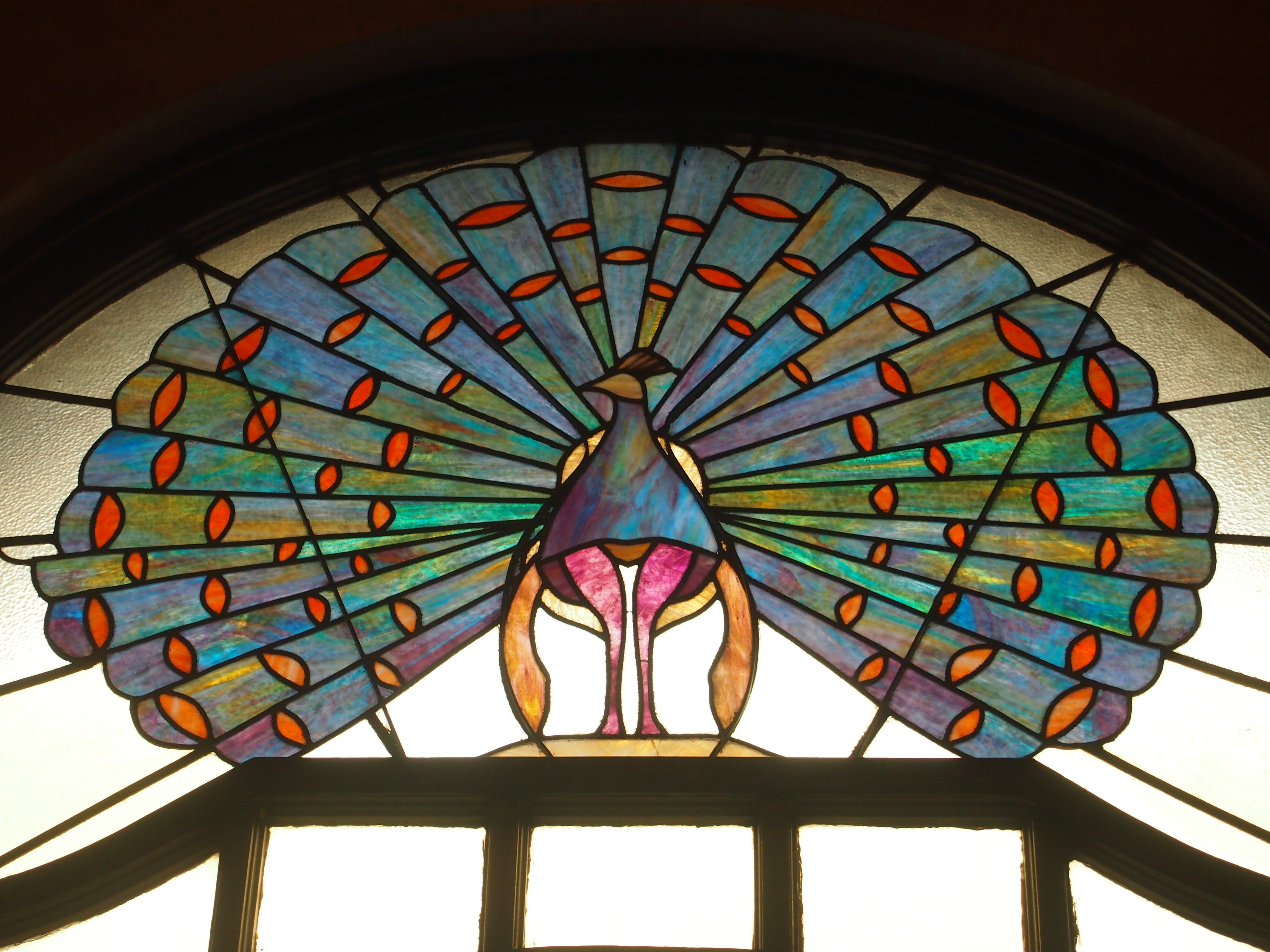
I ducked inside for a moment, fond as I am of spiffy hotel lobbies. Over the entrance, facing inward, is this nice piece of work.

Hotel Baker, Oct 2014The Baker Peacock, you could call it.

The University of the Incarnate Word

When I lived in San Antonio, we often drove by Incarnate Word College. I don’t ever remember visiting except (I think) one of its auditoriums for a high school mock UN one Saturday in 1978. (I was an Iraqi delegate, and eventually the Arab nations got together and walked out in protest over something or other.) These days the school is the University of the Incarnate Word, and it’s bigger than I realized: nearly 9,200 students, which makes it the largest Catholic university in Texas and the fourth-largest private university in the state.

The main campus measures 154 acres, and includes the previously mentioned Blue Hole, mainspring of the headwaters of the San Antonio River. On the way to the Blue Hole, we passed the mansion of George Brackenridge, which he called Fernridge. Brackenridge, a late 19th-century San Antonio business magnate, eventually sold the house and some land to the Sisters of Charity of the Incarnate Word to found their school. (He also called the nearby area Alamo Heights, which he owned for a while, and donated the land for Brackenridge Park.) I assume the university uses it for events now.

Brackenridge Villa, July 2014Not far away is a bronze nun. Not something you see every day. She seems to be in teaching mode, for the benefit of the young lady bronze. According to the plaque, the work is called “Living the CCVI Mission” and is by Paul Tadlock of New Braunfels. It was dedicated in 2006.

Bronze NunA little further into campus is a grotto. I seem to be running across a fair number of grottos lately. The Incarnate Word grotto is a Lourdes-class grotto, built in 1904 by Fr. J.G. Bednarek, a priest from Chicago, to mark the 50th anniversary of the promulgation of the dogma of the Immaculate Conception of the Virgin Mary. Apparently Fr. Bednarek taught at the school, but why he took an interest in building a replica of Lourdes there, I haven’t uncovered yet.

Incarnate Work grotto, July 2014Finally, there’s the first bridge over the San Antonio River, which is just south of the Blue Hole. The river’s pretty small at that point, where Olmos Creek joins the outflow from the Blue Hole. A rivulet in a ditch, really, but nice and leafy this time of year. Nearby is the 53-acre Headwaters Sanctuary. The sanctuary is the last remaining undeveloped property from the original 283-acres the sisters bought from George Brackenridge.

Incarnate Word campus, July 2014We decided it was too hot to walk on the sanctuary, which was still further. But since we’d come to the bridge, the thing to do was cross it.

Two Bridges of Madison County

While in Winterset and environs, I took the opportunity to see two of the wooden covered bridges of The Bridges of Madison County fame. The movie, at least, seems to be relegated to a chick flick ghetto. Wrongly, I think. The story was at least as much about the visiting photographer – the man – as it was about the farm wife.

Movie or not, I liked the bridges. At least the two I saw.  It’s remarkable that such artful wooden construction has survived for more than a century, but they have. Ann was less impressed. When we visited the first structure, the Cutler-Donahoe Bridge, she said something like, “What’s so special about this bridge?” You have to be older to appreciate older things, maybe. (Though I’ve liked old things since I can remember. I’m peculiar that way.)

Cutler-Donahoe Bridge, July 2014

The Cutler-Donahoe Bridge dates from 1870, built by one Eli Cox. In 1970, it was moved to Winterset City Park, where we saw it. Length, 79 feet. Weight – and you’d think it would be lighter – 40 tons. Nice work, Eli.

Cutler-Donahoe Bridge interior

Not far from town is the Holliwell Bridge, in situ over the Middle River.

Holliwell Bridge, July 2014Ann stayed in the car for this one. The structure’s a little newer than Cutler-Donahoe, built by Benton Jones in 1880 and renovated in 1995 (on the occasion of filming the movie, I guess, but my sources don’t say so explicitly).

Middle River, Iowa, July 2014This is the view from the north end of the bridge, looking out on the Middle River, a tributary of the Des Moines River that runs through the county. Iowa’s nice and lush this year.

Fifteen Days, Seven States, Nearly 3,000 Miles, and the Blue Hole

Our drive to San Antonio and back started on the morning of July 12 and ended a few hours ago. I actually remembered to set to trip meter as we were leaving, so I know that between backing out of the driveway and returning to it, the car had been driven 2,952 miles and change. Except for when my brother Jay used the car in San Antonio, I drove all those miles. Ann was in the back seat almost all of the time.

Our route southward wasn’t as direct as it could have been, passing from metro Chicago to Des Moines to St. Joseph, Mo., the first day; to Hutchinson, Kan., by way of Topeka the second; and Dallas by way of Wichita and Oklahoma City on the third. After some days in Dallas, travel resumed: to San Antonio via the most direct route, which turned out to be a mistake (more about which later).

Our return northward was more straightforward: San Antonio to Dallas to Lebanon, Mo., and then home, three days’ driving spread out over four days, with a jag into extreme northwestern Arkansas. More about that later as well.

We were caught in two storms so intense that we waited them out beside the road. I saw two suitcases broken open, and their contents spread on the road, on two different Interstates. I’m pretty sure I saw a guy pulled over on the shoulder of yet another Interstate, changing his pants outside his car. We listened to a lot of radio. As hard as corporate interests try, terrestrial radio isn’t quite homogenized.

When I wasn’t driving, I was working (that’s the self-employed life). Or visiting with family members and friends: my mother, two brothers, two nephews and one’s wife, my aunt, first cousin and his family, two friends from high school. Or eating. Some chains, of course, but I did my best to support independent eateries in places like Wichita, Dallas, Austin, San Antonio, and Mt. Olive, Ill.
Besides all that, we squeezed in visits to three museums, the outside of two capitols (closed, unfortunately), a mall, an enormous bookstore, a couple of wooden bridges, and a cemetery with an historic figure buried in it. I also watched a number of early episodes of Treme, an addictively good show.

And I saw the Blue Hole.

Blue Hole, SA, July 2014

I lived within 10 minutes’ drive of the Blue Hole for more than a decade, and every time I visited San Antonio after that for 35 years, I was equally close. Yet I never saw it before this visit. All I can say is, it was about time.

Tri-State Leftovers

Cool for July 2, but I know the heat will return. Such are Northern summers. Tomorrow isn’t a holiday, but it ought to be. Back to posting on Sunday.

The bridge that crosses the Mississippi from Savanna, Illinois, to Sabula, Iowa, is exactly wide enough for two vehicles, and no wider. It’s a steel truss bridge, and more than 80 years old. These facts alone make it a thrill to drive across, but a conscientious – make that sane – driver isn’t going to take in the view of the Father of Waters while crossing; he has to leave that to his passengers.

The main steel structure on the Iowa side eventually gives way to a much longer and slightly wider causeway that passes through high waters and lush green islands. At that point it’s Iowa 64, and also US 52. The last time I drove over such watery lushness was in Louisiana bayou country.

North from Sabula to Dubuque is also US 52, and a branch of the Great River Road. At this point, Illinois 84 (and a bit of US 20) is the branch of the Great River Road on the opposite bank, in Illinois. We spent a fair amount of time on both roads the weekend before last, and I can say one thing: bikers are fond of the Great River Road. We saw a lot of them on the roads and parked in various towns along the way. They weren’t usually young men, but mostly wizened fellows, probably out for the weekend.

The Great River Road is actually a chain of state and local roads passing through 10 states from Louisiana to Minnesota, or vice versa if you travel the other way. It’s a National Scenic Byway totaling over 2,000 miles, according to the Federal Highway Administration. Signs along the way look like this (and in fact we drove past this exact place).

We stopped for a moment in Bellevue, Iowa, on US 52 to take a peek at Lock & Dam No. 12. There’s a small roadside park that offers a nice vantage of the structure. Lock & Dam No 12, Mississippi River, June 2014As I got out of the car to look at the dam, I noticed a young family – husband, wife, child of three or four – also standing in the park, seemingly admiring the structure with more intensity than people usually devote to infrastructure. Odd. (My own family members were in the car.) Maybe they were a couple of young engineers. For the record, the dam creates Pool 12, with a total capacity of 92,000 acre ft. The US Army Corps of Engineers completed it in 1939 and still operates it, and the structure’s been on the National Register of Historic Places since 2004.

The campgrounds at Mississippi Palisades State Park are well-designed and expansive. They don’t cost that much, either: $10 per night for a tent site. But the wet spring and early summer, and probably the close proximity to the Mississippi and many smaller pools of water, also meant we were in close proximity to a lot of bugs. This bothered Lilly and Ann in particular – you should have heard the commotion when they discovered a spider hitchhiking a ride in the back of the car. In the vicinity of the campground itself, mosquitoes mostly weren’t the problem, or maybe our DEET kept those away. Gnats were the biggest nuisance.

By night, they’d all calmed down and the fireflies were out. Gnats = nuisance. Fireflies = joy to behold. They don’t get in your face and they put on a show.

On Stolp Island

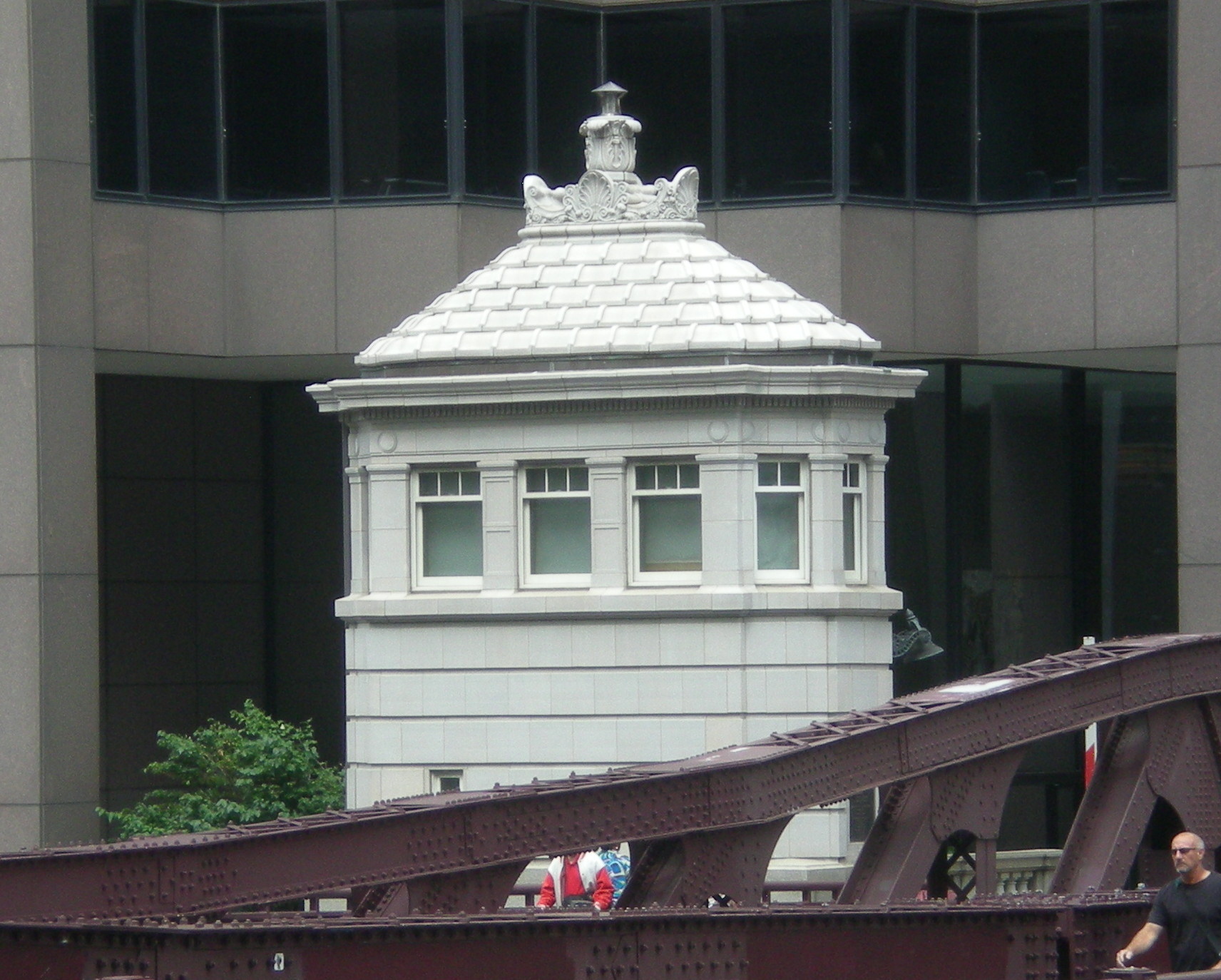
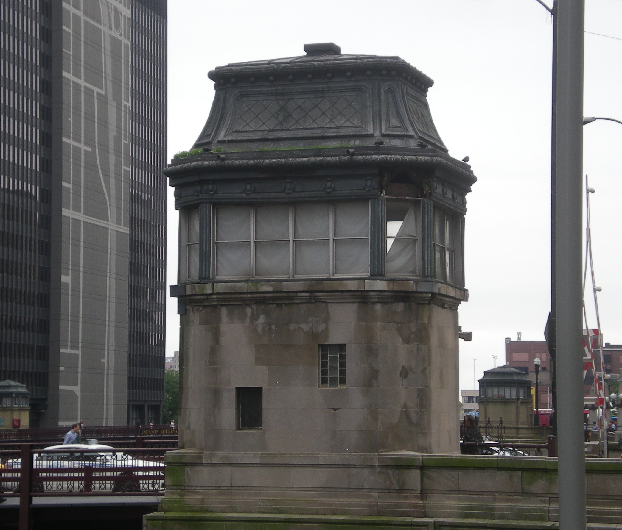
I took pictures at the western end of the New York Street Memorial Bridge in Aurora, but naturally I had to walk across it too. Or at least across the western section of the bridge to Stolp Island, because I didn’t realize at that moment that the eastern section of the bridge counted as part of the same bridge.

HistoricBridges.org explains: “The New York Street Memorial Bridge is technically a single bridge spanning the entire river. However, in the 1960s, fill was brought in to expand the island northward, and the center of the bridge was buried in the fill. Today, a parking garage is located south of the former center of the bridge and a casino is located north of the former center of the bridge.”

I made it as far that former center of the bridge, where I saw a plaque dedicated to Gen. Pershing.
It looks like it was tacked on to the parking garage, but the plaque came first, put there in 1960 for Pershing’s centennial (about 12 years after he died). Not far away was a bas-relief, flanked by eagles. I didn’t see a sign describing the work, but it’s safe to say it honors the ordinary soldiers of the Great War.

Across the street, in front of the casino, is the statue “Victory.”

“The Chicago Architectural Bronze Company manufactured the bronze tablets and light fixtures. Roman Bronze Works of New York City cast the bridge’s crowning central figure of Victory,” according to HistoricBridges.org.
Does anyone entering the casino mistake her for Lady Luck? Of course, Lady Luck doesn’t spend much time in a casino, however much gamblers want her to. Or maybe she does, but hews more closely to Fortuna, who inspired both good and bad luck. I think Dame Probability runs the joint – and she’s always on the side of the house.