Texas 130

A long and newly opened stretch of the toll road known as Texas 130, my sources tell me, includes the fastest posted speed limits in the nation – 85 mph. As we drove from San Antonio to Dallas last week, I made sure to take full advantage of that maximum. It’s fun for a while, but then you get used to the speed, especially since there isn’t much other traffic. You glide right along, mile after mile.

I haven’t followed the development of Texas 130 in any detail, though I know a little about it – it’s a private toll road, or rather a PPP (public-private partnership), which is generally just a new twist on the patronage schemes traditionally associated with road building. That aside, the theory of Texas 130 is to reduce congestion on I-35 through Central Texas, particularly Austin, which is awful and probably an unintended consequence of NAFTA allowing a free flow of trucks up from Mexico, plus rapid population growth in Central Texas in recent decades.

We drove the entire length of the toll road to take advantage of its stated purpose for being: avoiding traffic on I-35. If you’re going from San Antonio to Dallas, as we were, it adds a few miles to the trip, but it does indeed bypass the worst of Austin traffic.

It didn’t look like a lot of other drivers were doing the same. It is a toll road, after all. There was some traffic on the northern sections of the road, close to Austin, but not much. And no one seemed to be driving on the southern section of the road, near where it connects with I-10 (the main road from San Antonio to Houston). At times I saw no one on the road with us, ahead or behind.

That makes for more relaxing driving, but not a particularly successful toll road. The Austin American-Statesman reported earlier this year that “Texas 130, in 2011 traffic counts, saw a high of 43,000 vehicles a day on it in Pflugerville, about a fifth of what I-35 sees in Central Austin. Traffic on Texas 130 steadily ebbed further south, to just 9,600 vehicles a day near Mustang Ridge. Officials haven’t released traffic counts for the privately operated section south of Mustang Ridge, which opened last fall.”

The land along the road is also almost empty, too. Even at the few exits, there’s little development yet. Most of the time the view is open, not quite rolling, not quite flat, not quite green, not quite brown.  Some trees, but not a lot. It’s remarkable how much unpopulated space there still is in Texas, considering that 26 million people live there, with a good many of them along the Dallas-Austin-San Antonio axis.

Turns out a fair number of wild pigs live in the countryside near the road. We were warned not to drive Texas 130 at night, lest we run down pigs on the road.

Return to Cana

Leaving Sturgeon Bay, we headed up the Green Bay side of the peninsula on County Highway B, which later merges into County G and takes you into Egg Harbor. It’s a pleasant, two-lane highway, with bayside property on one side, mostly waterfront houses, and less-developed land – sometimes rising bluffs – on the other. All of it was lush. It’s been a rainy year in Wisconsin, too. I was expecting more traffic, this being the high season in Door, but most of the time no one was visible ahead or behind.

Until we got to Egg Harbor, that is. It might be quaint not to have any streetlights in your town, but Egg Harbor needs one at the juncture of County G and Wisconsin 42, the main road through town. The town seemed to be even more touristed than Sturgeon Bay, but with less space to put people. I asked if anyone wanted to get out and look around, but no one did, citing the early-afternoon heat.

We pressed on across the peninsula, via County Highway E, which passes mostly through farmland. The road also comes within sight of Kangaroo Lake, the peninsula’s largest inland lake. Kangaroo? I wondered. That’s the kind of name that makes me wonder. Maybe one of the pioneers of Door County imported kangaroos to see if they could be raised for meat. That failed, but some escaped, and their descendents live around the lake. They’re wily and hard to spot, in case you were wondering.

On the Lake Michigan side of the peninsula, we made a return visit to the Cana Island lighthouse. Most of us were back, anyway. Ann didn’t exist the last time we were there, almost exactly 12 years ago. Lilly of course didn’t remember being there, but in 2001, I took her picture wandering down the path to the lighthouse.

So I decided to do the same this time around, in roughly the same place along the path leading to the light. As I occasionally tell people I meet with small children, if you keep feeding them, they get bigger.

The grounds and the light are pretty much as I remember them. In his remarkable web site specializing on lighthouses of the western Great Lakes, Terry Pepper writes of the lighthouse: “Cana Island is somewhat a misnomer, since it is only an island when the lake levels are high. The majority of the time, there is an exposed rocky sinew of land which connects to the mainland.

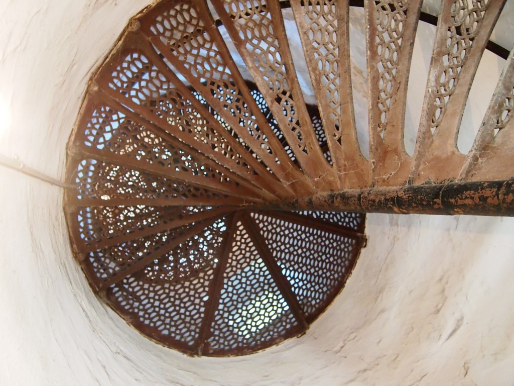
“Congress appropriated funds for construction the spring of 1869 and a crew immediately undertook the task of clearing a three-acre station site. Leveling a rock foundation, a buff-colored cream city brick tower began to take shape. Eighteen feet in diameter at the base, the tower rose 65 feet, gently tapering to a diameter of 16 feet at its uppermost… Spiraling within the tower is a gracefully spiraling set of cast iron stairs, with 102 stairs.

“The cast-iron lantern atop the tower was likely prefabricated at the Milwaukee Lighthouse Depot and transported to the site by Lighthouse tender. Equipped with a Third Order Fresnel lens with the focal center of the lens situated approximately 75 feet above the tower bottom, the lens boasted a focal plane of 82 feet above mean lake level.” (Visible for 16 miles, according to the docent, and lighting the waters near Door to this day.)

Ann wanted to climb to the top of the tower, which was open by extra admission. The top was accessible via the aforementioned 102 steps.

Her mother and sister didn’t want to go up, so I went with her. Before we went, and even after we’d climbed to the top, I was certain that we hadn’t gone up last time, probably because it was closed. But now I’m not so sure. You’d think I’d remember climbing a spiral of narrow cast-iron steps and taking in a sweeping view of the greens of the peninsula and the blues of Lake Michigan, with a constant wind blowing in my face, but maybe not. Memory’s a trickster.

Boerne Ramble

Sleet came down this afternoon, followed by heavy rain. It’s still raining, last time I looked. Or maybe that’s an ice-rain mix. There’s bound to be ice on the sidewalks and roads tomorrow, and probably ice on my old car. It’ll probably be a good day to stay home. A day on which the benefits of working at home are clear.

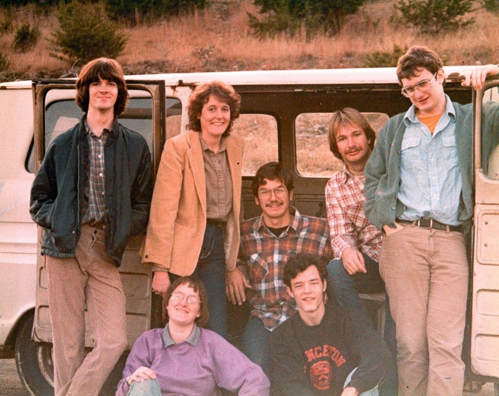
In early January 1983, not long before I returned to Tennessee to complete my formal education, some friends and I went out to the vicinity of Boerne, Texas, for the day. We might have passed through that town, but mostly I remember visiting Lester’s family’s ranch, which was out that way. We tooled around in a beaten-up van. At one point, we had to get out and push the thing to a downward slope, so that we could get it running.

Everyone ought to have that kind of experience with a motor vehicle sometime in his or her life. My experience was ideal: it wasn’t my vehicle, and there were a lot of other people pushing too.

Pictured: Stephen (RIP), Nancy, Debbie, Eric, Kirk, Tom and me. Lester took the shot and later sent us prints.