No point in burying the lead (haw, haw): among all the memorials at Graceland Cemetery in Chicago, Dexter Graves’ stone surely gets the most attention. For one thing, it stands out at a distance.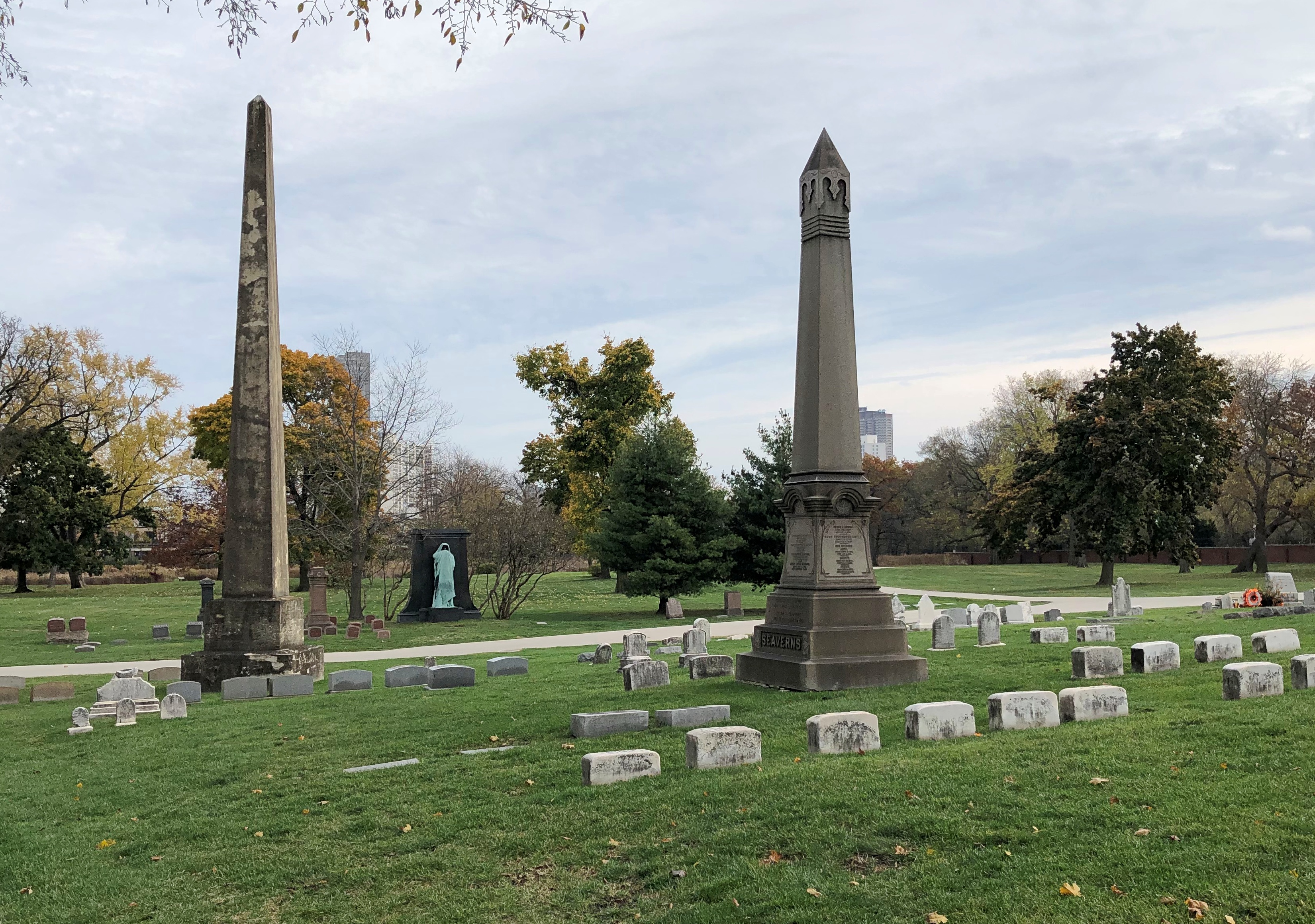
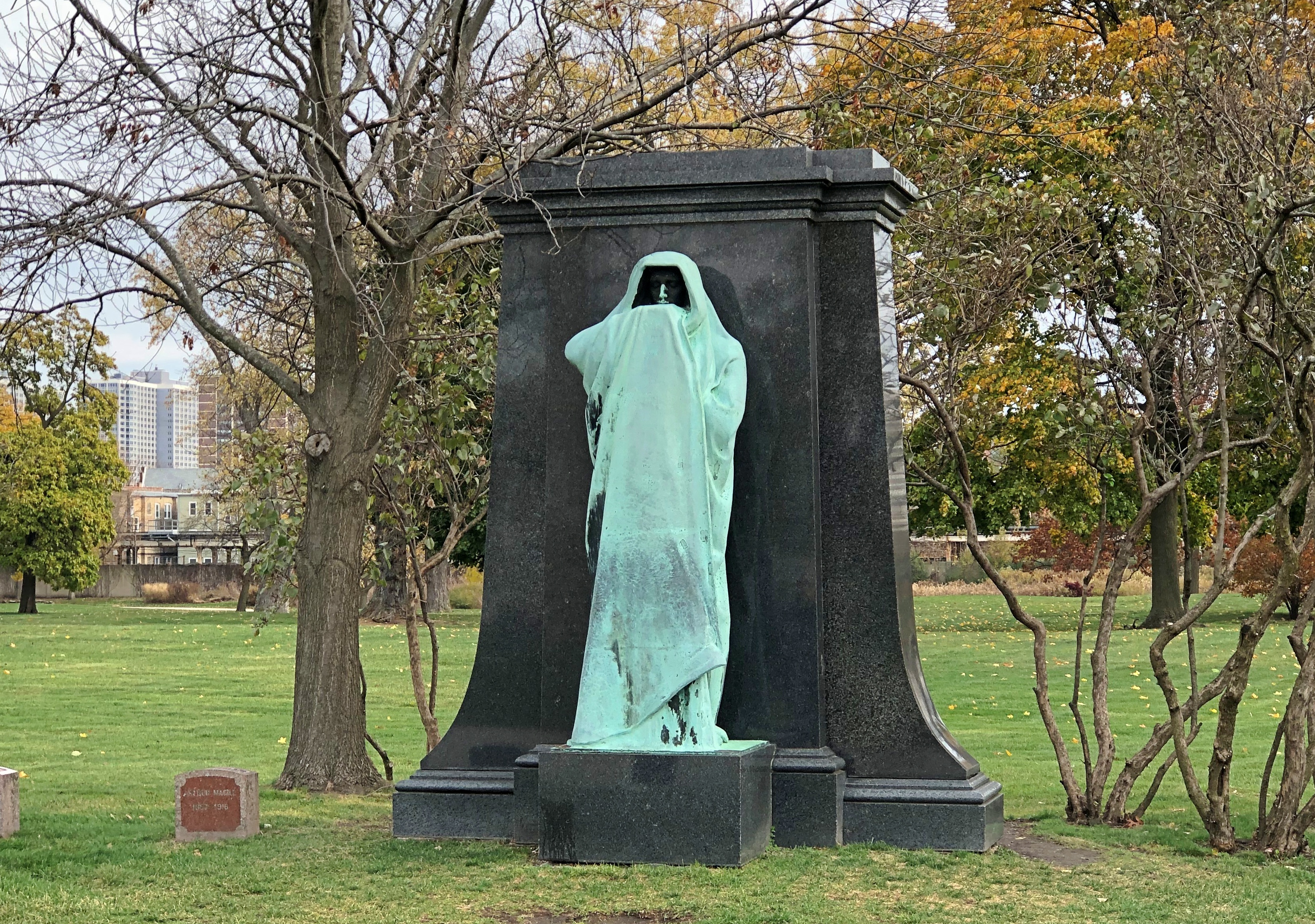
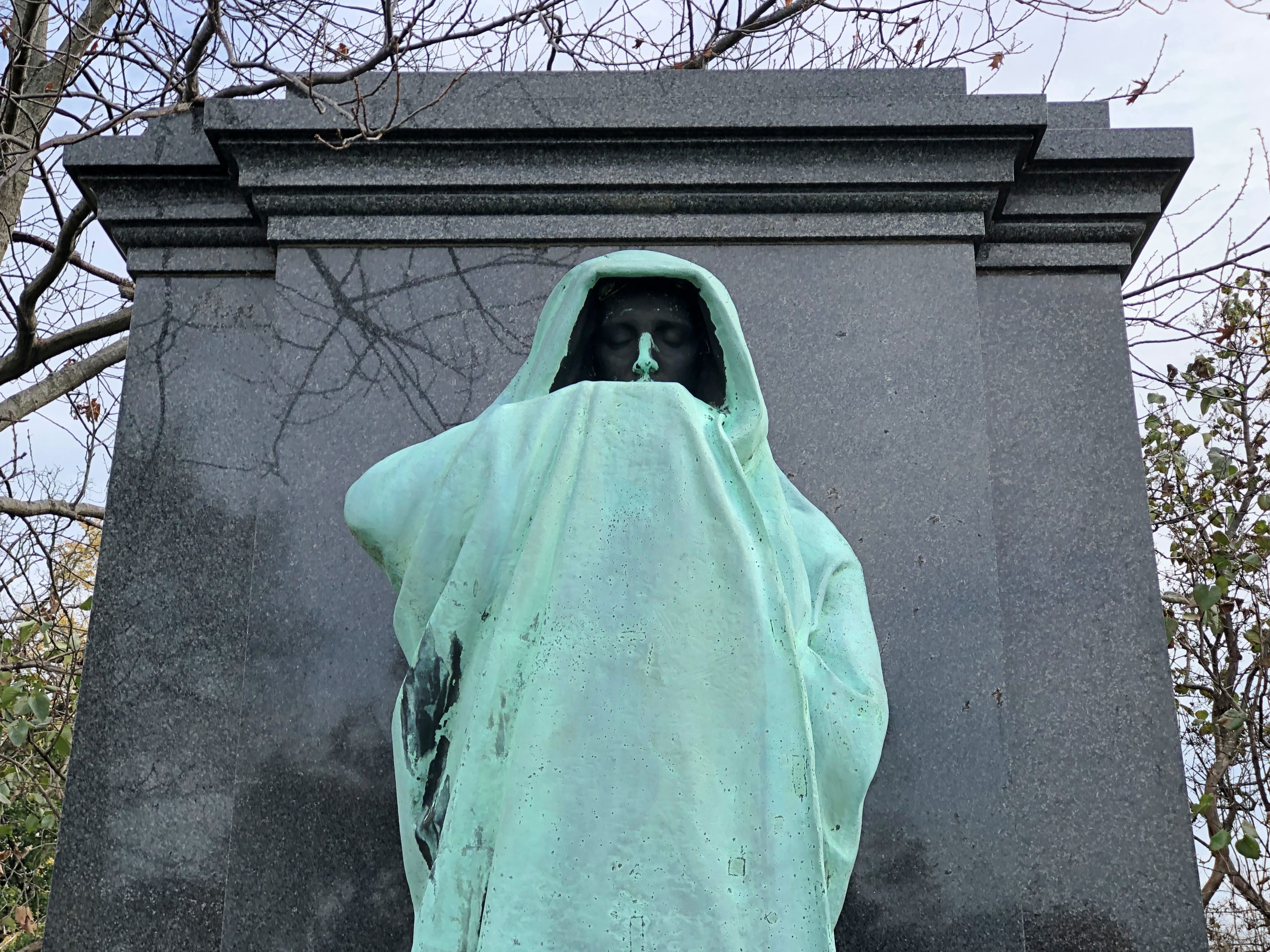
Safe to say that the memorial, especially a haunting bronze figure called “Eternal Silence,” is better known than Dexter Graves himself. Graves was a Chicago pioneer, settling in the area in 1833, when the place was little more than a marshy spot near the Chicago River. He died in 1845, with reinternment and the memorial coming much later at the behest of an elderly son of his, who is buried there too – in 1909, by which time Chicago was a vast metropolis that probably would have astonished Graves.
Lorado Taft created the sculpture, and while I made images of it standing alone, soon a small group of French tourists came by for a look, including posing with it for pictures. Since the work is near the cemetery’s only entrance, I came back again before I left for another look, and that time an American couple, about my age, were there. The woman asked me whether I’d also seen “Fountain of Time” down in the Hyde Park neighborhood. Happily, I was able to tell her I had, including the quote that goes with it, “Time stays, we go.”
I also recommended “The Eternal Indian,” out in Ogle County, which she said she hadn’t seen. I forgot to mention – it would have been showing off anyway – seeing his “Alma Mater” in Champaign, the memorial he worked on in Mount Carroll, Illinois, his sculptures in the Fern Room of the Garfield Park Conservatory or the Fountain of the Great Lakes at the Art Institute. That’s just a scattering. To see more of Taft’s work, you have to pay attention elsewhere in Illinois, Indiana, Kentucky (in Paducah, I wasn’t paying attention), Washington, DC, Colorado, Michigan, Louisiana, Pennsylvania, Kansas and probably other places.
Also, you can see “The Crusader,” which is Graceland, marking the grave of Victor Lawson (d. 1925), one-time publisher of the Chicago Daily News. Lorado Taft did that too, though later in his career, 1931.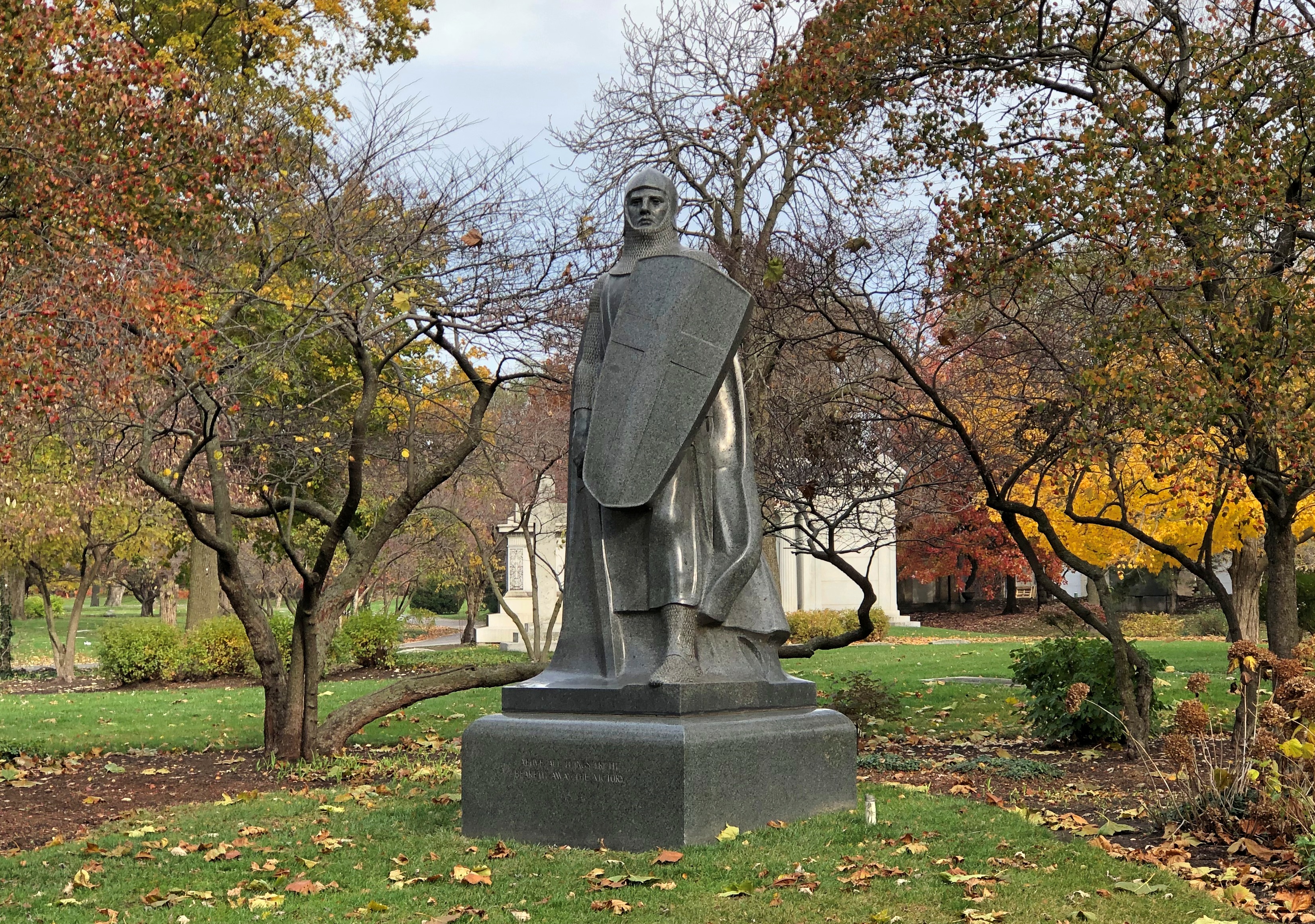
When was the last time a newspaper crusaded about anything? Not recently, private equity owners don’t like it.
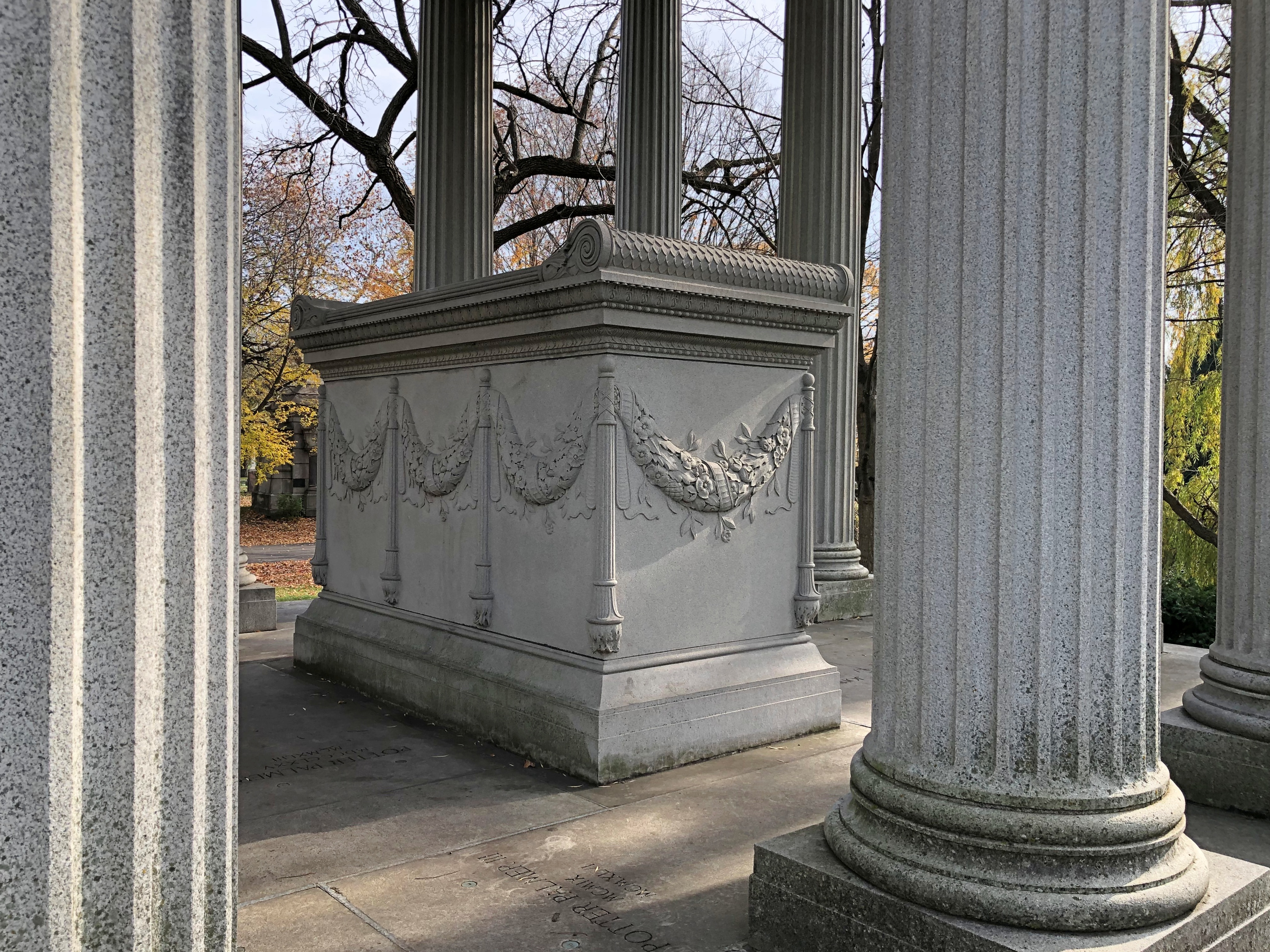
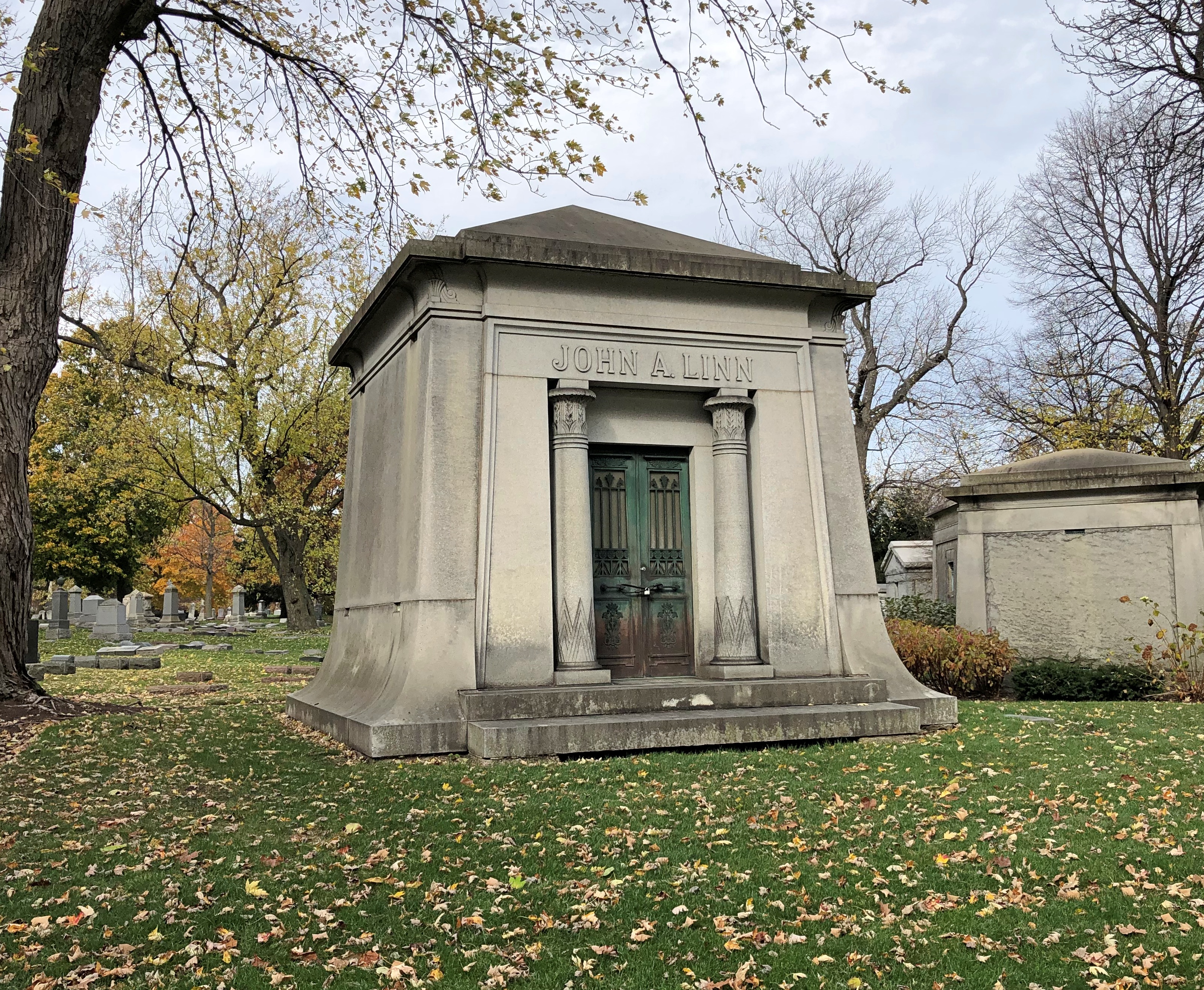
Assorted business tycoons, moguls and robber barons repose in Graceland, without a cent to their names these days. But in their day, they or their immediate heirs had big bucks to spend on big memorials. None is bigger than retailer and hotelier Potter Palmer (d. 1902).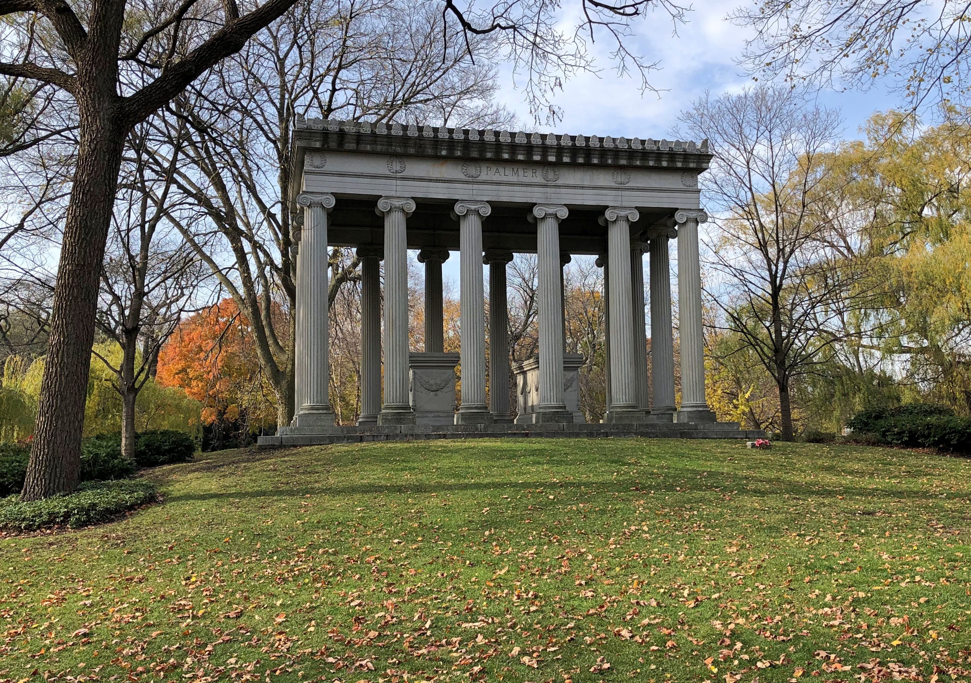
That kind of dough will also buy you a picturesque waterfront location.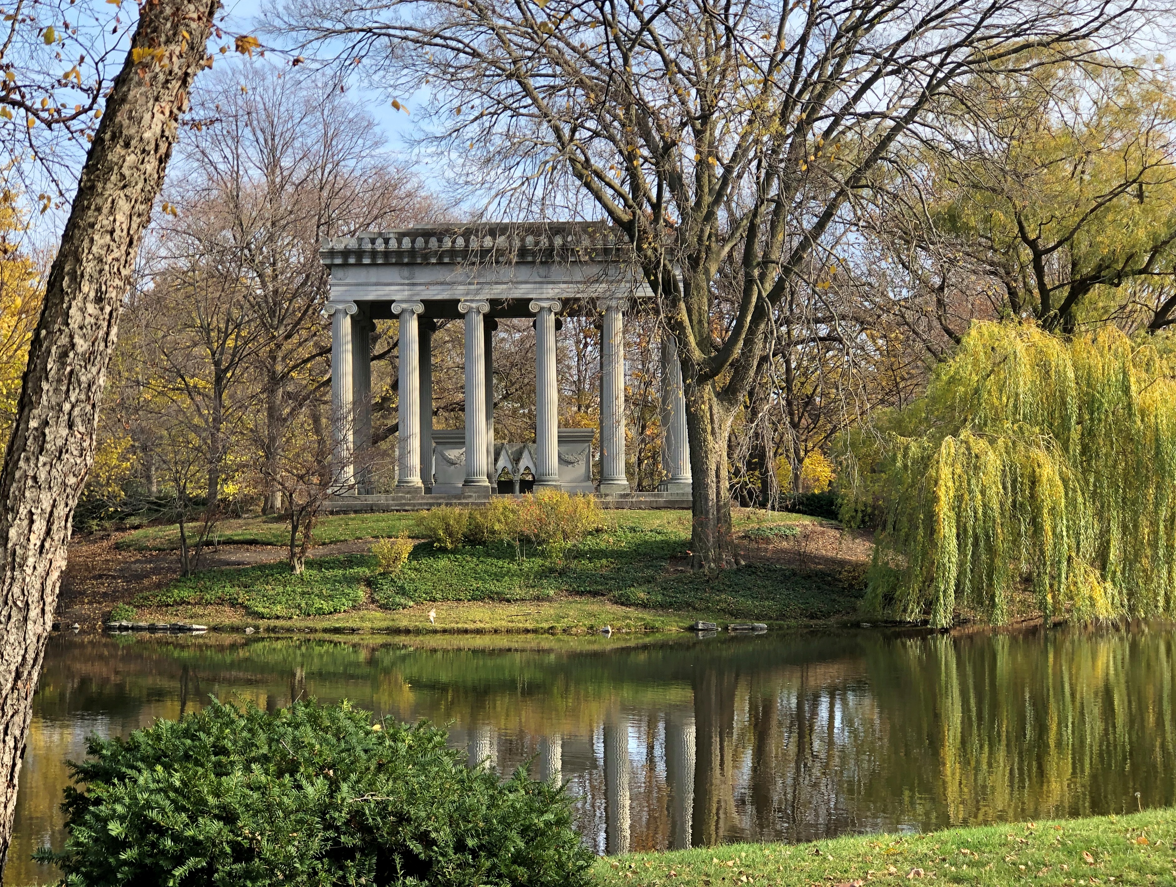
I have to say the Palmer tomb is quite a presence, standing out even among many other large tombs, of which there are many. Such as that for George Pullman.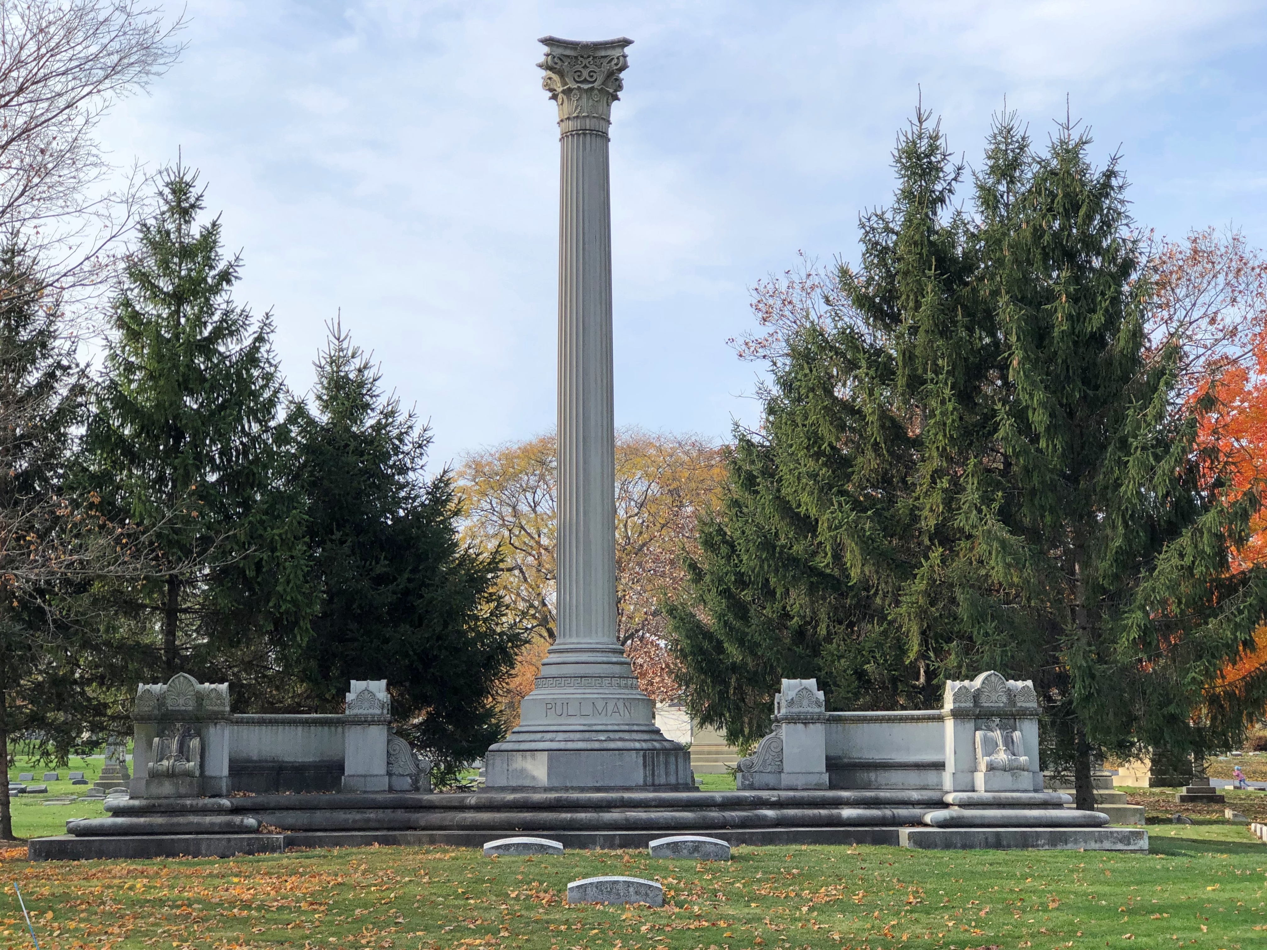
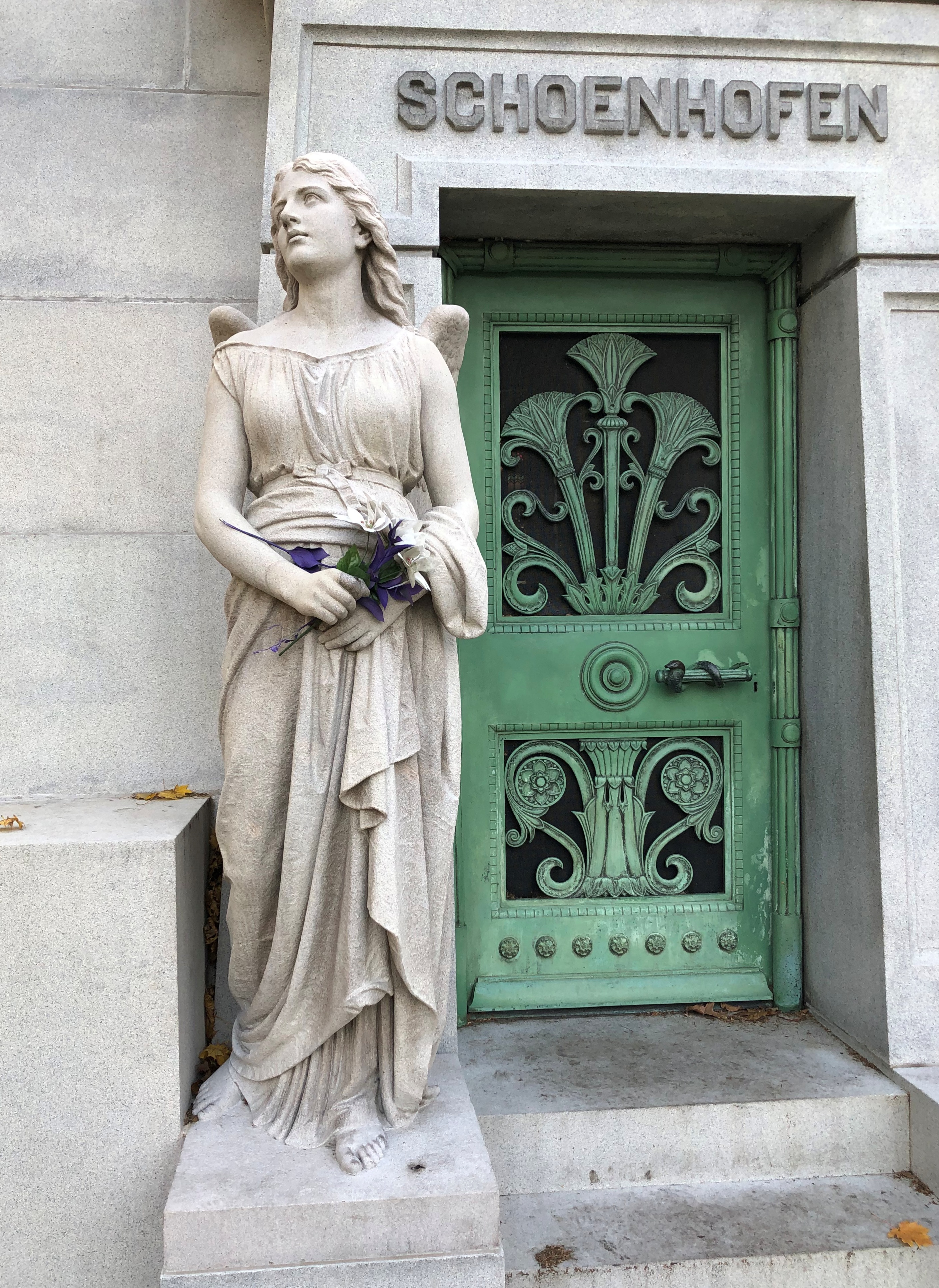
The pyramid of 19th-century beermaker Peter Schoenhofen.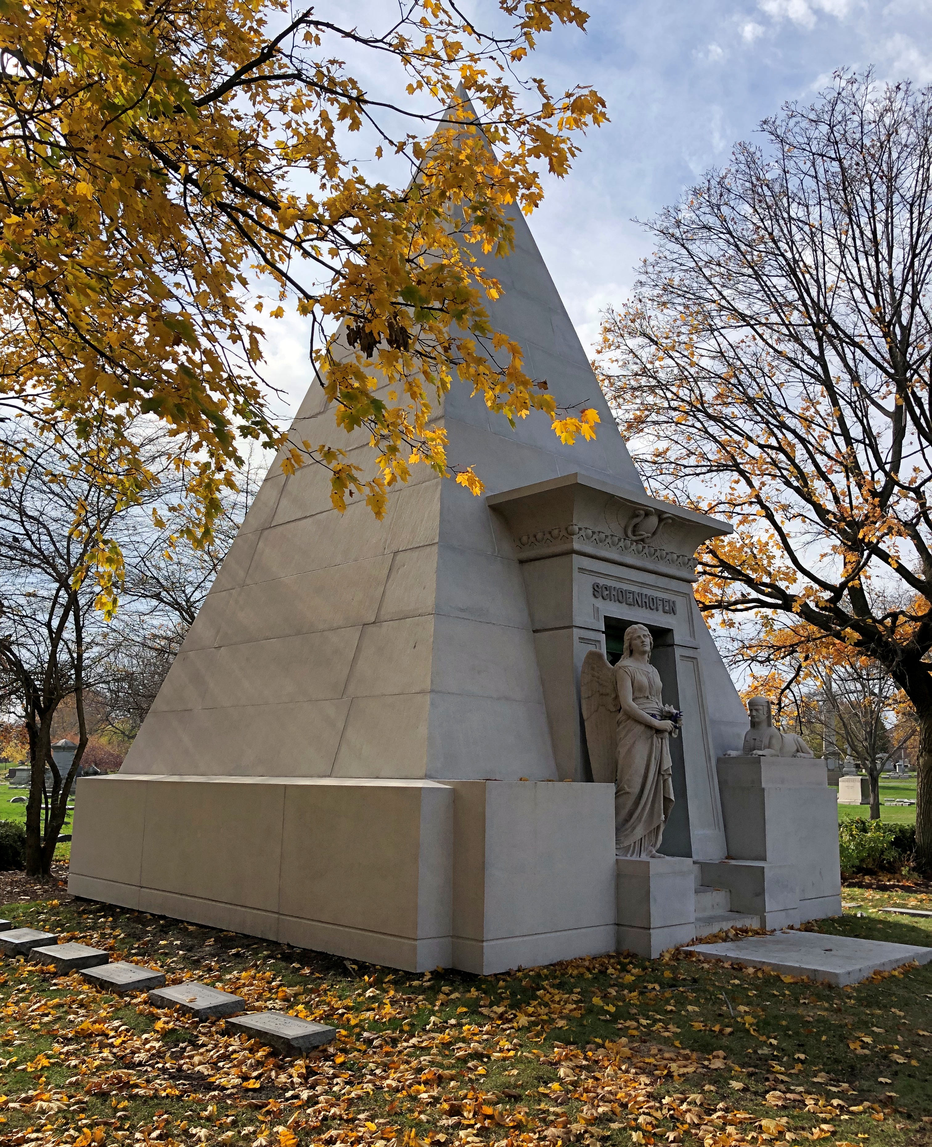

Others.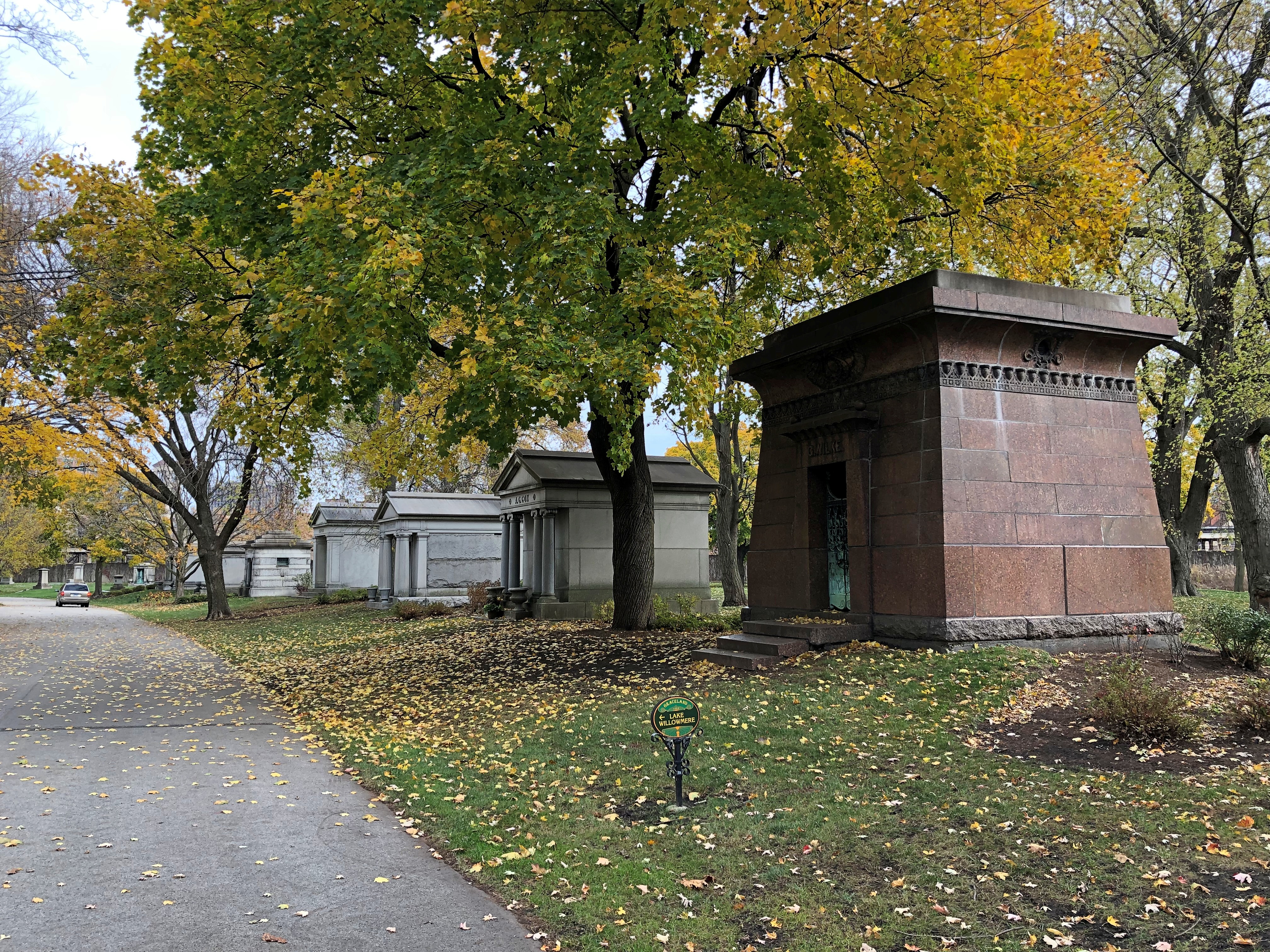
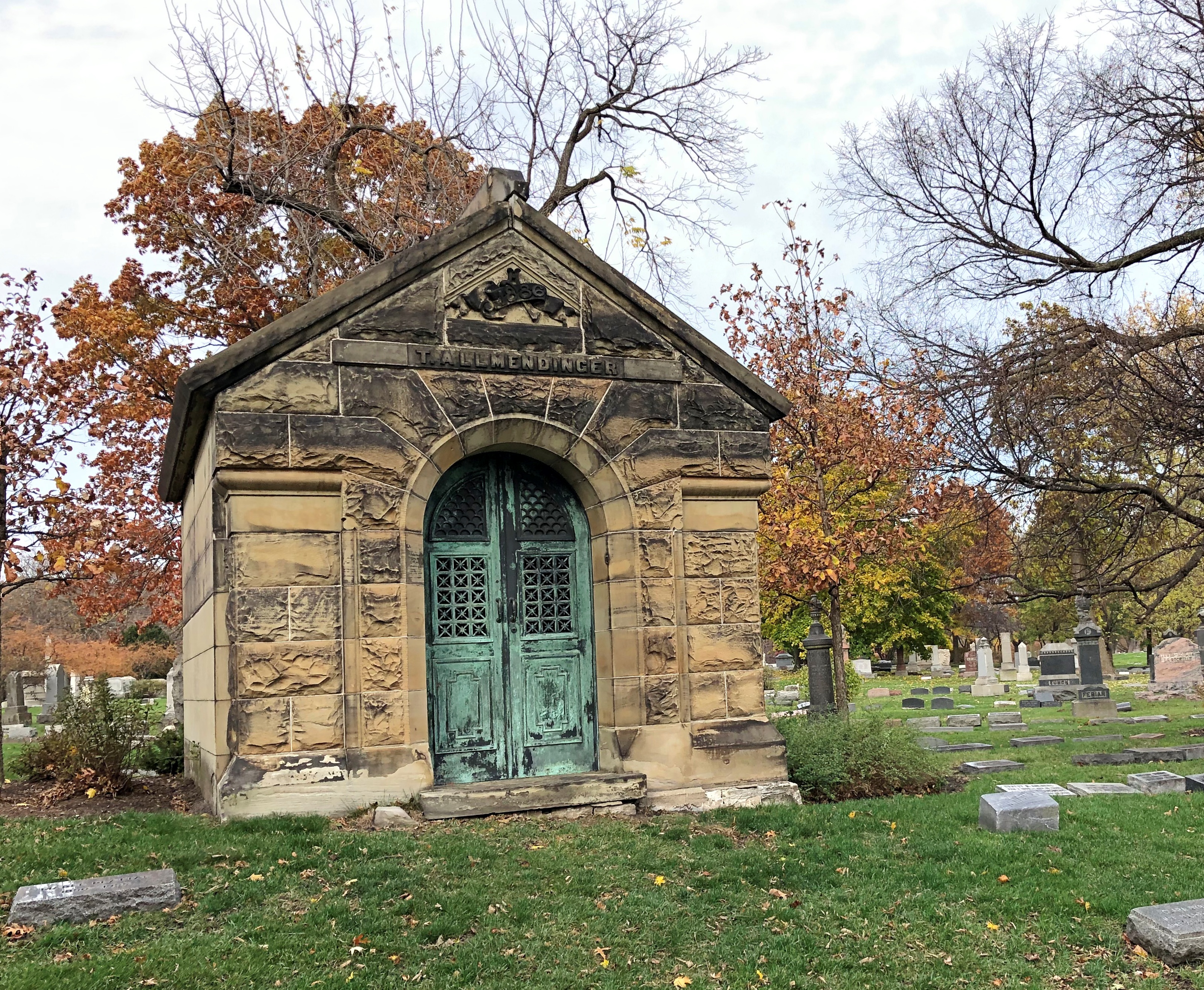
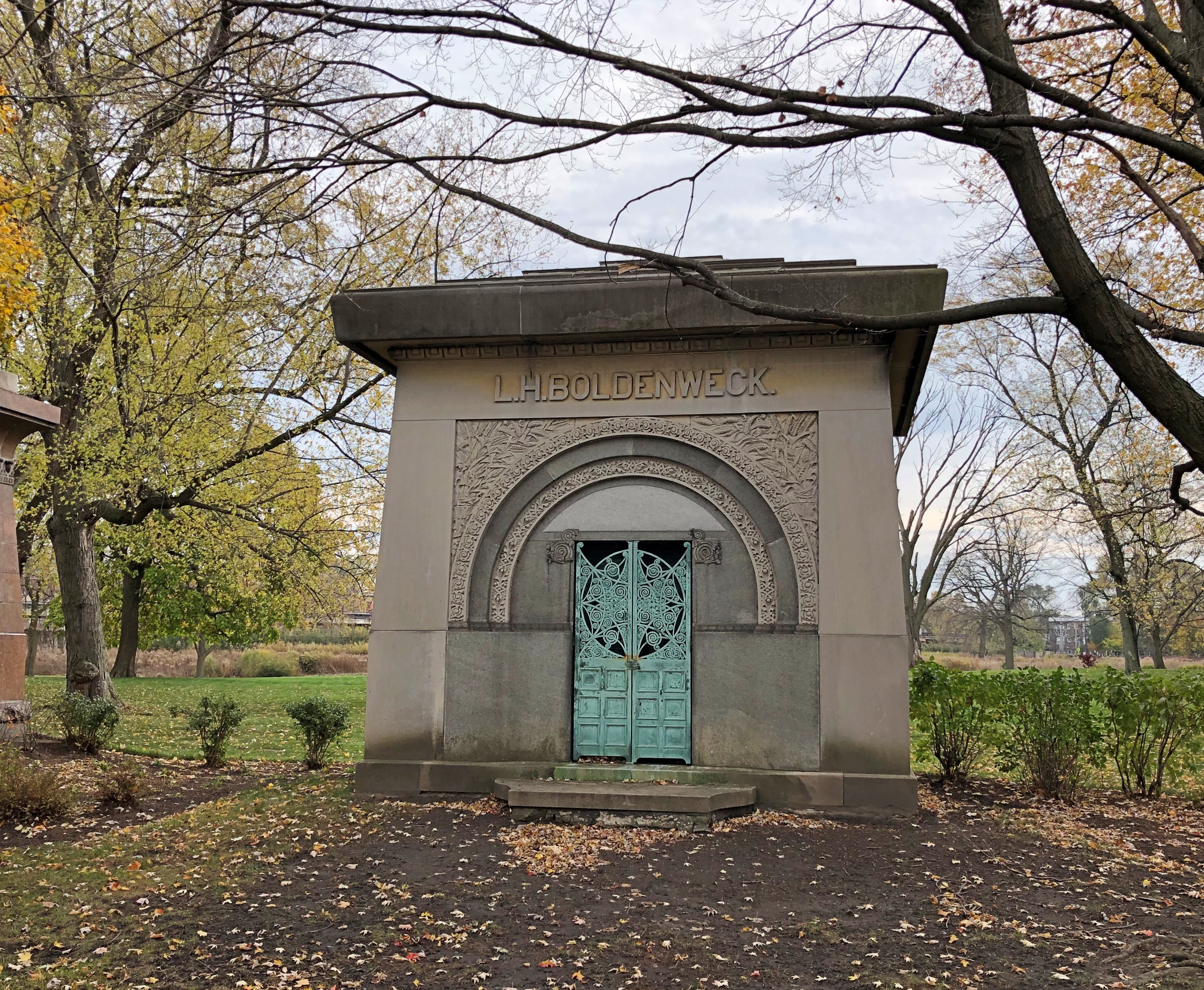
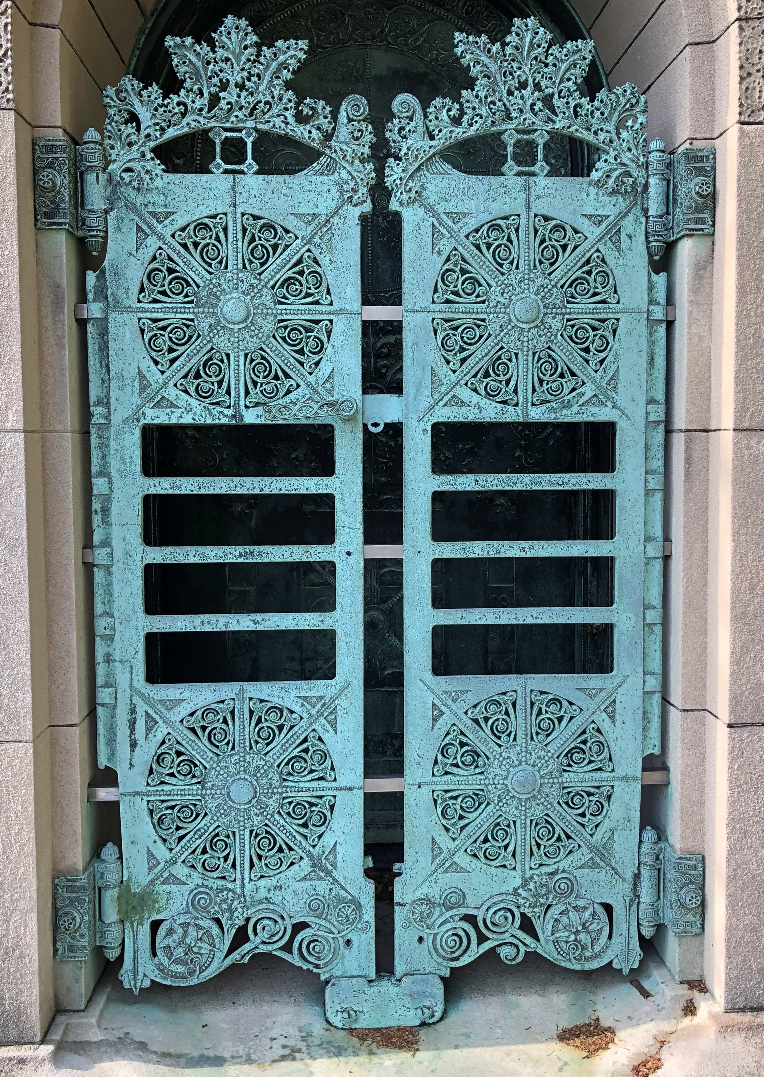
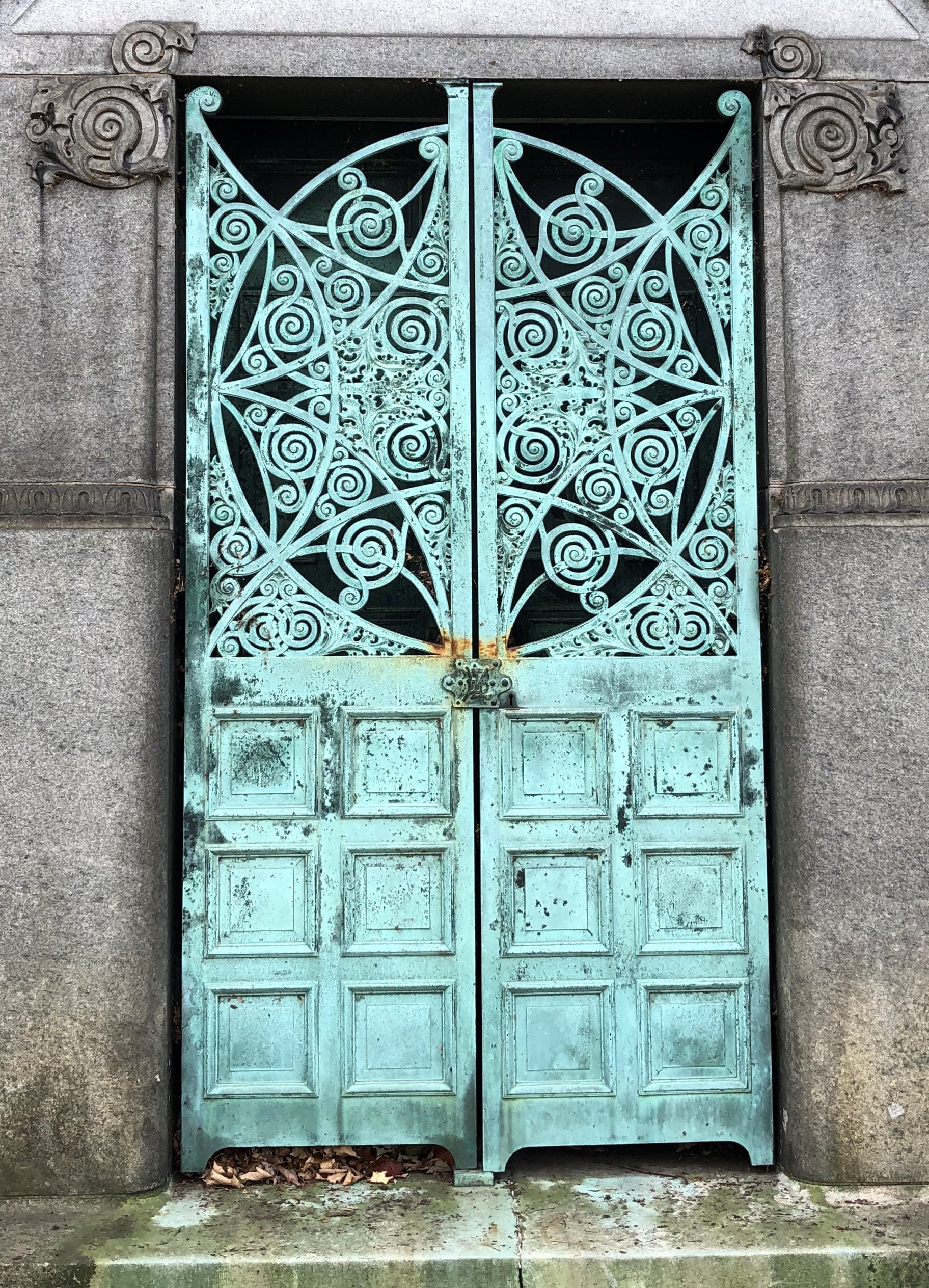
The cemetery’s stone- and metalwork curls and is otherwise shaped in ways remarkable to see. How can these hard materials be persuaded to take those shapes? By the rare skill of the artisans, as long gone as the captains of industry inside the tombs.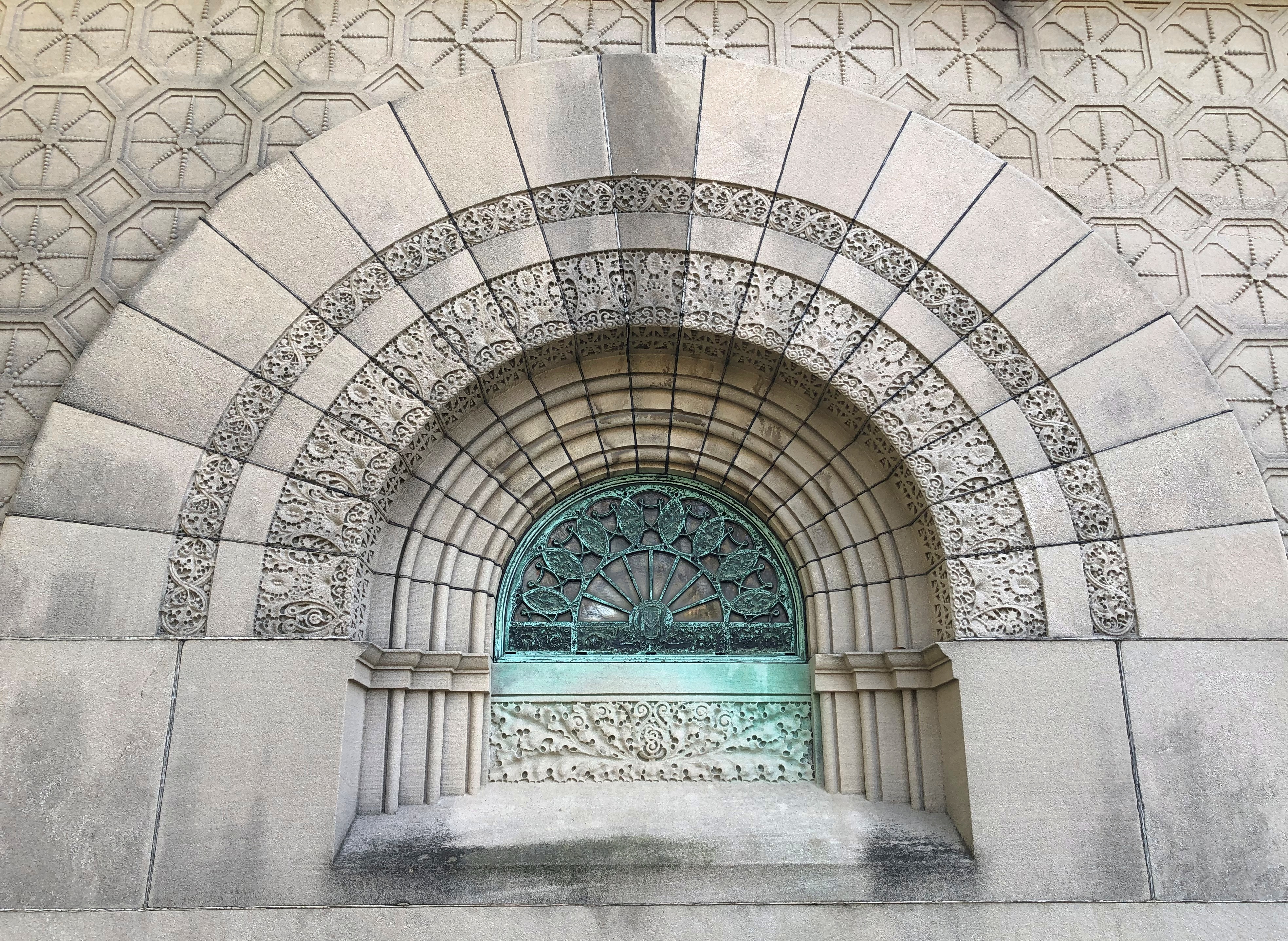
A small building stands near the entrance of Graceland, including a patio with iron tables and chairs, a few of which were occupied when I visited, since the day was just warm enough for that. Inside the building, heated this time of year, visitors can rest on a bench, go to the bathroom, watch a video about the cemetery and, just as important, pick up a free paper map that guides you to the graves of some (but hardly all) of the well-known permanent residents.
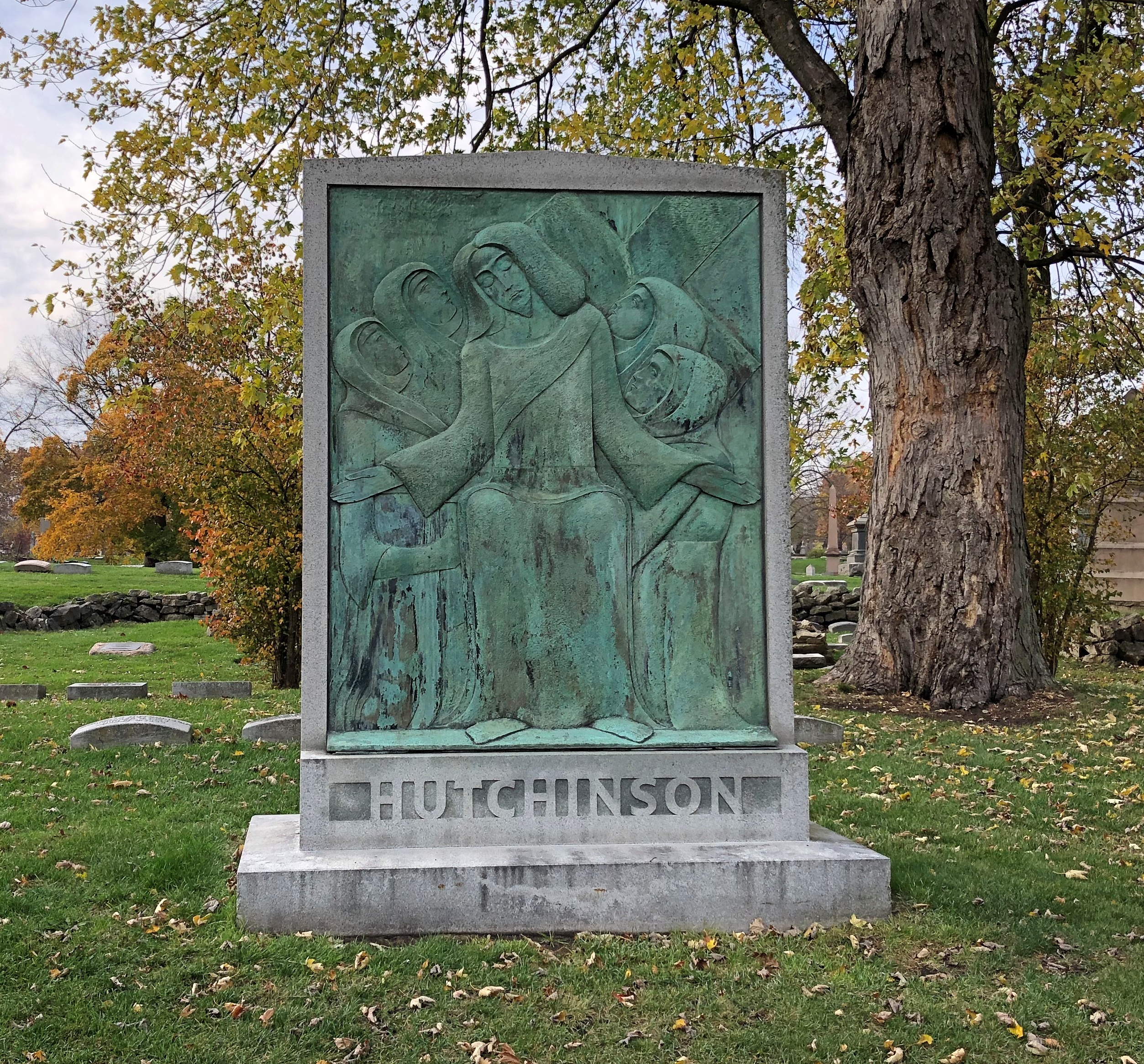
Not every grand cemetery has that amenity, but when you find one, that ups the visit into a kind of treasure hunt, if you want. A look for the famed stones, like at Hollywood Forever in Los Angeles with its movie stars or Forest Home in Milwaukee with its brewers. My idea of a good time, but I’m eccentric that way. Besides some of the stones mentioned above, the map takes you to lumber baron and Goodman Theatre patron William Goodman.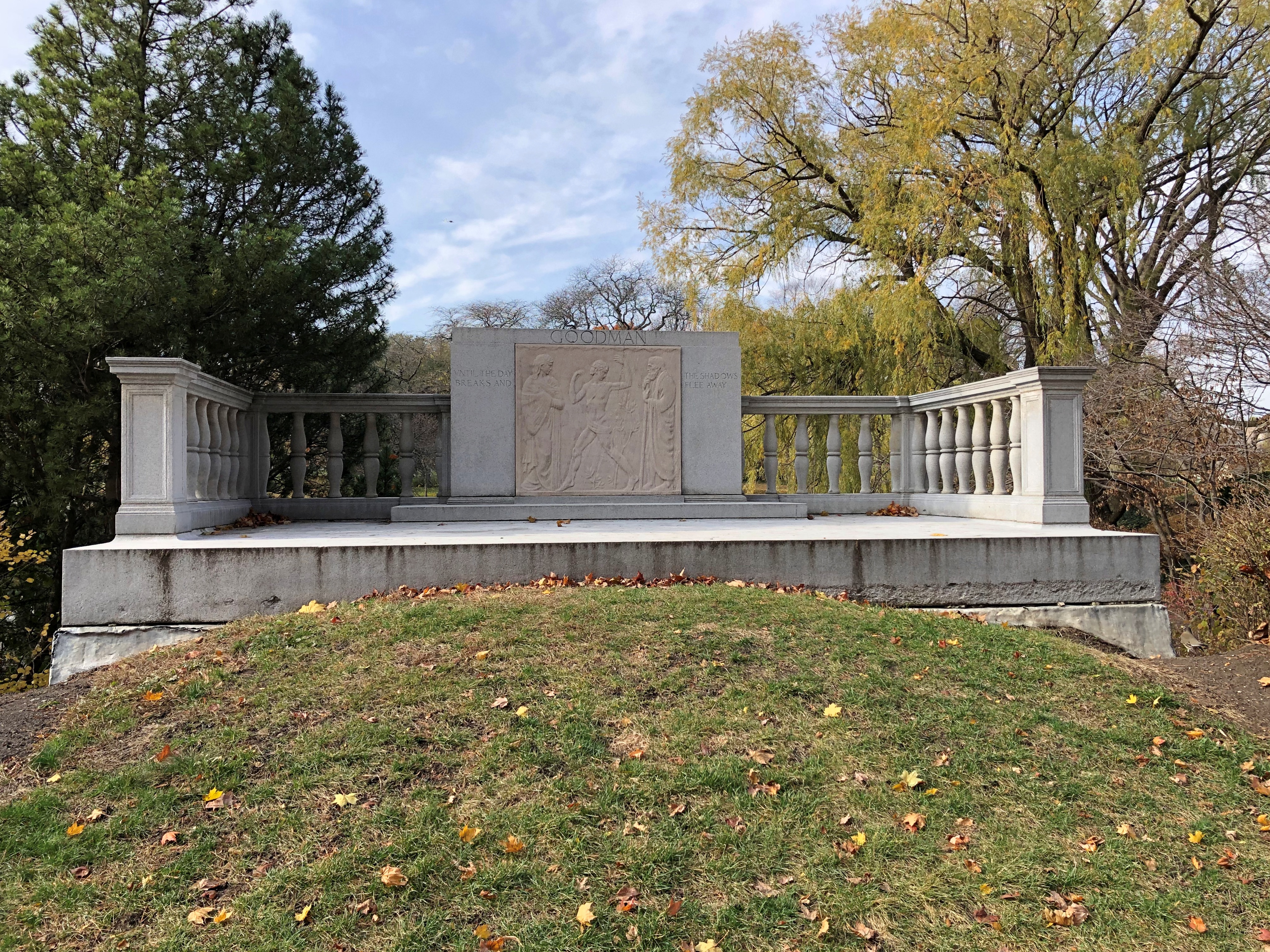
And Mr. Whipple.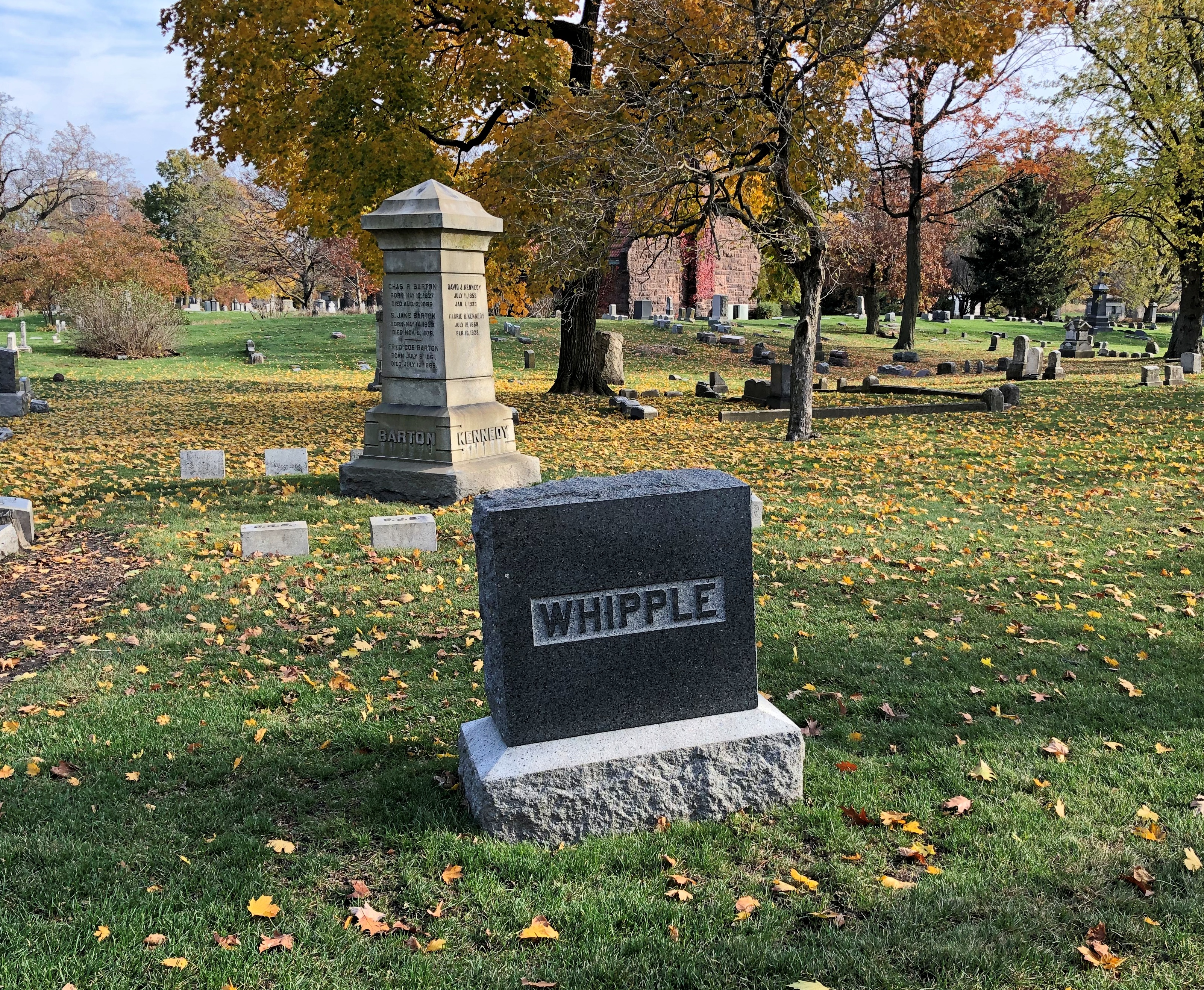
He’s not actually on the map, probably because the memorial isn’t for the person obsessed with toilet paper, since he was fictional. Even so, I understand he received treatment for his OCD, retired from the grocery business and lived with his daughter in Florida until his death in 2007.
MLB star Ernie Banks, “Mr. Cub,” and the first black player for the Cubs. Nearby is dancer Ruth Page.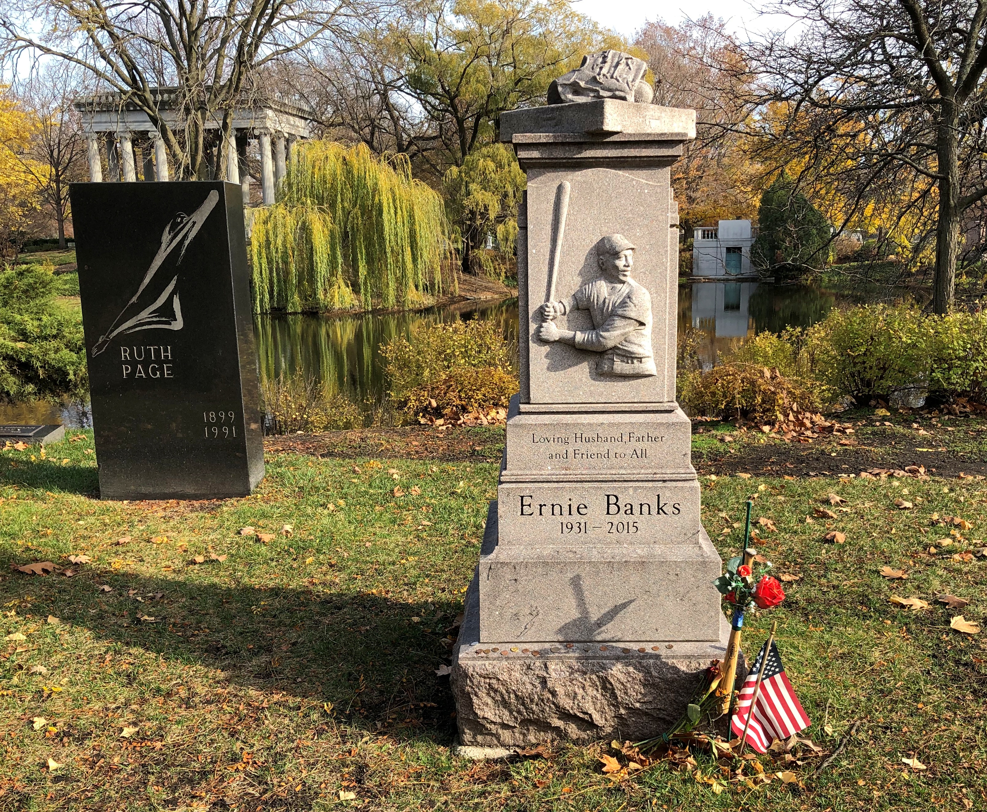
Minnie Miñoso, a fairly recent stone. In fact, I read that it was erected only this summer. Graceland is still an active cemetery, with more open land than I would have thought.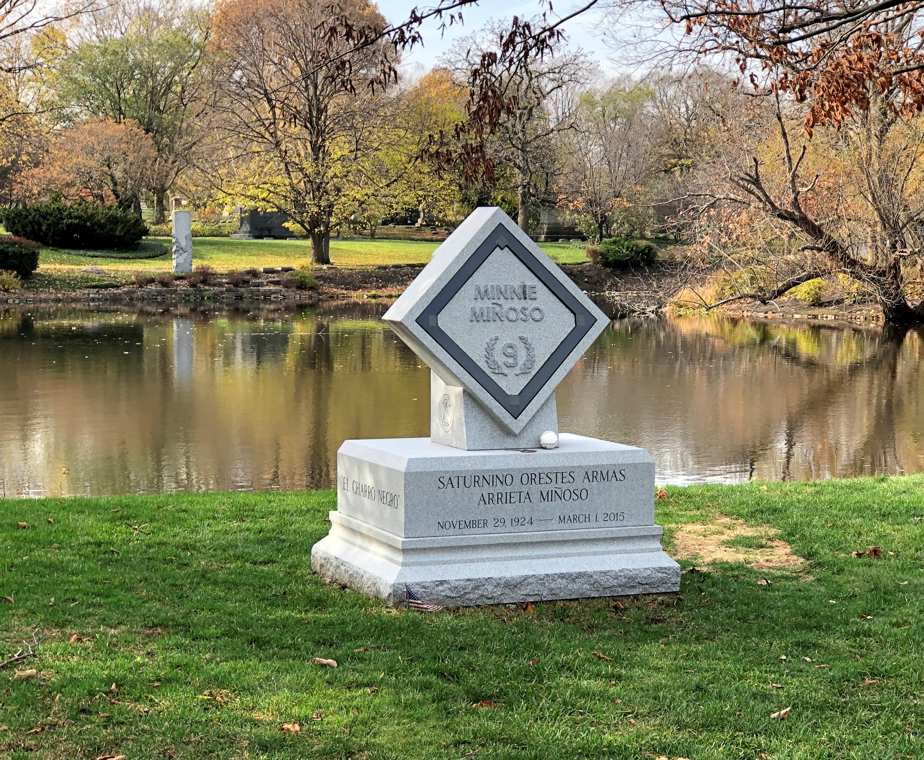
I had to look him up; among other things, he was the first black player for the White Sox. The Cuban Comet, he was called, which sounds like something invented by a sports reporter pounding print on his old typewriter.
Heavyweight prizefighter Jack Johnson, the Galveston Giant, famed for upsetting racists in the early 20th century.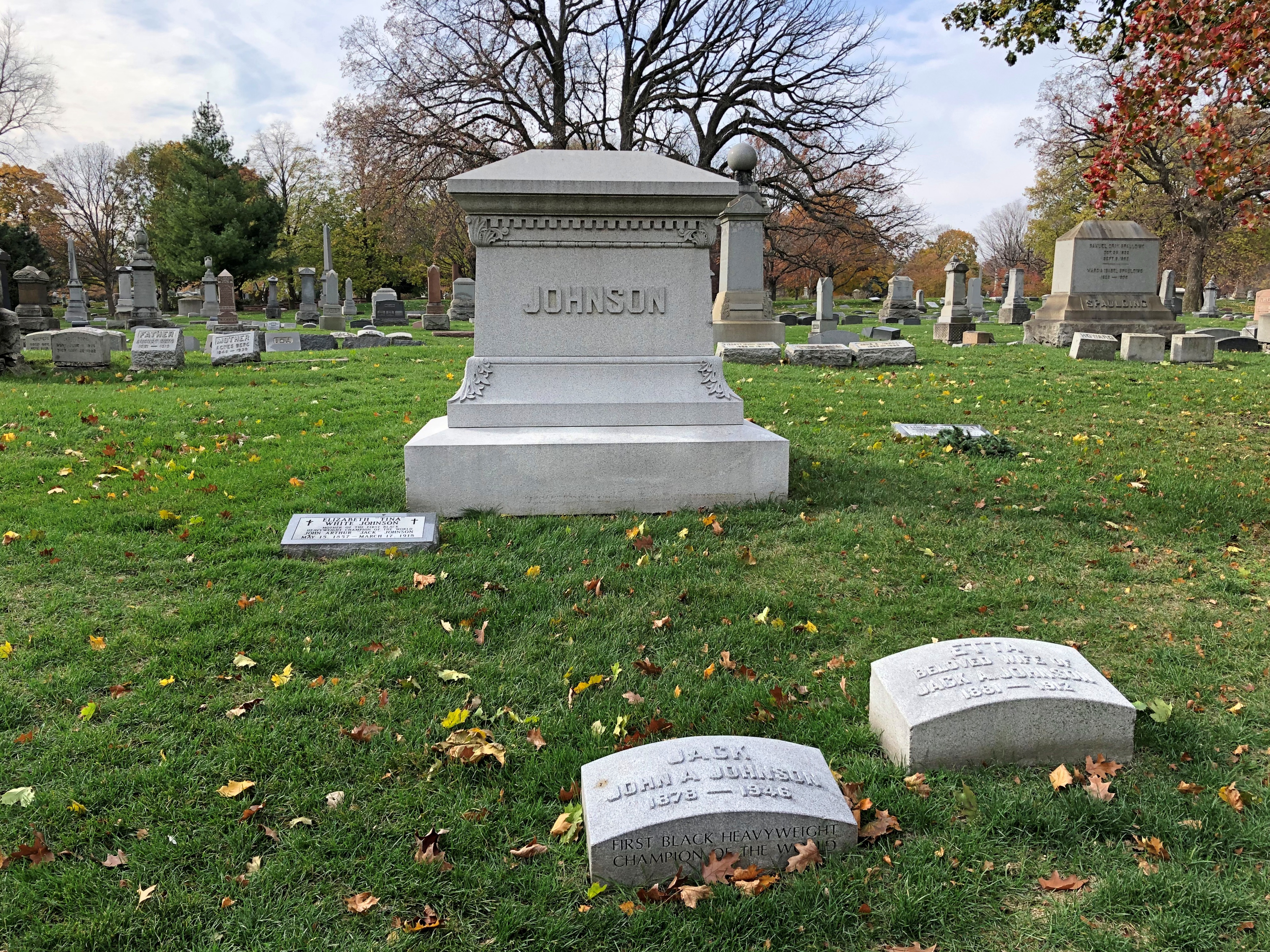
The small pyramid of architectural photographer and preservationist Richard Nickel, a favorite of mine in Chicago history.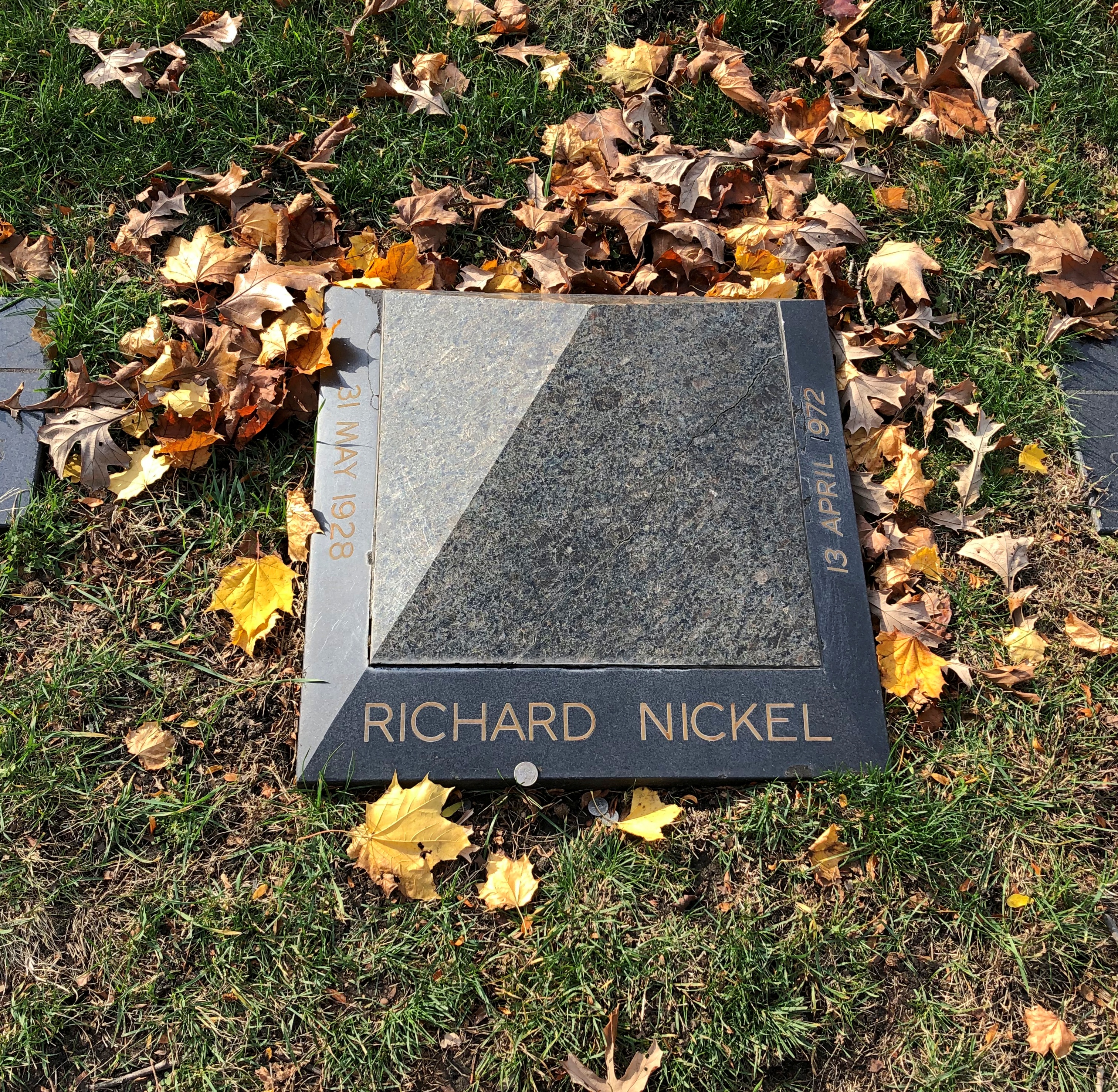
Gov. John Peter Altgeld, another favorite but from Illinois history, who knew that pardoning the surviving men convicted in the Haymarket bombing would probably cost him the governorship, as indeed it likely did. It was that or preside over a miscarriage of justice, he believed.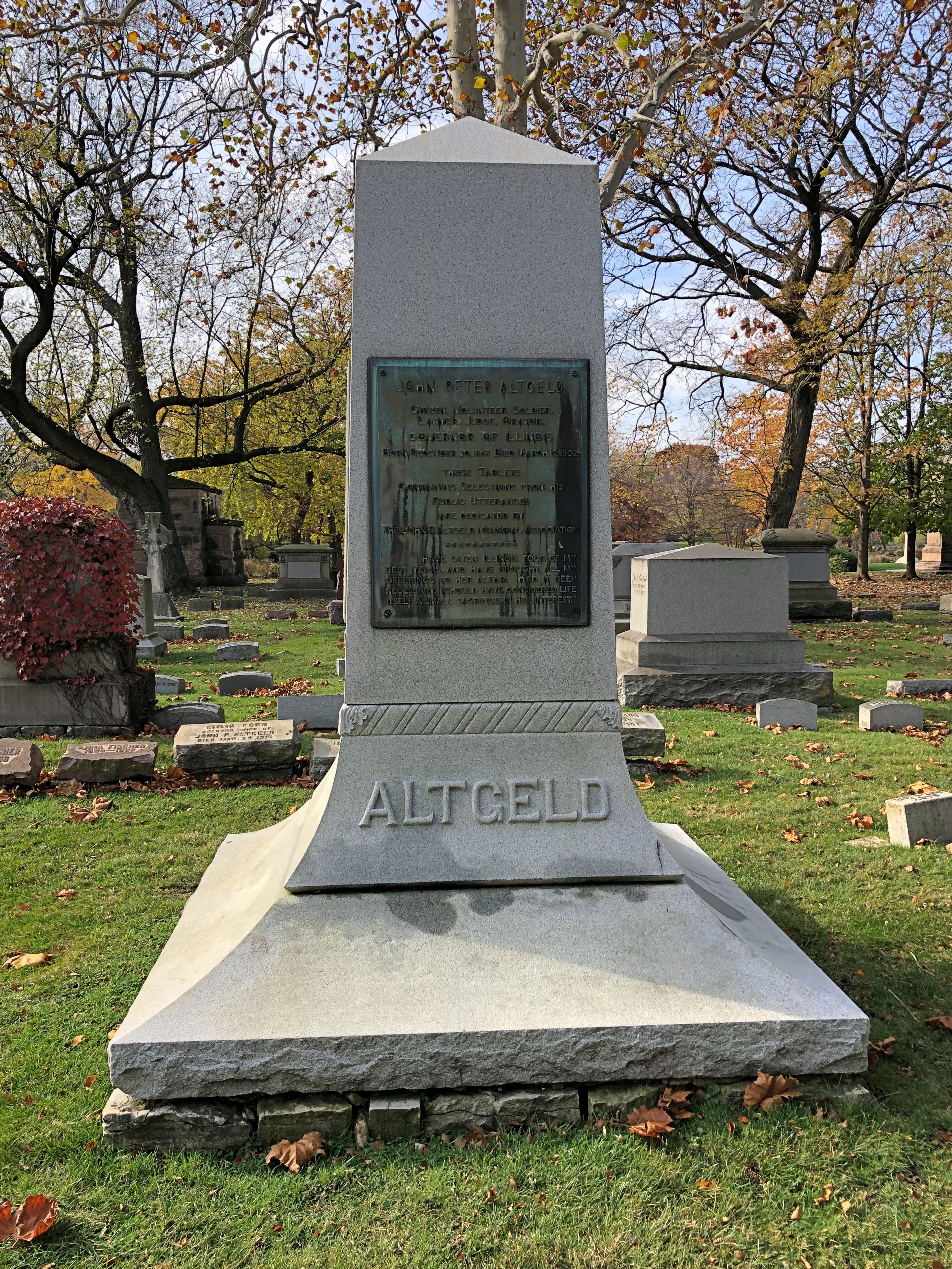
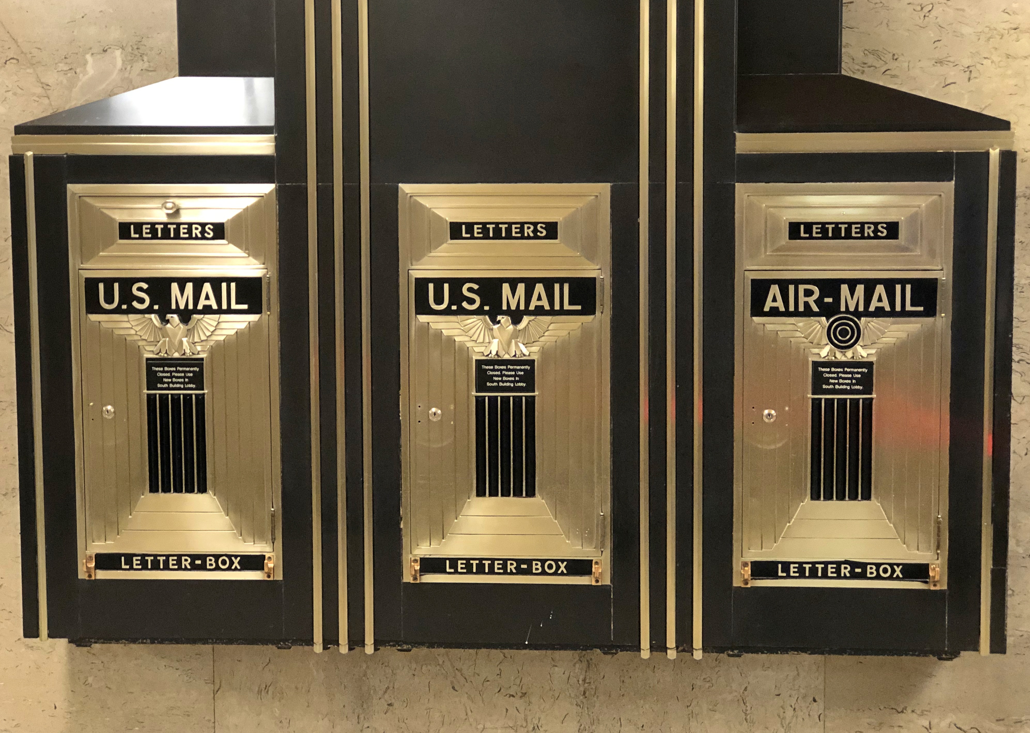
Chicago is a city of architects; Graceland is a necropolis of architects. I didn’t see them all – missed Burnham on his island, for example – but I got a good sample.
Including Mies van der Rohe. For him, a flat black spare Miesian sort of memorial.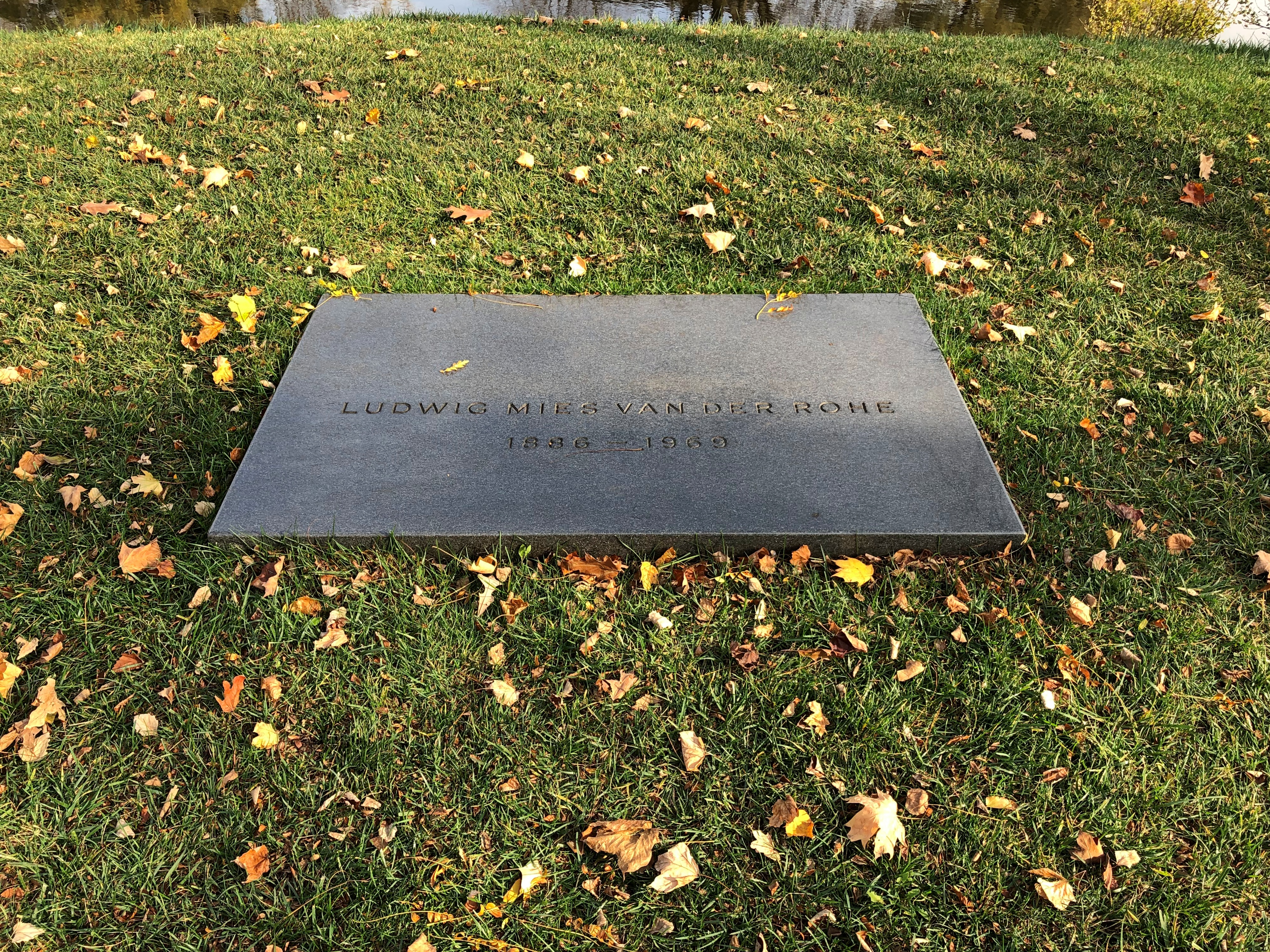
But he has a splendid view.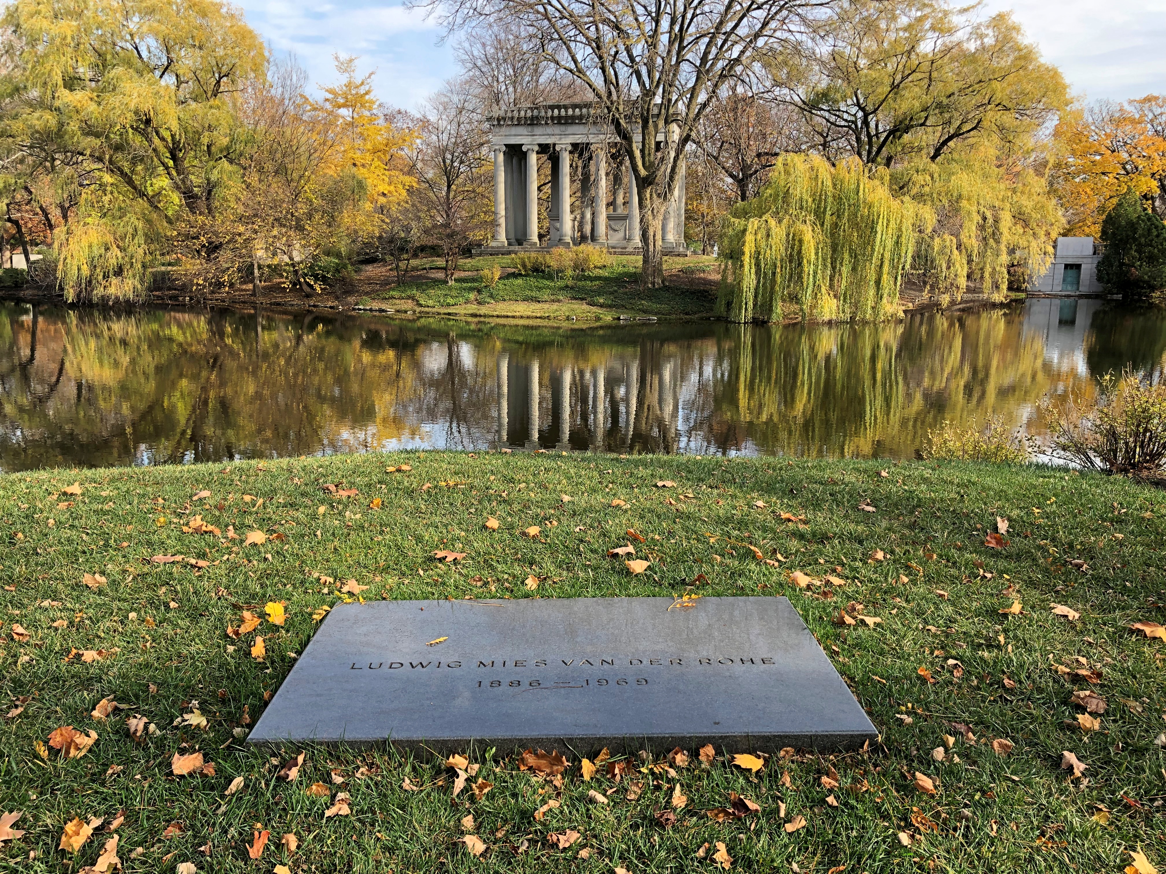
William LeBaron Jenny.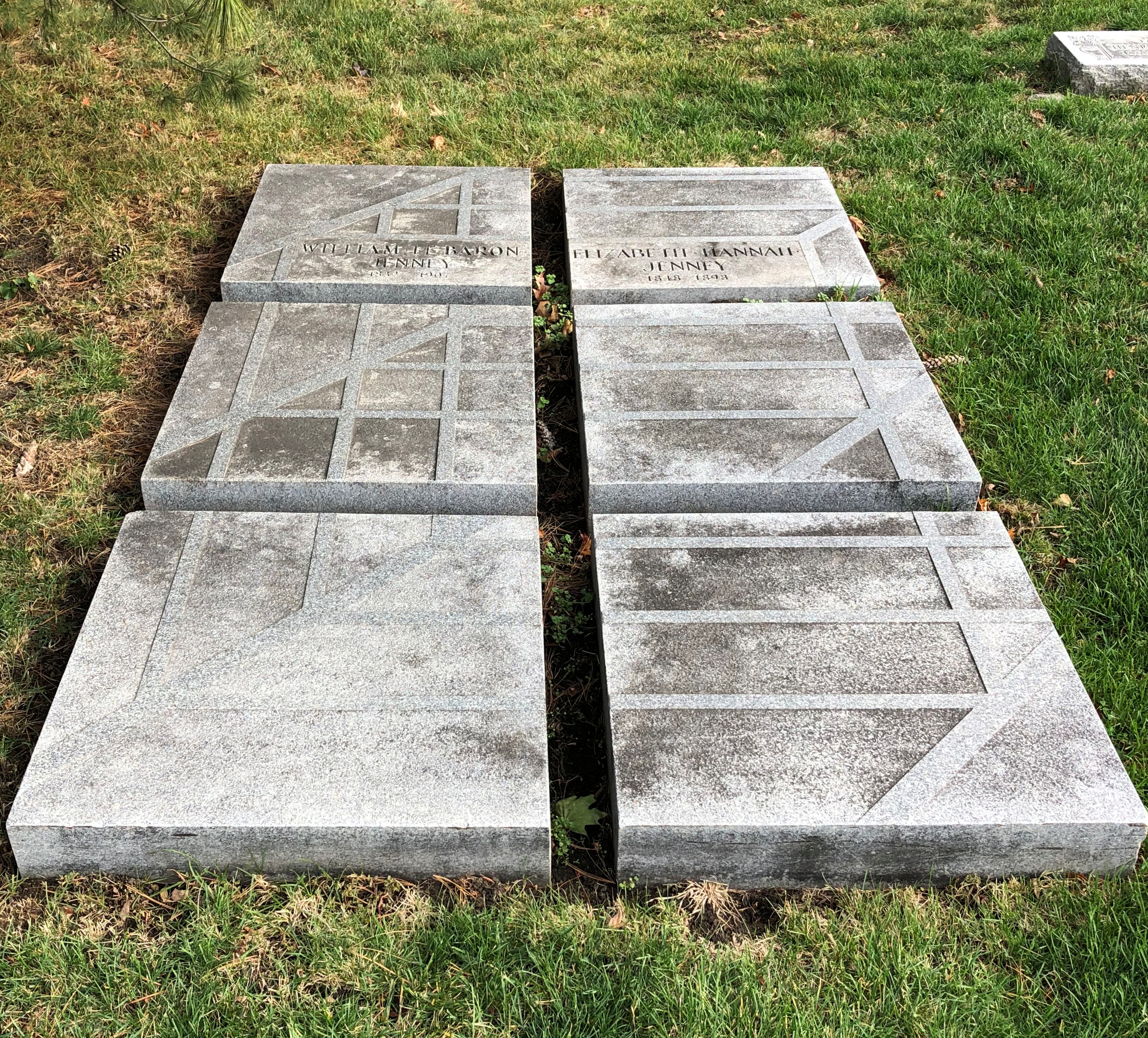
Bruce Goff.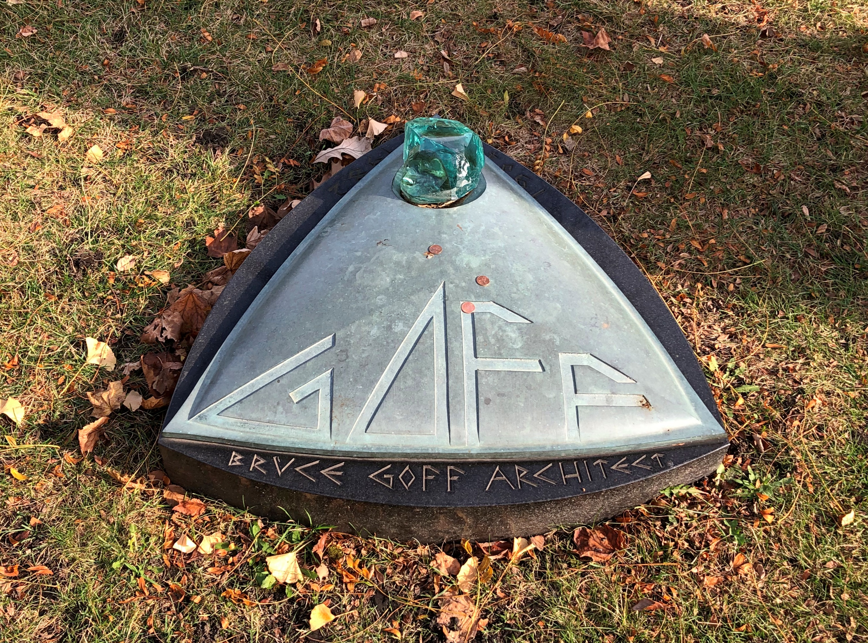
Louis Sullivan.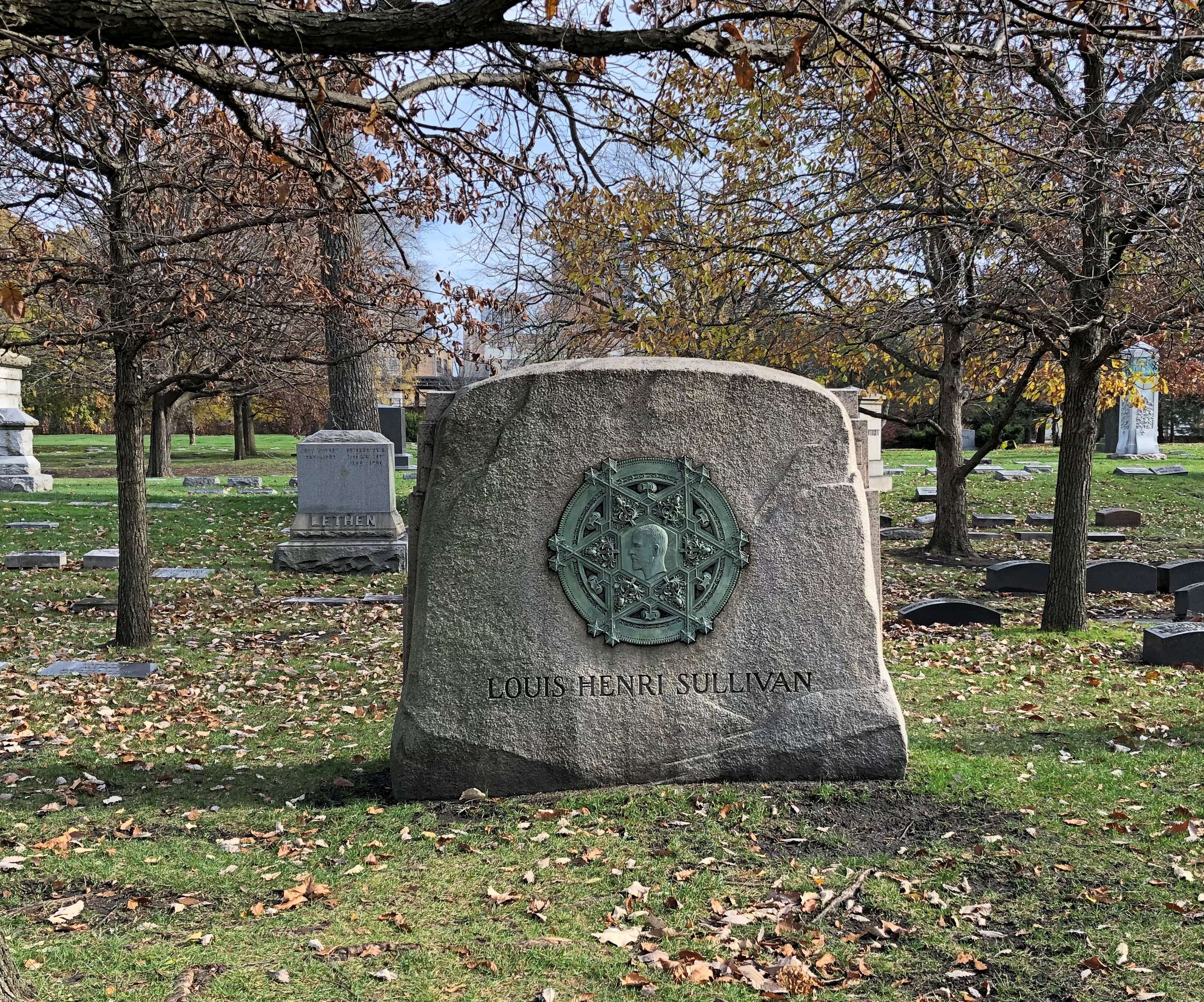
Talk about teasing a rarefied shape out of base metal. In this case, the work’s designer at least is known: Thomas Tallmadge (d. 1940), who is also at Graceland.


