The Wilder Park Conservatory

Near Elmhurst College in west suburban Elmhurst is Wilder Park, a mid-sized suburban park that includes the Elmhurst Public Library, Elmhurst Art Museum, Lizzadro Museum, Wilder Mansion and the Wilder Park Conservatory and Formal Gardens.

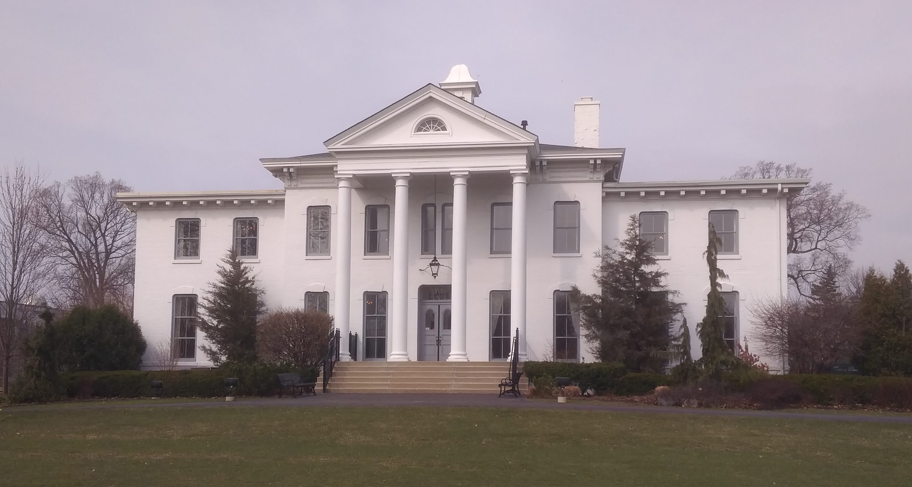
This is the Wilder Mansion, named after the last family that owned the place, before the Elmhurst Park District acquired it and the surrounding land in the early 1920s.
I understand that for most of the 20th century, the building housed the Elmhurst Library, but these days it’s a wedding and event venue. Even though it was late Saturday morning, the place was closed. I was a little surprised. I expected someone to be there, setting up for a wedding.

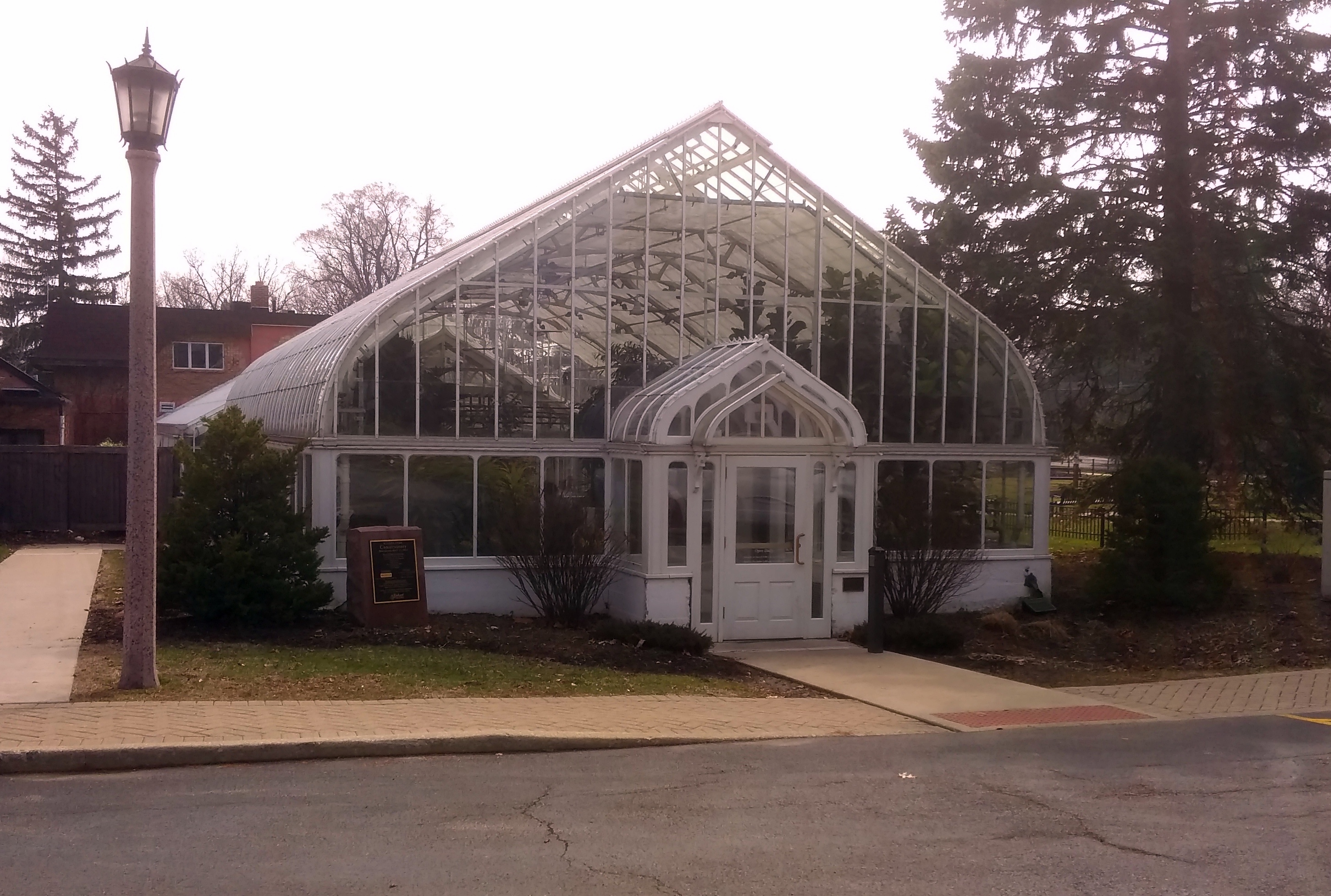
Not far away is the modest Wilder Park Conservatory and Formal Gardens. The gardens were around back and not growing much yet.
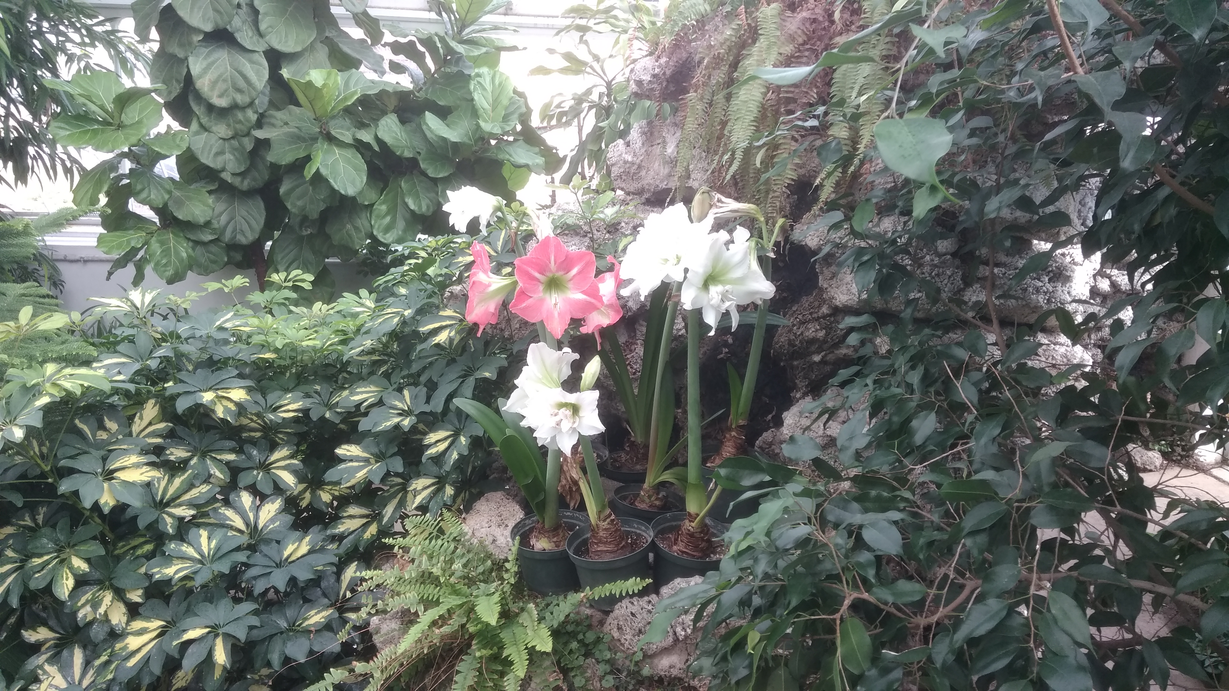
At one room and a non-public greenhouse, I believe the Wilder is the smallest public conservatory in metro Chicago, smaller even than the one in Mount Prospect, but it has a nice array of plants. Especially when outside is still mostly brown.
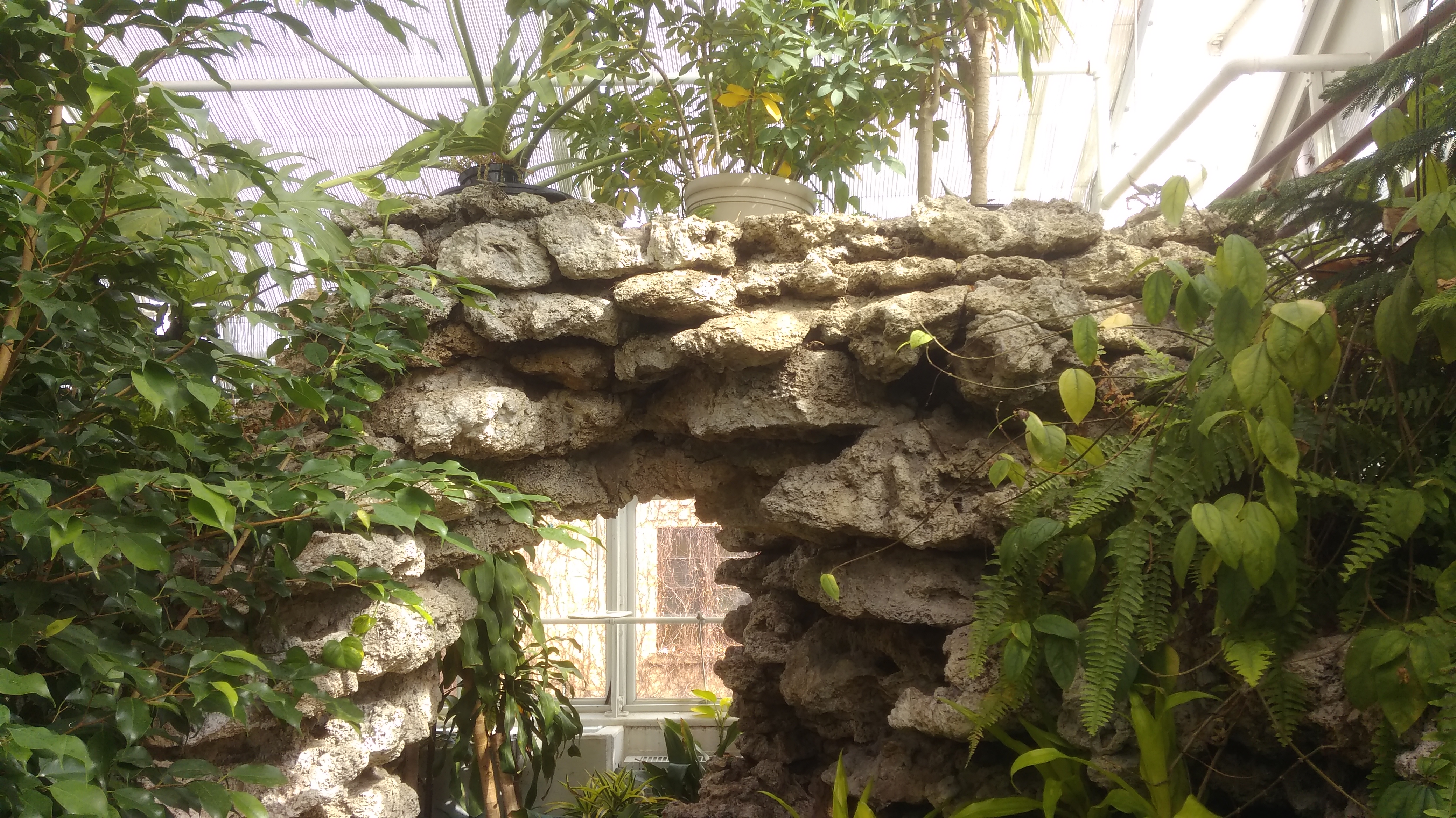
Along with a few rock formations.

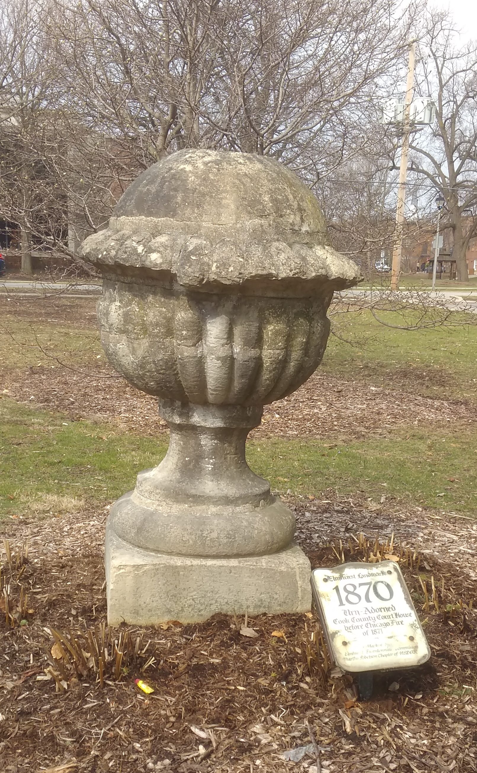
Outside the conservatory is a public oddity.
The sign says:

Elmhurst Landmark
1870
Urn-Adorned
Cook County Court House before Chicago Fire
of 1871

According to the ElmhurstHistory.Org: “Following the Great Chicago Fire of 1871, many people from the Chicago area collected ruins from the fire as a souvenir [sic]. Seth Wadhams, who lived in what is now known as the Wilder Mansion, brought two roof finials (decorative pieces) from the Cook County Courthouse, which had burned in the fire. One of the finials deteriorated over time. The second one remains in Wilder Park.”

It looks like you can see many of the courthouse finials in this pre-Fire photo. Strange thought that one of them might be, probably is, the obscure stone relic now miles from its original perch.

Bughouse Square & the Newberry Library in the Snow

You have to like a place nicknamed Bughouse Square. The city of Chicago has just such a place on the Near North Side. I quote at length from the Encyclopedia of Chicago.

“Bughouse Square (from ‘bughouse,’ slang for mental health facility) is the popular name of Chicago’s Washington Square Park, where orators (‘soapboxers’) held forth on warm-weather evenings from the 1910s through the mid-1960s.

“Located across Walton Street from the Newberry Library, Bughouse Square was the most celebrated outdoor free-speech center in the nation and a popular Chicago tourist attraction.

“In its heyday during the 1920s and 1930s, poets, religionists, and cranks addressed the crowds, but the mainstays were soapboxers from the revolutionary left, especially from the Industrial Workers of the World (IWW), Proletarian Party, Revolutionary Workers’ League, and more ephemeral groups.

“Many speakers became legendary, including anarchist Lucy Parsons, ‘clap doctor’ Ben Reitman, labor-wars veteran John Loughman, socialist Frank Midney, feminist-Marxist Martha Biegler, Frederick Wilkesbarr (‘The Sirfessor’), Herbert Shaw (the ‘Cosmic Kid’), the Sheridan twins (Jack and Jimmy), and one-armed ‘Cholly’ Wendorf.”

The Speakers’ Corner of Chicago, it was. But by the 1980s, when I first saw Bughouse Square, whose formal name is Washington Square Park, the place had quieted down. A number of homeless people were always in residence, however temporarily. Considering the way gentrification goes, those ragged souls might be regularly chased away now, a circumstance that would surely disturb the shade of Ben Reitman.

On Saturday morning, snow fell on Bughouse Square and most of the other people we saw there were walking dogs.
At the center of the square is a modest fountain, a recreation of an early 20th-century fountain on the site.

That morning fairly early, against our usual habit, Ann and I had gotten up and made our way to the city for an event across the street from the square at the Newberry Library.

As always, the library’s an impressive pile of stones.

The Henry C. Palmisano Nature Park (Mount Bridgeport)

Not long ago, I found myself looking up this hill.

I climbed the steps, since I still have the energy for that kind of thing sometimes, and at the top of the hill is this vista.
That only goes to show how easy it is for an image to mislead. How would someone merely looking at the first image know that the hilltop has a fine view of downtown Chicago from the southwest?

Anyway, I was at the Henry C. Palmisano Nature Park, though I have a good source that tells me its informal name is Mount Bridgeport, after the surrounding neighborhood, and it rises 33 feet above street level.

“In the late 1830s, the land was purchased by the Illinois Stone and Lime Company which began quarry operations,” says the Chicago Park District. “Within a short time, one of its partners, Marcus Cicero Stearns, took over and renamed the quarry. Stearns was an early Chicago settler who got his start by opening a supply store for workmen who blasted out rock to build the Illinois and Michigan Canal.

“Even after Stearns died in 1890, the quarry continued operating under his name until 1970. For the next few decades, the site was used as a landfill for clean construction debris. After the dumping ended, the idea of transforming the site into a new park emerged.”

The transformation took some time, but a park finally opened on the site in 2009, named for a man who died in 2006. It’s more than a grassy hill with a view, though that’s a standout feature in flatland like Illinois.

The path goes off in other directions.
Other parts of the city are visible from the hill.
Part of the old quarry hole is now a pond, available for catch-and-release fishing, according to a nearby sign.
This may be the closest waterfall to downtown Chicago. Modest, but nice to look at. The stream goes to the quarry-pond.
“This is a dynamic park, with a fishing pond, interpretive wetlands, preserved quarry walls, trails, an athletic field, a running track, and a hill that offers dramatic views,” the Park District notes. “Over 1.7 miles of paths, including recycled timber boardwalks, concrete walks, a crushed stone running path, and metal grating walkways traverse the park.”

The Stevenson Expressway is visible, and very much audible, from the park. How many of the many drivers on that highway have any notion of such an excellent park nearby?

I never did for some years. “What’s that park?” I wondered some time ago while looking at a map of Chicago, making a mental note to visit when I would be nearby, which happened to be just before Labor Day. Being a map enthusiast has its rewards.

Allen J. Benson Park. Or, the Illinois-Indiana Border Obelisk.

I have a certain fascination with borders, probably dating back as long as I’ve been looking at maps just for fun, which is a long time now. I seem to have written about them a lot as well, something I didn’t realize until I checked.

Such as the posting about the meeting of British Columbia and Alberta; of Banff National Park and Kootenay National Park; and on the Continental Divide. Or the U.S. Canadian border just south of Vancouver. Or the borders we crossed in 2005 and 2006 and another posting about them again. Or the Tennessee-North Carolina border. Or Missouri-Kansas. Or Texas-Louisiana.

Not long ago, I had an encounter with a closer border: Illinois-Indiana. But not just any point on that long line — as far northwest as you can go in Indiana and still be on land, because the NW corner of the state is actually a point in Lake Michigan.

This is what you see at the Illinois-Indiana line just a few feet from Lake Michigan, while you are standing in Indiana.
A weatherworn, graffiti-scarred limestone obelisk. This is a closer view.
“In 1833, as Chicago and the Midwest were starting to grow, Congress ordered a new survey of the boundary between Illinois and Indiana,” says Chicago History Today, which asserts that the obelisk is the oldest public monument in Chicago. “When the survey was completed, a 15-foot high limestone obelisk was put in place on the shore of Lake Michigan, straddling the state line.

“By the 1980s the marker was isolated and neglected among the rail yards. Allen J. Benson, a ComEd executive, convinced the company to sponsor its restoration, in conjunction with the East Side Historical Society and other interested groups. In 1988 the marker was moved 190 feet north to its present location, just outside the [ComEd coal-fired power plant] gate. A new base was added at that time.”

Though moved into an area created by landfill, I understand that the obelisk still straddles the north-south Illinois-Indiana border, which a few feet further north heads out into Lake Michigan. It’s also the border between the city of Chicago and the city of Hammond. (Chicago extended out this far in massive 1889 annexation, which is yellow on the map.)

There’s a plaque near the obelisk that says the small area (maybe inside the fence) is Allen J. Benson Park to honor the exec, who has since died. The power plant closed in 2012, and its former site, a brownfield on the Indiana side of the line, is being redeveloped to be home to a data center.

When the plant was up and running, the marker didn’t look quite so forlorn: in the 2011, according to a Wikimedia image, three flagpoles and some trees were in the vicinity — but no metal fence — and there were plaques on the side of the obelisk with the state names. Guess they were stolen. Such is life in the big city, but I’m glad this curiosity from the 19th century still stands.

Riverside

I’ve known about Riverside, Illinois, for years, and used to pass through it every weekday in the late ’90s and early ’00s when I took the Burlington Northern Santa Fe Metra line to work downtown. One thing I could see from the train window was the fine brick station.

As well as the town’s former water tower, not far from the station. The building underneath the tower is now the town’s park and recreation department.
Riverside is a special place beyond what you can see from the train. But I never got around to a longer visit than a train stop, so on Saturday morning, inspired by the fact that some of its buildings were part of Doors Open Illinois — not to be confused with Open House Chicago, or Doors Open Milwaukee — we drove to Riverside for a look around.

“Starting [in 1869] with a blank canvas of 1,600 acres of purchased farmland, the Riverside Improvement Company arranged for a complete utility infrastructure — water, sewer, and gas for lighting,” WTTW says. “They called their brand-new community ‘Riverside’ for the Des Plaines River that flows through the site.

“To design and plan the village, they hired Frederick Law Olmsted and his partner Calvert Vaux, whose Central Park success a decade before had made them superstars of design.

“Olmsted’s signature approach was to create a picturesque, landscaped topography. Inspired by the winding Des Plaines River, he eschewed a standard city grid, instead creating a series of curvilinear streets that wound across each other — a pattern that resulted in dozens of tiny triangular mini-parks.”

These days, Riverside is still a prosperous suburb, as it was intended to be from day one. We parked near the station and first got a better look at the station’s handsome interior.

As well as a closer look at the former water tower.
Unfortunately, it isn’t open to the public for a climb. Too bad. Even local vistas are usually worth the effort. A view of Riverside from that perch would probably be a fine thing.

A nearby former pumping station is now a small museum devoted to Riverside. Mostly it sports photographs on the wall of earlier times in the town.
The three volunteers inside, local ladies all, seemed really glad to see us. I expect that word never really got out about Open Door Illinois, and the little museum doesn’t get that many visitors anyway.

They told us a bit about the town and the structures we’d been looking at. For example: parking is usually possible near the train station, even on weekdays, which is unusual among suburban Metra stations. Most commuters walk or ride bicycles to the station, one of the volunteers said. Probably just as Olmstead wanted it.

More from WTTW about Riverside: “In 1871, when the Great Fire decimated Chicago and before Olmsted’s plan was fully executed, the developers went bankrupt. But before long, Riverside picked up momentum again, with community resident and notable architect William LeBaron Jenney stepping in to complete the town plan, and other notable architects of the day such as Frank Lloyd Wright and Louis Sullivan designing homes.”

One of the aforementioned mini-parks is next to the train station: Guthrie Park.
Named after a local luminary, not the folk singer. There are an assortment of commemorative plaques attached to rocks ringing the flag pole in Guthrie Park. Some of them honor men, presumably locals, who were killed in the Great War.

Rev. Hedley Heber Cooper, d. May 26, 1918. War was dangerous for chaplains, too.

Private Albert Edward Moore, d. July 19, 1918.

There’s also a plaque for a soldier who died not long after the Armistice, but here at home. A little late for the flu, but still possible. Accident, maybe.

Sgt. James P. Quinn, d. February 4, 1919, Camp Logan.

Near Guthrie Park is the Riverside Public Library, completed in 1931, which looks like a church. The architect is given as Connor & O’Connor, or simply “Mr. Connor” in this timeline.
On the inside it looks even more like a church. A certain kind of church, anyway.

The library is the only one I’ve ever seen with an Olmsted collection.

The collection takes up a number of shelves in its own special niche.

Leif Erikson and His Rose Garden

According to Wiki, which cites a book called Vikings in the Attic: In Search of Nordic America by Eric Dregni (2011), there are statues of Leif Erikson in Boston, Milwaukee, Chicago, St. Paul, Duluth and Seattle.

According to Leif Erikson.org, there are also statues of him in Reykjavik, as well as Newport News, Va.; Trondheim, Norway; Minot, ND, Eiríksstaðir, Iceland; Brattahlid (Qassiarsuk), Greenland; Cleveland (a bust); and L’Anse aux Meadows, Newfoundland.

That’s not counting the more generic Viking Big Ole, who stands in Alexandria, Minn., home of the pretty-sure-it’s-a-hoax Kensington Runestone.

I’ve seen the Chicago Leif Erikson myself; it’s in Humboldt Park. Now I’ve seen the one in Duluth. Here it is.

Carved on the plinth are the Viking’s name and “Discoverer of America 1000 A.D.” Also that the statue, designed and executed by John Karl Daniels, was erected by the Norwegian American League (no hyphen) of Duluth and “popular subscription.” It was “presented to the city” on August 25, 1956.

I wonder what Leif, an obscure chieftain from a remote island 1,000 years ago, would make of his current modest fame, which came to his name more than 800 years after his death. Modest fame, but then again, how many other 10th/11th-century figures are so well known in the 20th/21st century?

Who among the teeming billions on the Earth now, through some completely convoluted and unpredictable set of circumstances across the centuries to come, will be remembered at the beginning of the fourth millennium, for reasons impossible to imagine?

A stout iron fence surrounds the statue, I guess to discourage casual vandalism, but ardent vandals, statue revisionists, or garden-variety wankers could climb the fence without too much trouble. As far as I know, there hasn’t been much grumbling about old Leif, though skinhead lowlifes apparently try to co-opt a statue of the lesser-known Icelandic explorer Thorfinn Karlsefni in Pennsylvania each October 9.

That being Leif Erikson Day. Time And Date.com says: “October 9 was chosen because it is the anniversary of the day that the ship Restauration arrived in New York from Stavanger, Norway, on October 9, 1825. This was the start of organized immigration from Scandinavia to the USA. The date is not associated with an event in Leif Erikson’s life.”

Some context for the Leif Erikson statue in Duluth: it’s in Leif Erickson Park (sometimes styled Erikson) and next to the Leif Erikson Rose Garden, also known as the Duluth Rose Garden. It has some fine plantings.
The garden “was begun by Mrs. John Klints, a native of Latvia, who wanted to give her adopted home of Duluth a beautiful formal rose garden similar to those she’d known in Europe,” says Public Gardens of Minnesota. “It opened in 1965 within Leif Erickson Park, with 2,000 roses, all arranged in gently curving beds surrounding an antique horse fountain. Here it remained for 25 years….

“A vast and ambitious city redevelopment project, and a clever Department of Transportation solution to the termination point of the freeway entering Duluth, resulted in the new location of the rose garden. The garden reopened in 1994 after four years of construction… again as part of the new Leif Erickson Park.

“The six acres are still formal in nature and still have the fountain and gazebo from the original garden, but the beds are now two long beds and four circular beds. There are now in excess of 3,000 roses and 12,000 non-rose plantings, including day lilies, evergreen shrubs, mixed perennials and an herb garden.”

Good to see the garden’s gazebo. It has a nice view of Lake Superior. That’s what this country needs, more public gazebos.

Enger Tower

Whenever possible, I recommend finding a high perch to see the territory around you. Ideally, a spot reached without much danger of bodily harm. Even better, a structure created just for that purpose. Best of all, a structure open to the public at no charge, like the handsome Enger Tower in Duluth, which we climbed on July 29.

In full, the Enger Observation Tower. At least that’s what it says on a plaque just inside the entrance. That plaque also says that it’s named after Bert J. Enger (1864-1931), “Native of Norway, Citizen of Duluth.”

Enger was an immigrant who made good in the U.S., and left money for building the tower. Crown Prince Olav of Norway came all the way to Duluth to dedicate the structure in June 1939 (Olav wasn’t king until the 1950s, many eventful years later). A separate plaque notes that King Harald, the current Norwegian monarch, re-dedicated the tower in 2011 after renovations.

The blue stone tower rises 80 feet on top of an already high hill, so the view is terrific: Downtown Duluth, St. Louis River and St. Louis Bay, Superior, Wis., and the rolling greenery north of town.

Enger Tower

During our visit, the light was best for capturing images to the north of the tower, including woods and the park’s golf course.

The tower wasn’t the only attraction at Enger Park. There were gardens too.

Full of flowers enjoying the short boreal summer.

Oz Park

Oz Park is a mid-sized green space on the North Side of Chicago, bounded by W. Webster Ave. on the north and W. Dickens Ave. on the south, though there’s a patch of it south of Dickens; and N. Larrabee St. on the east and N. Burling St. on the west, which is a block east of Halsted.

After strolling north on Halsted recently, I visited Oz Park. Baseball fields and tennis courts take up much of the park, and people were using them to the fullest the day I wandered by. A fair share of the park is wooded or grassy, with walking or bicycling paths snaking through. Occasionally life is a walk in the park.

Oz Park is a successful example of urban renewal. That movement gets a bad rap, and it mostly should, but there are worthwhile spots as a result.

“In the 1960s, the Lincoln Park Conservation Association approached the City of Chicago in efforts to improve the community, and the neighborhood was soon designated as the Lincoln Park Urban Renewal Area,” the Chicago Park District says.

“The urban renewal plan identified a 13 acre-site for a new park, and in 1974, the Chicago Park District acquired the land. In 1976, the park was officially named Oz Park in honor of Lyman Frank Baum (1856-1919), the author of The Wonderful Wizard of Oz.”

Baum didn’t live in Lincoln Park, but he did live in Chicago, so close enough. Certain aspects of the park honor his work, such as the Emerald Garden.

In more recent decades, Wizard of Oz characters have come to the park, such as the Scarecrow, who’s at one of the Emerald Garden entrances.
“In the early 1990s, the Oz Park Advisory Council and the Lincoln Park Chamber of Commerce commissioned artist John Kearney to create a Tin Man sculpture, installed in October 1995, the Cowardly Lion, installed in May 2001, and the 7 ft., 800 lb. cast bronze Scarecrow, installed June 2005,” the park district says. “In Spring 2007 Dorothy & Toto joined their friends in the park.”

Being first, the Tin Man is the most prominent, standing in a highly visible spot where Larabee, Webster and Lincoln Ave. meet (Lincoln’s a diagonal that passes by the northeast corner of the park).

West of the Tin Man are Dorothy and Toto, standing back a bit in the shade.
Note the Ruby Slippers, not Silver Shoes. Artist’s prerogative, I guess.

I didn’t see the Cowardly Lion, but I figured he was elsewhere was in the park. As he is.

Allerton Park Statues

Below is an example, which I chanced across recently, of something you stop reading after only a moment. Full stop, no need to go on, or ever to think about the subject again.

Ever wonder what Daphne and Velma were up to before they met Scooby-Doo and the rest of the Mystery, Inc. gang? A new live-action…

Besides gardens, the Robert Allerton Park & Retreat Center features a number of sculptures. About 100 these days, I’ve read. Robert Allerton collected them, and when he owned the property, there were many more.

Still on display in the Walled Garden is “Girl With a Scarf,” by Lili Auer.

Near the Allerton manse are a number of works, such as this sphinx-like limestone piece, one of two near each other, created by John Joseph Borie III, the architect who designed the house.

It doesn’t count as sculpture, but nearby is a koi pond.

A little further from the house is this figure, about which I have no information.
Out on a tall pedestal between the Bulb Garden and the Peony Garden is a copy of Auguste Rodin’s “Adam.”
Further along is a place called the Avenue of the Chinese Musicians. It is an odd place.

Allerton bought the statues in England long ago.
Given the size of Allerton Park, there are plenty of other places and artworks scattered around that we didn’t get to, some with evocative names, such as Fu Dog Garden, House of the Golden Buddhas, the Sun Singer and the Death of the Last Centaur. Maybe next time.

Allerton Park Gardens

The Robert Allerton Park & Retreat Center (and why “center”?) is an expansive place, much of it wooded. Because of high humidity last Saturday, we didn’t walk along many of the wooded paths, though I made a mental note that fall, maybe October, would be a fine time to do so.

We did take a look at some of the formal gardens. Such as the Brick Walled Garden.

We walked between the long, tall bushes leading away from the visitors center to find other gardens.

The shrubery forming the row looked like it could be part of a complex maze, but it wasn’t, since it ran in straight lines. Also, it was fairly porous.
This was called the Chinese Maze Garden, and I suppose it would be a challenge for people a foot tall.

The Bulb Garden.
The blooms were off at the Peony Garden, unfortunately. But I liked the wall next to it.
The Annual Garden was fenced in to keep deer out.
A water sprinkler was also running. I spent a refreshing few seconds under it.