Wall Street

Not too many streets get to be metonyms, but Wall Street does, which is a little remarkable for such a short street, only eight blocks from the East River to Broadway, or vice versa. During my walk along the street just before sunset, I wanted to take a closer look at the physical street, not its high finance subtext, which I hear about enough as it is.

I started at the East River Waterfront Esplanade, near where Wall Street meets South Street, which is partly under FDR Drive. You can catch a fine view of Brooklyn from the esplanade.East River, Dec 2021

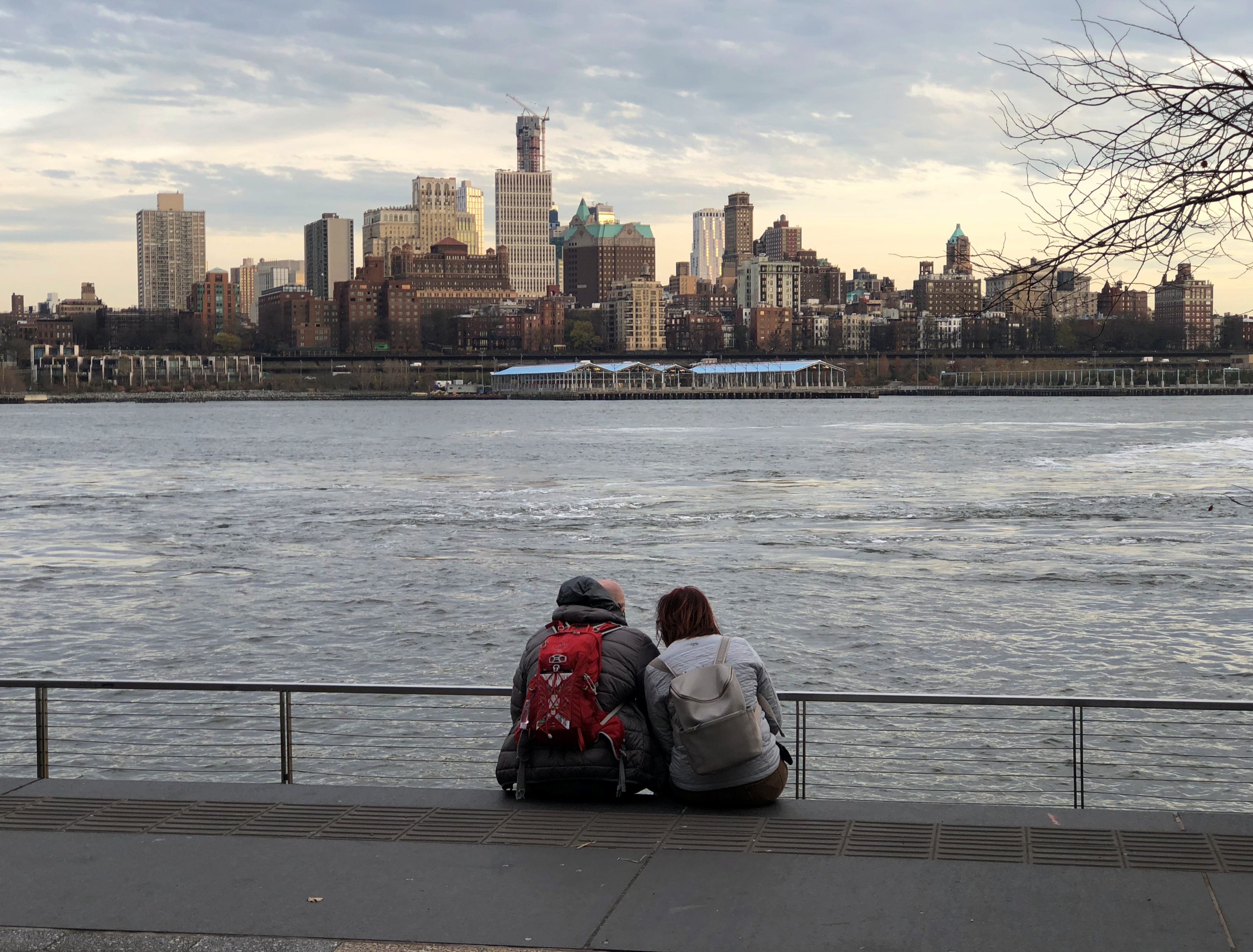
That’s as close as I got to Brooklyn this time around, as opposed to some other trips.

An enlargement of the sidewalk on the easternmost block of Wall Street forms Mannahatta Park, a pleasant place with bushes and trees and benches. Rose bushes bloomed there this December.Wall Street 2021

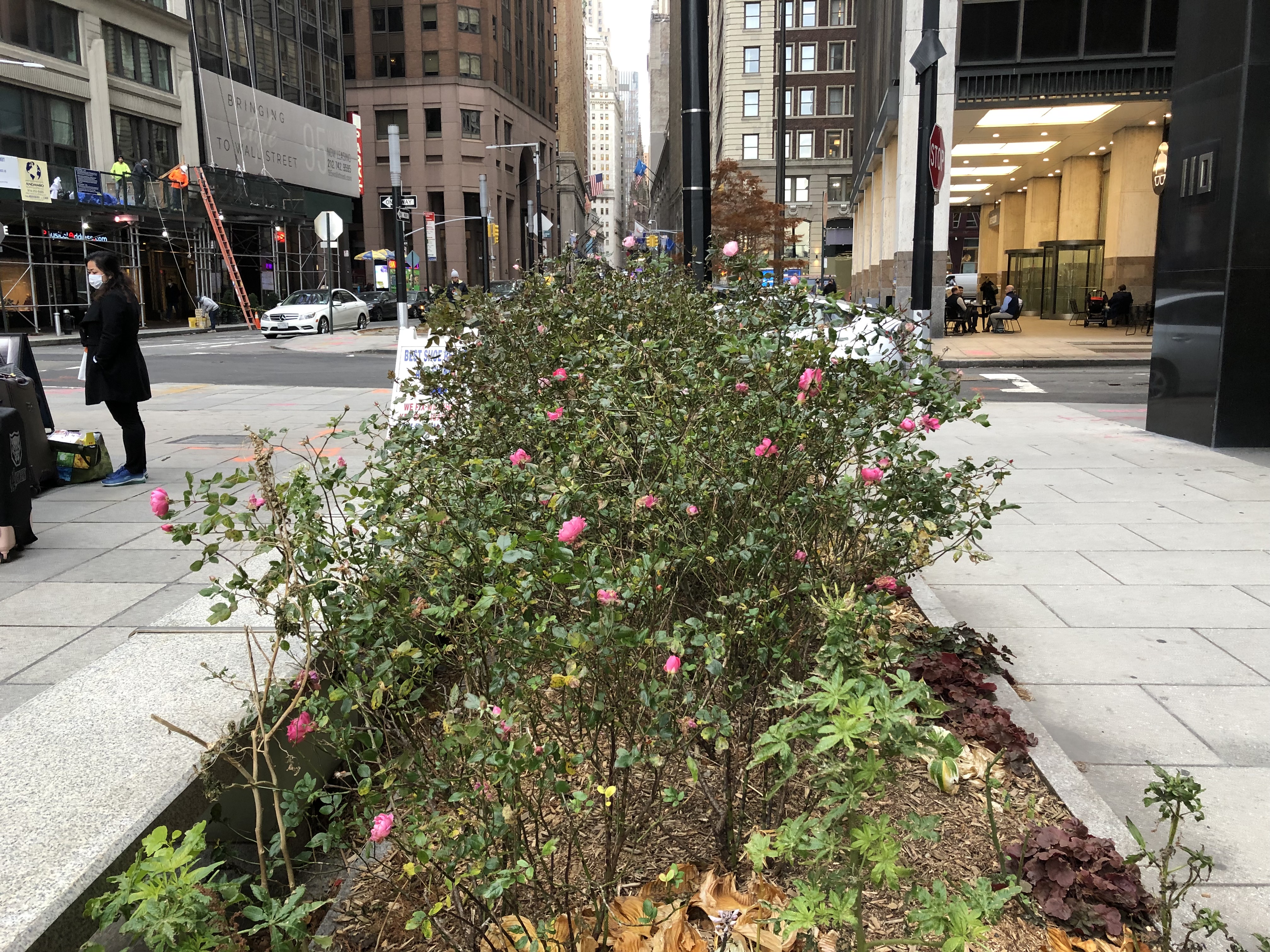
More than two centuries ago, the site was New York’s slave market, and surely not a pleasant place. The city erected a sign only in 2015 to mark the doleful history of the site.

At the corner of Water and Wall is 88 Wall Street, these days the Wall Street Hotel, very much an upmarket property (and not where I stayed) that opened only this year in a former office building.Wall Street 2021

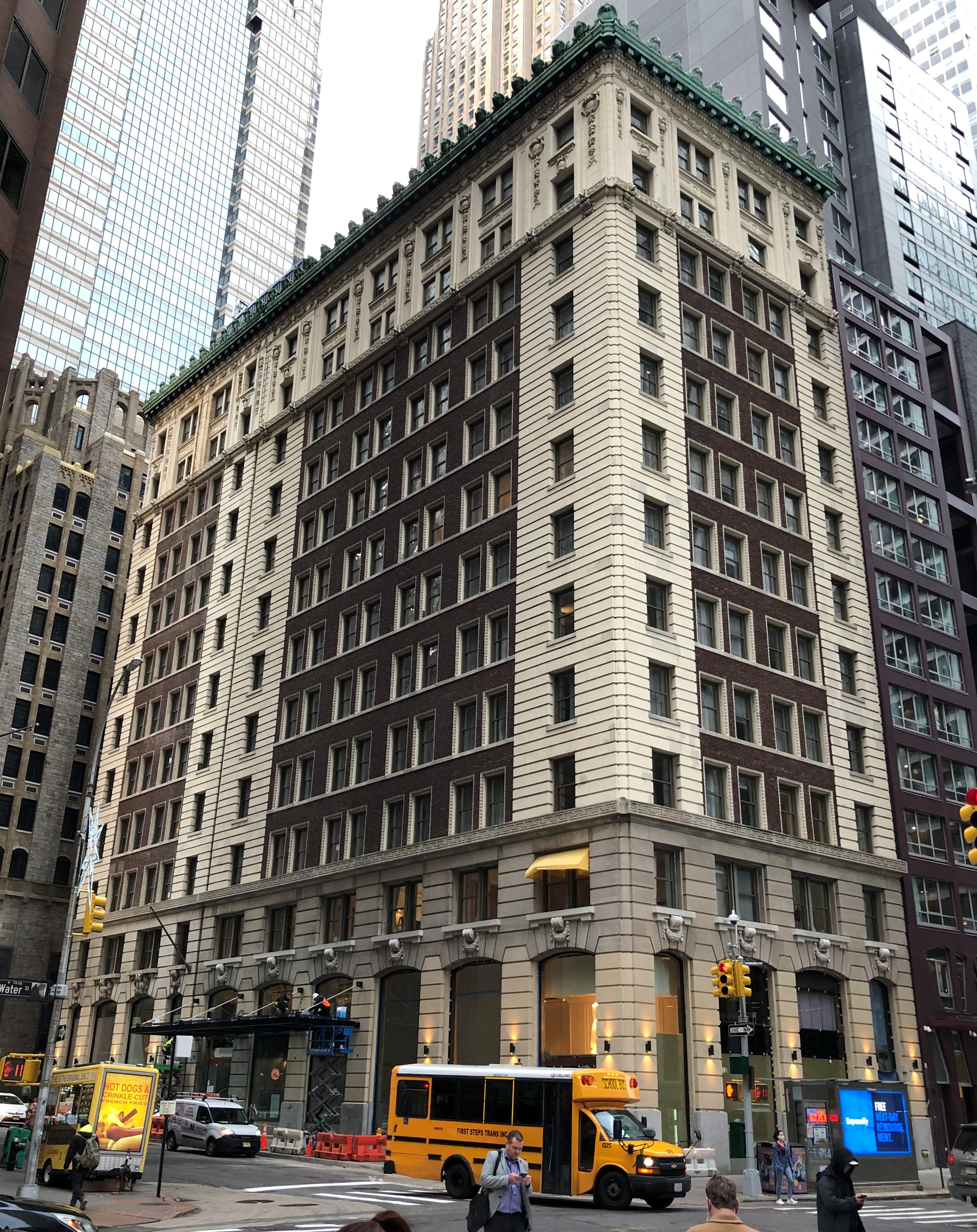
The hotel’s web site has an unusually long and detailed history of the site, which is only fitting, considering the richly layered history of the street. One of the more remarkable snippets of 88 Wall Street history is the fact that a series of two buildings on the site from 1791 to 1870 were owned by a tontine, and known as the Tontine Coffee House and then the Tontine Building. Out of the 203 investors who had funded the coffee house, seven survived to be beneficiaries of the tontine.

The current building, a Beaux-Arts structure designed by Clinton Holton & Russell in 1901, was for a time home to an import company that was, among many other things, the world’s largest dealer in mother-of-pearl. When plastic buttons bottomed out the market for that material, the company went into cultured pearls.

By the time you pass 88 Wall Street, the thoroughfare takes on its famed canyon-like aspect.Wall Street 2021

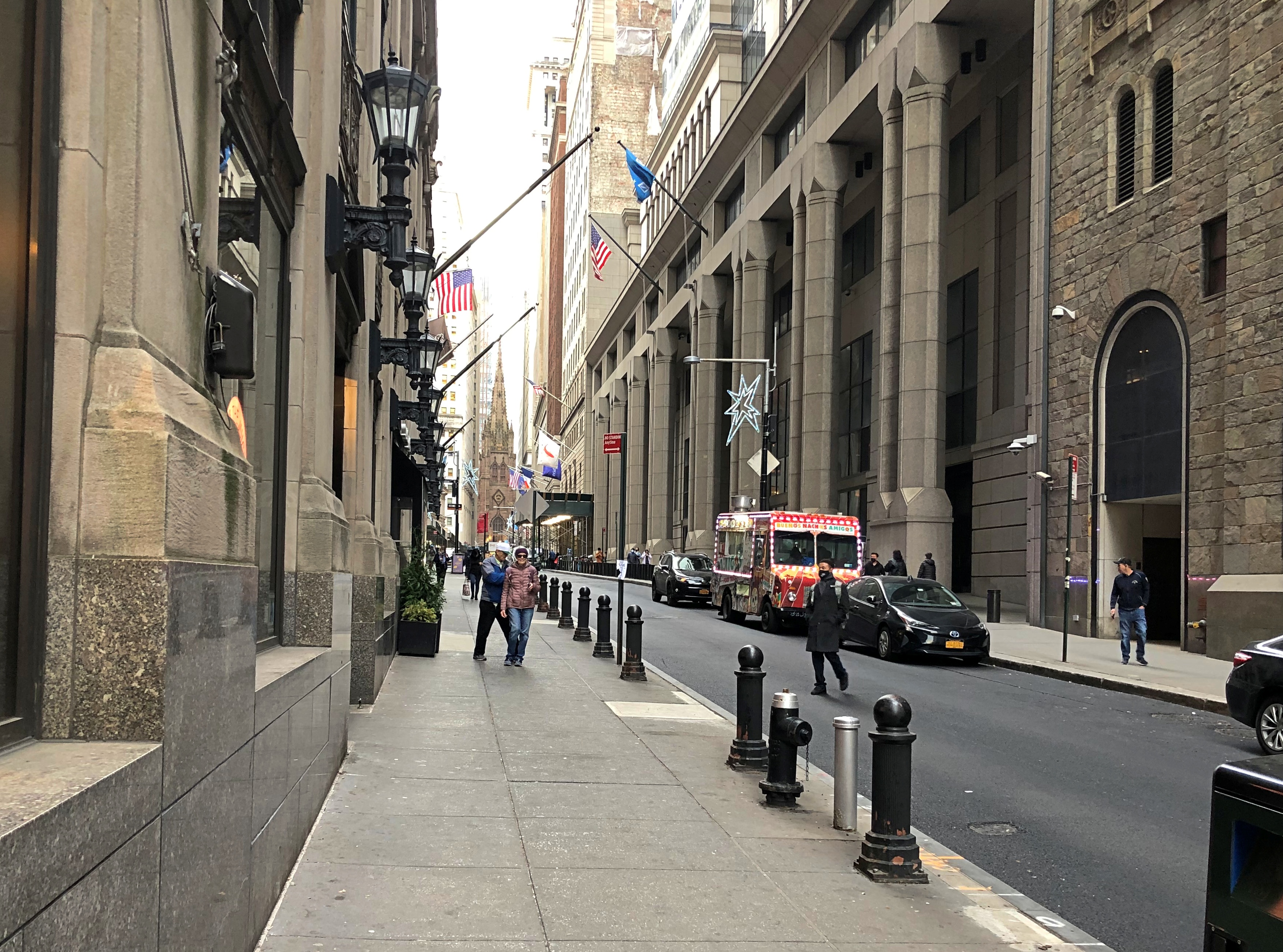
Next to 88 is 74 Wall Street. Its entrance caught my attention.Wall Street 2021

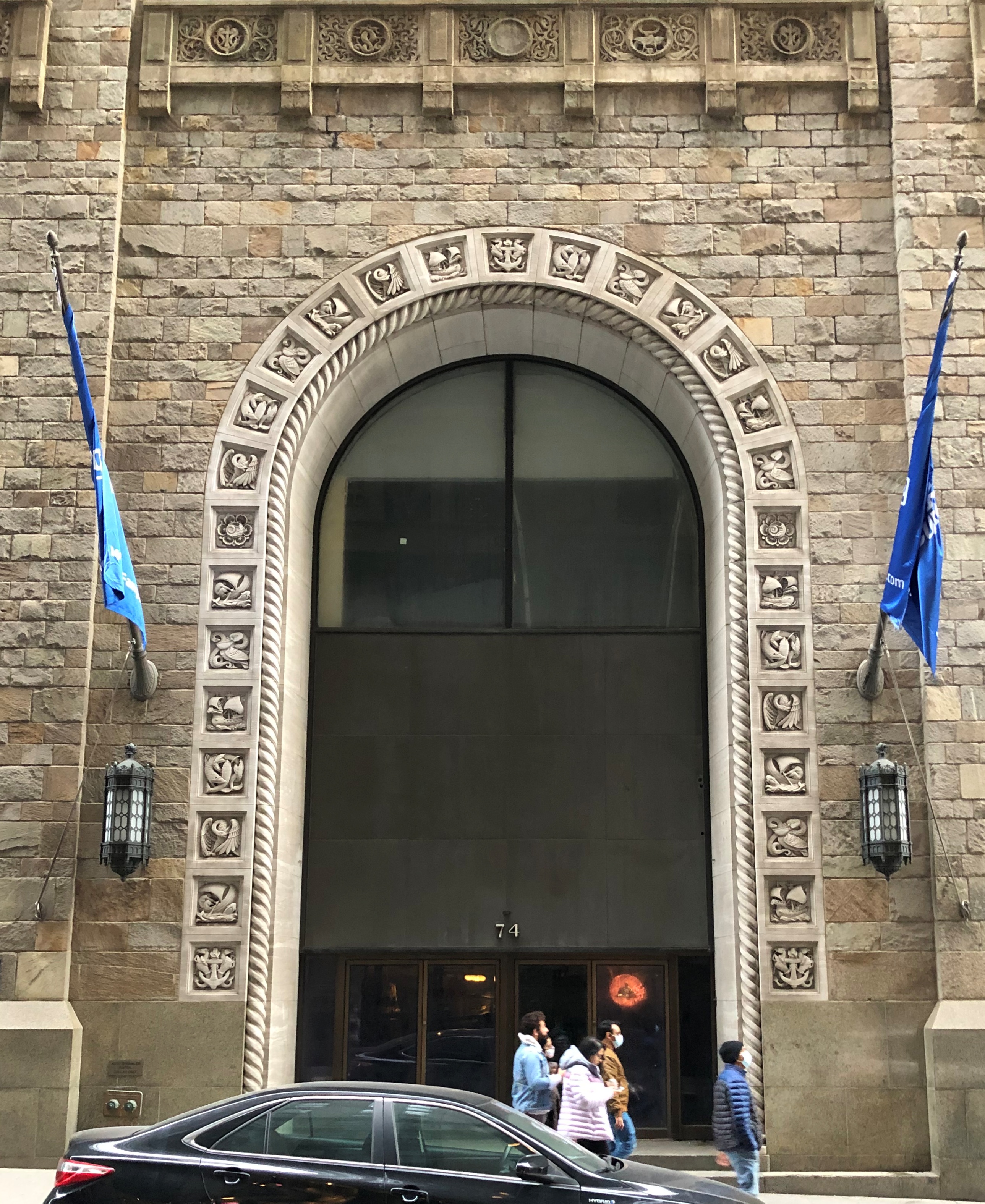
The ever-useful New York Songlines says: “This round-arched building was put up in 1926 as the Seamen’s Bank for Savings Headquarters (hence the seahorses, mermaids and other nautical motifs); the architect was Benjamin Wistar Morris.”

Nautical motifs, all right, though Seaman’s Bank is long gone.Wall Street 2021

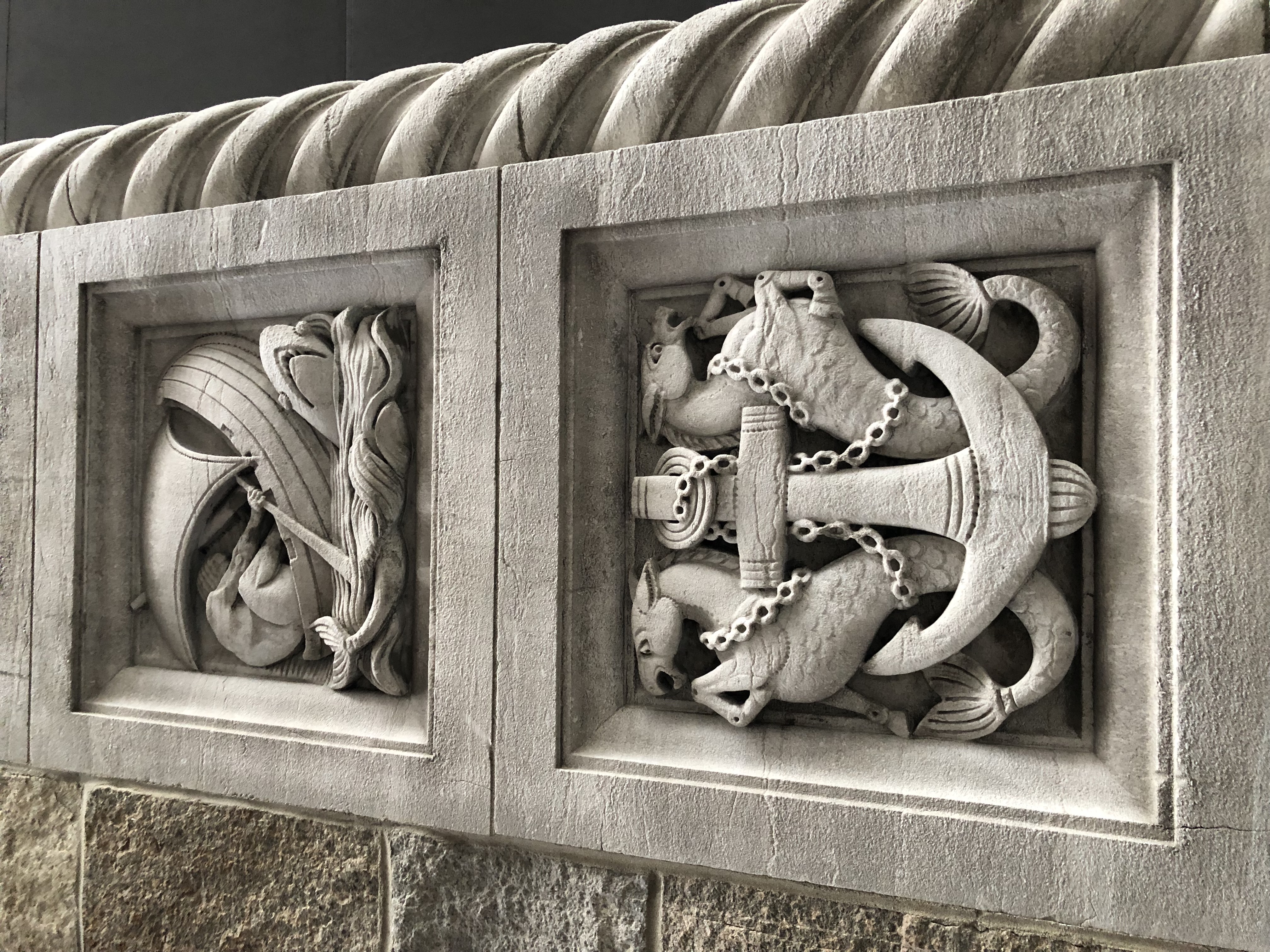
Almost as remarkable, the building seems to be vacant. Then again, maybe not so remarkable. Despite the persistence of Wall Street as an metonym, and the presence of the New York Stock Exchange, the street hasn’t been the hub of U.S. finance in many years; that moved on to Midtown.

Though not on Wall Street, 1 Wall Street Court — the Beaver Building, 1904 — is visible from there.
1 Wall Street Court

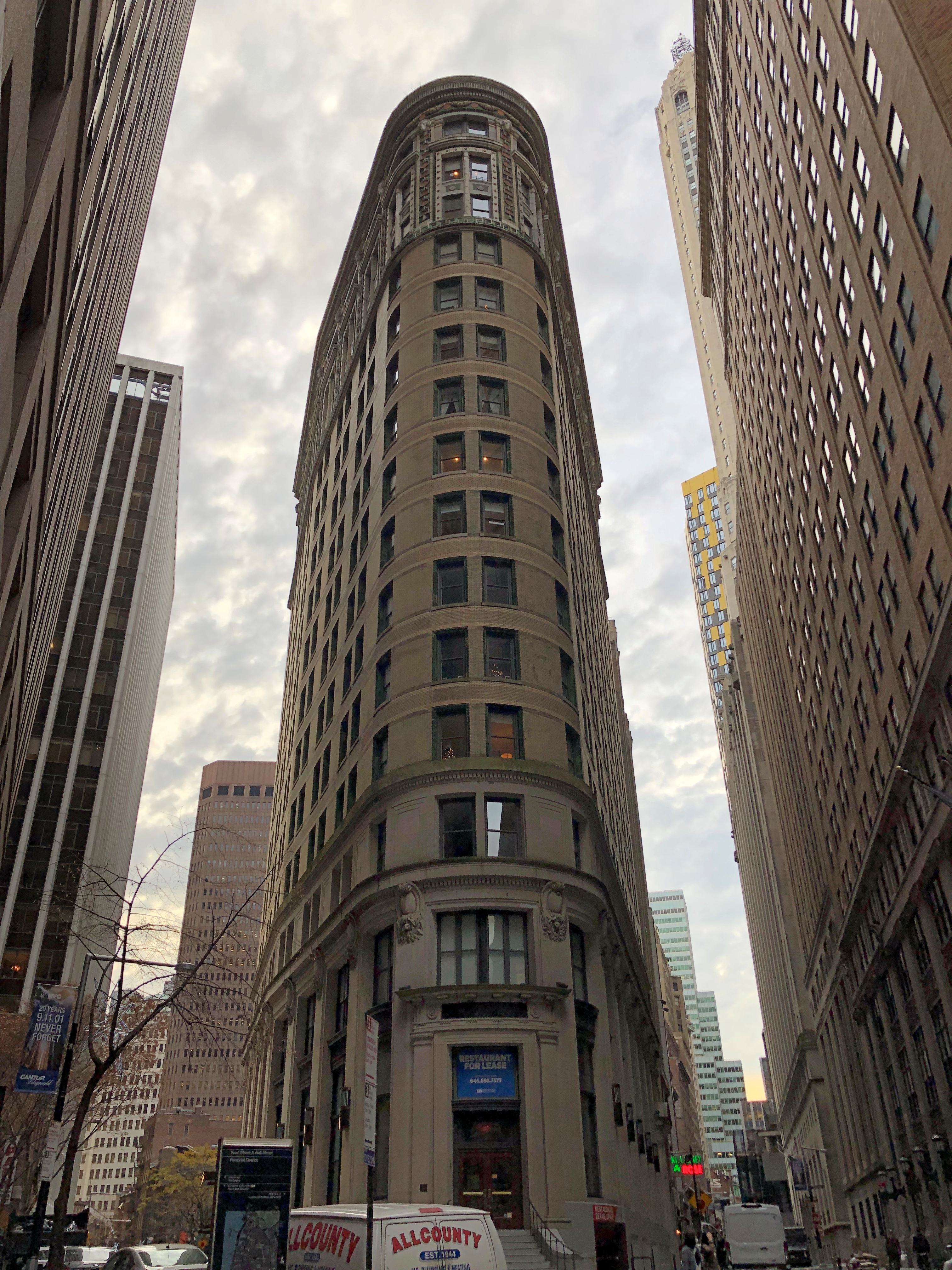
67 Wall Street, now a residential co-op.Wall Street 2021 Wall Street 2021

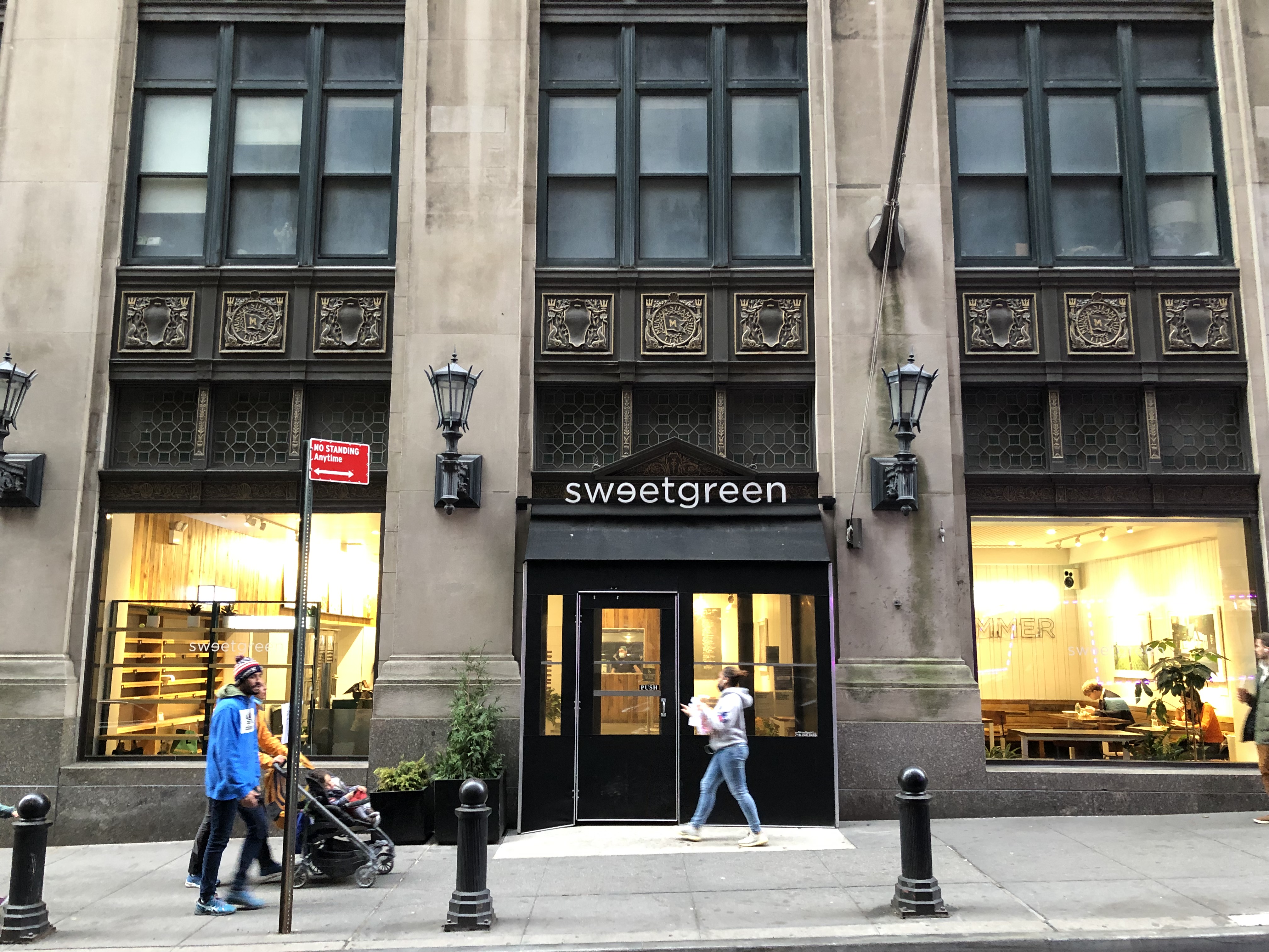
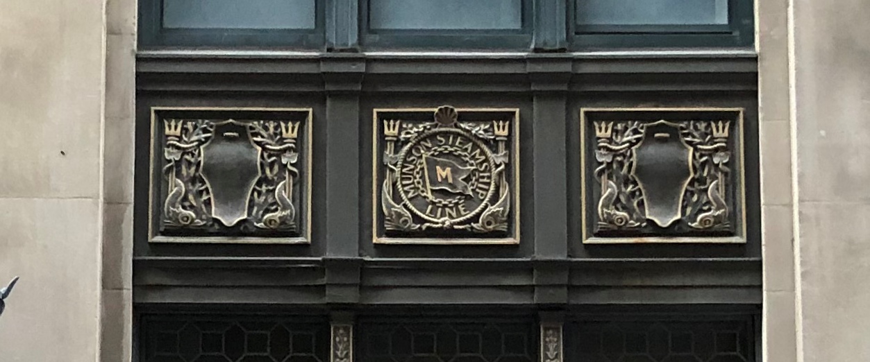
Songlines again: “This 25-story triangular building, originally known as the Munson Building, was designed in 1906 by Kenneth M. Murchison for the Munson Steamship [Line]. From 1931 until 1972 it was the New York Cocoa Exchange.”

63 Wall Street.Wall Street 2021

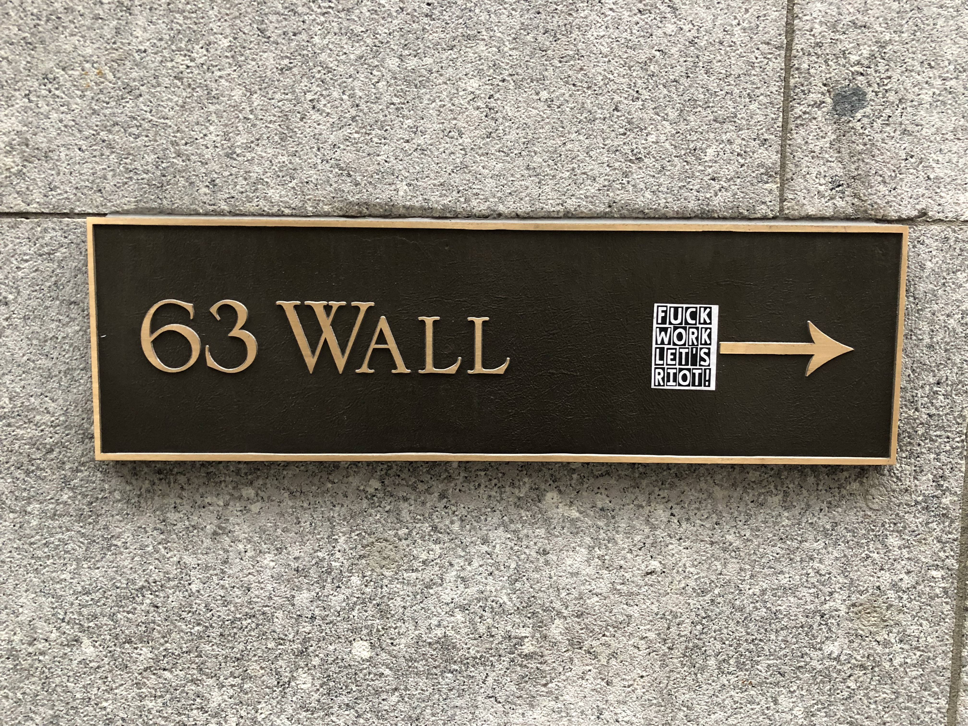
60 Wall Street, a 1988 building designed by Kevin Roche John Dinkeloo.Wall Street 2021

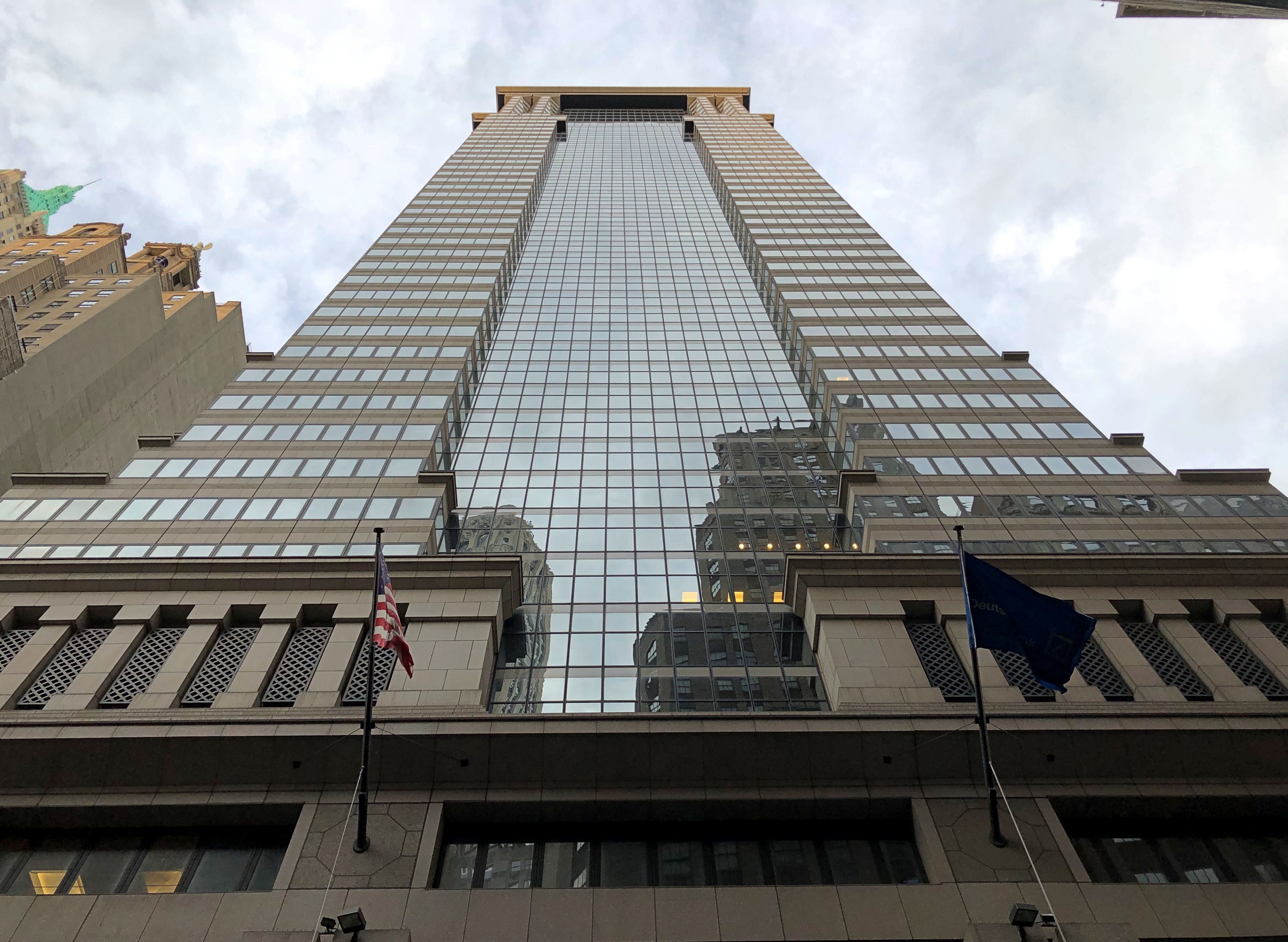
Originally Morgan Bank’s HQ, these days Deutsche Bank occupies it. I found the lobby impressive.Wall Street 2021

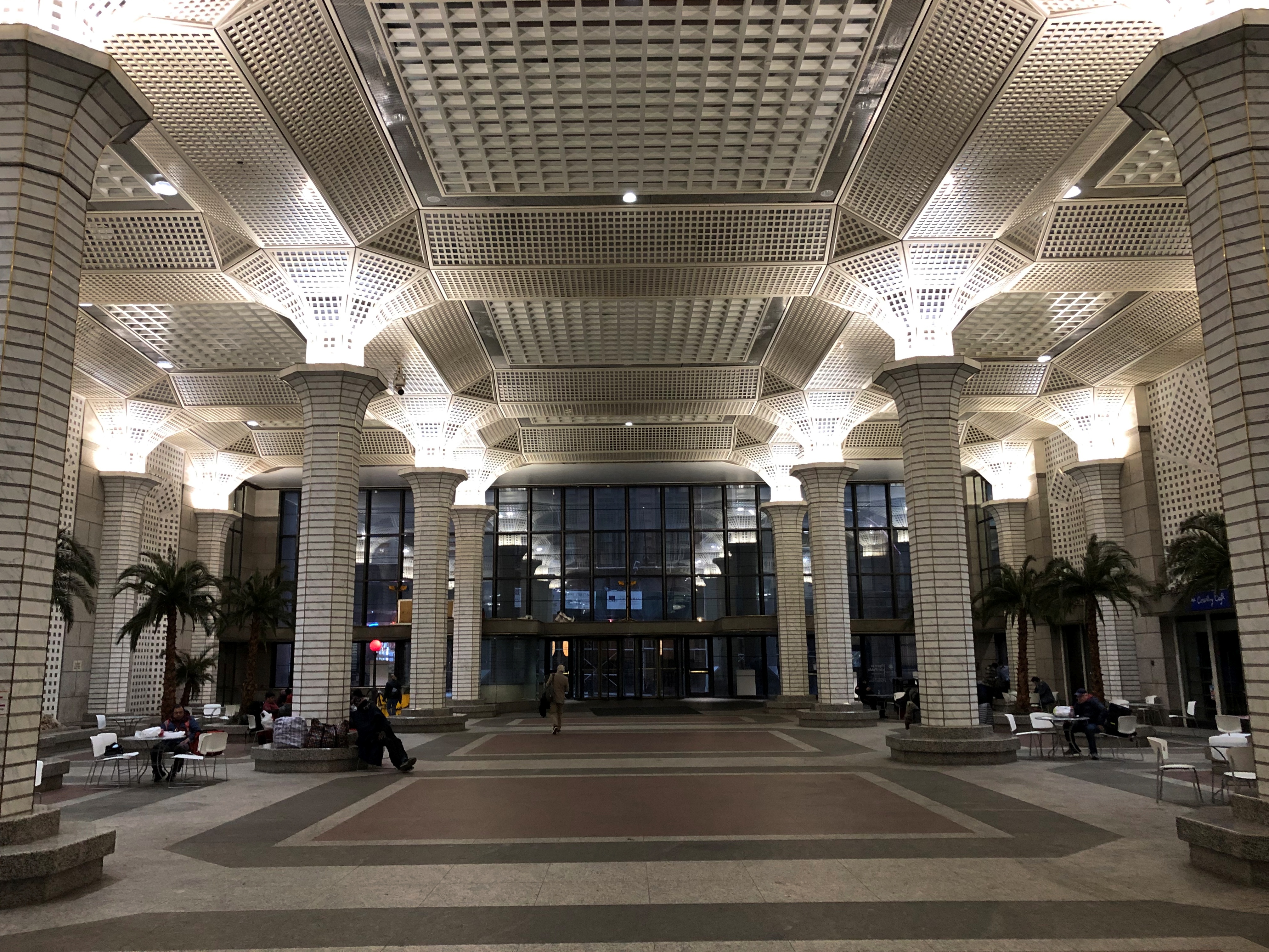
Soon after this point, it’s pedestrians only. Trinity Church isn’t far away.
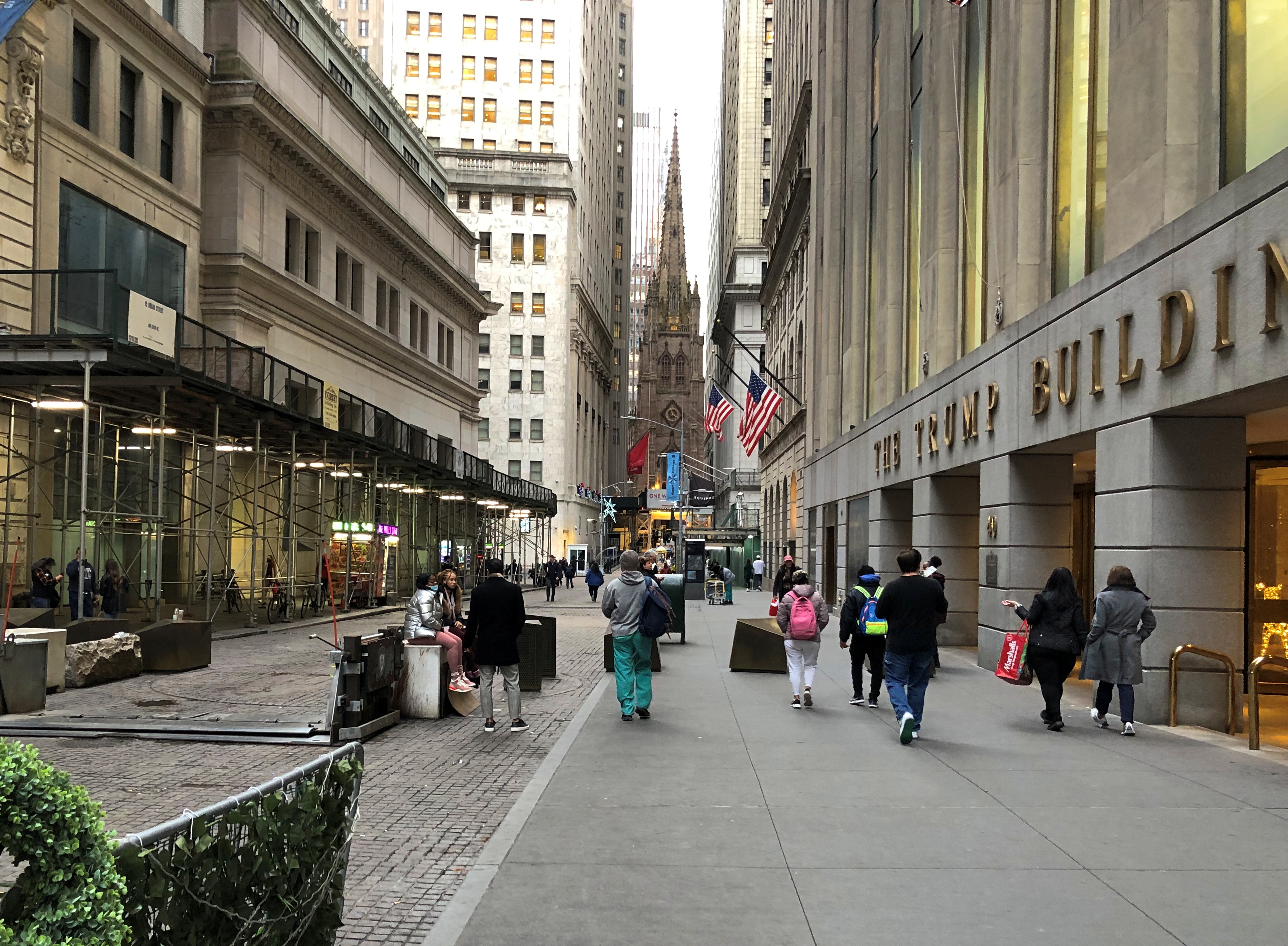
Wall Street 2021

40 Wall Street.Wall Street 2021

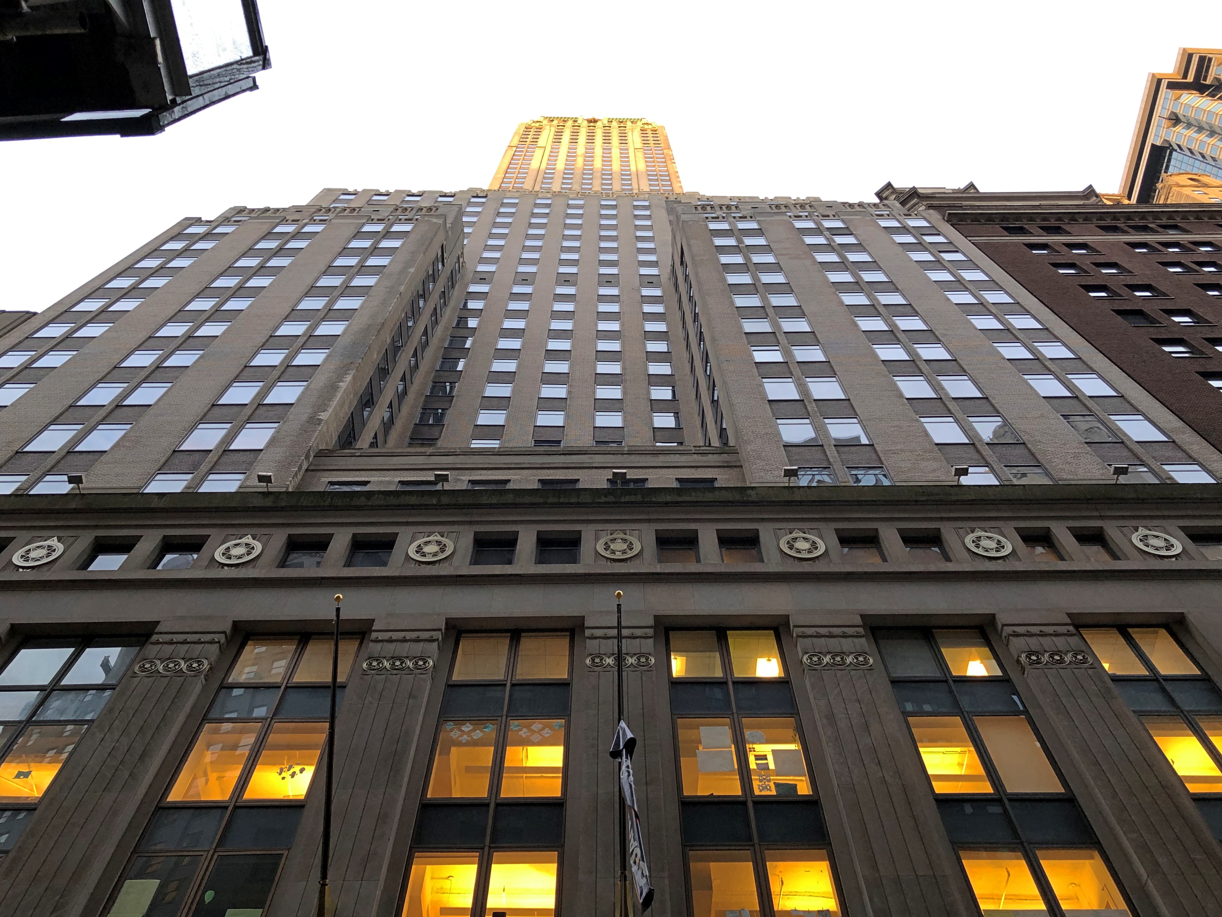
Lots of history here. A picture of the upper section.

Songlines: “Formerly the Manhattan Bank Building, this was designed to be the tallest building in the world, but was beaten out by the Chrysler Building’s surprise spire…

“The Bank of the Manhattan Company, which eventually became Chase Manhattan, opened its first office here in September 1799. It was founded by Aaron Burr against the opposition of Alexander Hamilton. The New York Stock & Exchange Board, as the NYSE was then called, had its first permanent office here in 1817.

“Donald Trump calls this the Trump Building; please don’t encourage him.”

37 Wall Street.Wall Street 2021

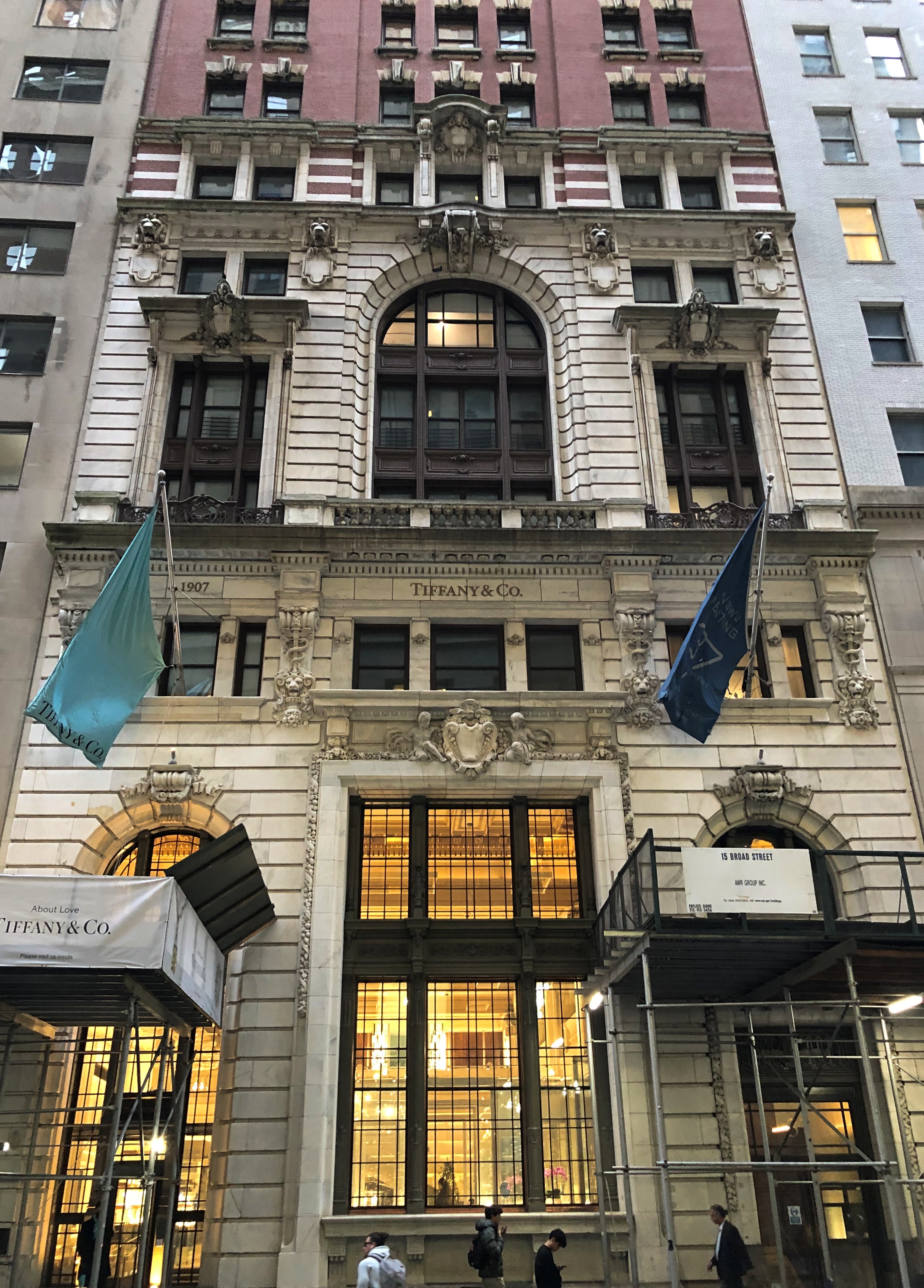
A familiar name, but Tiffany’s is a fairly recent occupant. Designed by Francis H. Kimball, a very busy New York architect, the building originally housed the Trust Company of America in 1907, and then a series of other banks. The upper floors are now residential.

Before long, one comes to Federal Hall National Memorial, which is behind some scaffolding now.Wall Street 2021

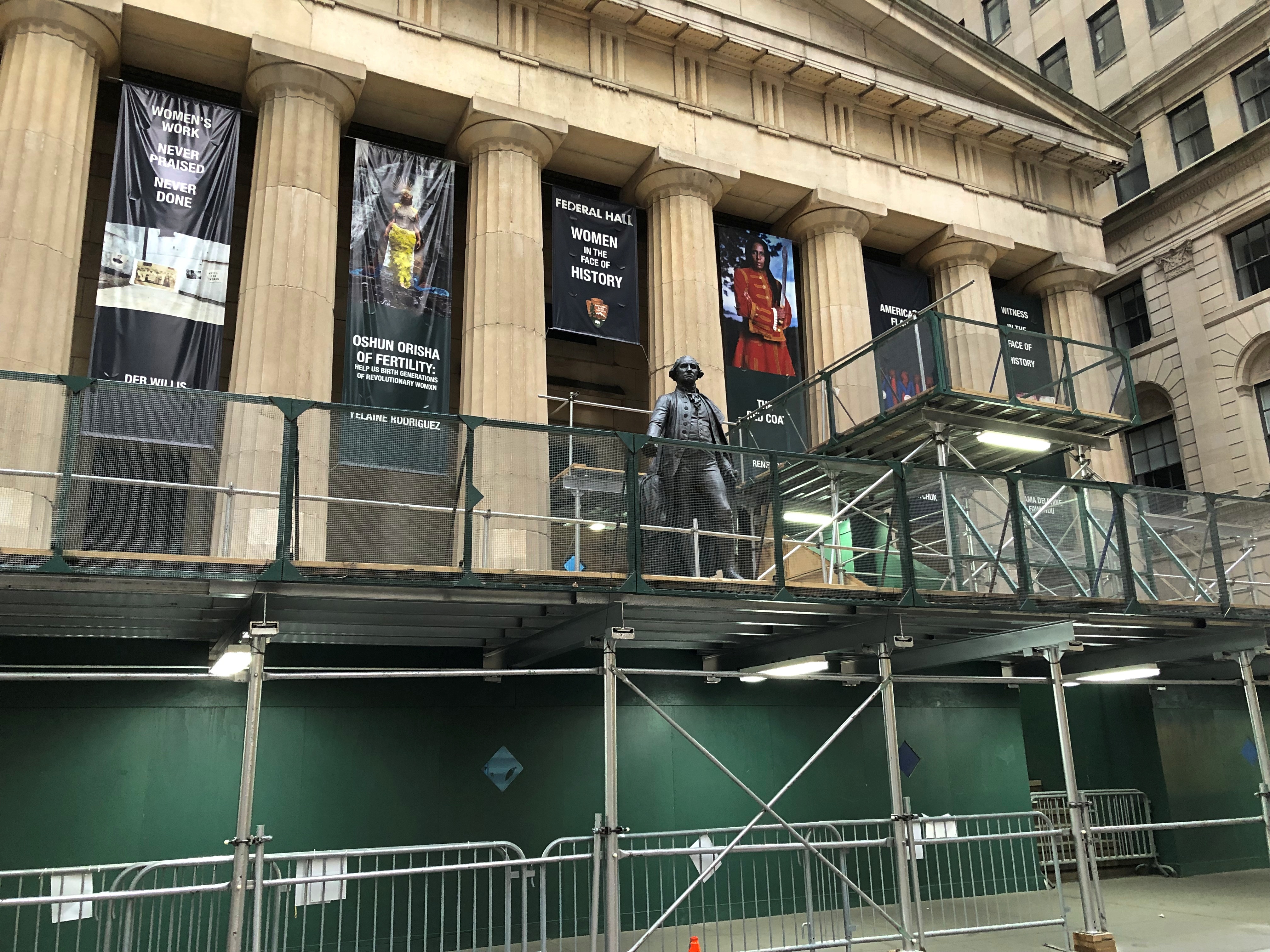
George looks a bit cut off up there. Looking down pensively, perhaps, on the nation he created.Wall Street 2021

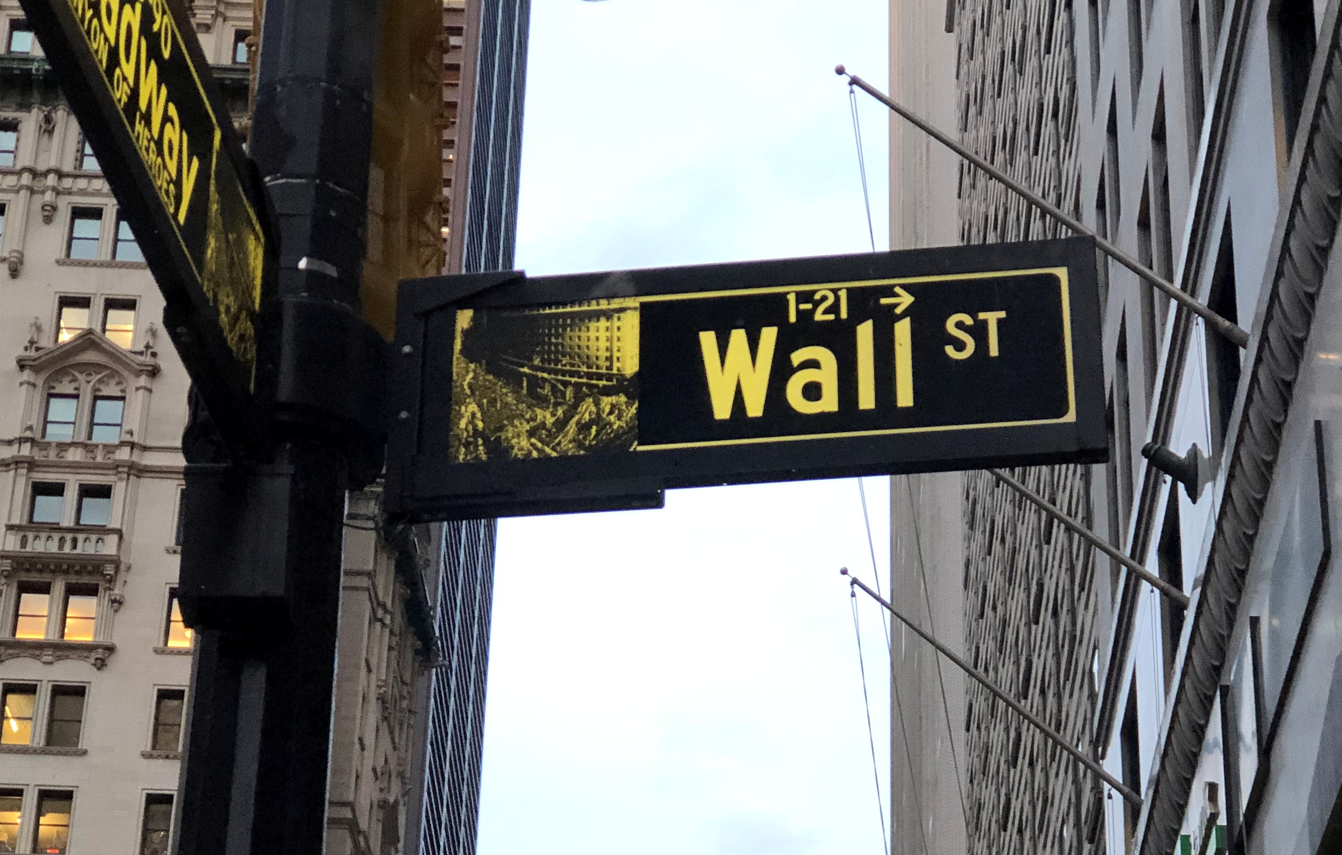
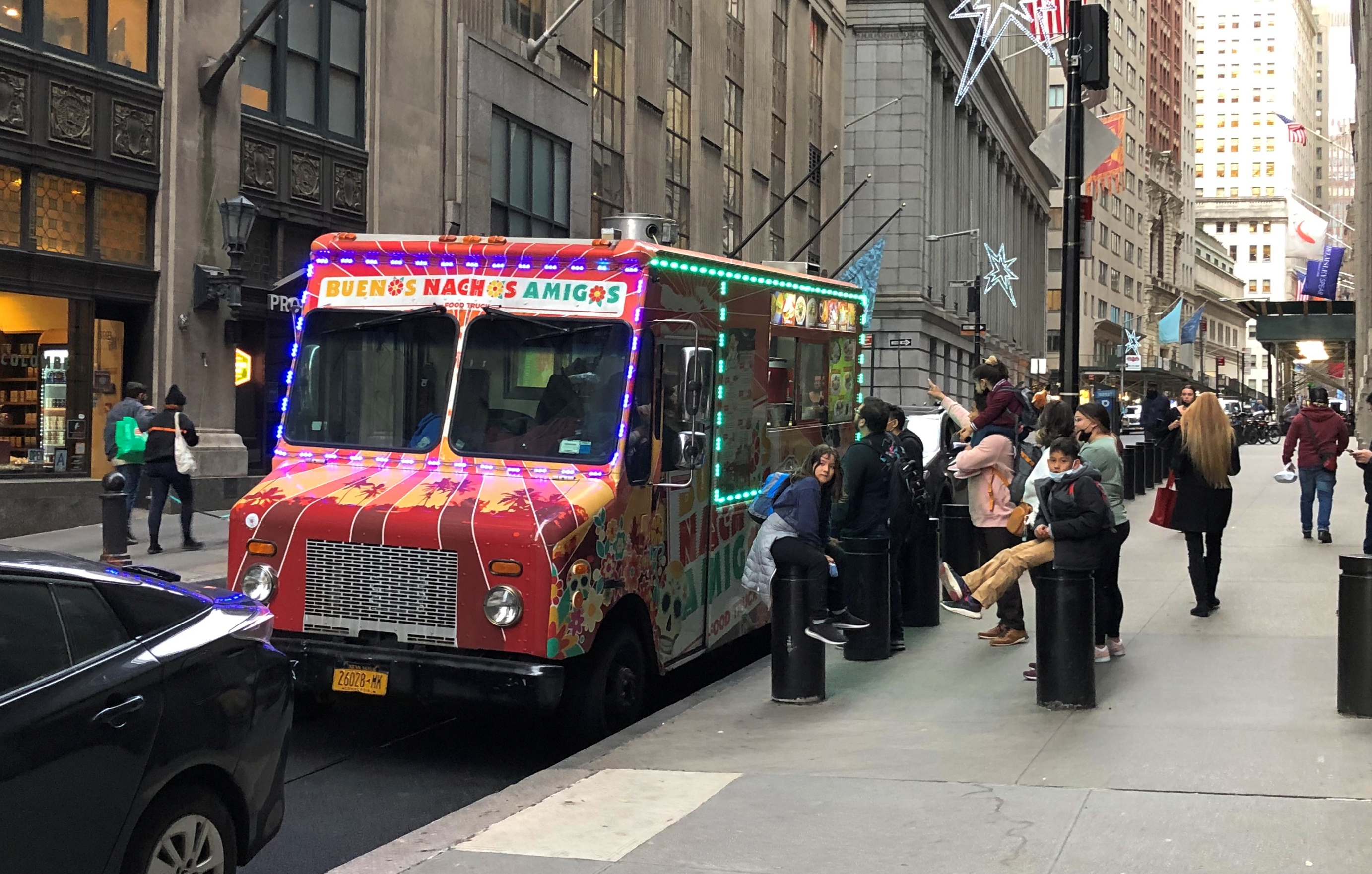
There’s plenty else on Wall Street that’s perhaps a little less permanent. For instance, sources of affordable food to price-oppressed New Yorkers.Wall Street 2021
Wall Street 2021

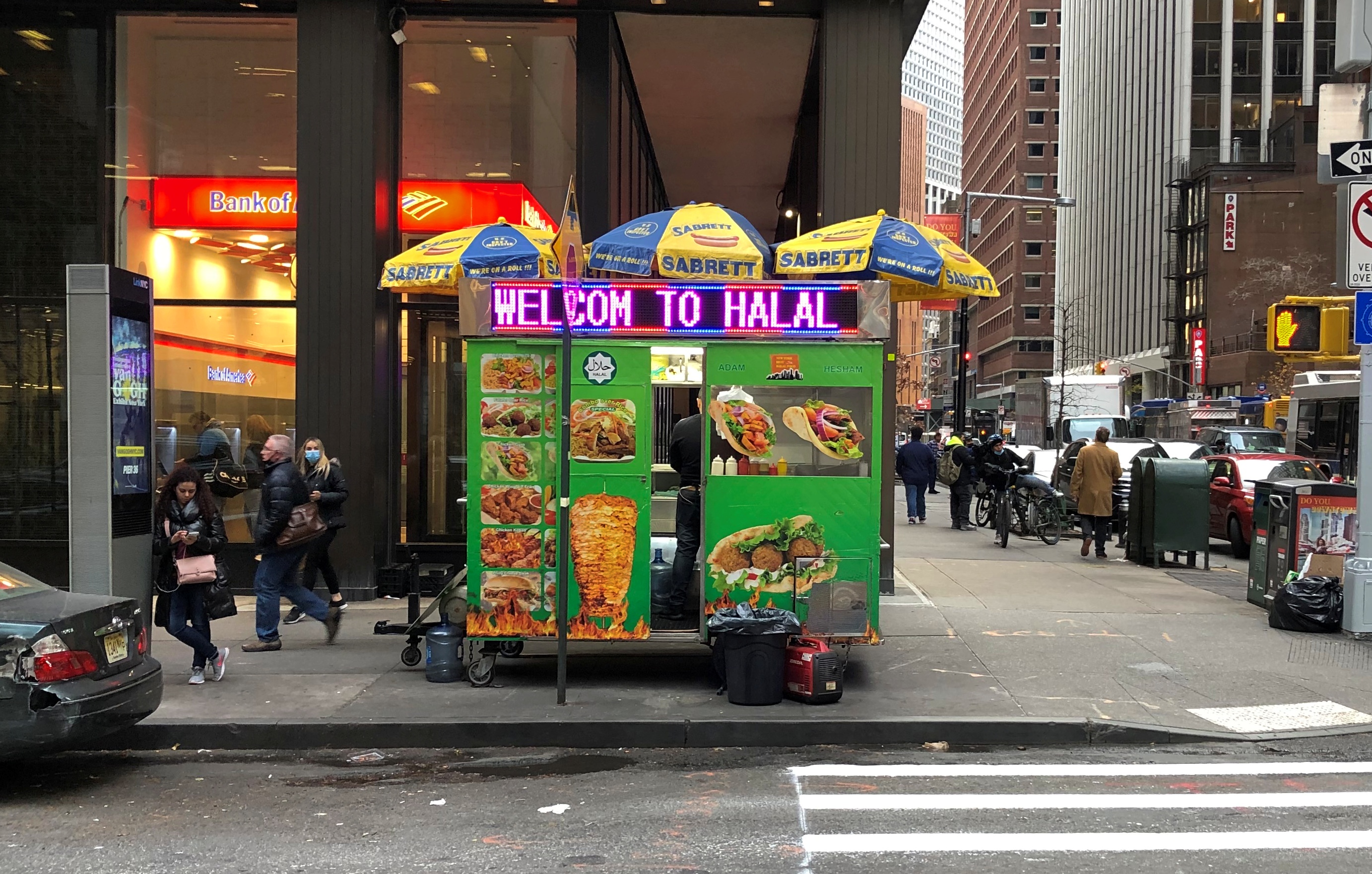
I bought a falafel at that first one, delicious and large enough to make part of dinner two nights in a row.

Also, men working.Wall Street 2021

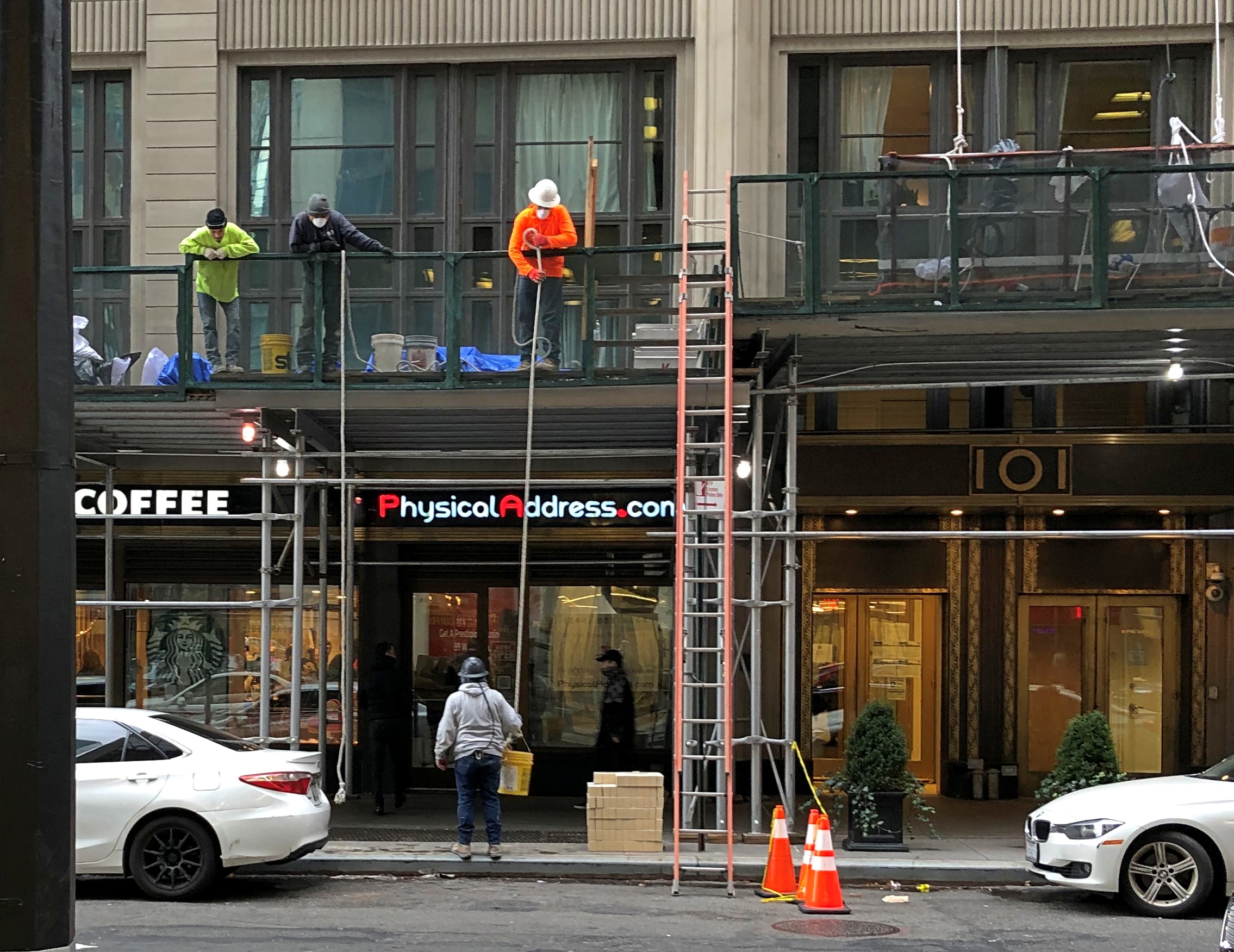
Finally, I couldn’t very well come to Wall Street without a look at the NYSE (11 Wall Street), whose after-hours trading floor I got to visit in 2002.Wall Street 2021

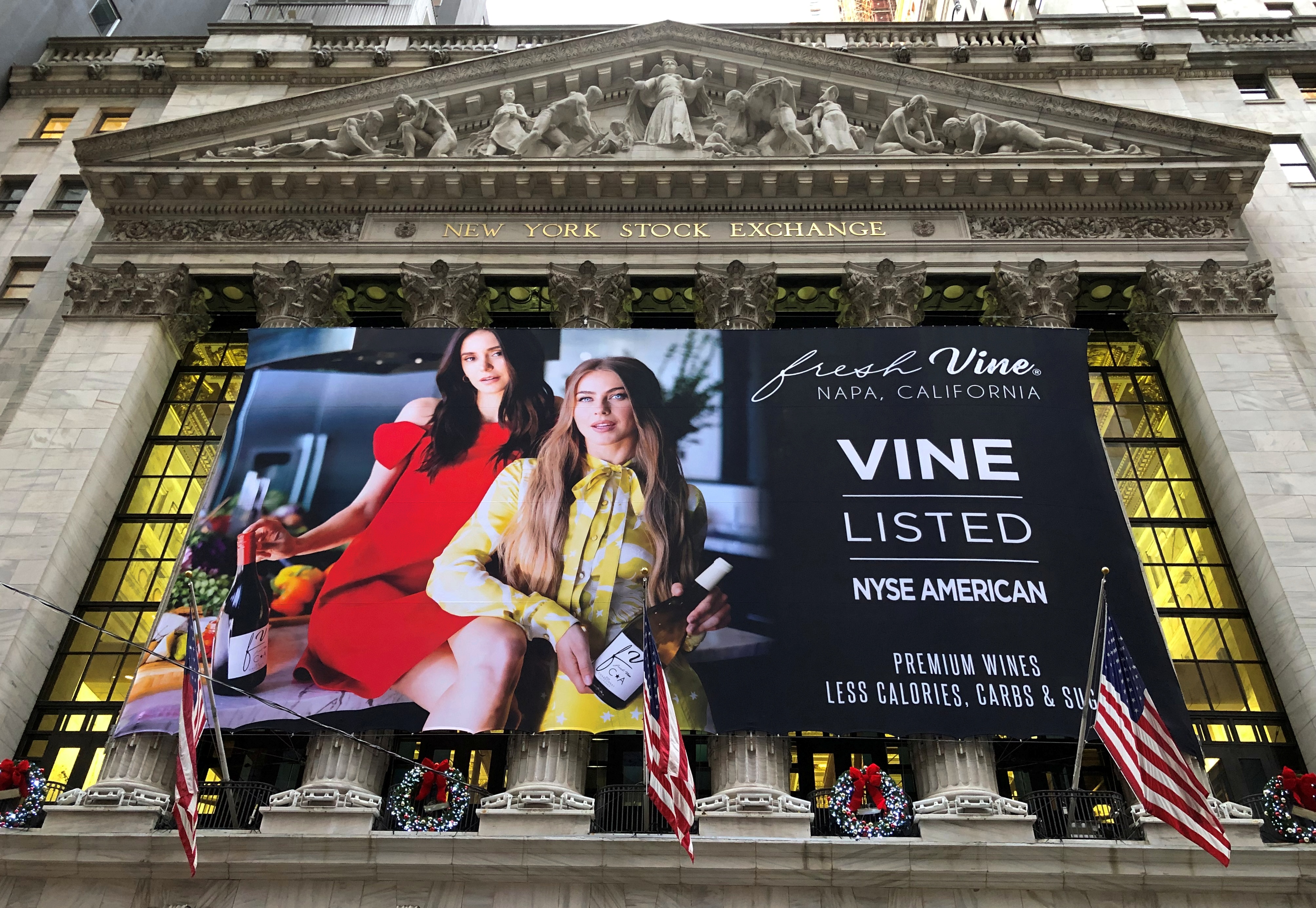
“It’s a primary rain forest of electronic equipment — the guts of the capitalist beast — no, the sinews of the Invisible Hand,” I wrote at the time. Looking at the allegory-stuffed pediment, I’d also say Temple of Commerce.

Up Russian Hill & Back Down Again

What to do on a warm afternoon in San Francisco? On October 29, after leaving the Ferry Building, I spent some time wandering around downtown, which isn’t famed in song and story. It is, on the other hand, much larger than I remembered. Then again, the nine-county Bay Area metro population is about 7.75 million these days, and downtown SF is the main one for the region. Add metro San Jose and it’s even more.

I wasn’t particularly systematic in my downtown walkabout, or I might have sought out Salesforce Tower, for instance. Here’s 101 California St. instead. A Philip Johnson and John Burgee design from 1982.101 California St

Bank of America Center (555 California), completed in 1969.
BoA SF

An older structure in the shadow of BoA, nicely restored.
Downtown SF

I couldn’t very well miss a shot of the Transamerica Pyramid, albeit at some distance.
Downtown SF

Designed by the unapologetic modernist architect William Pereira, the building was spanking new when my family and I visited San Francisco in 1973, and I regarded it with some fascination at the time. Still do.

I later took the streetcar along the Embarcadero to Fisherman’s Wharf, another place of fond recollections. As tourists, we went there in 1973 and ate at one of the restaurants — Jay had the squid — and in 1990, I stayed a few days at the Fisherman’s Wharf Holiday Inn.

Good to see that the place still attracts people. The sign at Jefferson and Taylor Sts. would have also been fairly new the first time I saw it, since it dates from 1968. It was featured during the jazz montage intro to The Streets of San Francisco, as I recall.
Fishermans Wharf

But I didn’t want to spend much time there in 2021, so I decided to climb Russian Hill. Specifically to reach the famed crooked stretch of Lombard St.

That I did. At my age, it wasn’t a steady walk, but walks followed by rests along the way.
Lombard St

Lombard St. attracts tourists too. I understand it’s even busier in the summer.

The scene at the bottom of the famed section, on Leavenworth St., which crosses Lombard at that point.
Lombard St

“The switchbacks design, first suggested by property owner Carl Henry and built in 1922, was intended to reduce the hill’s natural 27 percent grade, which was too steep for most vehicles to climb,” Wiki says.

“As it is one of the most visited tourist attractions in the city, this section of the neighborhood is frequently crowded with tourists. Tourists also frequent the cable car line along Hyde Street, which is lined with many restaurants and shops.”

The switchback street itself is paved in brick.Lombard St

The rest of the slope is heavily landscaped, with stairs on either side of the switchback.
Lombard St

The road might have been created to help vehicles climb the grade, but in our time Lombard is one way on this block — going down.
Lombard St

I stood watching for a while, and noticed that every other car or so that went down Lombard had someone in the passenger seat taking a video with their phone. So if you are a tourist with a car in SF, this is clearly a thing to do. The city wanted to make tourists pay for the experience, but Gov. Newson said no.

At the top of the block is Hyde St.Lombard St and Hyde St.

A cable car line runs along the street. It stopped at the intersection and people got out.
Lombard St and Hyde St.

I didn’t ride any cable cars this time. I did so in ’73 and ’90, but more importantly, it now costs $8. Sure, it’s an expensive system to maintain, but all transit is subsidized — including the roads themselves. Just another example of gouging tourists.

One thing San Francisco cannot charge tourists for are the views, though perhaps some mid-level functionary is working on figuring out how to. The view from Lombard and Hyde, looking over at Telegraph Hill, is wonderful. And free.Russian Hill vista

I walked down Hyde St. toward the Embarcadero. The view from just over Russian Hill Park is pretty good as well. Been a good year for vistas, I’d say.Russian Hill vista Russian Hill vista

More good views closer to the shore, at Aquatic Park.Aquatic Park, SF Aquatic Park, SF

Down on Beach St., I chanced into this space.Umbrella Space
Umbrella Space

Umbrella Alley. Besides featuring the umbrella installation and murals, the place is the starting point for such sightseeing as guided Segway tours, Jeep tours, electric scooter tours, and Lucky Tuk Tuk Private Group Tours. All very well, but after making a small donation for the art project, I continued on foot.

Jack London Square

Not too many authors have their names attached to places, but Jack London does, at least until someone points out loudly enough that he was an enthusiastic supporter of eugenics. But for now, if you cross under I-980/I-880 from downtown Oakland — part of whose underside is an informal neighborhood —Oakland shanty town

— you will arrive before long at Jack London Square, which is part of the larger Jack London District. Formerly a warehouse and port district, the rise of container vessels mostly made the area obsolete as an industrial zone. Various rehab projects began in the late 20th century, but I understand that adaptive reuse really got underway around 2000, with residential redevelopment especially pushed by former mayor Jerry Brown.

The sign on site says JACK LONDON SQ.Jack London Square

I understand the area was a good deal rougher when Jack London himself lived around there, but these days it’s an entertainment district, with shops, restaurants, hotels and a movie theater, as well as a marina where you can catch a ferry to San Francisco.Jack London Square Jack London Square
Jack London Square Jack London Square

There’s also London in bronze by Cedric Wentworth, a Bay Area artist.Jack London Square

Not far away is a non-bronze, “Golden Stomper,” by one Jeff Meadows. It’s an Oakland A’s thing, and I can’t get that excited about it.Jack London Square

London lived in a cabin in the Klondike during his gold-seeking period. On the North Fork of Henderson Creek, to be more specific. Much later (1968) half of the cabin was brought to Oakland and a replica created using those and newer materials at the behest of a wealthy Jack London enthusiast. The other half went to Dawson City, where another replica was created. So now there are two London cabins, one much easier to reach than the other.Jack London Square

And what would a Jack London cabin be without a nearby bronze of White Fang?
Jack London Square

Or maybe that’s supposed to be the dog in The Call of the Wild. No sign is attached to say which. I couldn’t hazard a guess, since I never did get around to reading either of those books, though I did read the Classics Illustrated version of The Call of the Wild.

Illinois Wesleyan University

College campuses, at least when the weather is temperate, have a lot to recommend them as walking destinations. Green space with expansive trees, good-looking or at least interesting buildings, the possibility of public art, inexpensive museums sometimes, a youthful vibe but also historical tidbits, and overall no admission charge.

And the certain knowledge that you (I) don’t have to show up for class, finish assigned reading or write papers. That’s all done.

Illinois Wesleyan UniversityBefore we dropped Ann off at her dorm on Sunday and returned home, we all took a stroll through Illinois Wesleyan University, which is in Bloomington, though not to far south of ISU. I’m glad to report that its motto is still in Latin.

Even better, I knew what it meant without looking it up because of the long-ago Latin teaching efforts of Mrs. Quarles and Dr. Nabors. But I have to say that even a little knowledge of the etymologies of the English words “science” and “sapient” would be enough to guess “knowledge” and “wisdom.”

Illinois Wesleyan, which as far as I can tell is only tenuously connected to the Methodist church, is pleasantly green though not quite the arboretum that is ISU.Illinois Wesleyan University
Illinois Wesleyan University

A good many buildings were newer-looking than I expected for a college founded in 1850.Illinois Wesleyan University
Illinois Wesleyan University

But not all of them.
Illinois Wesleyan University

There was a scattering of artwork, such as “Aspiration” by Giles Rayner (2015), a British artist specializing in water sculpture.Illinois Wesleyan University

For whatever reason, no water flowed when I was there. It would have been cooler, literally and figuratively, had it been.

Elsewhere is “Family With Dog” by Boaz Vaadia (also 2015), a Brooklyn-based artist.Illinois Wesleyan University
Illinois Wesleyan University

That second picture is my own composition, “Daughter With Dog With Family With Dog” (2021).

ISU Quad Walkabout

Heavy rain for a while today and cooler temps, but not till afternoon, so there was time for one more lunch on my deck.

Ann invited us to visit her over the weekend, which we did, heading down to Normal on Saturday morning and returning Sunday afternoon, spending the night in a motel near I-55. Daytime temps were nearly as warm as when I dropped her off at ISU in August.

Toward the end of the day on Saturday, it had cooled enough for a short walk — including the dog, whom we brought — around the prettier parts of campus. Mostly that meant the ISU Quad. What’s a university without a quad or two?

As mentioned yesterday, most of the foliage is still green. An eastern approach to the Quad.ISU Quad

ISU Quad

“The Hand of Friendship,” which honors Robert G. Bone.ISU Quad

Bone (1906-1991) was the ninth president of Illinois State Normal University, which was renamed Illinois State University during his tenure. Though only president for 11 years (1956-67), he oversaw a lot of construction, including the tower where Ann lives. Later, the school’s student center was named after him.

The Quad also counts as the heart of the arboretum that spans the campus — the Fell Arboretum, to cite its formal name, honoring one Jesse Fell.

Fell (1808-87) was the sort of businessman that America spawned in the 19th-century — lawyer, real estate speculator, newspaper publisher and sawmill owner. Specific to Illinois, he was a friend of Lincoln’s. He founded towns in central Illinois and helped organize counties there as well, and is considered a founder of ISU.

As for the arboretum, apparently Fell not only profited from cutting down trees, but was a fanatic when it come to planting them, so ISU named it in his honor.

Elsewhere, we saw a plaque on a rock honoring the horticulturist who designed the original landscape for the campus, William Saunders (1822-1900), who also happened to be a founder of the National Grange of the Order of Patrons of Husbandry, an organization I had only scant knowledge of before. That is to say, little that I remember, though I’m sure heard about the Granger movement in a U.S. history class. Always good to learn or re-learn something.

In the middle of the Quad is a lush garden.ISU Quad

ISU Quad

ISU Quad

The centerpiece is the Old Main Bell, dating from 1880.
ISU Quad Old Main Bell

Old Main was the campus’ first building, which stood from 1857 to 1958. A memorial honors the building not far from its bell. Unusually, it depicts all four elevations of the building.
ISU Quad Old Main
ISU Quad Old Main

We wandered on. This is Cook Hall.

“One of Illinois State’s most interesting buildings and the oldest one still standing on the Quad, Cook Hall was originally built to be a gymnasium,” ISU tells me. “It was completed in 1897 and was named after John Williston Cook, the University’s 4th President (1890-1899). He earned his diploma in 1865 from Illinois State Normal University and in 1876 he became a Professor of Mathematics.

“The building has also been known as the ‘Old Castle’ or ‘The Gymnasium.’ The governor at the time, John Altgeld, had a great liking for medieval castles and insisted all new state construction during his term in office resemble castles. You’ll find a Cook Hall look-alike at many other state schools; they are called ‘Altgeld’s Folly.’ ”

Really? I had to look into that more, and found this Wiki item about Altgeld Castles. It does indeed seem that a raft of crenellated, or quasi-crenellated buildings at Illinois state schools dates from the 1890s. I remember seeing Altgeld Hall at UIUC, but didn’t know it was part of a pattern. An eccentric pattern. That’s two things I learned (or relearned) today; makes for a good Monday.

Green Bay: State & Church

The town of Green Bay wasn’t our primary destination over Labor Day weekend, but when I stay somewhere, I like to look around if I can. Never know what you’ll see, such as a bit of history of the Green Bay Packers.Brown County Courthouse Wisconsin

Moreover, the sign said there’s a Packers Heritage Trail. A little further investigation reveals information posted by the Neville Public Museum in Green Bay.

“The Packers Heritage Trail consists of 22 commemorative bronze plaques. The trailhead is located at the front entrance of the Neville Public Museum. On the journey, you can see Curly Lambeau’s childhood home, as well as the birthplace of the Packers. Visit the train depot that sent off the team for road games. Stop at City Stadium, where the Packers played home games from 1925 to 1956. You will also see the hotel that Vince Lombardi held his first press conference as Head Coach, and the church where he attended daily mass.”

By golly, that’s quite a trail. The plaque pictured above is on the grounds of the Brown County Courthouse, itself a sight to see.Brown County Courthouse Wisconsin

Brown County Courthouse Wisconsin
Charles E. Bell design. He did other courthouses around the beginning of the 20th century, as well as the Montana and South Dakota state capitols. This courthouse dates from 1910, and with its Beaux Arts-ness, reminded me of the Palacio de Belles Artes in Mexico City.

Also on the courthouse grounds is “The Spirit of the Northwest,” by Sidney Bedore and dedicated in June 1931. Looks good for being out in the Wisconsin elements for 90 years; maybe it’s been restored at some point.Brown County Courthouse Wisconsin
The trio are an unnamed Fox Indian, Jesuit missionary Claude Allouez, who arrived in the area in 1669, and Nicholas Perrot, an explorer who arrived about 1664 and claimed the lands around the bay for the King of France.

One more: an unusually modest memorial to the Civil War veterans of Brown County. Late, too — erected in 1934 by the Woman’s Relief Corps No. 91 of the GAR.
Brown County Civil War Memorial

A few blocks away from the courthouse is St. Francis Xavier Cathedral, the cathedral church of the Diocese of Green Bay, completed in 1881.
St. Francis Xavier Cathedral Green Bay

“The original cost of $35,000 was contributed by the immigrant population of the area, the Bavarian Mission Society in Germany, including a donation from King Ludwig I and friends of Bishop Francis Xavier Krautbauer, the second Bishop of the Diocese of Green Bay,” the cathedral web site says. “The architecture is Romanesque in form and was modeled on the Ludwigkirche in Munich, Germany, where then Msgr. Krautbauer was pastor before immigrating to the United States.St. Francis Xavier Cathedral Green Bay

“Bishop Krautbauer is interred under a granite slab in the floor at the Bishop Wycislo entrance. A 40-by-25-foot mural entitled ‘The Crucifixion’ is painted on the rear wall of the sanctuary. It was painted in 1883 by Johann Schmitt, a German immigrant.”

Egg Harbor, Wisconsin

Here’s a short and incomplete list of businesses you can find on the few streets of Egg Harbor, Wisconsin, in Door County: Be Beauty, Buttercups Coffee, Fat Louie’s Olive Oil Co., The Fireside (restaurant), Greens N Grains Natural Food Market & Cafe, Grumpy’s Ice Cream and Popcorn, Hatch Distilling Co., Plum Bottom Gallery, and Shipwrecked Brew Pub & Restaurant.

Businesses aiming to capture out-of-town dollars, in other words. We dropped a few ourselves. We arrived just after noon on September 5, enjoying clear skies and warm temps, and by mere luck found a parking space on the main street (Wisconsin 42). On a slight rise at that spot, a little set back from the road, is Macready Artisan Bread.Egg Harbor Wisconsin

Egg Harbor WisconsinWith cast iron tables and chairs, it looked like a good place for an al fresco lunch, which it turned out to be. Good sandwiches: a braunschweiger and an egg salad. As Wiki says, braunschweiger refers to pork liver sausage in North America. At least it did in Egg Harbor that day.

As you’d expect, main street in Egg Harbor sports some handsome buildings and landscaping.Egg Harbor Wisconsin

Egg Harbor Wisconsin

Egg Harbor WisconsinEgg Harbor WisconsinA park adjoining the street leads to the lakeshore.Egg Harbor Wisconsin

The shore is mostly given over to a marina.Egg Harbor Wisconsin Egg Harbor Wisconsin

Egg Harbor Wisconsin“The Seafarer” by Jeffrey Olson, 2012. He’s a local artist.

There’s also this, with a sort-of egg on top.Egg Harbor Wisconsin

Just what is this kind of multi-directional sign post called, anyway? Who built the first one? How many are there?

Google Image “multi-directional sign post” and you’ll get a lot of images, so maybe that’s it. Seems a little too bland, though. This fellow, who built one, calls it a travel signpost. Also bland, but maybe current in the UK.

There’s whimsy to many (most?) of them, including the one in Egg Harbor. One sign points upward — the (sort of) direction of the International Space Station. Then there’s one pointing to Santa’s House, presumably due north, and a non-directional, still unfulfilled wish that Covid-19 disappear.

That reminded me that I saw a different take on such signs in Fairbanks.Fairbanks Multidirectional Mile Post

Alaskan destinations up top, but also international ones, which are listed on the post itself on the side not visible in my picture. As if you need more evidence that Fairbanks, unlike Egg Harbor, is a long way from everywhere.

North Pole, Alaska

Here’s a question I’ve never considered at all before, for any reason: Where is the world’s largest Santa Claus statue? Guinness World Records and other sources put it in Portugal, where the municipality of Águeda erected a 69-foot Claus made of aluminum and iron and LED lighting in time for Christmas 2016.

Yet other sources assert that the 42-foot-tall, 900-pound fiberglass Santa statue in North Pole, Alaska, deserves the honor, as a more permanent fixture. It is definitely older, having graced the Fairbanks suburb since 1983 after making its way up from the Lower 48 (Seattle, specifically) in a tale told by Roadside America.

I don’t have an opinion about the champion Santa statue. I did see the North Pole Santa, though, not long before I drove down to Denali NP.Santa Claus House, North Pole, Alaska

Santa stands at the Santa Claus House in North Pole, pop. 2,090 or so. I couldn’t come to greater Fairbanks and not see that. The establishment dates from nearly 70 years ago in the early days of the town, which supposedly renamed itself North Pole to attract a toy factory that never materialized (“Made at North Pole” could be stamped on such toys.) One Con Miller and his wife Nellie capitalized on the name, however, by calling their trading post Santa Claus House.

These days the place isn’t particularly a trading post, but most definitely a tourist attraction, still owned by the Miller family. I came myself exactly because it is a tourist attraction.Santa Claus House, North Pole, Alaska

Santa Claus House, North Pole, Alaska
Santa-themed murals decorate the exterior walls.

Santa Claus House, North Pole, Alaska

Santa Claus House, North Pole, Alaska
Inside, as you’d expect, is a large retail store devoted to Christmas decorations and other holiday paraphernalia.Santa Claus House, North Pole, Alaska

Santa Claus House, North Pole, Alaska

Santa Claus House, North Pole, Alaska
Not as large as the Bronner’s Christmas Wonderland in Frankenmuth, Michigan, but pretty impressive all the same. In one corner, a Santa and an elf were standing by, waiting for children to visit. I understand that a Santa always stands by at the store, no matter what time of the year it is.

Santa Claus House might be the main tourist attraction in North Pole, but other parts of the city play to the theme. For instance, visible from the highway is Universal Welding, and its locally themed sign. Local street names include Santa Claus Lane (what else could that be?), Snowman Lane, Mistletoe Drive, Kris Kringle Drive and Donner and Blitzen drives.

Then there’s the North Pole post office.North Pole, Alaska, post office

I had lunch at a diner in North Pole, Country Cafe. A nice ham and cheese sandwich. The place didn’t have a Christmas theme, but rather model military airplanes. No surprise, really. Eielson Air Force Base isn’t far down the Richardson Highway (Alaska 2) from North Pole. Santa Claus House and its tourist draw is nice, but I’m sure it’s Eielson that supports the local economy.

Alaska 3, Nenana & Warren Gamaliel Harding

One way to get from Fairbanks to the entrance of Denali NP is to ride the Alaska Railroad. In fact, that was the original route for tourism into the interior of Alaska, though I suspect from the 1920s to the early ’70s, most people came up from the port of Seward to access the grandeur of McKinley NP, as it was then known.

I considered taking the train down from Fairbanks myself — the wonderfully named Denali Star. That would have been a cool ride. But the pandemic bollixed up its schedule. Last year, the passenger trains didn’t run. This year, at least as I planned things back in April, service was more limited than it had been before 2020, such that I couldn’t make the train work for me logistically.

That’s how, on July 28, I came to be in a rental car heading west and then south from Fairbanks on the route Alaska 3. I picked the car up at the airport in Fairbanks at noon that day. Along with the other documents, the rental company gave me a list of proscribed roads.

Mostly gravel roads. During my ride on the Dalton Highway the day before, the driver told us that if you look closely, you’ll notice that a lot of cars and trucks in Alaska have cracked windshields. Insurance typically doesn’t cover that kind of damage, since gravel roads tend to dish it out too regularly.

The list is interesting for another reason, in that it gives names instead of route numbers. Most Alaska highways, it seems, are known by their names rather than numbers. I asked the bus driver on the Dalton whether that road had a number, and he had to think before he told me. It’s Alaska 11, but no one calls it that, and I didn’t see any signs along the way using the number.
In Fairbanks and a little ways south, I also drove on Alaska 2, but the signs called it the Steese Highway (not to worry, I was well south of Mile Post 81).

Later I learned that Alaska 2, the Steese, is the Alaskan portion of the Alaska Highway. I smile at the thought that I’ve driven on the Alaska Highway, even if only about 12 miles of it between Fairbanks and the town of North Pole.

As for the road between Fairbanks and Denali NP, its name is the George Parks Highway, named for a mining engineer and governor of the Alaska Territory in the 1920s and ’30s. Remarkably, he lived to see his name attached to the road, since he died at age 100 in 1984.

I didn’t see too many signs calling it the Parks Highway, though. Mostly I saw the Alaska 3 signs, featuring the state name, the number, and the Big Dipper and Polaris, arrayed as they are in the northern sky and the Alaska flag. An excellent design, one that made me think, damn — I’m in Alaska. For miles at a time, those were the only signs I saw. The road the was remarkably free of most the signage you might see elsewhere: directional signs, mileage signs, billboards and so on.

Alaska 3 was mostly a two-lane shot through the boreal forest. The terrain between Fairbanks and Denali NP, which runs about 125 miles, follows the Tanana River, and then passes by the Minto Flats and the Tanana Flats, so it isn’t a mountainous crossing. I suppose that facilitated the road’s construction, completed only 50 years ago.

That isn’t a long drive, certainly not for someone who learned to drive in Texas. But it was mesmerizing in a way that few roads are. Traffic was light, so my eyes were able to wander sometimes from the road ahead to the forested expanse on either side.

The were a few directional signs. My favorite.

Alaska 3

That was at an intersection with Alaska 3 in the town of Nenana, the only settlement of any size (pop. 341) between suburban Fairbanks and the tourist town of Healy, just north of the entrance to Denali NP.

The road crosses the Tanana River at the town of Nenana, very near where the Nenana River — which I would see later, near the national park — joins the Tanana, on its way to the Yukon River.Nenana, Alaska
The other bridge in the town of Nenana (across the Tanana River) is the Mears Memorial Bridge, which takes the railroad across the river. More about that shortly.

Nenana seemed like a good place to look around. Near the highway is a cluster of tourist and memorial structures, including a boat out of water, the Taku Chief.Nenana, Alaska Taku Chief
The nearby sign says: “The last commercial wooden tug to ply the Yukon and Tanana River Basins, the Taku began her career in 1938 in Southeast Alaska. After 7 years in service she was requisitioned by the CAA for use on the rivers of the Interior. In 1956, she joined the fleet of Yutana Barge Lines, and after a colorful history, the sandbars and sweepers finally took their toll. On July 18, 1978, she was condemned. She rests in her last port, Nenana, a tribute to the heartbeat of Alaska transportation.”

Near the ship is another casting of the James Grant work memorializing the Alaska Territorial Guard, 1942-47.Nenana, Alaska - Alaska Territorial Guard, 1942-47

The town’s main street (besides the highway) is A Street, with a scattering of houses, buildings, abandoned buildings and empty lots. The pandemic might have done in this business; or maybe it closed before then.

Tenana, Alaska

St. Mark’s Mission church.

Tenana, Alaska - St. Mark's

“The Episcopal Church, continuing work done by Episcopal and Anglican missionaries along the Yukon River, envisioned a series of missions throughout the Tanana basin to serve its Native population,” Sketches of Alaska says. “Eventually four missions were established: St. Barnabas at Chena Native Village, Luke’s at Salcha, St. Timothy’s at Tanacross (near Tok), and St. Mark’s at Nenana…

“The picturesque church is similar in design to other Episcopal mission churches throughout Interior Alaska — a log structure with gable front and bell tower. The 22-foot by 28-foot building is constructed of logs squared on three sides, with the bottom courses of logs flaring outwards. Gothic arched windows contain stained glass, and the building is topped by a shake roof.”

At A Street and Front Street near the Tanana River is a curious tower.Nenana, Alaska - tripod

I didn’t look that up till I got home. I’d assumed it was some kind of winter sporting event, but no. Wiki: “The Nenana Ice Classic is an annual ice pool contest held in Nenana, Alaska. It is an event in which individuals attempt to guess the exact time the Tanana River ice will break up at Nenana.

“The ‘tripod,’ which actually has four supports, is planted on the river ice between the highway and railroad bridges in Nenana, 300 ft from the shore… A line is attached to the top of the tripod and once that end is anchored the other end is taken to the Ice Classic tower nearby on the banks of the river. Attached there to the clock inside the tower, when the ice goes out and moves the tripod 100 feet the line breaks and stops the clock.”

The pool is no small potatoes. According to the pool web site, the prize money in 2021 totaled $233,591. The clock stopped on April 30 at 12:50 pm and the prize was split among 12 winners. The rest of the funds generated by the pool go to local charities.

The Wiki photo of the tripod looked awfully familiar. Then I remember that I’d seen the tripod, standing next to the tower (and there was another one near the Taku Chief). There was nothing to explain what they were. Tourist photographer that I am, I took a picture of one of them anyway.

Nenana, Alaska - tripod
Finding out what it was produced a bit of mild amazement, here during the post-trip writeup. What a fun thing to learn about, like the Sopchoppy Worm Gruntin’ Festival. How often do we look at things on the road, or near home for that matter, without the slightest idea what they are?

At the meeting of A Street and Front is the handsome Nenana depot, which still seems to be a stop on the Alaska Railroad, but it’s also the State of Alaska Railroad Museum. It was closed when I got there.Nenana, Alaska - depot
Nenana, Alaska - depot

Next to the depot is a plaque and, I assume, the same golden (colored) spike that Warren G. Harding pounded on July 15, 1923, to mark the completion of the railroad. The last part completed was the Mears Memorial Bridge.Nenana, Alaska - Warren Harding golden spike

The Anchorage Daily News published an article a few years ago about presidential visits to Alaska. “The most ambitious trip to Alaska, by far, was Harding’s,” the article says. “He departed from Seattle on July 5, 1923, and returned to Vancouver, British Columbia, on July 16, 1923. During his tour he spoke in Metlakatla, Ketchikan, Juneau, Skagway, Valdez, Seward, Anchorage, Nenana and Fairbanks, among other stops.”

President_Harding_in_Alaska_on_Presidential_Train
At that moment, he was running out of days, though neither he nor the nation knew it. President Harding died in San Francisco on August 2, 1923, not long after his visit to Alaska.

Fairbanks Walkabout

When planning my trip to Alaska, I set up two tentpoles: the visits to the Arctic Circle and Denali NP. The marquee attractions, you might say. But I also wanted to see Fairbanks. More than Anchorage, considering Fairbanks’ position as the northernmost city of the nation and its intriguing origin as a gold rush camp.

The city clings to the Chena River, a tributary of the Tanana, which eventually empties into the Yukon River. Downtown Fairbanks is the spot on the Chena where the buildings are slightly larger and slightly closer together than elsewhere in the city, but by no stretch of the imagination is Fairbanks a dense place with tall buildings, even downtown.

A plaque marks the city’s spot of origin, put up for the centennial of the Alaska purchase. It’s the site of where Fairbanks founder E.T. Barnette set up a riverside trading post in 1901, which prospered as gold seekers swarmed to the area. (These days, Barnette is a downtown street.)Fairbanks origin plaque

Views of the Chena at Fairbanks.Chena River Chena River Chena River

The high water mark for the flood of August 15, 1967. It was a whopper. Flood control infrastructure has been built since.Chena River flood 1967

Smack on the south banks of the Chena is Golden Heart Plaza.

“Completed in 1986, Golden Heart Plaza is located where the center of gold-rush activity occurred,” notes the American Planning Association on its page on Great Places in America. Don’t know about great, but the plaza seemed pretty good.

“The decorative-concrete plaza features a ramp that leads directly down to the river, the literal and figurative heart of Fairbanks. The plaza boasts more than 70 bronze plaques that act as a permanent register of names of Interior Alaska families, organizations, and institutions, along with historical vignettes.

“The plaza’s central feature is a fountain statue, ‘Unknown First Family’ by Malcolm Alexander. Standing 18 feet high with water cascading over it into the surrounding pool, the statue has been dedicated to all the Alaska families of the past, present, and future.”

Cascading in the summer, anyway.

Golden Heart Plaza

Golden Heart Plaza
I read some of the many plaques. Some were straightforward history, others honored various organizations or groups of people, and yet others were corporate propaganda.
Golden Heart Plaza oil plaque

As I wandered around downtown, I took note of other public art. This is the “Interior Alaska Antler Arch,” made of more than 100 moose and caribou antlers, and a few skulls. A local artist and outdoorsman, Sandy Jamieson, put the arch together.Interior Alaska Antler Arch

A memorial to the Alaska-Siberia Lend Lease Airway, designed and created by Alaskan sculptor R.T. Wallen and erected only in 2006.

Alaska-Siberia Lend Lease Airway memorial

Alaska-Siberia Lend Lease Airway memorial

One hears about the Murmansk Run, but that was only one of the four Lend-Lease routes to provide war materiel to the Soviet Union. Aircraft flew from North America via Alaska to Siberia and then on from there.

“Polaris.”"Polaris."

"Polaris."
“An arresting collection of crossing steel spires, ‘Polaris’ combines the ideas of ice, quartz, and the Aurora Borealis, the world-famous nightly electrical atmospheric phenomenon that Fairbanks, Alaska, is ideally positioned for,” says Atlas Obscura.

“Its longest spire points directly at the North Star. The artwork was designed and constructed by artists Michael Vandermeer and Cheryl Hamilton in Vancouver, Canada, and then transported to Fairbanks.”

A memorial statue to the Alaska Territorial Guard, 1942-47, by Athabascan artist James Grant.A memorial statue to the Alaska Territorial Guard

A memorial statue to the Alaska Territorial Guard
I also got a look at some downtown buildings (or near downtown), though not in any systematic way. Just whatever I thought interesting. For instance, no Denali for this bank.

Mt McKinley Bank

The mural on side of the Crepery, where I had lunch one day.
Crepery mural

An Irish bar, far from Ireland.
The I Fairbanks

More.

Downtown Fairbanks

Downtown Fairbanks

Downtown Fairbanks

I didn’t go.
Downtown Fairbanks

I thought it strange that a building this large was boarded up.
Downtown Fairbanks closed hotel

I didn’t look it up until I got home. It’s an abandoned hotel and the tallest building in Fairbanks. Looks to be 11 stories. Quite a story.

A couple more buildings, somewhat further from downtown, though still within walking distance of everything else I saw. First, a major riverside facility of Aurora Energy, an electric utility.Aurora Energy Fairbanks

Fairbanks has a handsome deco city hall, designed by Tourtellotte & Hummel, who has offices in Boise and Portland, Oregon. Developed in the 1930s, it was a school for decades. Fairbank’s only school until 1951.

Fairbanks City Hall

I went in. No guard or metal detectors. No one paid the slightest bit of attention to me. That was refreshing.

City Hall is one of Fairbank’s more aesthetic buildings, but that wasn’t the only reason I went in. A pamphlet I picked up on public art in Fairbanks tipped me off to artwork inside that I had to see. A bust by Franklin Simmons.Fairbanks City Hall
Fairbanks City Hall - Charles Fairbanks

It’s Vice President Charles Fairbanks.