Main Street, Van Buren, Arkansas

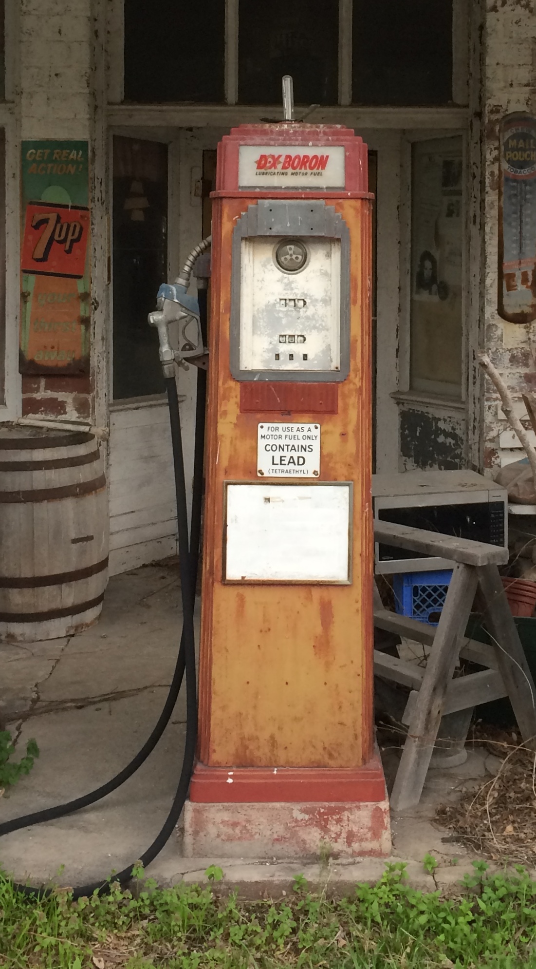
I spent the night of April 16 in Alma, Arkansas, a part of greater Fort Smith, and the next morning I decided to see Fort Smith National Historic Site, so I headed into town via U.S. 71 Business. My breakfast was in a sack in the seat next to me, so I was also looking for a place to stop and eat. Sometimes small parks are just the place, either to eat in the car away from traffic whizzing by, or to find an outdoor table.

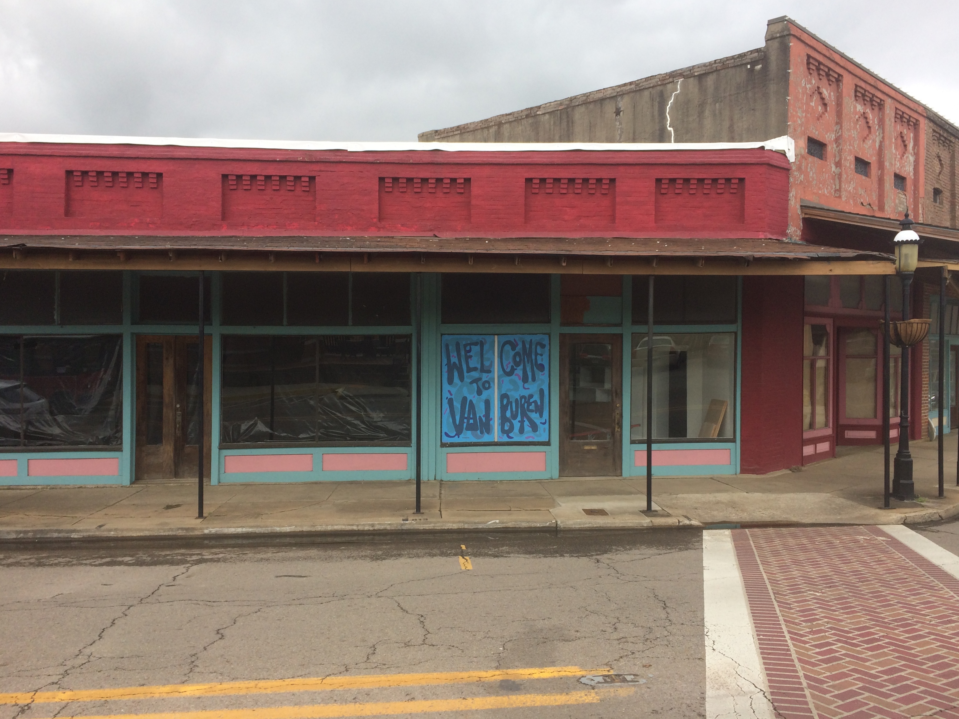
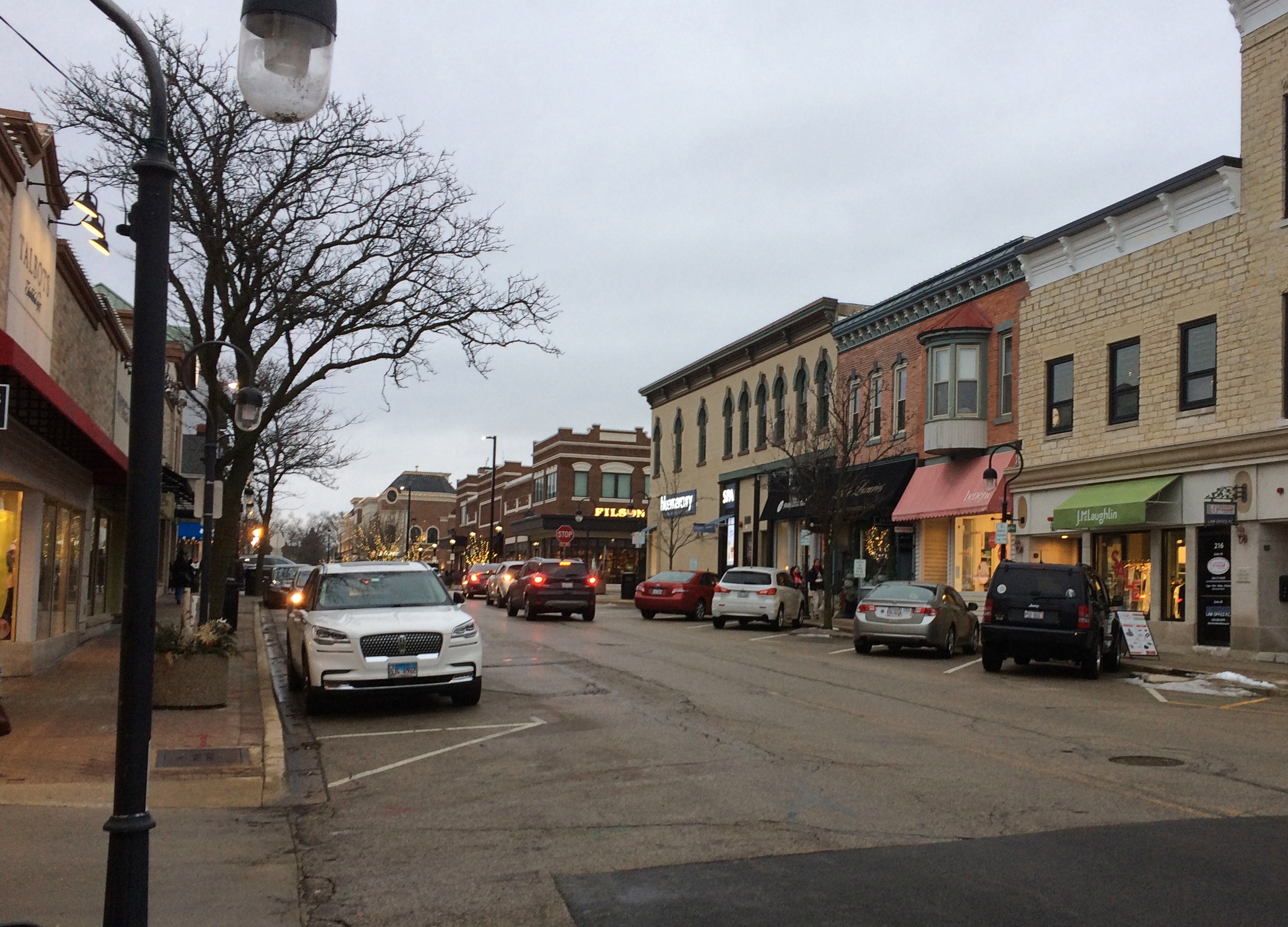
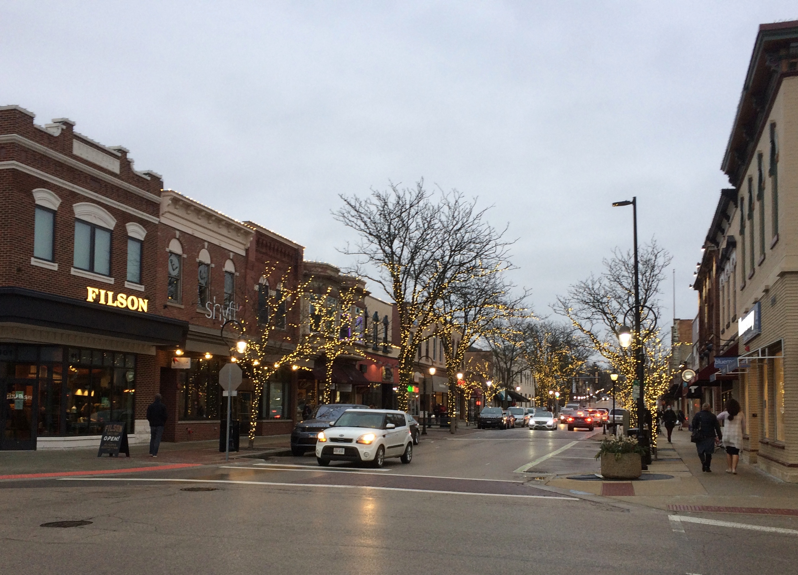
I saw a small sign that said PARK –> , so I turned right off the main road. Soon I found myself at the intersection of 6th and Main Street, main artery of the picturesque Van Buren Historic District. I parked on Main and ate my breakfast, and naturally got out for a walk after that.Van Bureau Main Street

Van Bureau Main Street
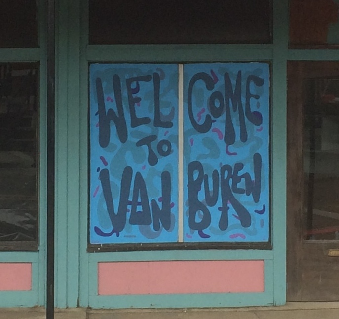
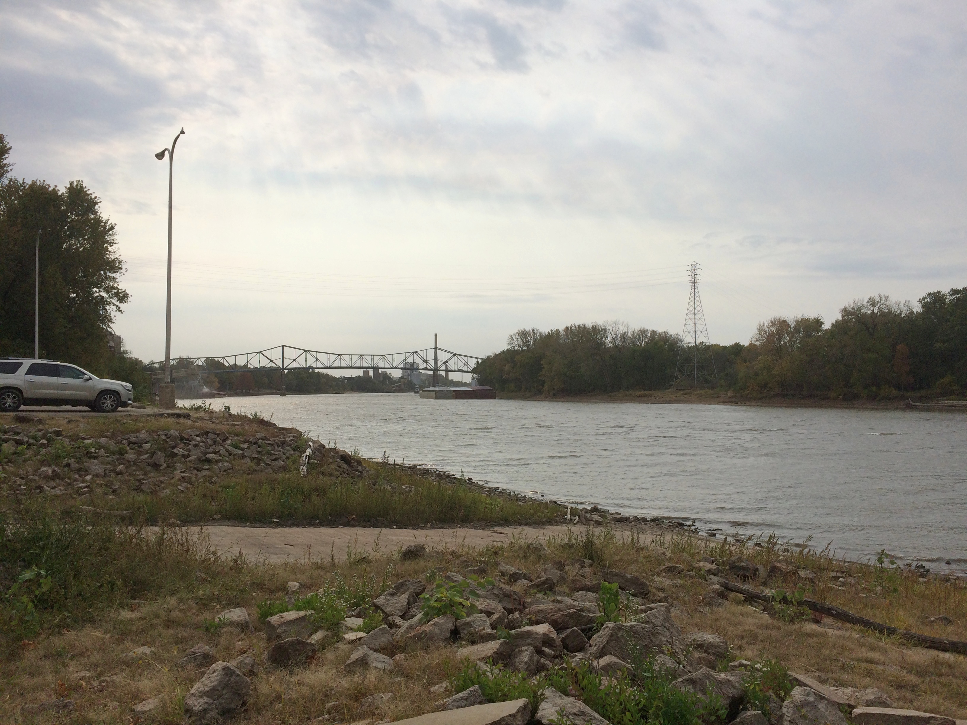
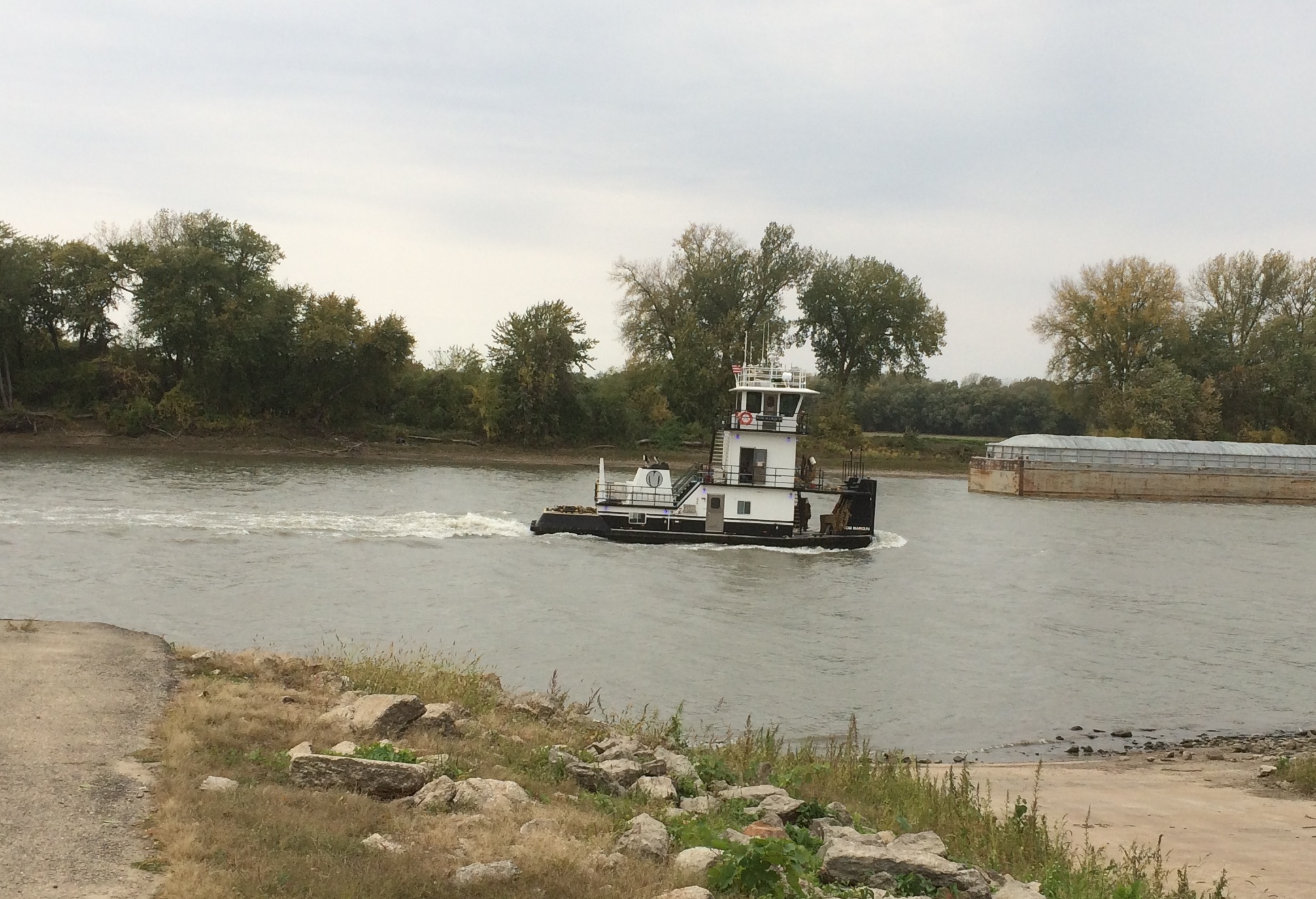
Except for Fort Smith itself, Van Buren is the largest place in the Fort Smith MSA, with about 23,600 residents, founded on the Arkansas River well over a century and a half ago. Van Buren, Arkansas

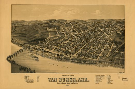
Much more recently, the river got pretty angry.

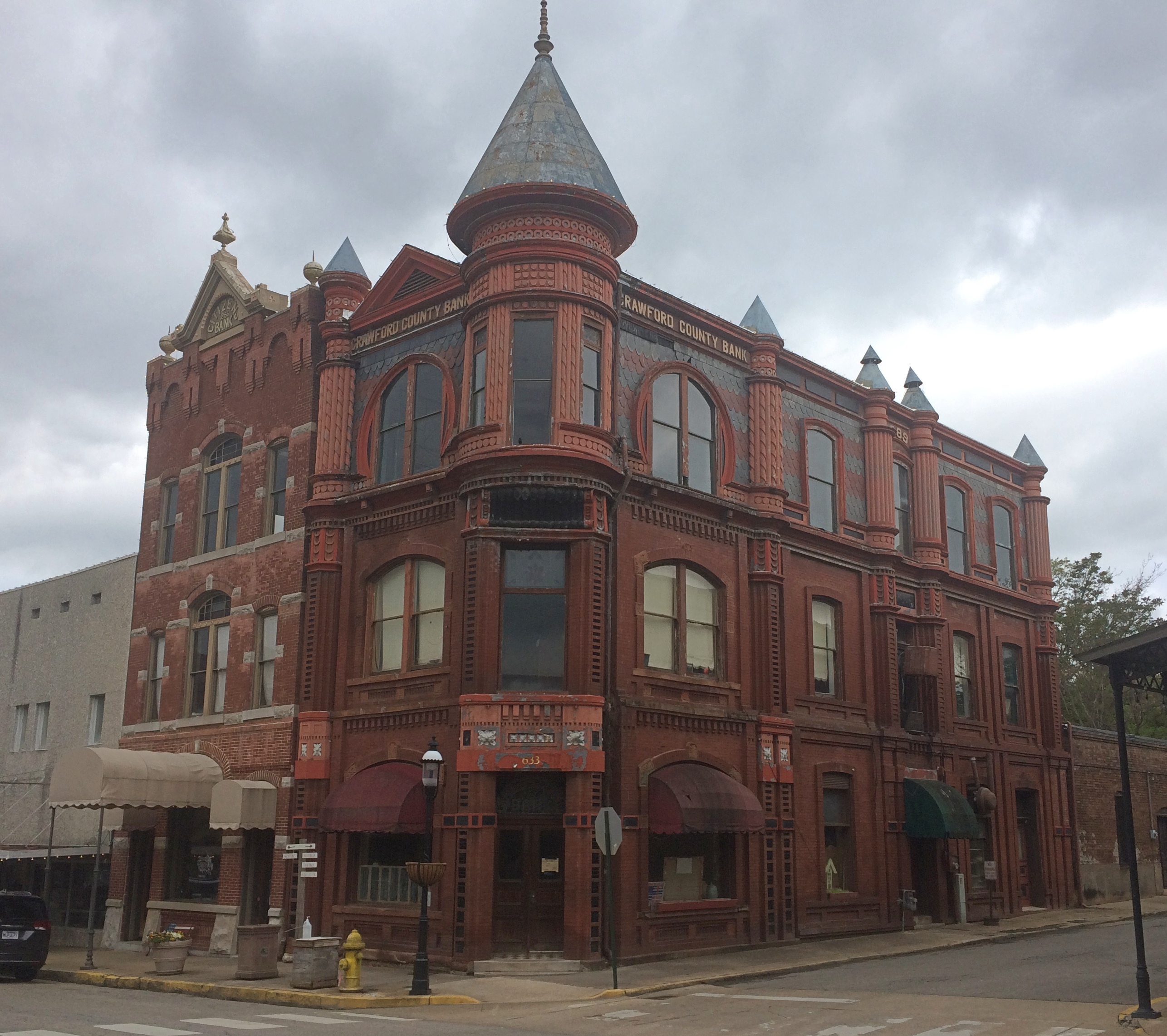
Though a bit chilly that Saturday, the weather was comfortable enough for a walk on Main Street, mostly sporting buildings of a certain vintage.Van Buren Main Street Van Buren Main Street Van Buren Main Street

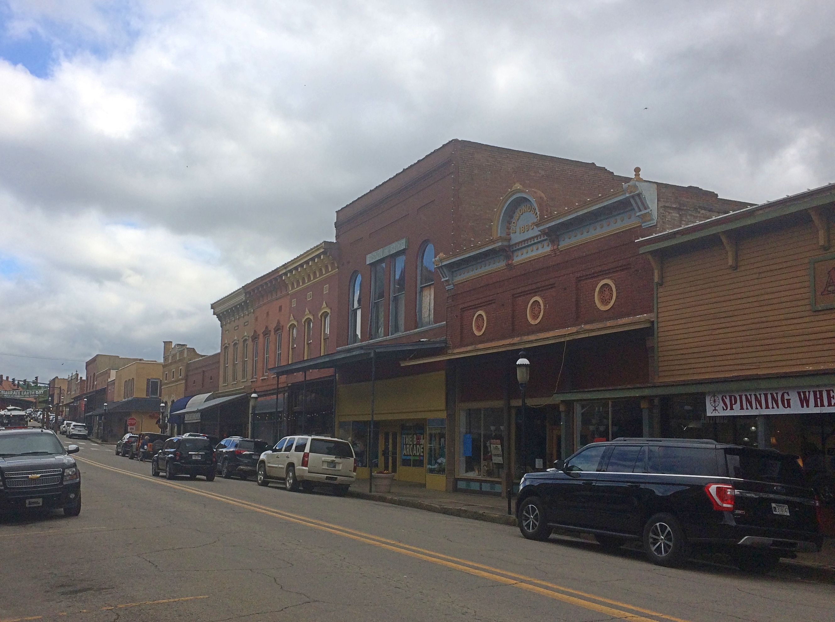
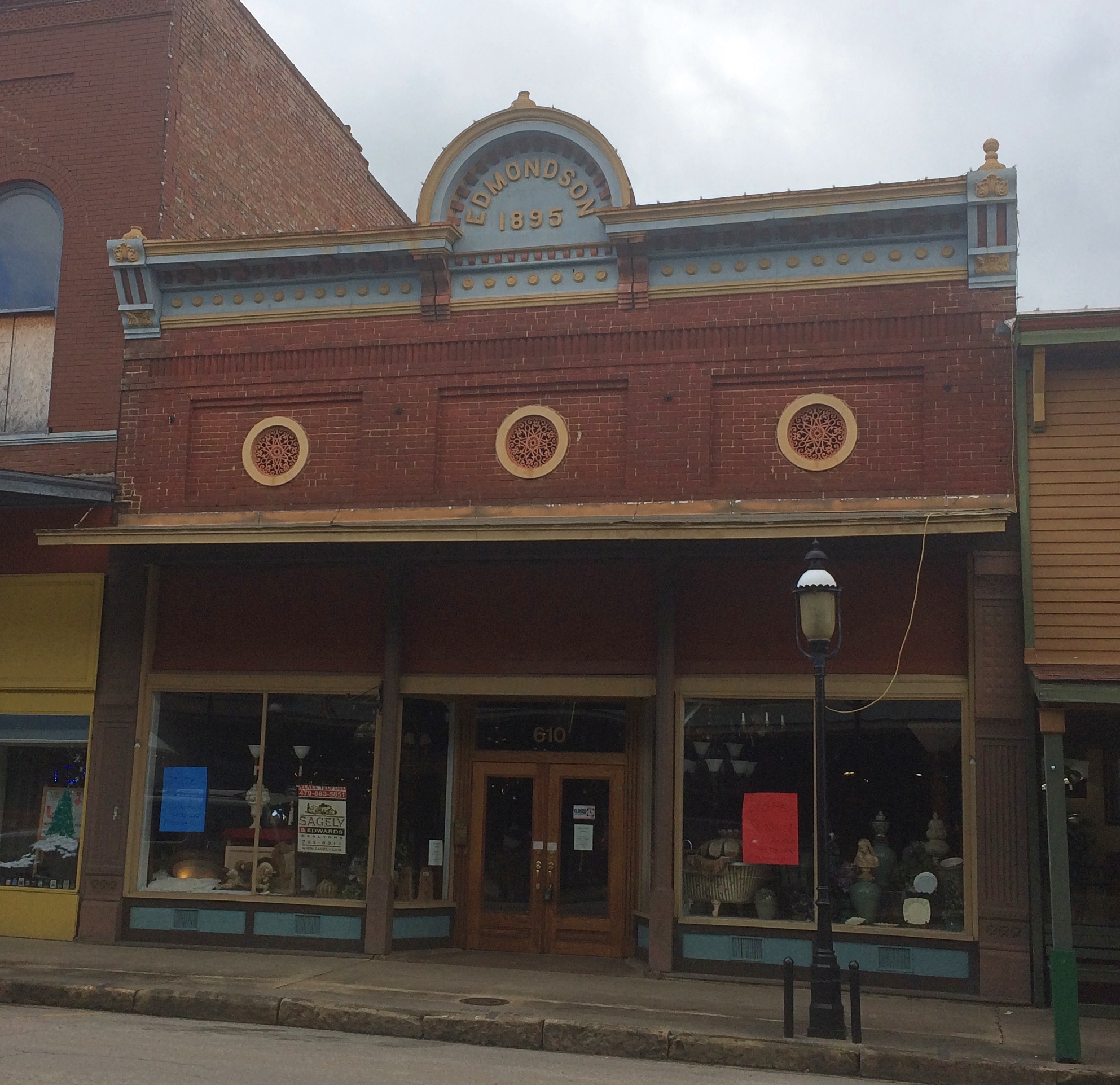
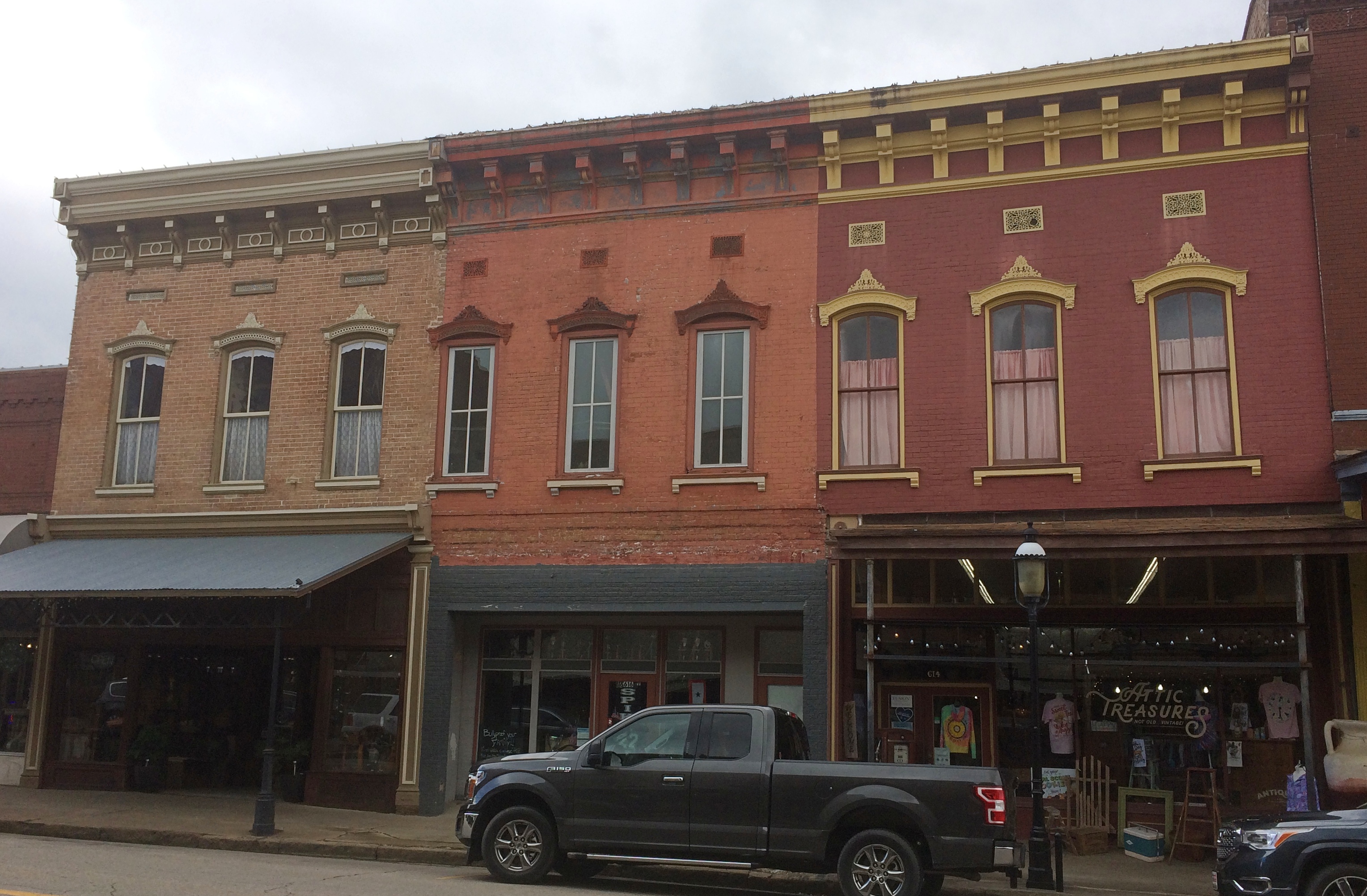
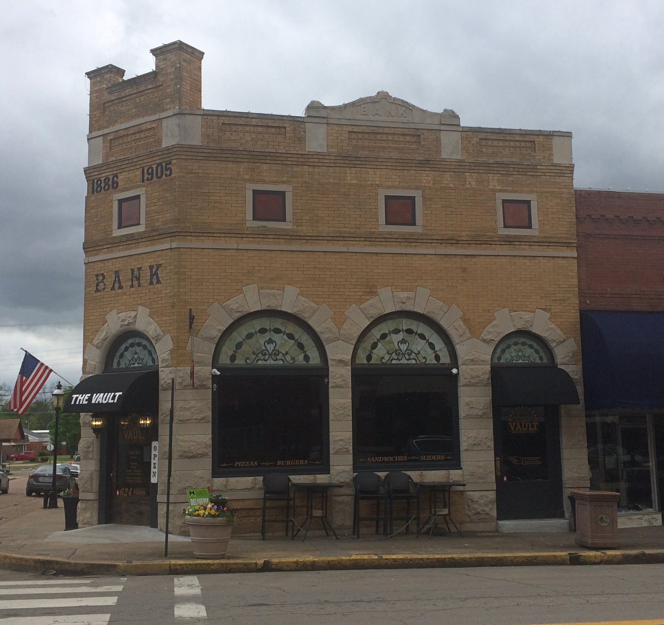
Older buildings, but with distinctly contemporary uses, including the likes of Rethreadz Boutique, The Vault 1905 Sports Grill, Sophisticuts, Corner Gifts, The Vault, and Red Hot Realty.Van Buren Main Street Van Buren Main Street Van Buren Main Street

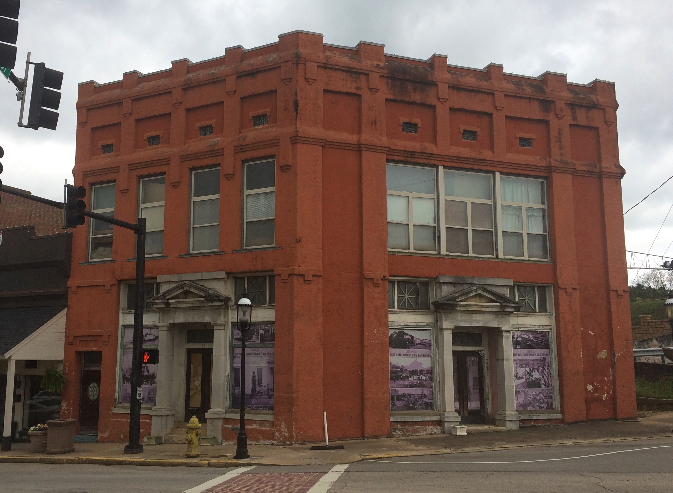
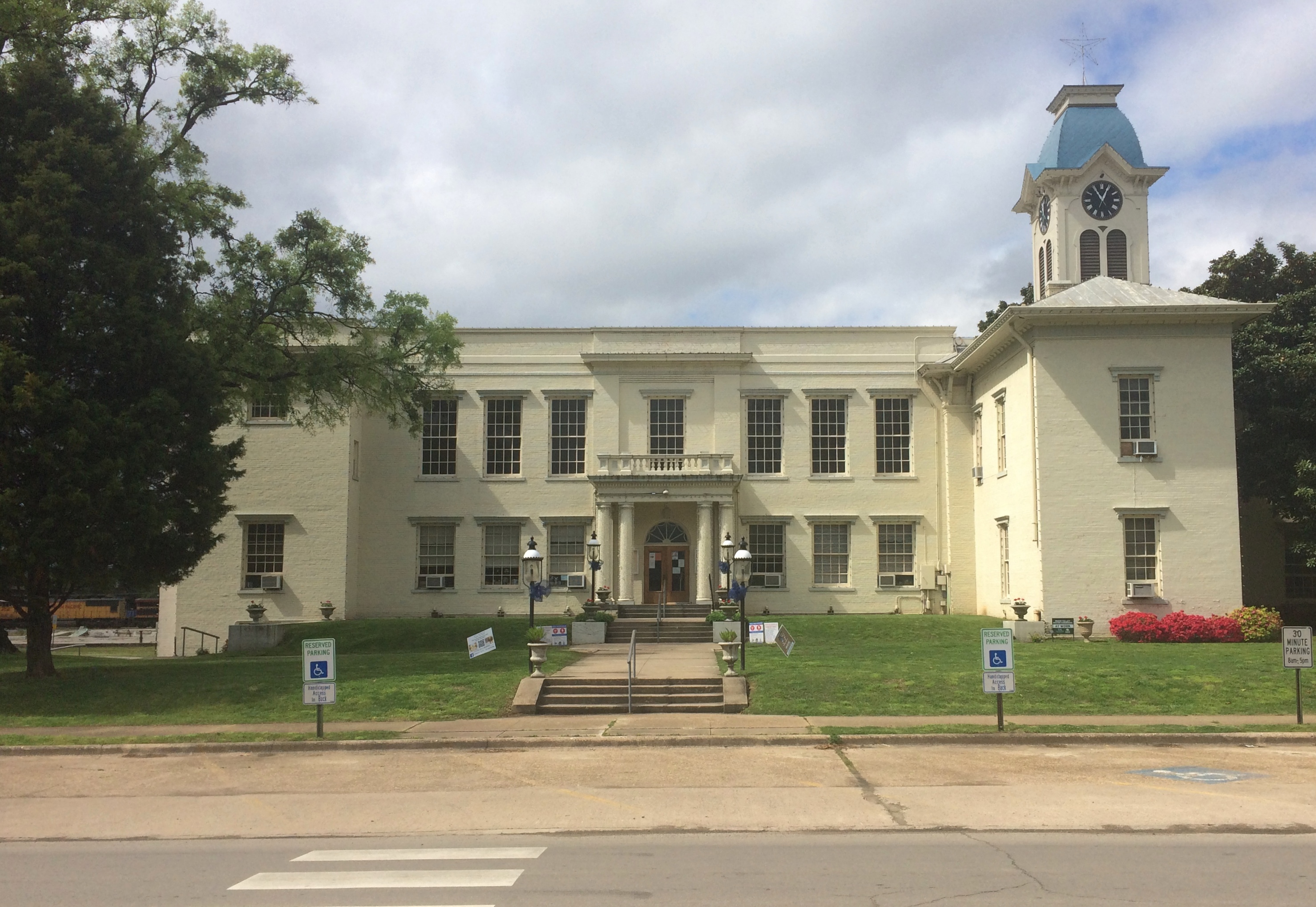
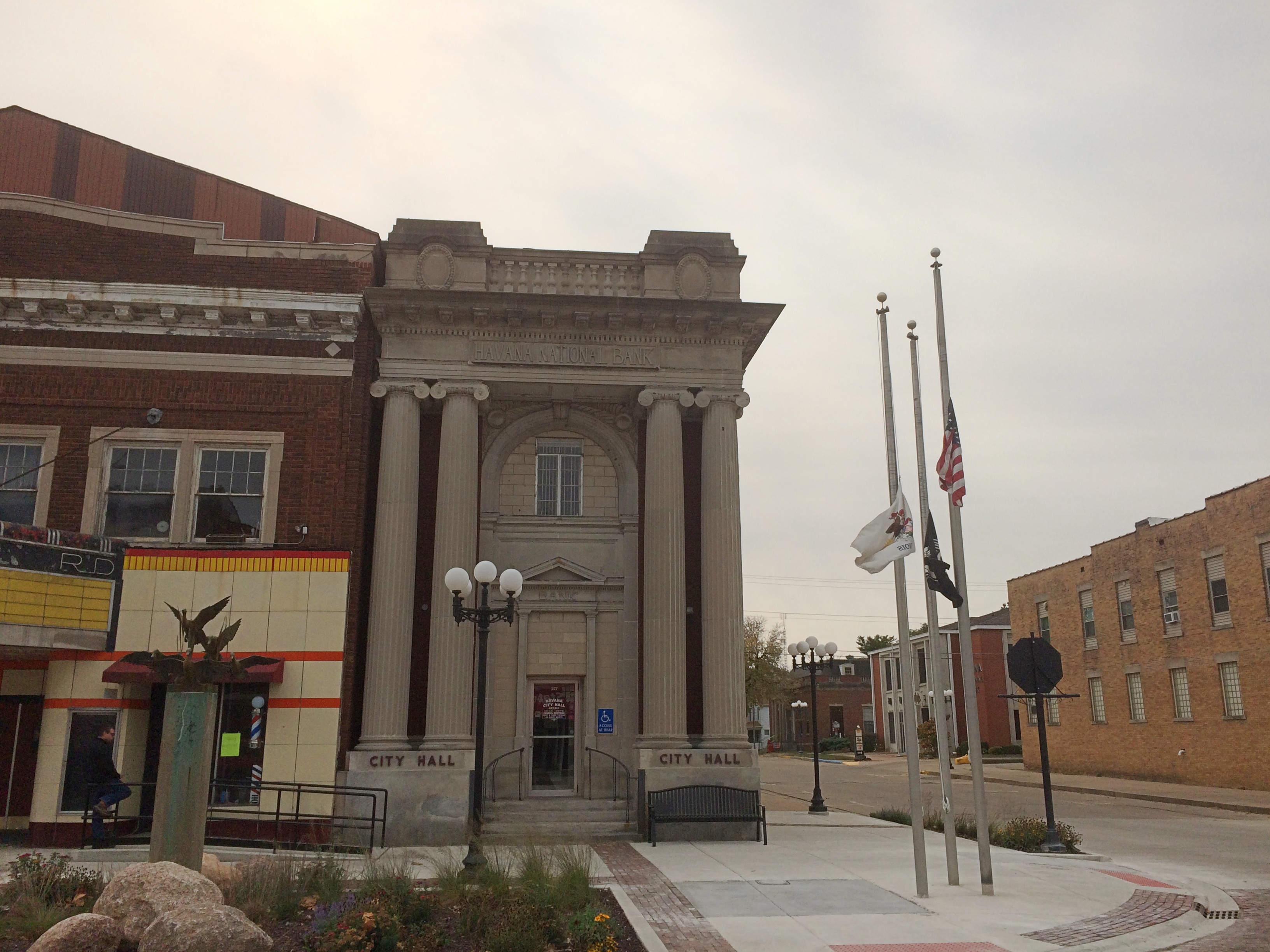
At Main and 4th is the Crawford County Courthouse, dating from 1842 and as such, according to Wiki anyway, the oldest operating courthouse west of the Mississippi.

Crawford County Arkansas Courthouse
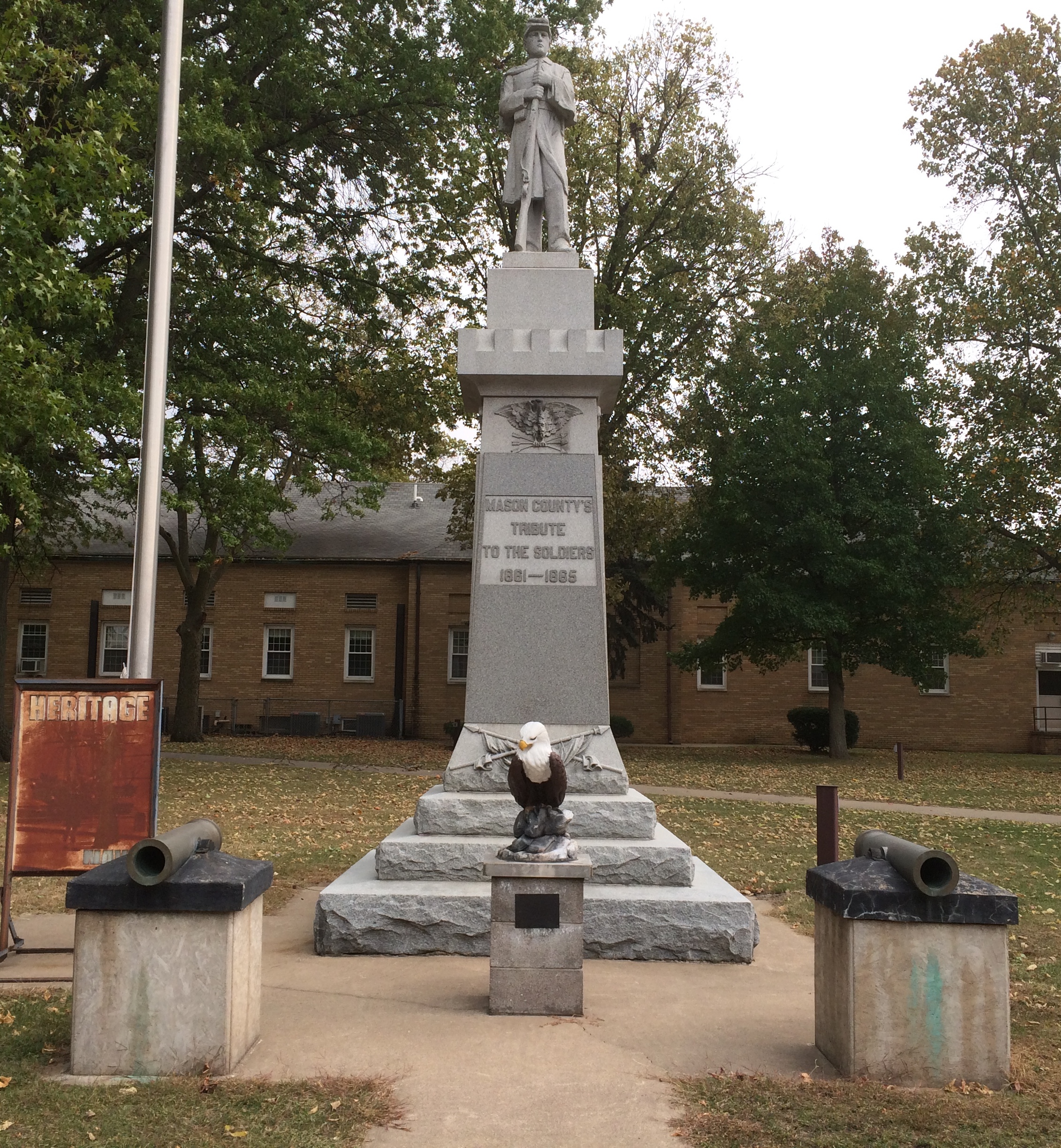
It wouldn’t be much of a Southern courthouse without its Confederate memorial, dating from 1899.Crawford County Arkansas Courthouse

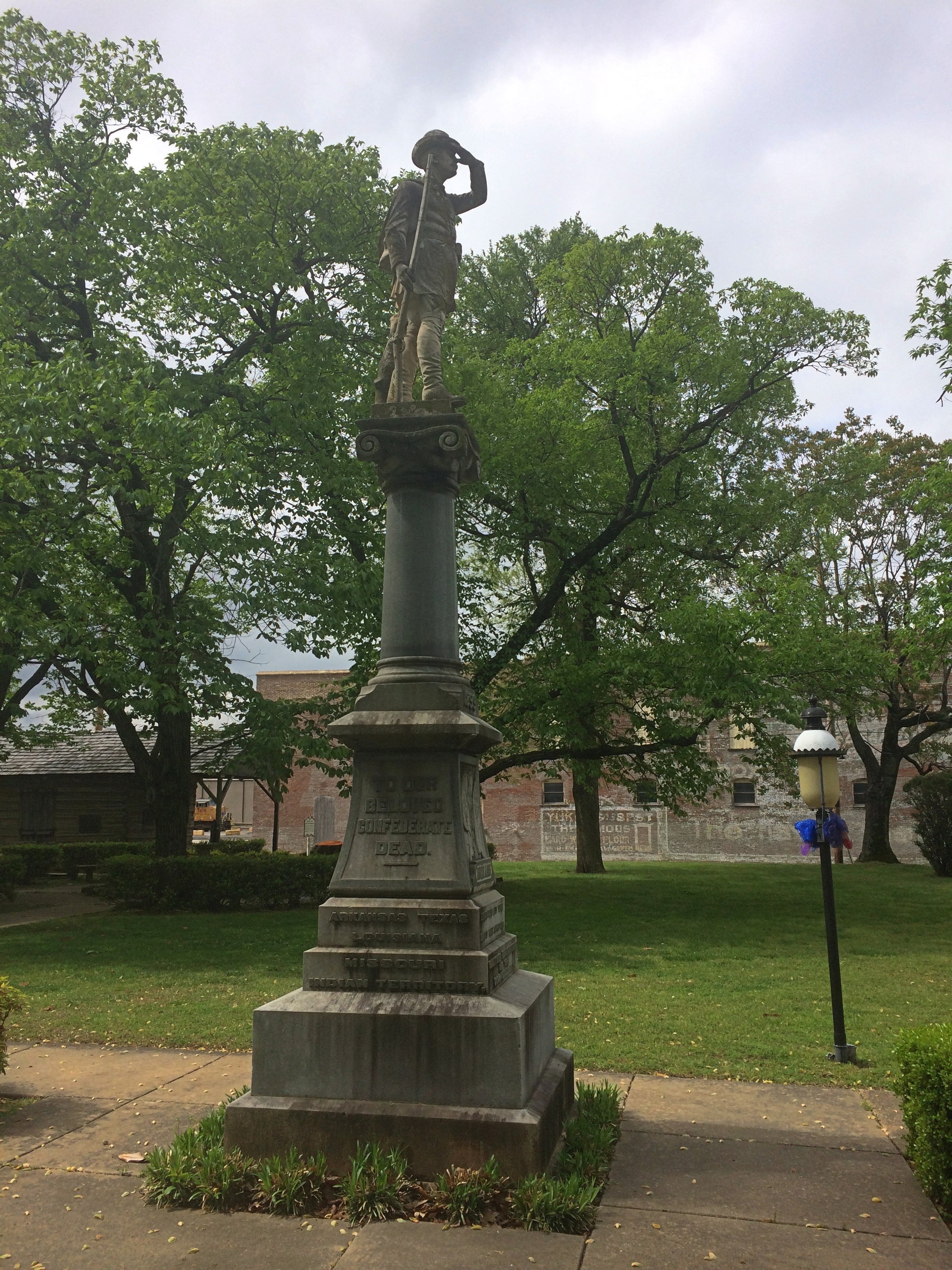
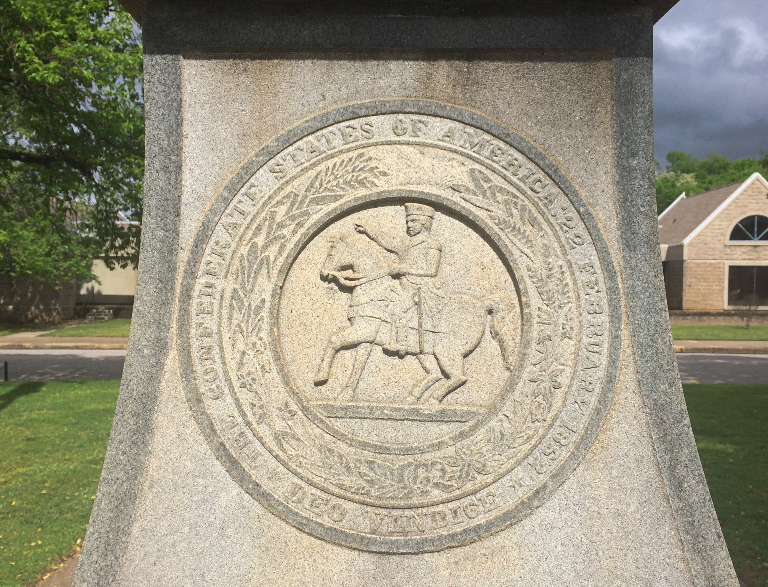
A detail from the base. Something you don’t see too often.
Crawford County Arkansas Courthouse

Something you see even less at courthouses, North or South: a Greek goddess, namely Hebe, goddess of youth and youthful joy.Crawford County Arkansas Courthouse Hebe Crawford County Arkansas Courthouse Hebe

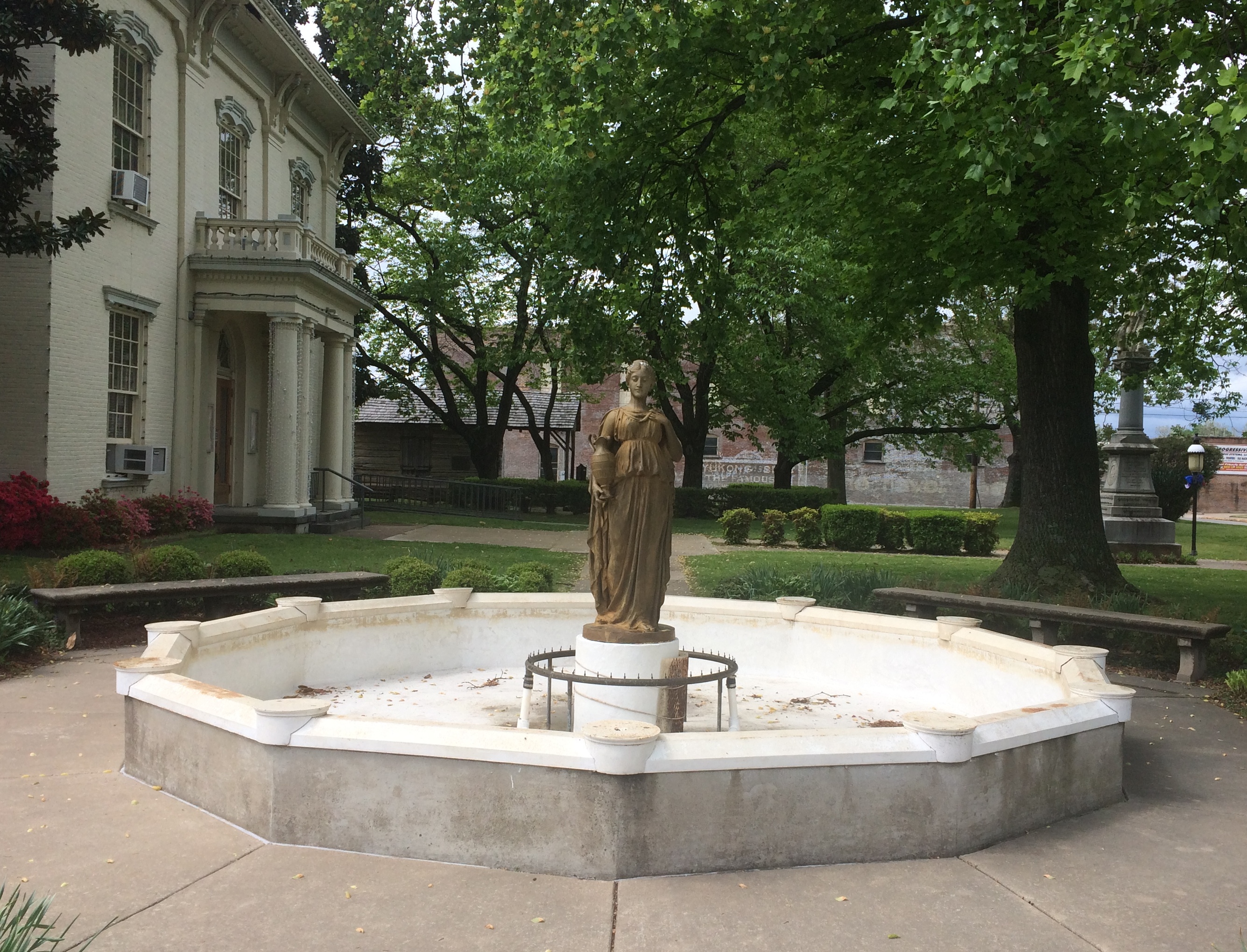
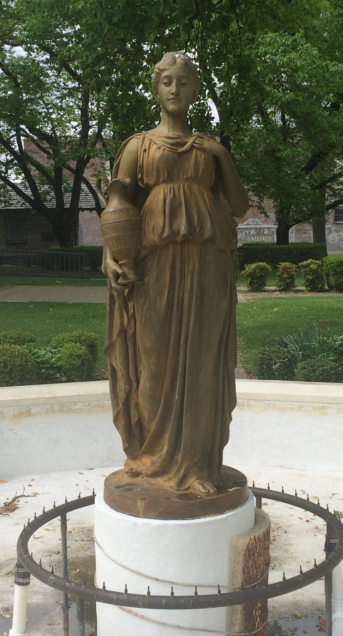
The original was a 1908 gold-painted iron statue, according to a sign on site. This 2003 bronze is a replacement for the original, which now resides in the Crawford County Museum.

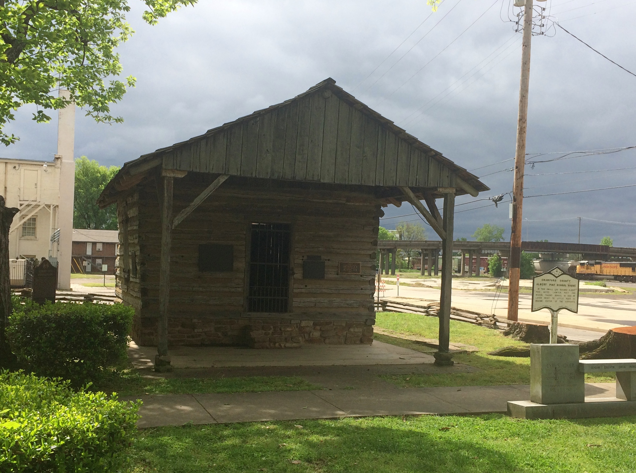
Off to one side of the courthouse is the Albert Pike Schoolhouse, thought to be one of the oldest extant buildings in Arkansas, built ca. 1820 and later relocated to its current spot.
 Albert Pike Schoolhouse

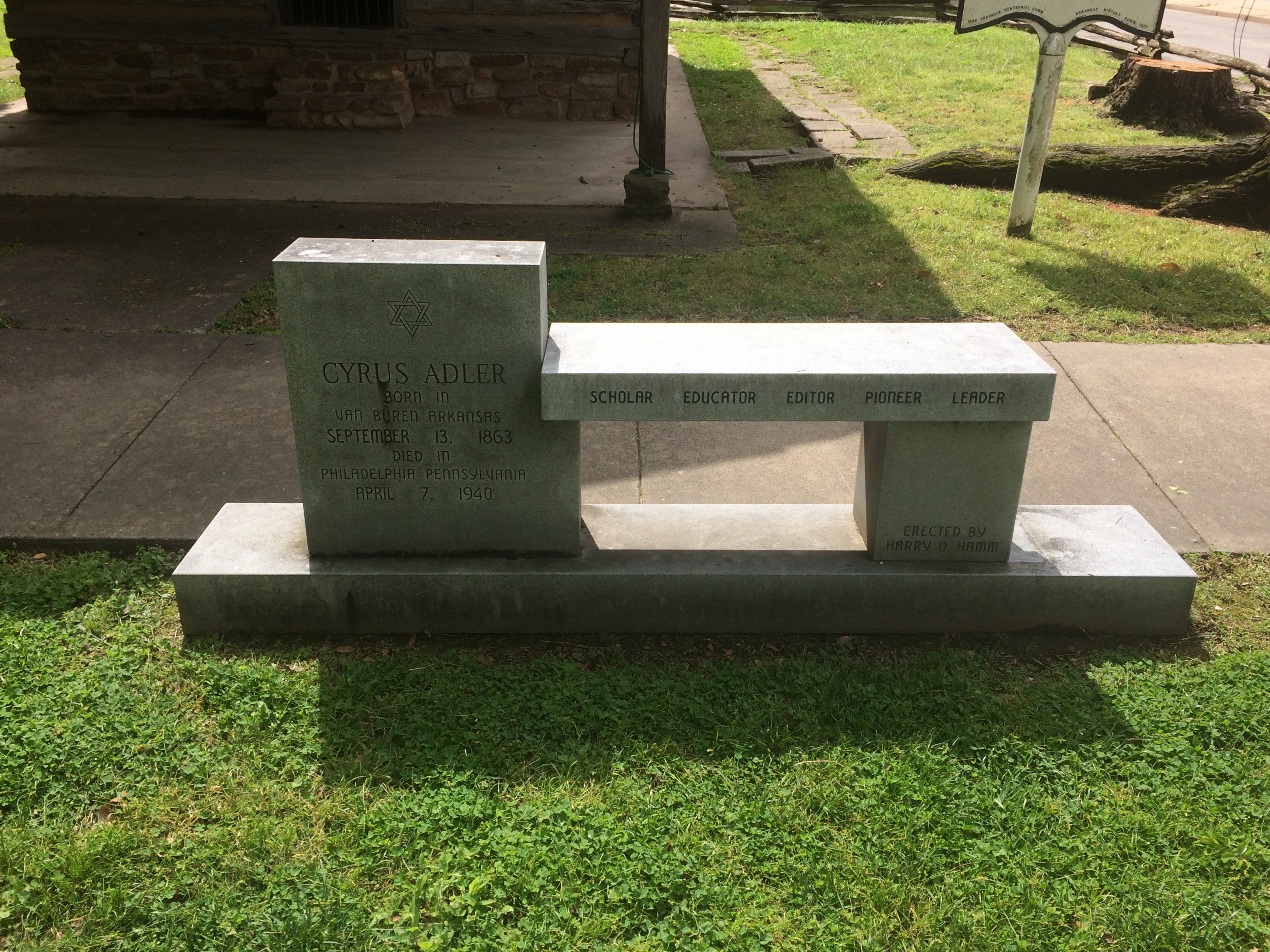
Another memorial on the grounds. I’d never heard of Cyrus Alder before; now I have.

Cyrus Alder memorial
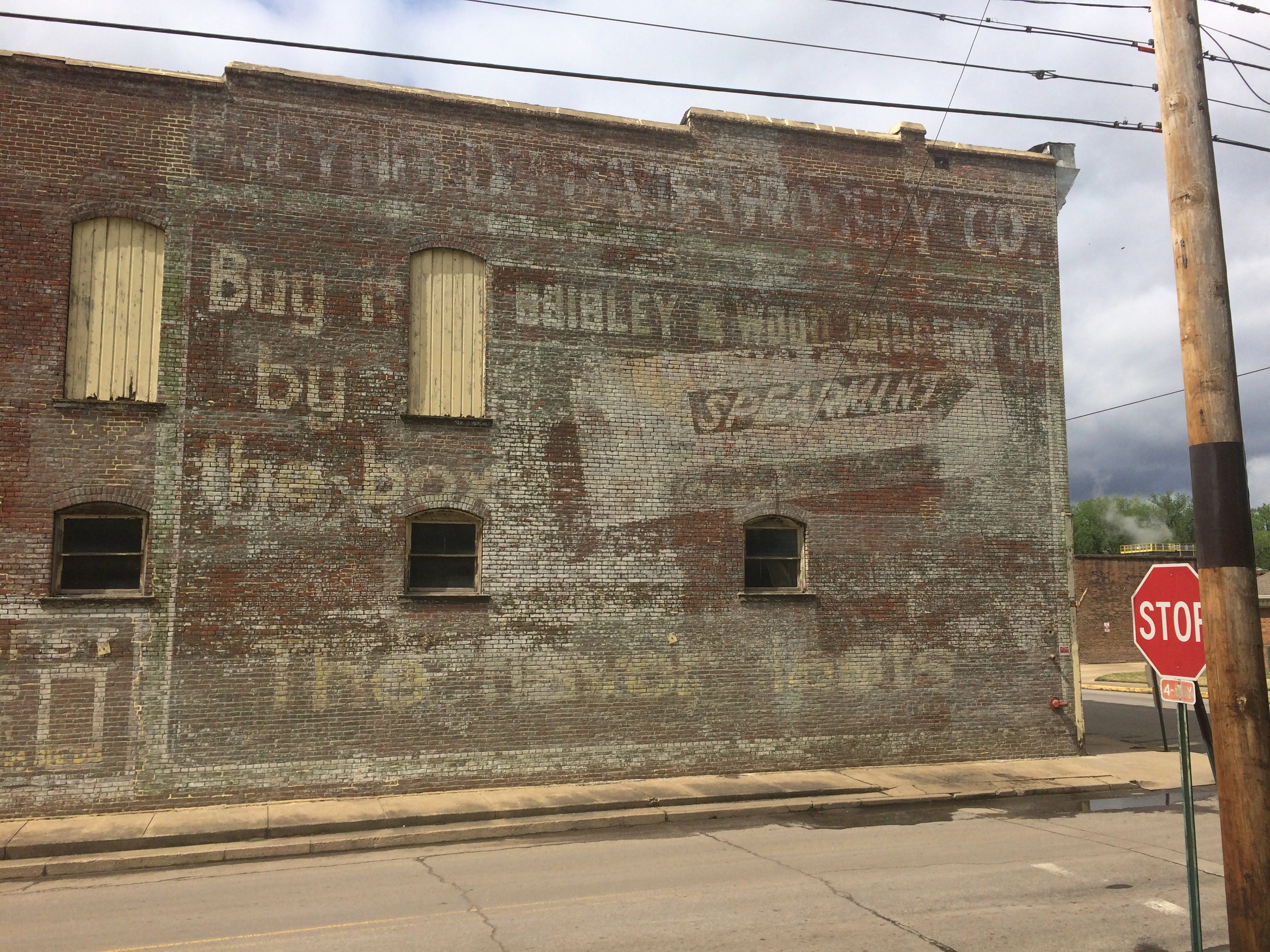
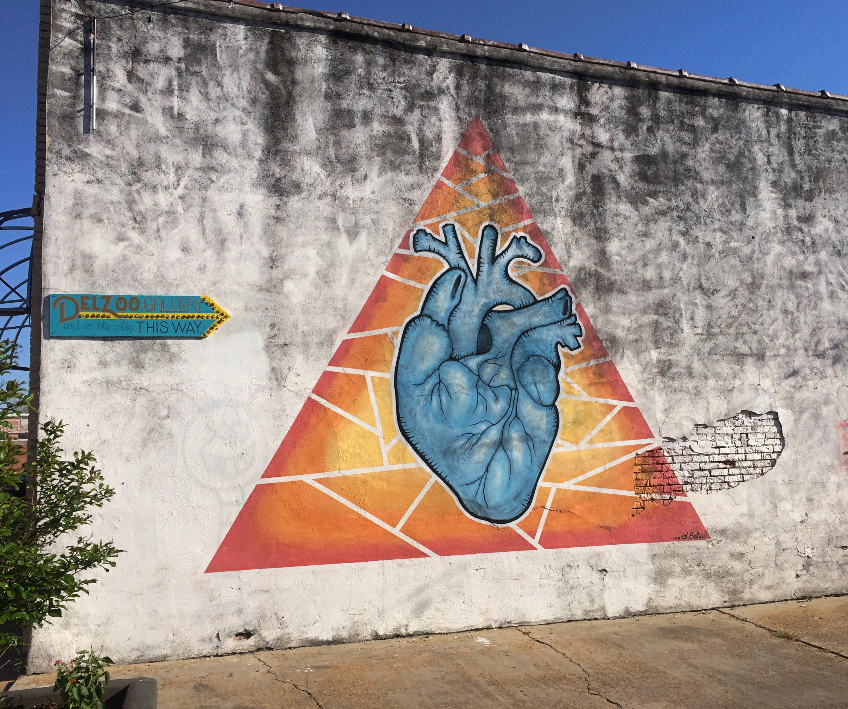
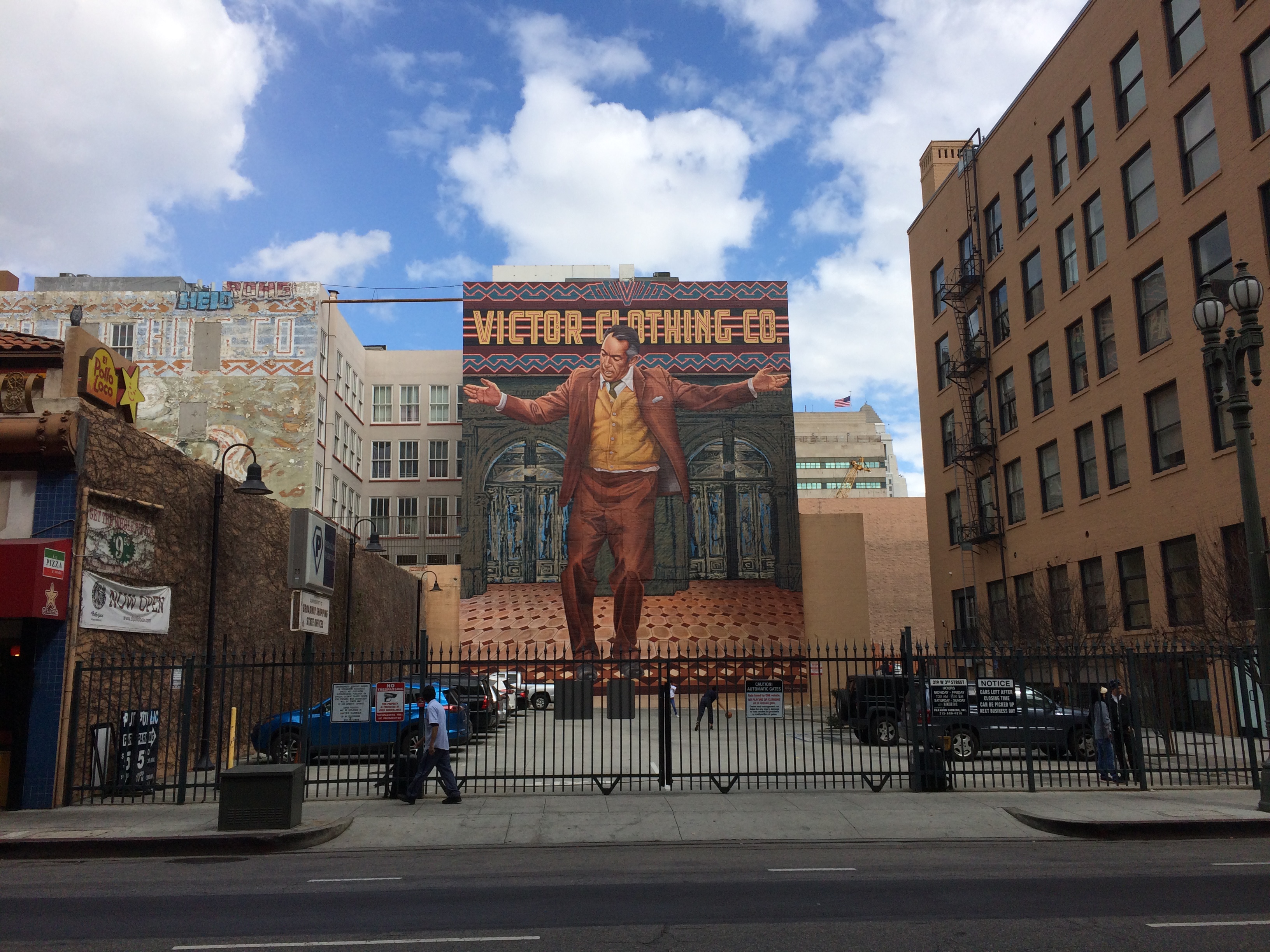
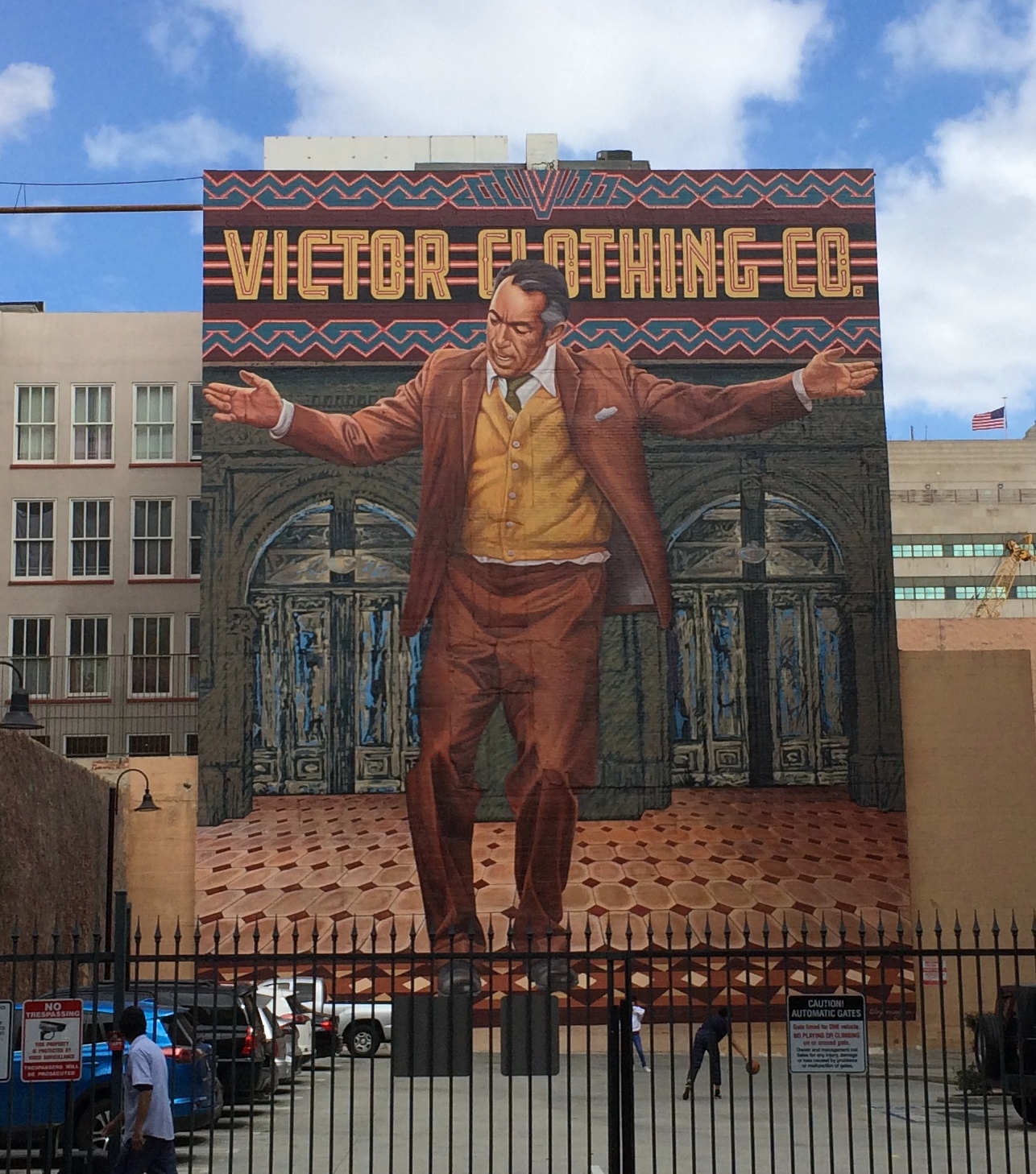
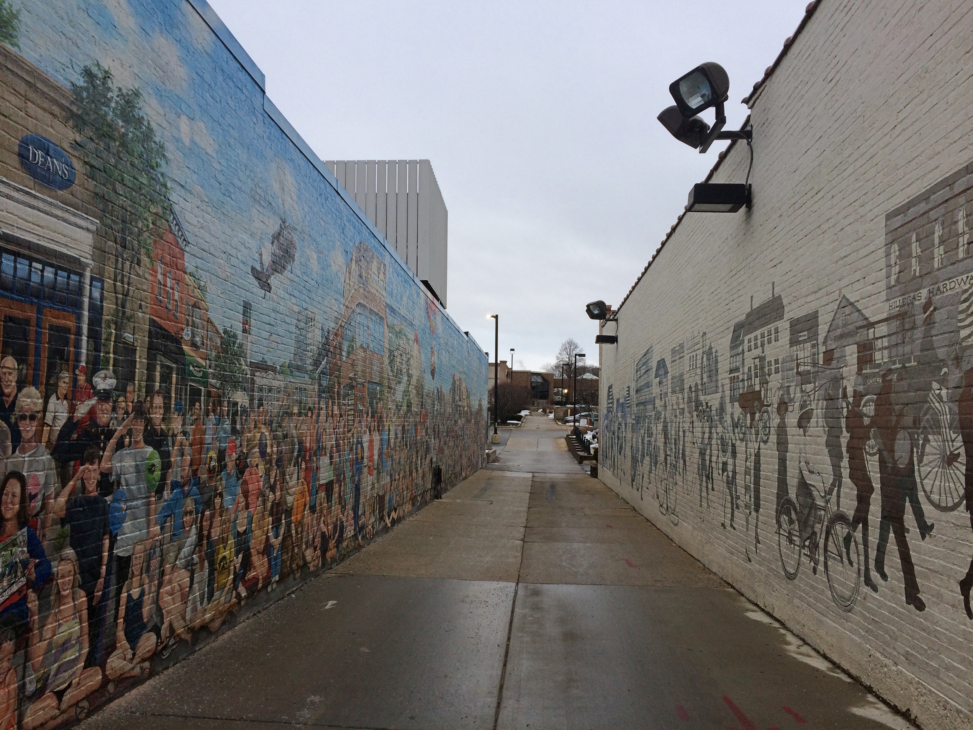
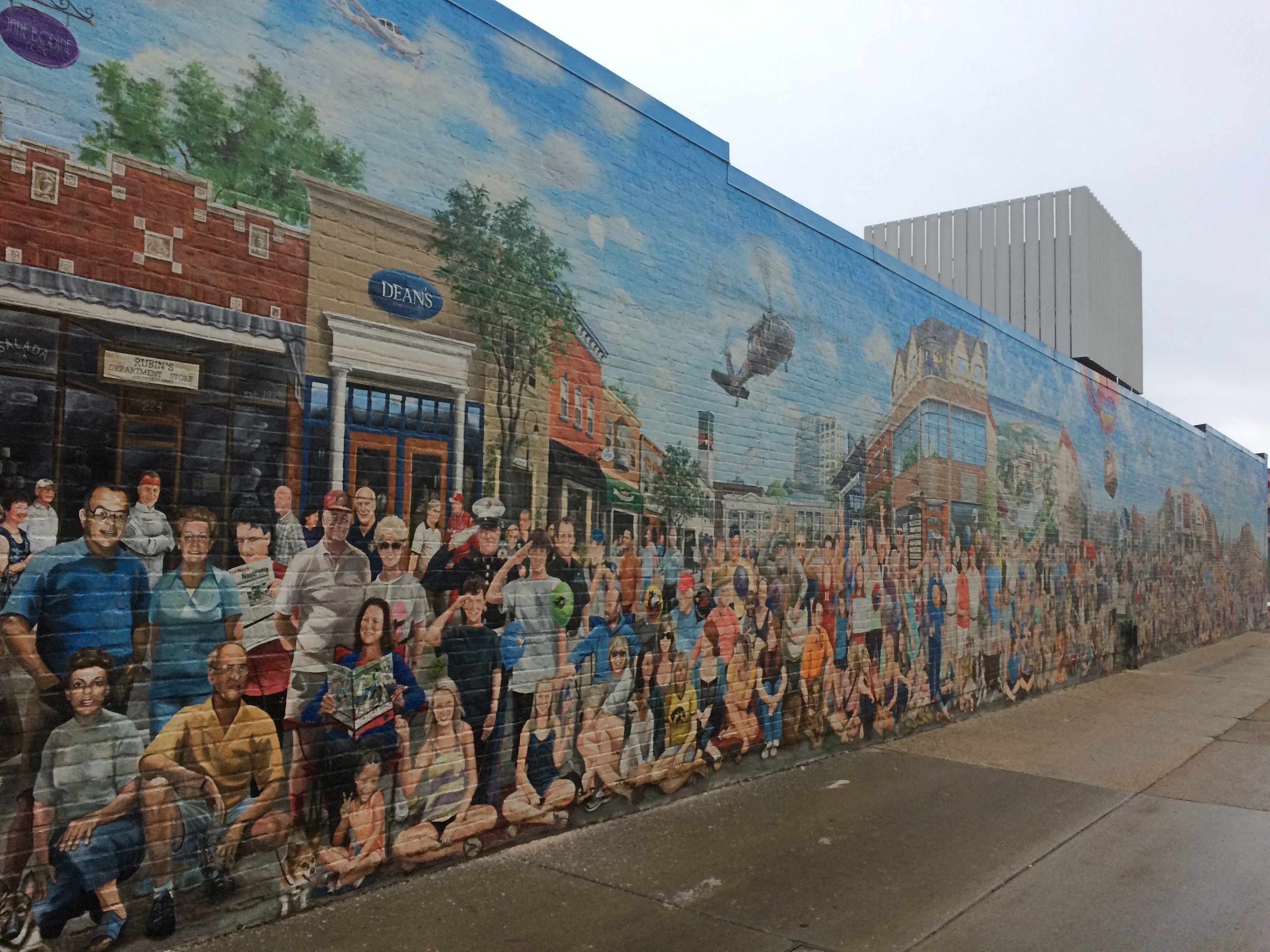
Finally, I spotted some interesting walls in the vicinity of the courthouse. Such as what looks to be a palimpsest ghost sign wall.
Van Buren ghost wall

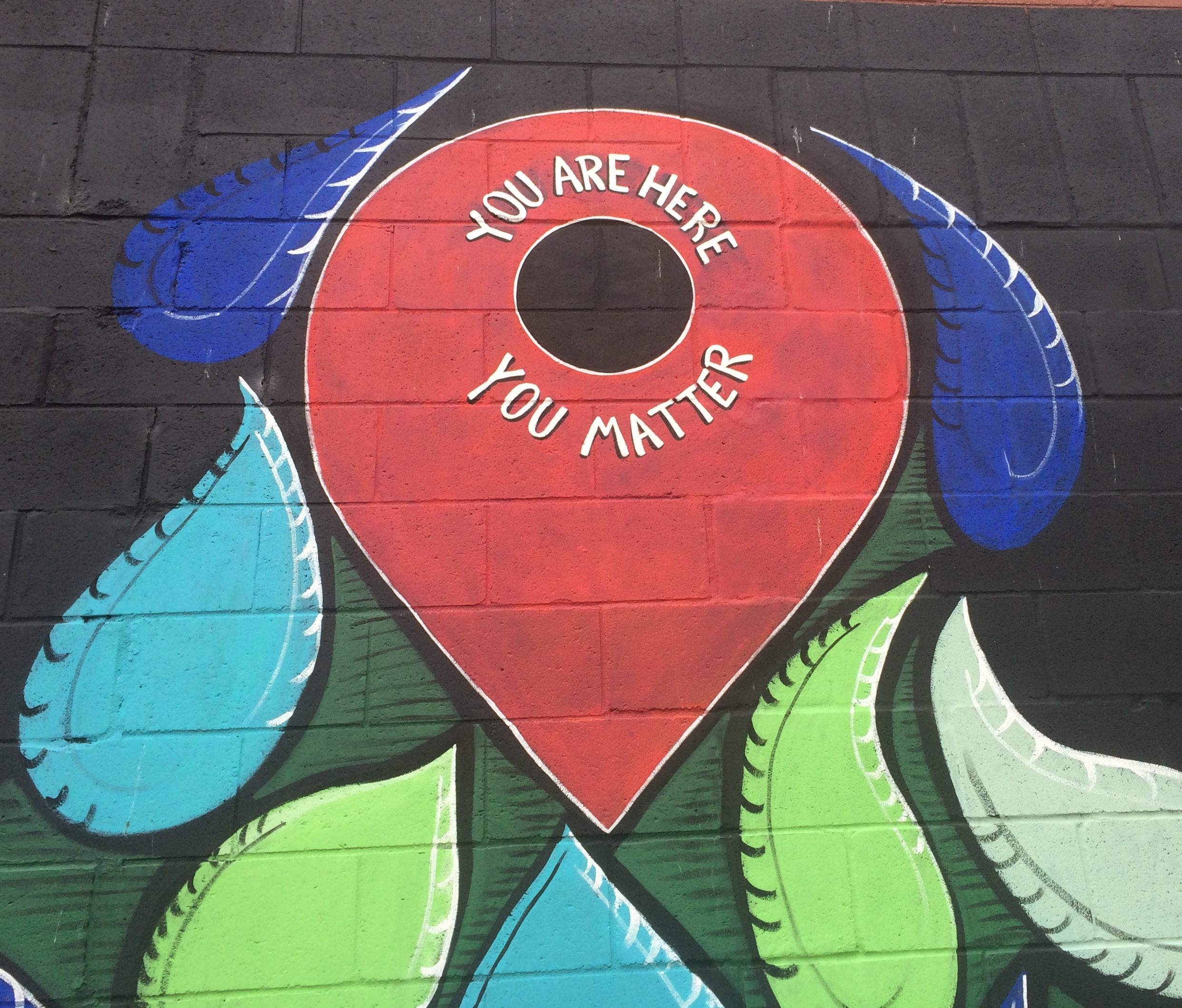
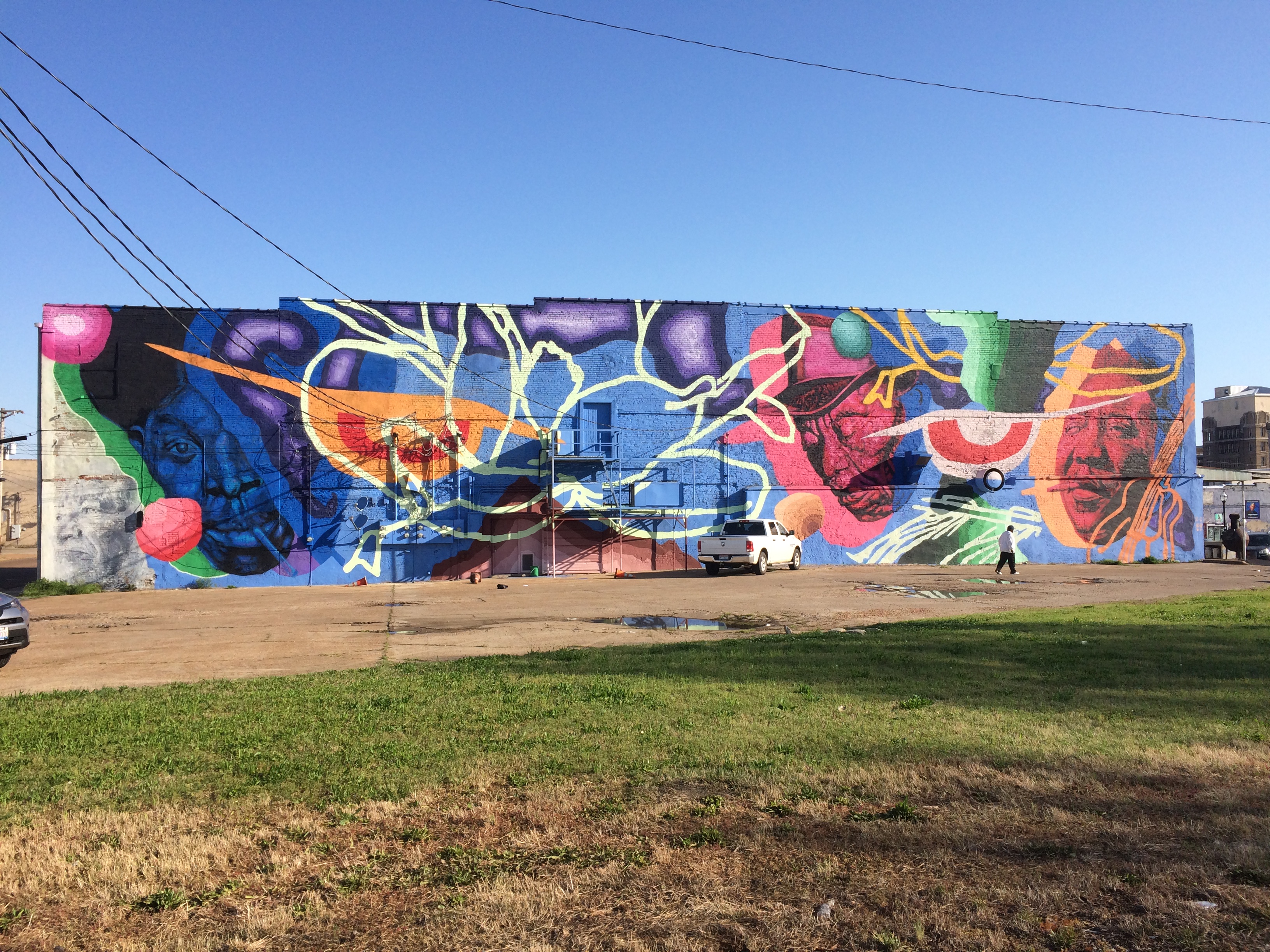
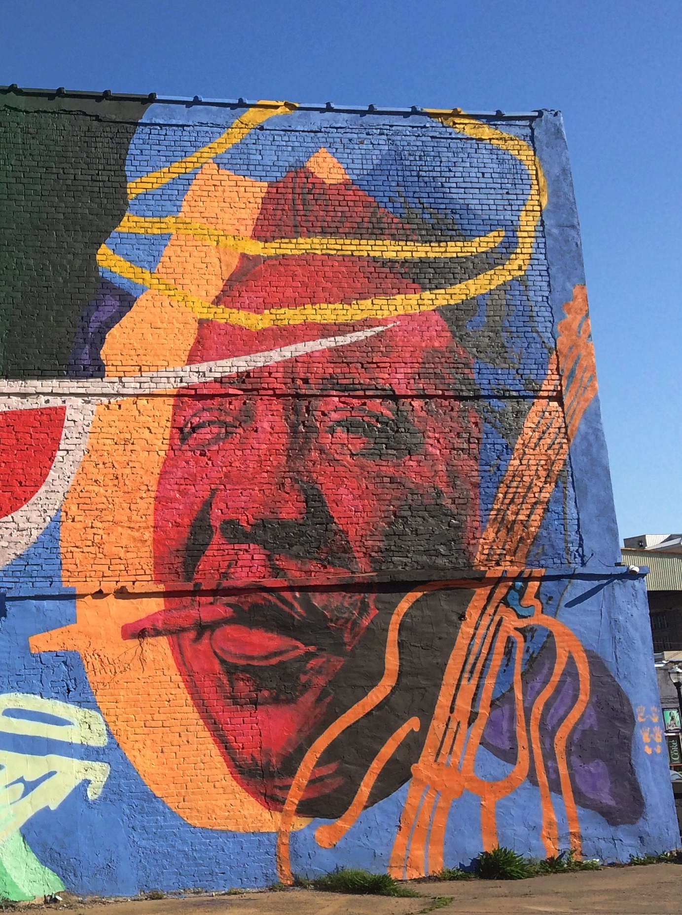
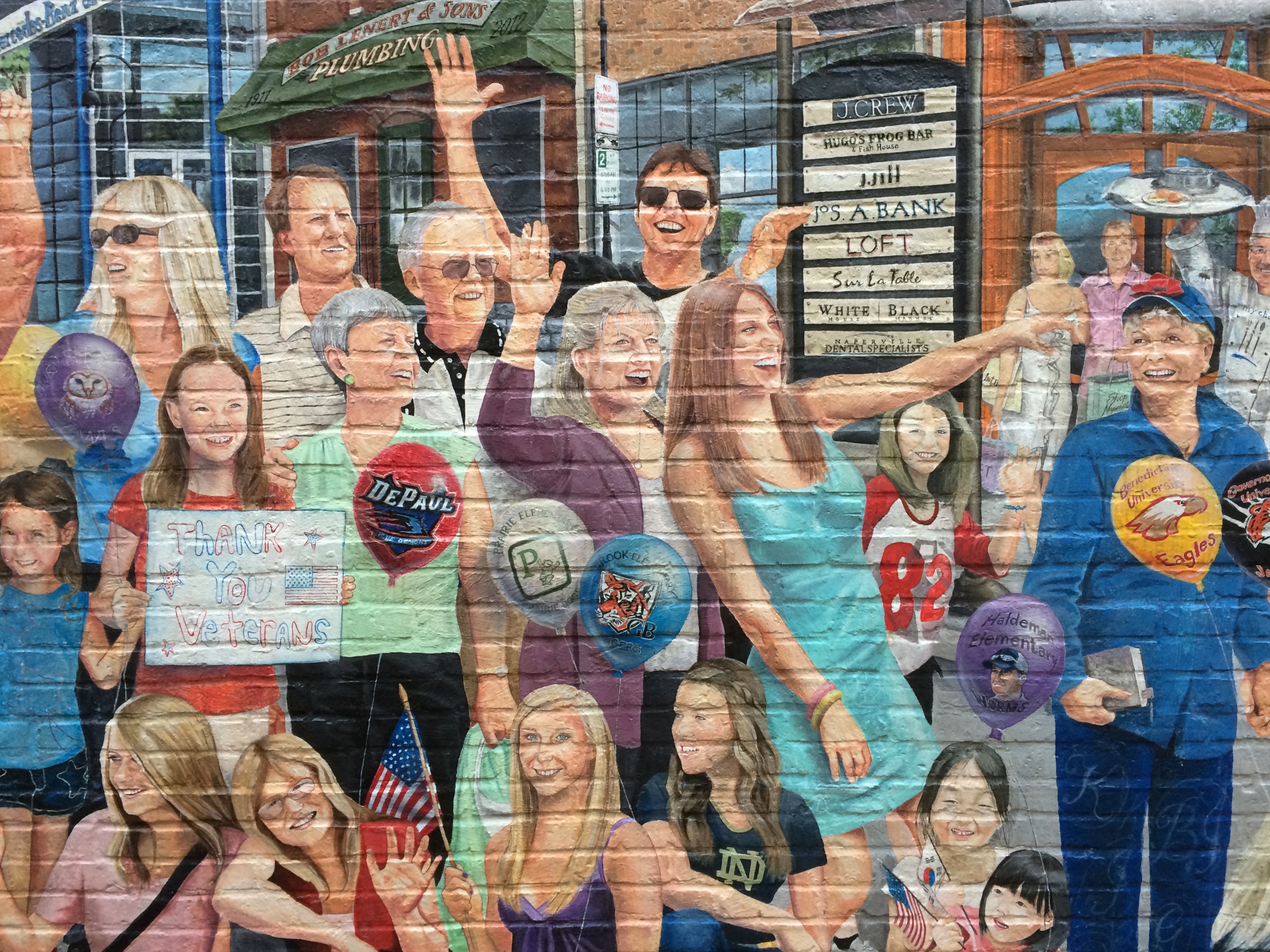
In an alley across the street from the courthouse, this. It’s fairly new, as you’d think. Streetview of May 2018 has a blank wall there.Van Buren You Are Here mural Van Buren You Are Here mural

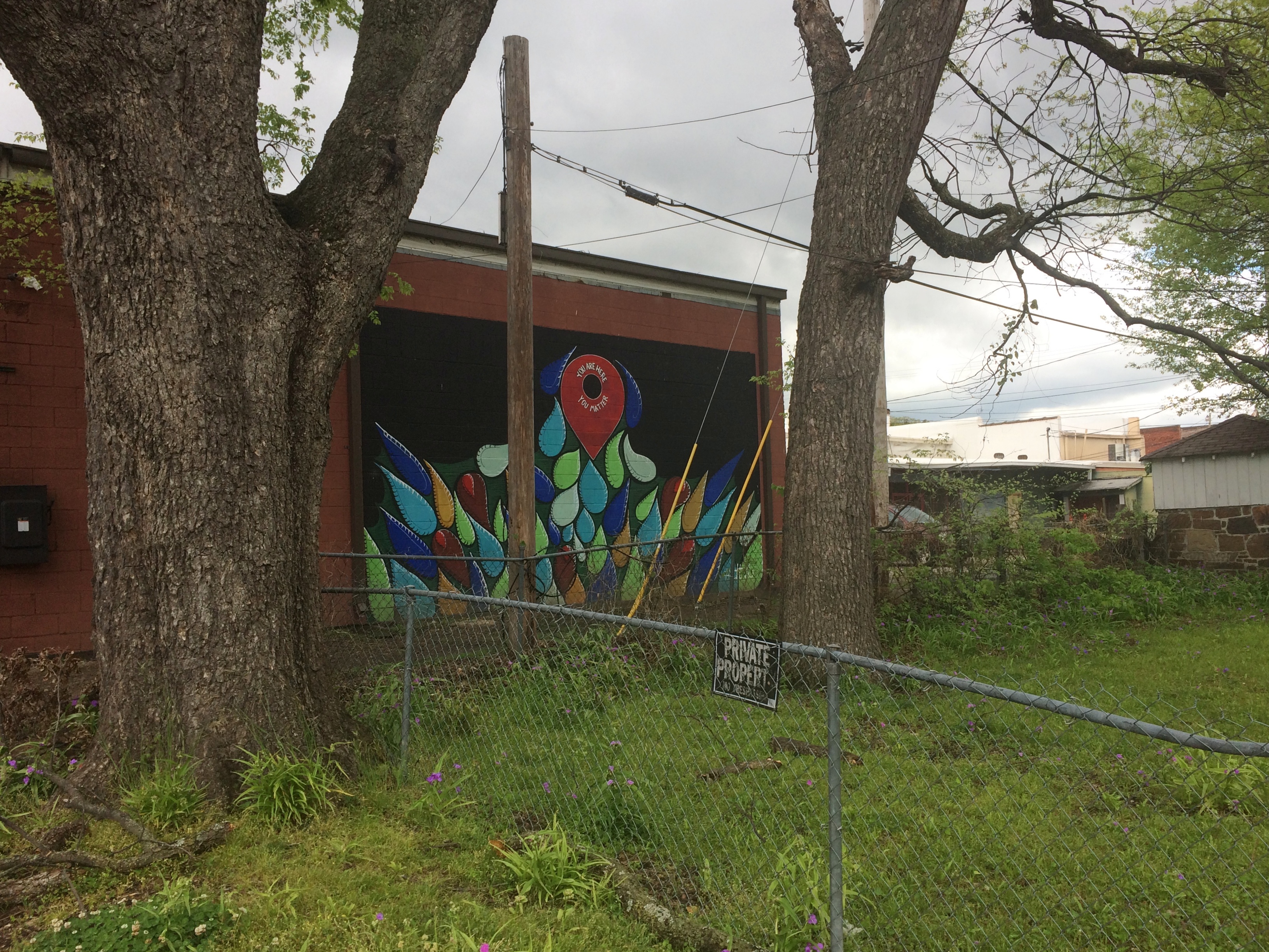
My knee-jerk reaction: izzat so? I never did find the park that I thought might be a good place for breakfast. I did much better, enjoying a bit of serendipity on the road, since I had no inkling of Van Buren, Arkansas before I found myself there.

Vicksburg National Military Park

Had my second shot today. Now George Soros is controlling my brain. Or is it Bill Gates? Hard to keep all these kaleidoscopic alt-realities straight, you know.

Over the years I’ve bypassed Vicksburg, the city and the battlefield, a number of times, so I made a point of visiting this time. I arrived at Vicksburg National Military Park just after noon on April 11, pausing to eat lunch in my car in the parking lot.
Vicksburg National Military Park

At more than 2,500 acres, it’s a large park, but actually smaller than most of the other national military parks, such as Chickamauga (9,500+ acres), Shiloh (9,300+ acres), Fredericksburg (8,400+ acres) or Gettysburg (6,000+ acres). Takes a lot of land to wage near-modern war, after all.

Still, with its winding roads, thick woods, open fields, and monuments of all sizes and descriptions, the place feels expansive. And lush. Full spring had come to Mississippi, along with a pleasant warmth in the air that must have been blazing hot by the time the siege happened in the summer.Vicksburg National Military Park
Vicksburg National Military Park Vicksburg National Military Park

Everywhere you look, a few more cannons. According to Wiki, there are 144 emplaced cannons in the park.Vicksburg National Military Park

Only fitting, since the event was largely a duel of artillery. Also according to Wiki, the park includes 1,325 historic monuments and markers, 20 miles of trenches and earthworks, a 16-mile tour road, a 12.5-mile walking trail, two antebellum homes, and the restored gunboat USS Cairo, the luckless Brown Water Navy vessel that became first ship ever sunk by a remotely detonated mine.

Each state on both sides that sent men to the campaign has a sizable memorial — as many as 117,000 soldiers took part — but it looks like none is more sizable than Illinois.Vicksburg National Military Park - Illinois Vicksburg National Military Park - Illinois

“The design was by W. L. B. Jenney and sculptor was Charles J. Mulligan. Jenney served with distinction as a major in the Union Army during the Civil War as an engineer,” says the National Park Service.

“Stone Mountain (GA) granite forms the base and stairway. Above the base is Georgia white marble. There are forty-seven steps in the long stairway, one for each day of the Siege of Vicksburg.

“Modeled after the Roman Pantheon, the monument has sixty unique bronze tablets lining its interior walls, naming all 36,325 Illinois soldiers who participated in the Vicksburg campaign. Atop the memorial sits a bronze bald eagle sculpted by Frederick C. Hibbard of Chicago, who would also sculpt the statue of General Ulysses S. Grant in the park.” Vicksburg National Military Park - Illinois
Vicksburg National Military Park - Illinois

Near the Illinois memorial is one of the aforementioned antebellum homes, the well-restored Shirley House, which survived 1863 against all odds.

As it is now.
Vicksburg National Military Park - Shirley House

As it was then.
Shirley-House-During-Siege-of-Vicksburg

Just down the road from the Shirley House is a statue of Gen. John Logan, who commanded the 3rd Division of the XVII Corps of the Union Army in this area, and who ought to be better known for a number of reasons, such as fostering Memorial Day and for his change of heart about black people during the war.
Vicksburg National Military Park - John Logan

“But what of JOHN A. LOGAN? I will tell you. If there is any statesman on this continent, now in public life, to whose courage, justice and fidelity, I would more fully and unreservedly trust the cause of the colored people of this country, or the cause of any other people, I do not know him. Since [Charles] Sumner and [Oliver. P.] Morton, no man has been bolder and truer to the cause of the colored man and to the country, than has JOHN A. LOGAN. There is no nonsense about him. I endorse him to you with all my might, mind, and strength, and without a single shadow of doubt.”

— Frederick Douglass’ endorsement of John Logan during the 1884 presidential election.

Because of heavy rains (I assume) some of the roads were closed, including the one to Grant’s headquarters, where his equestrian statue is, so I didn’t see that.

Moving along, I came to another impressive state memorial: Mississippi. The home team, so to speak.Vicksburg National Military Park - Mississippi Vicksburg National Military Park - Mississippi

Wisconsin. That’s no mere eagle on top, but Old Abe.
Vicksburg National Military Park - Wisconsin

Missouri, which is dedicated to combatants on both sides.Vicksburg National Military Park - Missouri

Besides the state memorials, there was an array of statues and stones and plaques honoring other men and groups of men, or detailing movements during the siege.Vicksburg National Military Park Vicksburg National Military Park Vicksburg National Military Park Vicksburg National Military Park

The USS Cairo, partly protected from the elements. Its visitor center was closed, not for Sunday but still for the pandemic.
Vicksburg National Military Park

The view from Fort Hill.
Vicksburg National Military Park

I’m glad I got around to Vicksburg. Also glad to report a fair number of other visitors, most clearly tourists from other places, though some people were out jogging or walking their dogs. Best of all, I spotted some people with their kids (or grandkids) in tow. Maybe being the weekend had something to do with that, or that the city of Vicksburg is fair-sized. Even so, I remember how few other people I saw on the summer day I visited Shiloh — and only one or two families with children.

Clarksdale and Vicksburg Walkabouts

No question about it, Clarksdale, Mississippi, is a poor Delta town. The median household income in Coahoma County, of which Clarksdale is the seat and only town of any size, is $29,121 as of 2019, according to the Census Bureau, and over 38% of the population lives below the federal poverty level. For all of Mississippi — by household income the poorest state in the union — median household income is just over $45,000, and 19.6% of the population lives in poverty. (The U.S. figures are about $68,700 for median household income, with 10.5% living below the poverty level.)

Coahoma County is also majority black, 77.6%, compared with 37.8% for Mississippi as a whole. Since 2010, the county has lost 15.4% of its population; Mississippi has managed to eke out a 0.3% gain over the same period.

By contrast, Warren County, whose seat is Vicksburg, Mississippi, is considerably more prosperous by the same metrics, though it too lost population in the 2010s: down 6.9%. Median household income is $45,113, just over the state median, and about 20% of the population officially lives in poverty. Black and white are more evenly divided in Warren County, at 49.3% and 48.4%, respectively.

I took a walk around the downtowns of both Clarksdale and Vicksburg on the same day, Sunday, April 11, fairly early in the morning for the former, and late in the afternoon for the latter.

Poor it may be, Clarksdale is distinct as the hub of the Delta blues, a fact that the town very much plays up in the early 21st century, with a museum, music venues, plaques, public artwork and more. Funny, I have a hunch that the city fathers in segregationist Clarksdale a century or so ago didn’t give a fig for the music that the black population was creating and exporting to Chicago and other places.

Few other people were about on that Sunday morning. The first thing that caught my attention was a large mural.Clarksdale, Mississippi mural, Ground Zero Club 2021

Clarksdale, Mississippi mural, Ground Zero Club 2021 Clarksdale, Mississippi mural, Ground Zero Club 2021

That’s the back wall of the Ground Zero Blues Club, and the mural must be of recent vintage, since a Streetview image from September 2019 shows a few smaller murals, but mostly a blank wall.

That’s hardly the only public artwork in downtown Clarksdale.Clarksdale, Mississippi public art Clarksdale, Mississippi public art Clarksdale, Mississippi public art

The town sports a lot of interesting old buildings in various conditions, some music oriented, some ordinary commercial structures.Clarksdale, Mississippi public art Downtown Clarksdale, Mississippi Downtown Clarksdale, Mississippi

One of the music businesses is a place called Deak’s Mississippi Saxophones and Blues Emporium. Not something you’re likely to see anywhere else.

Deak's Mississippi Saxophones and Blues Emporium

Deak's Mississippi Saxophones and Blues Emporium
Late that day, I took a walkabout of similar duration in Vicksburg, after visiting the local battlefield.Welcome to Vicksburg

It’s a larger town with larger buildings, such as The Vicksburg, formerly the Hotel Vicksburg, which I’ve read is the tallest building in town and in recent years an apartment building. Next to it are the Strand Theatre and the B.B. Club, formerly the B’nai B’rith Literary Association building, and now an event venue.Former Vicksburg Hotel Strand Theatre Vicksburg

downtown Vicksburg

Some smaller structures grace downtown Vicksburg as well, of course.downtown Vicksburg

The city is mostly on a loess bluff overlooking the Mississippi.downtown Vicksburg

Old Man River.
Mississippi at Vicksburg
The damage that Old Man River can do, when he’s in the mood. There’s no doubt that 1927 is the one to beat, and not just in Louisiana, though 2011 was a whopper too.

Mississippi at Vicksburg
That’s on the river-facing side of the modern floodwall system protecting Vicksburg. On the town-facing side are a lot of different murals. Some details:

Vicksburg floodwall murals Vicksburg floodwall murals

My own favorite, “President McKinley Visits the Land of Cotton,” is based on a photo of an arch built from cotton bales to greet the president, who visited for a little less than two hours on May 1, 1901, not long before his date with Death in Buffalo.
Vicksburg floodwall murals

If possible, I like to see a presidential site on each trip. That counts as one for the trip.

Southern Illinois Going and Coming Back

I spent the first 24 hours of my recent trip, as well as the last 18 hours or so, in southern Illinois. Not far from Carbondale, in Shawnee National Forest, is Pomona Natural Bridge, which is the first place I went after a drive down from metro Chicago.
Pomona Natural Bridge
The official trail is a short loop from the parking lot to the natural bridge.Pomona Natural Bridge Pomona Natural Bridge

The trail goes over the top of the bridge.
Pomona Natural Bridge
Which looks like this from another angle. You can climb steps down to under the bridge, and that’s what I did.
Pomona Natural Bridge
Though a short trail, the drop to under the bridge is a little steep, and I navigated it carefully, testing my new hiking shoes and walking stick in the field. They proved useful.

The road to the natural bridge passes some farms, complete with an array of rusting equipment, available any time for spare parts.near the Pomona Natural Bridge near the Pomona Natural Bridge

This building, forgotten by time, stood next to a crossroads.near the Pomona Natural Bridge near the Pomona Natural Bridge

The next morning, April 10, I drove south, eventually passing through the ruin that is Cairo, Illinois, pop. 2,000 or so, a town that never became St. Louis or Cincinnati or even Cape Girardeau or Quincy, despite its location. One hundred years ago, more than 15,000 people lived there.

Sure, it’s still technically a functioning municipality, and the houses off the main street show that people still call Cairo home, but the main street was like a little piece of the early ’80s Bronx had landed here in low-lying southern Illinois: a parade of empty lots, rubble, recently burned structures, and otherwise vacant buildings, with a scattering of intact buildings, mostly part of one level of government or another, including the handsome public library. Mine was the only moving car, and I saw only two pedestrians.

I acquainted myself with a number of small towns on this trip, also including New Madrid, Mo., Clarksdale and Vicksburg, Miss., Paris, Tex., Van Buren, Ark., and Belleville, Ill., all at least a little more prosperous than the forlorn Cairo.

At the confluence of the Ohio and Mississippi rivers is the 191-acre Fort Defiance State Park, known as Camp Defiance during the war. When I passed by, the park was closed by high water. Too bad. I wanted to see the confluence.Defiance State Park, Illinois Defiance State Park, Illinois Defiance State Park, Illinois

On the night of April 17, I arrived in Belleville, my last stop before returning home. The next morning I strolled along the town’s well-to-do main street, which is populated by restaurants, one-off retailers, and law and other professional offices. No one else was around.

Before leaving town, I stopped at the Cathedral of St. Peter.Cathedral of St Peter, Belleville Cathedral of St Peter, Belleville Cathedral of St Peter, Belleville Cathedral of St Peter, Belleville

The original church was completed in 1866, but in 1912 the building nearly burned to the ground. Rebuilding gave it a Gothic style patterned after the Exeter Cathedral in Devon, though its vaulted ceiling isn’t as elaborate.

A few miles away is the National Shrine of Our Lady of the Snows, a complex featuring not only a large shrine, but also a church, Lordes-style grotto, gardens, conference center, gift shop, residence hall, restaurant and hotel.

The shrine as seen from the slope in front of it.National Shrine of Our Lady of the Snows

National Shrine of Our Lady of the Snows

National Shrine of Our Lady of the Snows

The design screams 1960 and sure enough, there’s a cornerstone with that date on it. Construction began in 1958 and finished that year, with a design by one Richard Cummings, a 1952 Washington University graduate who worked at the St. Louis firm of Maguolo & Quick at the time.

“It is easily the most Space Age-fabulous building in the region,” asserts Built St. Louis. “Seated at the bottom of a hill that forms a natural amphitheater, the main shrine of Our Lady of the Snows is a complex arrangement of curved forms and overlapping, intertwined spaces, a sort of High Googie architectural style.”

At the back of the shrine are some fine mosaics. Always good to find mosaics.

National Shrine of Our Lady of the Snows

At the top of the slope is Millennium Spire, a work installed in 1998.National Shrine of Our Lady of the Snows

National Shrine of Our Lady of the Snows

The shrine is a project of the Missionary Oblates of Mary Immaculate, whom I’ve run across before in San Antonio, location of their school of theology. No Space Age-fabulous structures there that I recall.

Southern Loop ’21

Just returned today from a series of long drives totaling 2,610 miles that took me down the length of Illinois and through parts of Missouri, Tennessee, Mississippi, Arkansas, Louisiana and Texas. Dallas was the prime destination, where I visited Jay for the first time in well over a year.

I drove on crowded Interstates, nearly empty Interstates, U.S. highways, state and county roads, and urban streets, and logged a lot of miles on roads through farmland, forests and small towns. I crossed the Mississippi more than once, including on a bridge that felt so narrow that moving the slightest bit out of your lane would crash you into the side of the bridge or oncoming traffic. Rain poured sometimes, drizzle was common and there was plenty of evidence of a wet spring in the ubiquitous puddles and the lush greenery of the South.

On I-20 east of Shreveport, I spotted a small truck carrying mattresses that had stopped on the right shoulder ahead of me. Then I spotted the mattress he’d dropped in the middle of the road, a few seconds ahead of me. The truck was 50 feet or so further than the mattress; he’d probably stopped to pick it up, but fortunately hadn’t got out of his truck yet. To my left another car was just behind me, so I threaded the needle to the right of the mattress and left of the truck, missing both.

I left metro Chicago mid-morning on April 9, making my way to Carbondale in southern Illinois, and took a short afternoon hike to the Pomona Natural Bridge in Shawnee National Forest. Overnight an enormous thunderstorm passed over that part of the state, and intermittent rain continued the next day as I drove through the southernmost tip of Illinois, a slice of Missouri, the length of West Tennessee and into Mississippi, arriving in Clarksdale after dark.

En route I’d stopped for a couple of hours at Fort Pillow State Park and about half that long in downtown Memphis. Dinner that night was Chinese food from a Clarksdale takeout joint called Rice Bowl.

On the morning of April 11, I took a walk in downtown Clarksdale, then drove south — stopping to mail postcards in Alligator, Mississippi — and spent most of the afternoon at Vicksburg National Military Park.
Alligator, Mississippi

As the afternoon grew late, I walked around downtown Vicksburg and one of its historic cemeteries. The next day I headed west across the Mississippi River into Louisiana, where I stopped at Poverty Point World Heritage Site, locale of an ancient Indian settlement much older than Cahokia, or the pyramids outside Mexico City for that matter.

I stayed in Dallas from the evening of April 12 to the morning of the 16th, mostly at Jay’s house, though I did visit my nephew Sam and his family, meeting their delightful two-year-old daughter, my grandniece, for the first time.

On the 16th I drove north from Dallas, spending a little time in Paris, Texas. In Oklahoma I headed on small roads to the Talimena Scenic Drive through Winding Stair Mountain National Recreation Area, where I followed its winding (as the name says), up and down two-lane path through near-mountainous terrain. In a thick fog. That was excitement enough for one day, but that didn’t stop me from visiting Heavener Runestone Park toward the end of the afternoon. I spent the night just outside Fort Smith, Arkansas.

The next morning I headed toward Fort Smith and chanced across the picturesque Main Street of Van Buren, a large suburb of Fort Smith, or maybe its mate in a small twin cities. I also looked around the Crawford County Courthouse before crossing the Arkansas River to Fort Smith proper, spending an hour or so at Fort Smith National Historic Site. From there a long and tiring drive took me to Belleville, Illinois for the last night of the trip, stopping only for gas, food and a quick look at the Mildred B. Cooper Memorial Chapel.

The place I stayed in Belleville last night was an inexpensive motel at the end of the town’s downtown shopping and restaurant street. Up earlier than usual this morning, around 7, I took a walk in area’s handsome, near-empty streets and sidewalks. Before leaving town I stopped at the Cathedral of Saint Peter, and a few miles away, Our Lady of the Snows shrine.

That ought to be enough for any trip, I thought, till I saw that the world’s largest catsup bottle in nearby Collinsville as a point of interest on my paper map (I now use both paper and electronic, which complement each other). So I went to see that. Later heading north on I-55, I thought, that ought to be enough for any trip, till I saw the pink elephant. Pink Elephant

That is, the Pink Elephant Antique Mall northeast of St. Louis, which I’ve driven by many times over the years, but never stopped at. This time I did and it became the cherry on the sundae of the trip.

Bradley University Walkabout

Before each Easter comes around, you don’t know whether you’ll get a pleasant early spring day or a chilly late winter one, at least at my latitude. This year, as if to echo the glory of the holiday, we enjoyed a flawless spring day.

Easter Monday and Easter Saturday were pretty nice, too, and on the latter of those two, Ann and I spent much of the afternoon in Peoria, Illinois. During this Vaccine Spring, appointments have proven hard to book close to Cook County, and so I’d found one for her at a pharmacy in Peoria, not far as it happened from the campus of Bradley University.

Since driving down to Peoria, getting the shot, and zipping right back seems like an opportunity wasted to me, we didn’t do that. Bradley was close at hand, so after the shot we took a walk in the springtime sunshine around campus.

Bradley isn’t the grandest or prettiest or most historic campus I’ve ever seen (UVA would contend for all of those, actually), but it had its interests, such as the Hayden-Clark Alumni Center, which fronts a wide lawn.
Bradley University
“Adjoining the circa-1897 Bradley Hall, the center welcomes alumni, students and visitors in a three-story, multi-use building for tours, meetings and special events,” Peoria magazine wrote of the building, which was completed in 2011. “The center’s Shaheen Hall of Pride has become a popular destination, featuring 22 display cases, dioramas and videos that chronicle the university’s growth and influential history.

“Designed by architectural/engineering firm Dewberry, the building incorporates elements of collegiate gothic architecture, such as arches, buttresses and a crenellated tower. The façade is constructed of Indiana limestone, like Bradley Hall and other historic campus buildings.

“Four hand-carved limestone gargoyles sit atop the center. In a gesture of appreciation to the past, two of them are replicas of existing gargoyles on Bradley Hall. The other two are original, overlooking a new view to the west. Technically, they are ‘grotesques,’ rather than gargoyles. Gargoyles are functional — usually as waterspouts and drains — but these are ornamental.”

I have to appreciate a 21st-century building that bothers with gargoyles. Elsewhere, there’s a bronze of Lydia Moss Bradley (1816-1908) in her later years.Bradley UniversityShe founded Bradley Polytechnic Institute in 1897, later to become a university. The statue was erected for the centennial of the school in 1997.

Other campus details that caught my eye follow. A small sampling.Bradley University Bradley University Bradley University
That last one is another bit of Bradley art, “Split Figure: Woman,” by Nita K. Sunderland, an art professor at the university who died only last year.

SoCal Snaps From An Age Ago

Slightly warmer this weekend, but not enough to melt much snow. That may start happening this week, though I expect the last traces of February snow to linger well into March.

It’s been a year since I went anywhere by airplane. Much of the nation can probably say the same. A year ago, I went to southern California and Texas. Seems like an age ago.

At the apex of the Los Angeles Central Library, there’s a small sculpture depicting a handheld torch. That’s the light of knowledge, I’ve read. Guess knowledge can be a flickering thing, rather than a steady shine. The one on top of the building now is a replacement for the original, which is in an alcove in the Cook Rotunda.
Torch at LA Central Library
From one exit of the Bradbury Building in downtown Los Angeles, you can see a sizable mural of Anthony Quinn.
Anthony Quinn mural

Anthony Quinn mural

Artist Eloy Torrez did the work, known as the “Pope of Broadway,” in 1985 and restored it a few years ago.

Grand Park in downtown LA, looking toward City Hall. When we visited the area in 2001, we got closer to the building, but its observation deck was closed.LA City Hall

A Wells Fargo bank in Azusa, California.

In Palm Springs, the “Agua Caliente Women” sculptures, created by Doug Hyde in 1994.
Agua Caliente women Palm Springs
The Agua Caliente Band of Cahuilla Indians have had a long history in the area, very much down to the present. The tribe and its members currently represent the largest single land owner in Palm Springs, according to the tribe’s web site.

Sinclair Dinosaur, Eastern Iowa, 2001

Here we are in the Mariana Trench of winter. A little later than usual, but well within the scope of a normal winter.

The headline above pretty much says it all. Twenty years ago this month, when we visited eastern Iowa for a long weekend, I spotted a Sinclair dinosaur in that part of the state.Sinclair dinosaur Iowa 2001

I’d have said at the time that as advertising, the heyday of the Sinclair dinosaur was long over. But I would have been wrong. It’s just that I didn’t see them around much in the Chicago area, so that when I spotted one out of town, it struck me as a novelty, or maybe something left over from an earlier decade. That’s probably why I bothered to take a picture.

Just do a Google image search and plenty of fairly recent green fiberglass dinosaurs appear. Wiki asserts that many of the dinosaur-sporting Sinclair stations are along I-80 in our time, and while I’m not quite sure where in Iowa I took the picture, we weren’t far from that road.

“Sinclair Oil began using an Apatosaurus (then called a Brontosaurus) in its advertising, sales promotions and product labels in 1930. Children loved it,” the blog of the American Oil & Gas Historic Society says, also noting the popular notion at the time that dinosaurs decayed into the oil that mankind had found.

Of course, Sinclair Oil itself has a lot to say about its brontosaurus. I particularly recommend the short video at the Sinclair site about Sinclair at the World’s Fair in 1964.

As a small child, I had a green plastic brontosaurus bank, into whose slot I put pennies, nickels and less frequently other coins. I suspect my mother got it as a premium for buying gas from Sinclair.

The coins in that bank taught me, among other things, that some of the older ones were silver, while the newer ones — not nearly as satisfying as coins — were some weird mix of copper and nickel. I’m fairly sure I actually learned about silver and non-silver coinage from one of my brothers. But having the coins probably promoted me to ask them questions in the first place, such as, why are these different from the others?

Downtown Naperville

Naperville counts as an edge city, in as much as I understand the term. At about 148,000 people, it could stand alone as a small city — third largest in Illinois, as it happens — and it has a mixed economy: the usual large employers such as the local schools and a hospital, but also Nokia, BP, BMO Harris and North Central College.

For a suburb, Naperville has a remarkably robust downtown core, including retail, office space, and public buildings. After we walked near the river on Saturday, we wandered over to Naperville’s downtown, which isn’t far from the riverwalk.

Downtown NapervilleDowntown NapervilleOne reason that downtown has been able to grow, I’ve read, is that long ago the village made sure that the area has a lot of free parking. Want people to drive to your relatively dense town, stop and spend money? Provide free parking. Is that sustainable? I don’t know. Maybe it won’t really be until we all drive electric cars. But for now that brings people in, and encourages them to linger. No worries about feeding the meter.

So simple, so hard for towns who see parking as a revenue stream to understand. I’ll bet whatever revenue Naperville would have gotten from parking fees is vastly outpaced by property tax and sales tax revenue generated by its robust downtown.

Of course, it probably isn’t that simple. Except I have a hunch that it is.

Robust, but not everything’s good, as you’d expect. These are hard times.
Downtown NapervilleThere was (to me) a surprising amount of public art downtown, the legacy of a recent public art initiative. For instance, there’s an alley off S. Main St., “Rubin’s Way,” that sports long, twin murals.
Downtown NapervilleOne seems to depict idealized modern Naperville.
Downtown NapervilleDowntown NapervilleThe other an idealized past Naperville.
Downtown NapervilleDowntown Naperville“The mural is part of the nonprofit Naperville Century Walk public art initiative and depicts a crowd watching a parade go by. One of the artists, Diosdado ‘Dodie’ Mondero, told the Naperville Sun in 2012 the work is ‘Normal Rockwell-inspired,’ ” the Chicago Tribune reports. Yep.

“At the time of its installation [beginning in 2011], businesses paid $1,000 or more to have their business name on a sign included in the mural, the Sun story said. The cost was $1,000 for a full adult figure, $600 for an adult head and $3,000 for families or groups to be in the scene.”

There’s a petition, with nearly 50,000 signatures now, to add more people of color to the modern wing of the mural.

Not far away, also off Main St., is a mural honoring the Masons, including George Washington and Joseph Naper (1798–1862), founder of Naperville.
Downtown NapervilleSeems Naper was a mason, too. And much else besides — a real 19th-century CV, to quote Wiki: “early Illinois pioneer, ship captain, shipbuilder, businessman, surveyor, state militia officer, soldier, politician, and city planner.”

“Chartered October 2, 1849, Euclid Lodge No. 65 A. F. & A. M. has had a presence throughout downtown Naperville for 170 years, noted Paul Felstrup for the Freemasons during the recent celebration that began with a re-dedication of the Century Walk Masonic Mural ‘Faith, Hope & Charity,’ ” says a site called Pos!tively Naperville.

“Back in 2011, the mural was designed and painted by Naperville artist Marianne Lisson-Kuhn. Formerly gracing the wall at Main and Jefferson outside of Russell’s Dry Cleaners, the mural was relocated to the exterior wall near the intersection of Main Street at Jackson Avenue.”

Also on Main St.
Downtown NapervilleA plaque next it says in part:

HEARTLAND HARVEST 1997

Honoring the soybean, oat, wheat, corn and butterfly-filled landscapes that once dominated the area, this Italian glass tile mosaic pays homage to the historic contributions of Naperville’s family farms…

Downtown Naperville Glass Mosaic

A block to the east on S. Washington St. is an unusual plaque. Developers don’t get much memorializing, but there is one to Norman Rubin (1929-2010).
Downtown NapervilleIt’s at the entrance to a building called Washington Place, a small retail development of Rubin’s that currently includes Athleta, Banana Republic and Ulta as tenants. Just one of a number of local developments for him, since he was instrumental in making downtown Naperville what it is. Him and free parking.

Now I’ve Been to Havana

Havana IllinoisThrough the marvel that is Google Maps, I located Chinatown. That’s a restaurant in Havana, and we got food to go there for lunch on October 17. Havana, Illinois, of course, a town of about 3,000 on the east bank of the Illinois River.


The streetscapes along the north side of Main Street, including the restaurant. It runs east-west, so has a terminus at the river.
Havana IllinoisThe former Mason County Bank. Now it seems to be partly occupied at least by World of Color, a painting service. Havana is in Mason County, and in fact is the county seat.
Havana IllinoisFormerly handsome, now dowdy. Ghost lettering is toward the bottom, but I can only make out BROS.

Havana Illinois

A sign below that, not visible in my pic, says Apple Ducklings Preschool, which I suspect isn’t a going concern anymore.

On the other side of Main is the former Havana National Bank building, repurposed as Havana City Hall.
Havana IllinoisWaiting for lunch, I had time to walk up and down Main, while Yuriko visited some of the uncrowded antique shops on the street. Crowding, I suspect, is seldom an issue in this Havana.

I took a quick look at the Old Havana Water Tower, uphill from where I started outside Chinatown.
Havana IllinoisDating from the late 19th century, the brick water tower is not only on the National Register of Historic Places — detail here — but also is an American Water Landmark, a list I’d never heard of before. Old it may be, but apparently it’s still a functioning part of the local water system.

Not far from the water tower is the Mason County Courthouse.
Havana IllinoisBy my way of thinking, that isn’t a courthouse. It’s an office building for minor bureaucrats. But probably not faceless bureaucrats, since most everyone knows most everyone else around here.

At least there are a handful of memorials on the grounds. One for the Civil War.
Havana IllinoisThe World War.
Havana IllinoisOne for Lincoln. If Lincoln so much as passed through a town in Illinois, stopping only to get a new feedbag for his horse and use the outhouse, there’s going to be a 20th-century marker acknowledging the event.
Havana IllinoisDownhill from my starting point is Riverside Park. It includes a large bluff overlooking a bit of green space next to the river. According to a plaque, the bluff is called the Havana Mound.
Havana IllinoisI won’t quote all of the plaque. Enough to say that it says the mound was the site of Mississippian and later Indian “activities,” as well as the first white settlement in Mason County. In the 1830s, a four-story hotel was built there, which also served as a trading post and post office. Of course, Lincoln used to visit. But it didn’t last long, since the building burned down in 1849.

The odd thing about that plaque is the language at the end: Erected in 1984 by Havana Members of the Church of Jesus Christ of Latter-Day Saints. That’s the first Mormon plaque I think I’ve ever seen.

In case you’re arriving by river, the town has put out a sign.
Havana IllinoisWe sat at a picnic table in the park at the bottom of the bluff, and ate our Chinese food. The park has nice views of the river.
Havana IllinoisHavana IllinoisHavana used to be an important river town, back when that was an important mode of transport, but these days it mostly sees barges and tugs.