Cave-in-Rock State Park

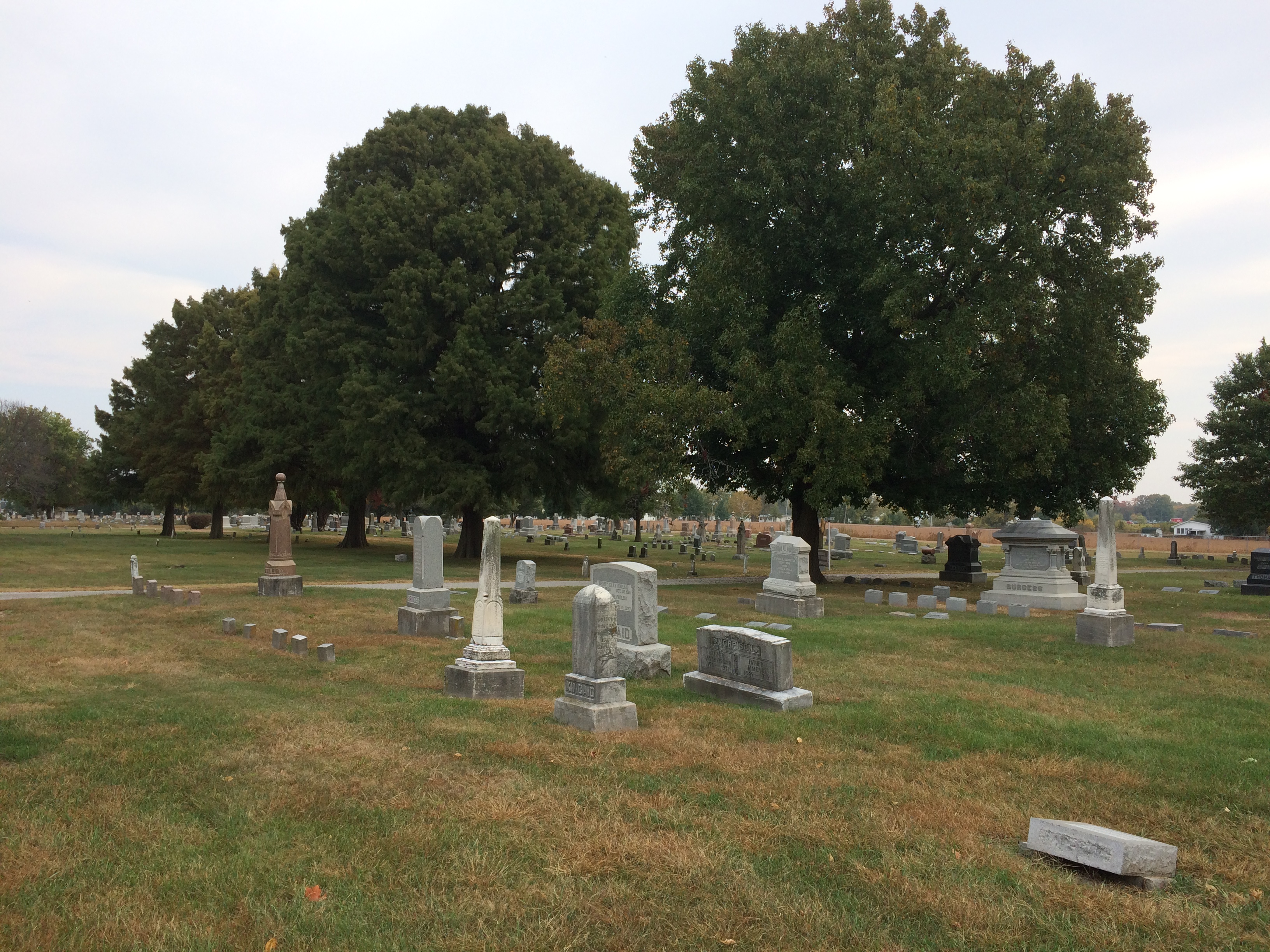
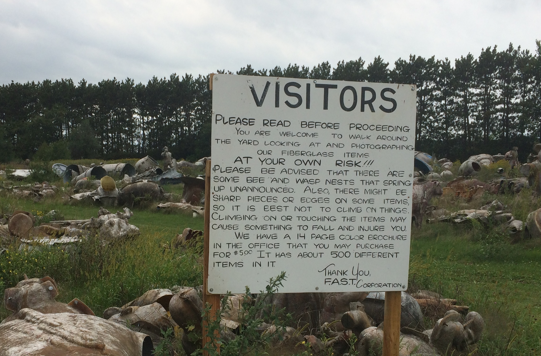
Snow this morning. It didn’t stick, but it did remind us all of the cold months to come.

At the beginning of 2020, works published in 1924 finally entered public domain in the U.S. The Center for the Study of the Public Domain noted some of the better known works now available to all.

“These works include George Gershwin’s ‘Rhapsody in Blue,’ silent films by Buster Keaton and Harold Lloyd, and books such as Thomas Mann’s The Magic Mountain, E. M. Forster’s A Passage to India, and A. A. Milne’s When We Were Very Young.”

Plenty of obscure works are now available as well. One I have in mind is The Outlaws of Cave-in-Rock by Otto A. Rothert, published in 1924. Rothert (1871-1954) was secretary of the Filson Historical Society in Louisville, and apparently took a strong interest in regional history

The Outlaws of Cave-in-Rock can now be found in Google Books. I haven’t read it all, but I have sampled some of it. Such as the first few paragraphs.

“This book is intended to give the authentic story of the famous Cave-in-Rock of the lower Ohio River… and to present verified accounts of the most notorious of those highwaymen and river pirates who in the early days of the middle West and South filled the Mississippi basin with alarm and terror of their crimes and exploits.

“All the criminals herein treated made their headquarters at one time or another in this famous cavern. It became a natural, safe hiding-place for the pirates who preyed on the flatboat traffic before the days of steamboats….

“A century ago and more, its rock-ribbed walls echoed the drunken hilarity of villains and witnessed the death struggles of many a vanished man. Today this former haunt of criminals is as quiet as a tomb. Nothing is left in the Cave to indicate the outrages that were committed there in the olden days.”

The book also tells the tale, in four chapters, of the exceptionally murderous Harpe brothers (or cousins), a bloody story deftly summarized by the late Jim Ridley in the Nashville Scene some years ago. Enough to note here that the Harpes and their women roamed western Tennessee and Kentucky around the beginning of 19th century, murdering and robbing as they went, but especially murdering.

They spent some time among the blackguards at Cave-in-Rock, but were forced to leave after they threw a man bound to a horse to his (and the horse’s) death off the cliff’s edge above the cave for fun. Even river pirates have their standards.

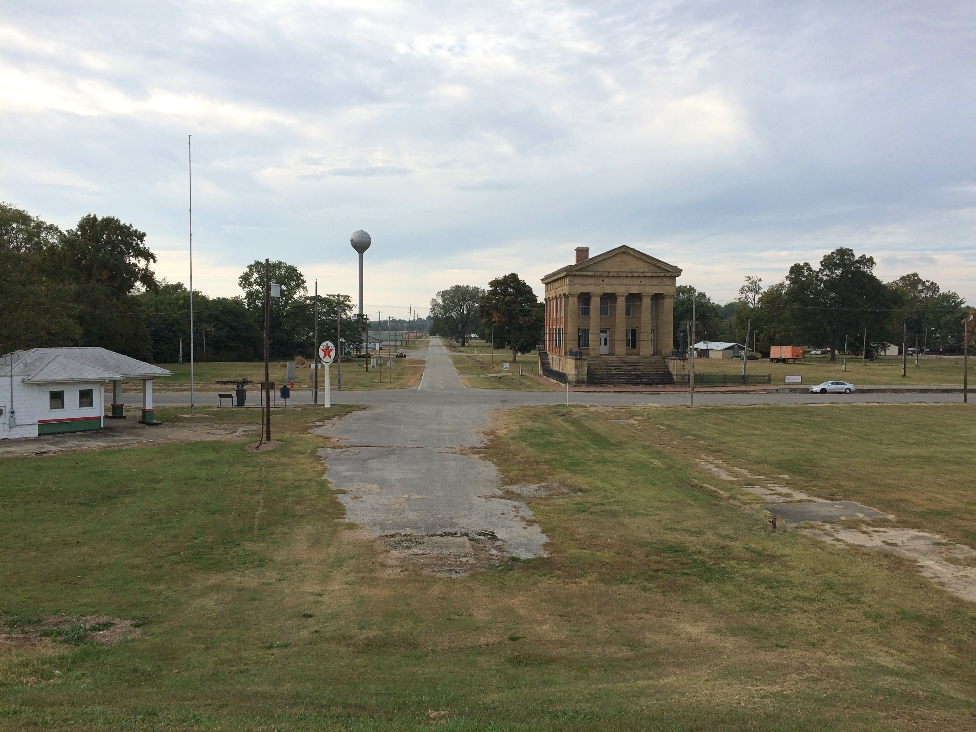
In our time, and in fact since 1929, the cave has been the central feature of Cave-in-Rock State Park. Not quiet as a tomb, quiet as a minor tourist attraction. It isn’t part of Shawnee National Forest, but some of the national forest lands are nearby. Note the sign isn’t a stickler for hyphens.Cave-in-Rock State Park

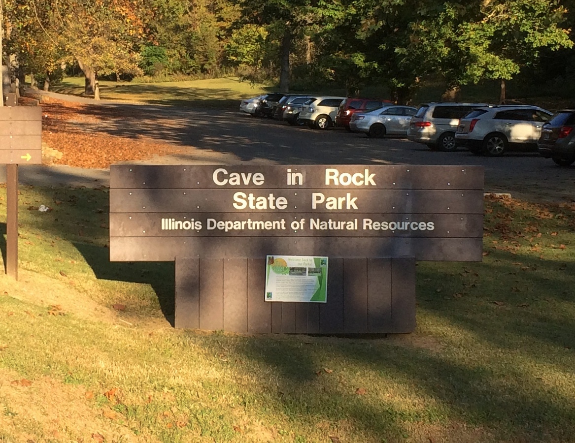
The park is near the small town of Cave-in-Rock, Illinois, which is walkable distance to the south from the park. We arrived at the park on the afternoon of October 11.

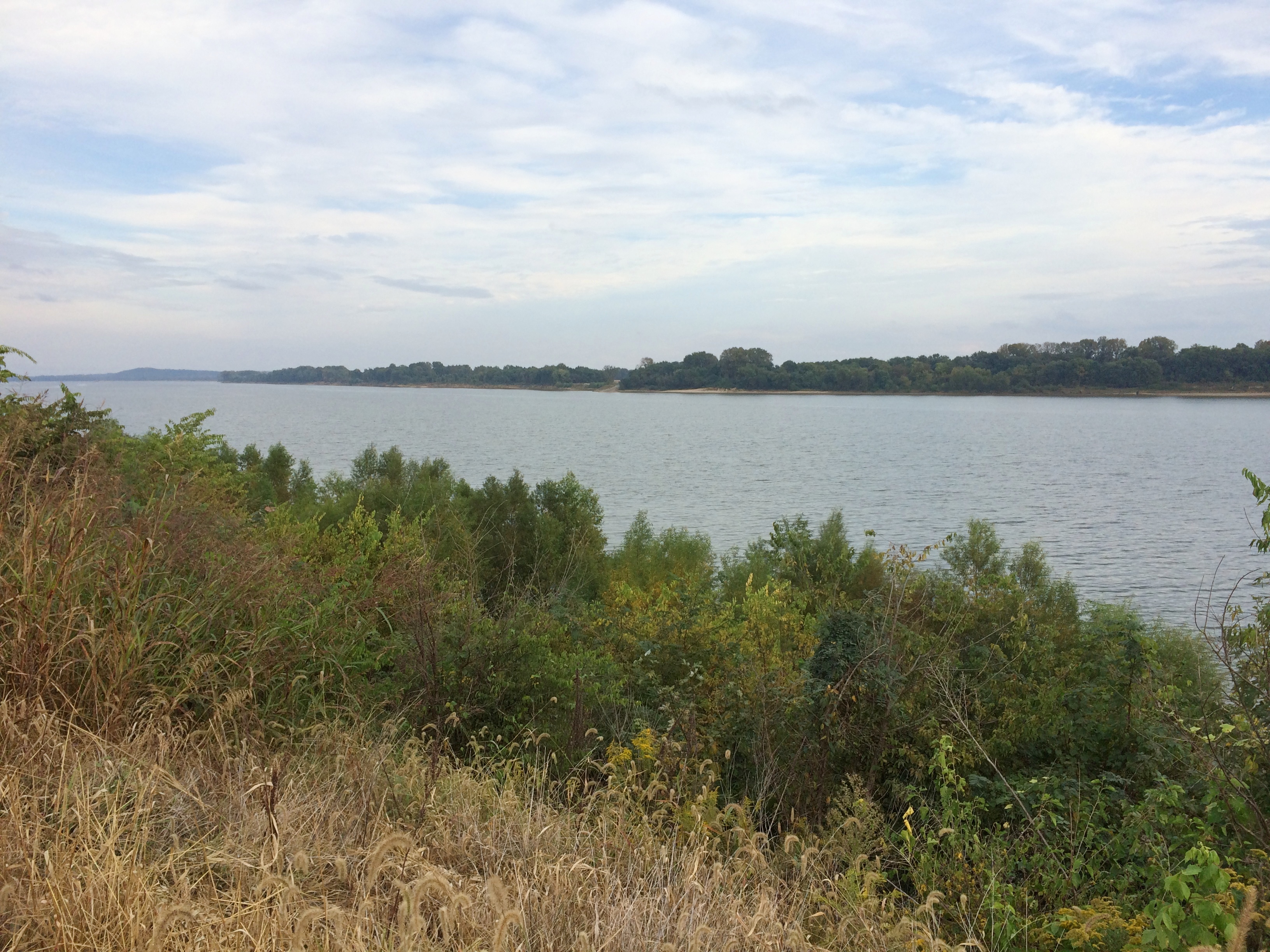
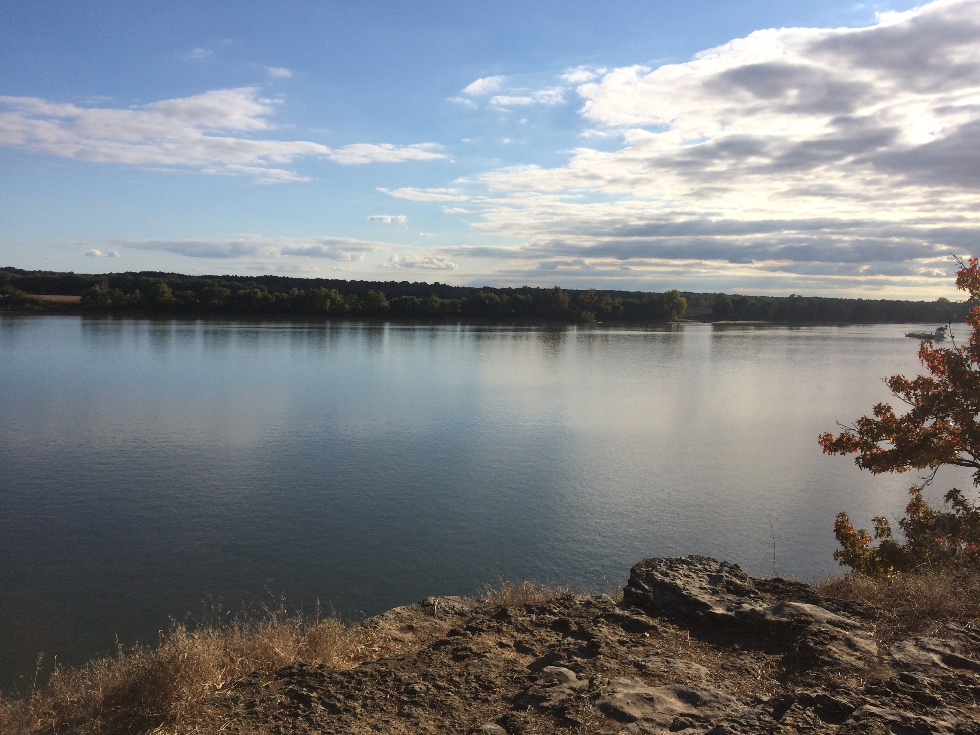
You park in a small lot and climb 50 or so steps uphill, to a crest overlooking the Ohio River, sporting picnic shelters and tall trees. Views from the crest, looking across to Kentucky.Cave-in-Rock State Park Cave-in-Rock State Park

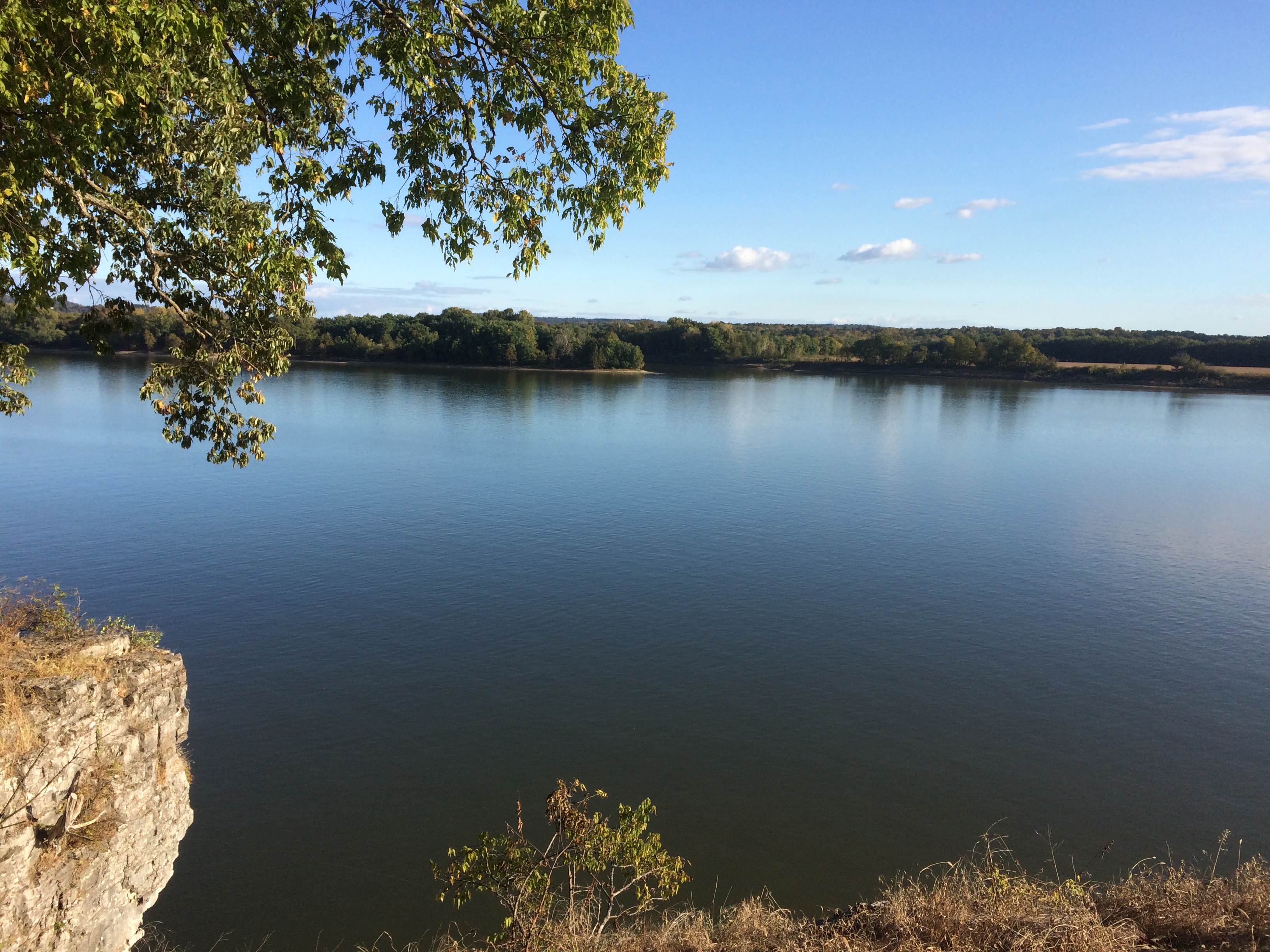
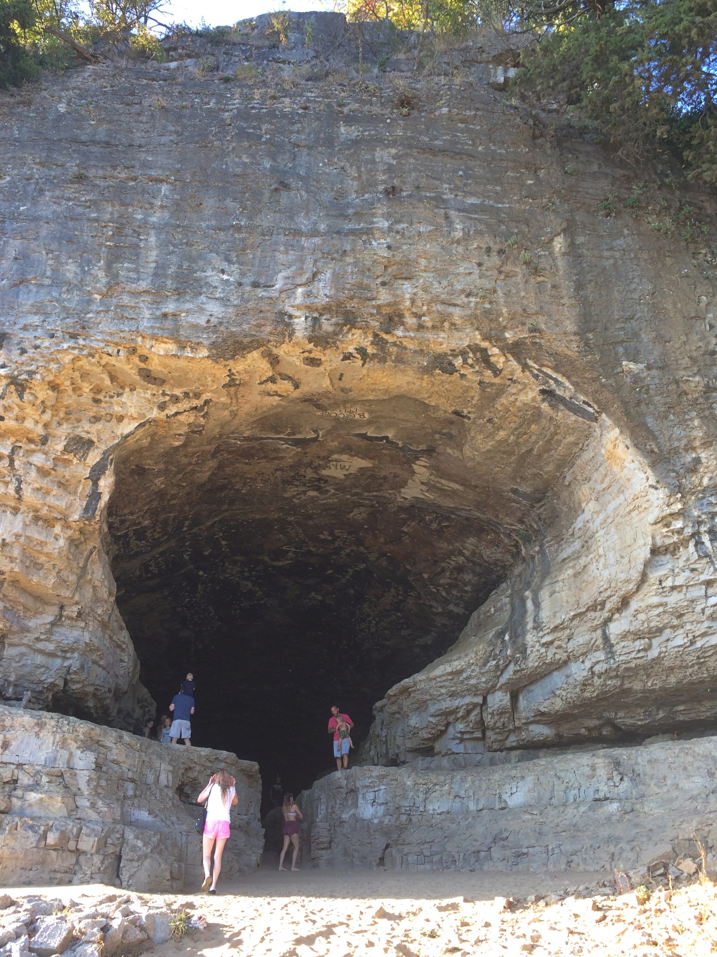
From the crest, you go down more stairs most of the way to the river’s edge. The cave entrance is under a high cliff and a few feet higher than a small beach on the river.
Cave-in-Rock State Park
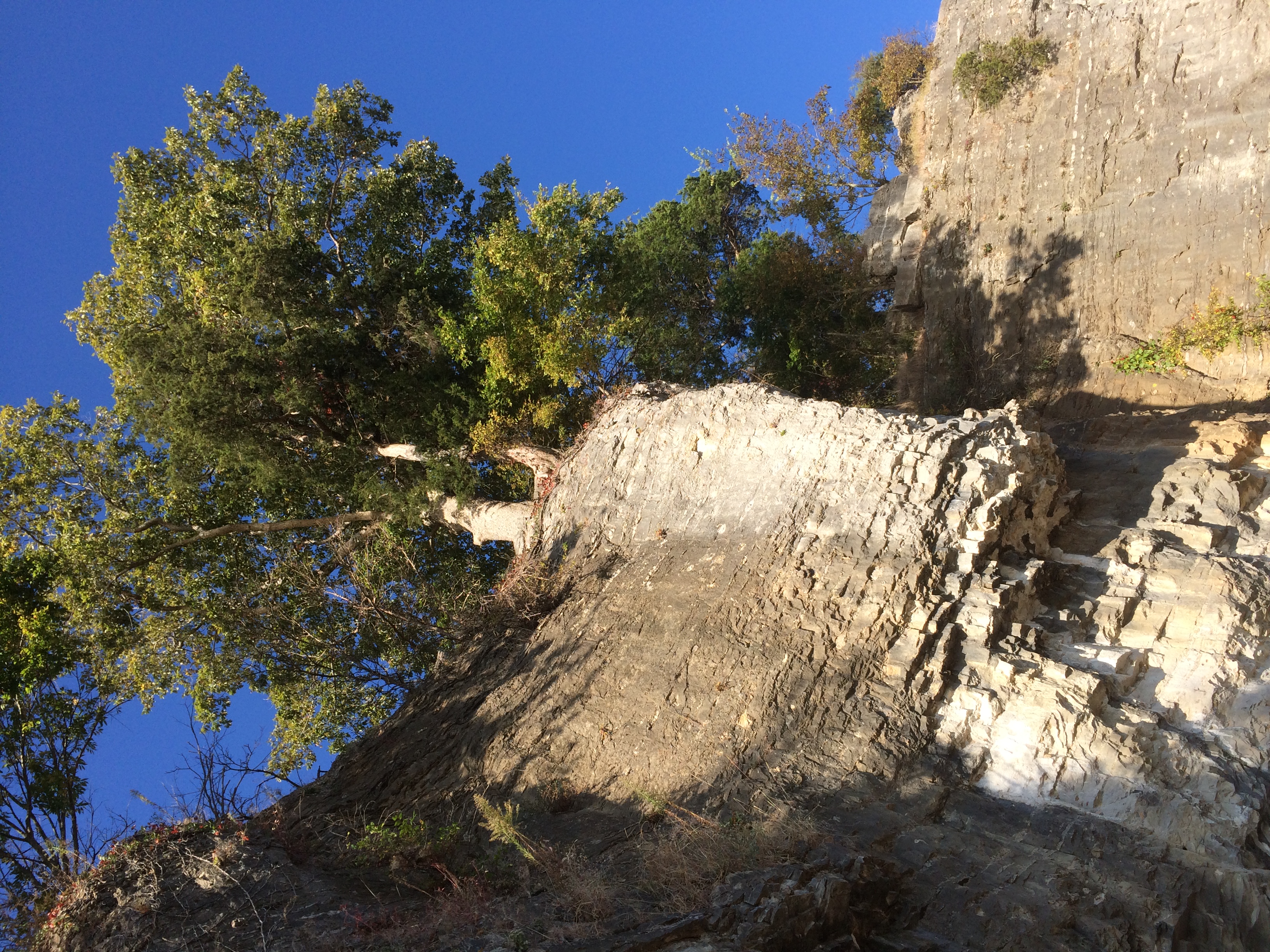
Looking back up at some trees lording over the edge of the cliff.
Cave-in-Rock State Park

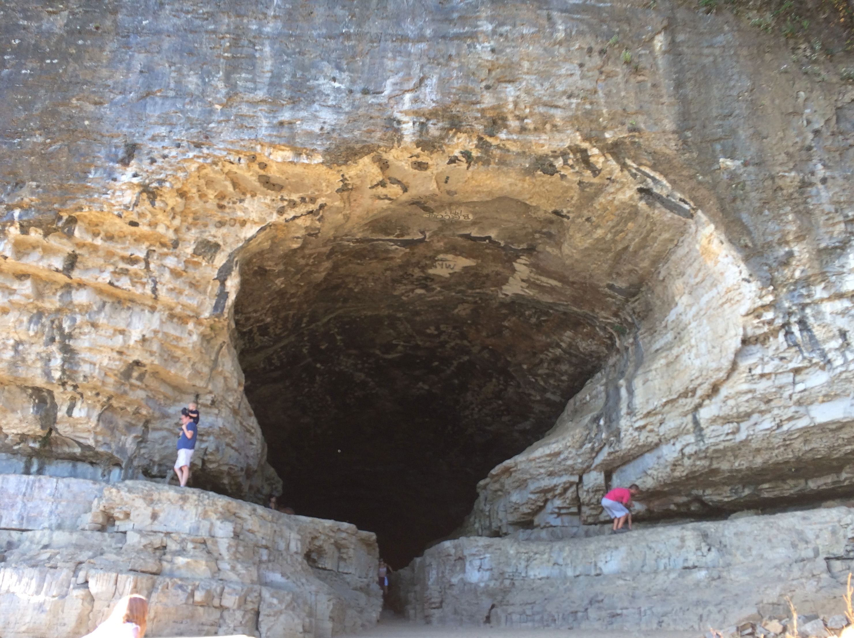
A few more steps and you’re in front of Cave-in-Rock. It’s an apt name.

Cave-in-Rock State Park Cave-in-Rock State Park

Soon you’re inside, looking out.
Cave-in-Rock State Park

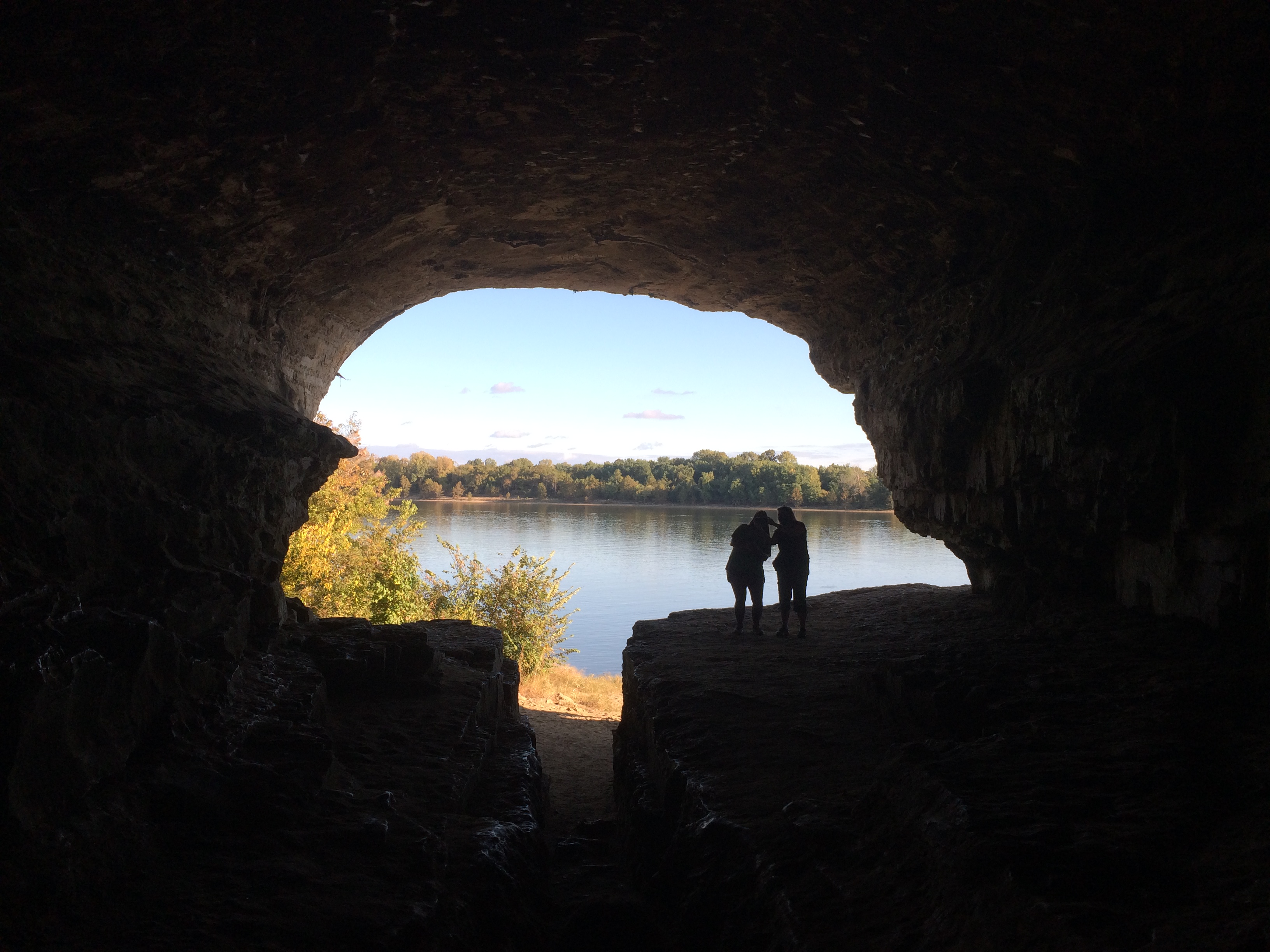
It doesn’t go too far back, at least not that I know of. Graffiti, mostly painted signatures, is prominent on the roof of the cave.
Cave-in-Rock State Park

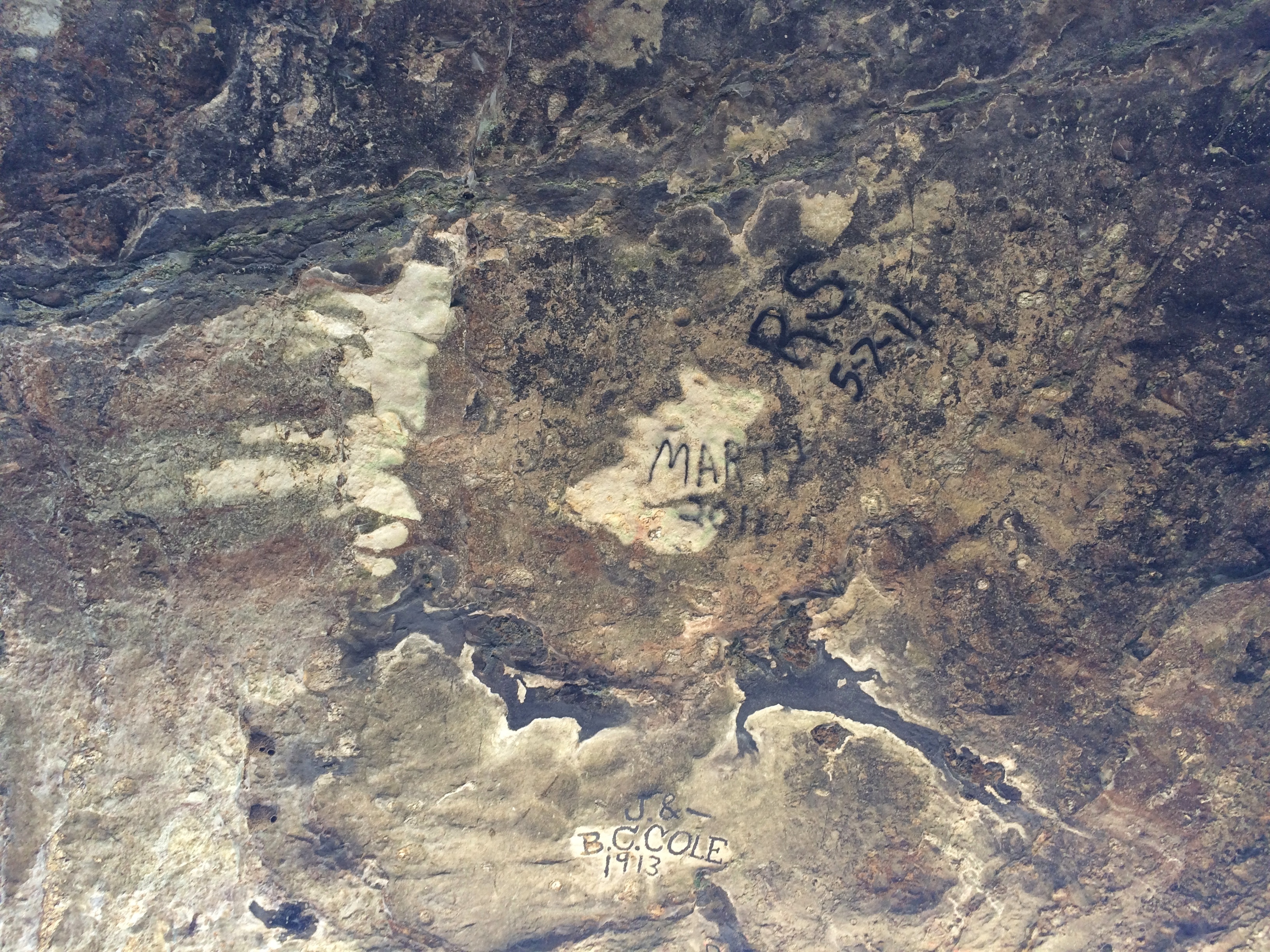
J. & B.C. Cole were here in 1913, pre-park and probably dangling from a rope over the cliff edge. The more recent Marty and R.S. were here in 2011, and probably had rappelling gear.

Old Shawneetown

If you drive east from Carbondale along Illinois 13, you’ll pass through a number of towns connected by that four-lane highway: Cartersville, Marion and finally Harrisburg, after which the road narrows to two lanes. That was our route on the afternoon of October 10.

There’s a branch of 17th Street Barbecue in Marion, with the original in Murphysboro, Illinois. It’s a barbecue joint of some local renown. I can’t remember when I first heard about it. Some Internet list, probably, but anyway I knew about it and decided to get lunch there in Marion.

Meals on the road in 2020 have involved takeout in all cases, either to eat in the car, or our room, or when possible at an outdoor public picnic table. We found a table in a small park in Marion to eat our 17th Street ‘cue.

We both got barbecue pork sandwiches. The meat was fine, but whoever made the sandwiches shorted us on the sauce, so the meal was a little dry. I’d be willing to try the place again if ever I’m down that way, but I’m going to insist on sauce.

The eastern terminus of Illinois 13 is Old Shawneetown on the banks of the Ohio River. Too close to the river, and thus prone to flooding. The Great Ohio River Flood of 1937 finally drove most of the residents away to found a new Shawneetown a few miles to the west. But Old Shawneetown isn’t a ghost town in our time, since 160 or so people live there, just the residuum of a larger place.

The town’s main intersection.
Old ShawneetownThe original Shawneetown had its moment, a little more than 200 years ago, when it was home to a federal government land office for the Illinois Territory, and as a transshipment point for salt extracted nearby. During the famed 1825 tour of the U.S. by Gen. Lafayette, Shawneetown was on his itinerary, surely marking the town’s peak of fame if not population.

Peaked too soon, looks like. No railroad passed through Shawneetown in the following decades, at least by the time this map was published in 1855. That tells me that Shawneetown never really prospered after the land office and salt mine closed.

I’ve known about the place for a long time. I knew girl in college from around Shawneetown, a coaxing elf of full Irish ancestry who grew up on a nearby popcorn farm. Gallatin County even now is a nexus of popcorn agriculture. Last I heard, she lived in Ankara with her French husband. People get around.

The main surviving building from the town’s storied past is the Shawneetown Bank State Historic Site, dating from 1840. Home to banks for about 100 years — they seem to have come and gone with various financial panics — it stands neglected these days.Shawneetown Bank State Historic Site
Shawneetown Bank State Historic Site
It’s not the only abandoned structure in the neighborhood. A white Texaco station is catercorner across from the bank. If it were on U.S. 66, it might be a little museum. Maybe someone has that in mind. Though abandoned, the structure looks in fairly good shape, especially the sign.
Old Shawneetown Texaco
There are a few plaques and other acknowledgments of the town’s history. Such as cutouts of Lewis & Clark, who passed this way just before there was a town.
Shawneetown Texaco
I like to think that the Corps of Discovery made a stop here at the only gas station along their route.

As Lewis wrote in his journal, Nov. 6, 1803: Arrived at Swanee Txco Station. Pay’d owner 2 dollards for provisions, — Cheetos, other divers chips, Coke & Pepsi, choco bars etc. Men also bought provis. for own use Mr Wm. Jones store mger, reports recent visit by Indian band from furth. north. — buying his entr. stock of funyuns.

Down the street from the abandoned bank and the abandoned gas station is Hogdaddy’s Saloon, an abandoned entertainment venue, though not so long ago, from the looks of it.
Hogdaddy's Old ShawneetownWhat Old Shawneetown needs (in more normal times) is a music festival right there on the main street. If Bonnaroo can, so can Shawneetown. Something for the hipsters to discover, to put the town on the hipster map and attract hipster dollars. As long as they believe the place is authentic somehow, they will come. That way a place like Hogdaddy’s could make a go of it.

An embankment separates the town from the river, part of a levee system built long ago to keep out flood waters — in vain. The always interesting WPA Guide to Illinois (1939) tells the story better than any online source I’ve found (p. 436). For that book, the ’37 flood was a recent event.

“The town bore the yearly invasions of the Ohio unprotected until the unusually severe flood of 1884, after which it constructed a comprehensive levee system,” the Guide notes. “But in 1898, and again in 1913, Shawneetown was under water. In 1932, the levee was raised five feet above the 1913 high-water mark….

“But Shawneetown had not envisioned anything like the 1937 flood. By January 24 of that year, menacing yellow waters were slipping silently past the town, only inches from the levee top… Small groups of people huddled on street corners, terrified, waiting; the telephone service ceased; hemmed in by the ever-swelling Ohio, Shawneewtown flashed a desperate cry for help over an amateur’s short-wave radio.

“Responding to the call, a river packet and several motorboats evacuated the townspeople just as the waters began to trickle over the levee. A roaring crashing avalanche soon inundated the cuplike townsite…

“The 1937 flood marked the end of Shawneetown’s ‘pertinacious adhesion’ to the riverbank. Gone were the packets and keelboats which induced her to hazard annual submersion. Gone was the steady traffic of settlers, goods and singing rivermen. With the aid of the State, the RFC, and the WPA, a project is under way for transplanting the town to the hills 4 miles back from the river… The State plans to establish a State park at the present site of Shawneetown.”

Guess the state never quite got around to that, maybe because not everyone wanted to leave.

A stairway leads to the embankment’s top, which offers a view of the Ohio. Looking upriver.
Ohio River Old Shawneetown
And downriver, looking at the bridge that crosses over to Kentucky.
Ohio River Old Shawneetown
On the side of the embankment is a graffito. Any graffiti would be a little odd in such a town, but this would be odd anywhere.
Ohio River Old Shawneetown
Left by a passing bailiff with a can of spray paint?

SIU and Buckminster Fuller Too

On October 10, Ann and I tooled around the Southern Illinois University campus a bit, agreeing that it isn’t the aesthetic experience that some college campuses are. Visitor parking proved hard to find, so we didn’t take a walk on campus.

We did spot the Wham Building on Wham Drive. Ann suggested that the donors were the British pop duo, now about 35 years passed their heyday. Though as a matter of style, it ought to be the Wham! Building. Their connection to SIU? None that we knew, but never mind. Maybe they decided they had enough money to fund a building on a college campus, and they threw a dart at a map to determine where it would be.

Not long after that conversation, we heard a local station playing “Wake Me Up Before You Go Go.” Coincidence or synchronicity? Coincidence, I’d say.

Not far from campus is a residential neighborhood with a fair amount of student housing, marked by some genteel seediness. Parking was easy around there, so we stopped for a short walk down a residential street.

Some of the residences stood out more than others. Some for their décor. It might be hard to see in the picture, but there’s a neon sign in the window of this Halloween-ready house: PALM READER.Carbondale palm readerOther properties stand out for more fundamental reasons. The R. Buckminster Fuller and Anne Hewlett Dome Home is at the intersection of two small streets in an otherwise unremarkable location in the neighborhood.fuller dome carbondale
fuller dome carbondale
The dome is fenced off and closed. But someone used to live there. Bucky himself, as it happens. A sign on the fence says: “Buckminster Fuller is considered one of the leading visionaries of the 20th century. He patented the geodesic dome in 1954 and it is his most enduring legacy. In April 1960 he assembled this dome home (The Fuller Dome) and lived in it with his wife Anne until 1971.”

How long had it been since I’d thought about Buckminster Fuller? Before finding out about the dome, that is, which was a few days before our visit to Carbondale. A long time, that’s how long. I suspect much of the world can say the same. Whatever Fuller’s contributions to civilization, and I’ll be the first to say geodesic domes are pretty cool, he’s headed for obscurity as surely as Ernie Pyle.

Reading about Fuller made me think of Lucy Kulik, a sixth-grade teacher of mine. She taught us math and I believe also led our participation in Man: A Course of Study almost 50 years ago. I hadn’t thought about her in a long time, either, and checked to see whether she was still among the living. Possible, but not likely, though it turned out she died only last year at 97, and now has a stone at Fort Sam Houston National Cemetery next to her husband, an Air Force lieutenant colonel — something I didn’t know about her.

RIP, Mrs. Kulik. The details have faded after a half century, but I remember you were a good teacher.

In class one day Mrs. Kulik mentioned Buckminster Fuller as the fellow who invented a dome made of triangles and who wanted the world to give up the words “sunrise” and “sunset.” I’d never heard of him at the time, or if I had, I’d forgotten.

Fuller suggested the words sunsight and sunclipse to replace sunrise and sunset, arguing that the common words reflect an incorrect understanding of the way the Earth and the Sun move. You could argue that they do, of course, and the words he suggests are perfectly fine, but to object to sunrise and sunset on those grounds itself reflects an excess of literalism in understanding language. That might be a reason his suggestions didn’t catch on.

His domes might be cool — you can’t stand in front of the Expo ’76 Fuller dome in Montreal and not feel a little awe — but I also have to add that a few of them go a long way. In the case of Carbondale, one is probably enough.

Jeremy Rochman Memorial Park, Carbondale

During the early planning for our recent trip, I didn’t give Carbondale, Illinois, much thought as a possible destination, but then Ann mentioned a park there she’d heard about from a friend who used to live in the area. After a little further investigation, I worked Carbondale, especially the park, into our plans.

“A vocal fan of the role-playing game Dungeons and Dragons, Jeremy ‘Boo’ Rochman was tragically killed in a car accident at the young age of 19,” Atlas Obscura says. “To honor his memory, his father bought a parcel of land across the street from their home in order to build a memorial park. His late son’s passion was for the role-playing game Dungeons and Dragons, so his father decided to turn the park into a fantasy land that his son would have been proud of.”

Jeremy Rochman Memorial Park is on the outskirts of Carbondale. When you arrive, various painted concrete creatures greet you.Jeremy Rochman Memorial Park
Jeremy Rochman Memorial Park

Jeremy Rochman Memorial Park

Jeremy Rochman Memorial Park

Including an enormous dragon, good for climbing, if you’re agile enough.Jeremy Rochman Memorial Park
The “castle” — the whole place is sometimes called Castle Park or Boo Castle Park — is a wood and stone structure with an elaborate set of passageways and stairs for kids to climb around.
Jeremy Rochman Memorial Park
With plenty of figures of its own.
Jeremy Rochman Memorial Park
The park wasn’t overrun with people, but we did notice a birthday party off in one corner.Jeremy Rochman Memorial ParkIf ever there were a good place for a children’s birthday, this is it.

Shawnee National Forest ’20

During my break from posting, Arlo Stribling was born to my nephew Dees and his wife Eden in Austin. Congratulations to the new parents, here’s hoping the boy is a joy. Best regards to little Arlo, an emissary to a future my generation will not see.

On the afternoon of Friday, October 9, Ann and I went southward for a visit in and around Shawnee National Forest, which stretches in large patches — in typical national forest style — from the Ohio River to the Mississippi, or vice versa, occupying a lot of extreme southern Illinois. We looked around the east part of the forest. The weather turned out to be flawless for such a little trip, warm and partly cloudy.

We spent the first night in Mattoon, Illinois, continuing southward the next morning. The first place we went on Saturday morning wasn’t in southeast Illinois, but further west: Carbondale, visiting Castle Park, or more formally Jeremy Rochman Memorial Park, on the outskirts of town. Afterwards, we looked around Southern Illinois State University, and saw the nearby Buckminster Fuller House. A domed house, of course.

Heading east on Illinois 13, we eventually made our way as far east as that road goes, Old Shawneetown, a husk of a formerly much more populous place on the banks of the Ohio, and home to the Shawneetown State Bank Historic Site. We spent the next two nights in Harrisburg, Illinois, which bills itself as the Gateway to the Shawnee National Forest.

On Sunday, we drove the roads of the southeast part of the forest, climbed a modest flagstone path to a grand vista — the Garden of the Gods — hiked along a small lake surrounded by trees approaching their peak coloration, climbed a bluff via a CCC staircase, and visited a large cave entrance facing the Ohio River at Cave-in-Rock State Park.

Small, winding roads pass through the national forest, rising and falling, flanked  alternately by walls of trees and expanses of flat farmland, post-harvest but before a winter freeze. Towns come in the sizes small, smaller and hamlet. In that part of Illinois, sometimes known as Little Egypt, small white churches are a common sight, more Baptist than any other denomination. Not quite as common, but enough in evidence were abandoned structures: farmhouses, gas stations, motels, restaurants and shops. If it were up to the people who put up political signs in that part of the country, the president would be re-elected by a wide margin. A smattering of Confederate battle flags were flying here and there.

Traffic is at a trickle on those roads most of the time. That made for easy, and sometimes picturesque, driving. Car commercial driving, I told Ann.

On Monday, Columbus Day Observed, that lightest, most gossamer of all national holidays, we headed home, with one major short detour into Indiana, to visit the town of New Harmony. The 19th-century utopian colonies there might have failed (two! count ’em, two utopian experiments), but the town has succeeded in being highly pleasant and intriguing everywhere you look in our time. Also, a famed theologian is buried there, in as much as theologians get fame.

As mentioned above, we didn’t spend much time in Mattoon. But early on Saturday I got up and looked around for a few minutes. The town looks frayed, buffeted by the contraction of U.S. manufacturing and the vagaries of the farming industry and the rural economy as a whole.

The town’s relatively greater prosperity in the early 20th century is reflected in its cemetery. A sizable place, the Dodge Grove Cemetery measures about 60 acres and has 20,000 permanent residents, including three Civil War generals and 260 soldiers from that war, one of whom is an unknown Confederate. There’s a story in that last detail, probably lost to time.Dodge Grove CemeteryDodge Grove Cemetery

Dodge Grove Cemetery

Blazes of fall color rise in places.
Dodge Grove Cemetery
According to Find a Grave, only one of those Civil War generals counts as a notable burial in Dodge Grove, James Milton True, commander of the 62nd Illinois Volunteer Infantry. I like the other major item on his CV: U.S. consul in Kingston, Ontario in the 1870s.

That hints at some pull with the postwar federal government, probably based on connections he made during the war, or because he became a local politico who could deliver votes. Or both. Seems like a plumb diplomatic assignment in the 19th century: no language skills necessary, close enough to home that you can visit periodically, and no danger of catching malaria or some other dreaded tropical disease.

I didn’t see his grave. I didn’t know he was there till later. I did see the Pythias obelisk.
Dodge Grove Cemetery

Erected by
Palestine Lodge No. 46
Knights of Pythias
In Memory of
Deceased Members
1929

I’ve encountered vestiges of the Knights before, such as in Atlanta, Illinois. I associated them with an earlier time, the sort of organization that George Babbitt might have mentioned in passing as having a chapter in Zenith. But no: the Knights of Pythias are still around, though at much diminished numbers.

Still around, and up with the times. “The Summer 2020 Edition of the Pythian International is now online,” the fraternal org’s web site says. “It includes information on the rescheduled Supreme Convention, Oct. 1-6.”

As I was about to leave, I spotted this stone.
Dodge Grove CemeteryA heartbreaker of a stone. Though I’m sure combat deaths didn’t quite stop exactly at 11 am on the 11th, since even modern armies with good internal communications can’t stop on a dime. Still, the day before the Armistice. Damn.

I don’t know why I’m surprised any more at anything online, but I was surprised to find a local newspaper account of Lawrence Riddle’s last days, though it doesn’t specify how he died (and this too: a niece that he never knew). In the article, the most attention is paid to Riddle’s participation in combat during the days before his death, charging a German machine gun position with four other men. They seized the position and brought back prisoners.

I wonder whether the Germans, eager to surrender at this point in the war, were making it easy for the raiders, or whether the Americans faced bitter-enders who were still playing for keeps. Either way, a clear act of bravery on the part of Riddle and the others.

Hickory Street Parade, Denton, Texas, 1967 (Probably)

I have a photo book holding a scattering of images made when my family lived in Denton, Texas, which was from 1965 to ’68. There are perhaps two dozen pictures. Photos were only made on special occasions, such as my birthday or when family visited from out of town.

Three of the pictures are of the Denton High School band, of which my brother Jay was a member, marching down Hickory St., which is the street our house was on, in 1967.  The edge of the photos says Aug 69, but that only means we didn’t get around to developing the film for almost two years.
Denton Texas Hickory Street Sept 13, 1967 That is not me sitting on a car in the first image. My mother must have taken the shots with our Instamatic 104, since I don’t think she would have been interested in fiddling with the more complicated cameras that my father left behind. Provided we had our Instamatic by then, which seems likely.

She stood on the sidewalk on Hickory St., probably near its intersection with Denton St.
At least, the angle of the third picture makes me think that’s where she stood. One the houses not far west of that point is still there, though deeper blue.

I must have watched the parade, but I have no memory of it. At the time I was six, and had just started first grade at Sam Houston Elementary School in Denton. I walked to school, so it wasn’t far away. There’s a school of that name still in the Denton ISD, but it’s far from where we lived and has a late 20th century look to it.

Thinking about it now, I suspect the school I went to was already old when I went there — maybe built in the ’20s to update whatever rudimentary facilities the town had before that. I expect the building I knew is long gone.

Also: here’s the house where we lived. The house is a different color now, but the enormous tree is still in the front yard! It seemed so vast to my boyhood self. Then again, it is pretty big. An old maple that produced huge leaves. Or was it an oak that produced huge acorns? Both kinds of trees were in the neighborhood and I would collect their scatterings.

I digress. Why was there a parade on that day in Denton, Texas? One possibility is that it was part of the September 13 publicity celebration for the regional premiere of Bonnie and Clyde, which was at a movie theater near the courthouse, only a few blocks to the east of where we lived. Parts of the movie were filmed in North Texas, near Denton, in places that could easily pass for 30 years earlier. The University of North Texas published an article a few years ago about the filming and the regional premiere.

Some of the stars of the movie rode in a small motorcade down Hickory to the courthouse square, and naturally the high school band had to be part of it. If my mother took any pictures of the movie stars, they’ve been lost. But I seriously doubt she did. Taking pictures of her son’s band is one thing, but actors in a movie (I suspect) she had no interest in seeing? Naah.

FAST Fiberglass

Also not far out of Sparta, Wisconsin, is property belonging to FAST Fiberglass, until recently known as FAST Corp., which specializes in fabricating fiberglass statues.

Or, as its web site puts it [all sic]: “The next time you see a life size elephant at a gas station, 8 foot high cheese mouse at the store, 6 foot frog water slide, 20 foot high flamingo, or 3-story eyeball you can bet the piece originated in Sparta Wisconsin at FAST Fiberglass.”

This concerns me how? Turns out that the property is also an informal tourist destination. As a fairly informal tourist, the prospect of visiting the place intrigued me. Not the manufacturing facilities themselves, but rather the large patch of land where the company stashes the molds it uses to make statues.
FAST FiberglassA large sign welcomes visitors, but warns them as well.
FAST FiberglassWe heeded those warnings and didn’t climb the molds or disturb bee or wasp colonies. We merely looked around the weedy dumping ground, and were well rewarded by the whimsy of it all.FAST FiberglassFAST FiberglassLook! A Big Boy. I explained to Ann what that was.
FAST FiberglassMore oddities.FAST Fiberglass

FAST Fiberglass

FAST Fiberglass

A muffler man? Maybe.
FAST FiberglassOld Scratch.
Old ScratchThere was an old woman who lived in a shoe/She had so many children, she didn’t know what to do?
 FAST FiberglassAlso, the field sported a large number of animal casts. FAST Fiberglass

 FAST Fiberglass

Including animal shapes made into slides — the kind you see at kiddie pools. FAST Fiberglass

 FAST Fiberglass

FAST Fiberglass was our last destination for our recent Labor Day weekend jaunt, and I’d say we ended things on an odd but satisfying high note.

Sparta, Wisconsin

After leaving La Crosse on September 6, we spent time driving some picturesque Driftless Area roads, but soon we were feeling the pull of lunch. That is, we wanted to find a place to eat. We arrived in Sparta, Wisconsin, and started looking around. Doing it the old fashioned way — not with a search engine or an electronic map, but by keeping our eyes peeled as we drove.

Sometimes you get lucky. Right in the middle of town, on W. Wisconsin St., we found Ruby’s. We stopped right away.Ruby's Sparta Wisconsin

Ruby’s has a most traditional drive-in menu, with one exception.
Ruby's Sparta WisconsinBetween the three of us, we ate a satisfying drive-in lunch: a chili cheese & onion dog, a grilled cheese sandwich, onion rings, cheese curds (this is Wisconsin, after all) and the unusual item: a walnut burger.

As the menu explains, it’s “seasoned walnut & cheese patty with lettuce, tomato, pickle & honey mustard on a whole wheat kaiser bun.” I had a bite. It was tasty. The menu also notes “the Historic Trempealeau Hotel” above the Walnut Burger description, presumably as its provenance. Naturally, I looked it up. The boutique hotel, dating from the late 19th century, is still around, on the Mississippi upriver some distance from La Crosse in a burg called Trempealeau.

Rudy’s also sports a fiberglass statue. A bear on roller skates.
Ruby's Sparta WisconsinUnlike Gambrinus, I suspect the bear is holding a mug of root beer. Rudy’s has a special section for that on the menu, including a root beer float, but not beer.

While we ate, I noticed another statue, much larger — or at least taller — than the bear. It was across the street catercorner from Ruby’s, in a park.

Of course I had to go see that, after we ate. The Sparta Downtown River Trail runs through the park.
river trail Sparta WisconsinAt this point, a footbridge crosses the small La Crosse River, which eventually empties into the Mississippi in the city of that name.
river trail Sparta WisconsinOn the other side of the bridge is the statue I saw from across the street.Ben Bikin' Sparta Wisconsin

Ben Bikin' Sparta WisconsinIt has a name: Ben Bikin’. Sparta, pop. just shy of 10,000, is the self-proclaimed Bicycling Capital of America. A nice local distinction. I imagined that Sparta might have been a bicycle manufacturing town at one time, maybe as long ago as the bicycle craze of the ’90s that popularized the modern bike. The 1890s, that is.

But no. “Sparta’s claim as the ‘Bicycling Capital of America’ is based upon the first rail bed in Wisconsin to be converted to bike trails between Sparta and Elroy,” says the city’s web site. That trail was completed in 1967, so fanciful penny-farthing statues aside, the town sobriquet isn’t that old.

In fact, I don’t remember seeing any more bicycles in Sparta, or dedicated bike lanes, than in any other small town. That is to say, not many. There is, however, a bicycle museum in town.

More than that: the Deke Slayton Memorial Space and Bicycle Museum. I knew it was closed, but we drove by before leaving town anyway.
Deke Slayton, Sparta WisconsinSlayton, the only Mercury astronaut who never flew in a Mercury capsule, grew up on a farm near Sparta. So he’s the town’s other attenuated claim to fame. The thinking must have been, best to combine the two into one (slightly) larger museum. Well, why not?

More La Crosse, Including Gambrinus

After everyone was awake last Sunday, we packed up to leave La Crosse. But there were a few more places to see on the way out, such as Riverside Park.Riverside Park La Crosse

As the name says, it’s along the Mississippi.
Riverside Park La CrosseLooking toward the bridge where U.S. 14 crosses between Wisconsin and Minnesota.
Riverside Park La CrosseA hyperpartisan had set up his table in the park, complete with flags and literature and, I expect, a willingness to talk about his candidate till the heat death of the universe. I didn’t talk to him any more than I would any other religious fanatic.
Riverside Park La CrosseNear the park is a pedestrian path into downtown, lined with heron statues.La Crosse heron statues

The birds were originally displayed in 2008, during the vogue for public displays of animal statues. Apparently the statue herons were returned to public display in La Crosse two years ago, a task overseen the Pump House Regional Arts Center, a local nonprofit.

A selection of da birds.
La Crosse heron statuesThe La Crosse Loggers are a team in the Northwoods League, a summer collegiate league.La Crosse heron statuesLa Crosse heron statues La Crosse heron statuesThere was one more place in La Crosse that I knew about that Sunday morning and didn’t want to miss. Namely, the World’s Largest Six Pack, which stands above 3rd Street S.
World's Largest Six Pack La CrosseRoadside America recalls its early years painted to resemble cans of Heileman’s Old Style Lager. These days, the six pack advertises La Crosse Lager, but apparently the effect wasn’t created by paint, but wallpaper.Namely, the World's Largest Six Pack, which stands above 3rd Street S.

A sight to see, but a little drab, though the morning light doesn’t bring out whatever color it has. Still, other paint jobs looked brighter. A place like this can’t hide from Google Images comparisons.

Across from the six pack, which are in fact for storing beer, with a capacity of 22,000 barrels (688,200 gallons), are other buildings in the brewery complex. Most notable is an earlier brew house, or at least its facade, which is easily more than a century old.
La Crosse Lager BreweryTo the left of the old facade (from my POV).
La Crosse Lager BreweryTo the right.
La Crosse Lager BreweryUnder that big brick wall, standing with his goblet held high, is Gambrinus.
La Crosse Lager Brewery GambrinusGood old Gambrinus. I didn’t know about that particular bit of Euro-lore growing up. I first saw him in Chicago, looking somewhat different but crowned and holding a vessel all the same.

La Crosse Walkabouts

Last Sunday I woke fairly early, because there are only a few good reasons for doing such a thing, such as catching a plane or looking around somewhere new while other members of your family sleep.

I drove to historic downtown La Crosse for a closer look. The first place I stopped was on 3rd Street S., across from The Library.
Downtown La CrosseThat was worth a chuckle. As far as I can tell from The Library’s web site, it isn’t a book bar — there are such things, I’ve heard — but an ordinary student bar, though the site is a little vague on that point.

From there I walked around a square block of La Crosse’s handsome historic core, full of late 19th- and early 20th-century buildings that have found 21st-century uses. Besides bars — a fair number of those — there are restaurants, coffee shops, specialty shops, music venues and professional offices.

Such as along the east side streetscape on 3rd, between Main and Pearl.
Downtown La CrosseThe Rodolf Building the west side of 3rd., dating from the late 1860s and early ’70s.
Downtown La CrosseThe State Bank of La Crosse on Main St., dating from 1885. It’s an impressive pile.
Downtown La CrosseThe streetscape along 4th St.
Downtown La CrosseAnd along Pearl St.
Downtown La CrosseThere are a variety of shops in the old buildings, including some unexpected ones. Such as a saddlery on 3rd.
Downtown La Crosse saddle shopThere’s a book store on Pearl that didn’t used to be a book store. According to the mosaic at the entrance, you could buy shoes there once upon a time.

Downtown La Crosse Arenz ShoesArenz Shoes had eight locations in the region as recently as the 1970s, but the last one, in Sparta, Wisconsin, is closing even now. The Pearl St. location was a shoe store from 1903 to 1992.

This promise of sustenance made me smile.

Downtown La Crosse FOODThat’s just a small sample of the charms of historic downtown La Crosse. Much more about the buildings is here, though unfortunately without any pictures.

Next I drove east on Market St. until I came to St. Rose Convent and Viterbo University, which are adjacent. I stopped on Market and took another walk around a city block, through the university campus as well as near the convent.
St. Rose Convent The entrance to the convent, looking like an academic building.
St. Rose Convent On a street called Franciscan Way — Viterbo is run by Franciscans — is San Damiano Chapel, which, as part of the university, I assume takes some inspiration from the church of that name near Assisi. It was closed.

Viterbo University

Down the block to the east is Mary of the Angels Chapel, which is part of the convent. The view from the west.
Viterbo UniversityThe view from the south.
Viterbo UniversityAbove one of the entrances, maybe the main one. It too was closed.
Viterbo UniversityThe campus features a number of statues, including “Dancing Francis,” by Paul Granlun.Viterbo University Dancing Francis

Viterbo University Dancing Francis

A work that’s still yet exudes motion. Francis inspires poses in motion. I didn’t realize until I read about this statue that Francis is depicted standing on a crescent moon.