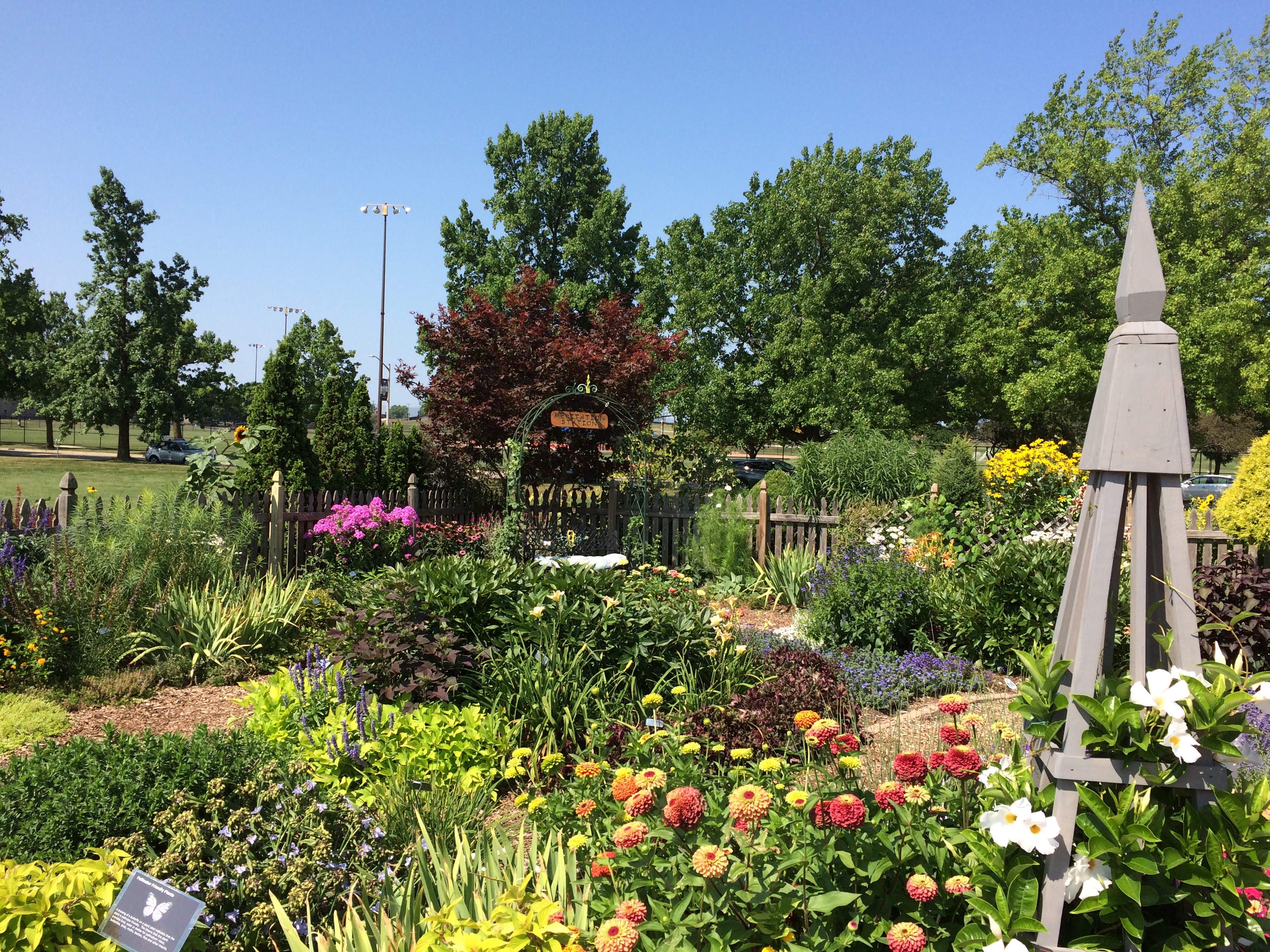
Besides Decatur, we spent some time over the weekend in Champaign, including a short visit to the Idea Garden of the University of Illinois Arboretum.
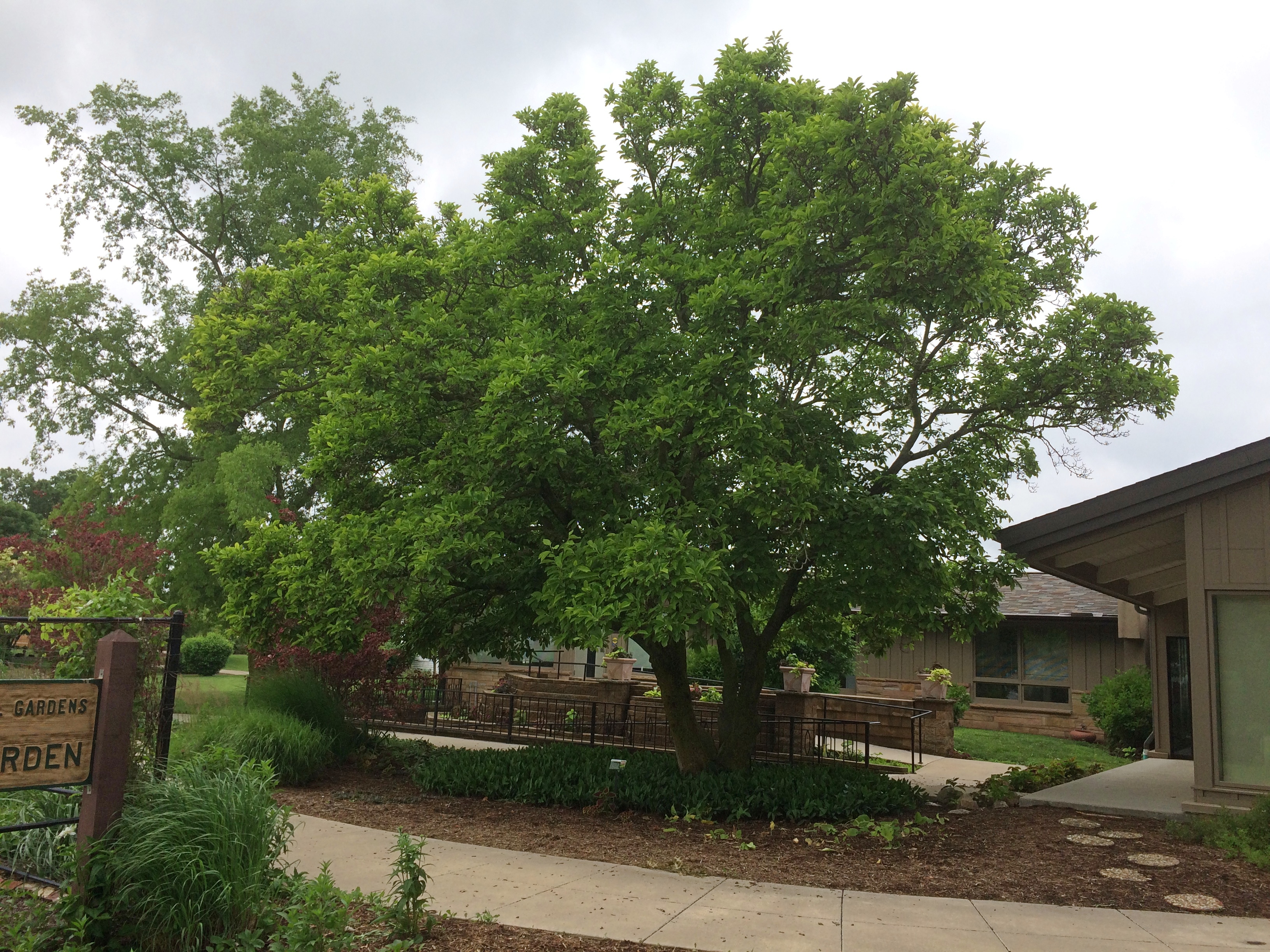
Back in the spring, the Idea Garden was mostly just that, notional, but since then volunteers have brought the place to full flower. Literally. A small structure mid-garden was being used for an informal gardening class when we passed by. Something about garden pests. Sunflowers reaching to the sky. Taller than a grown human being. One of the volunteers told me it was a special kind that grows tall. Not a lot of gardeners like them, he said, but he did.
Elephant ears! I have fond memories of large elephant ears when I was a child. The picture is ca. 1970, of my brother Jim and I and the front-yard elephant ears. I might have been small, but that’s not why I remember our elephant ears as large — they were objectively large. That’s the way they grew for a few early years at our house in San Antonio. In later years, they came up smaller and eventually disappeared.
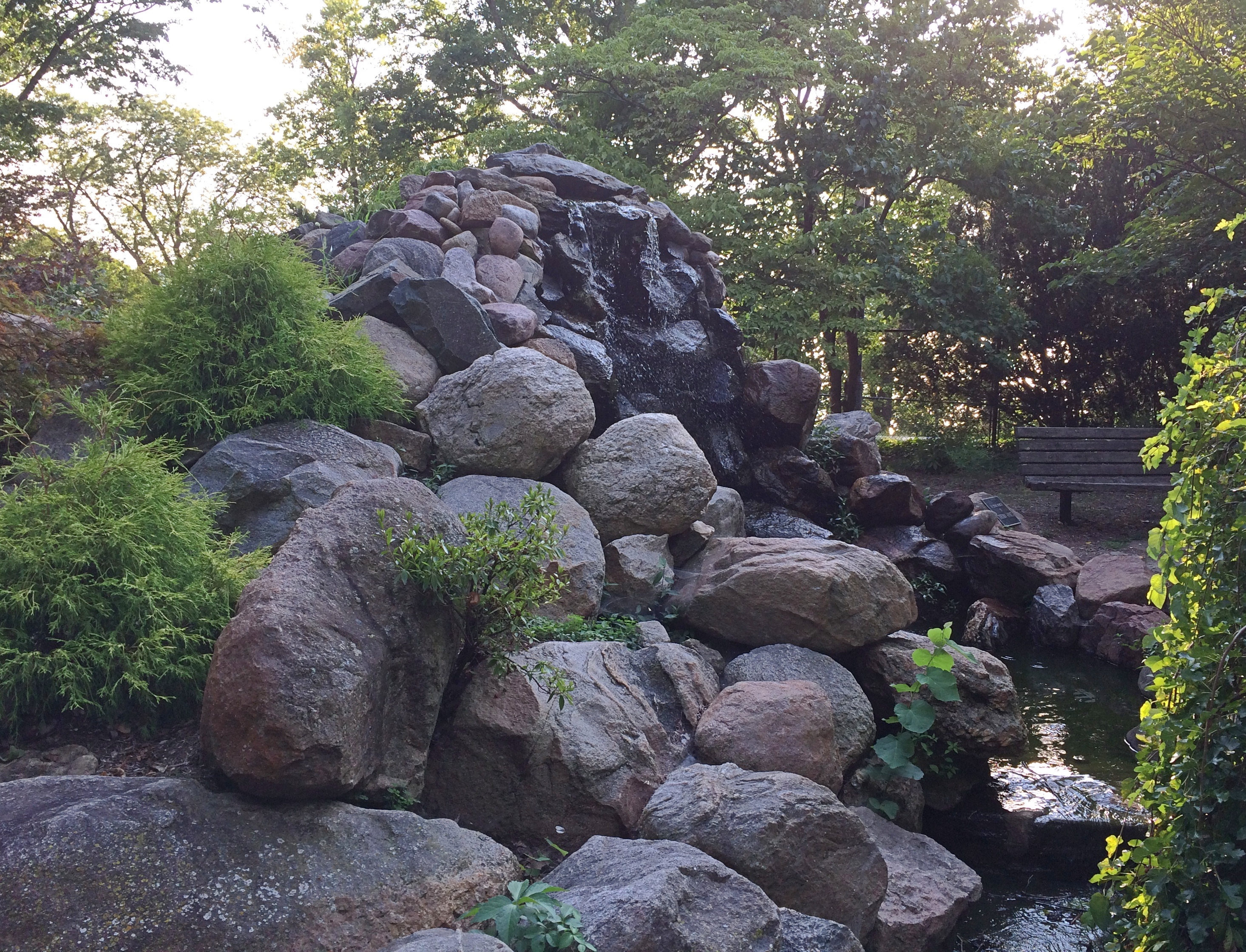
First, we drove across Lake Decatur on US 36. Later, we walked near the shore of the lake, though at that point a fence was between us and the lake. We didn’t mind, because we were taking a late afternoon stroll on Saturday at Scovill Sculpture Park. As these things go, the lake is old — almost 100 years, a project of civic improvement that also happened to be very useful for corn wet-milling. A.E. Staley, of corn products fame (see yesterday), had a major hand in the creation of the lake by damming the Sangamon River upstream in the early ’20s.
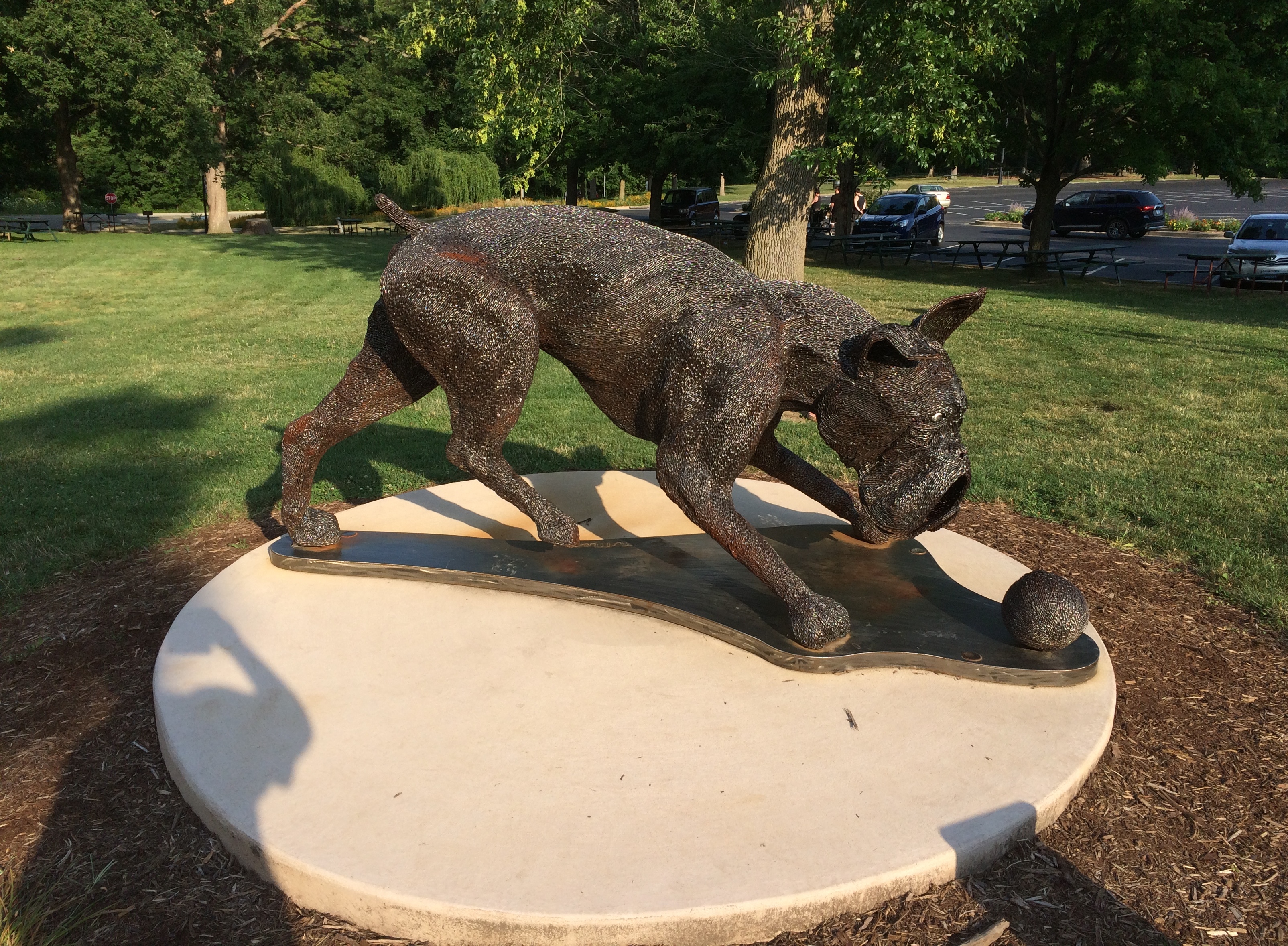
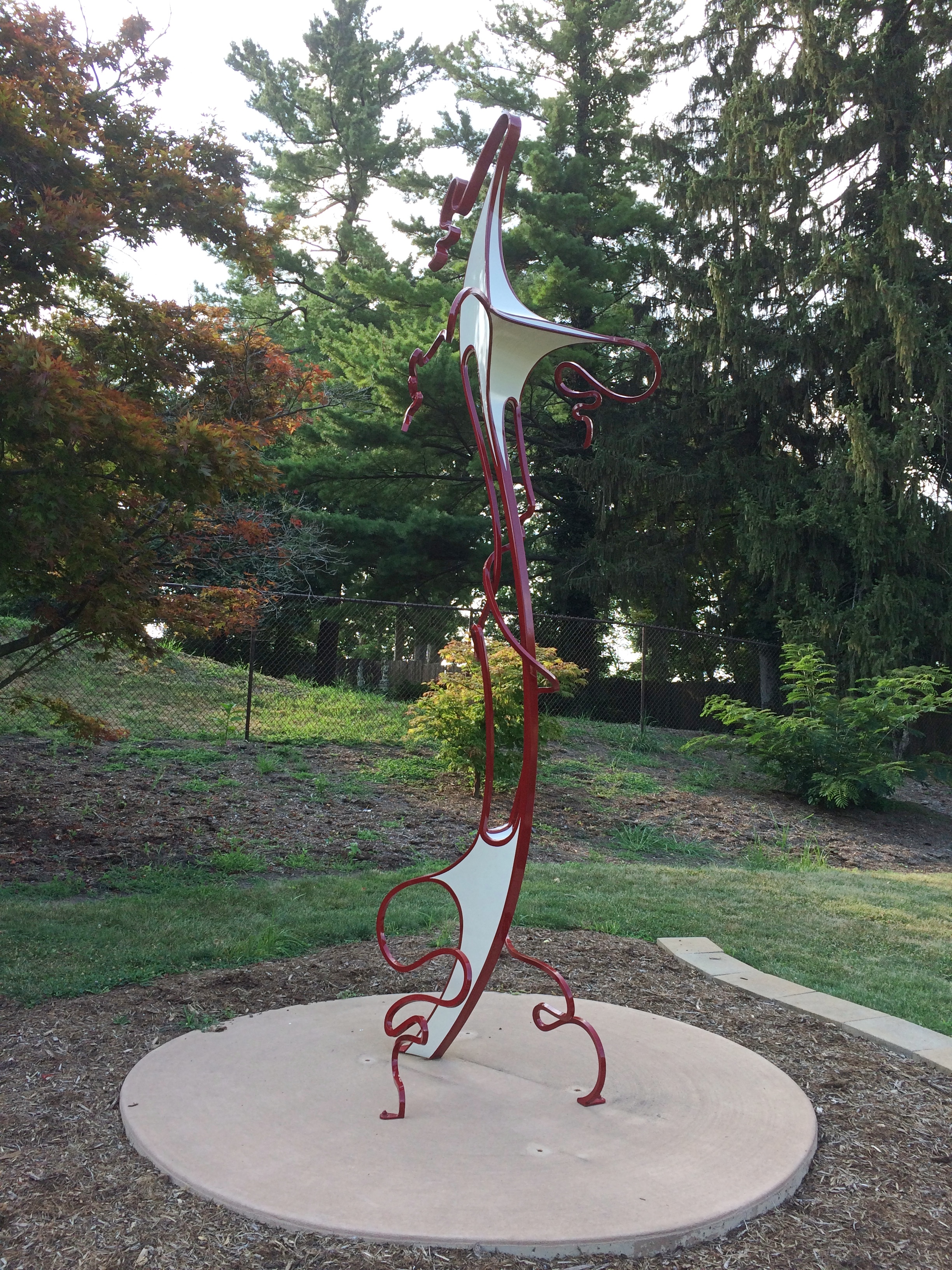
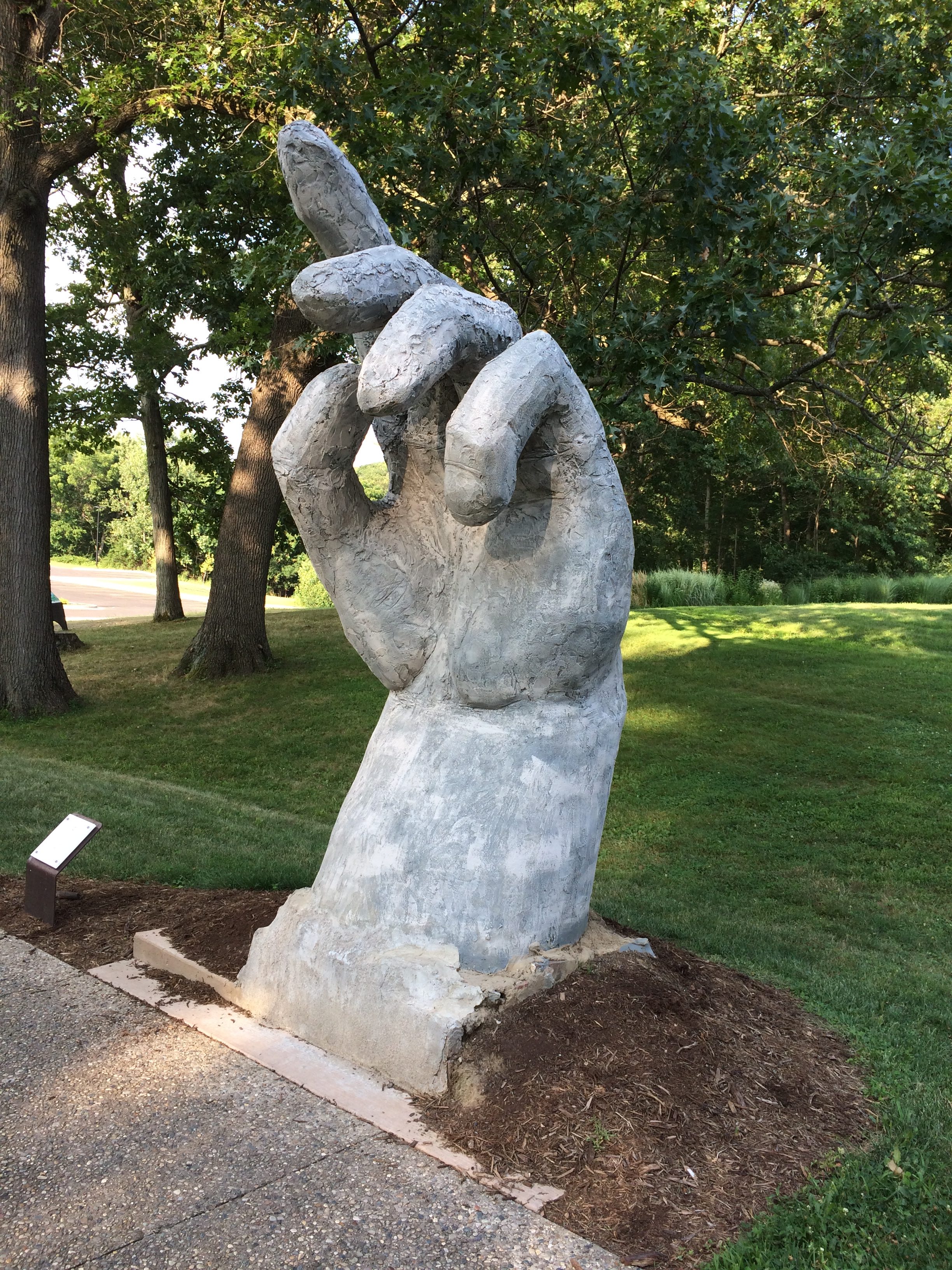
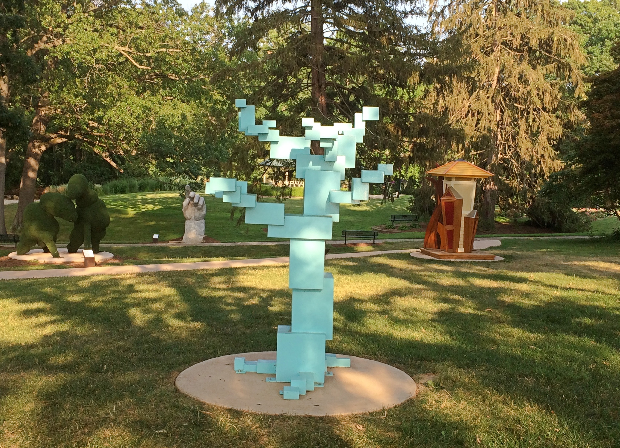
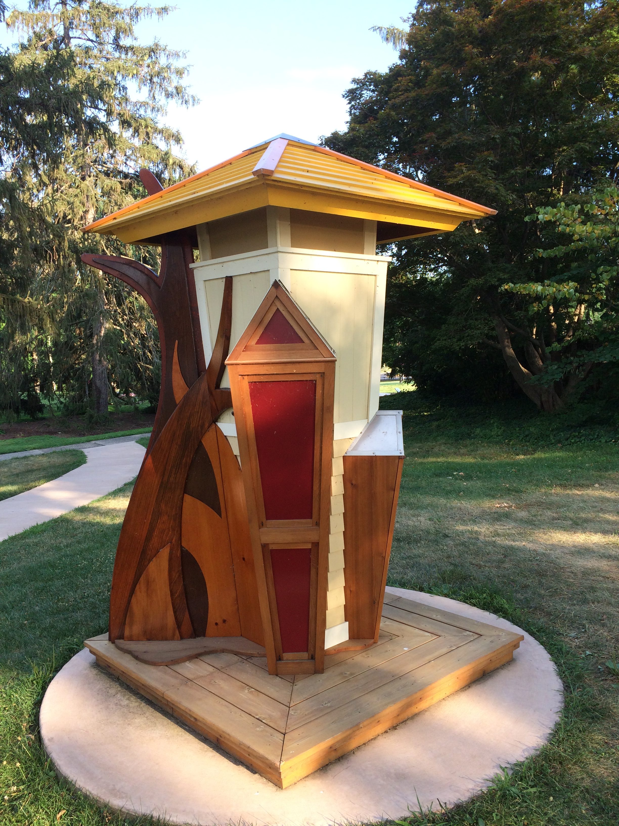
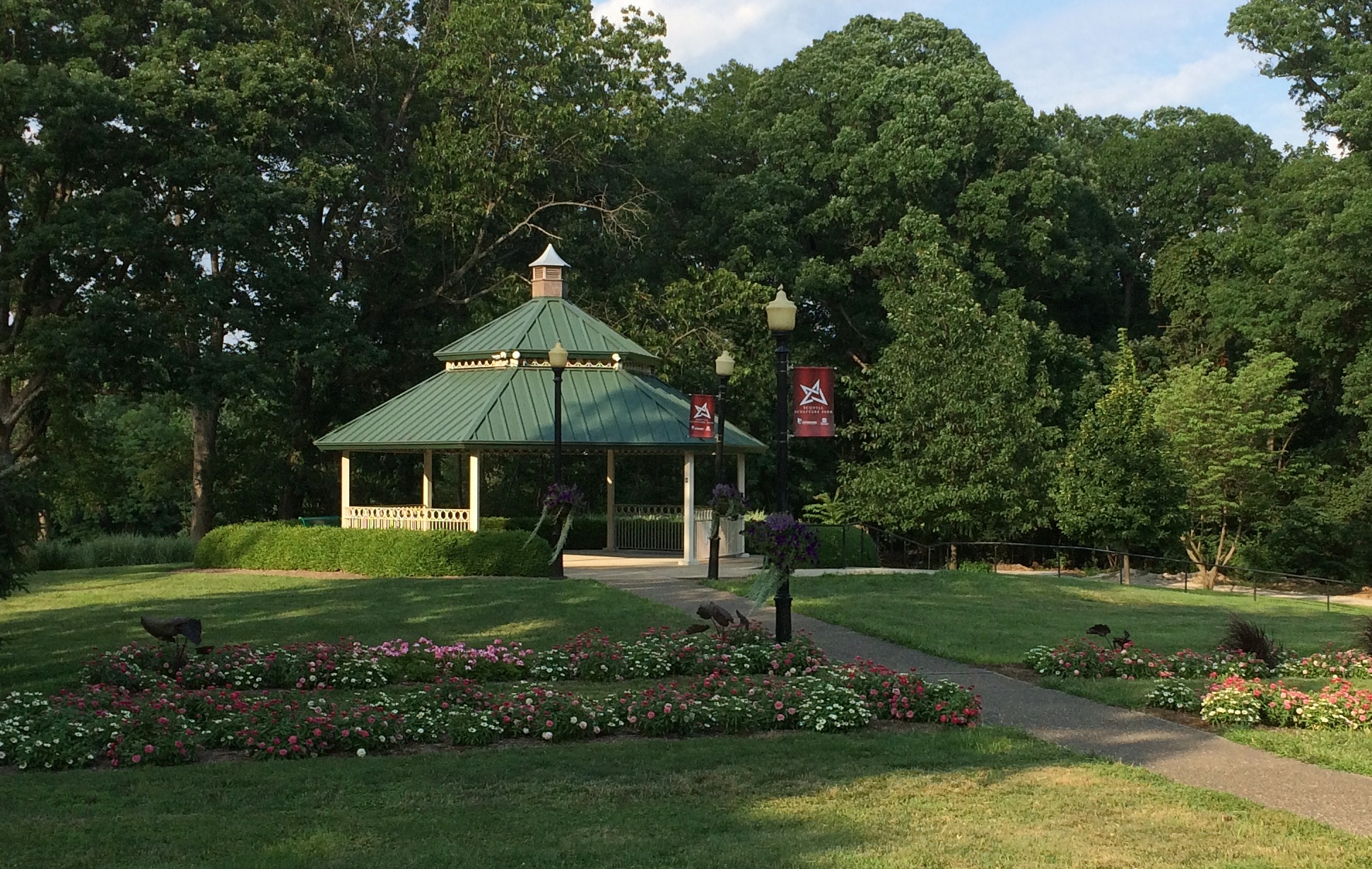
On the other hand, the sculpture park, on Decatur Park District land between the Scoville Zoo and the Decatur Children’s Museum, isn’t that old — only about three years. Interestingly, the sculptures aren’t permanent fixtures, but leased from the artists. After a few years, a new crop is brought in. According to my sources, the second set of 10 is in place now.
“My Favorite Things,” by Travis Emmen. “Calibration,” by Luke Achterberg. “Absence,” by Joseph Ovalle. “Urban Forest,” by Richard Herzog. “Rybee House 2,” by Stephen Klema.
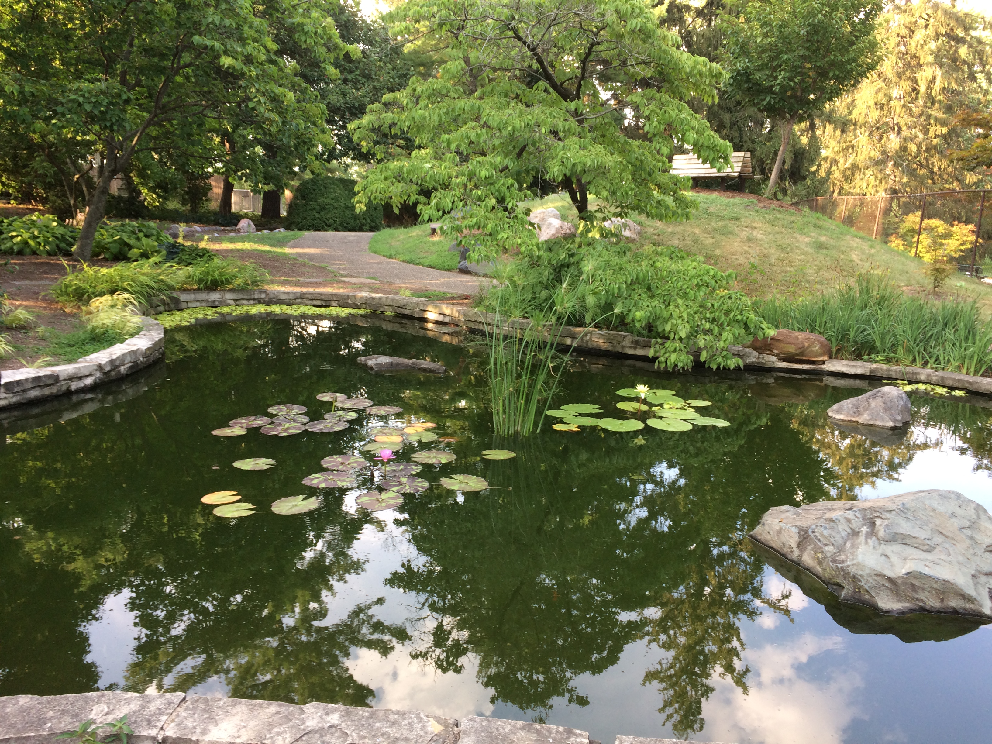
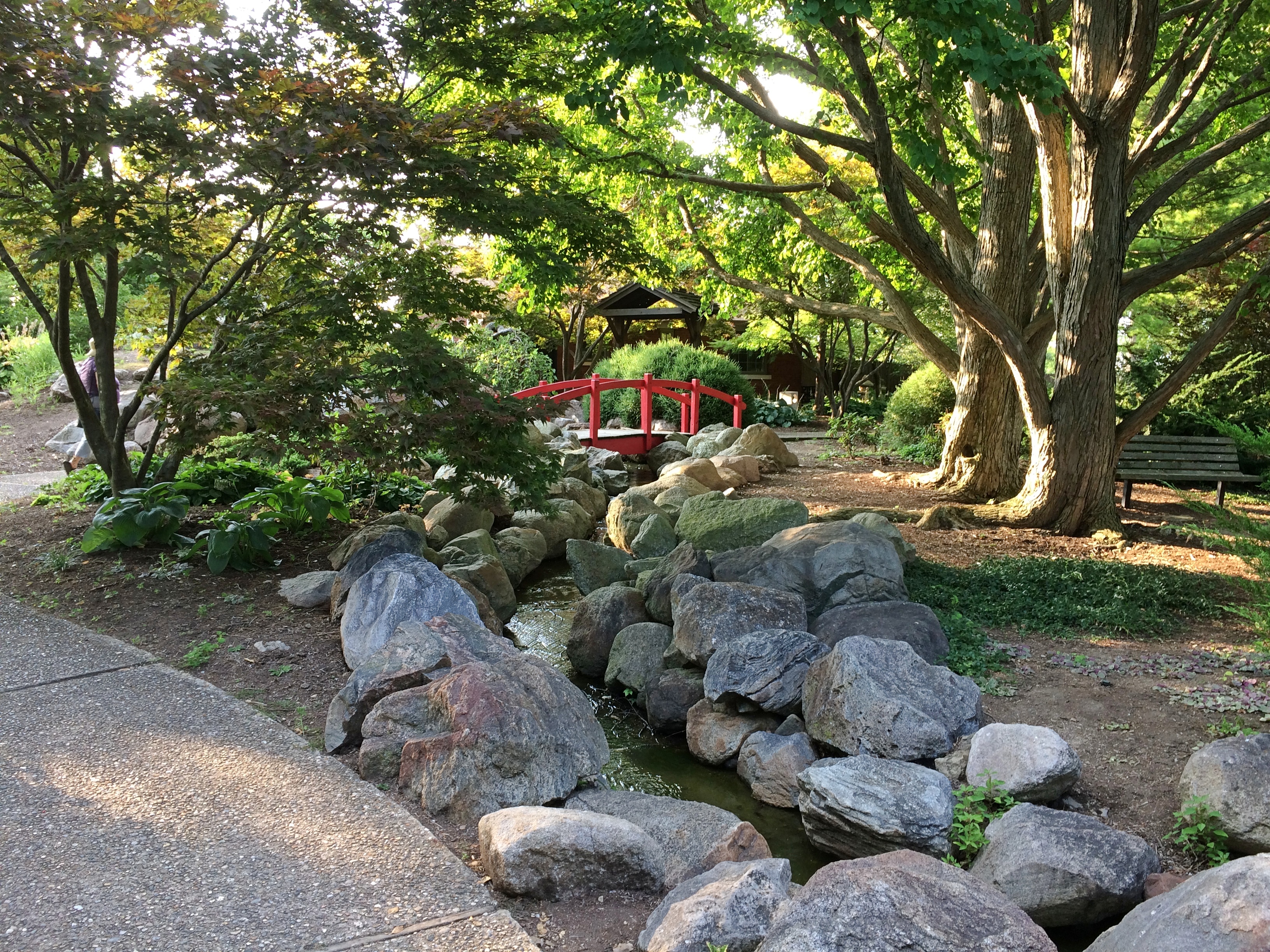
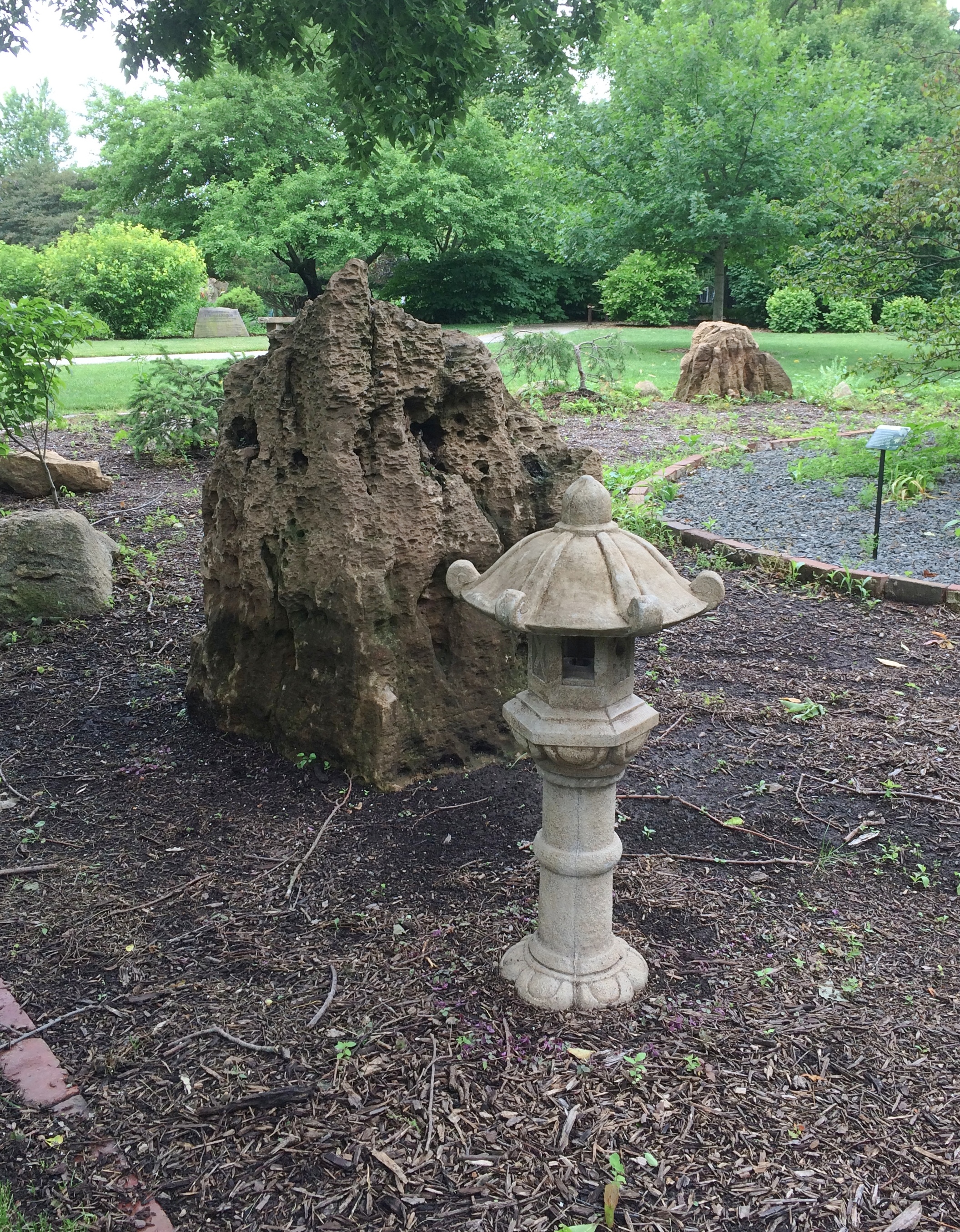
The park also includes the Scovill Oriental Garden, which has elements of Chinese and Japanese gardens.
Of course the park has a gazebo. As well it should. Here’s a book or database for someone to create someday: TheGreat Gazebo Gazetteer.
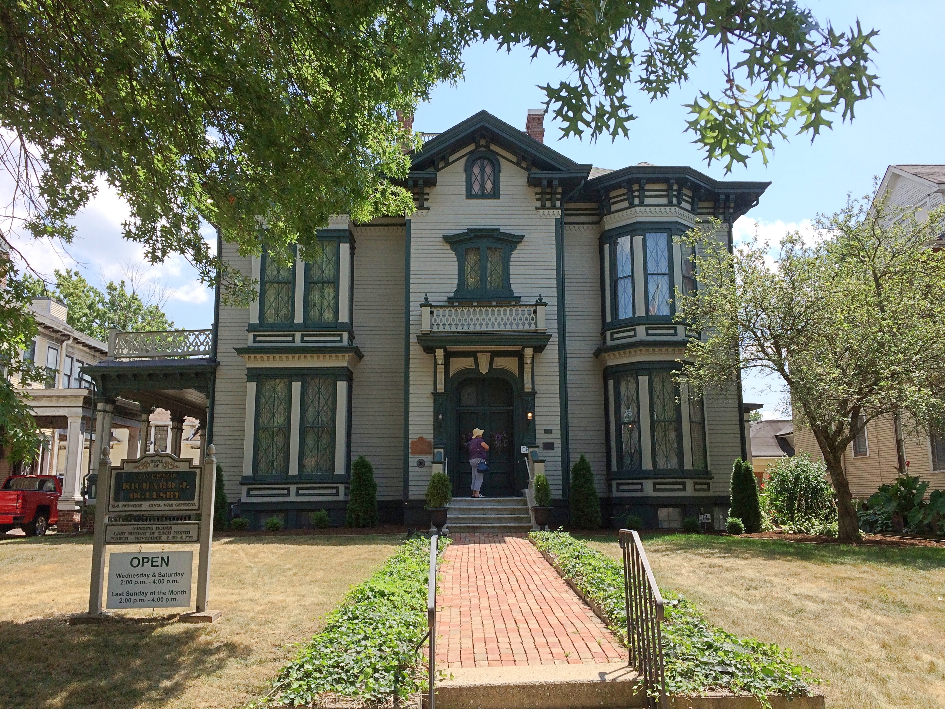
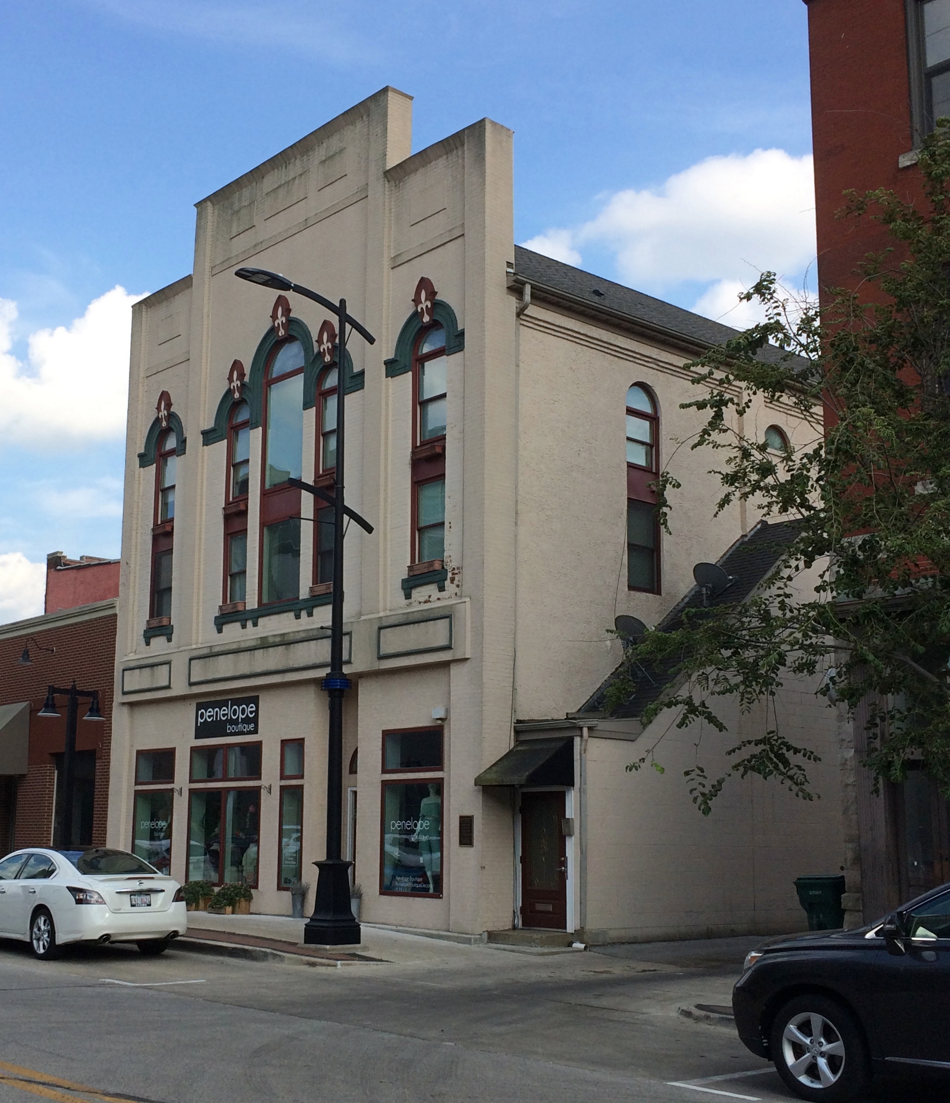
Near (or on) Eldorado St. — one of Decatur, Illinois’ main streets — are three small museums. Two are former mansions, one is attached to a factory. I figured we had time for two on Saturday afternoon, but in the end we visited all three.
This is the former mansion of three-time Illinois Governor, U.S. Senator and Civil War General Richard J. Oglesby (1824-99).
I’ve encountered Oglesby, in bronze anyway, in Chicago. He grew up in Decatur and had a successful run as an Illinois lawyer, Union Army officer, and politician. He panned for gold in California, traveled in Europe in the 1850s, married at least one wealthy woman (not sure about his first wife) and knew Lincoln well — was in fact at the Petersen House in Washington City when the Great Emancipator died.
Designed originally in the 1870s by William LeBaron Jenney, father of the skyscraper, in the 21st century the mansion is resplendent, the work of decades of restoration.
The museum’s web site says: “The Library is the most significant room in the house regarding authenticity. It remains as it was built. All the wood is of native black walnut, with the exception of the parquet floor. The original shutters have been reproduced, and glass doors were added to the shelves which were on the architect’s drawings. The books in the cases are Oglesby family books.
“The dining room is the other area that is known to be correct. During the restoration, the complete decoration of the room was found, even the color of the ceiling and all the faux finishes. This room has been reproduced as it was during the Oglesbys’ time in the house.
“The dining room wallpaper was reproduced by a company that was making authentic Victorian wallpapers. All the walls with the exception of the hall and the library are covered with Bradbury and Bradury Wallpaper copied from papers of the time period.
“Furnishings in the home have been chosen for the time period 1860-1885. Most came from old Decatur families. Many of the pieces and the artifacts have come from Oglesby descendants.”
My own favorite artifact is tucked away behind glass: a 19th-century prosthetic leg, that is, a primitive wooden item purported to belong to Antonio de Padua María Severino López de Santa Anna y Pérez de Lebrón, Napoleon of the West, and captured at the Battle of Cerro Gordo in 1847 after said Napoleon badly mismanaged things.
The authenticity of the leg hasn’t been confirmed, however. Unlike the other one in Illinois. Per Wiki: “Santa Anna, caught off guard by the Fourth Regiment of the Illinois Volunteer Infantry, was compelled to ride off without his artificial leg, which was captured by U.S. forces and is still on display at the Illinois State Military Museum in Springfield, Illinois.”
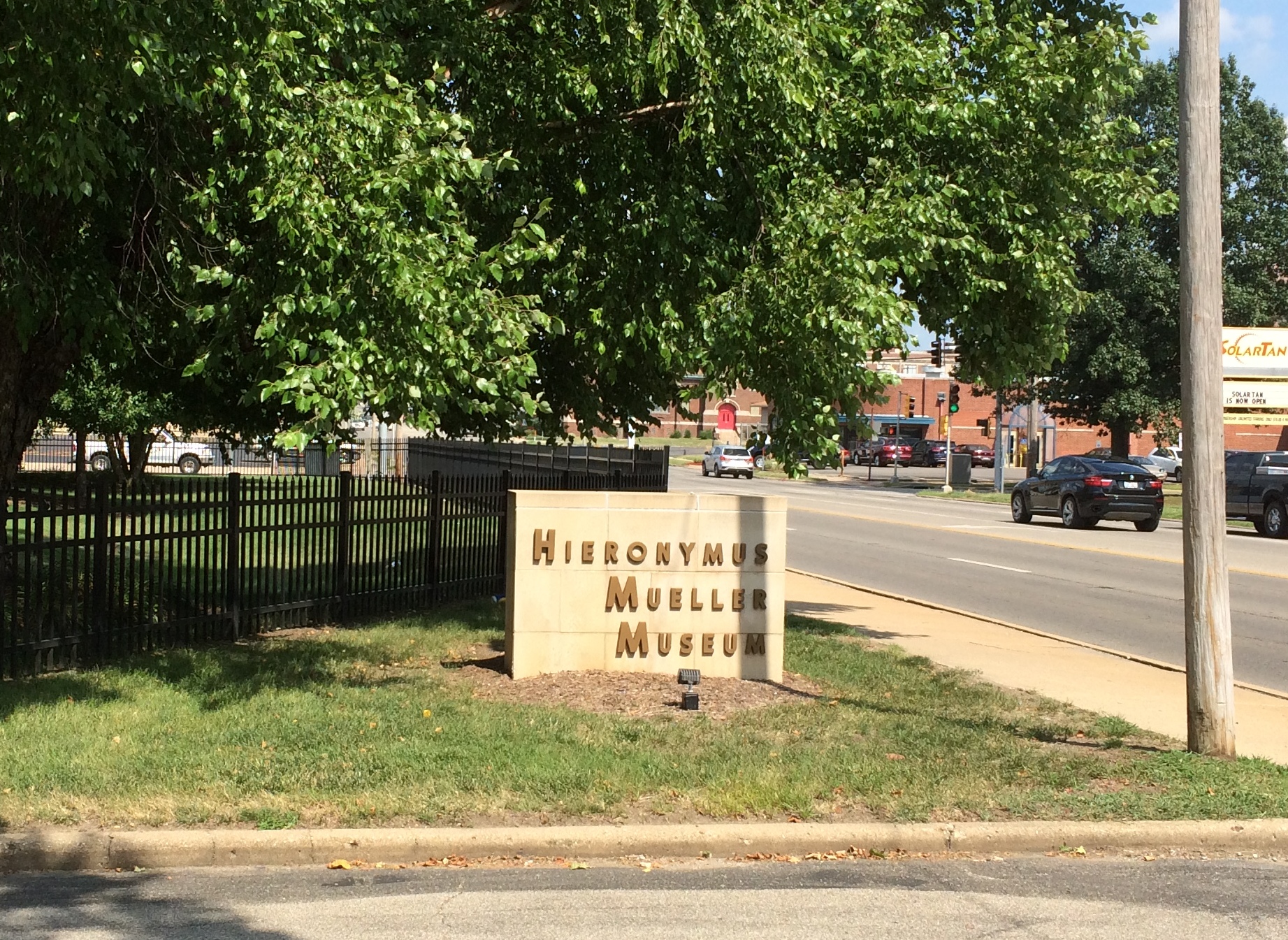
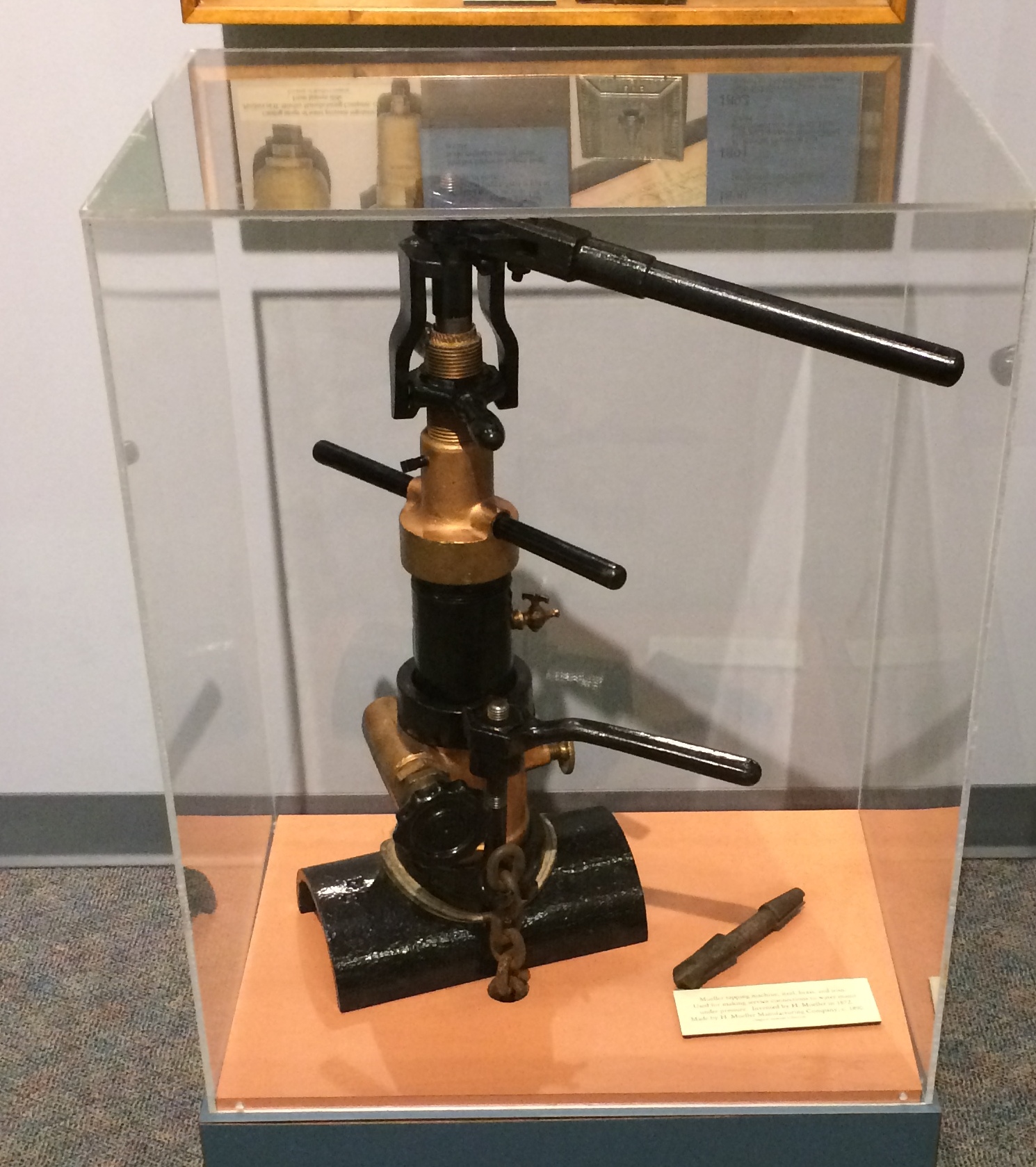
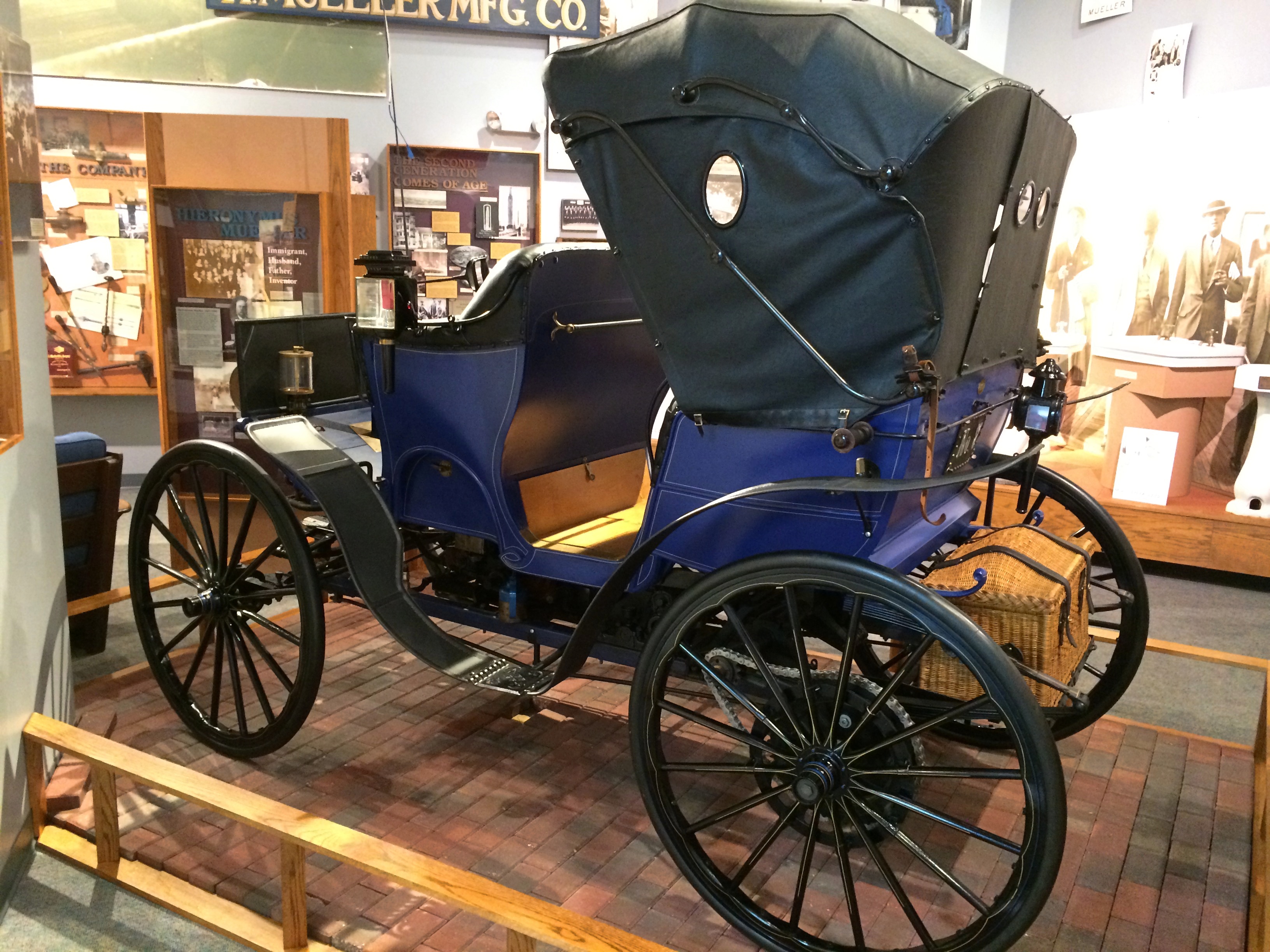
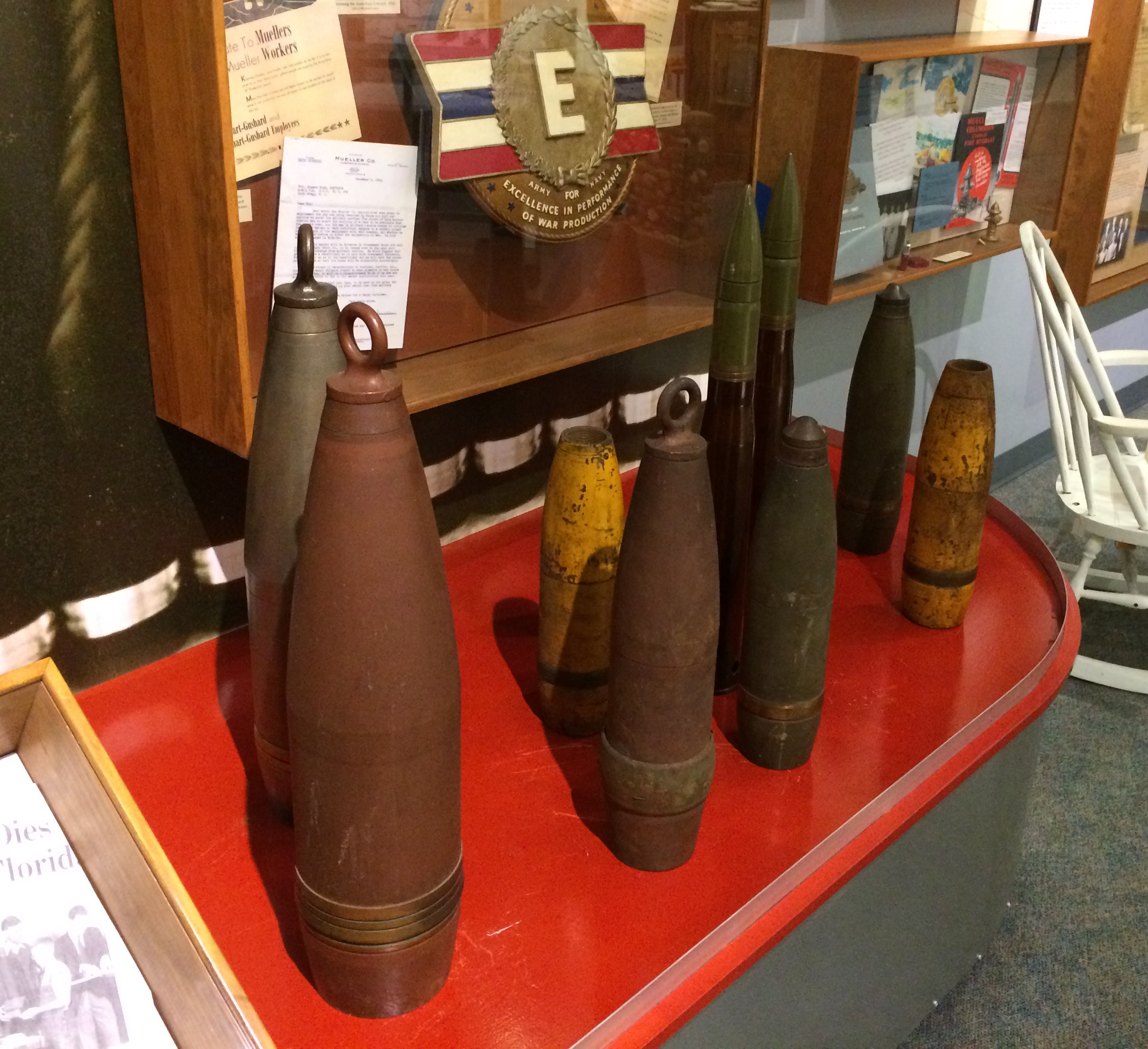
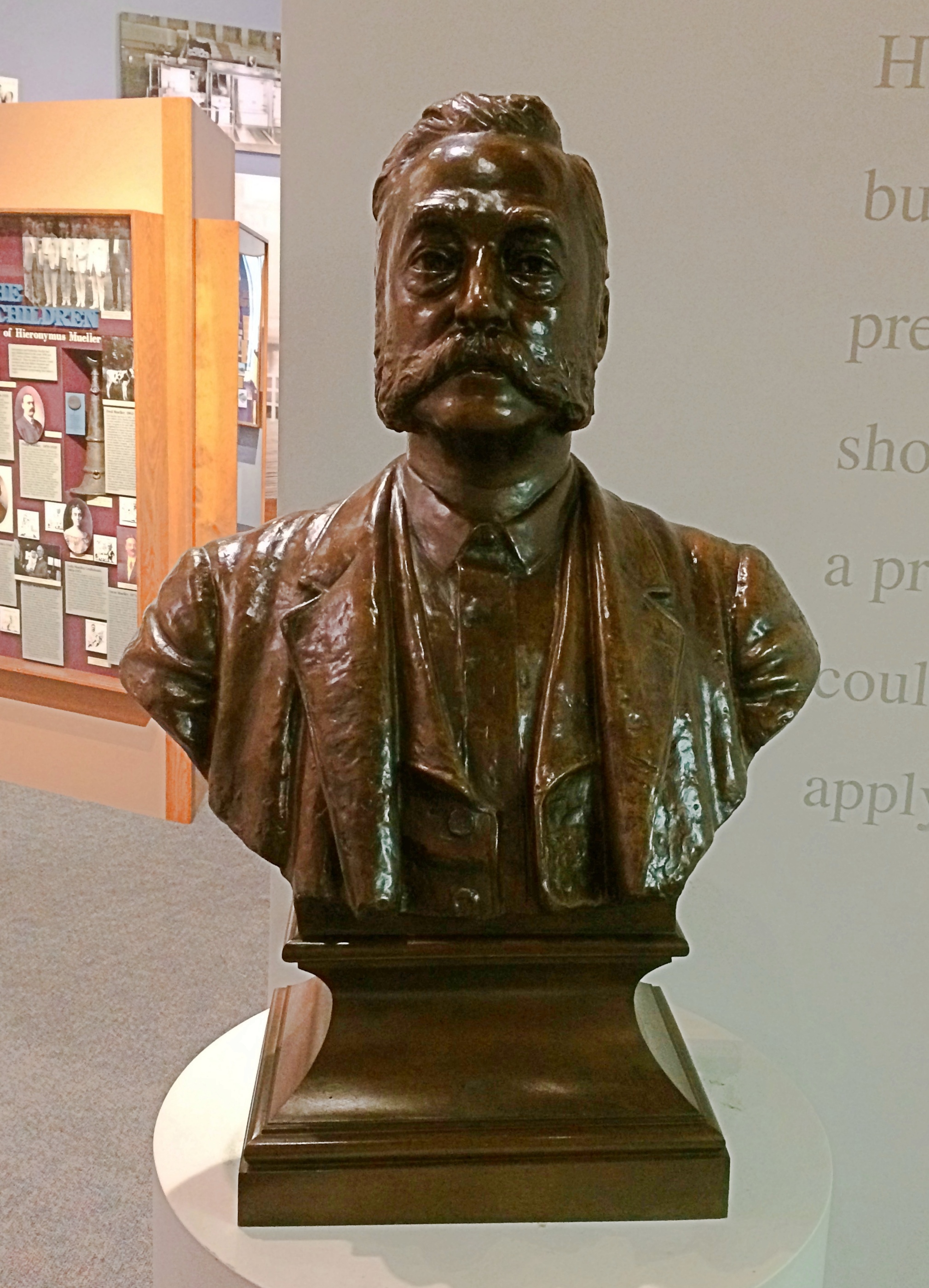
Not far from the Oglesby mansion is the Hieronymus Mueller Museum, a different sort of place. Mueller, as in the Mueller Co. These days headquartered in Tennessee, but for a long time a Decatur company. Even now the company has a factory in Decatur, which is next to the museum. Mueller Co. made, and makes, metal parts and structures and machines. Half of the fire hydrants sold in the United States are Mueller made, for instance. But that’s just a part of the output. Many examples of the company’s products are on display at the museum, along with various exhibits about the German immigrant Hieronymus (1832-1900) and his many children and grandchildren. The company dabbled in horseless carriages, but didn’t go whole hog into that. It did its part in WWII. Here’s Hieronymus in bronze. He was a whiz during the golden age of American invention. The museum says: “He started his business with a small gunsmithing shop but soon added locksmithing and sewing machine repairs. He had a knack for understanding mechanical devices. This led to his appointment as Decatur’s first ‘city plumber’ in 1871 to oversee the installation of a water distribution system.
“The following year he patented his first major invention, the Mueller Water Tapper who [sic] is, with minor modifications, still the standard for the industry.
“He and his sons went on to obtain 501 patents including water pressure regulators, faucet designs, the first sanitary drinking fountain, a roller skate design, and a bicycle kick-stand. In 1892 Hieronymus imported a Benz automobile from Germany and, together with his sons, began refining it with such features as a reverse gear, water-cooled radiator, newly designed spark plugs, and a make-and-break distributor – all leading to patents.”
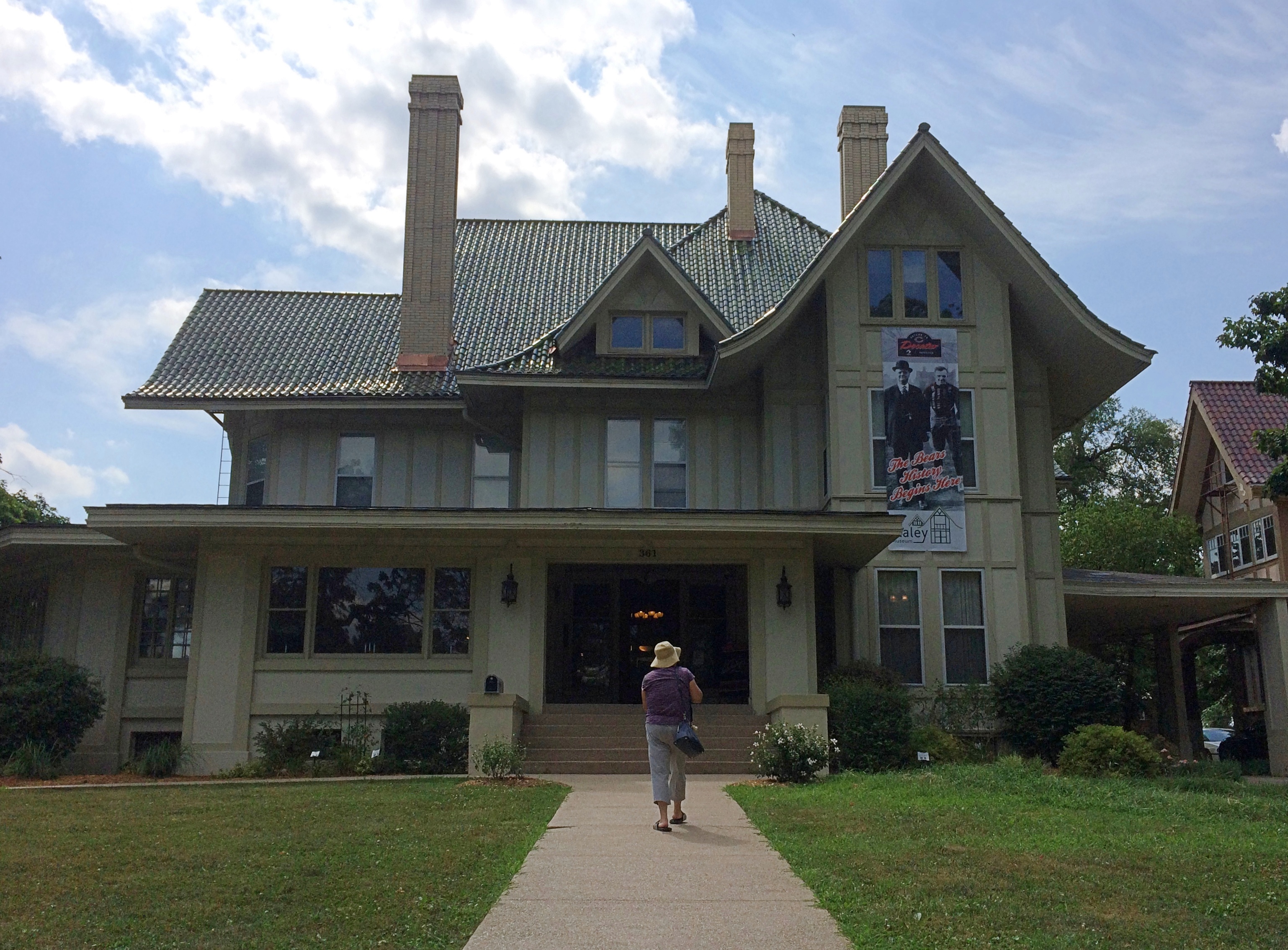
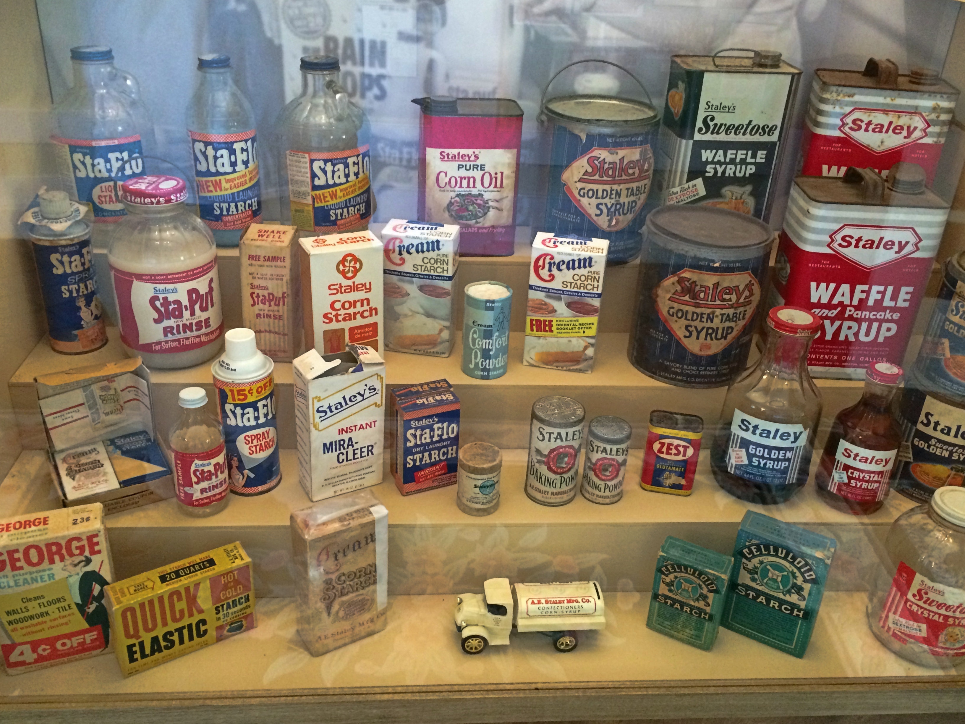
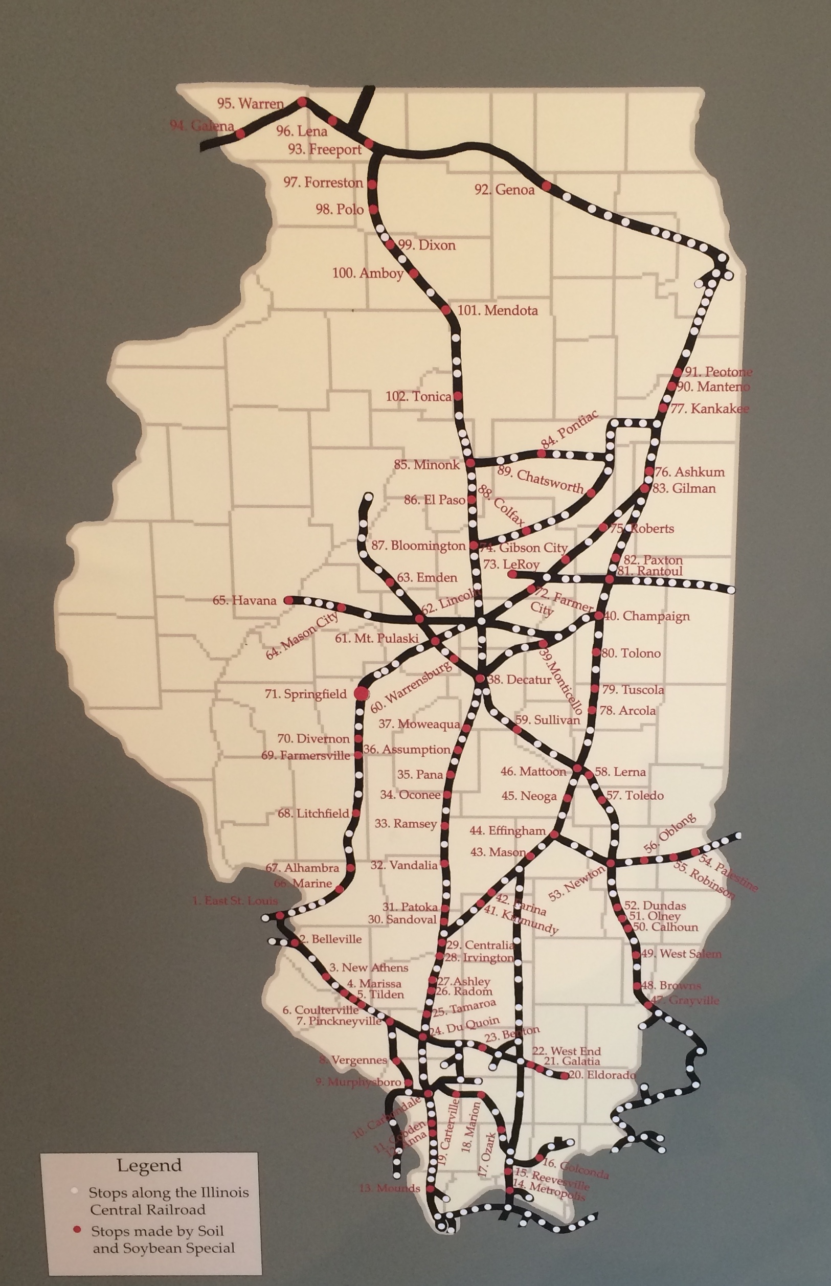
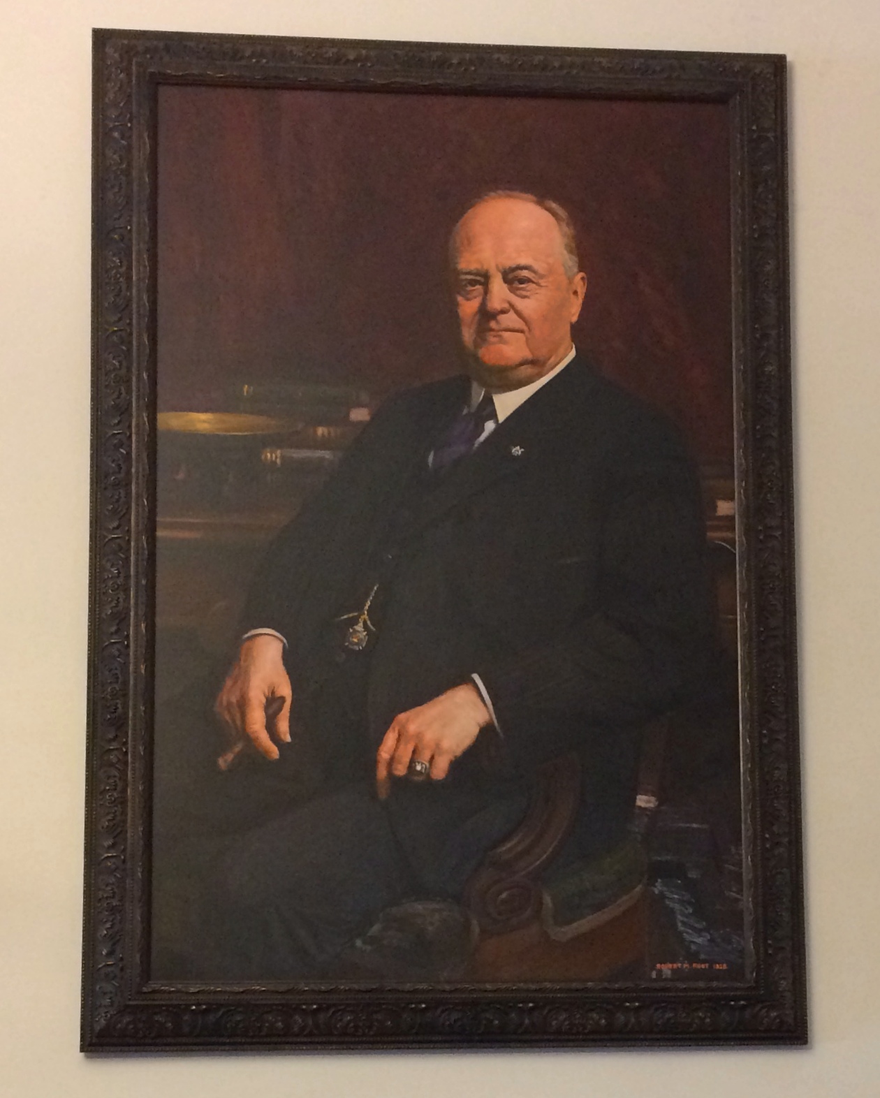
Our third and final small Decatur museum for the day: the Staley Museum, one-time house of Decatur businessman A.E. Staley. Staley was neither politician nor inventor, but had considerable talents as a salesman and ultimately boss man of A.E. Staley Mfg. Co., which started out as a starch specialist and expanded into many other products, mostly made from corn and soybeans. As a child, I ate Staley syrup. Among other causes, Staley (1867-1940) was a soybean booster. In the spring of 1927, he organized a train to publicize and facilitate soybean cultivation in Illinois, the Soil and Soybean Special. As the promotional material with the map says, “This is a farmers’ institute on wheels. If the farmer can’t go to college, this college will come to him.”
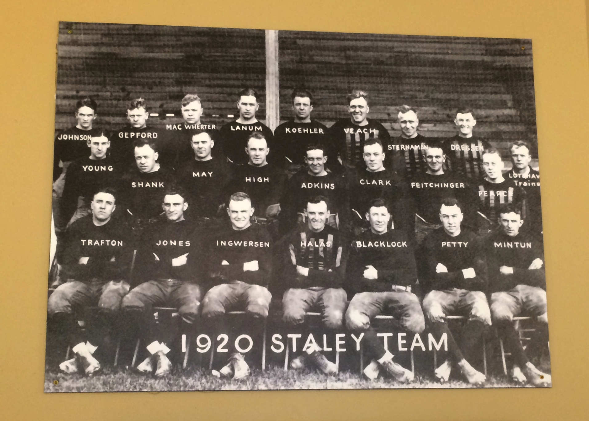
Staley is also known for founding the football team that evolved into the Chicago Bears: the Decatur Staleys, a leather-helmet company team. Here they are in 1920. The origin of the team isn’t forgotten. Even now, the team mascot is Staley Da Bear.
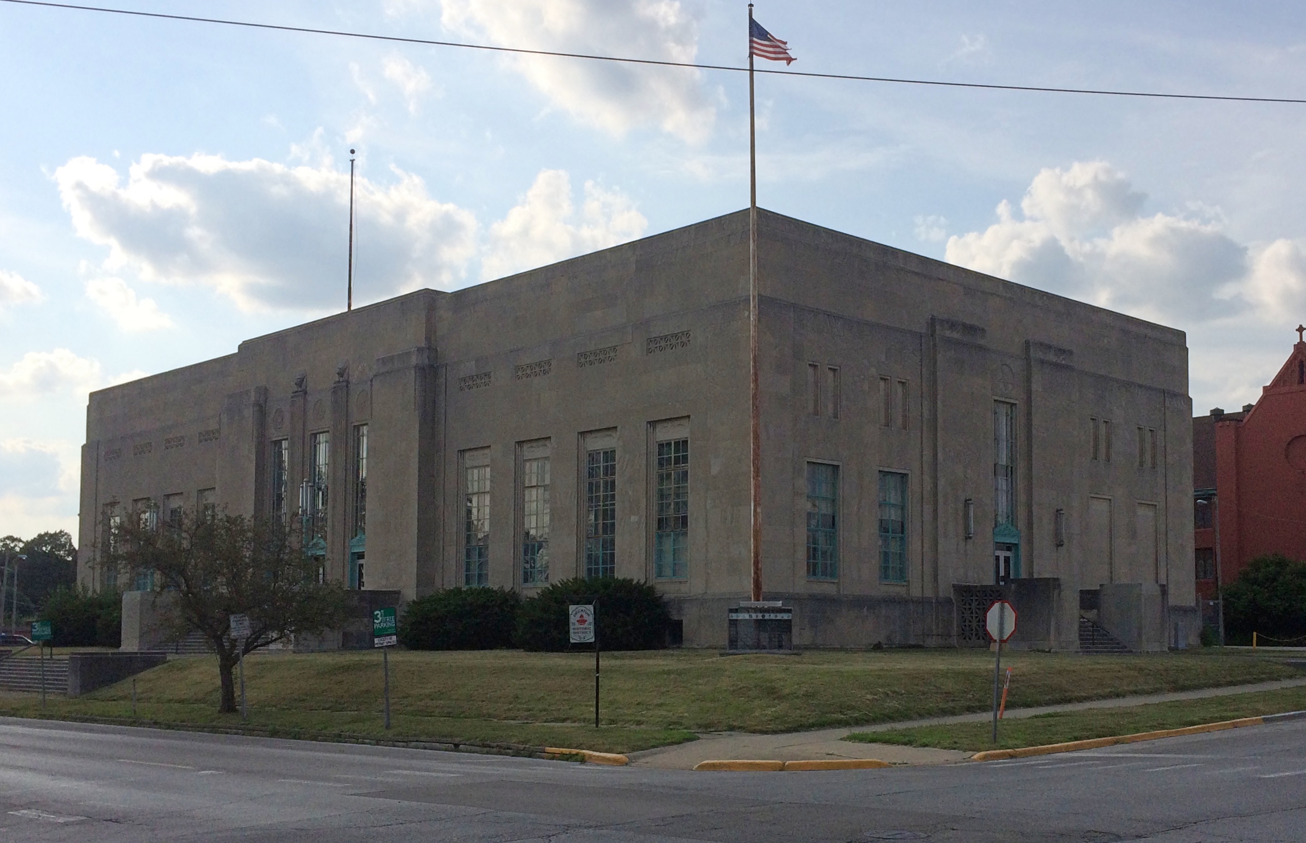
Here’s the boss man himself. Looking every bit the ’20s tycoon. He also developed an office building for his company a few miles from the home. The structure was one of the largest things in Decatur at the time, and a stylish ’20s design it is (see page 5).
Later in the day, we drove by for a look at the office building from the street. It’s still a commanding presence in its part of Decatur, though like the A.E. Staley Mfg. Co., it’s part of Tate & Lyle, a British supplier of food and beverage ingredients to industrial markets.
On Saturday, I wondered how many U.S. cities and towns are named for Stephen Decatur. Later I looked it up: Counting Decatur City, Iowa, and a ghost town in Missouri of that name, 17 — not counting counties, of which there are six among the several states.
Now mostly forgotten except by the Navy and naval history enthusiasts, he had his moment. He even took a lethal bullet in a duel, though Commodore Decatur isn’t known as well as Alexander Hamilton for that distinction. Lin-Manuel Miranda needs to get on the stick and write Decatur: A Musical of Kicking Barbary Pirate Asses.
Decatur’s moment also happened to be when towns and counties were being named in the United States. Decatur, Illinois, has the largest population of any of them, edging out Decatur, Alabama by some thousands of souls, even though the Prairie State Decatur has been shrinking in recent decades.
We spent most of Saturday afternoon in Decatur, Illinois, our second visit to acity of that name this year. Though the more northern Decatur isn’t quite the industrial town it used to be, a number of large manufacturers are still in evidence, such as Mueller Co., more about which later. Downtown Decatur seemed in fair shape as well. Good enough for a walkabout late in the afternoon, when the heat was ebbing away.
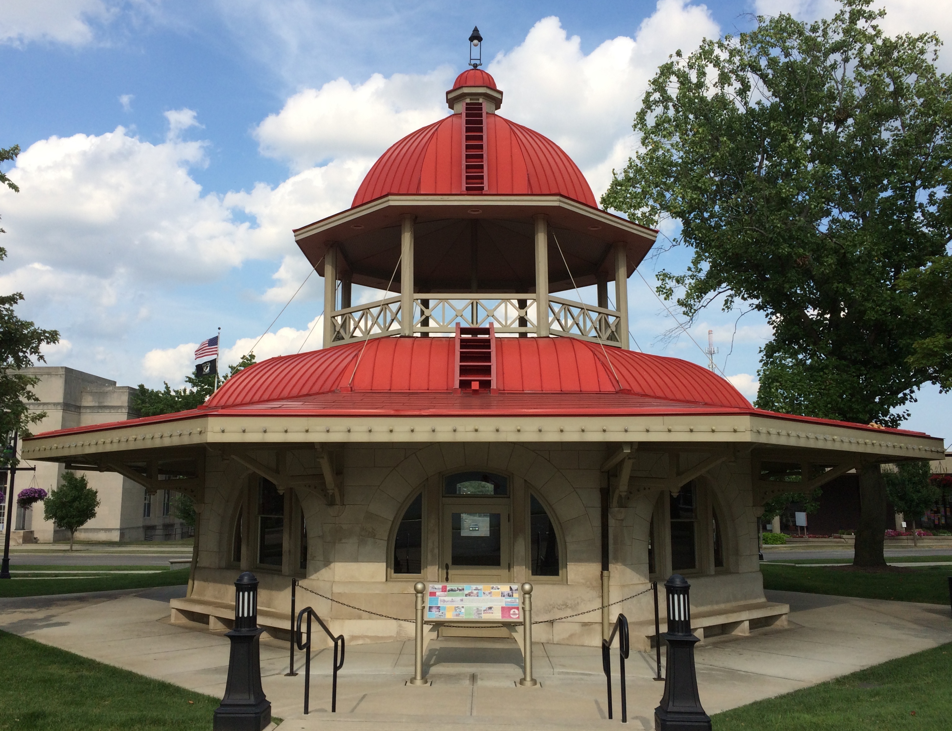
Decatur’s signature structure is the Transfer House. “The Transfer House was erected in 1895, replacing a smaller shelter dating from 1892,” writes H. George Friedman Jr., whose page features many pictures. “The City Electric Railway paid $500 toward the $2,700 building fund subscribed by local merchants and property owners, and agreed to furnish and maintain the building. As its name implies, it was used as a central transfer point for all the streetcar lines (and later the bus lines) in the city.”
Designed by W.W. Boyington, of all people. That only seems odd to me because we visited another one of his works just last week, the Old Joliet Prison. So there’s nothing really odd about it. The man got a lot of commissions.
Remarkably, the Transfer House was originally located at Main and Main streets — that always sought-after address, at least among commercial real estate investors. Decatur still has a north-south Main and an east-west Main, and their meeting looks like an ordinary intersection, though there is a statue of young A. Lincoln nearby.
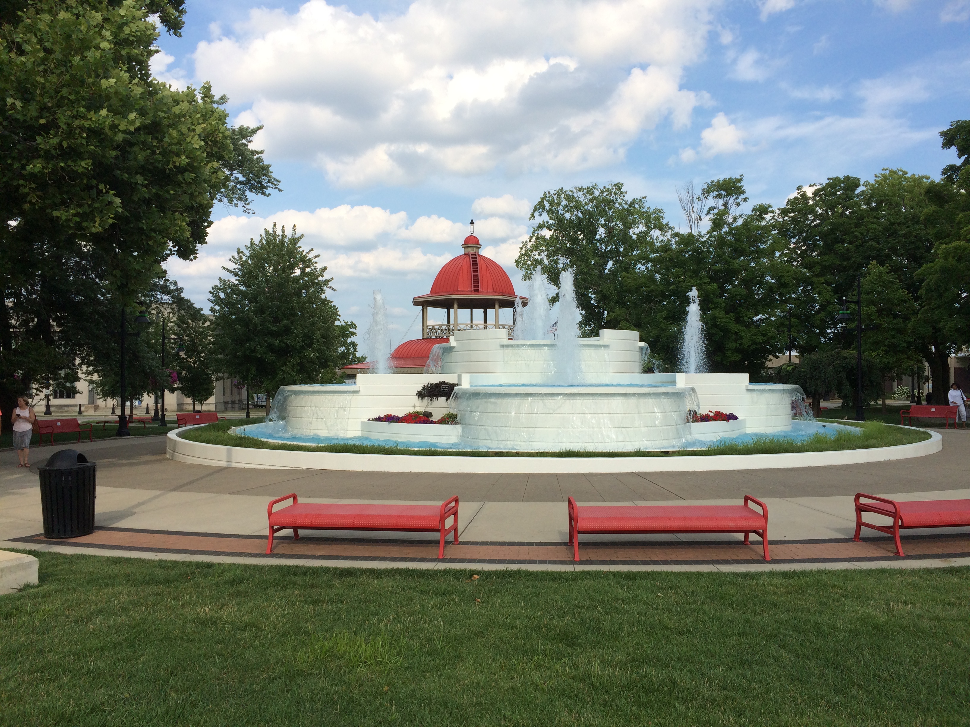
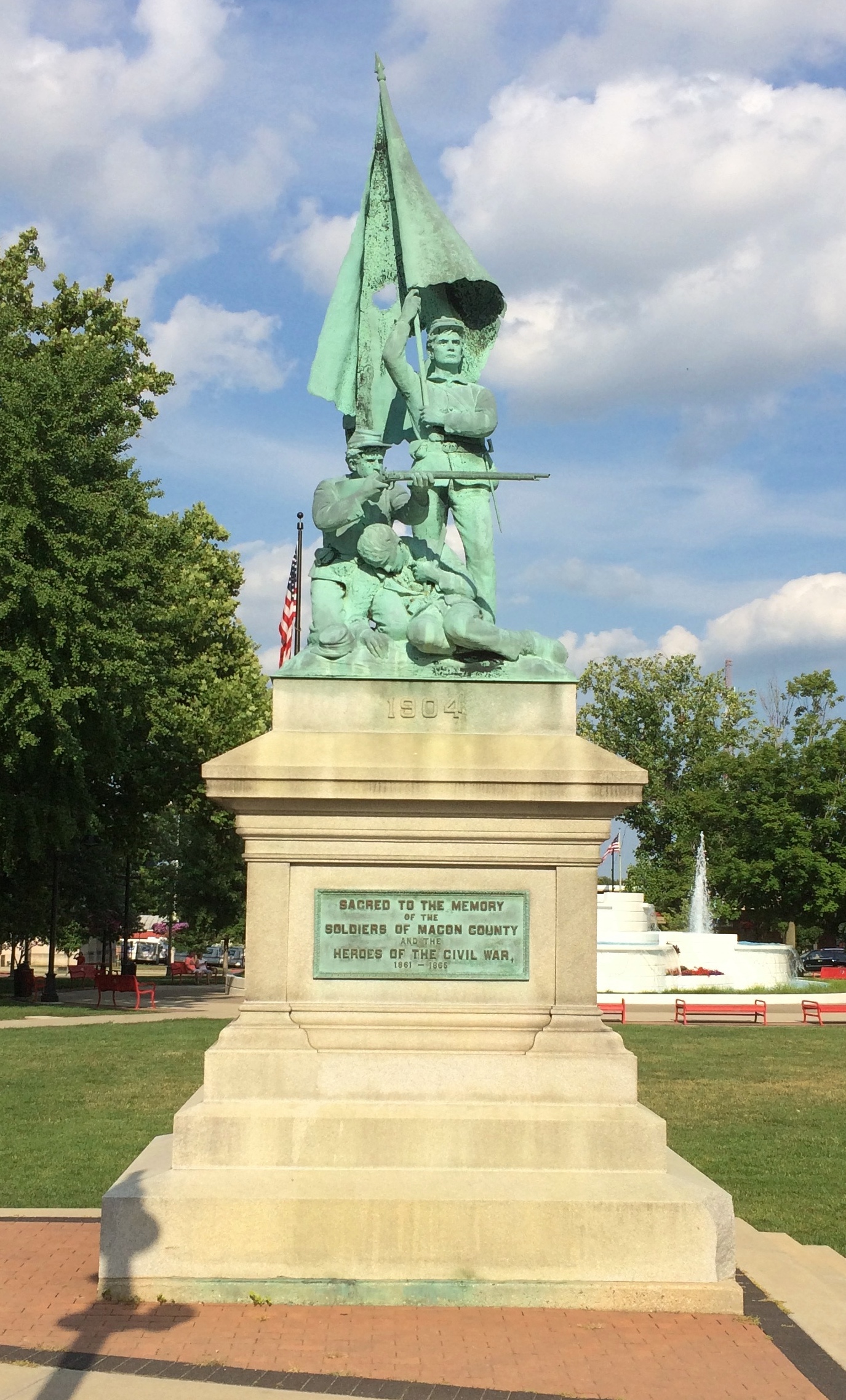
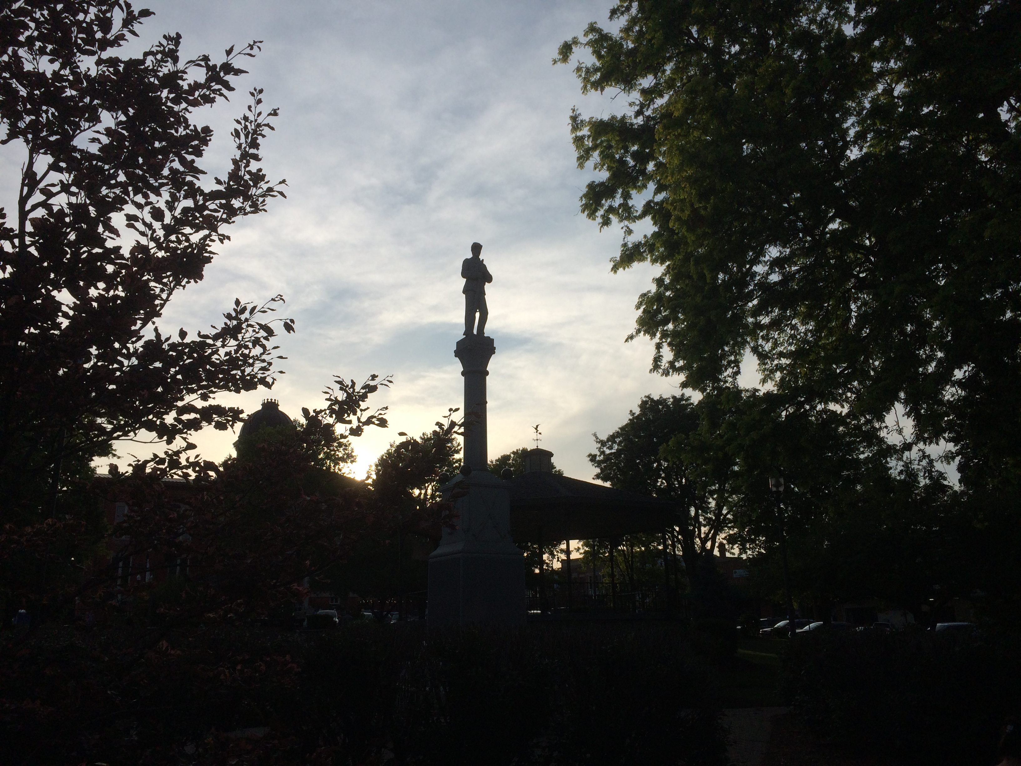
In 1962, the city moved the Transfer House to its current location in Central Park, near a fountain. The park also features a memorial to the Macon County’s Civil War soldiers. On the back of the base, a plaque says:
Grand Army of the Republic Organized in this city April 6, 1866 Erected by Dorcas Society, and Other Patriotic Citizens
Not erected until 1904. Maybe funds were in short supply for years, but then the people of Decatur realized their veterans didn’t have much longer.
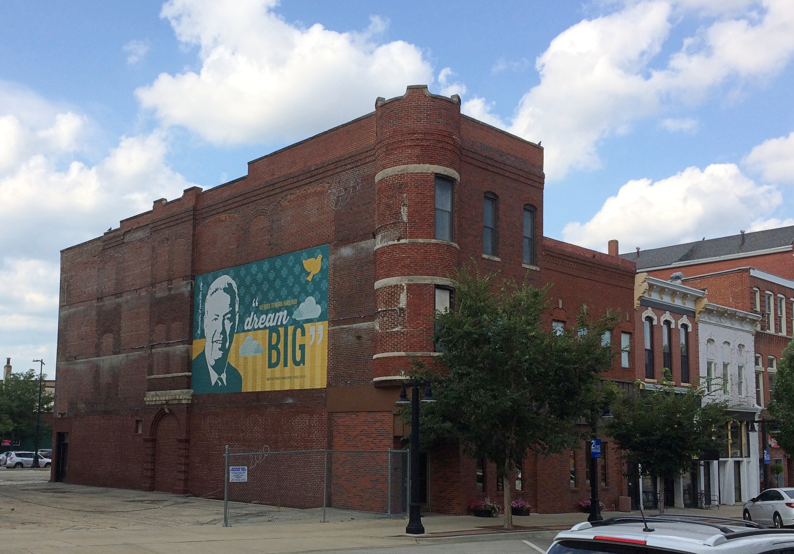
Near Central Park are a number of buildings, including this one sporting one of Decatur’s murals, featuring Mike Elroy, a recent mayor. Driving into town we saw a more interesting mural featuring Bob Marley on the side of a record store building, but we didn’t stop for it.
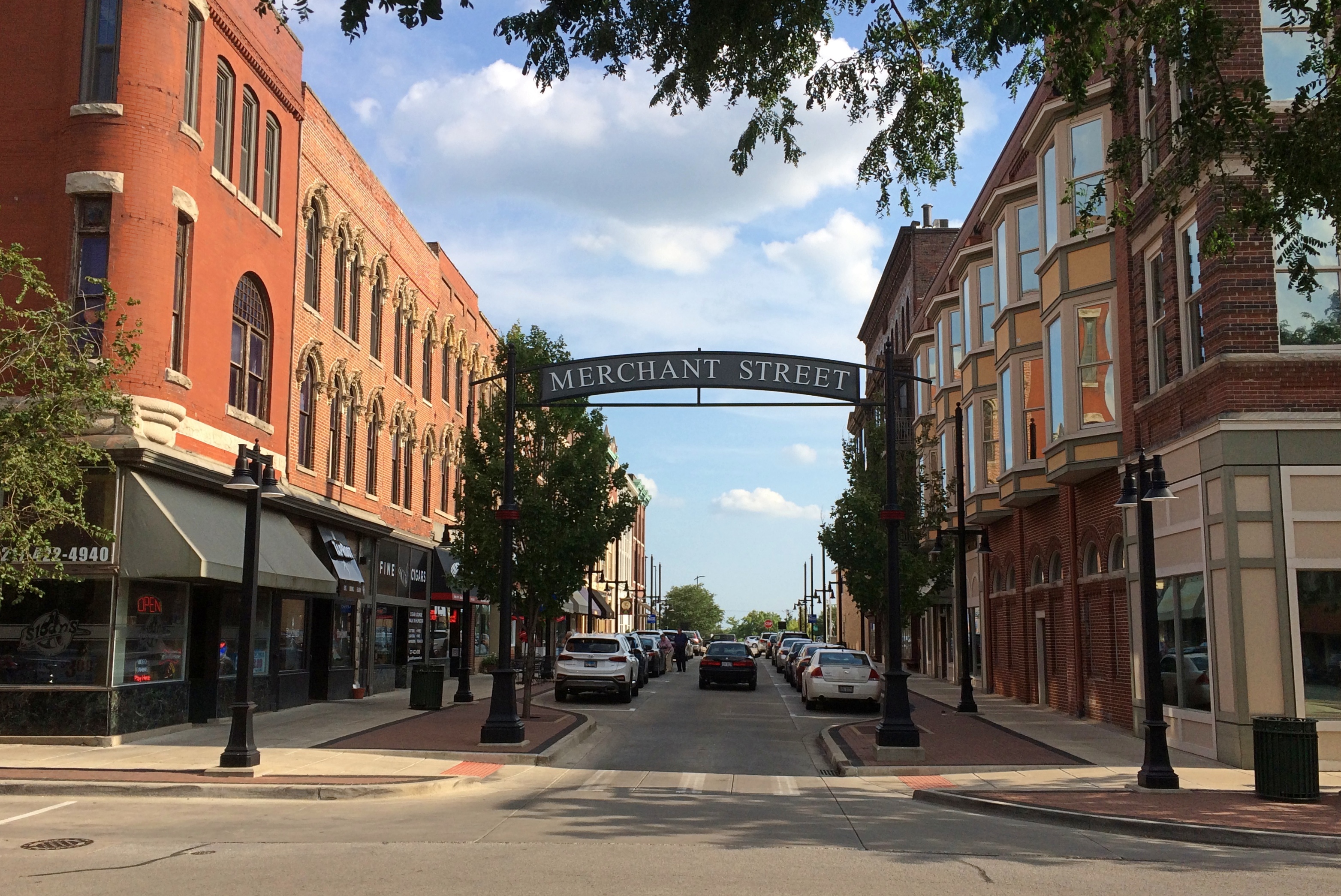
A former Universalist church building, originally erected in 1854. The handsome Merchant Street, formerly a hive of scum and villainy.
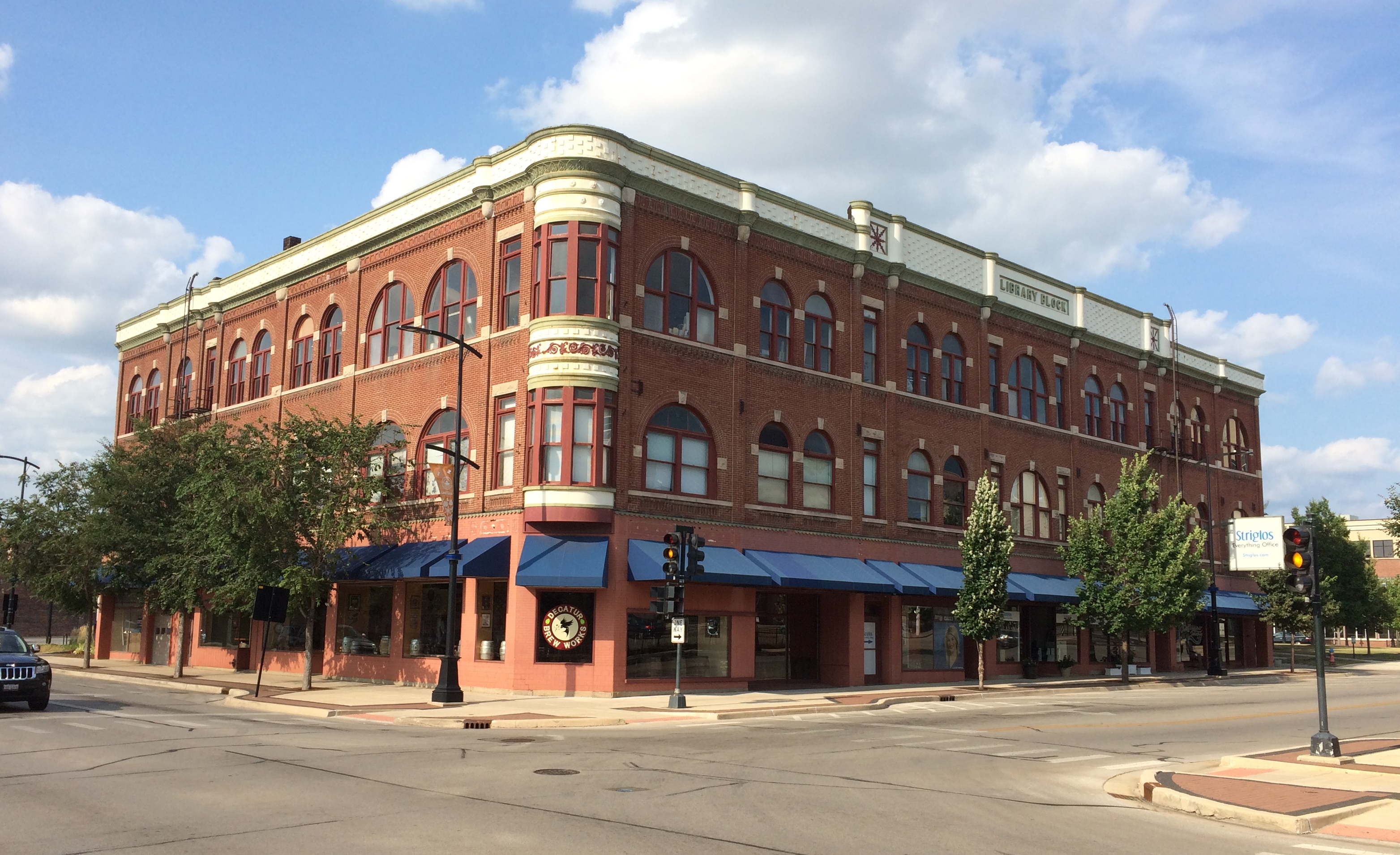
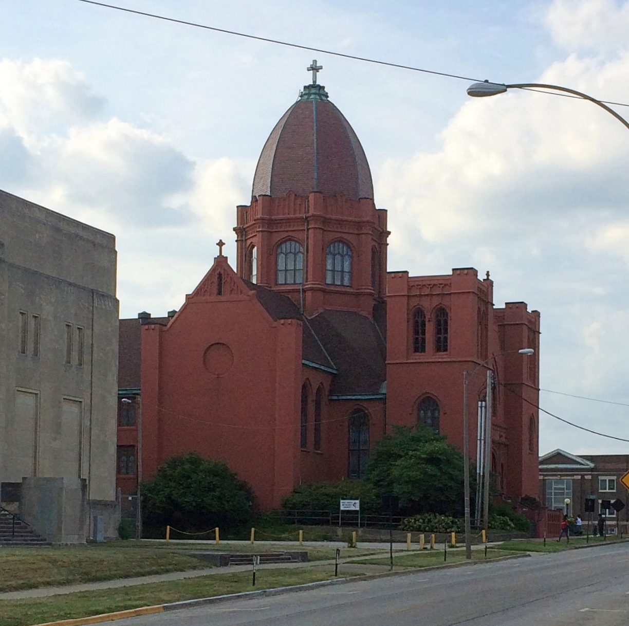
Further from the park was the equally handsome Library Block, home these days to a brewpub and other businesses. The Decatur Masonic Temple, looking a lot like a WPA post office. The First United Methodist Church of Decatur. As with many city churches, it would have been nice to get inside for a look, but no go.
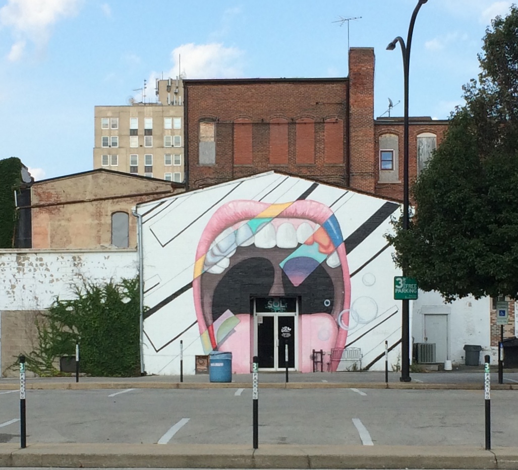
At first, I thought this might be the entrance to an eccentric dentist’s office, an oral equivalent of the eyes of Doctor T. J. Eckleburg.
But no: it’s the entrance to the Sol Bistro restaurant.
At noon on Saturday, the sun was high and mighty and toasting northern Illinois well into the 90s F. Later in the afternoon, an unexpected storm blew through. Unexpected because I hadn’t looked at any weather reports. By late afternoon, the storm was over and temps were in the pleasant 70s.
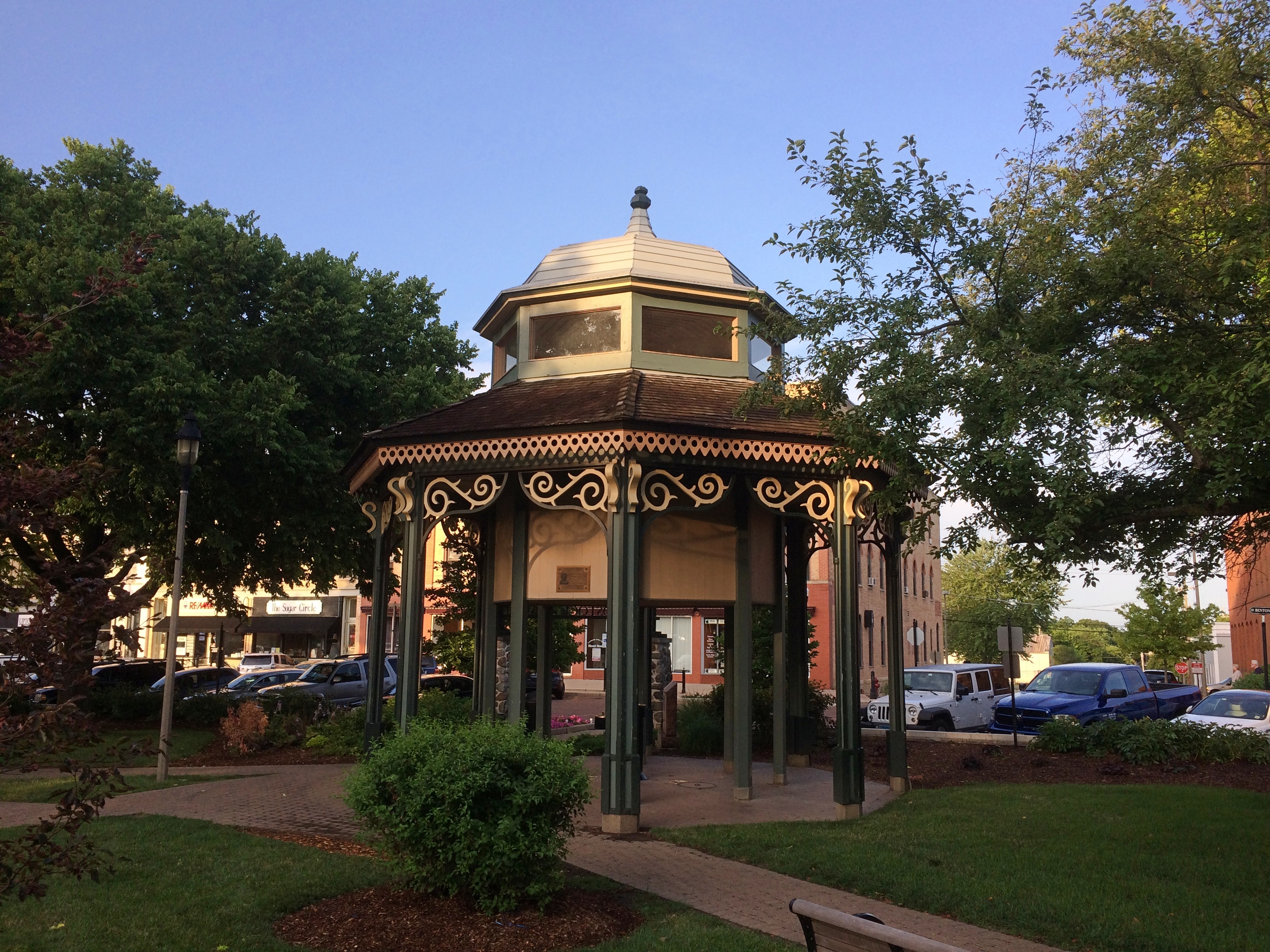
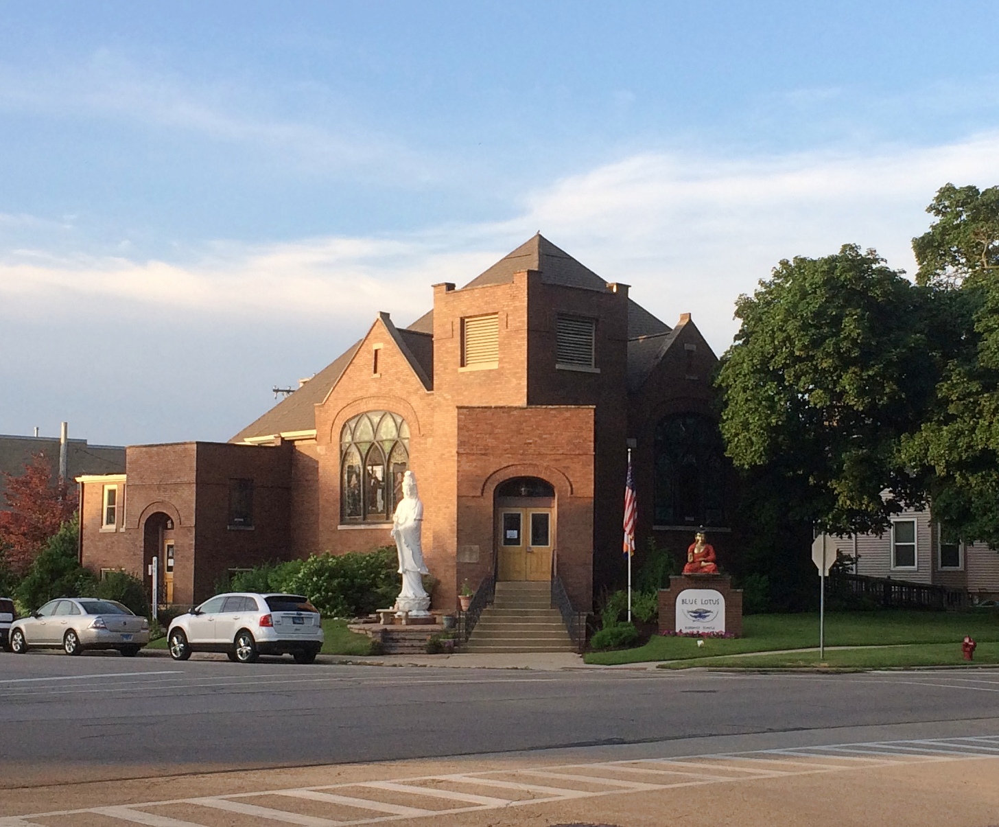
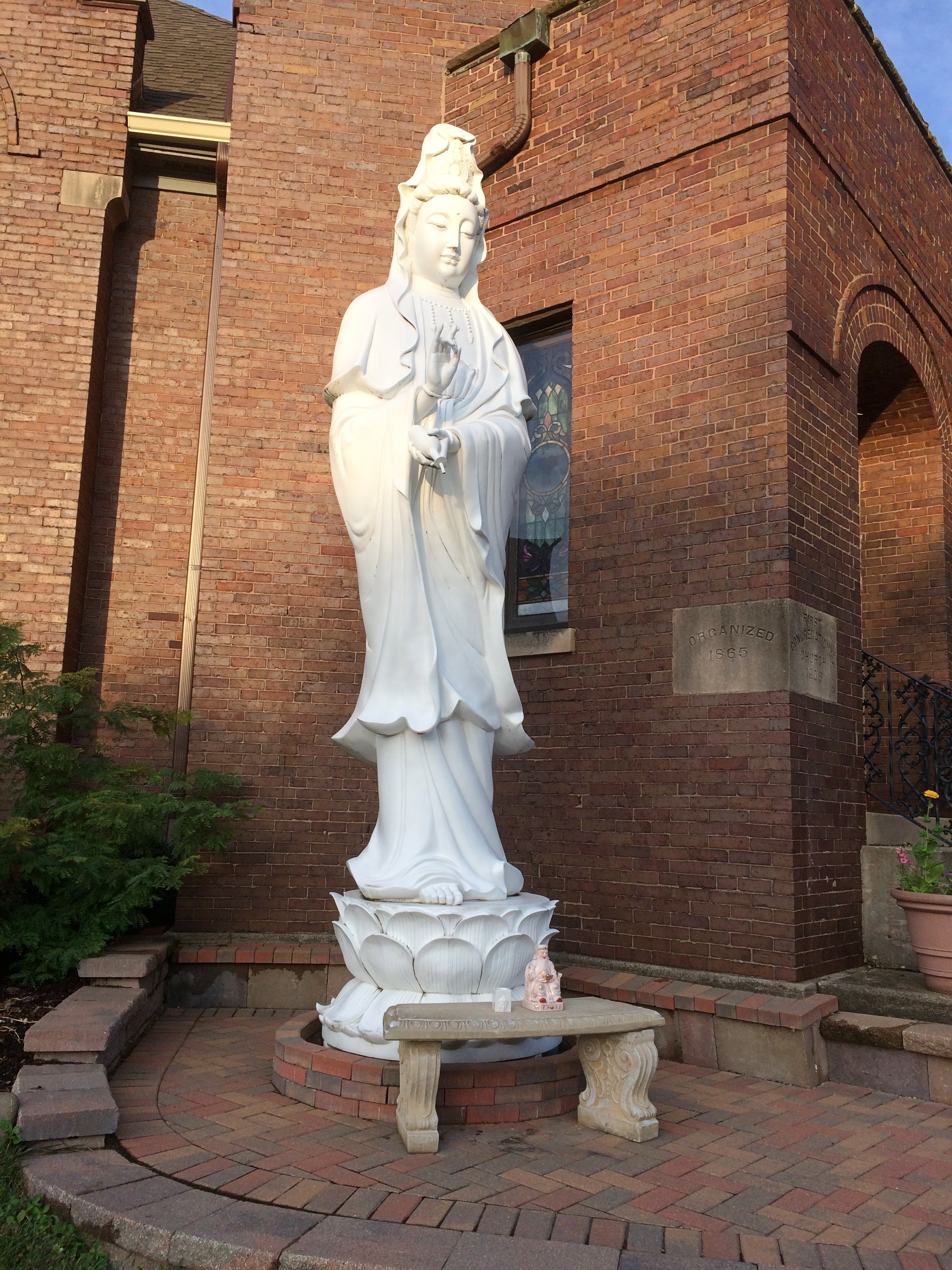
A good time to take a short walk in Woodstock, Illinois, which might be one of the state’s most pleasant towns. A good place to start was Woodstock Square. At the very center of the square is a GAR memorial to Union soldiers and sailors from Woodstock, which was founded in 1852. What’s a town square without a gazebo? Strolling south from Woodstock Square, I passed by the Blue Lotus Buddhist Temple. I noticed it on a previous visit to Woodstock.
I don’t believe these statues were there the last time. It’s been seven or so years, after all. Plenty of time to add a few depictions of Buddha. The temple isn’t the only religious site in the vicinity. Cater-cornered across the street is Woodstock’s First Church of Christ, Scientist. Not far away are the First United Methodist Church and the Unity Spiritual Center of Woodstock.
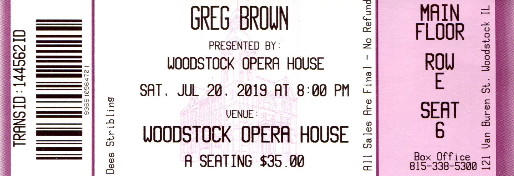
It was dark after the show, but I didn’t want to hurry away from Woodstock. Besides, I’d read that there was a new(ish) mural just north of Woodstock Square. So it is, in an alley — which the town calls a “pedway” — off Main Street next to Classic Cinemas Woodstock Theatre.
The mural honors the likes of Groundhog Day, filmed locally and remembered elsewhere in town.
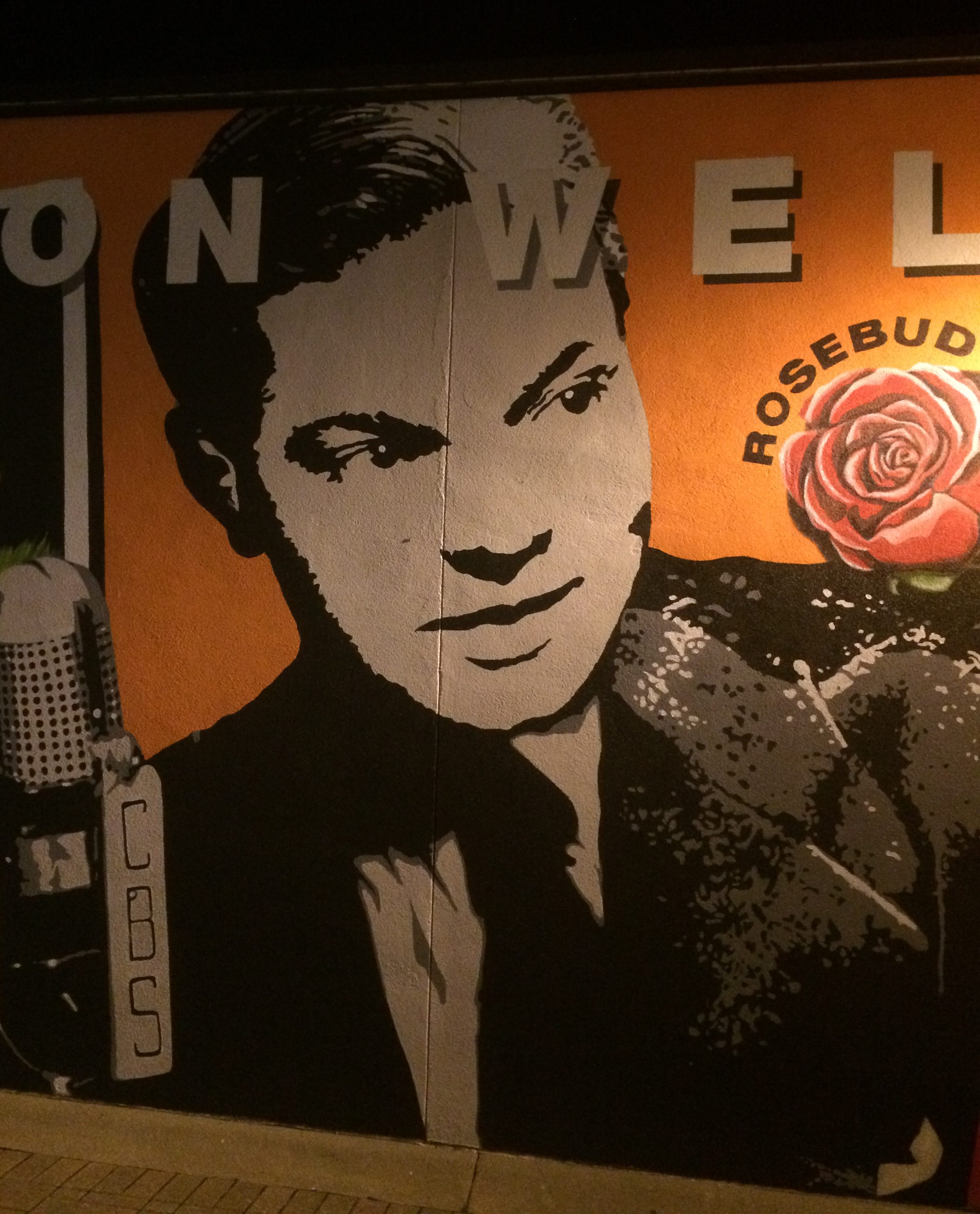
Orson Welles, who spent part of his youth in Woodstock.
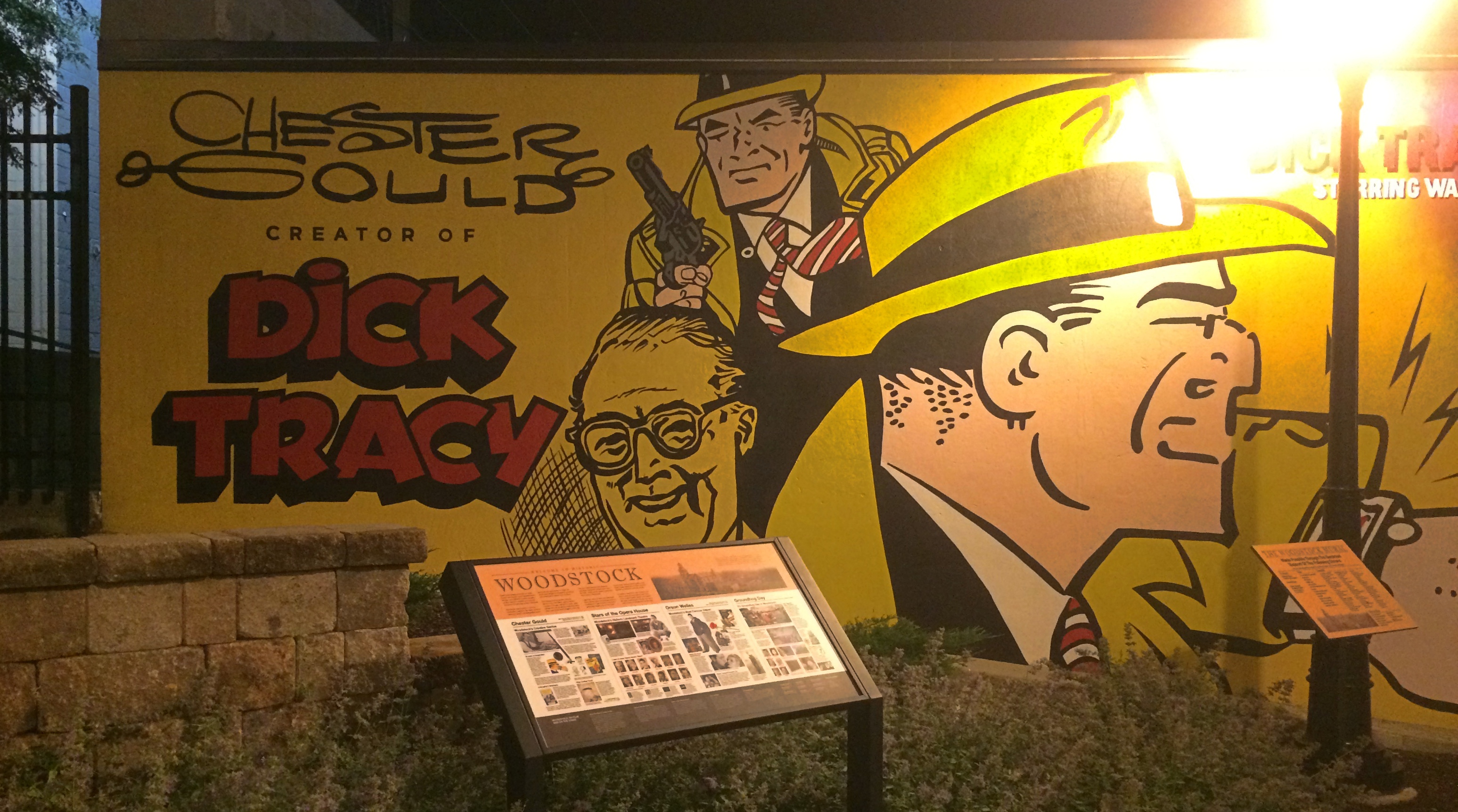
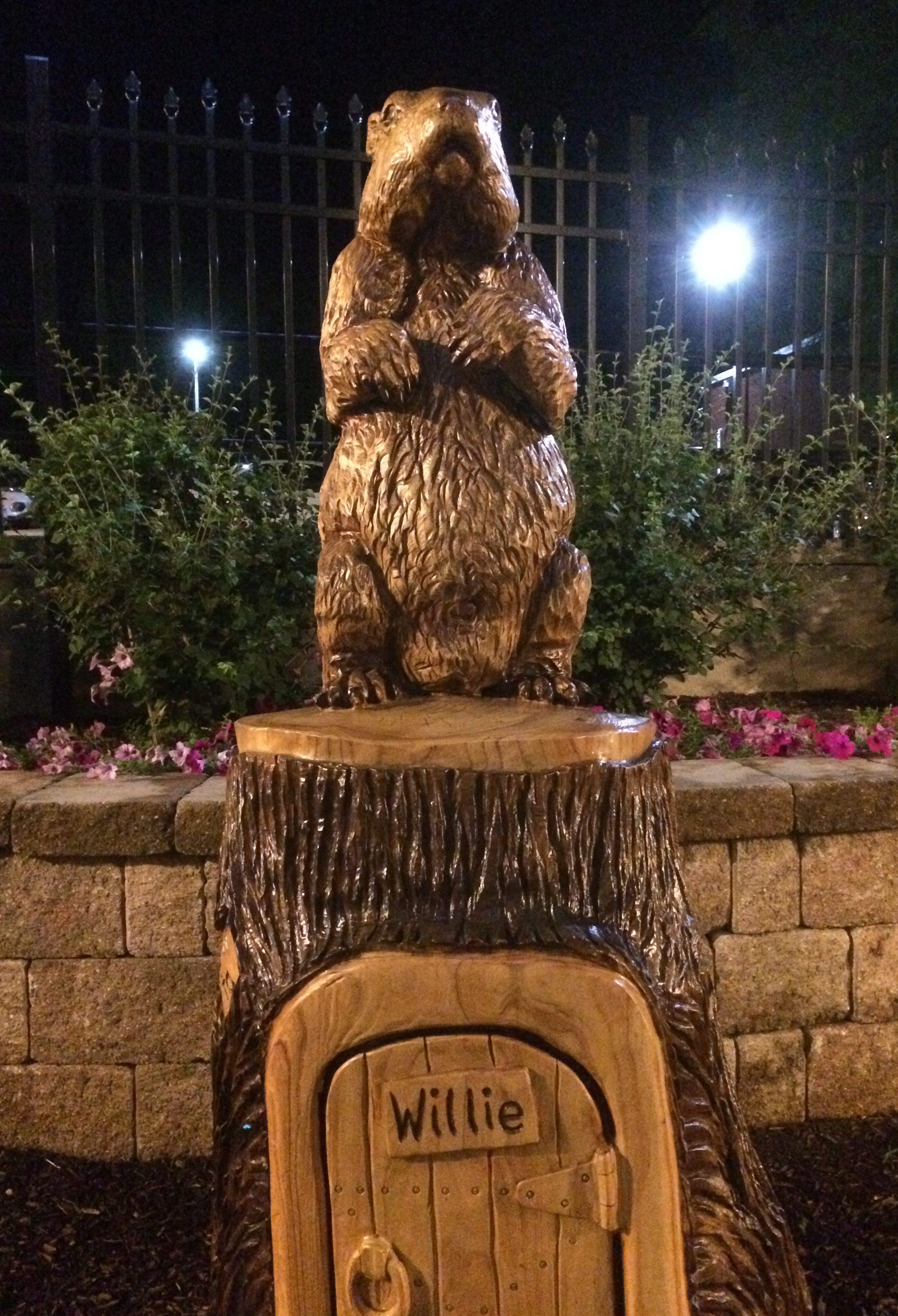
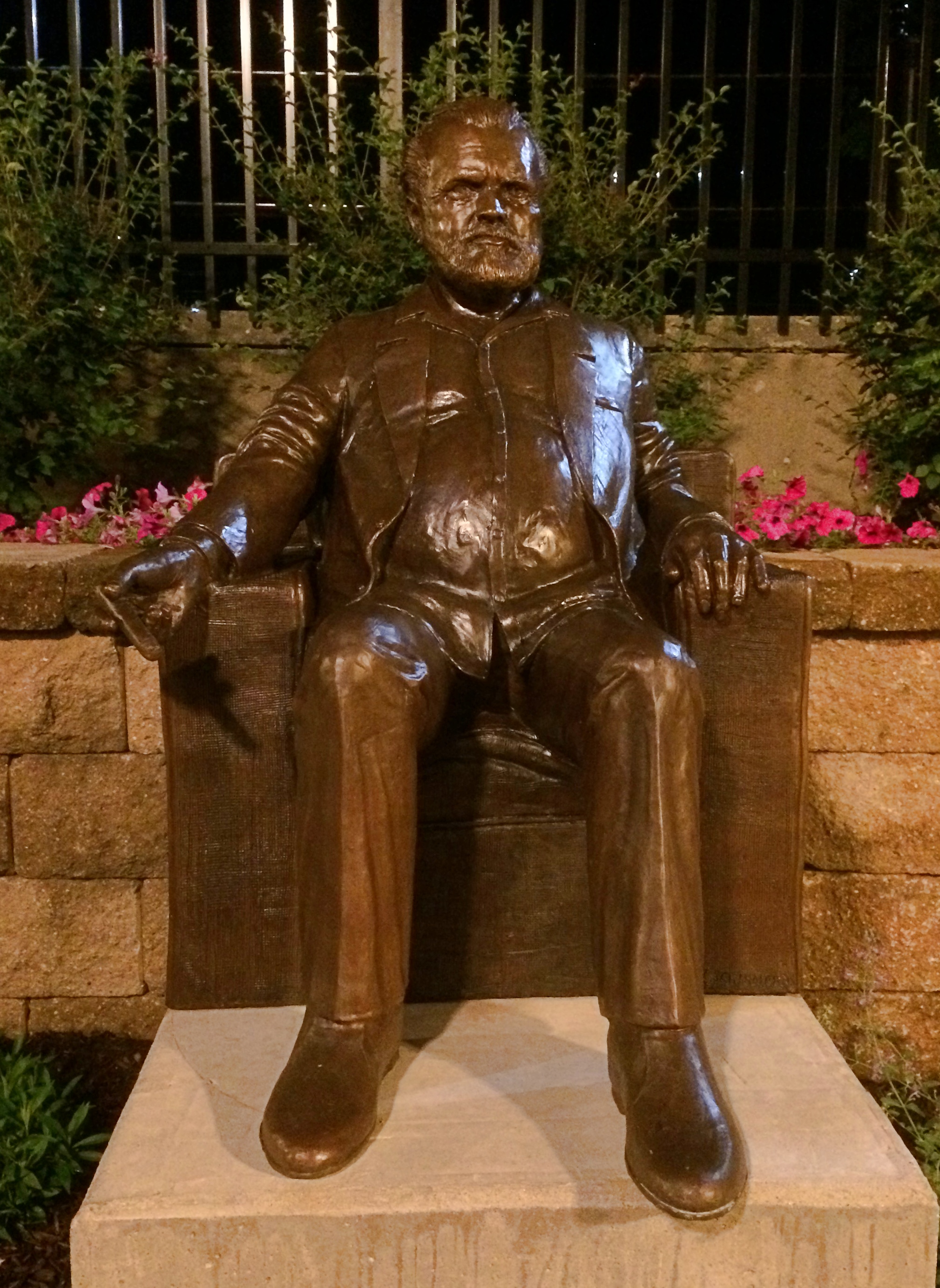
The town also remembers Chester Gould, though the Dick Tracy Museum in Woodstock closed a number of years ago. The alley features two statues as well. One is a wood carving of Woodstock Willie, presumably the town’s answer to Punxsutawney Phil, created by carver Michael Bihlmaier. Oddly enough, also near the mural is a small bronze of Welles by a local artist, Bobby Joe Scribner. According to the information sign near the work, it’s the only statue of Welles on public display in the United States. Interesting that it depicts an older Welles. His Paul Masson period, you might say.
RIP, Bernie Judge. He was an old-school Chicago newspaperman and my boss 30 years ago. Not a mentor, exactly, but I did learn a few things from him — most of which I didn’t appreciate until later.
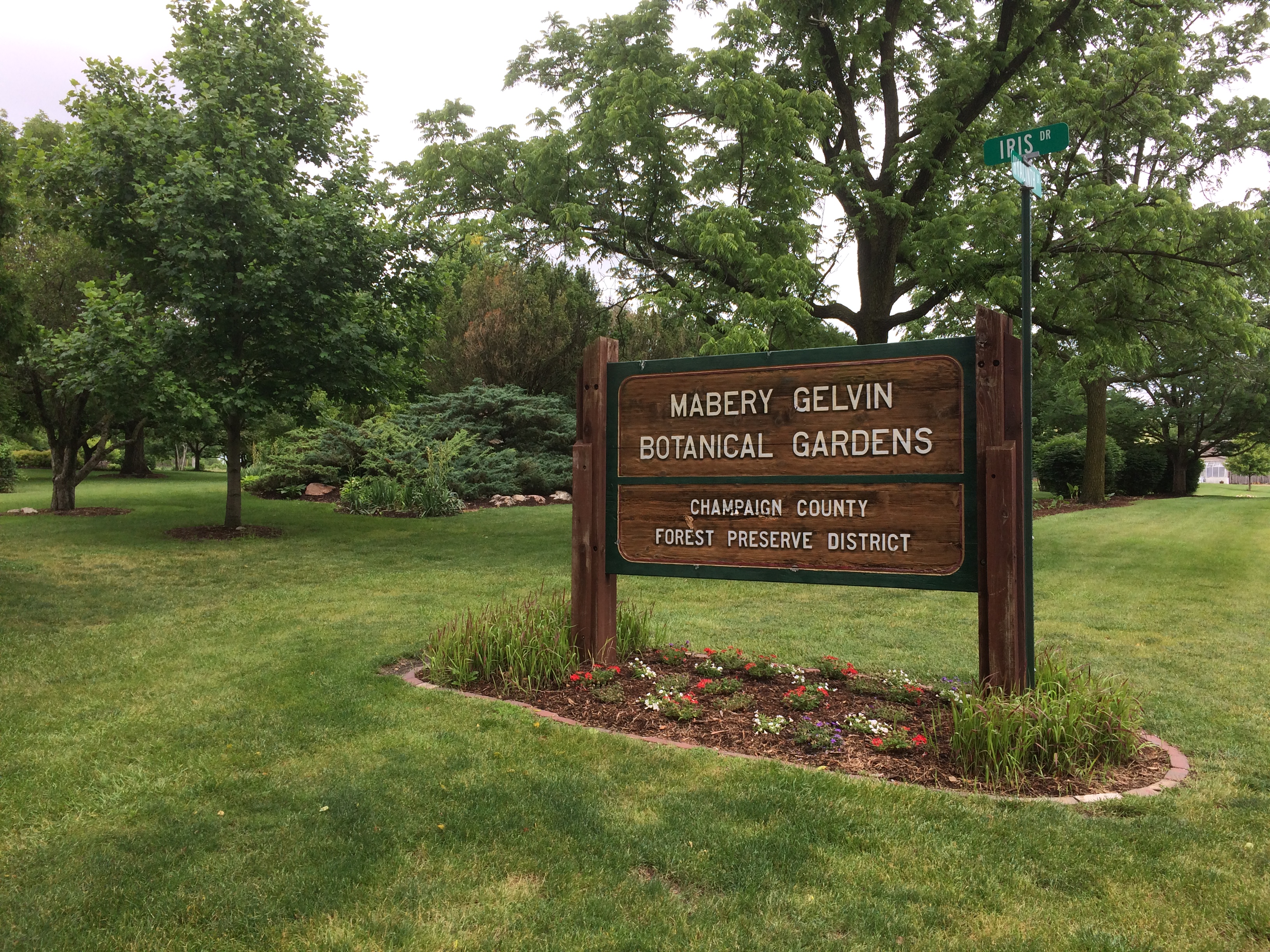
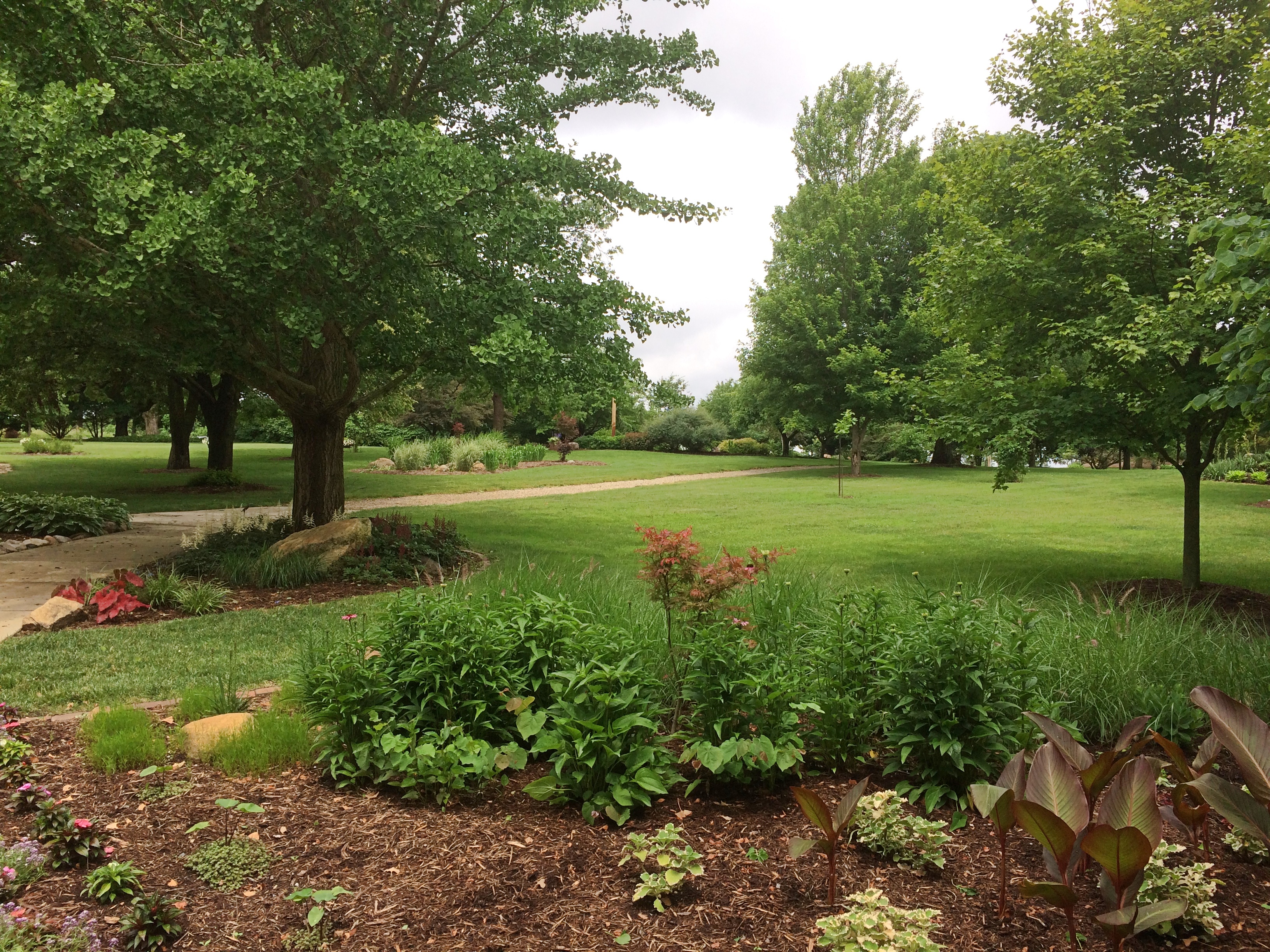
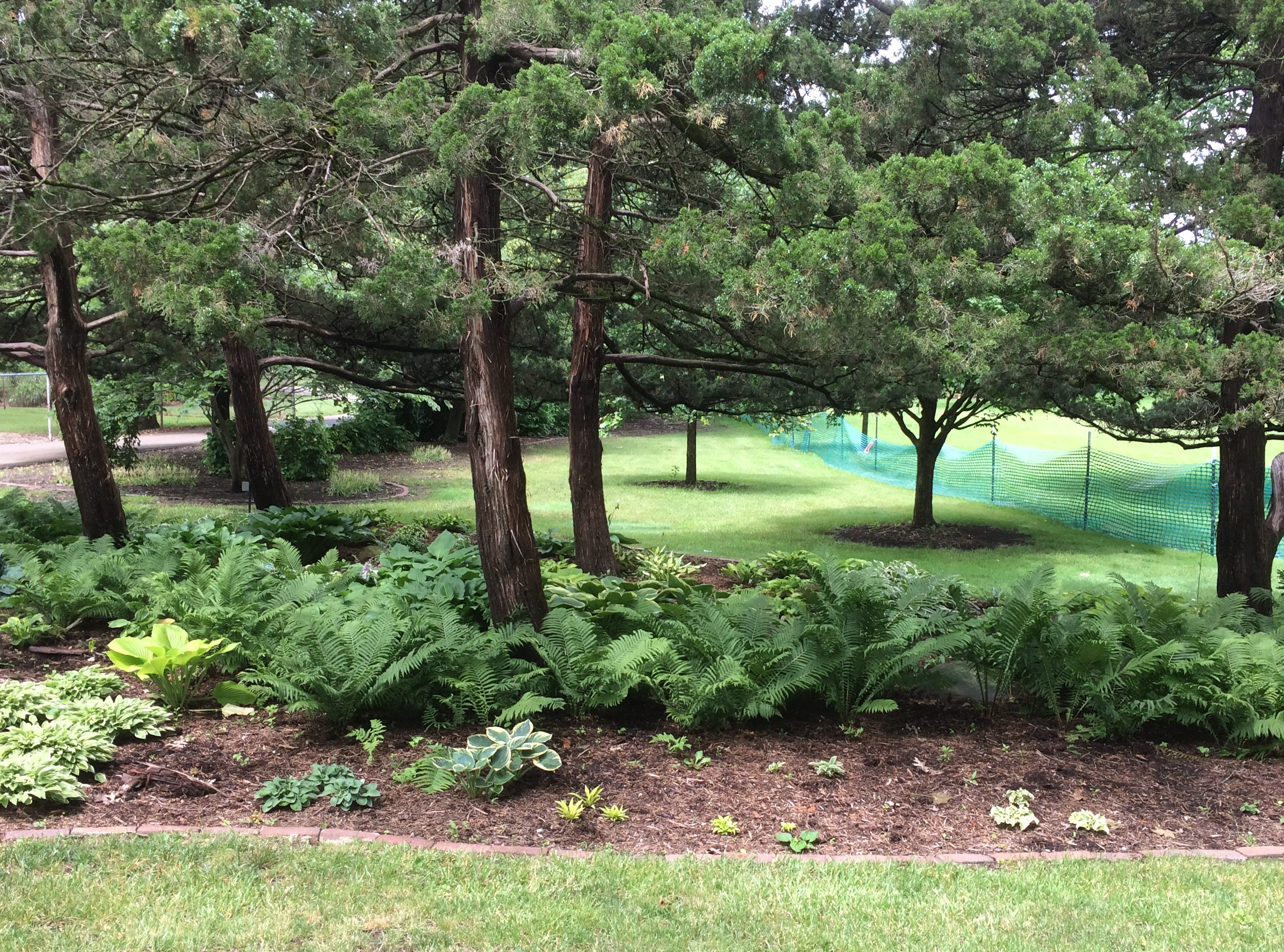
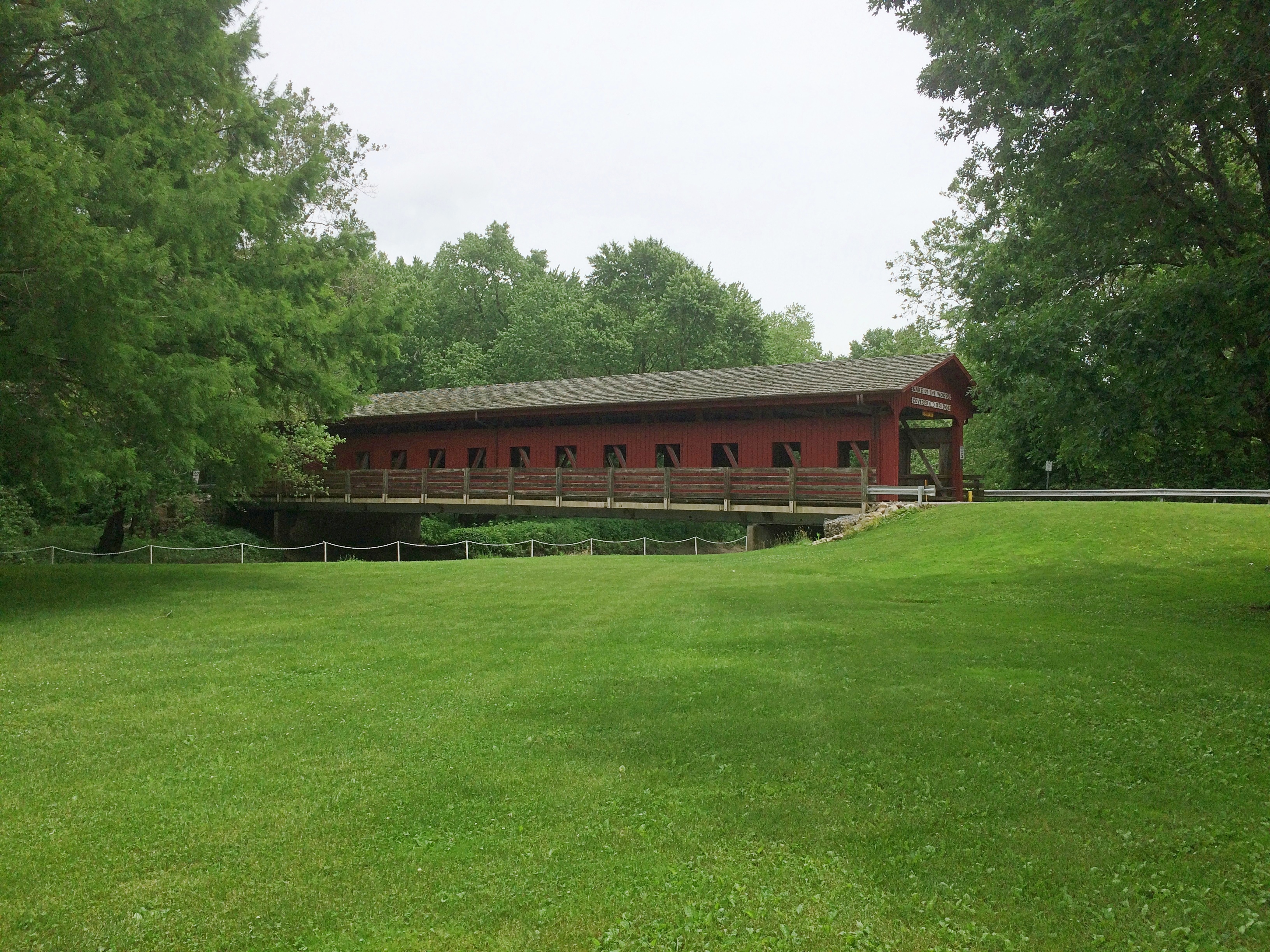
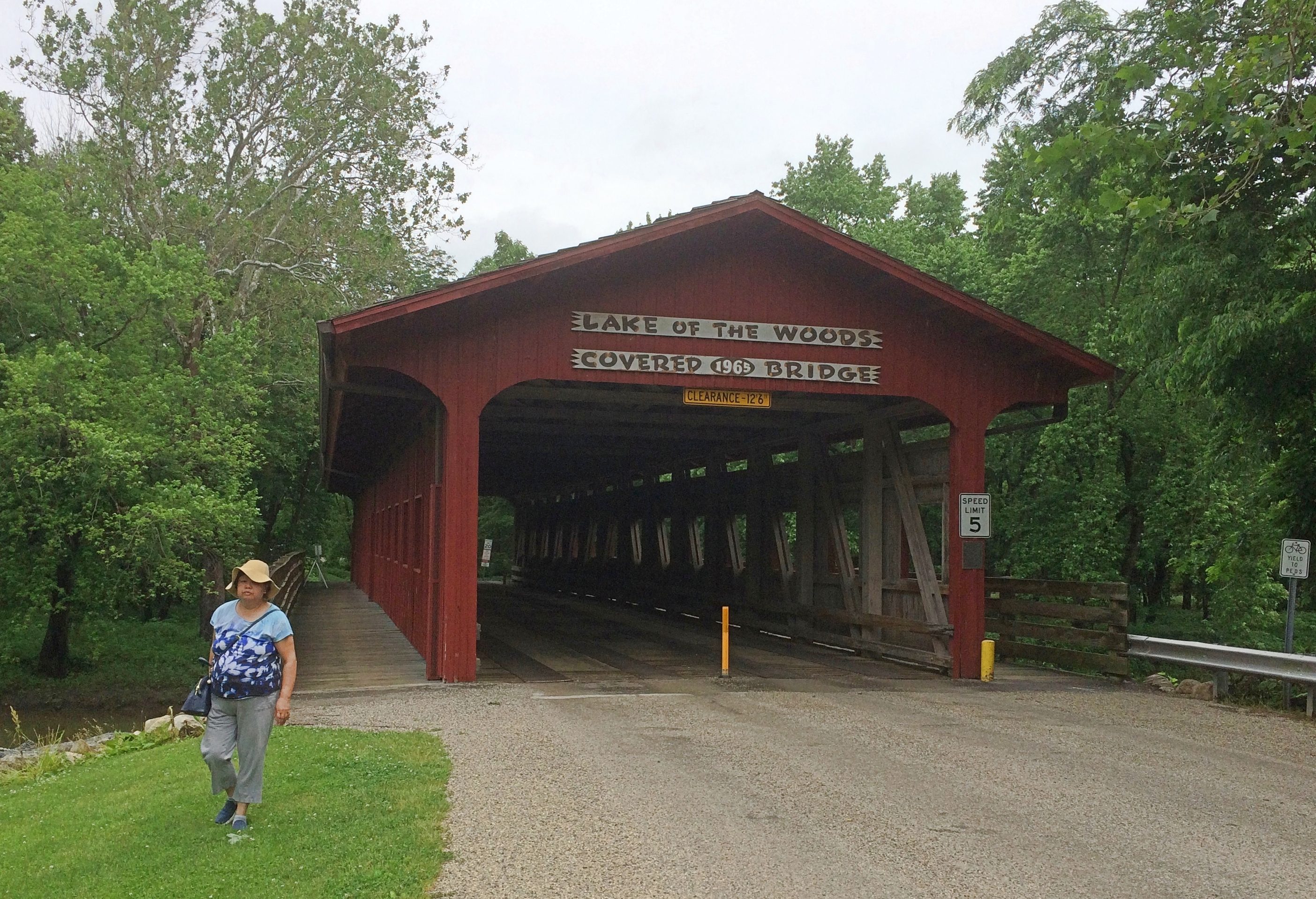
By last Sunday morning, the rain had stopped and we visited the Mabery Gelvin Botanical Gardens in Mahomet, Illinois, not far outside Champaign. At eight acres, the garden isn’t large, but it is a pretty place in June. Featuring the blooming Dogwood (Cornus kousa). A Saucer Magnolia (Magnolia x soulangeana). The South doesn’t get all the magnolias. According to the sign next to the tree, “… the genus magnolia is 95 million years old. Older than bees, they are pollinated by beetles.” Japanese lilac (Syringa reticulata). The garden is part of the larger Lake of the Woods Forest Preserve. We took a walk along some of its trails, eventually coming to a covered bridge: Lake of the Woods Covered Bridge. Wooden construction, but also with hidden steel support to make it vehicle-worthy. It isn’t one of the 19th-century bridges you find in the Midwest. Rather, vintage 1965. As the park district says: “After the purchase of an 80-acre tract of land west of the Sangamon River in the 1960s, the Lake of the Woods Covered Bridge was constructed to connect the two sides of Lake of the Woods Forest Preserve in Mahomet. Designed by German Gurfinkel, a Civil Engineering instructor at the University of Illinois, the bridge was a replica of the Pepperel Bridge [sic] near Boston.”
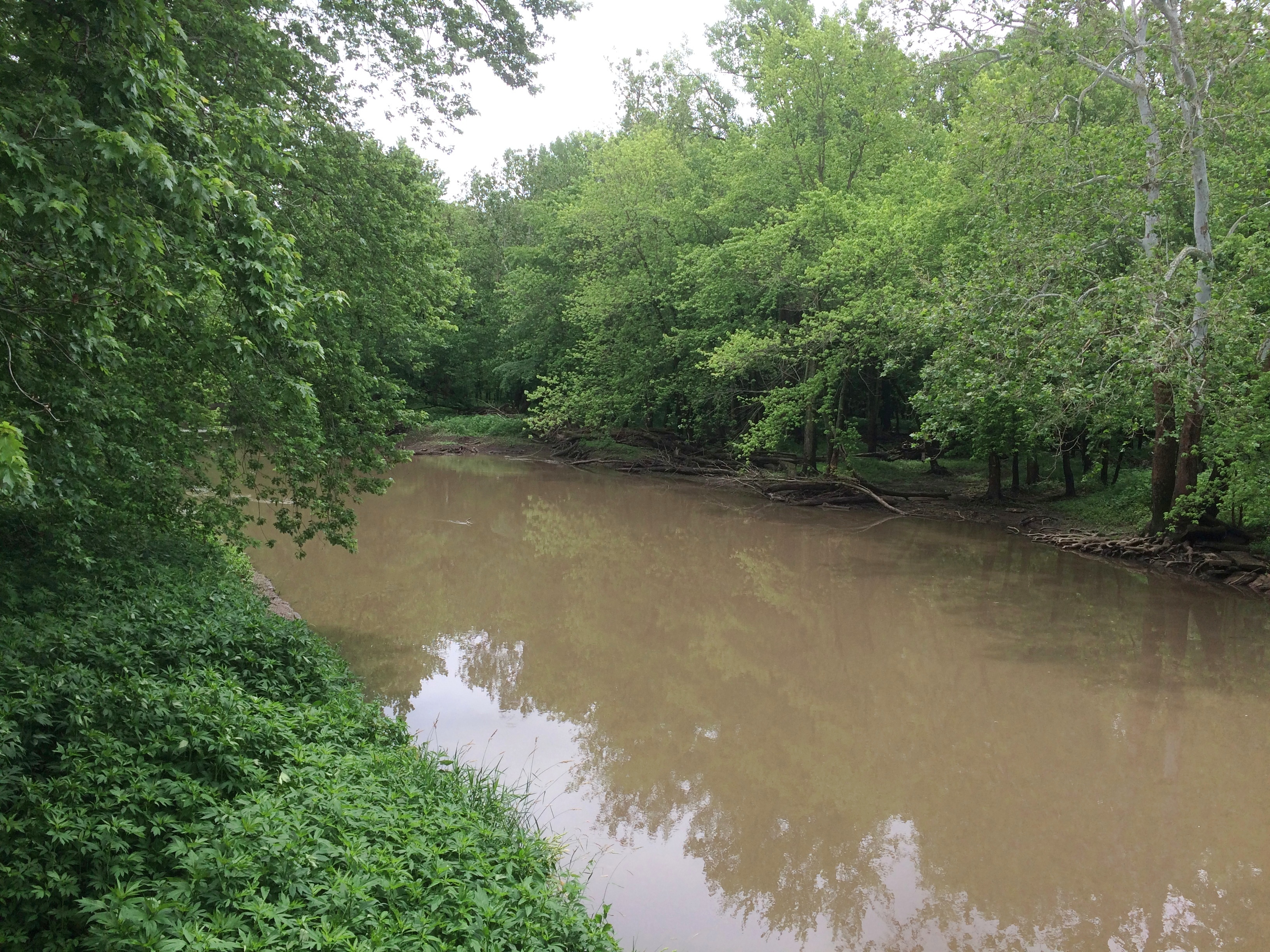
The view from the bridge of the Sangamon River, which flows on to Springfield and then to the Illinois River. We walked across the bridge. You should cross bridges when you come to them, if possible. Before we left the forest preserve, we also drove across it, because we don’t get to drive across covered bridges that much.
Our recent short trip to east-central Illinois and west-central Indiana found us spending two nights in Champaign, last Friday and Saturday. During the day on Saturday, we drove east on U.S. 150 and a short way on I-74 into Indiana. Then we headed south on Indiana 36 to Terra Haute, stopping in Dana.
Returning from Terra Haute, we took U.S. 150 westward — that road jogs oddly to the south from Danville, Illinois — and caught Illinois 133 in Paris, Illinois, a town that sorely needs a replica Eiffel Tower or Arc de Triomphe or some such to distinguish it. That road takes you to Arcola, a town we’re familiar with. From Arcola it’s a straight and not too interesting shot back to Champaign on I-57.
So it was a rectangular driving course (roughly east-south-west-north), good for a day trip, despite the heavy rain at times. It’s been a rainy spring and early summer, which we noticed must be damaging crops, since a lot of corn and soybean fields were covered by large puddles (an item from Ohio about the problem).
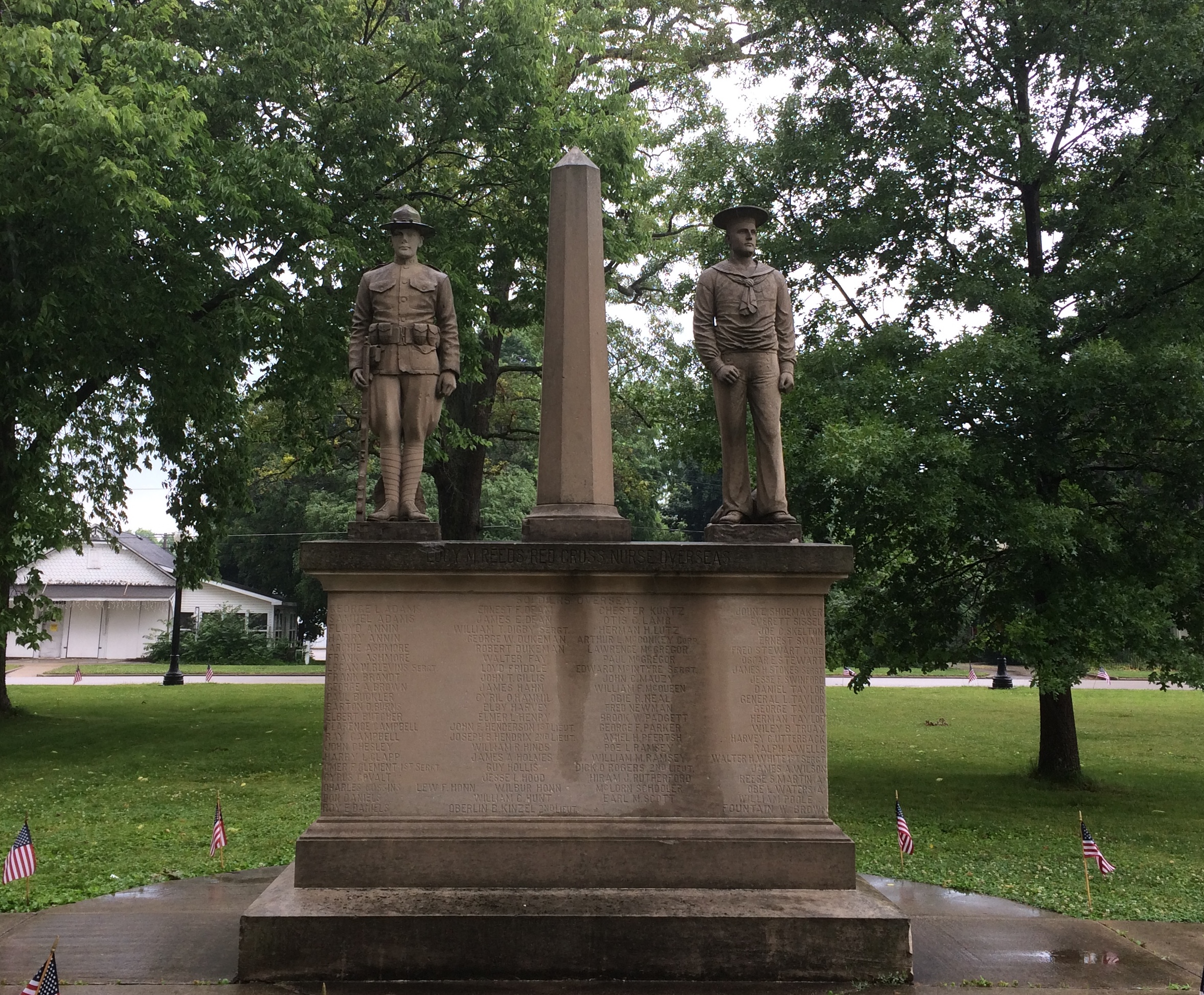
The sites associated with Ernie Pyle and Eugene V. Debs, honoring Hoosiers of somewhat different cast, were our main destinations. But I had a couple of minor destinations in mind as well. One was an obscure memorial in the obscure town of Oakland, Illinois, which is Coles County. I had passed that way 12 years earlier. Here’s what I said then about the Oakland town square:
“The place was gloomy. Maybe it was just the overcast skies… Still, I wanted to see the monument in the middle of the square. It was Memorial Day, after all. Someone had decorated the edges of sidewalk leading to the monument with small flags, forming a spot of color in the square, so that was something. The monument consisted of two statues sharing one plinth, one of a soldier and the other sailor, clearly World War I vintage, with the names of locals who had participated in that war carved in the plinth. All of it was weathered and dark.”
I wanted another look. In 2019, the square’s a little better looking (officially it’s the Oakland Centennial Park). The monument, a lot better looking. The darkness this time was from the recent rain. Maybe it was refurbished for the centennial of the war or its own centennial, since carved in stone is the memorial’s dedication date: May 30, 1919 — the first Decoration Day after the Armistice.
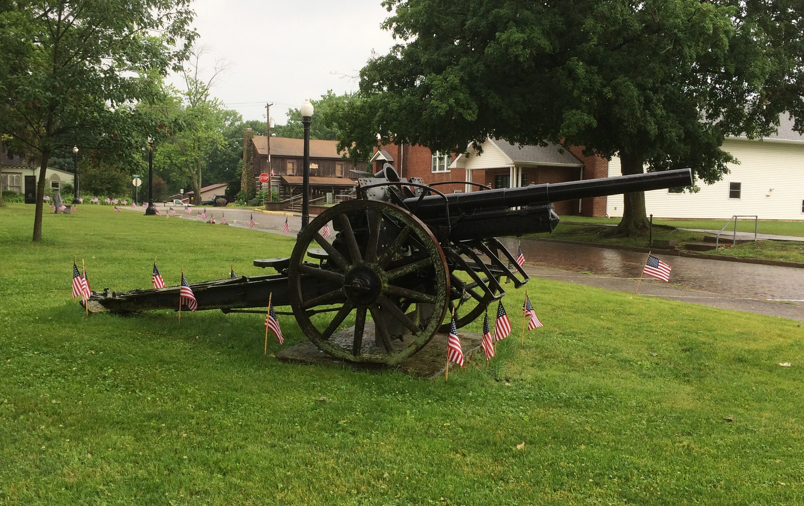
I’d forgotten about this item in the town square, a 77mm Feldkanone 16 German artillary piece. A local prize of war, I guess.
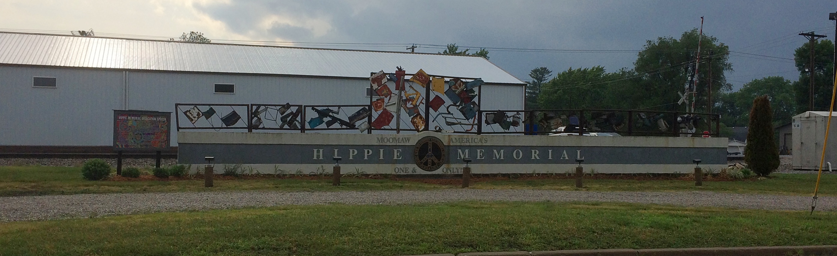
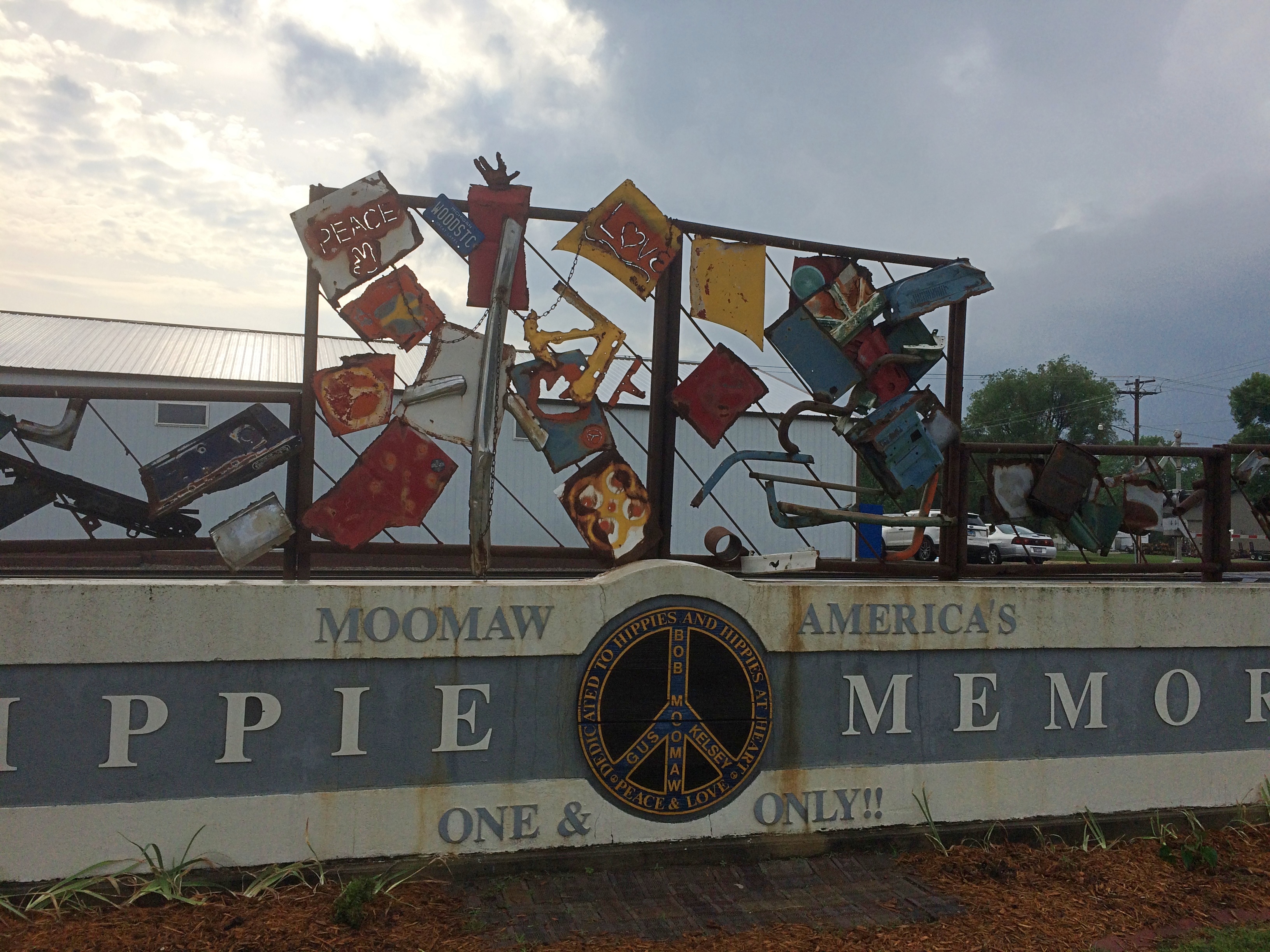
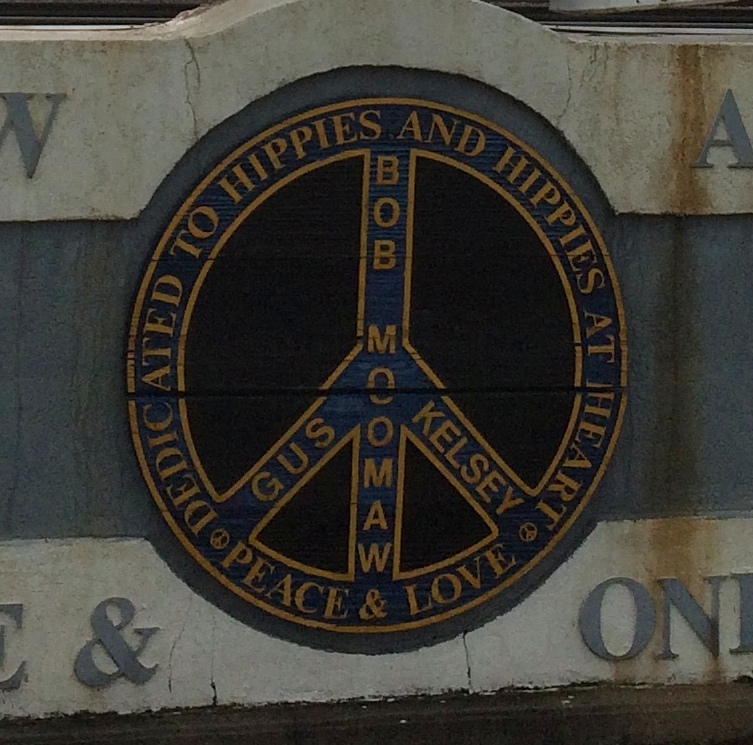
In Arcola, I wanted to see something we’d overlooked last year: the Hippie Memorial. How we missed that, I don’t know, since it’s less than a block away from that town’s Raggedy Ann and Andy sculptures, which we saw.
The Hippie Memorial is a very horizontal structure and an example of vernacular art. Better still, a vernacular memorial, which isn’t that common.
Just how much recognition does ☮ get these days? I wonder.
Nearby, a sign offers the dedication speech, made by the widow of the creator, local eccentric Bob Moomaw, almost exactly 20 years ago. The text seems the same, but the background is a lot more psychedelic than it used to be.
Sure, why not honor the hippie movement? It’s been subject to retroactive derision all out of proportion to its risibility. You can argue that hippies were yet another flowering of bohemianism, a periodic occurrence that’s helped keep things interesting since the Romantic movement at least.
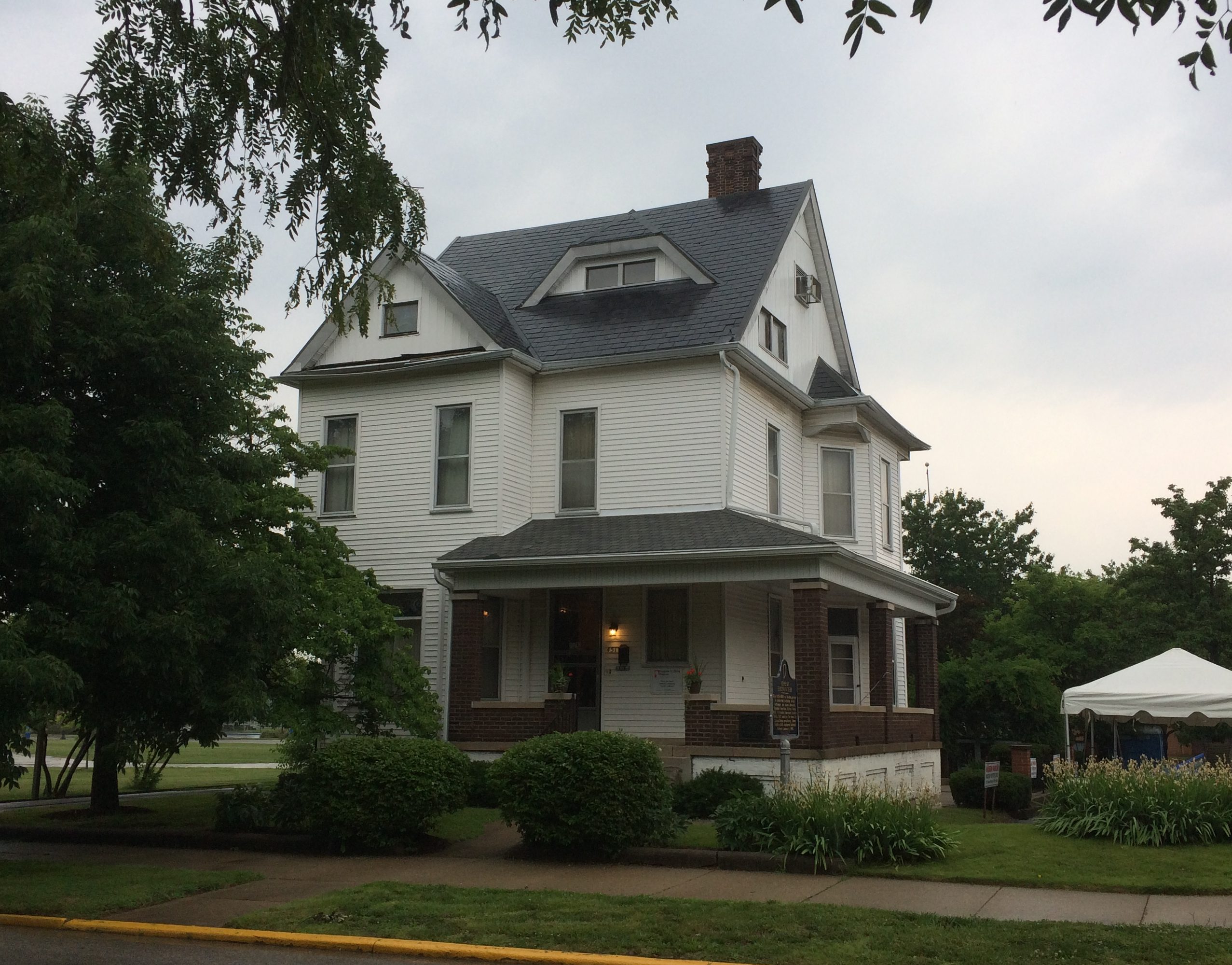
Tucked away among the buildings and open fields of Indiana State University in Terra Haute is a structure from the Gilded Age, but also associated with the golden age of socialism in the United States: the Eugene V. Debs House.
We arrived in the mid-afternoon on Saturday, in time to take a detailed tour from an exceptionally knowledgeable guide, but not for an event earlier that day in honor of the 125th anniversary of the Pullman Strike.
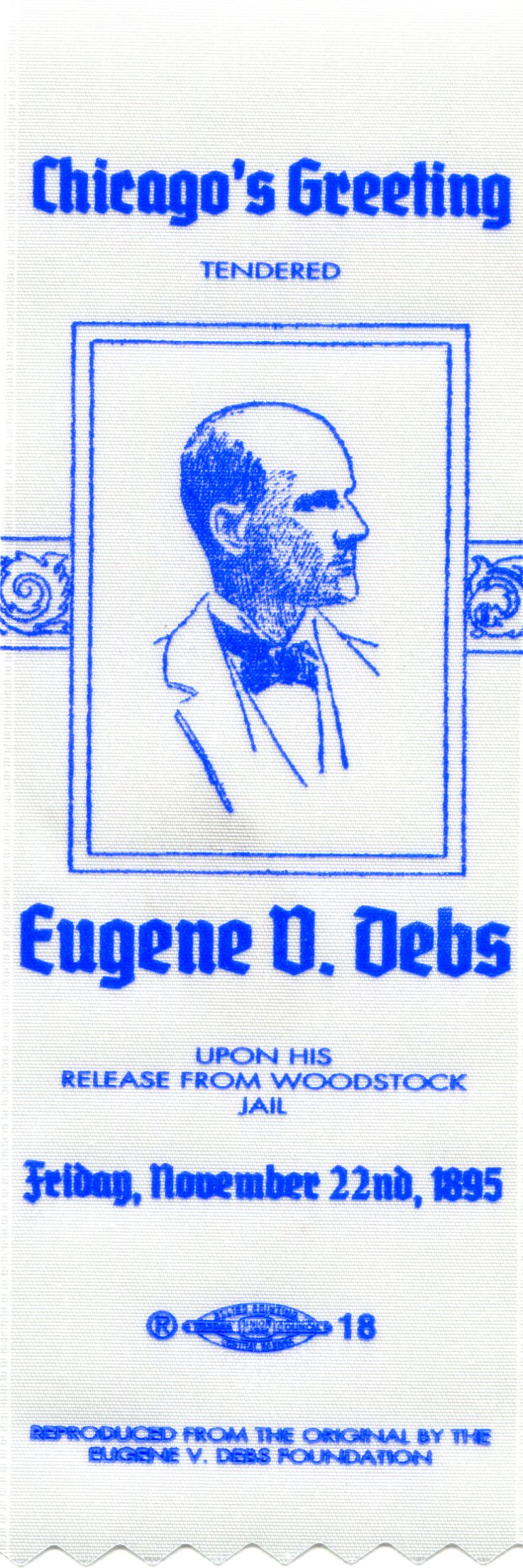
Debs led the strike, of course, and for his trouble was tossed in the McHenry County Jail in Woodstock, Illinois, for six months — an event that radicalized him. After he got out, his commitment to socialism never wavered.
The museum’s event involved a book signing of a new volume about the Pullman Strike — The Edge of Anarchy: The Railroad Barons, the Gilded Age, and the Greatest Labor Uprising in America by Jack Kelly — and a reading of “Liberty,” the speech that Debs delivered to a crowd of thousands of supporters in Chicago after his release from Woodstock Jail, on November 22, 1895.
It was a speech I’d never read, so I looked it up later. Credit to Debs for giving good speeches in an era when political discourse hadn’t yet been dumbed down to semiliterate 280-character bursts. A couple of selections:
“Out of range of the government’s machine guns and knowing the location of judicial traps and deadfalls, Americans may still indulge in the exaltation of liberty, though pursued through every lane and avenue of life by the baying hounds of usurped and unconstitutional power, glad if when night lets down her sable curtains, they are out of prison, though still the wage-slaves of a plutocracy which, were it in the celestial city, would wreck every avenue leading up to the throne of the Infinite by stealing the gold with which they are paved, and debauch Heaven’s supreme court to obtain a decision that the command ‘thou shalt not steal’ is unconstitutional…
“I remember one old divine who, one night, selected for his text George M. Pullman, and said: ‘George is a bad egg, handle him with care. Should you crack his shell the odor would depopulate Chicago in an hour.’ All said ‘Amen’ and the services closed.
“Another old sermonizer who said he had been preaching since man was a molecule, declared he had of late years studied corporations, and that they were warts on the nose of our national industries, — that they were vultures whose beaks and claws were tearing and mangling the vitals of labor and transforming workingmen’s homes into caves.”
The museum staff was giving away souvenir ribbons, replicas of the ribbons worn by supporters who greeted Debs when he got out of Woodstock. We got one.
The house is both a house museum of the period, with many of the Debs’ possessions, as well as a museum about labor organizing, American socialism — Debs was adamant that the ideology wasn’t some imported Euro-virus — and the fight against government overreach, as expressed by siding with the bosses in the ’90s and the sedition laws of the First World War.
It was a pretty nice house for its time, vintage 1890. I understand that Debs caught some flack for living in a comfortable house. Comfortable with a few touches of affluence, since his wife Kate brought some money to the marriage. Some of the fireplaces feature cobalt blue porcelain tiles imported from Italy, the mahogany dining and parlor furniture is pretty nice, and a display case sports the Debs’ set of Haviland china.
Of course that’s the kind of lightweight criticism that politicians and activists of all stripes receive. The house was clearly upper-middle class for the time, but so what? The Debs were supposed to live in a shotgun shack? Besides, bread and roses.
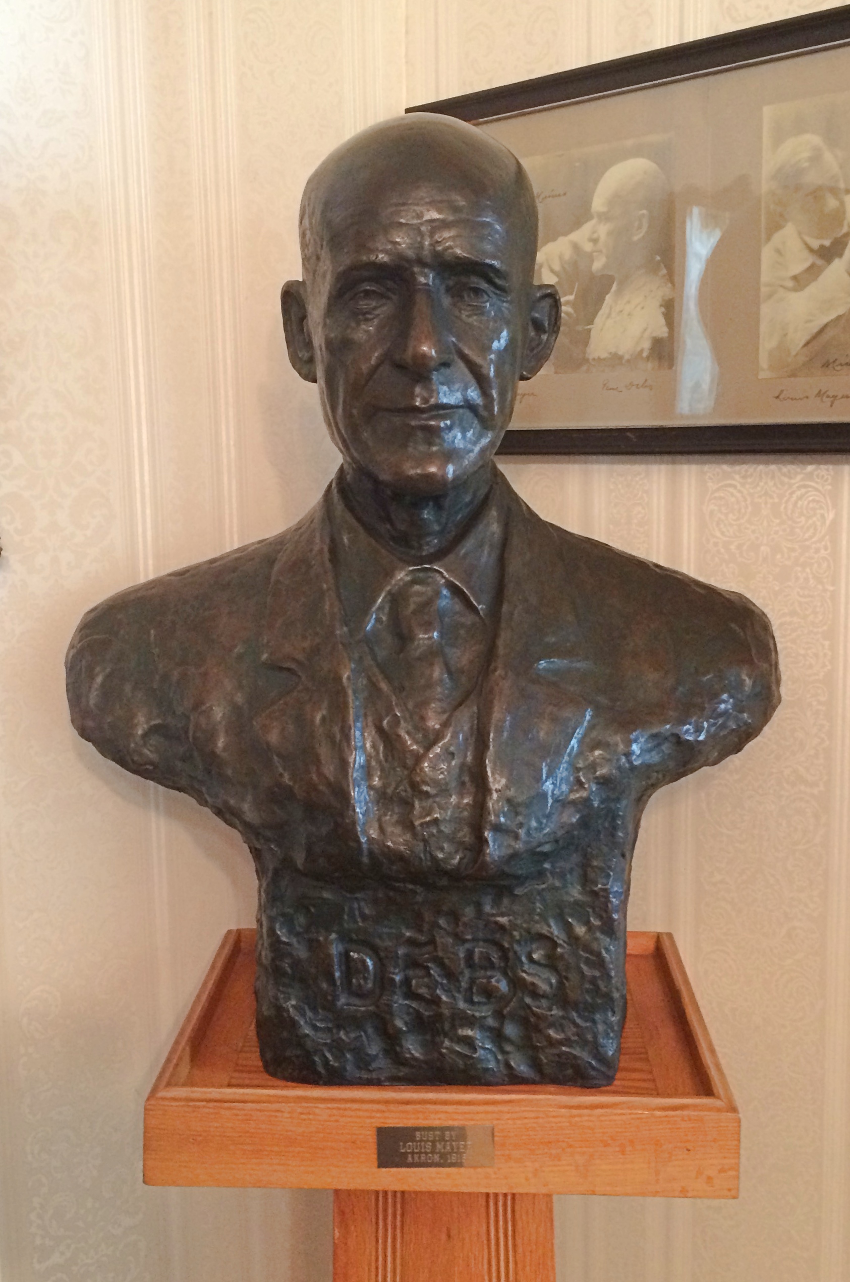
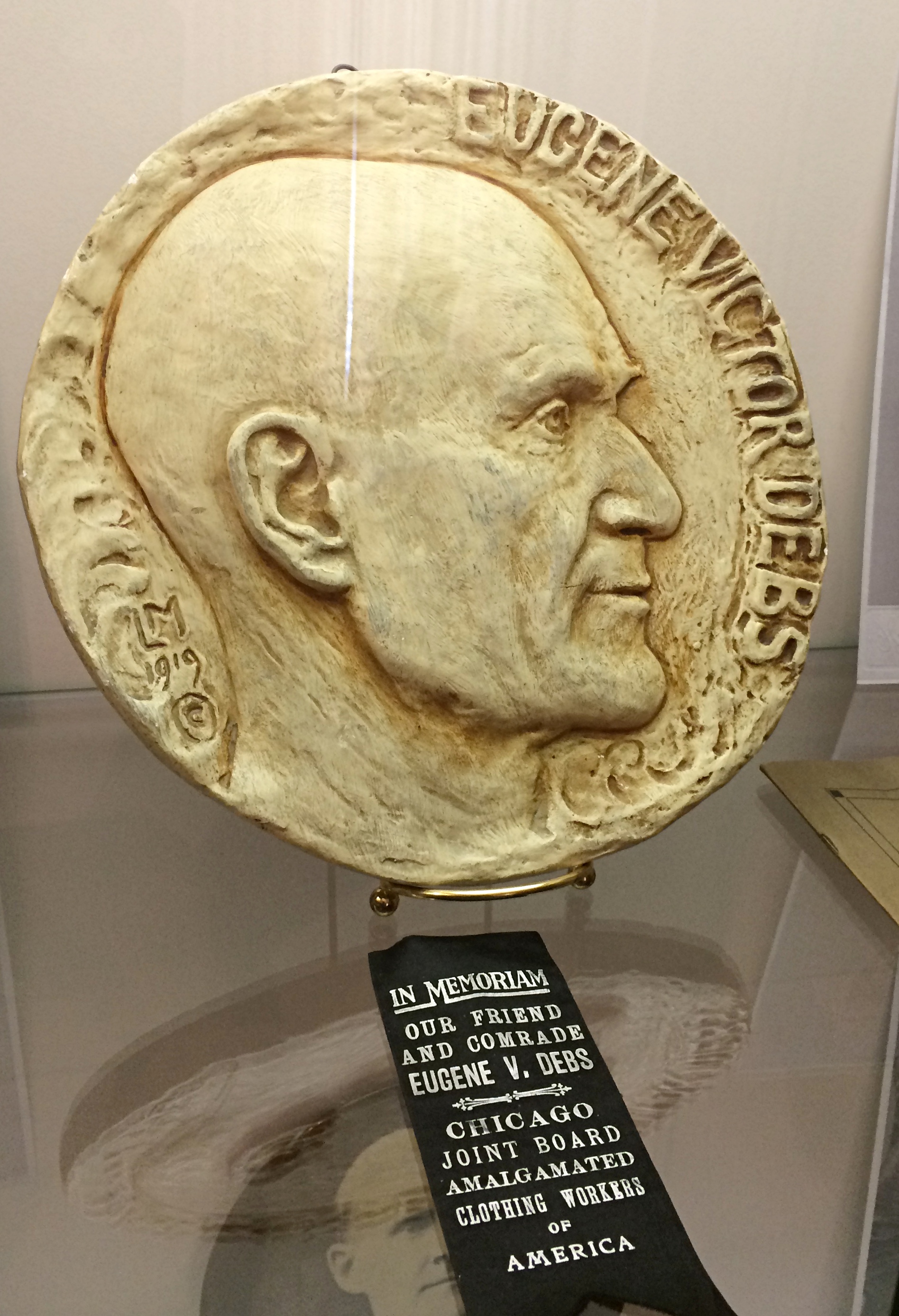
Also on display are a number of depictions of Debs. This one is by Wisconsin sculptor Louis B. Mayer (not the movie mogul).
LM could also be Louis Mayer. In any case, this is also a sedition trial-era work.
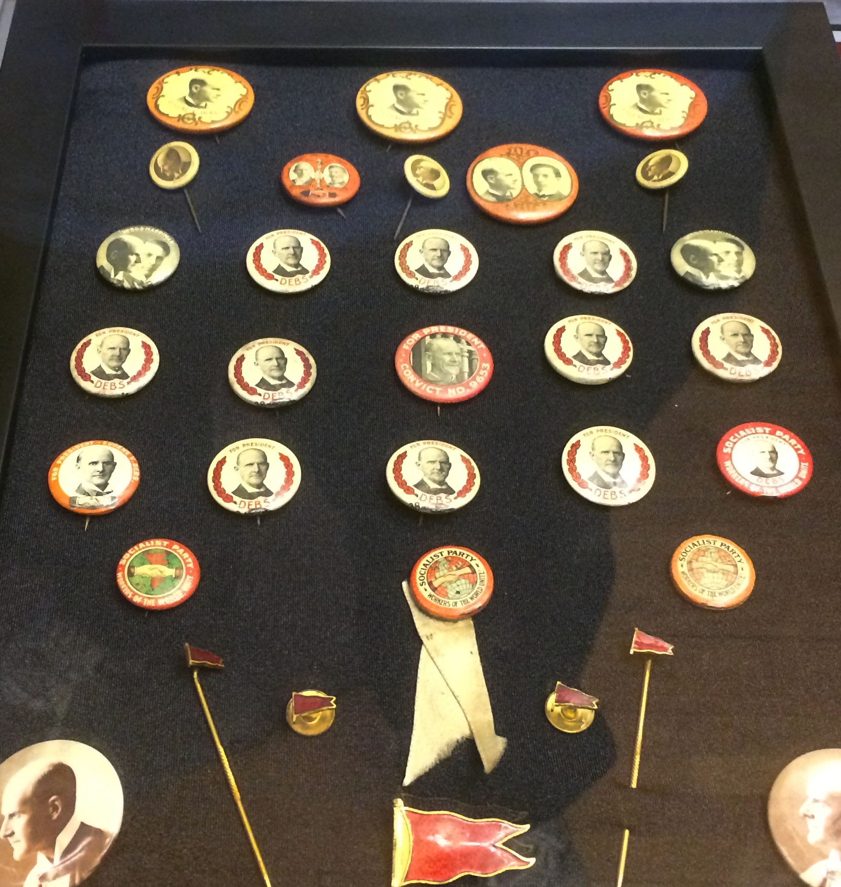
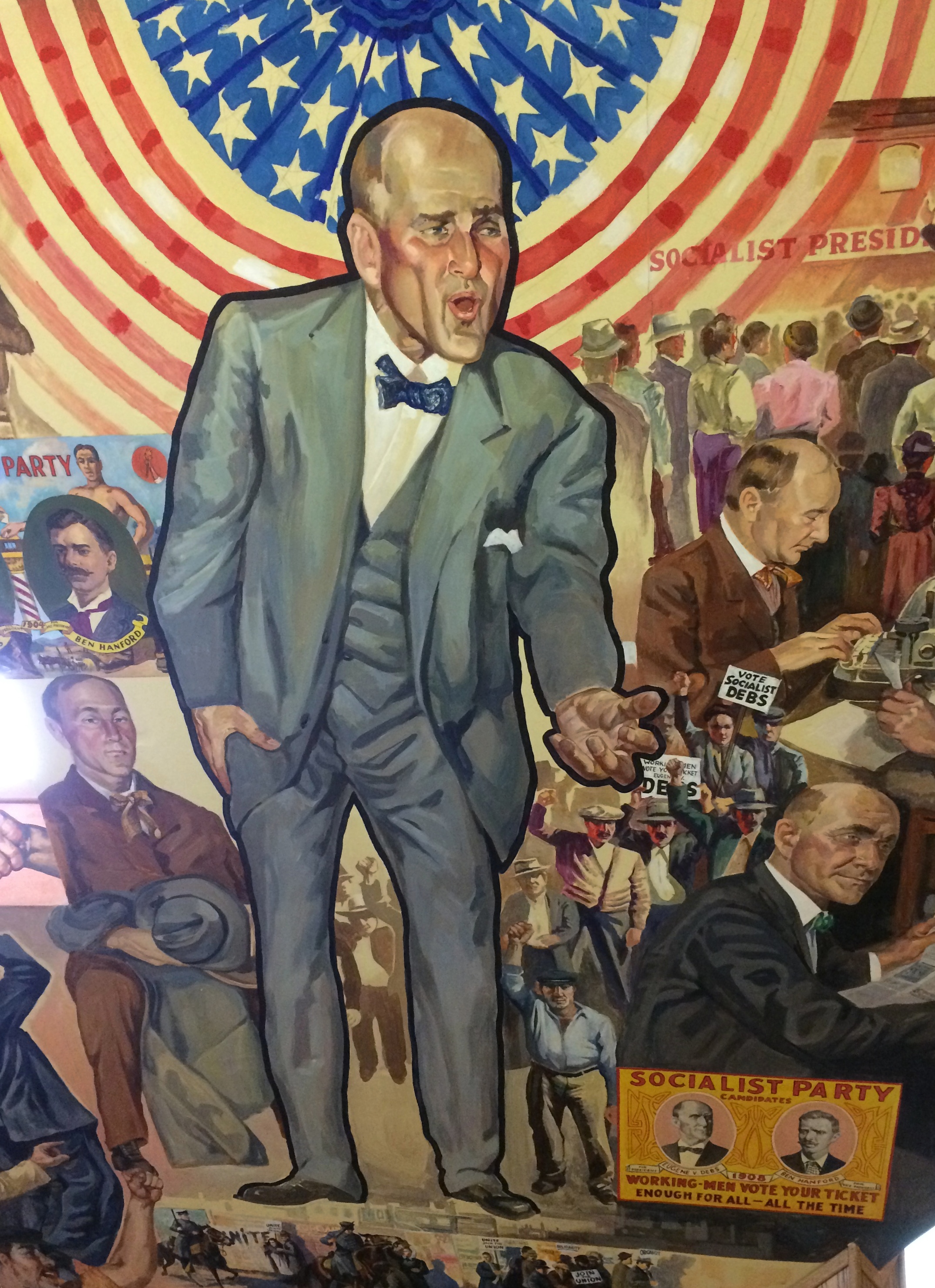
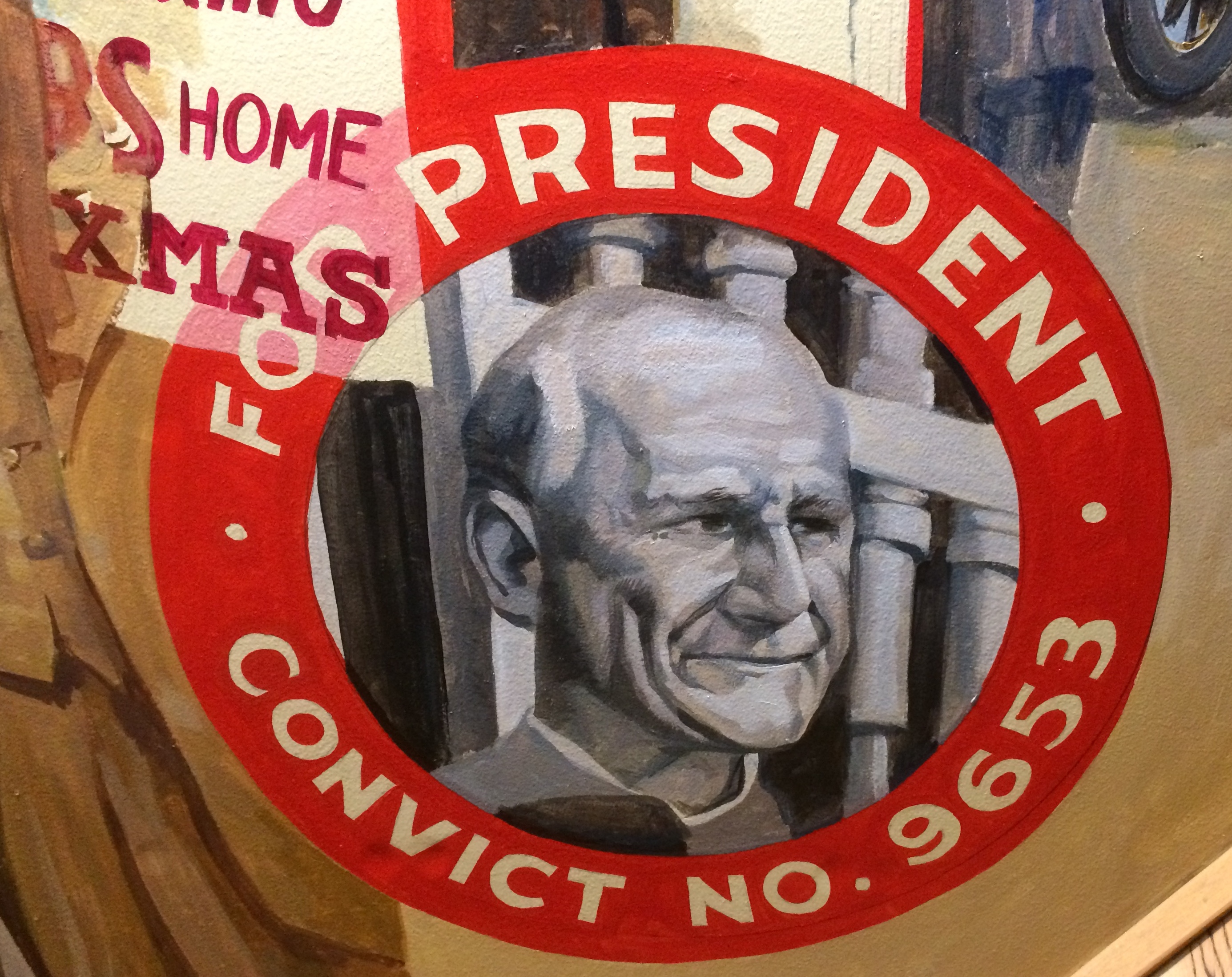
Plus plenty of buttons from Debs’ many runs for president. In the house’s attic, which was once merely storage, all of the walls are covered with murals. The centerpiece is Debs in campaigning mode. One of the smaller details on the mural walls, but one I liked best, is a campaign button from 1920. Debs received 3.5 percent of the popular vote, more than any other socialist candidate for U.S. president, before or since. While in federal prison. The museum notes: “The murals were painted by John Laska, former Professor of Art at Indiana State University and active Foundation member. Completed in 1979 after three years of hard work, the murals depict Debs’ life and time in chronological order…”
The Ernie Pyle museum reminded me of a long-ago English teacher of mine, Mr. Swinny. The Debs museum reminded me of another long-ago teacher, Mrs. Collins. She taught us freshman U.S. history. About 60 at the time, she grew up in Buffalo and — I think I remember this correctly — had been a Wobbly as a young woman.
That would have been during the Depression, after the heyday of the Wobblies, but still. Mrs. Collins wasn’t shy about throwing in some labor history and using texts sympathetic to socialism, most notably The Jungle. Naturally, Debs came up as well.
This year’s back yard grilling and gabfest has come and gone, when old friends gather to sit on our deck and gab. You know, old-fashioned conversation. It’s been an annual event now since 2014 on the second Saturday of June. In recent years, I’ve been claiming that we gather to celebrate Cole Porter’s birthday, which was on Sunday this year. No Porter songs were sung at the event, however, probably because none of us can sing.
Beer bottles remain behind. Actually, beer and hard cider this year. I drank the Two Hearted Ale and tried one of the ciders this year, though I forget which.
We had a domestic array of alcohol this time. Know-Nothing brews, you might say. In fact, not just domestic, but all Midwestern.
The Holy Moses White Ale was brewed in Cleveland, while the Two Hearted Ale originated in Comstock, Michigan. Both ciders were from Stevens Point, Wisconsin, despite the Union Jack-themed label, and it did my heart glad to learn that.
Among Wisconsin towns, I have a sentimental attachment to Stevens Point, where I spent a few days in the summer of ’78. If you can’t be sentimental about the summer of ’78, when can you be?
When were driving through LaGrange, Texas, on the first day of the trip, I began to wonder. What’s this town known for? I know it’s something. Then I saw a sign calling LaGrange “the best little town in Texas.” Oh, yeah. Famed in song and story.
On the way to Buffalo Bayou Park in Houston, we took a quick detour — because I’d seen it on a map — to see the Beer Can House at 222 Malone St., a quick view from the car. Looks like this. Had we wanted to spend a little more time in Houston, I definitely would have visited the Orange Show. Ah, well.
We enjoyed our walk along Esplanade St. in New Orleans, where you can see some fine houses. Plus efforts to thwart porch pirates. We saw more than one sign along these lines during our walk down the street. We spent part of an evening in New Orleans on Frenchman St., which is described as not as rowdy or vomit-prone as Bourbon St., and I suppose that’s true, though it is a lively place. We went for the music.
At Three Muses, we saw Washboard Rodeo. They were fun. Western swing in New Orleans. Played some Bob Wills, they did.
At d.b.a, we saw Brother Tyrone and the Mindbenders. Counts as rock and soul, I’d say. Also good fun, though they were playing for a pretty thin Monday night crowd.
Adjacent to Frenchman St. is an evening outdoor market, the Frenchman Art Market, which we visited between the two performances. The market featured an impressive array of local art for sale, though nothing we couldn’t live without.
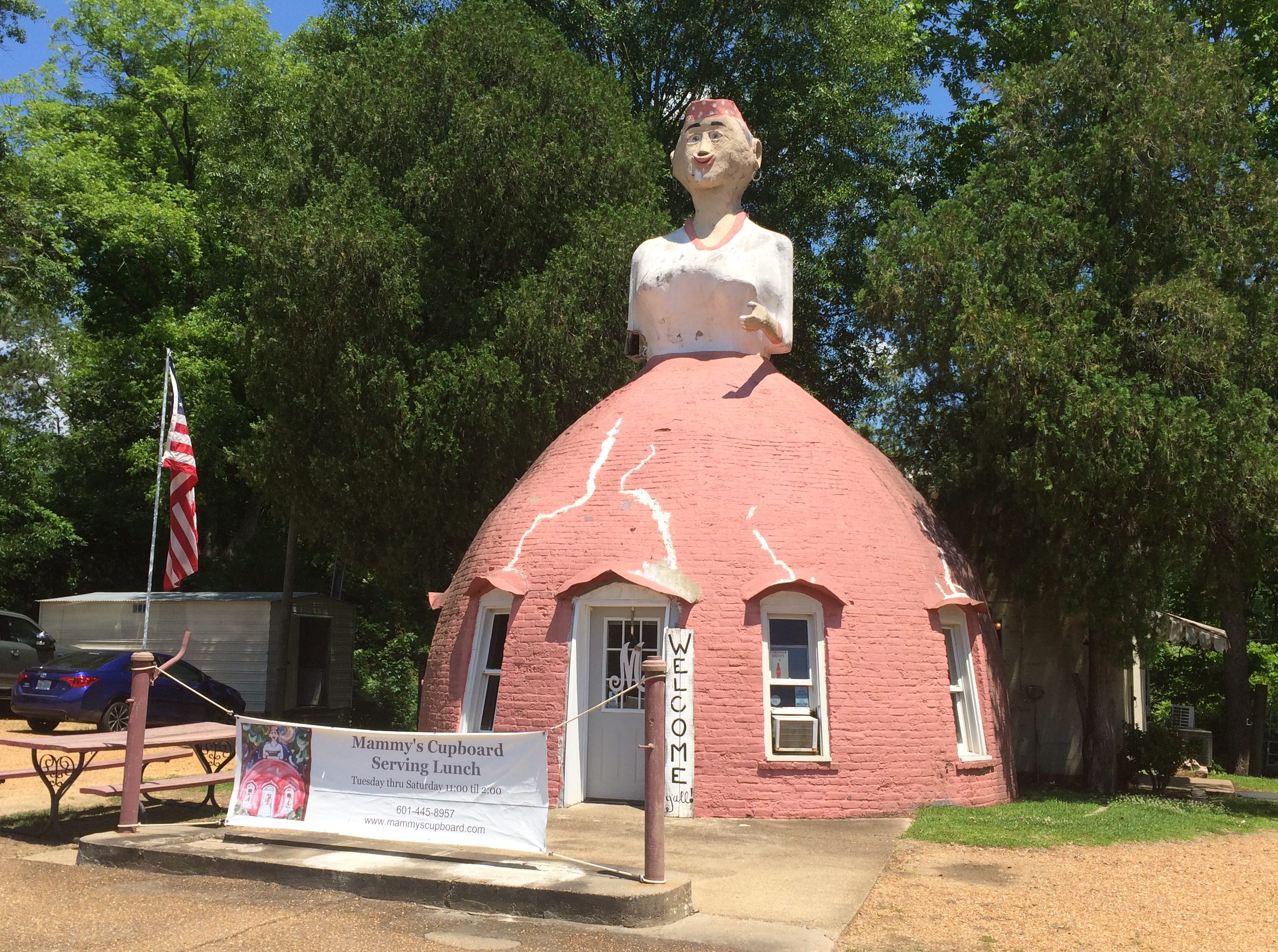
Something you see on U.S. 61 just outside of Natchez, Mississippi: Mammy’s Cupboard, a restaurant.More about it here.
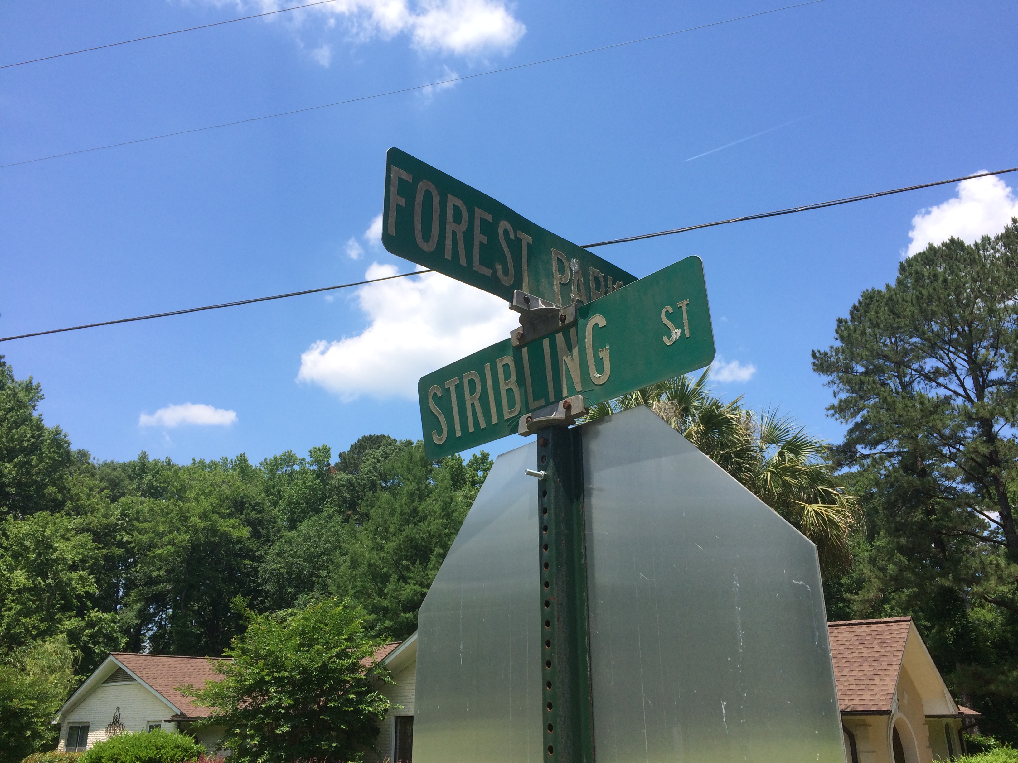
In Philadelphia, Mississippi, Stribling St. is still around. I don’t know why it wouldn’t be, but after nearly 30 years, I wanted another look.
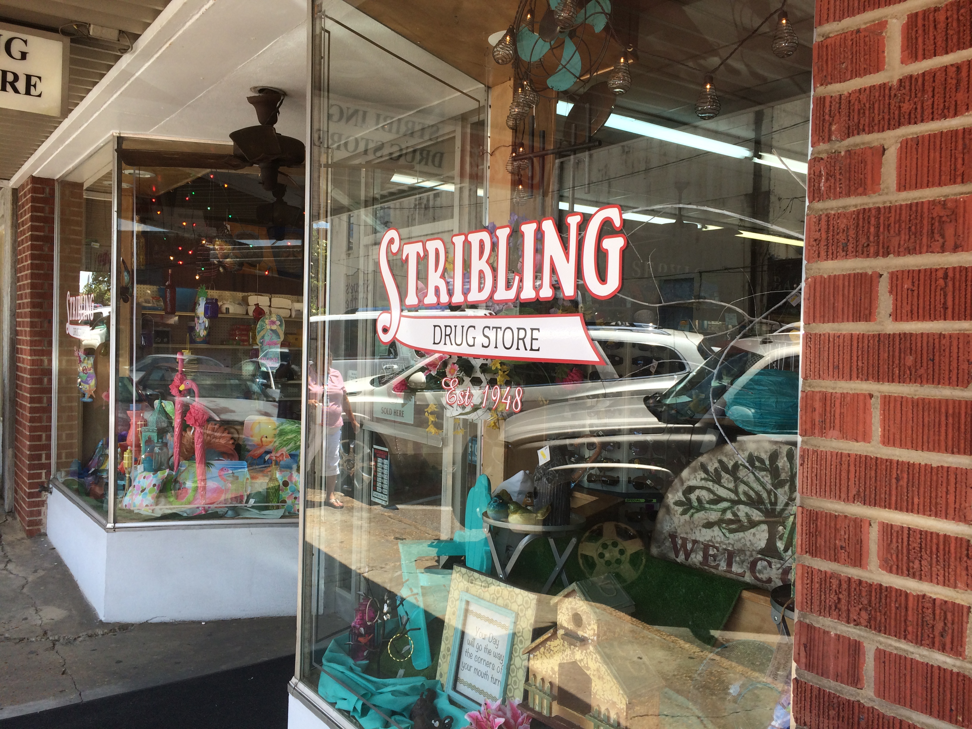
So is the local pharmacy run by distant cousins. Glad the chains haven’t spelled its demise.
During our drive from metro Jackson, Mississippi, to Montgomery, Alabama — connected by U.S. 80 and not an Interstate, as you might think — we passed through Selma, Alabama. I made a point of driving across the Edmund Pettus Bridge, though we decided not to get out and look around. Remarkably, the bridge looks exactly as it does in pictures more than 50 years old.
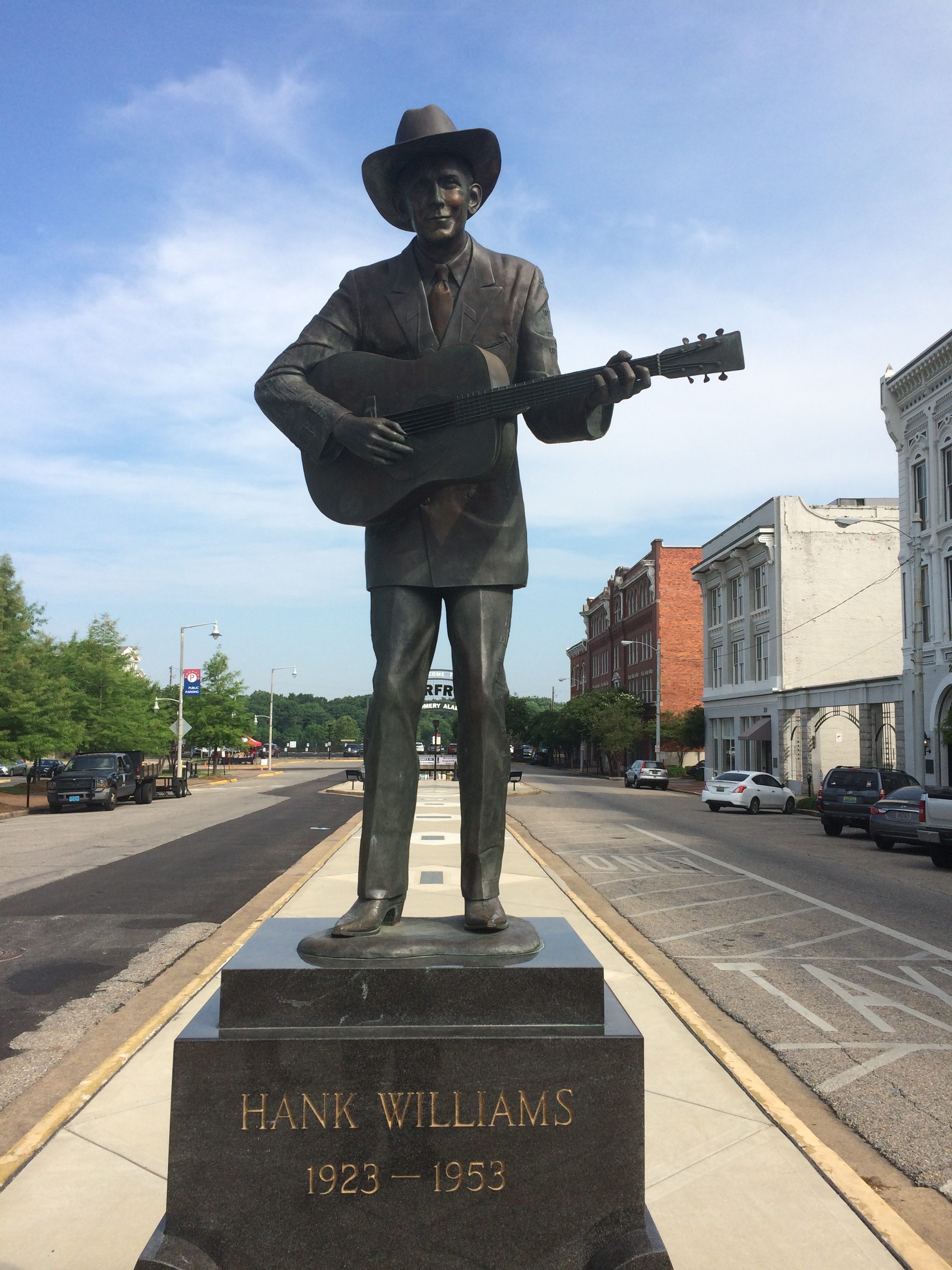
In downtown Montgomery, you can see this statue. I understand the bronze has been around since 1991, but was only recently moved to its current site not far from Riverfront Park, the river of course being the Alabama. I’d forgotten native son Hank Williams died so young. Some singers die rock ‘n’ roll deaths, some die country deaths like Hank.
Speaking of death, early in the trip, I was activating my phone — whose dim algorithm always suggests news I seldom want to see during the process — and I noticed the name “Doris Day” in the feed. I figured that could mean only one thing. Sure enough, she became the first celebrity death of the trip.
I hadn’t known she was still alive. In fairly rapid order during the trip after Ms. Day, the reaper came for Tim Conway, I.M. Pei and Grumpy Cat. I didn’t know that last one, but Lilly did.
I remember a time that Tim Conway described himself as “the funniest man in the universe” on the Carol Burnett Show. We all took that as a comedian’s hyperbole. But what if he was right? What if some higher intelligence has made a four-dimensional assessment of human humor and come to that exact conclusion?
As for Doris Day, I will try to park as close to my destinations as possible in her honor for the foreseeable future (a term I remember hearing as long ago as the ’80s in Austin).
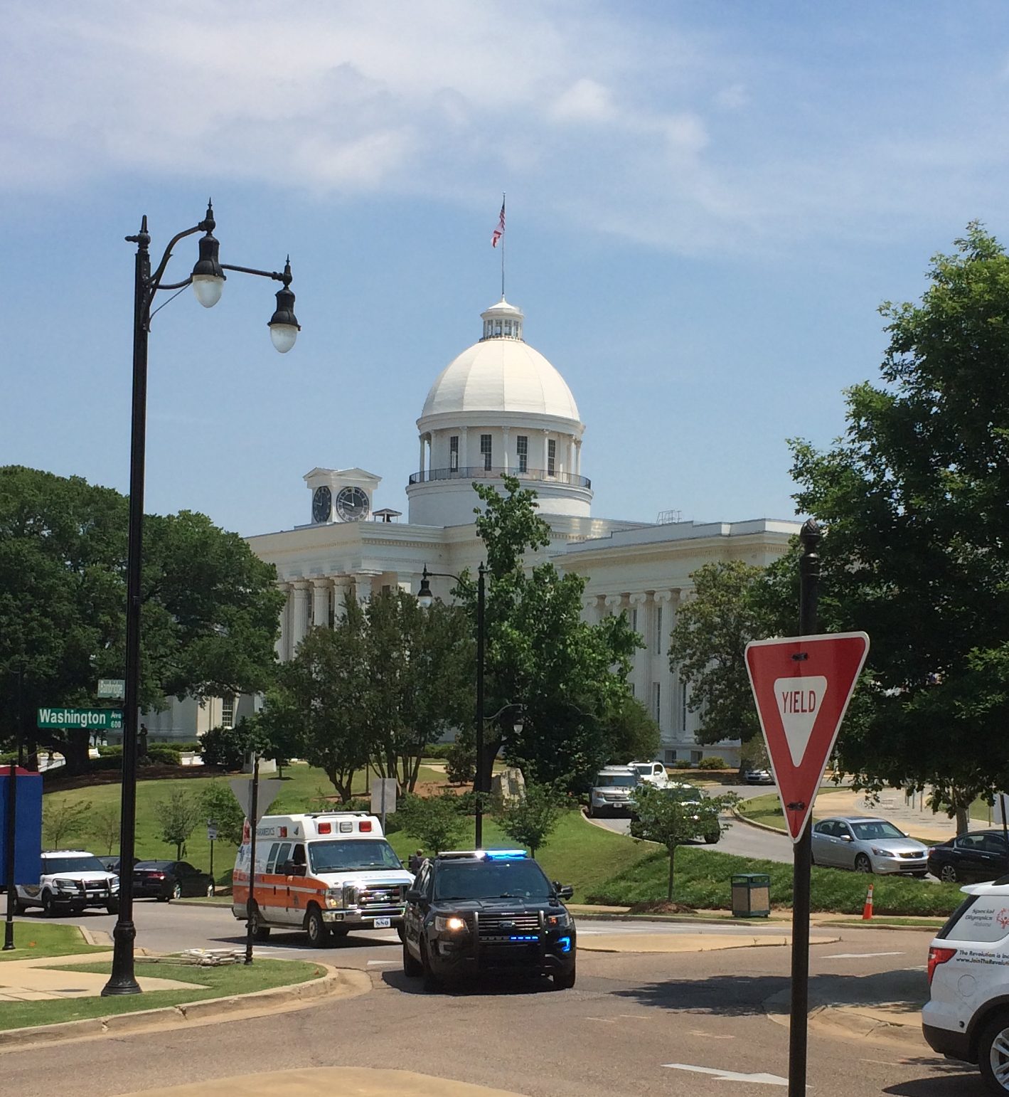
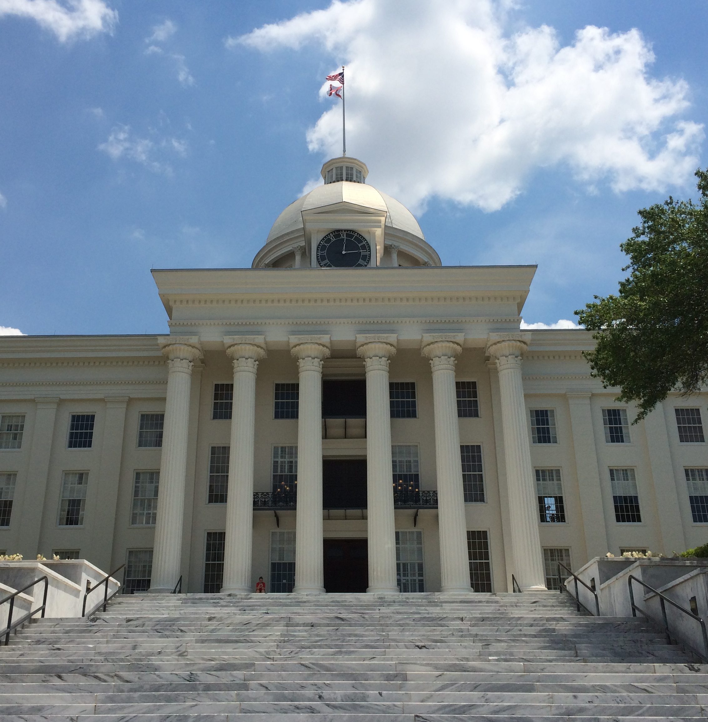
Also in Montgomery: the Alabama State Capitol. The Alabama legislature had been in the news a lot before we came to town, as the latest state body to try to topple Roe v. Wade. That isn’t why I visited. I see capitols when I can.
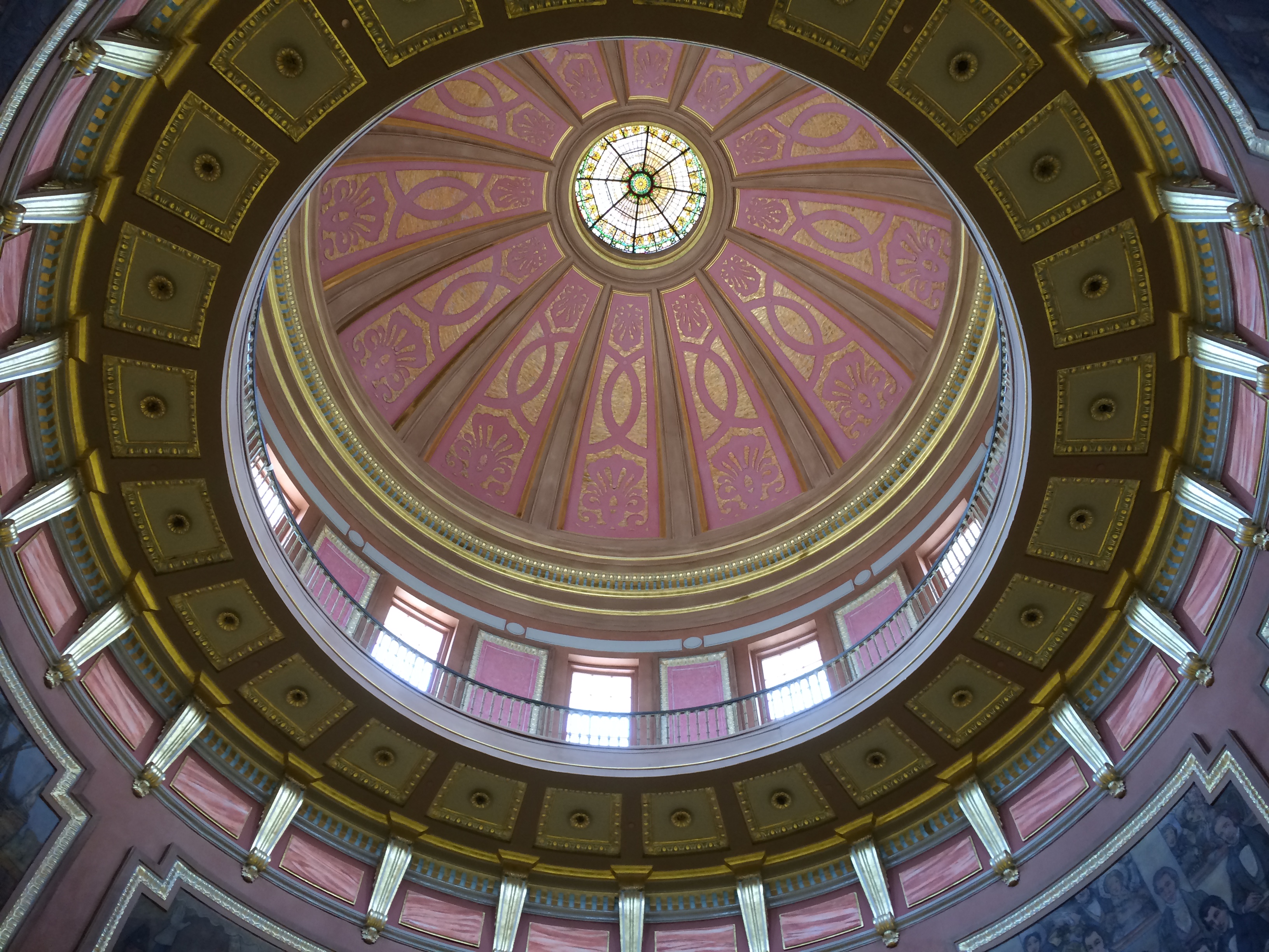
From a distance. Closer. The capitol was completed in 1851, though additions have been made since then. The interior of the dome is splendid.
Actually, the Alabama House and Senate don’t meet in the capitol any more, but at the nearby Alabama State House, something I found out later. When we visited, the capitol’s House and Senate chambers seemed like museum pieces rather than space for state business, and that’s why.
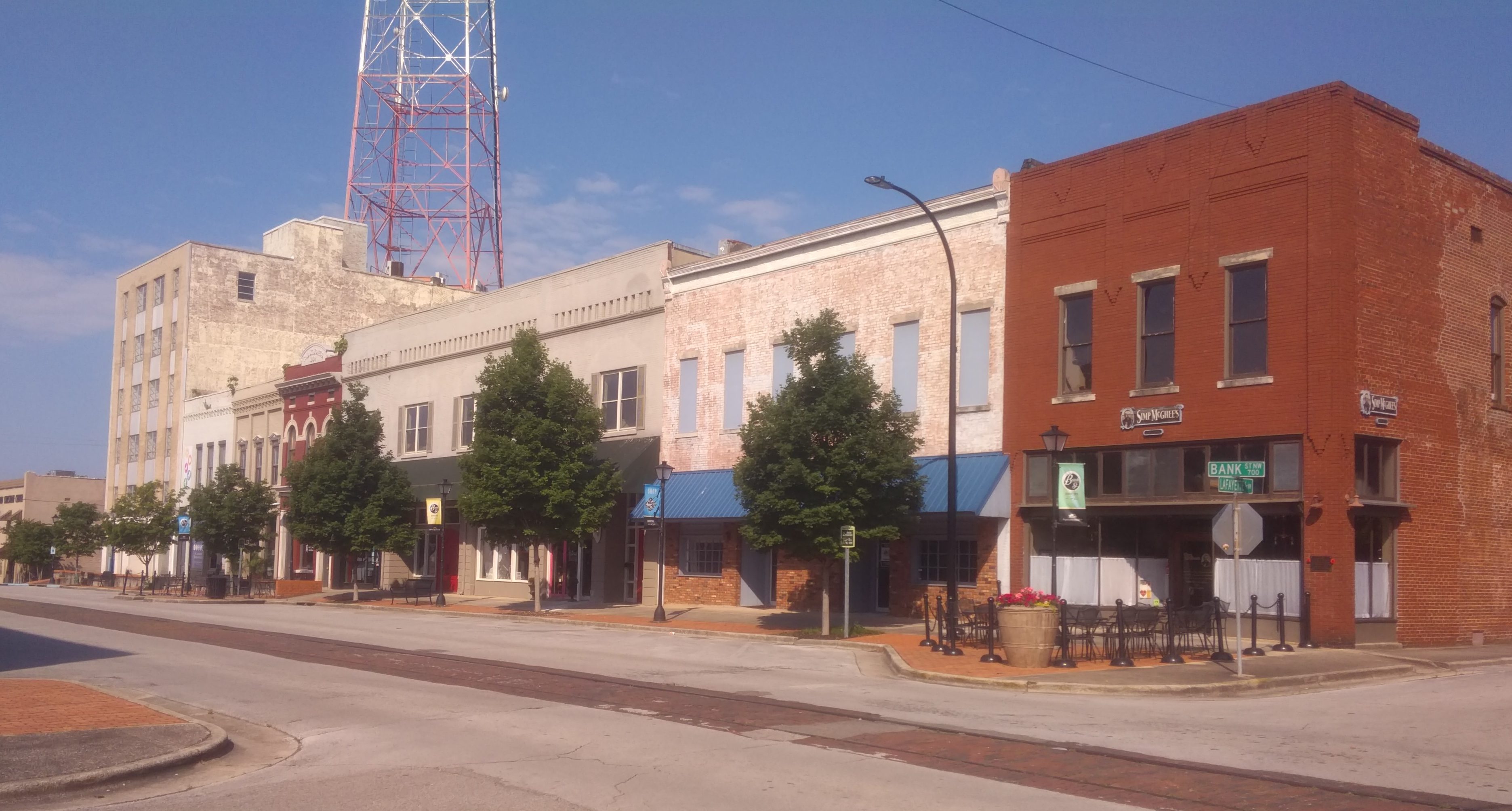
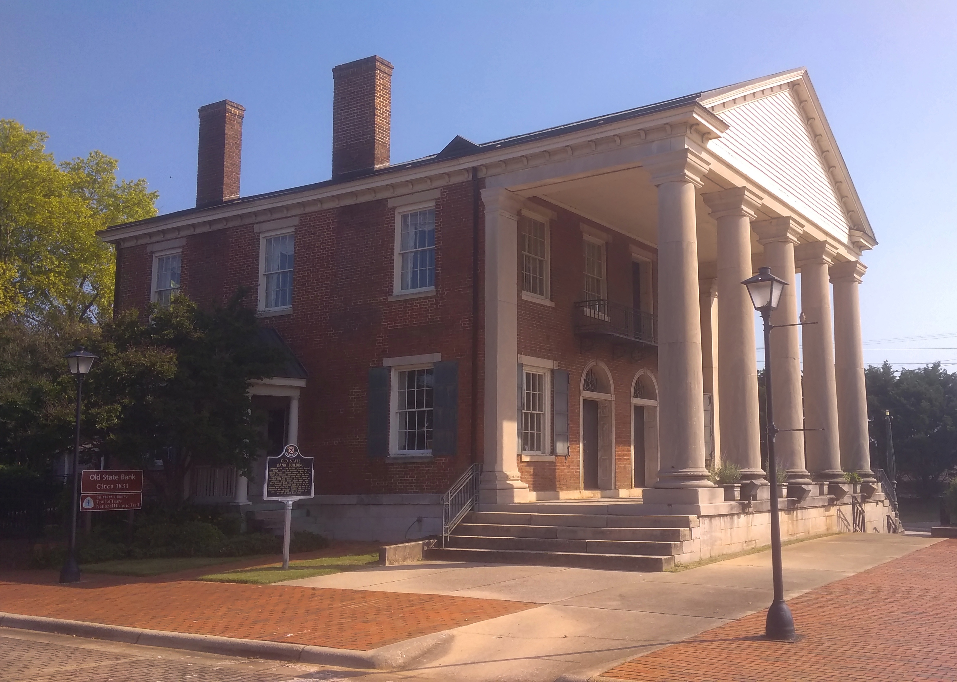
Seems like hipsters haven’t discovered Decatur, Alabama, yet. But as real estate prices balloon in other places, it isn’t out of the question. The town has a pleasant riverfront on the Tennessee and at least one street, Bank St., that could be home to overpriced boutiques and authentic-experience taprooms. Of more interest to me was the Old State Bank, dating back to 1833 and restored toward the end of the 20th century. It is where Bank St. ends, or begins, near the banks of the Tennessee River.
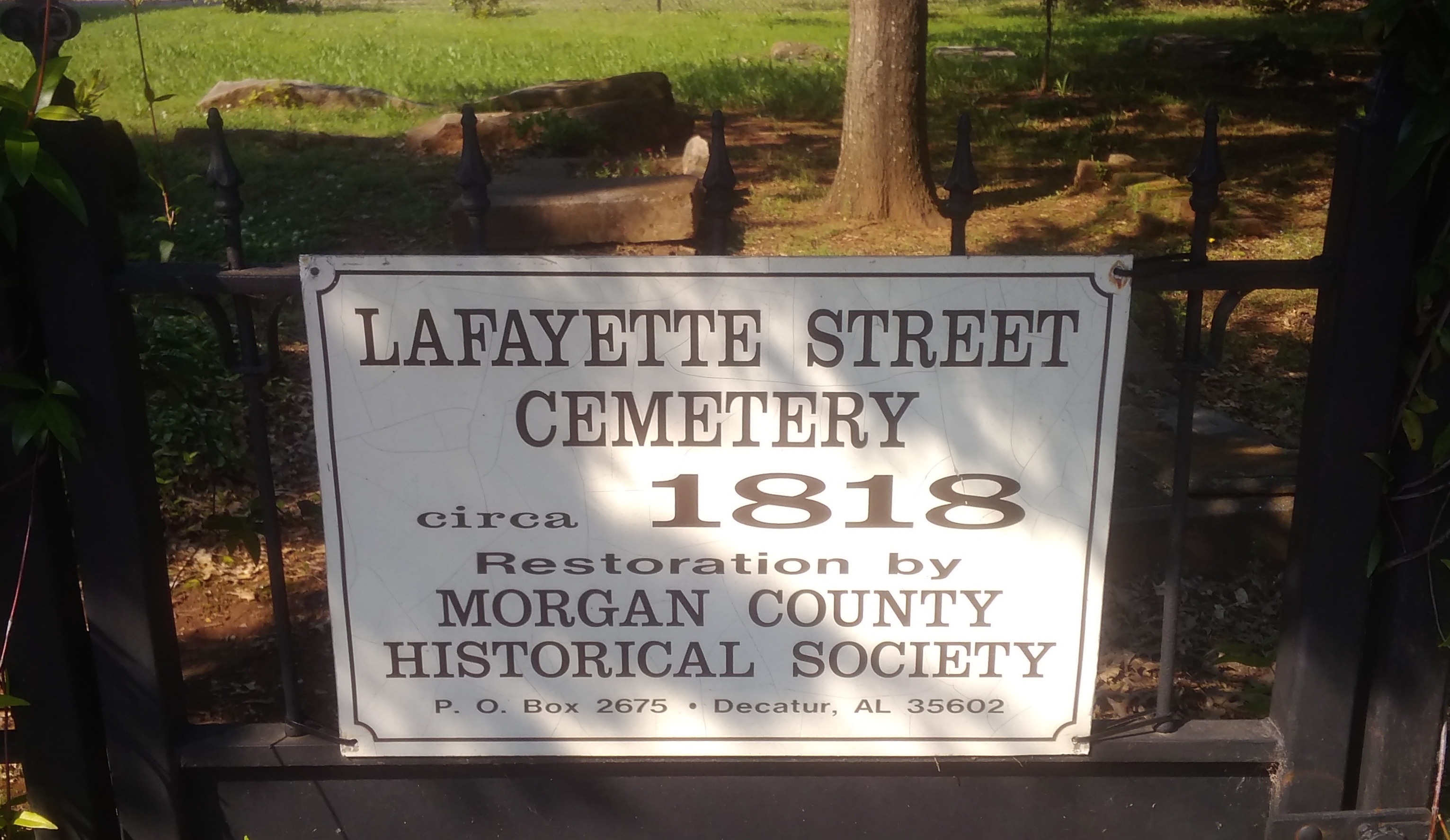
Even more interesting is the Lafayette Street Cemetery, active from ca. 1818.
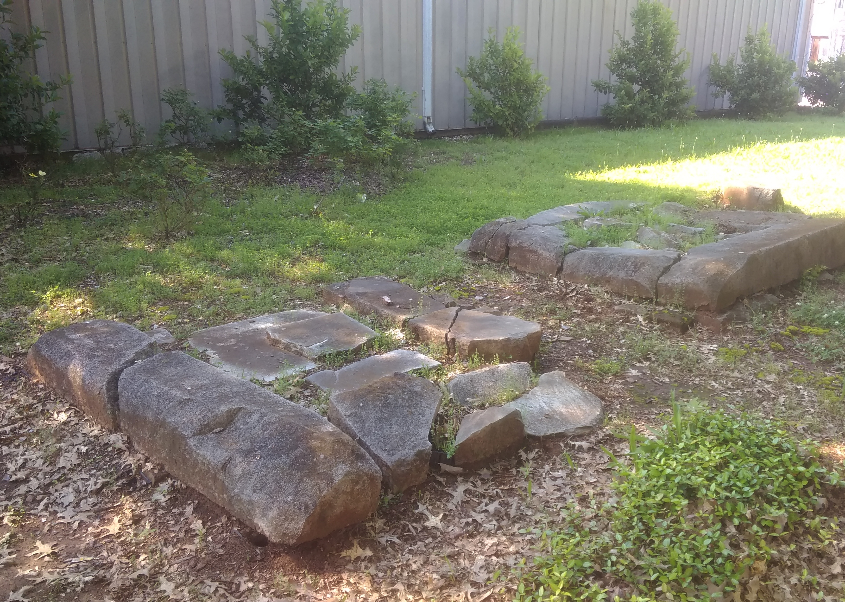
It’s more of a ruin than a cemetery, but I’m glad it has survived. During the entirety of the trip, there were plenty of random bits of the South to be seen along the way. We also listened to a lot of Southern radio on the trip — something Lilly plans to avoid on future trips, Southern or not, with her Bluetooth and so on — and we had a little game whenever we tuned into someone discussing some social problem in earnest on a non-music, non-NPR station. The game: guess how long will it be before the discussion turns to God. It was never very long.
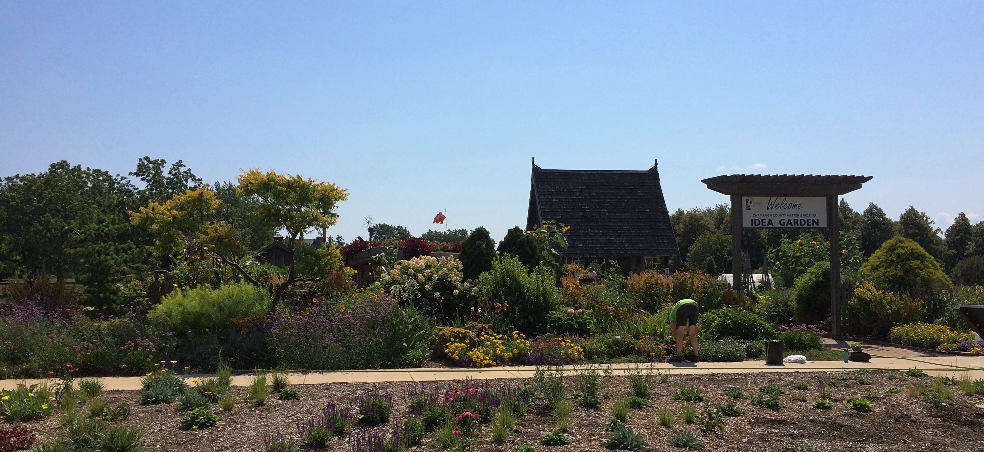


 A small structure mid-garden was being used for an informal gardening class when we passed by. Something about garden pests.
 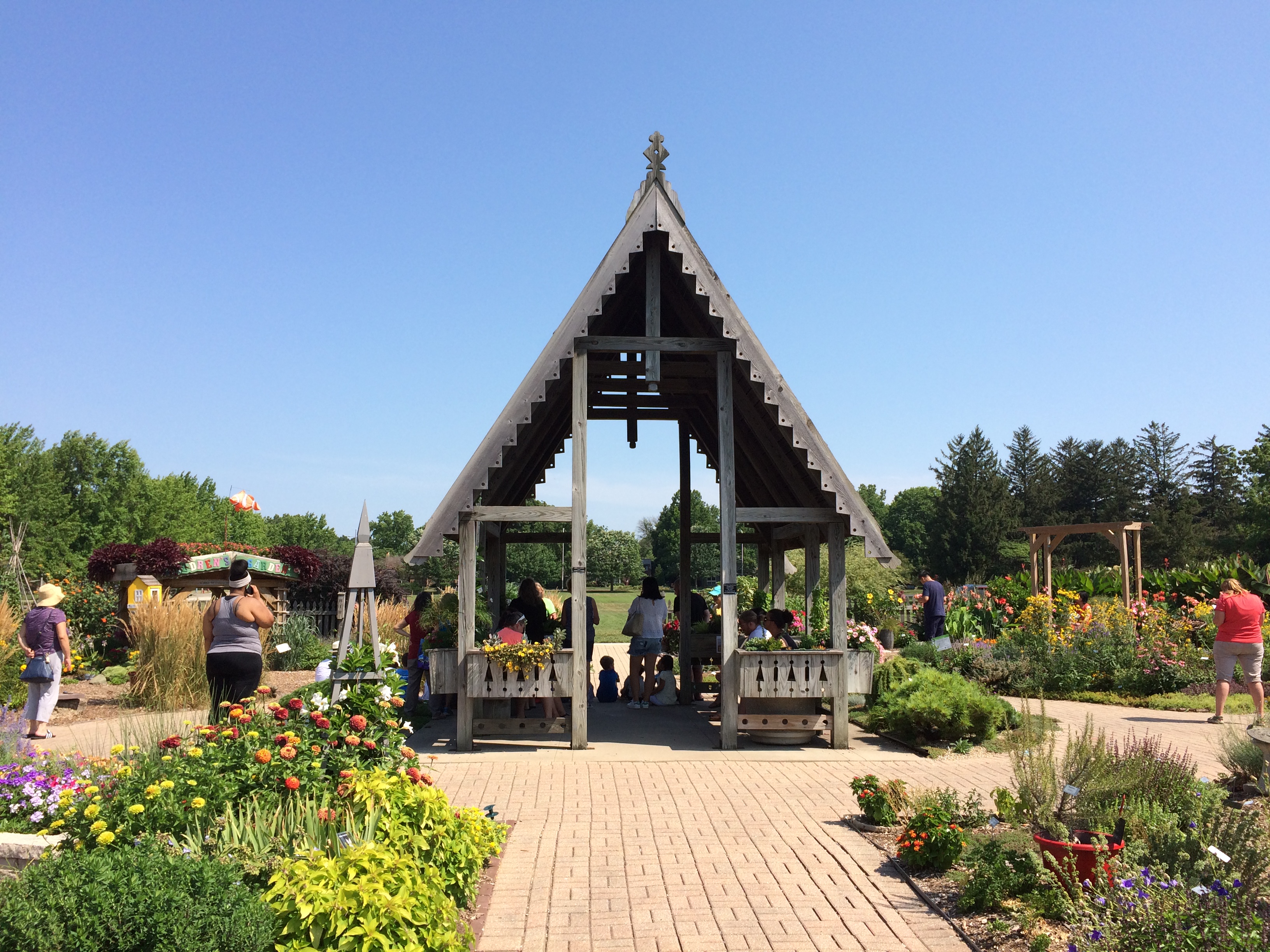 Sunflowers reaching to the sky. Taller than a grown human being. One of the volunteers told me it was a special kind that grows tall. Not a lot of gardeners like them, he said, but he did.
 I have fond memories of large elephant ears when I was a child.
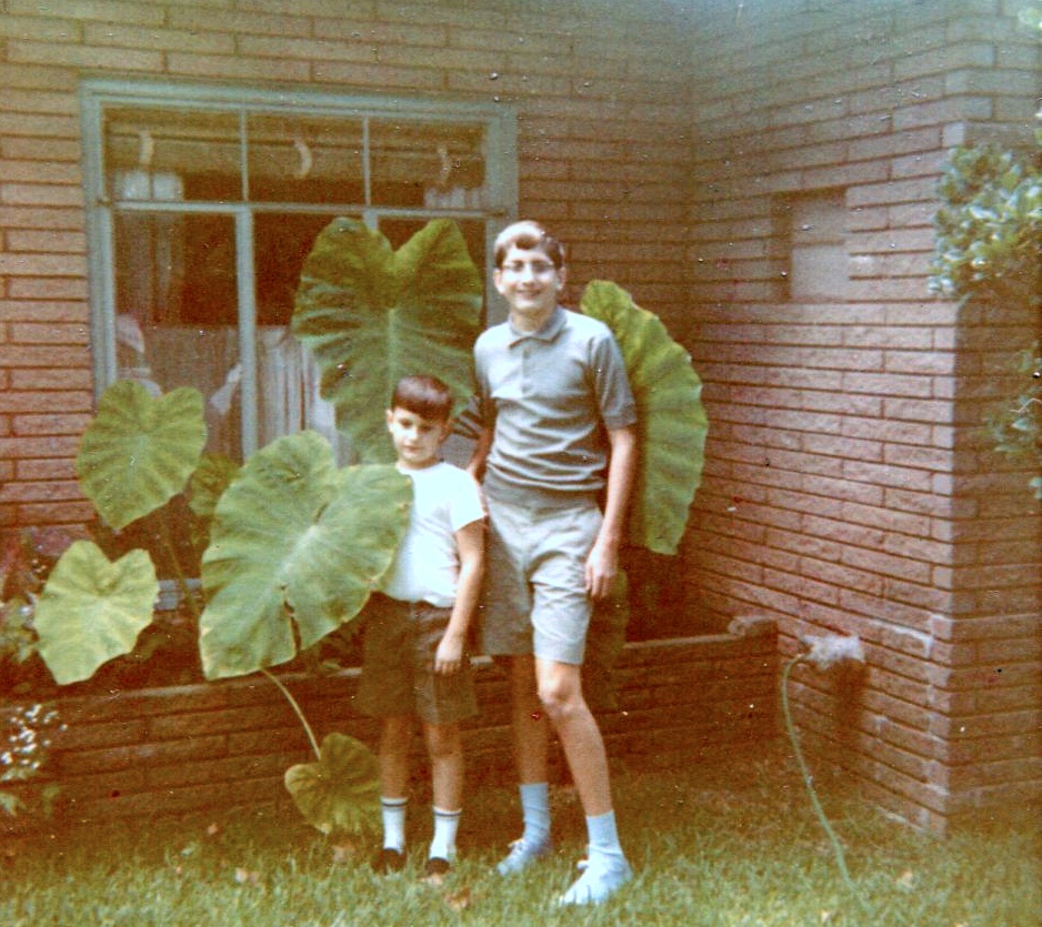 The picture is ca. 1970, of my brother Jim and I and the front-yard elephant ears. I might have been small, but that’s not why I remember our elephant ears as large — they were objectively large. That’s the way they grew for a few early years at our house in San Antonio. In later years, they came up smaller and eventually disappeared.
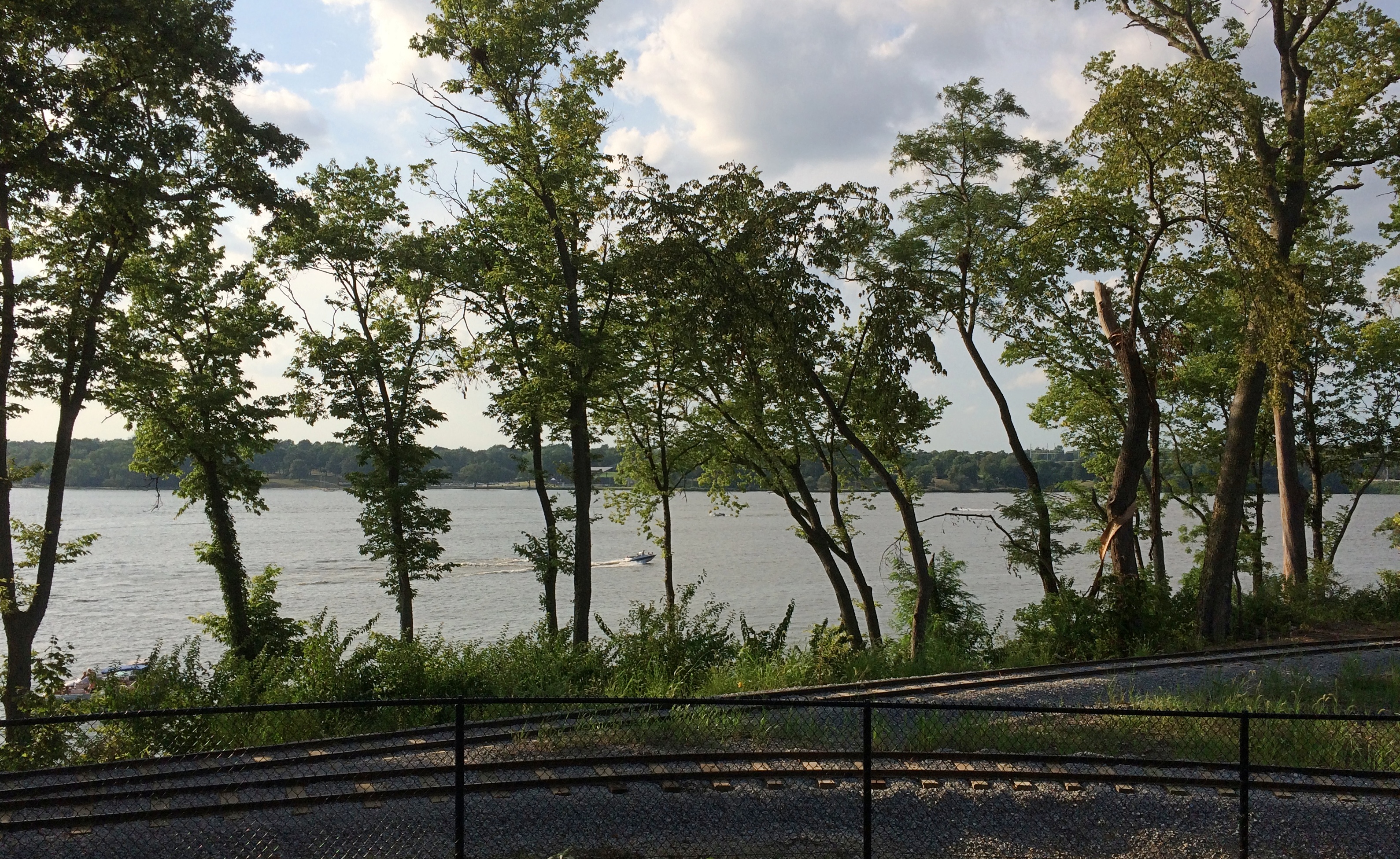


 Nearby, a sign offers the dedication speech, made by the widow of the creator, local eccentric Bob Moomaw, almost exactly 20 years ago. The text seems the same, but the background is a lot more psychedelic than it
 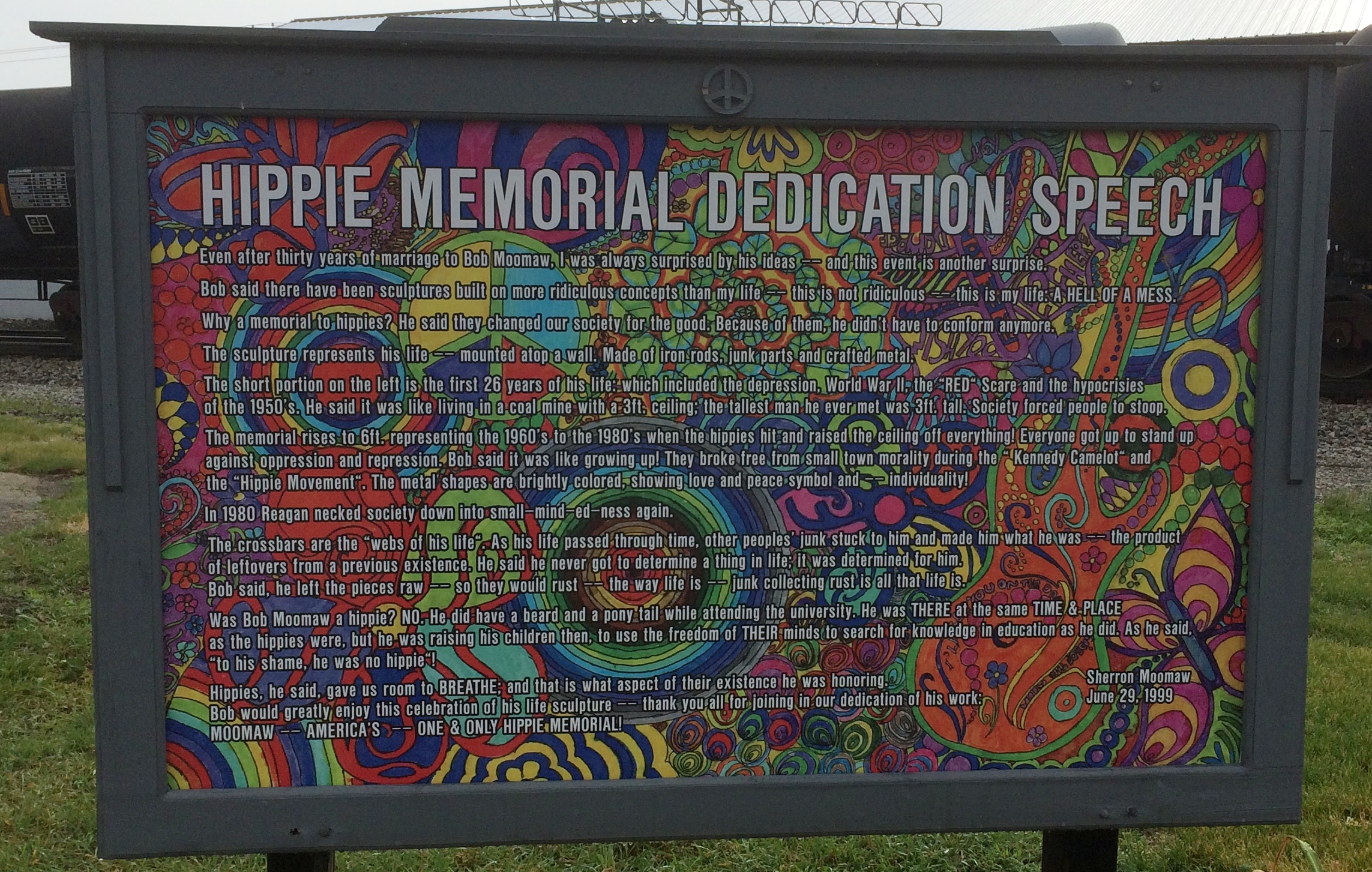 Sure, why not honor the hippie movement? It’s been subject to retroactive derision all out of proportion to its risibility. You can argue that hippies were yet another flowering of bohemianism, a periodic occurrence that’s helped keep things interesting since the Romantic movement at least.