Main Street, Buffalo (Theater District)

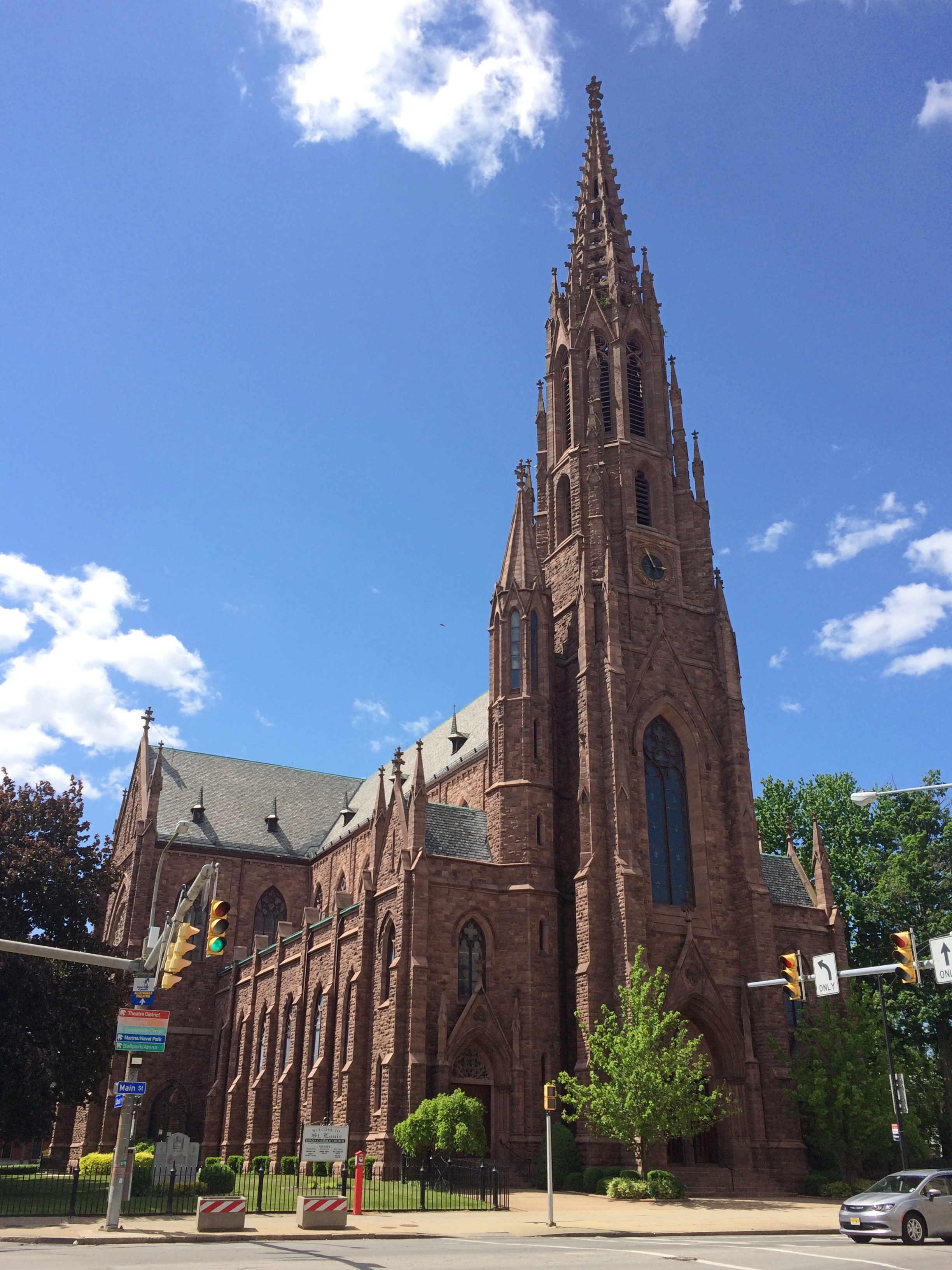
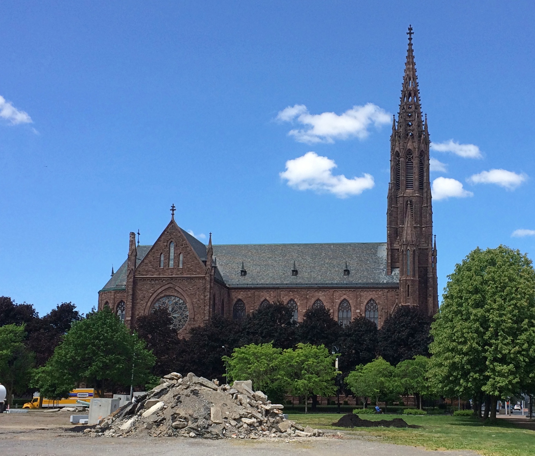
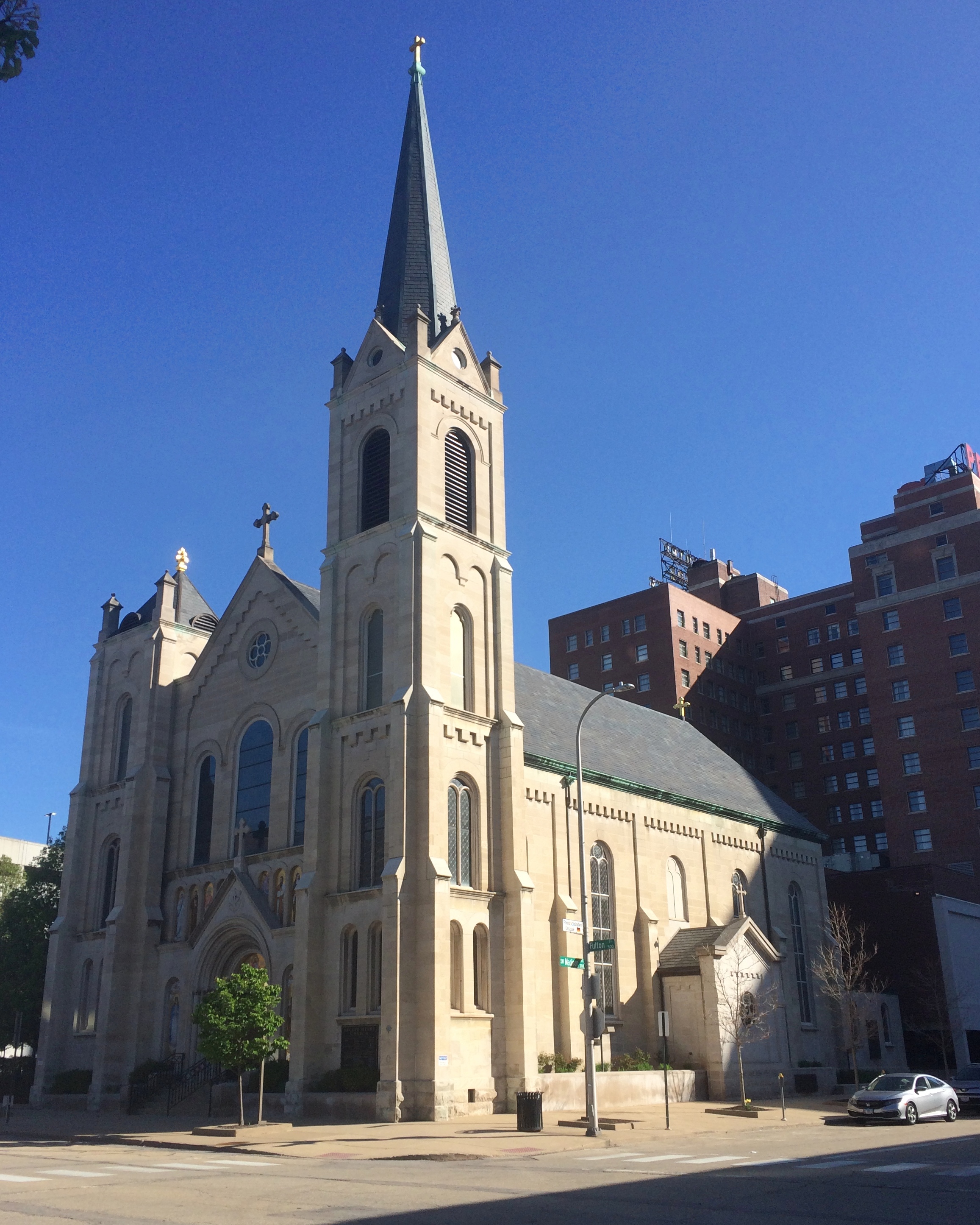
At the five-way intersection of Main, Edward, Pearl and Goodell streets in Buffalo — only Main has the same name on both sides — stand the Catholic Center and the Sidway Building (mentioned yesterday) but also St. Louis Roman Catholic Church.St Louis Roman Catholic Church Buffalo St Louis Roman Catholic Church Buffalo

Designed by Schickel and Ditmar in 1889 on the site of the two earlier churches, it’s considered the Mother Church of the Diocese of Buffalo. Local architectural firm HLL, who did some restoration work in 2003, notes that “the 245-foot-tall steeple includes a 72-foot-tall, pierced spire, reportedly the tallest open-work spire ever built completely of stone without reinforcement. It is reputed to be the only remaining pierced spire in the United States.”

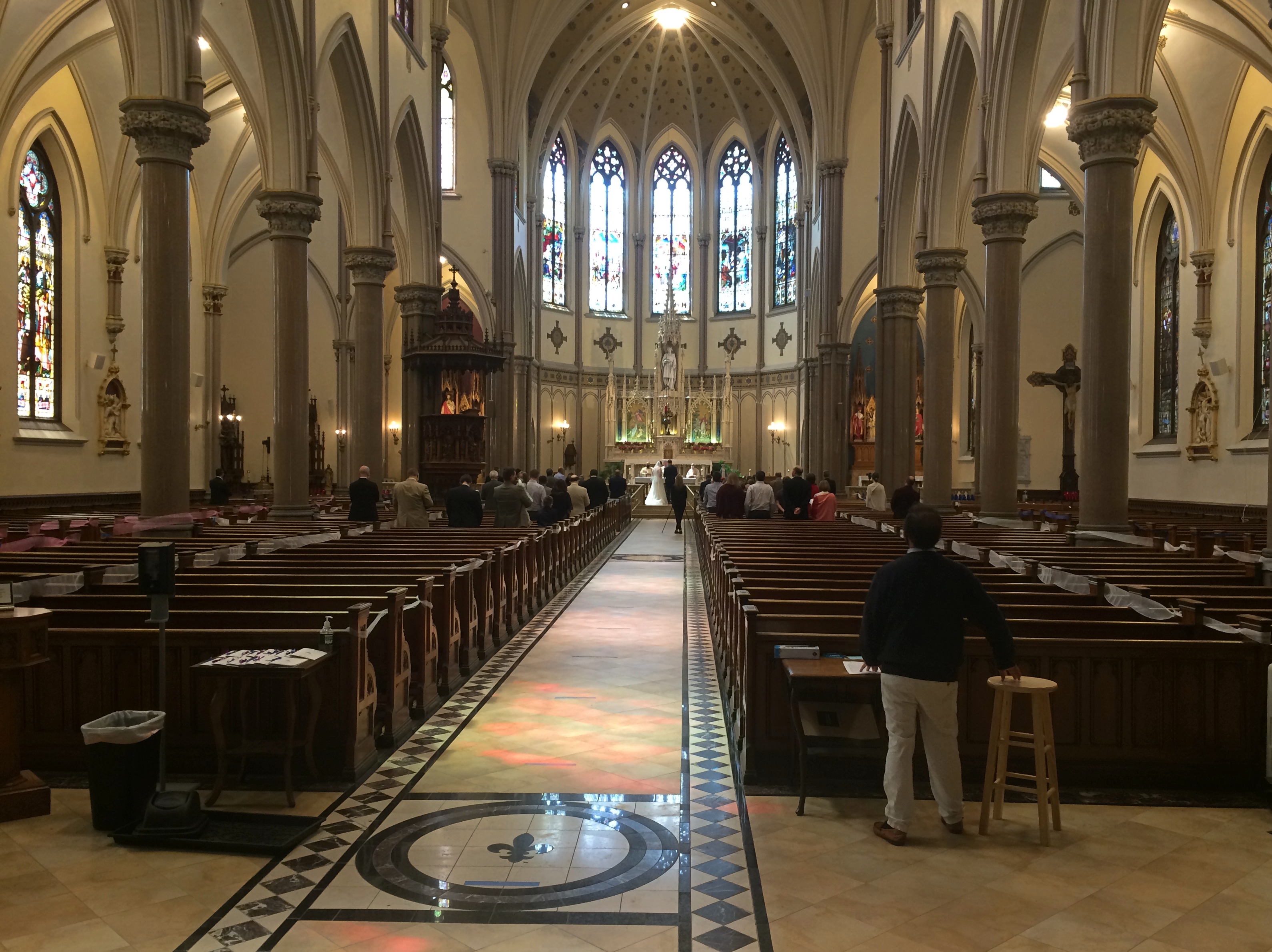
I popped in for a look, surprised to find it open on Sunday afternoon. A wedding was in progress, but I was able to see much of the interior from the narthex, through large windows in the doors.
St Louis Roman Catholic Church Buffalo

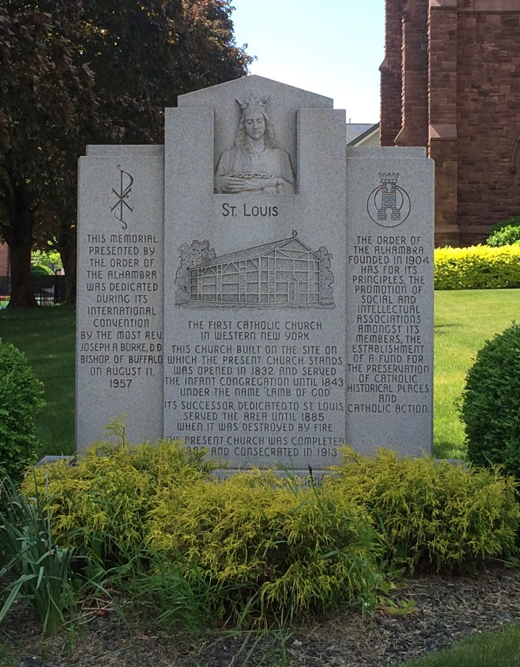
A descriptive stone outside the church.
St Louis Roman Catholic Church Buffalo

Main Street continues southward, but not as New York State Route 5, which veers off onto Edward St. and heads into downtown via another street. Main becomes narrower at that point, includes tracks for Buffalo’s light rail system, and runs through Buffalo’s Theater District, which I expect hasn’t been too busy lately. By that I mean in 2020, but also since its heyday about 100 years ago, when it was home to about 50 theaters of various sorts. I didn’t count, but maybe there are seven or eight.

Still, even former or diminished theater districts have their interests. Dotonbori in Osaka, for instance, only has a single theater any more (for Kabuki), but it sure is interesting to walk through.

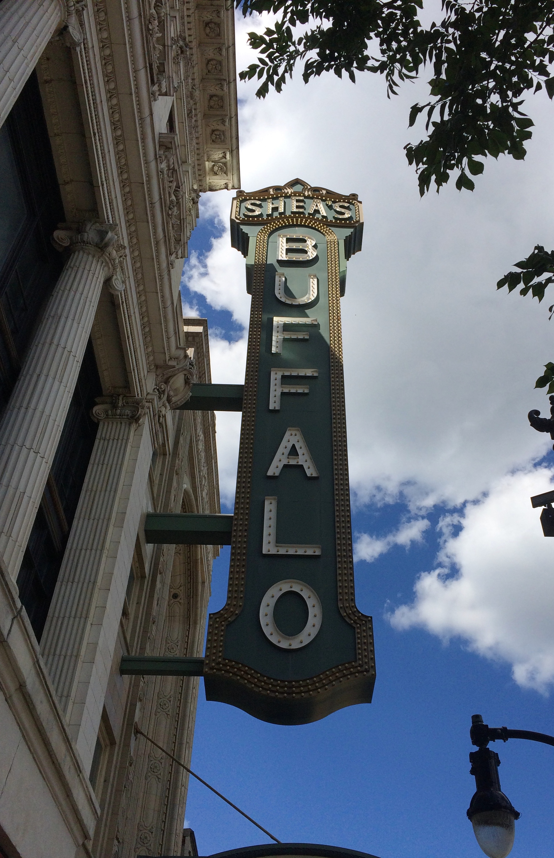
The grande dame of Buffalo theaters is Shea’s Buffalo, these days one of a complex of three theaters known as Shea’s Performing Arts Center.

It’s one of the many Rapp and Rapp theaters that started as a movie palace in the 1920s, like the Chicago Theatre. If it had been open, I would have gone in.

Shea's Buffalo
“A casual observer may not know the history behind Shea’s. Michael Shea, for whom the venue is named, was born in St. Catharines, Ontario, in 1859,” Buffalo Tales reports. “Around the turn of the century, he operated several vaudeville theaters in Buffalo and Toronto. By the early 1920s, Shea and his associates had traveled the country to gather ideas for constructing an ornate theater in Buffalo.

“Cornelius and George Rapp, famous theater architects based in Chicago, were hired to design a building that would resemble a European opera house and ‘compare favorably with such buildings in other cities.’ The initial plan was to spend approximately $1 million, but investors eventually spent twice that.”

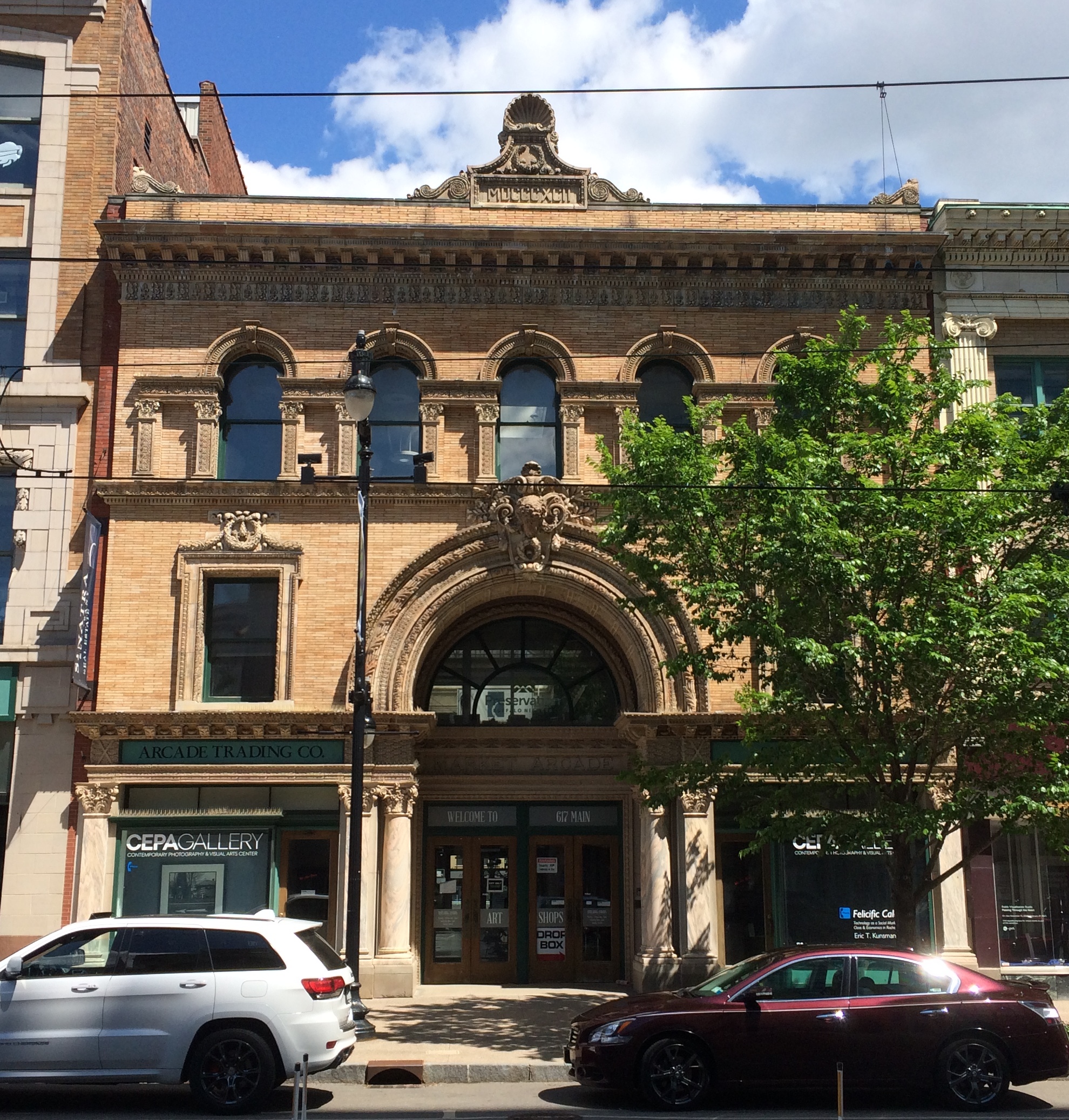
A little further south and across the street is another splendid bit of Beaux Arts, the Market Arcade.Market Arcade Buffalo

“Designed in 1892 by Buffalo architects Edward B. Green and William S. Wicks, the Market Arcade is the city’s only historic covered shopping arcade,” the site Buffalo As An Architectural Museum says. “This nineteenth century building type, which first achieved popularity during the 1820s, is generally regarded as the forerunner of the contemporary suburban mall.

“The Market Arcade recalls more famous arcades, such as the Gallery Umberto I (1887-90) in Naples and London’s Burlington Arcade (1818-19), which G.B. Marshall, the builder of the Buffalo Arcade, suggested to the architects as a model for his structure.

“Like European arcades, the Market Arcade maintained close ties to the street life around it. When constructed, the building connected this bustling stretch of Main Street with the flourishing public market that formerly existed at Washington and Chippewa streets. It was the market — the ‘belly of Buffalo’ – that gave the arcade its name.”

These days, the restored Market Arcade is home to CEPA Gallery and a mix of retail shops. The building was closed when I wandered by.

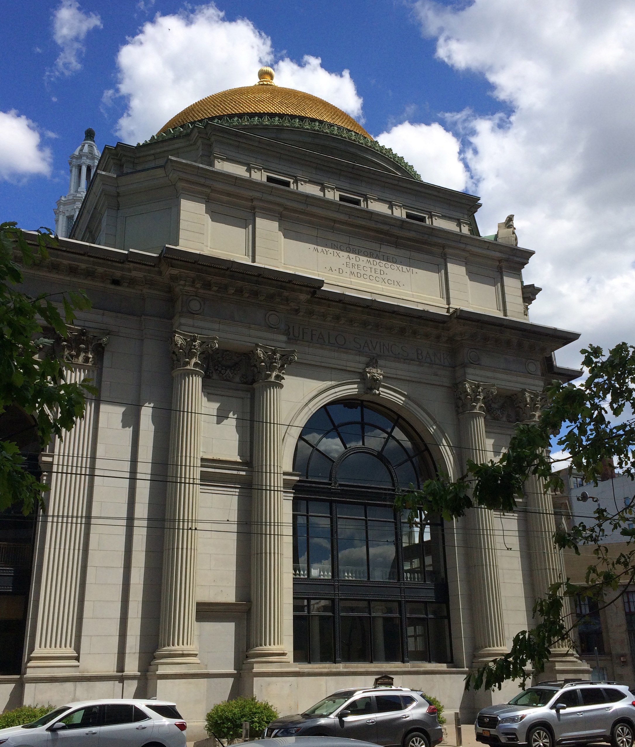
Further south still, the theater district peters out, giving way to a more general commercial area. I was a little tired by this point, but I had to get a closer look at the gold-domed building on Main, which I’d seen from a distance earlier in the day from the lawn of the Buffalo and Erie County Public Library, and which I’d imagined might be a church.

Turns out it’s a temple of mammon instead, a branch of M&T Bank that used to be Buffalo Savings Bank. That institution was founded in the 19th century by prominent Buffalonians, including local attorney and politico Millard Fillmore.
Buffalo Savings Bank

“Few buildings on Buffalo’s skyline are as pronounced or recognizable as the historic Gold Dome building,” USA Today reported in 2014. “Designed by E.B. Green [him again], the granite landmark was commissioned in 1898 and opened in 1901 — just before the Pan Am Exposition. But back then, this ornate edifice was actually rather plain.”

The article details the artwork added in the 1920s to the interior — inaccessible on a Sunday — and then says about the outside of the dome: “When it was built, the tiles were a simple beige terra-cotta. They stayed that way until the ’50s when they were gilded with 23 and 3/4 karat gold leaf.”

A bank building with a gold leaf dome. Now that’s something you’d think there would have been more of, at least adorning banks of the pre-FDIC period. A good-looking way to send a simple message: We’ve got the dough.

Along the Niagara Gorge

What’s within walking distance of Niagara Falls State Park if you want a (relatively) inexpensive lunch? There’s a food court in an ugly building, but also Zaika Indian Cuisine, Taste of Nepal and Punjabi Hut on streets near the park, all of which speak to fairly recent immigration in this corner of western NY. When honeymooners visited Niagara in the early 20th century, or even most of the rest of the century, those were surely not options. We had the buffet on Saturday at Punjabi Hut, which was pretty good.

Afterwards, we spent a little more time at the park riding the Niagara Scenic Trolley, whose route was shortened during the pandemic, and then headed north by car on the Niagara Scenic Parkway. The road is fairly short — 18 miles or so — and goes from the town of Niagara Falls to Lake Ontario, but it is definitely scenic, except for the section that passes by the New York Power Authority plant on the river. Just north of the falls the parkway follows the river fairly closely.

The road was known as the Robert Moses Scenic Parkway until about five years ago. Looks like Confederate memorials aren’t the only ones getting the boot these days. So are those honoring urban planners with a taste for neighborhood-impinging expressways. (And what’s to become of this state park on Long Island? Time will tell.)

North of the town of Lewiston, the parkway still follows the river, but at a remove of a mile or so. It’s pretty enough, but I understand that the Niagara Parkway on the Canadian side, which follows the river quite closely, is the prettier drive. But one goes where one can go.

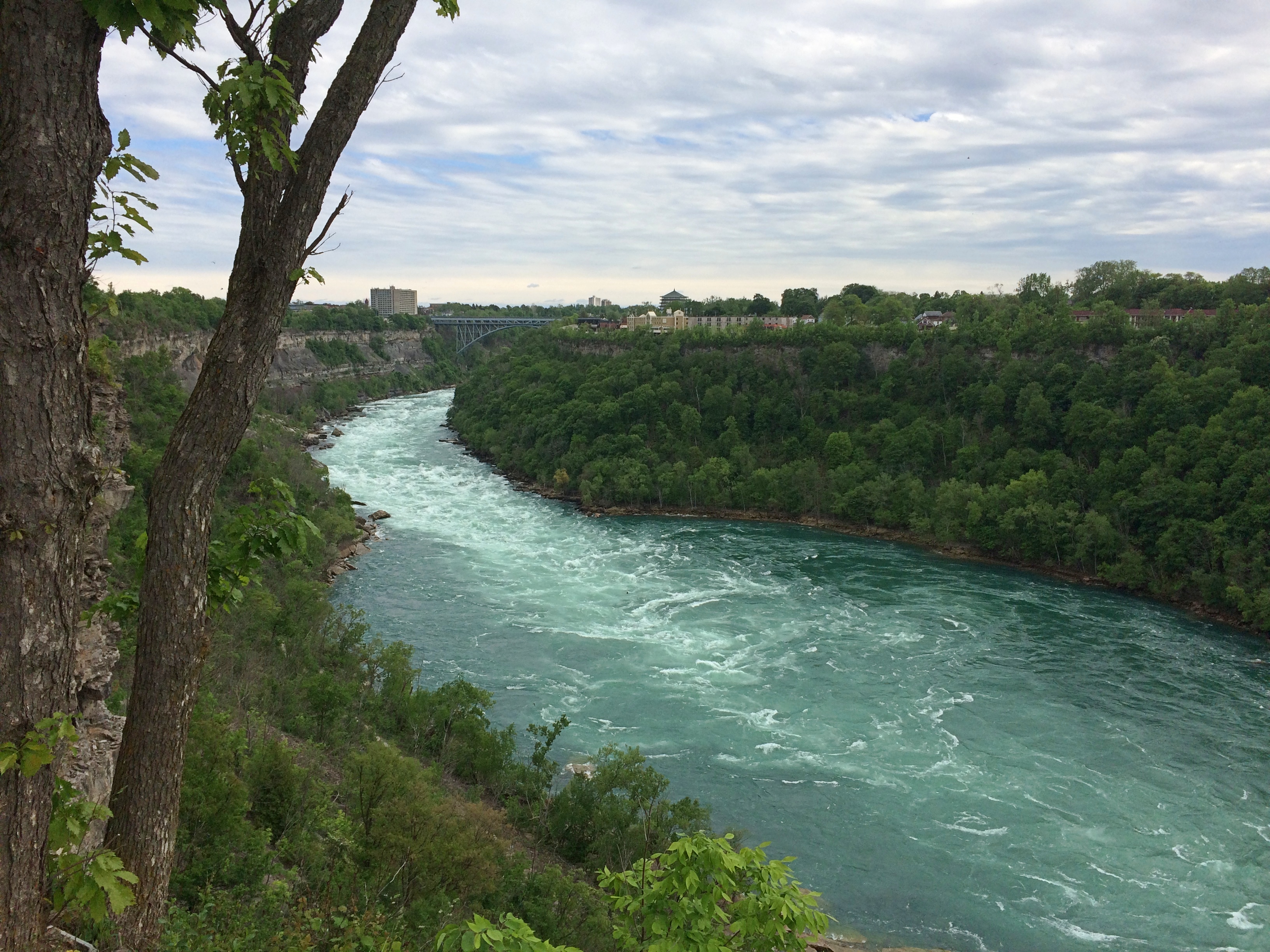
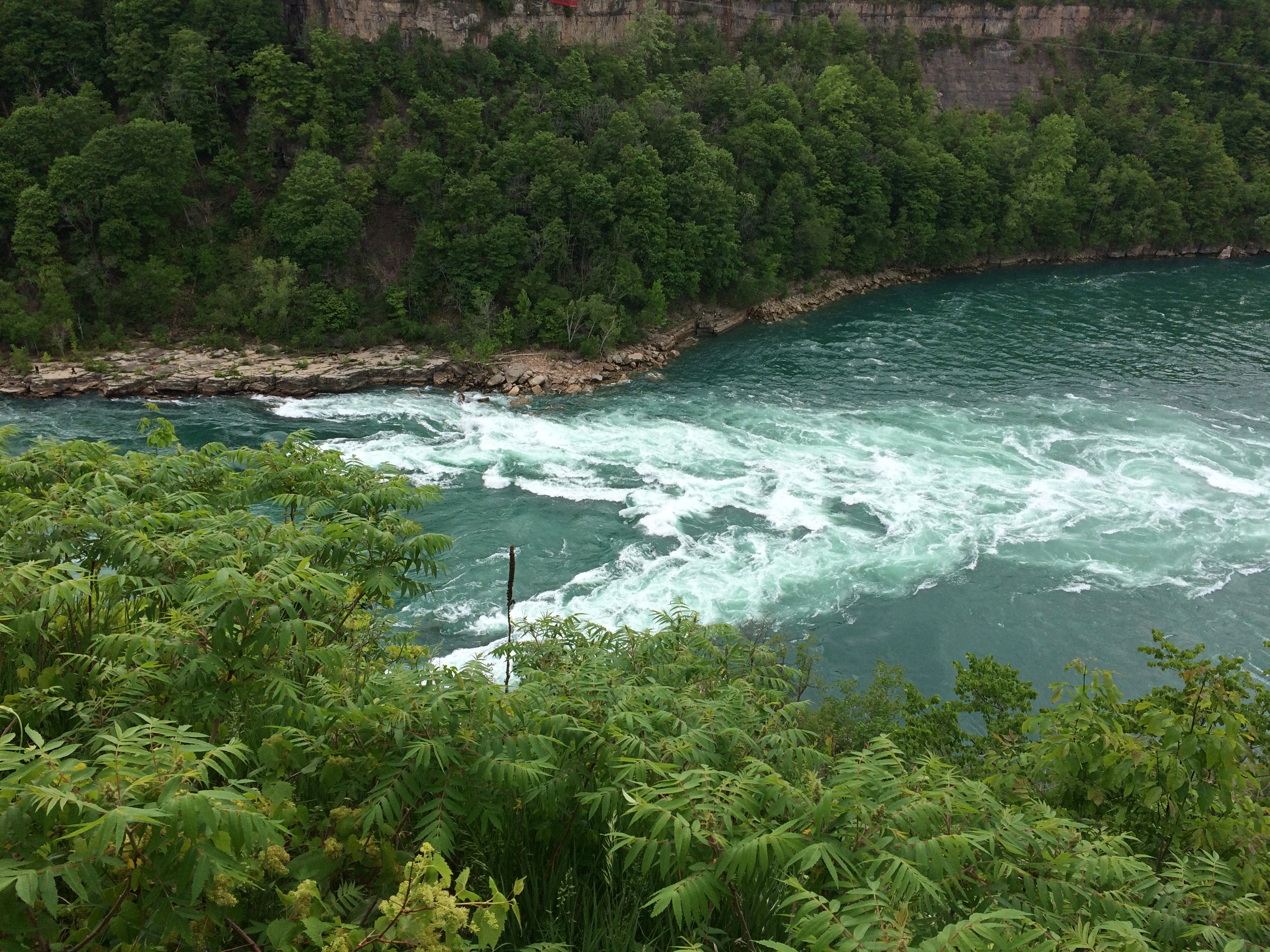
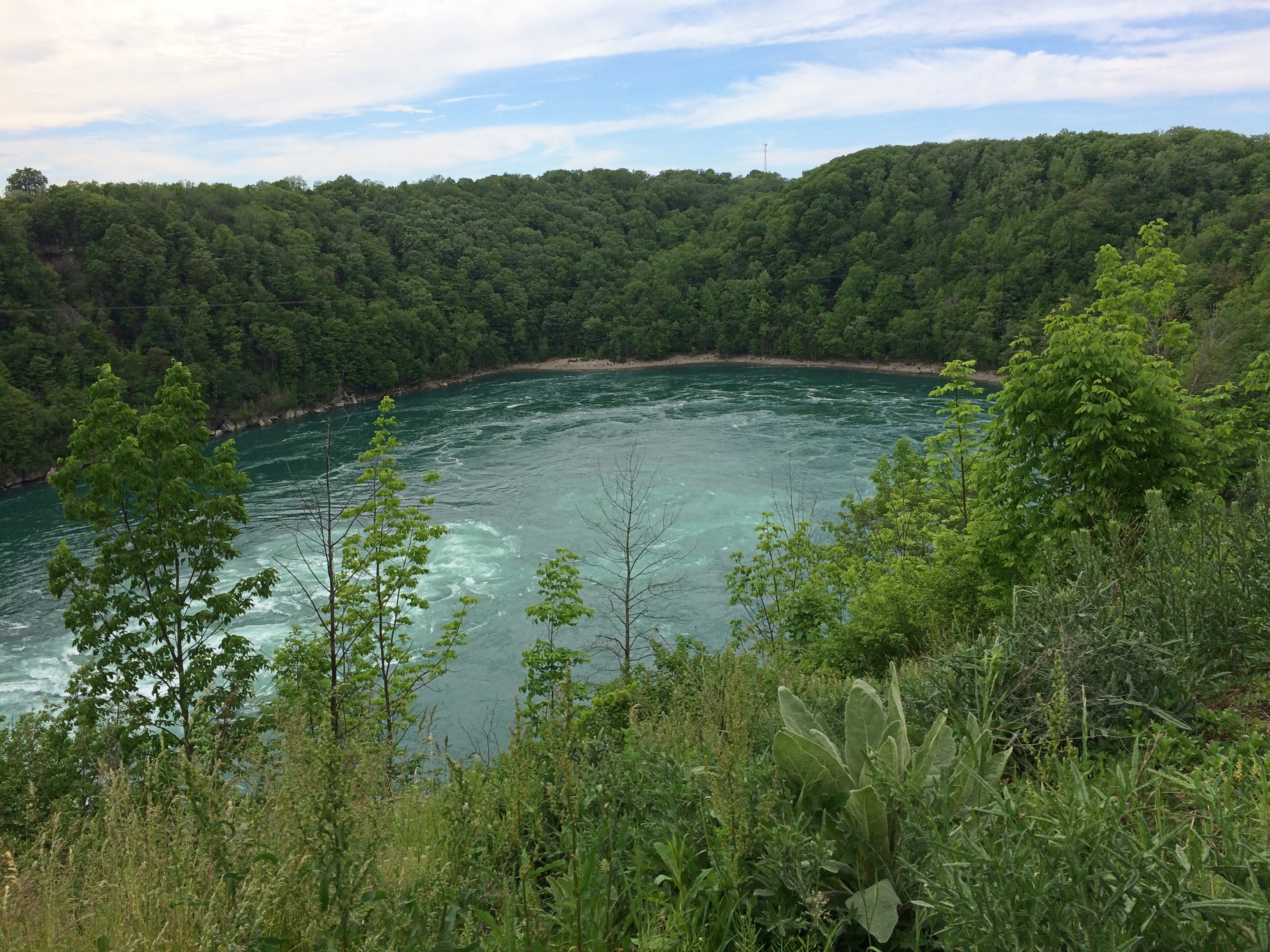
First stop: Whirlpool State Park. The intense current of the Niagara River rushes to this point and forms a enormous whirlpool at a bend. Been quite a while since I’ve had a good look at a natural whirlpool which, despite the name, looks like a choppy patch of water rather than the thing you see in a drain.

The view upriver. In the distance is the Rainbow Bridge. As I’ve said, nothing is very far from anything else in this part of New York state.Niagara Gorge

The flow into the whirlpool.
Niagara Gorge

The whirlpool.
Niagara Gorge Whirlpool

It doesn’t look like a particularly safe place for boats, but that doesn’t keep tourists from venturing there under the command of “highly skilled captains.” I’d hope so. I don’t know whether the jetboats are running now. We didn’t see any. The cable car that dangles over the whirlpool, the Whirlpool Aero Car, and which launches from the Canadian side, looked immobile, still shut for the pandemic.

Then there’s the story of Capt. Joel Robinson, skipper of the Maid of the Mist in 1861, who shot the Niagara rapids and whirlpool. Niagara Falls Info tells the story:

“In 1861, due to a financial crisis and the American Civil War, the Maid of the Mist was sold at public auction to a Canadian company. The deal would go through if the boat could be delivered to Lake Ontario. To get to Lake Ontario, the Maid of the Mist had to be navigated through the Great Gorge Rapids, the Whirlpool, and the Lower Rapids.

“On June 6th 1861, 53-year-old Captain Joel Robinson undertook this risky mission along with two deck hands…[McIntyre and Jones]. With both shores lined with onlookers, Captain Robinson and crew rode the Maid of the Mist into one of the world’s most wild and dangerous whitewater rapids.

“The first giant wave that struck the boat threw Robinson and McIntyre to the floor of the wheel house. It also tore the smoke stack from the boat and Jones was thrown to the floor of the engine room. The tiny boat was now at the mercy of the massive waves crashing against it. The boat was carried at approximately 63 km/h through the rock strewn rapids. Soon the Maid of the Mist was propelled into the Whirlpool where Captain Robinson was able to regain control of the boat.

“Captain Robinson had great difficulty maneuvering the Maid of the Mist from the grip of the Whirlpool… The 5 kilometre journey through the rapids and the Whirlpool was well executed, although they lost the smoke stack. Captain Robinson was the first person to accomplish the impossible [obviously not, just difficult] task of taking a boat through the dangerous waters.

“The frightening experience of this journey caused Captain Robinson to give up a career that he loved. He retired into near seclusion and died two years later at the age of 55.”

In modern terms, sounds like he suffered from PTSD. In 19th-century terms, I figure people said he was spooked by the ordeal. No mention of the aftermath for the deck hands.

Not long after visiting Whirlpool State Park, we spend a while in the pleasant town of Lewiston, New York, whose equally pleasant riverfront isn’t at the top of a gorge, but at river level. Not far from the river is the Freedom Crossing Monument, an ensemble of bronzes by Susan Geissler commemorating those escaped slaves who crossed into Canada.Lewiston, NY
Elsewhere in Lewiston is the variously named Earl W. Brydges Artpark State Park, or Earl W. Brydges State Artpark, or simply the Artpark, a venue for summertime musical entertainment. It also includes some other standard features of a park, such as playground equipment and picnic tables, as well as an Indian mound. I expect there haven’t been any events there in more than a year, but maybe that will pick up soon.

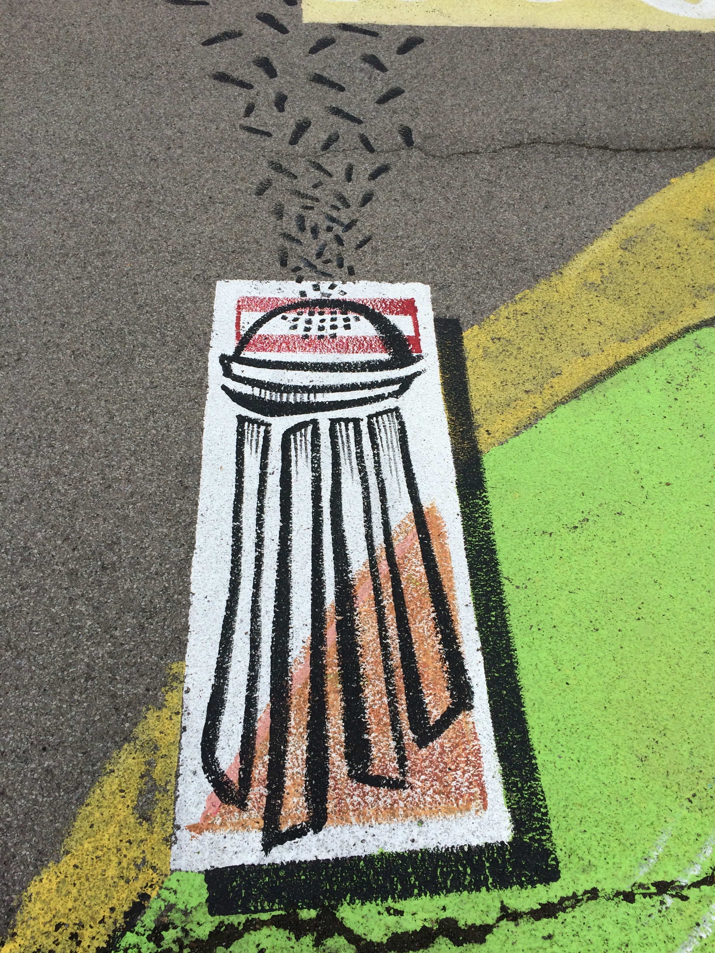
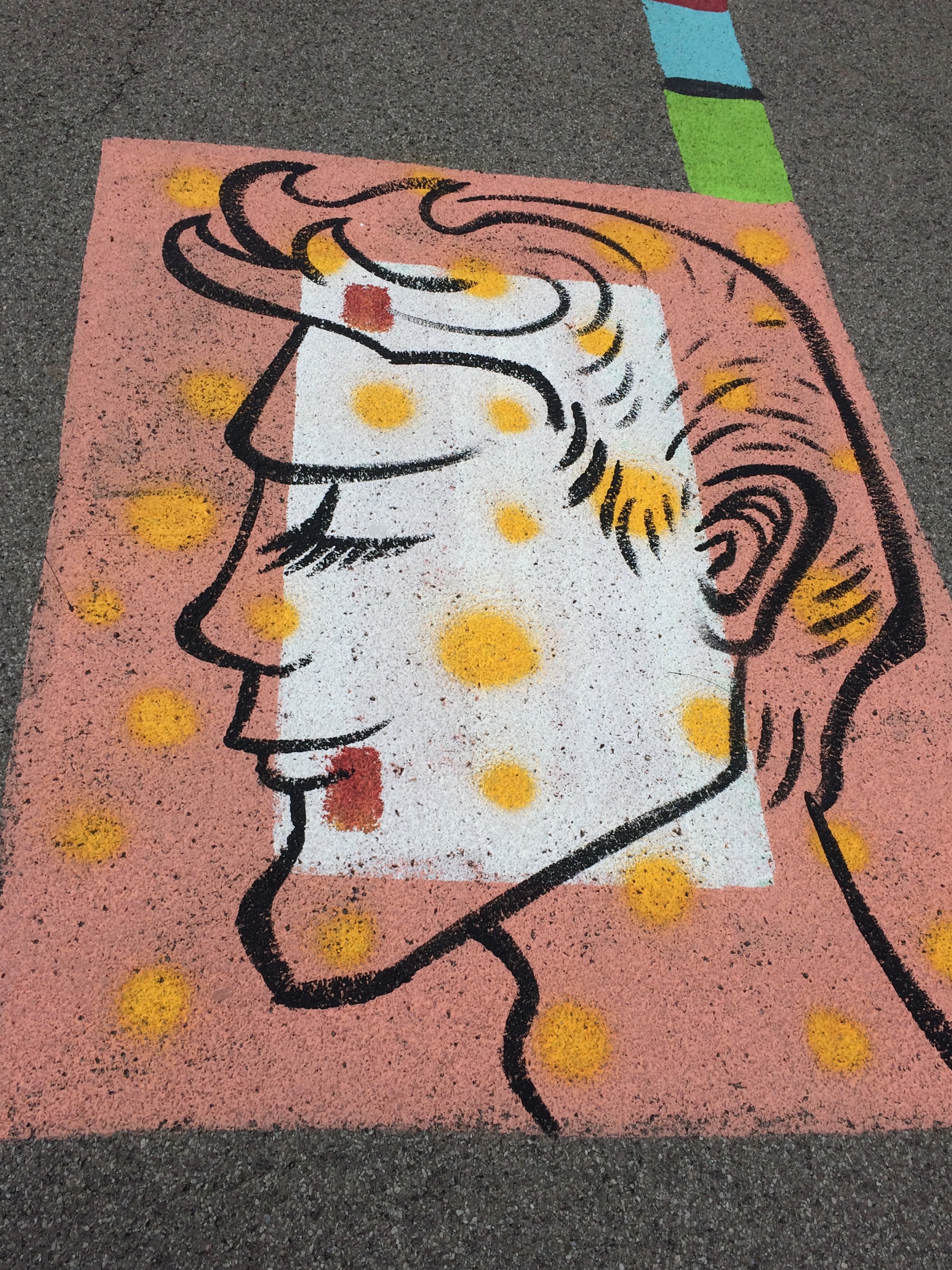
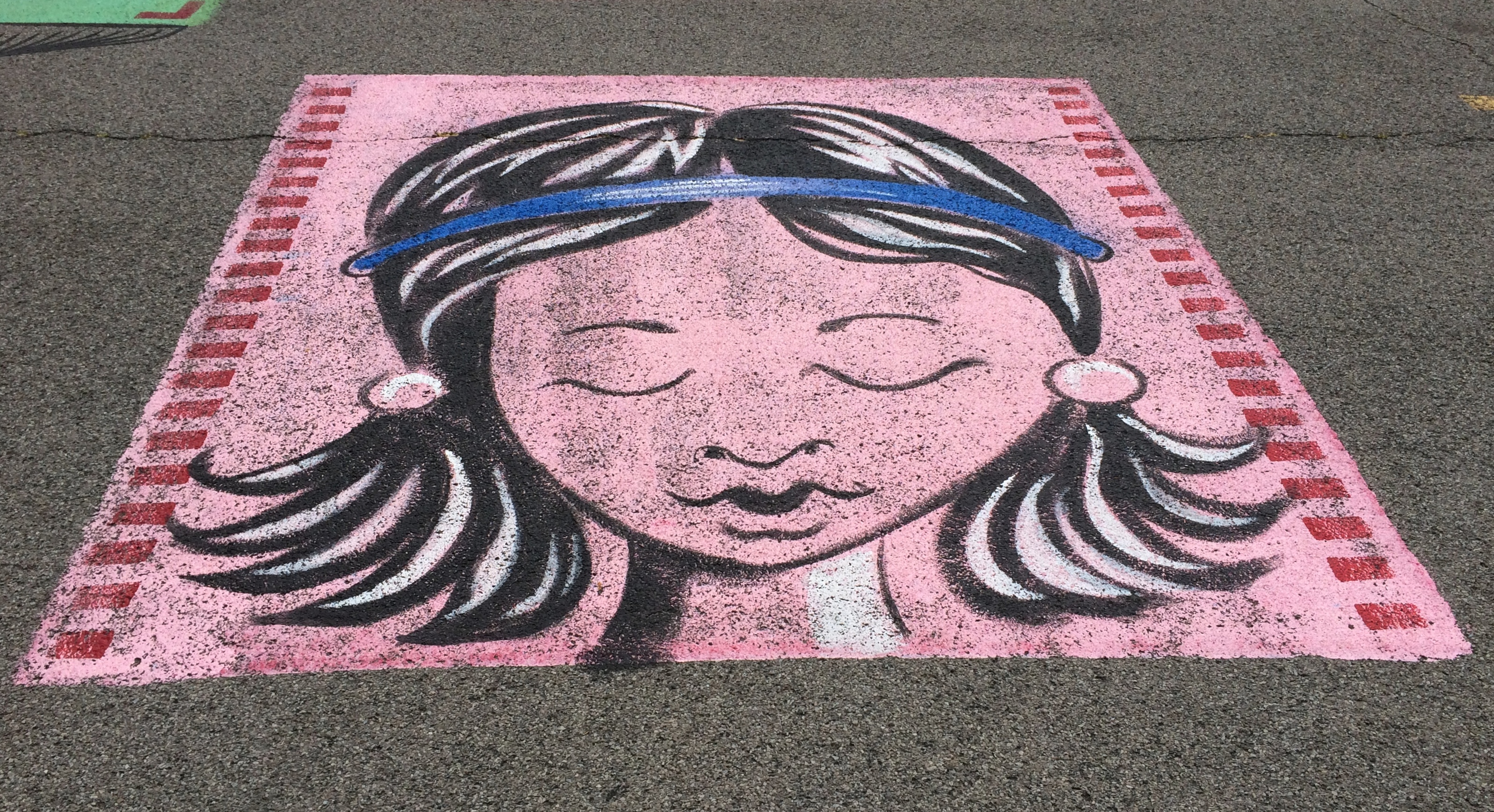
All very interesting, but what struck me was the parking lot. It’s large and undistinguished except for the paintings on its surface. When I pulled into the lot, I took them for children’s chalk drawings, maybe left over from a kids’ event, but soon I noticed they were paintings, and extensive in scope across the lot.Lewiston, NY Artpark parking lot art

More parking lots such be decorated like this.Lewiston, NY Artpark parking lot art Lewiston, NY Artpark parking lot art Lewiston, NY Artpark parking lot artThe end of the line for the Niagara Scenic Parkway is near Old Fort Niagara State Historic Site, which overlooks the mouth of the river on Lake Ontario. The fort itself, which is ringed by an iron fence, was closed by the time we got there. But the rest of the grounds were open. While Yuriko napped in the car, I looked around.

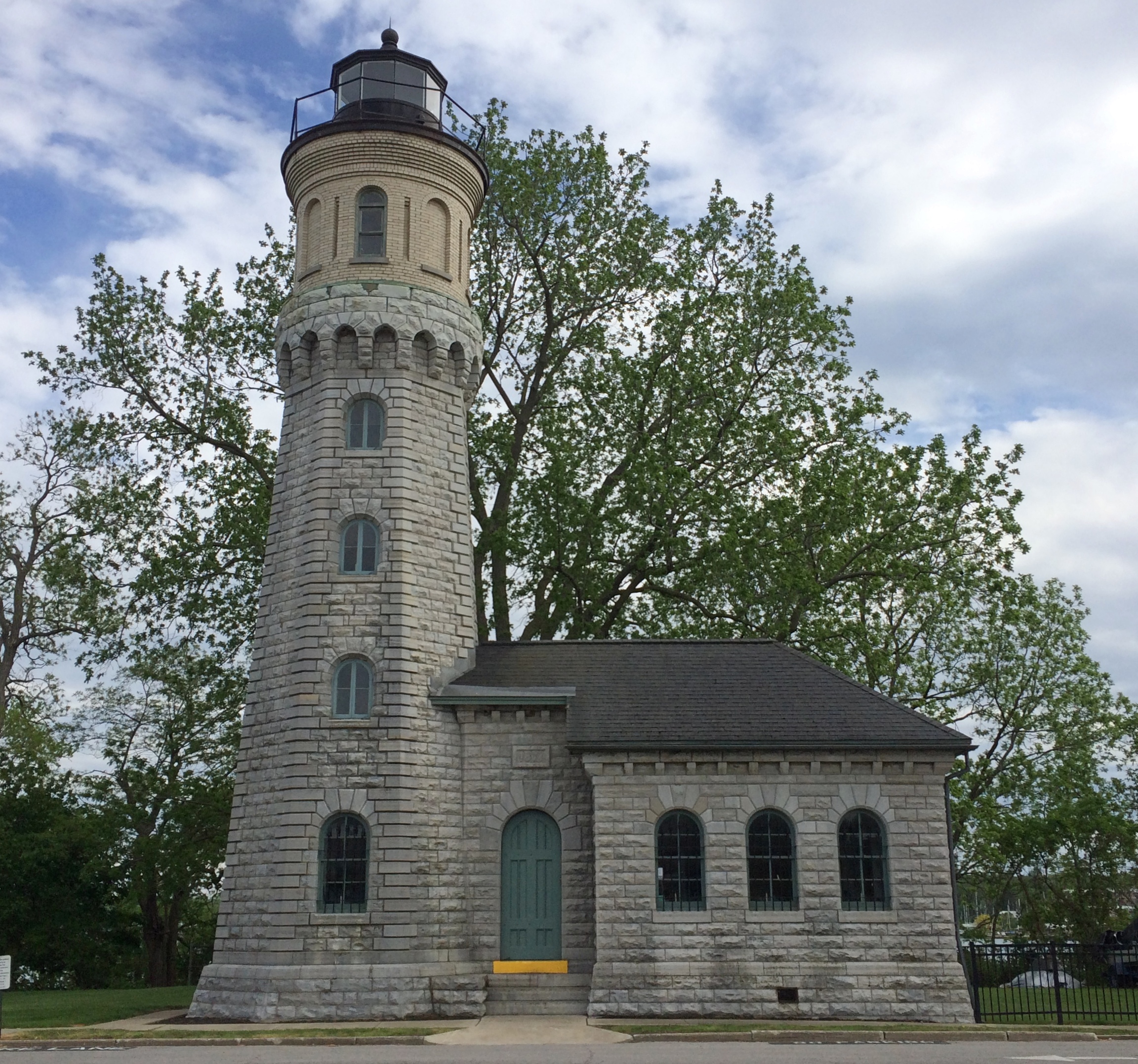
The Old Fort Niagara lighthouse.
Old Fort Niagara lighthouseThis particular light dates from 1871, but the fort had more primitive lights much earlier than that, ca. 1781, which count as the first lights on the Great Lakes.

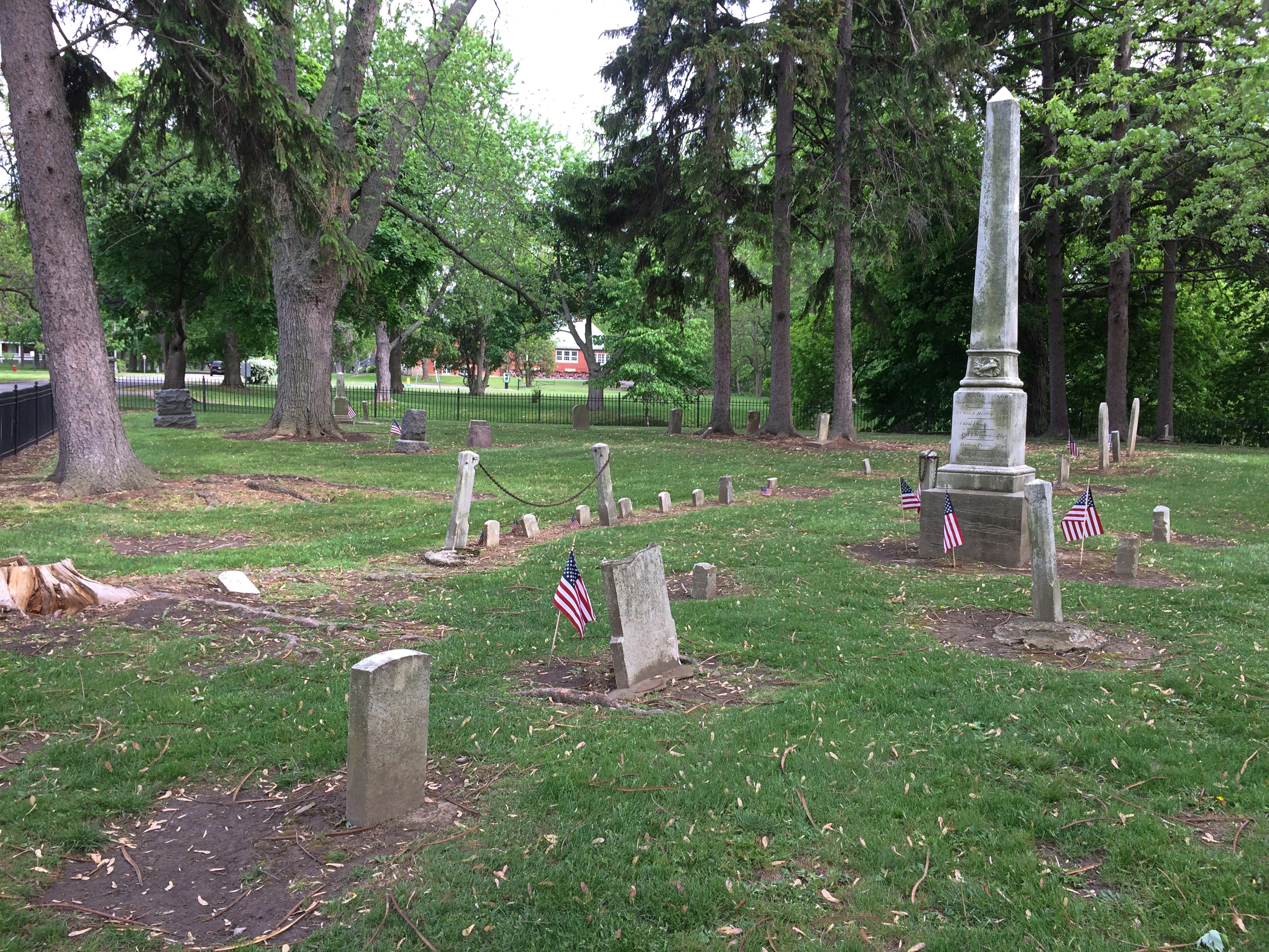
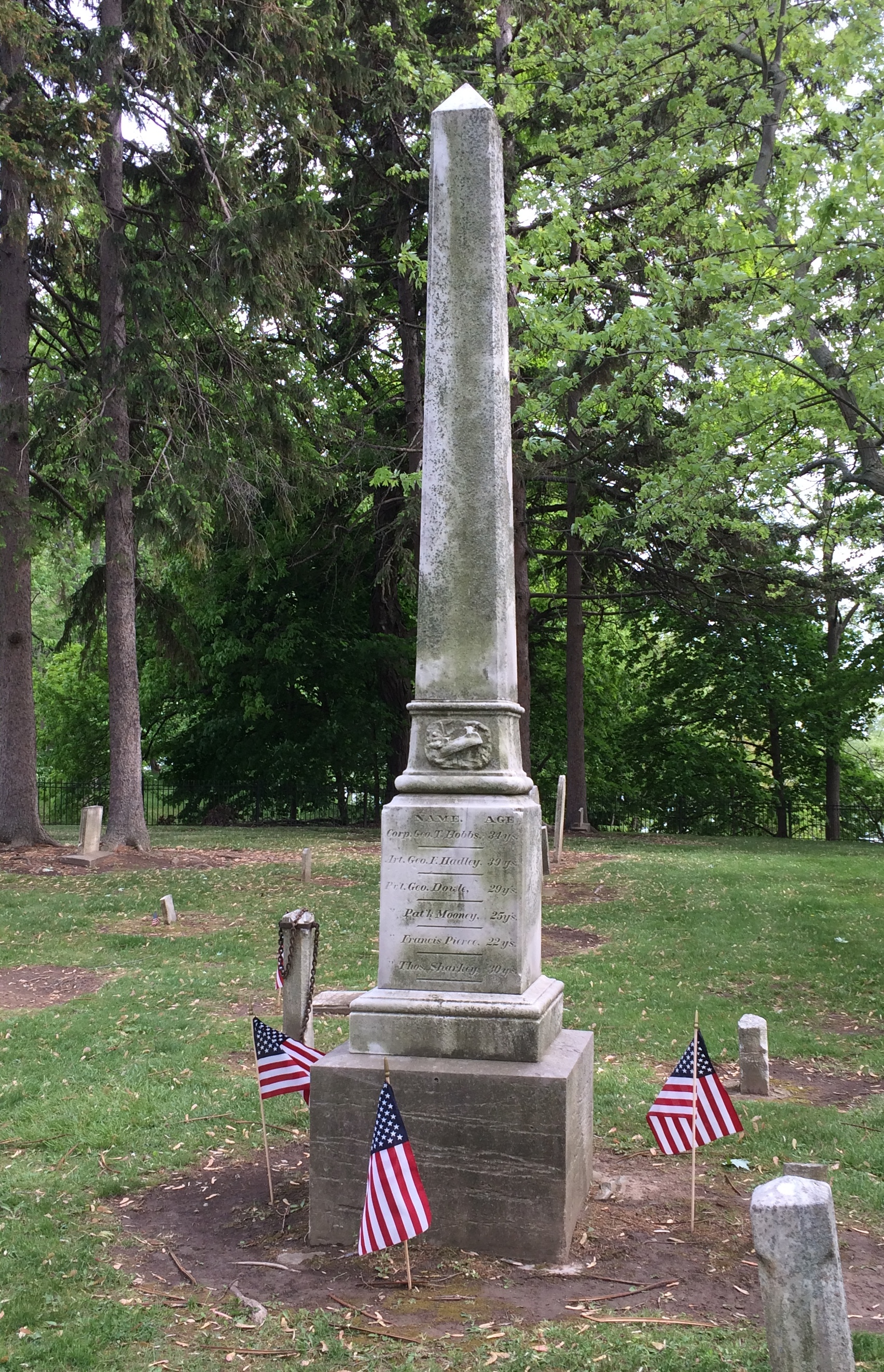
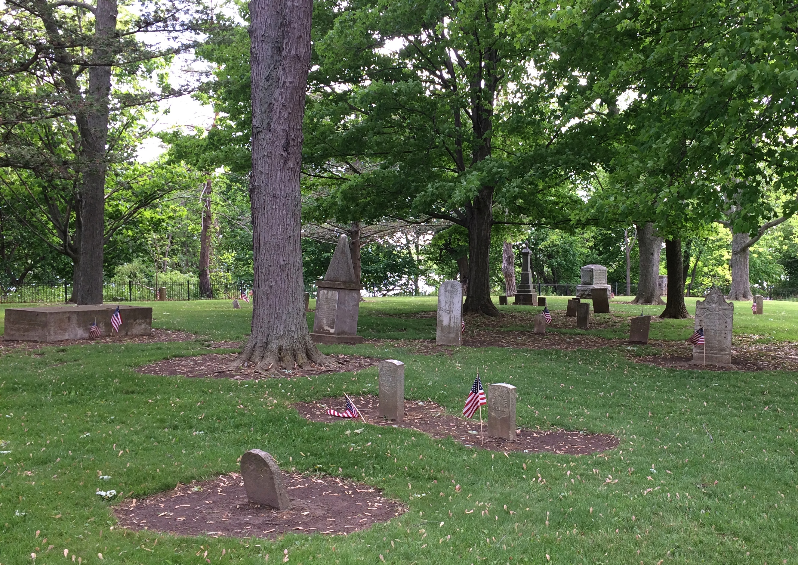
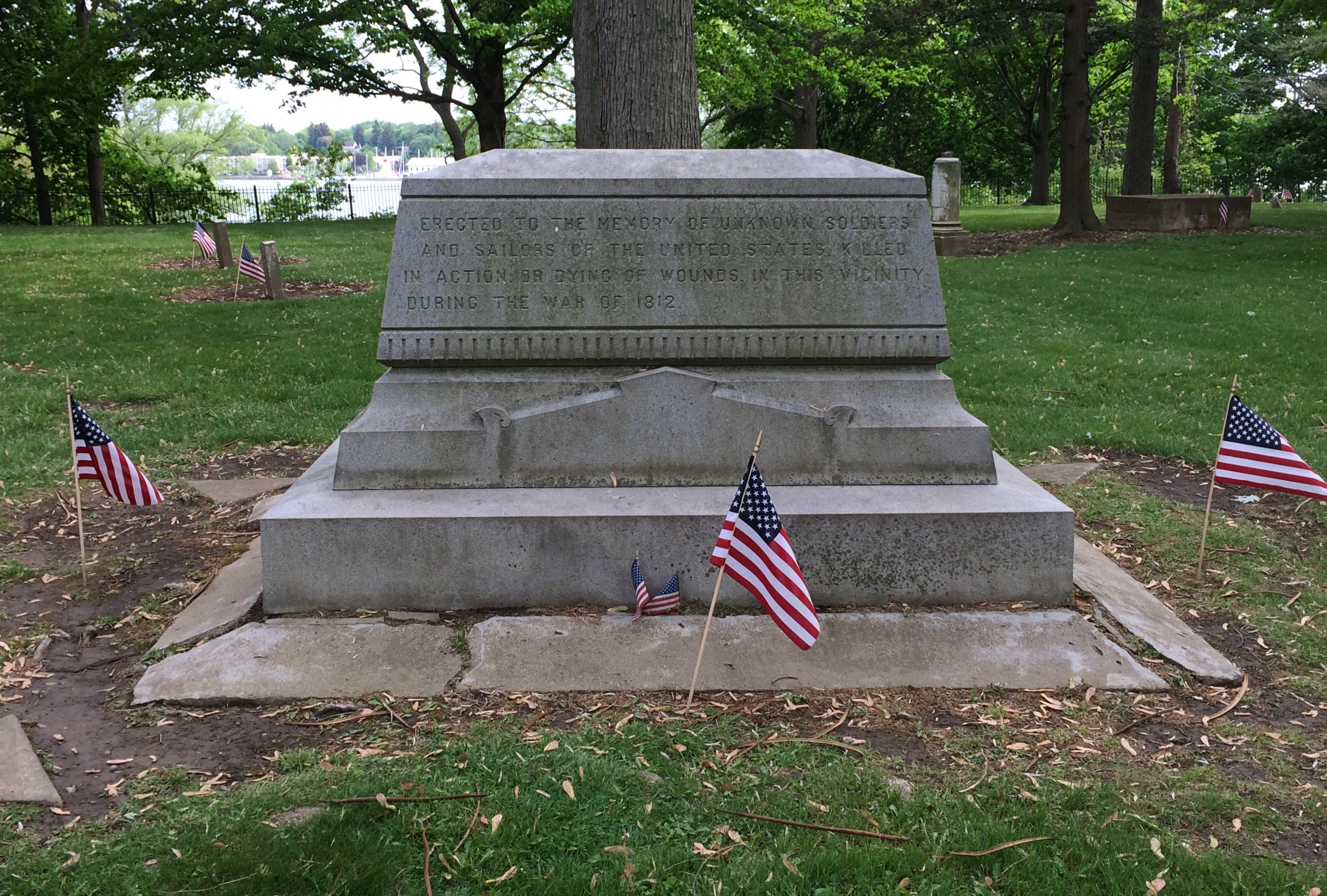
The old fort also has an old cemetery.Old Fort Niagara cemetery Old Fort Niagara cemetery Old Fort Niagara cemeterySmall, but a dignified spot for those who died during here the War of 1812. The fort was scene of a bloody bit of business during that dimly remembered war. Good to see that the stones were ready for Decoration Day.Old Fort Niagara cemeteryErected to the memory of unknown soldiers and sailors of the United States killed in action or dying of wounds in this vicinity during the War of 1812.

Shuffle Off To Buffalo

Just back yesterday evening from 72 hours in Buffalo. Roughly. Not quite 72 hours over Memorial Day weekend and not quite all in Buffalo, though we were in the Buffalo-Niagara Falls MSA the whole time.

Three days isn’t enough to drive to Buffalo from northern Illinois and spend a worthwhile amount of time. Like Pittsburgh, that would be a four-day venture. So we flew. First time since early 2020. Except for mandatory masking at the airports and on the planes, everything was about the same as it used to be, including holiday-weekend crowds. One of our flights was on a Boeing 737 MAX-8, and clearly we lived to tell the tale.

We, as in Yuriko and I, arrived late Friday night and made our way to Amherst, New York, a Buffalo suburb, where we stayed. We were up early the next morning to spend most of the day at Niagara Falls State Park. I was fulfilling a promise I made in 1996, when we arrived at the falls in March to find the American Falls still frozen. I told her we’d come someday when the liquid was moving again, and so we did.

That wasn’t the whole first day. I discovered that nowhere is very far away from anywhere else in this corner of New York state by driving north along the Niagara Gorge, stopping at Lewiston and Fort Niagara, and then returning to Amherst.

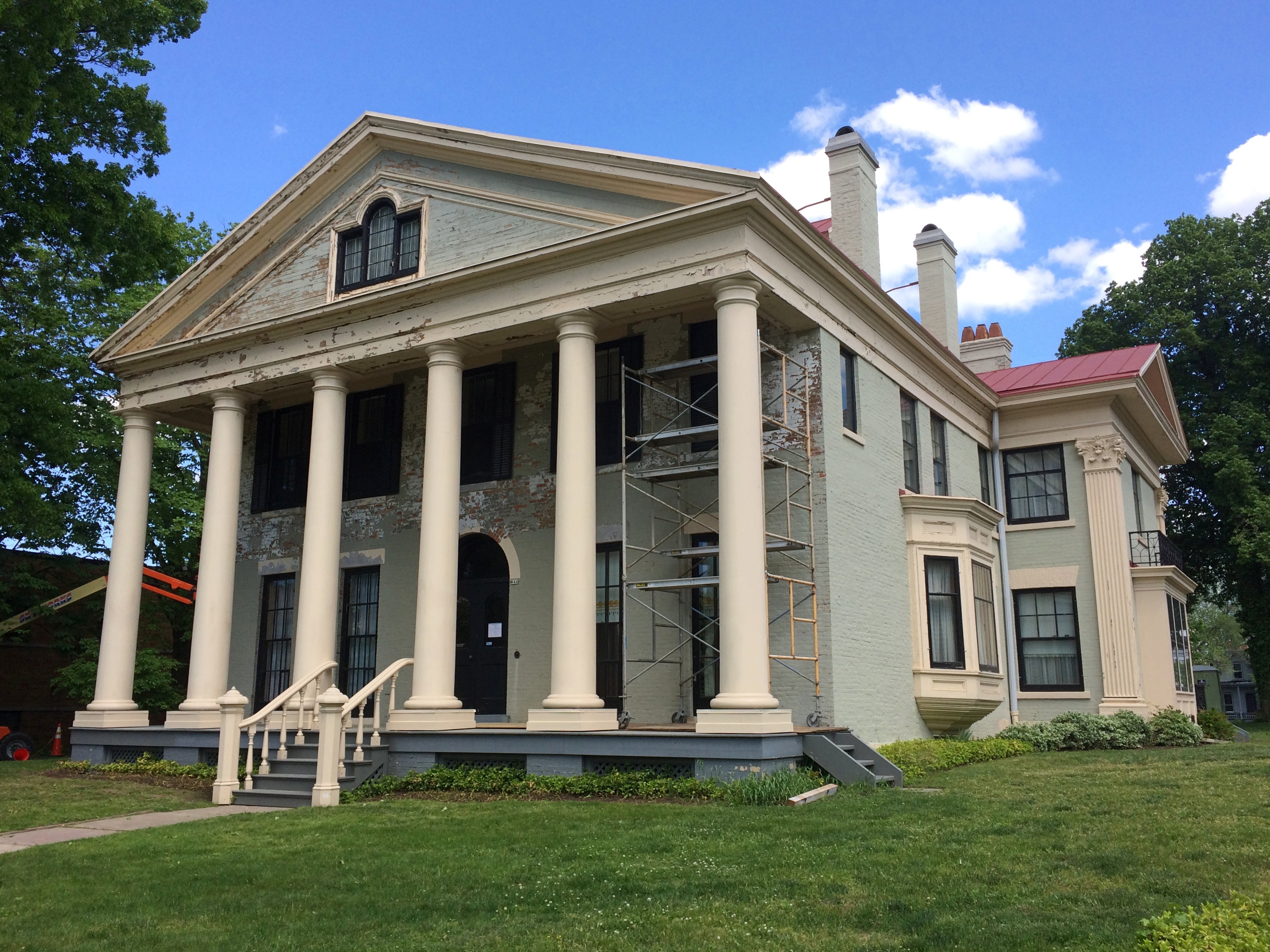
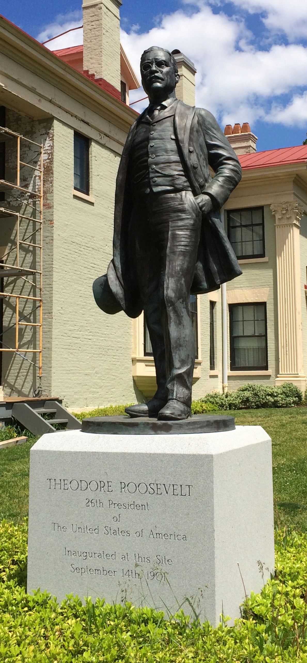
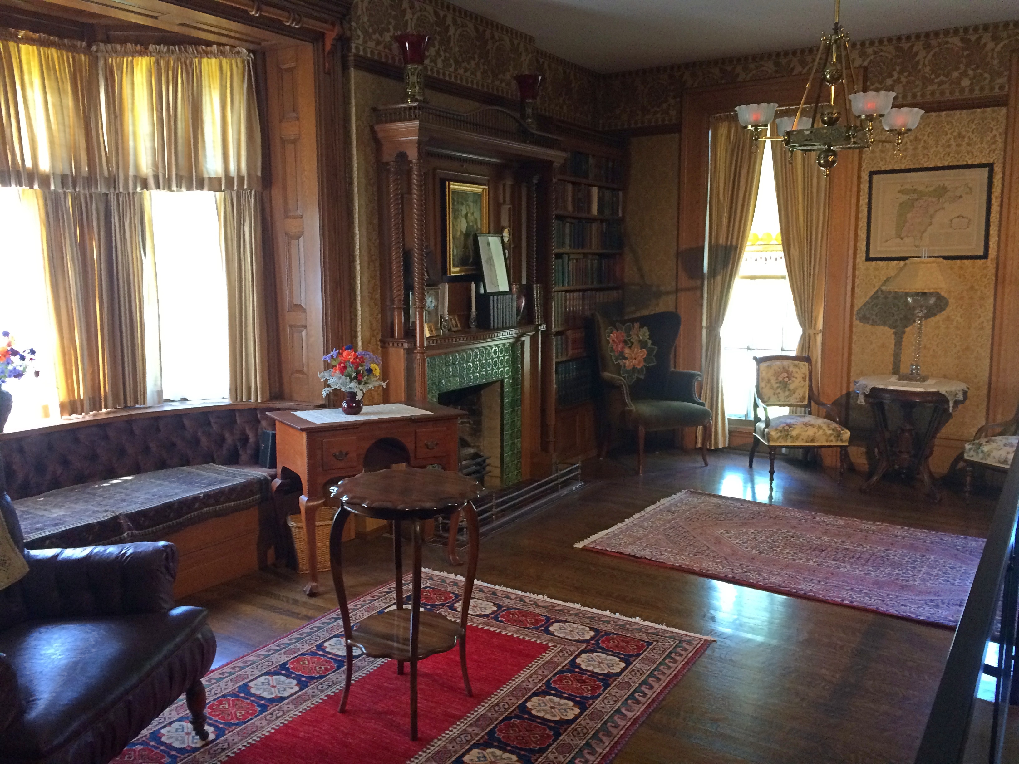
On Sunday, we weren’t up quite as early, but we made it to downtown Buffalo in the morning for a walkabout. As promised by various sources, the city has some first-rate architecture, most especially Buffalo City Hall. Late in the morning, after a brief stop at Tim Horton’s — they’re everywhere in metro Buffalo — we toured the Theodore Roosevelt Inaugural National Historic Site, formerly the Ansley and Mary Wilcox home.

Lunch that day was on Main Street at the Anchor Bar, which specializes in Buffalo wings and claims their invention, but in any case the joint didn’t disappoint. Afterward, Yuriko napped in the car while I spent time looking around Main Street, which includes Buffalo’s theater district and Saint Louis Roman Catholic Church.

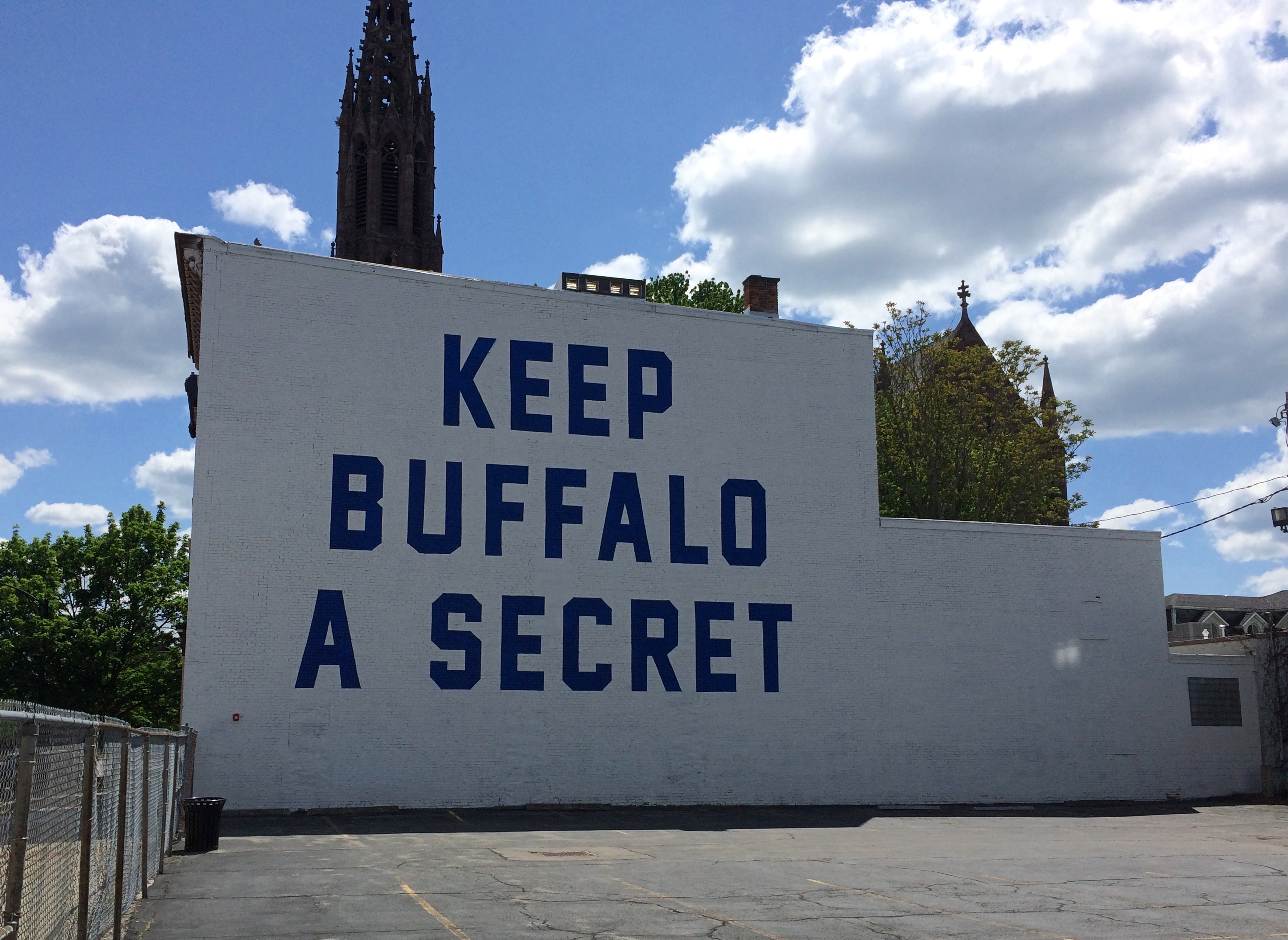
Also, this mural.Keep Buffalo A Secret
Created by local t-shirt designer David Horesh and painter Ian de Veer, it’s highly visible when you’re traveling southbound on Main.

Could it be that current Buffalonians might not want millennials, or more importantly, tech-industry millennials with high incomes, to show up in droves to drive up prices for everyone else? Maybe. Not sure Buffalo has the tech ecosystem, as they say in the biz, to support such an influx. Then again, in the vicinity of the mural are places probably supported by people with at least some disposable income, such as Just Vino, the House of Masters Grooming Lounge, Hair to Go Natural, and Fattey Beer Co. Buffalo.

I had a mind to visit Delaware Park afterwards, since a Frederick Law Omstead park is always worth seeing, but we ended up sampling it merely by driving around it. Looks like a nice place to while away a warm afternoon.

By that time, Sunday afternoon, it was fairly warm in greater Buffalo. Rain had clearly fallen the day before we arrived, and cool air arrived afterward, taking temps down into the low 50s early Saturday, when we got to Niagara Falls. Did that matter? No. It wasn’t cold enough to freeze anything.

On Monday I got up early and visited the splendid Forest Lawn Cemetery, permanent home of President Fillmore and Rick James, among many others. Later, we drove to Lockport, New York and spent some time along the Erie Canal. As long ago as elementary school, I heard about the Erie Canal, but had never seen it. We also took a tour of one of the manmade caves near the canal, where rapid water flows formerly powered local industry.

Back in Buffalo for a satisfying lunch at Lake Effect Diner, housed in a chrome-and-neon diner car dating to 1952. Then we drove south via surface streets to Lackawanna, where you can see the Basilica of Our Lady of Victory, our last destination for the trip.

Why Buffalo? There was that promise to visit the falls, of course. But I also wanted to see Buffalo. My single previous experience there had been a quick drive-through in 1991 after I saw Niagara Falls for the first time, from the Canadian side. Every city of any size has something interesting. A lot of smaller places do as well. So we shuffled off to Buffalo.

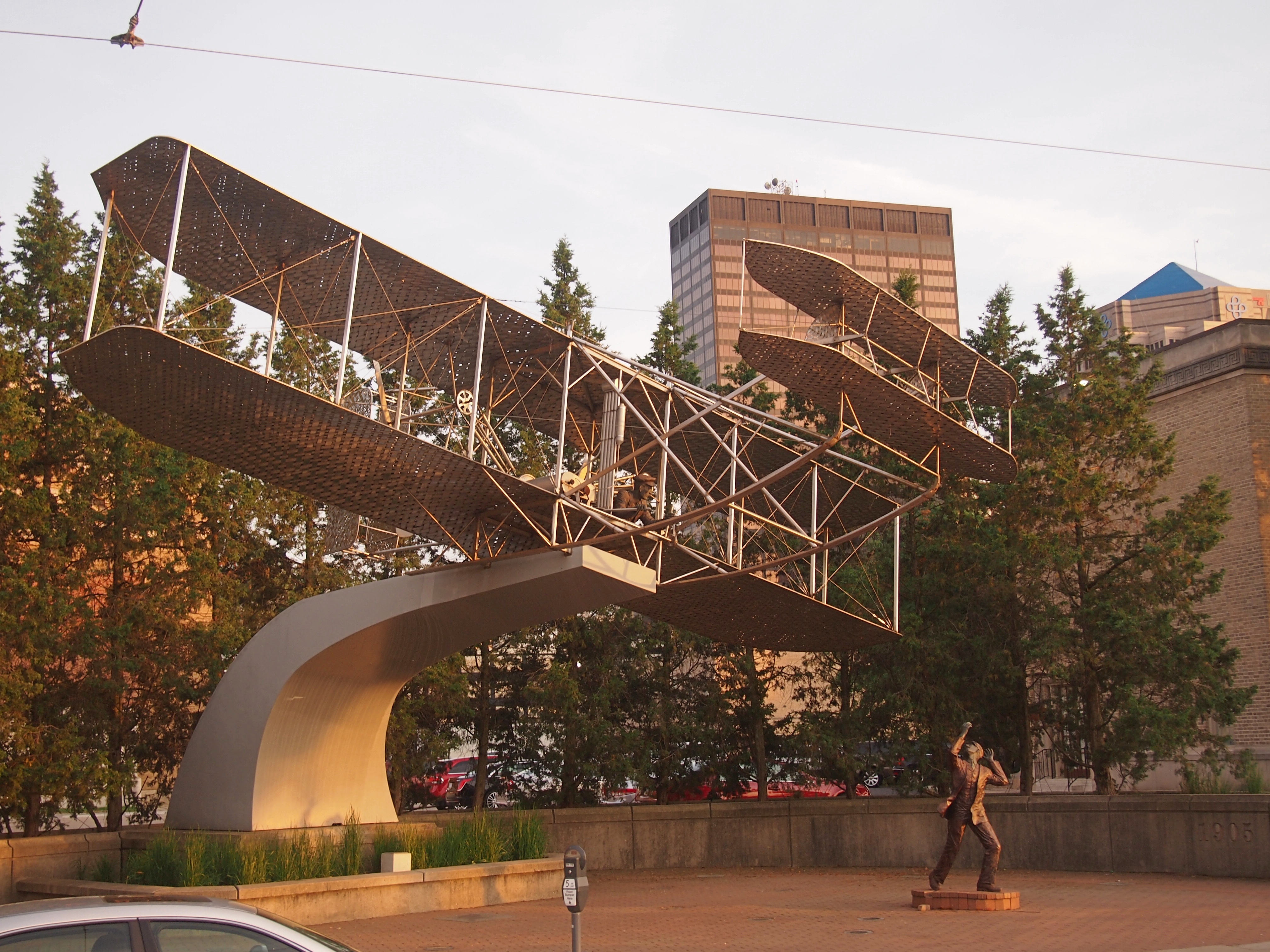
Wright Flyer III

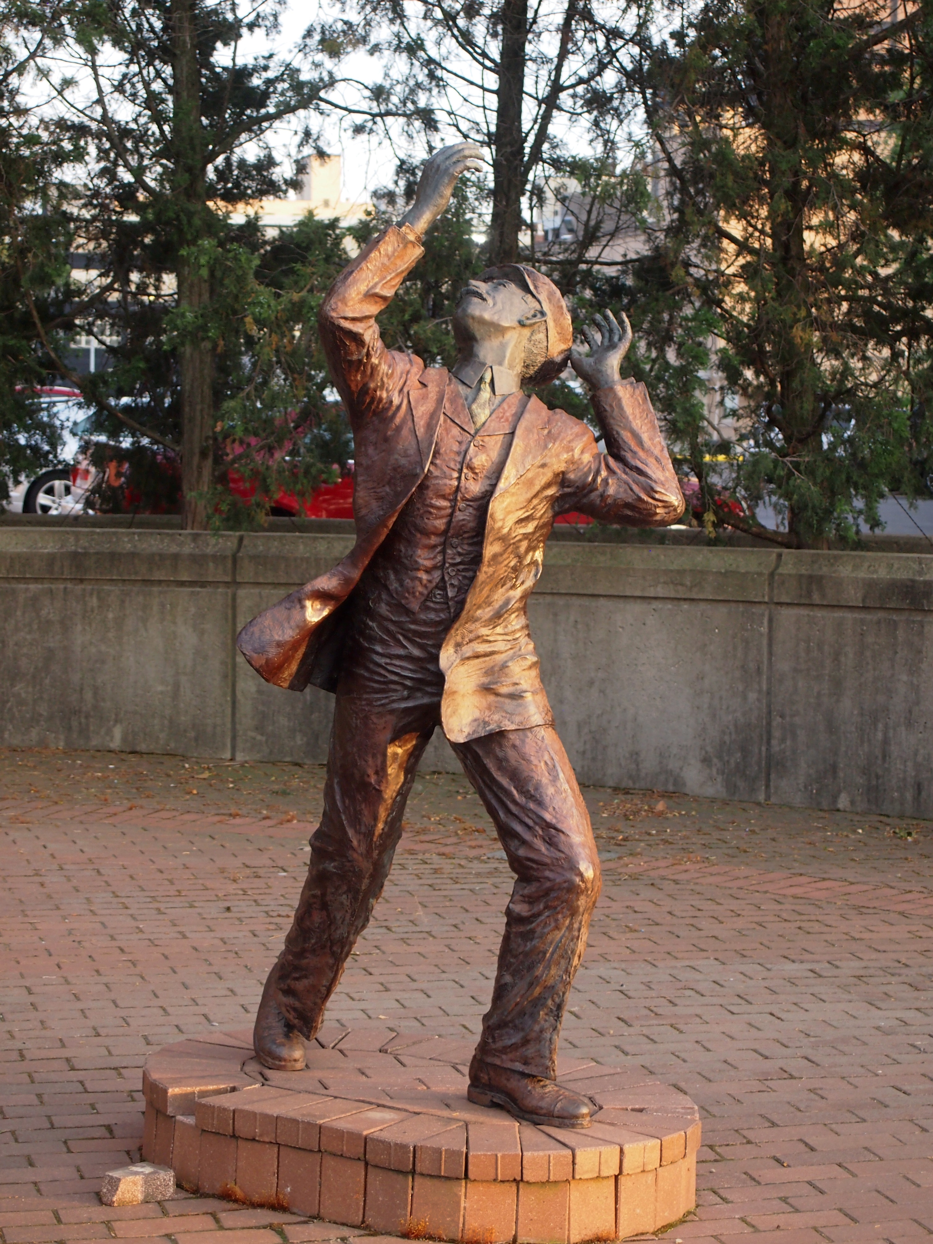
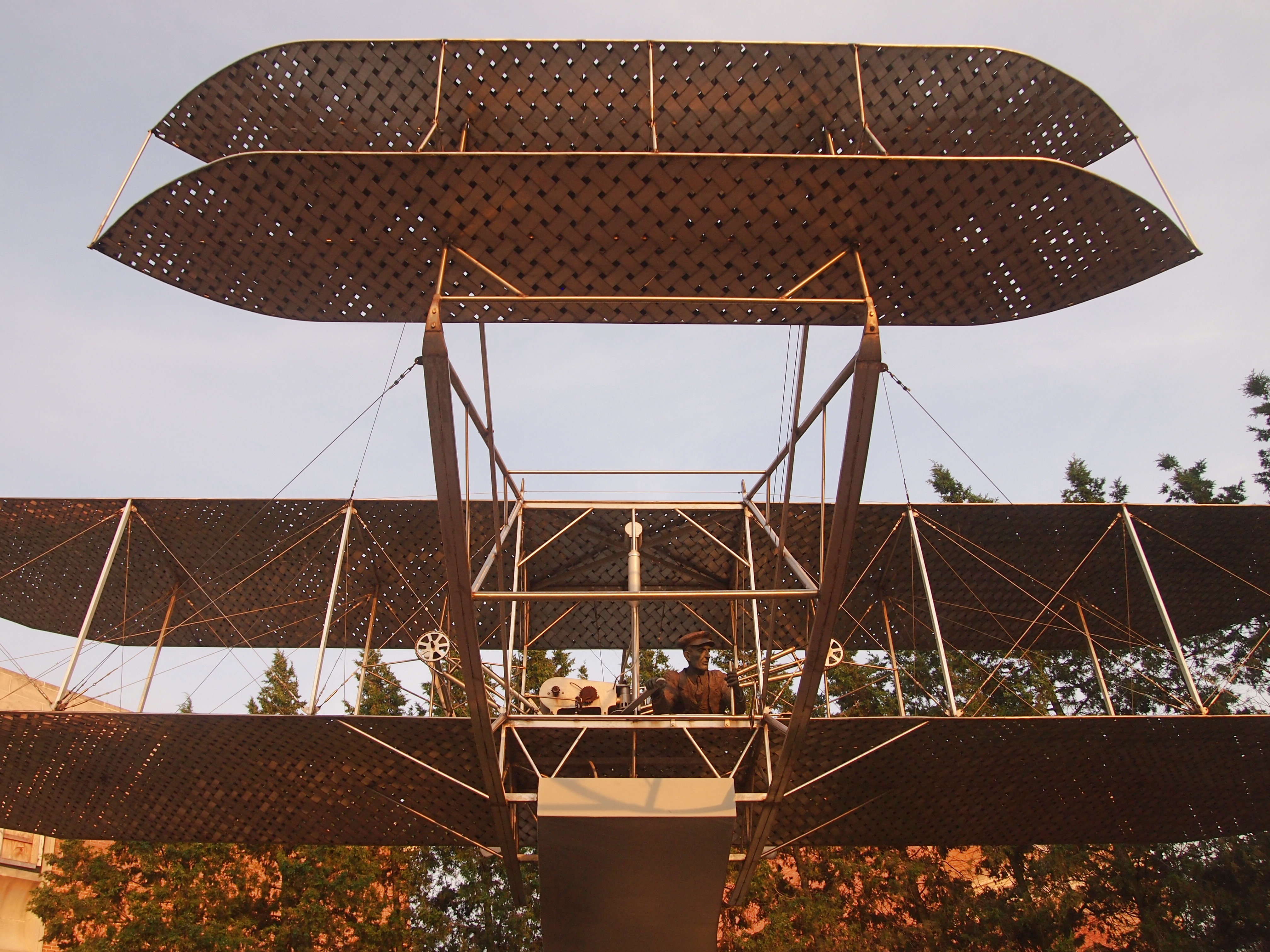
During our visit to Dayton five years ago — has it been that long? — we saw this downtown sculpture array, depicting the Wright Brothers and the Wright Flyer III, which the brothers built and first flew in 1905, a much improved version of their two earlier planes.Flyer III Dayton Flyer III Dayton Flyer III Dayton

Sometimes I’m curious to keep up with places I’ve been, so I checked and the sculpture group, by Dayton architect and sculptor Steve Brown, has been removed, reportedly for re-installation elsewhere at an unspecified later time. Hope that unspecified time doesn’t stretch out so far that it becomes “never,” and the works remain in storage somewhere or gets lost in some future decade. Sidewalk sculpture this kinetic deserves to be out in public.

Even More Peoria: The Cathedral of St. Mary, The Great Agnostic & The Bolshevik Cookie Monster

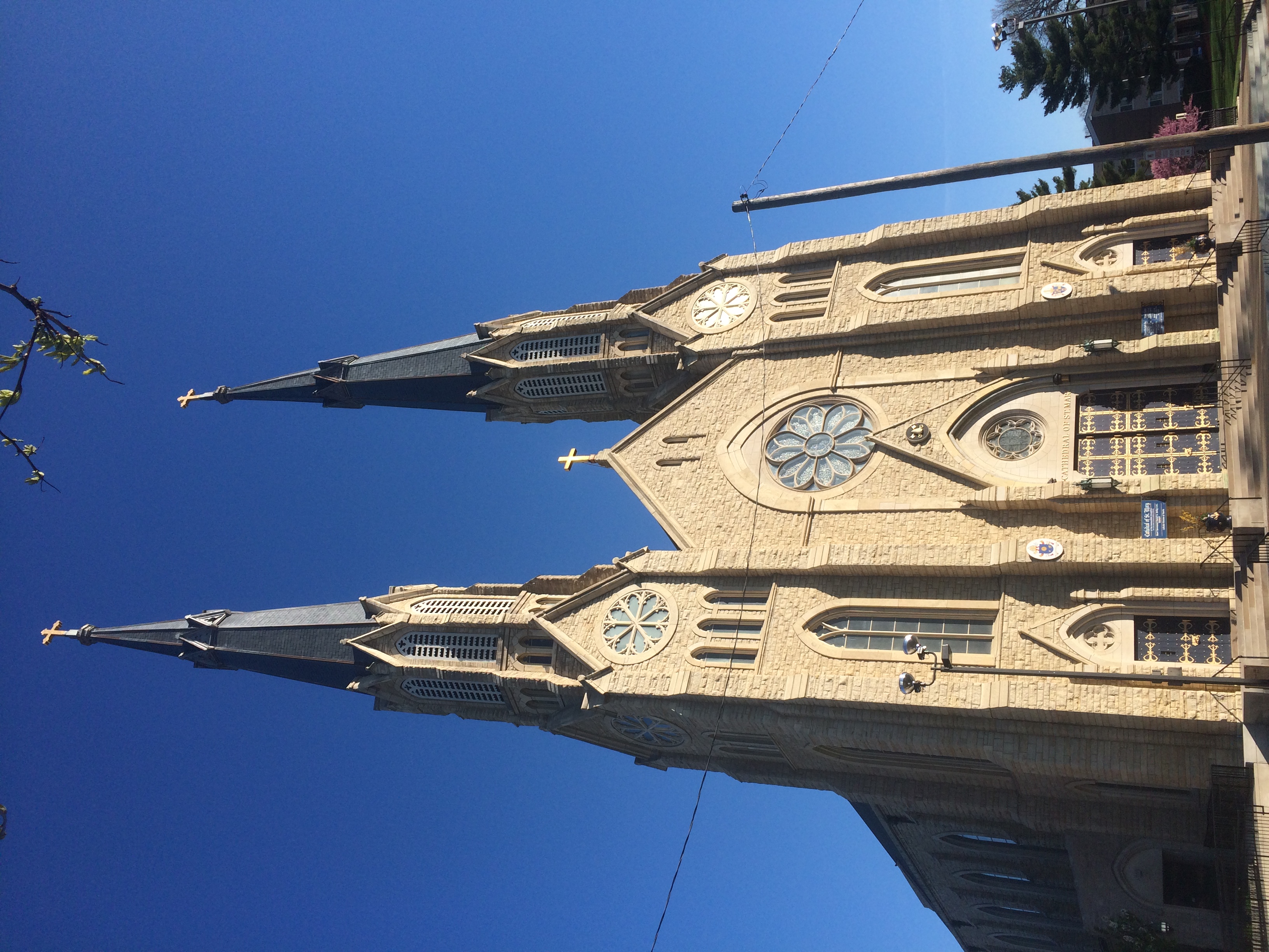
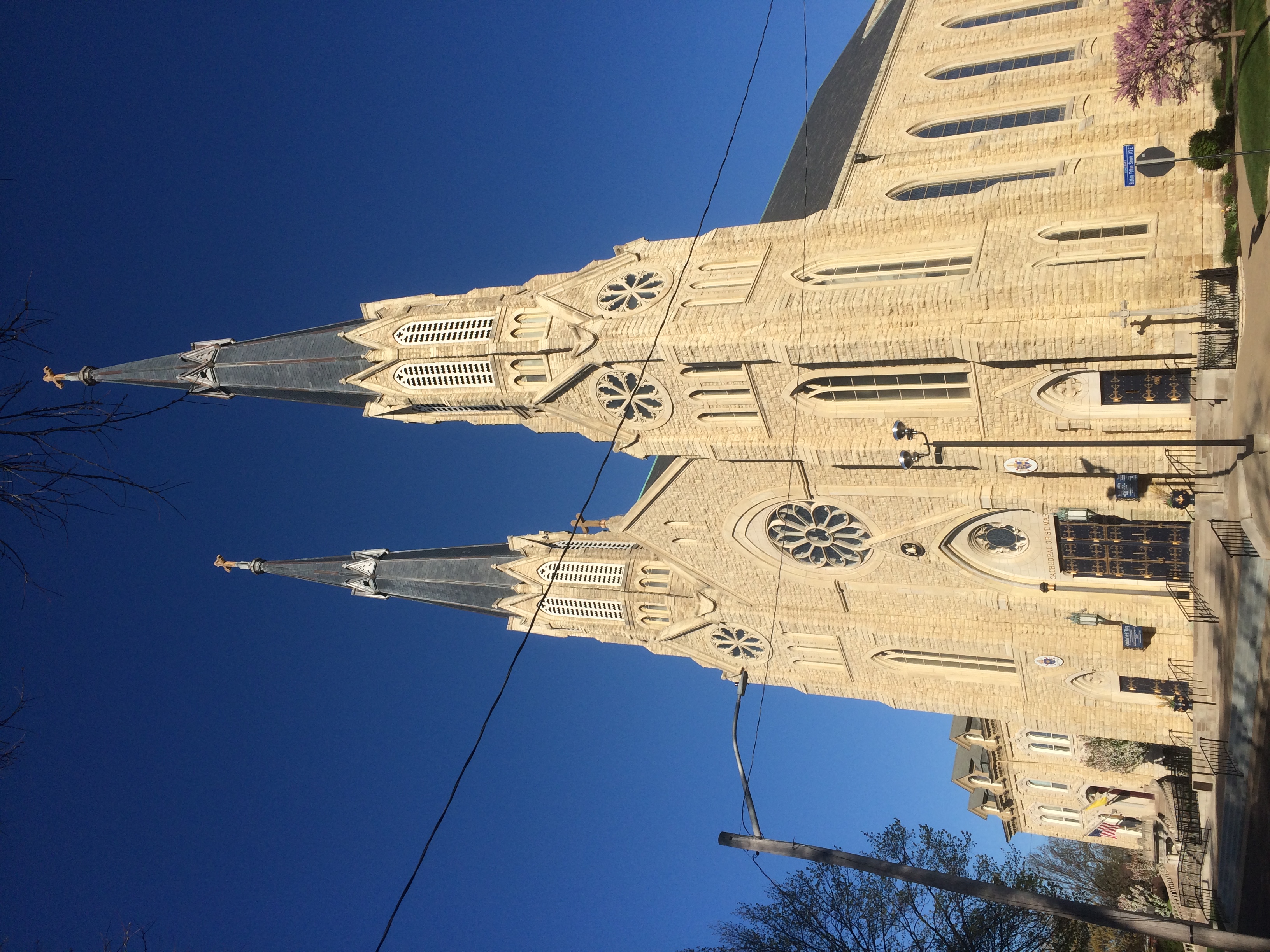
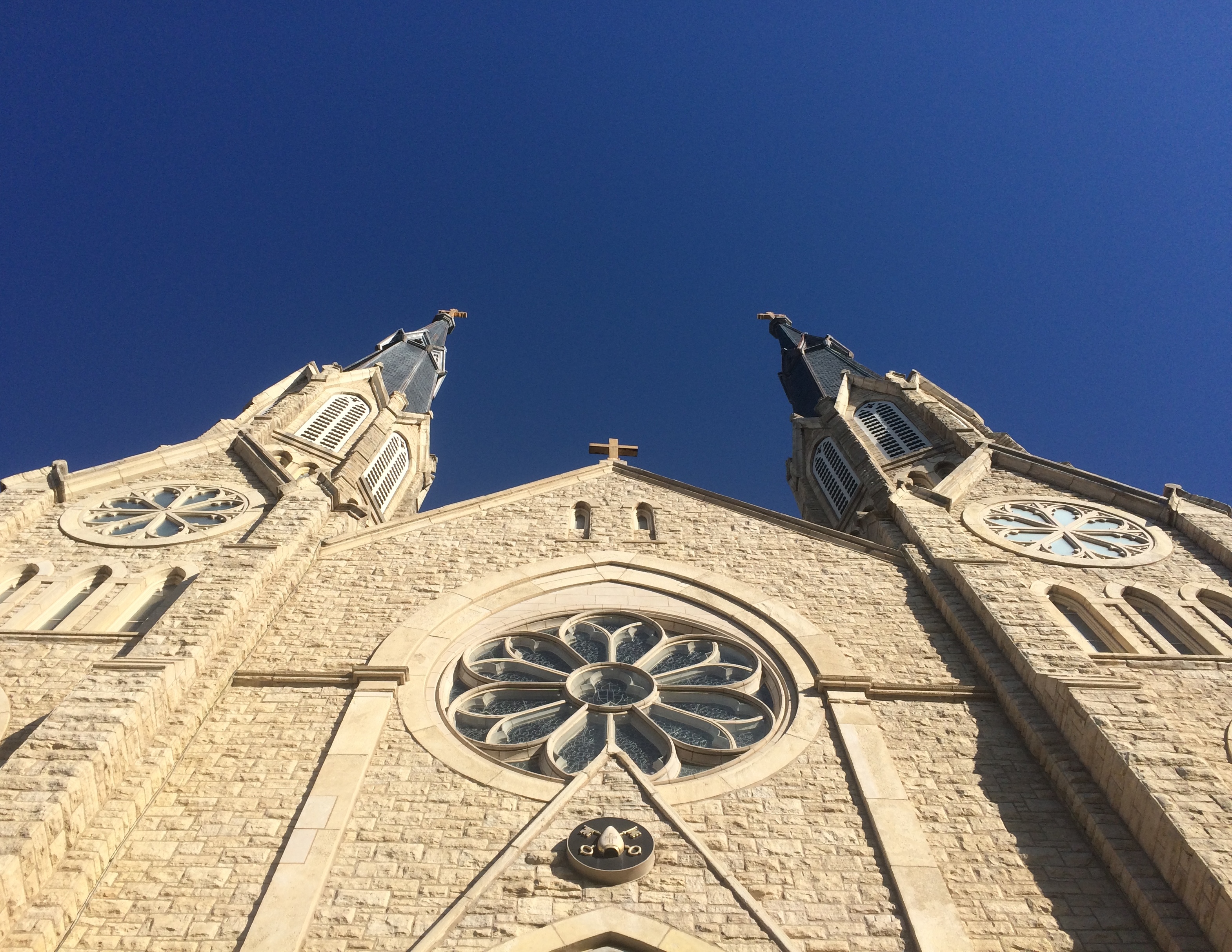
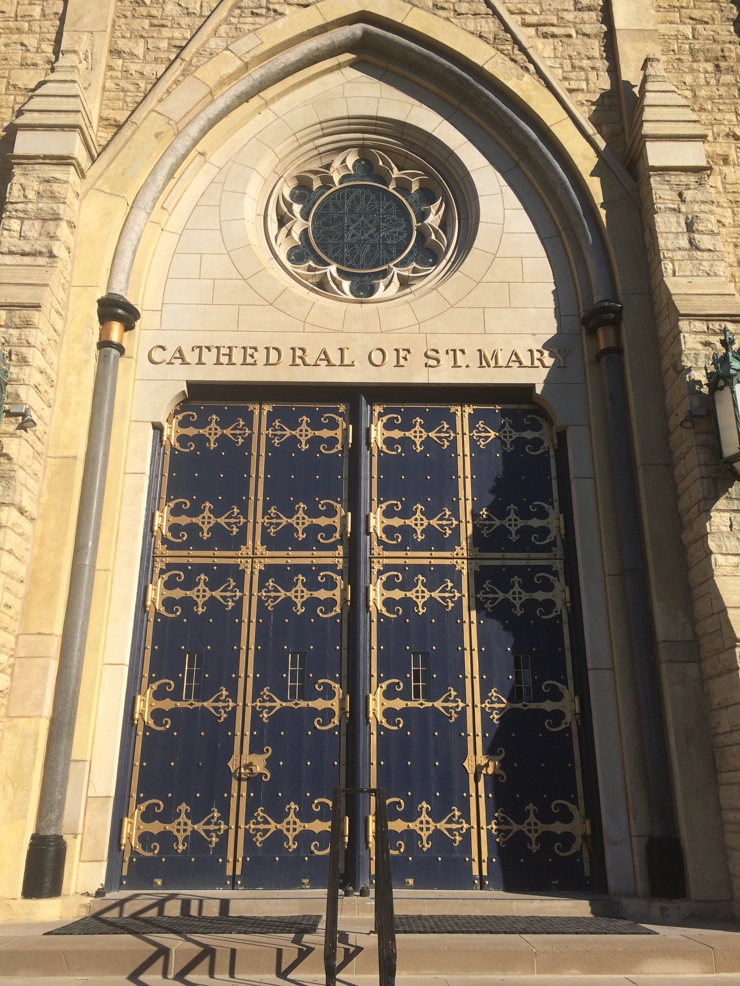
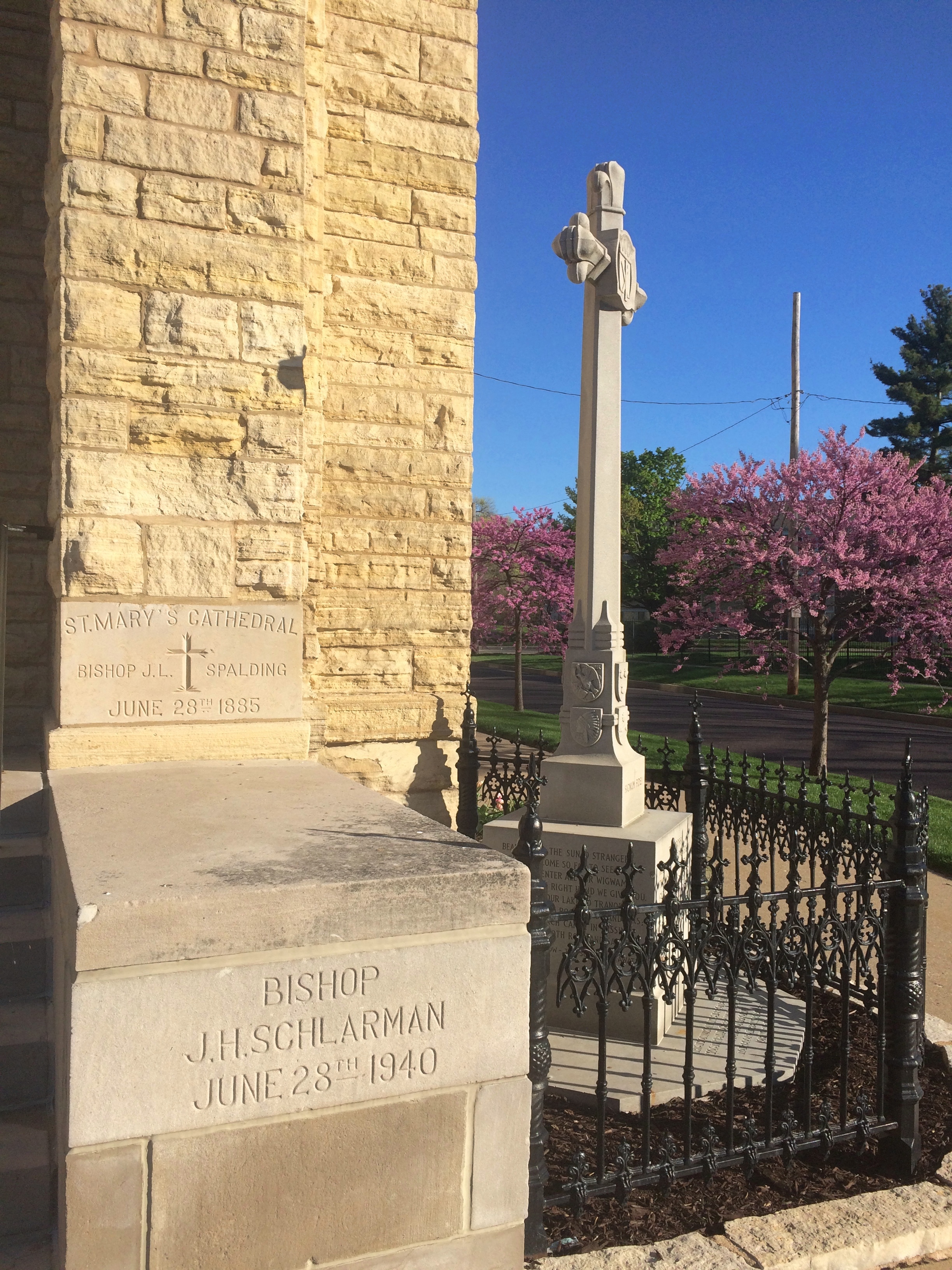
Near downtown Peoria is the Cathedral of St. Mary of the Immaculate Conception, mother church of the Diocese of Peoria, completed in 1889 and restored in the 2010s. I was able to catch it resplendent in the full eastern sun on a Sunday morning, before it opened for mass.

Cathedral of St. Mary of the Immaculate Conception Peoria

Cathedral of St. Mary of the Immaculate Conception Peoria

Cathedral of St. Mary of the Immaculate Conception PeoriaCathedral of St. Mary of the Immaculate Conception Peoria

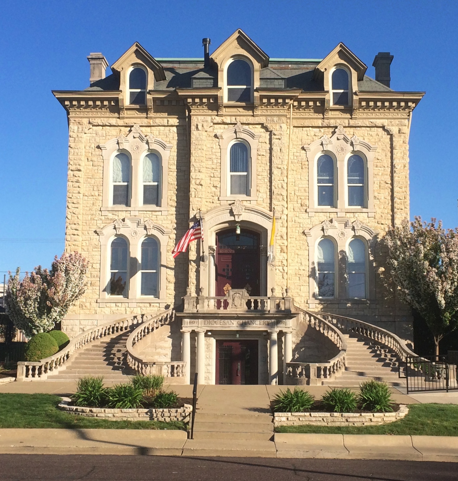
The adjacent cathedral rectory and, on the lower level, the diocesan chancery.
Cathedral of St. Mary of the Immaculate Conception rectory
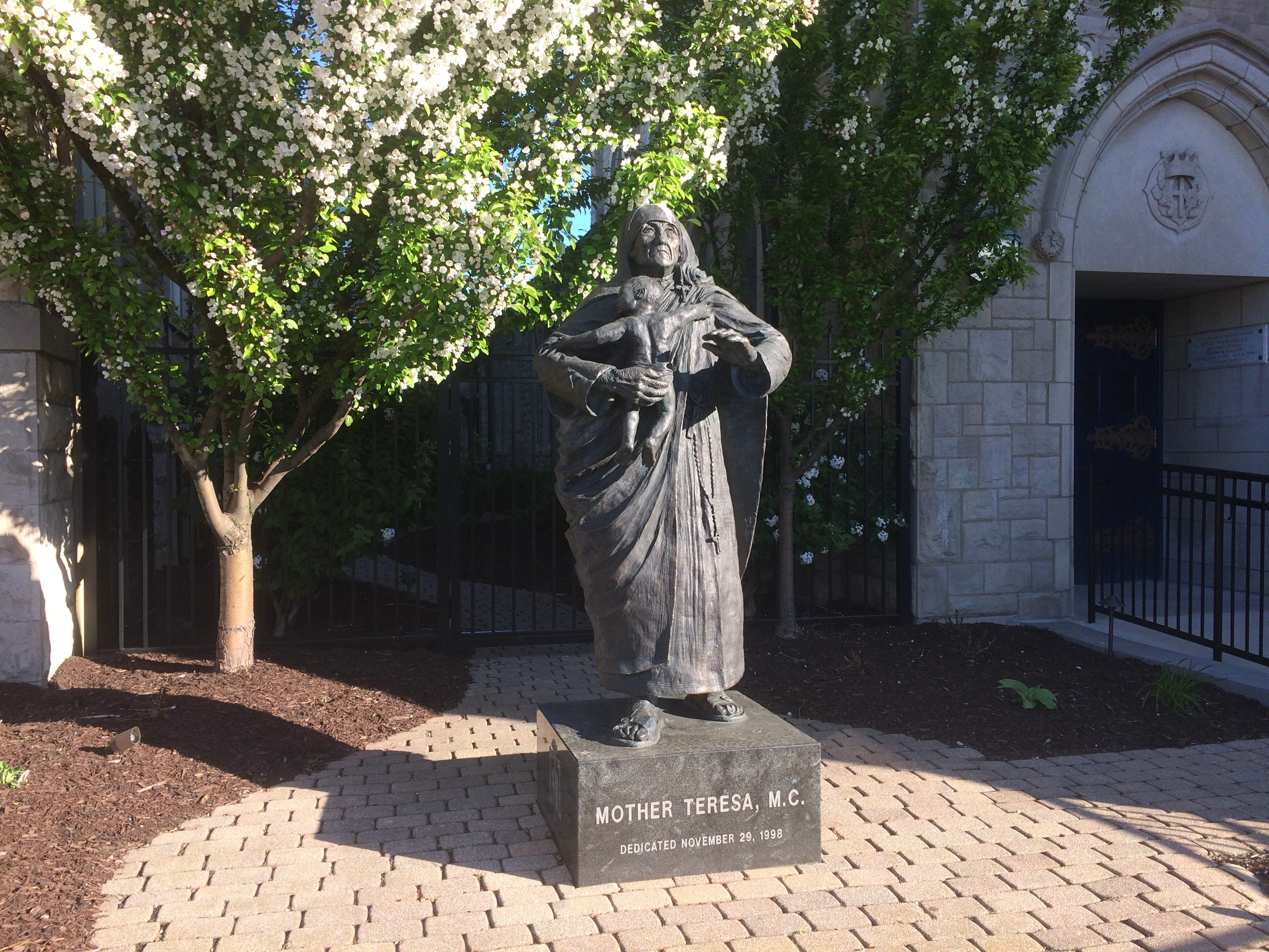
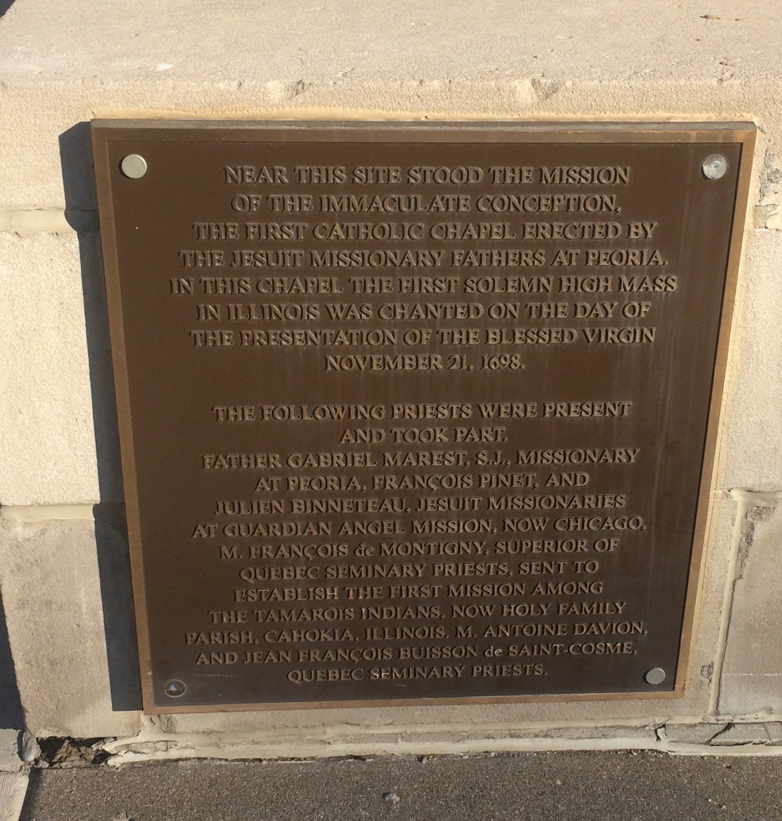
Other details, including a statue of Mother Teresa.Cathedral of St. Mary of the Immaculate Conception Cathedral of St. Mary of the Immaculate Conception Cathedral of St. Mary of the Immaculate Conception

Later, we popped inside just before the beginning of mass. The interior is just as grand as the outside.

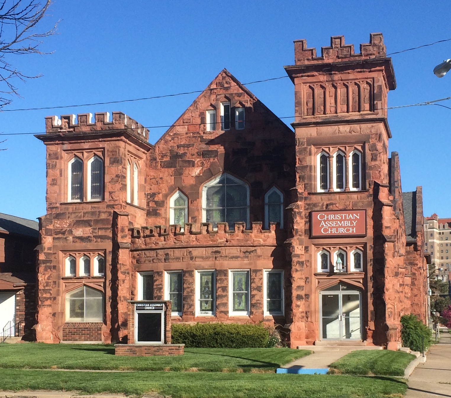
The cathedral isn’t the only church in the neighborhood. Not far away is Christian Assembly Church.
Christian Assembly Church, Peoria
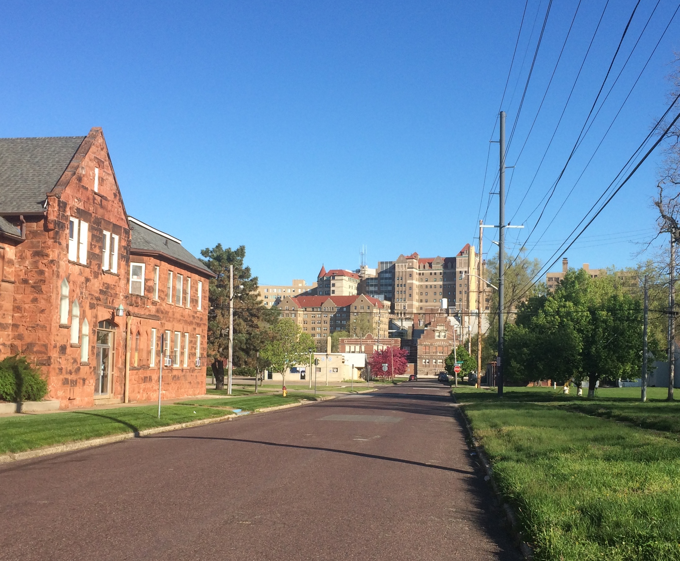
West of there looked to be a hill made of buildings.
OSF Saint Francis Medical Center, Peoria
This is at the base of that “hill.”
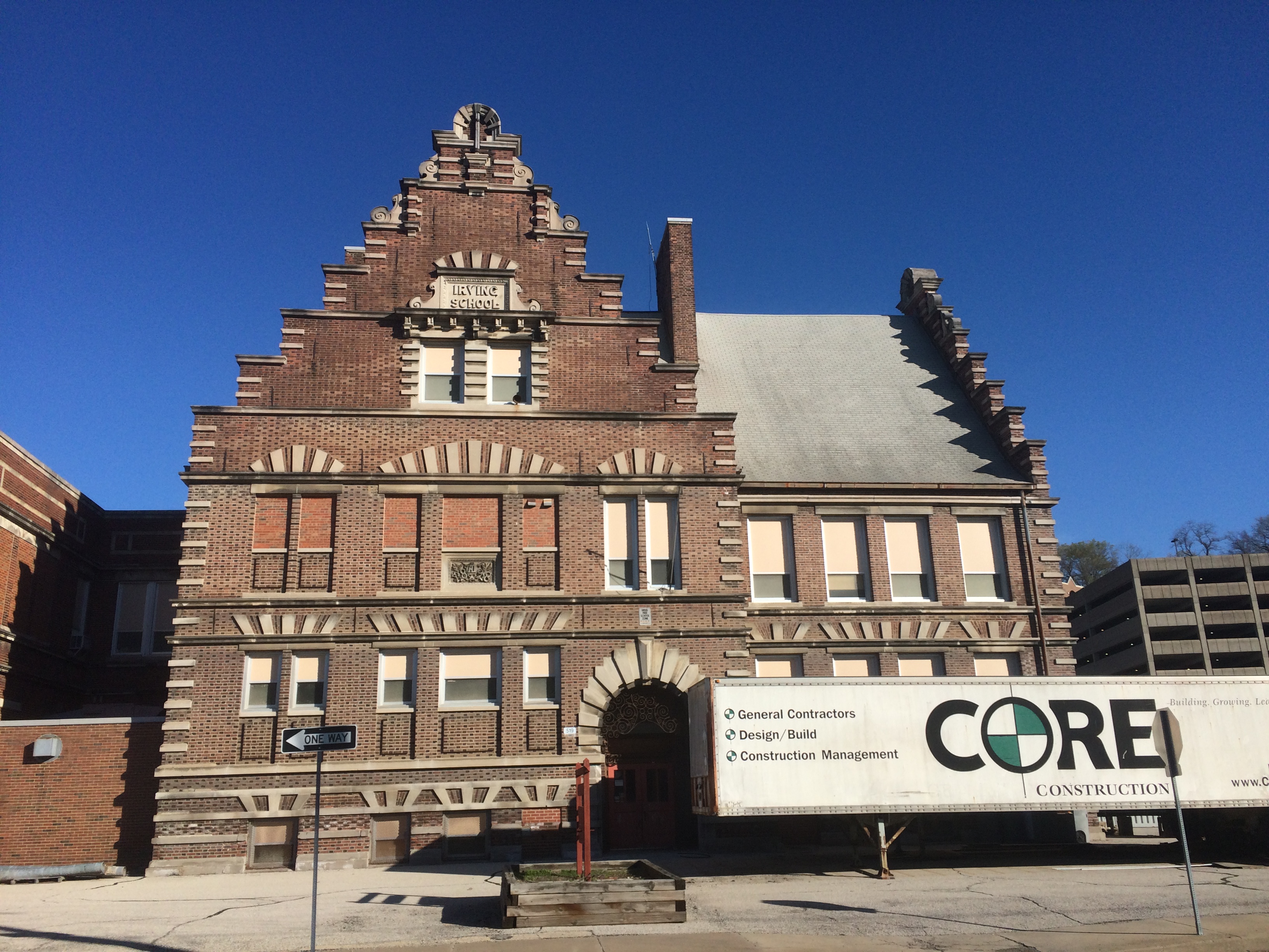
The Irving School Peoria

The Irving School was the Peoria School District’s oldest school, built in 1898, when it closed in 2012.

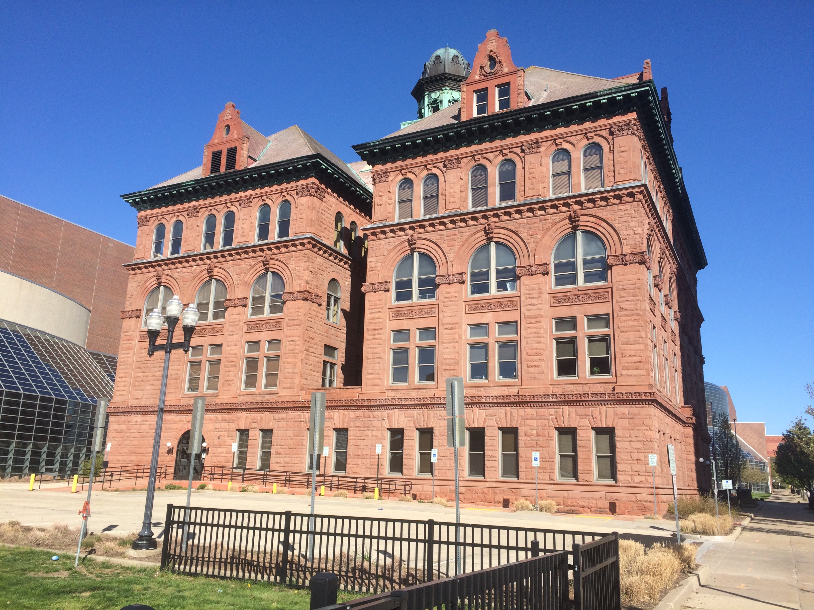
“Irving and Peoria City Hall are the city’s only two representations of the architecturally significant Flemish Renaissance design,” noted the Journal Star at the time. What are the odds that I’d see both of them on the same morning during a ramble in Peoria? Not bad, actually, since Peoria isn’t that large.

Looks like it’s being redeveloped, to judge by the construction truck. The buildings on the hill, incidentally, form the OSF Saint Francis Medical Center, the largest hospital in metro Peoria.

Last time we went to Peoria, we visited the Springdale Cemetery. Next to it is the Peoria Zoo, Luthy Botanical Gardens and Glen Oak Park. This time we stopped for a few minutes at the entrance of that park, which happens to be on Dan Fogelberg Parkway.

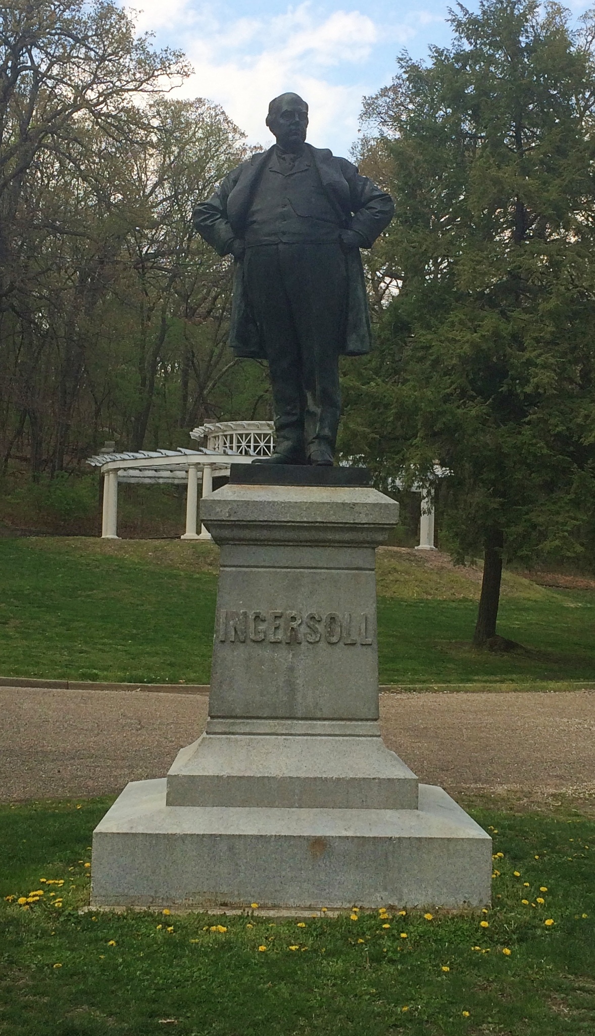
We went there because I want to see the statue of the Great Agnostic. I’m glad to see that the artist — no other than Fritz Triebel — wasn’t trying to hide the man’s portliness. That was insurance against 19th-century wasting diseases, anyway.
Robert Ingersoll statue Peoria
If I ever knew it, I’d forgotten that Robert G. Ingersoll (1833-99) spent much of his adult life in Peoria, though he lived other places, such as Shawneetown (before it was Old Swaneetown). He’s not buried in Illinois, however, but Arlington National Cemetery, as befits the commander of the 11th Illinois Volunteer Cavalry of the Union Army.

I can’t remember how I first heard of him, but it was in high school. He’s another of those interesting public intellectuals who’s been completely forgotten, which would be almost all of them. Forgotten except by his hometown, though I expect most Peorians don’t know who he was either.

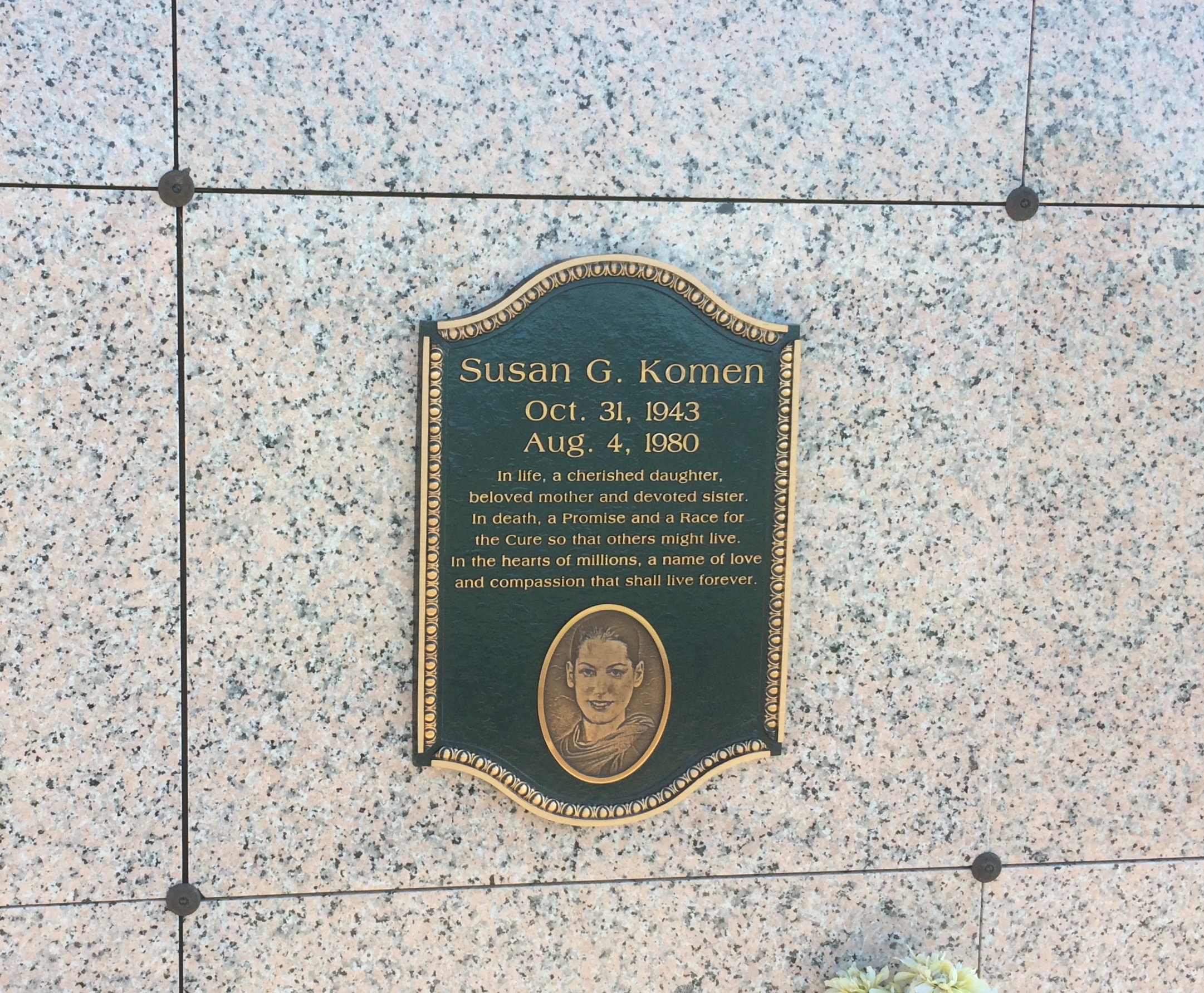
While driving on I-74 just west of downtown, I saw a sign pointing to an individual’s grave nearby — a rare thing, now that I think about it. The individual was Susan G. Komen. I was still by myself at that point, so there was no one to object to checking out yet another cemetery.

She’s in a niche in Parkview Cemetery.
Susan G. Komen grave

It occurred to me as I read the nearby plaque that I knew nothing about her, except that her name is attached to the breast cancer foundation. She died from the disease in 1980 at age 36. It was her sister, Nancy G. Brinker, who established the foundation.

Later Nancy Brinker was U.S. ambassador to Hungary, early in Bush the younger’s administration, a job I expect she got since she and her husband, the inordinately successful chain restaurateur Norman Brinker, were serious donors to the Bush campaign. (Seems she also had enough pull to have a sign put up directing people to her sister’s memorial.)

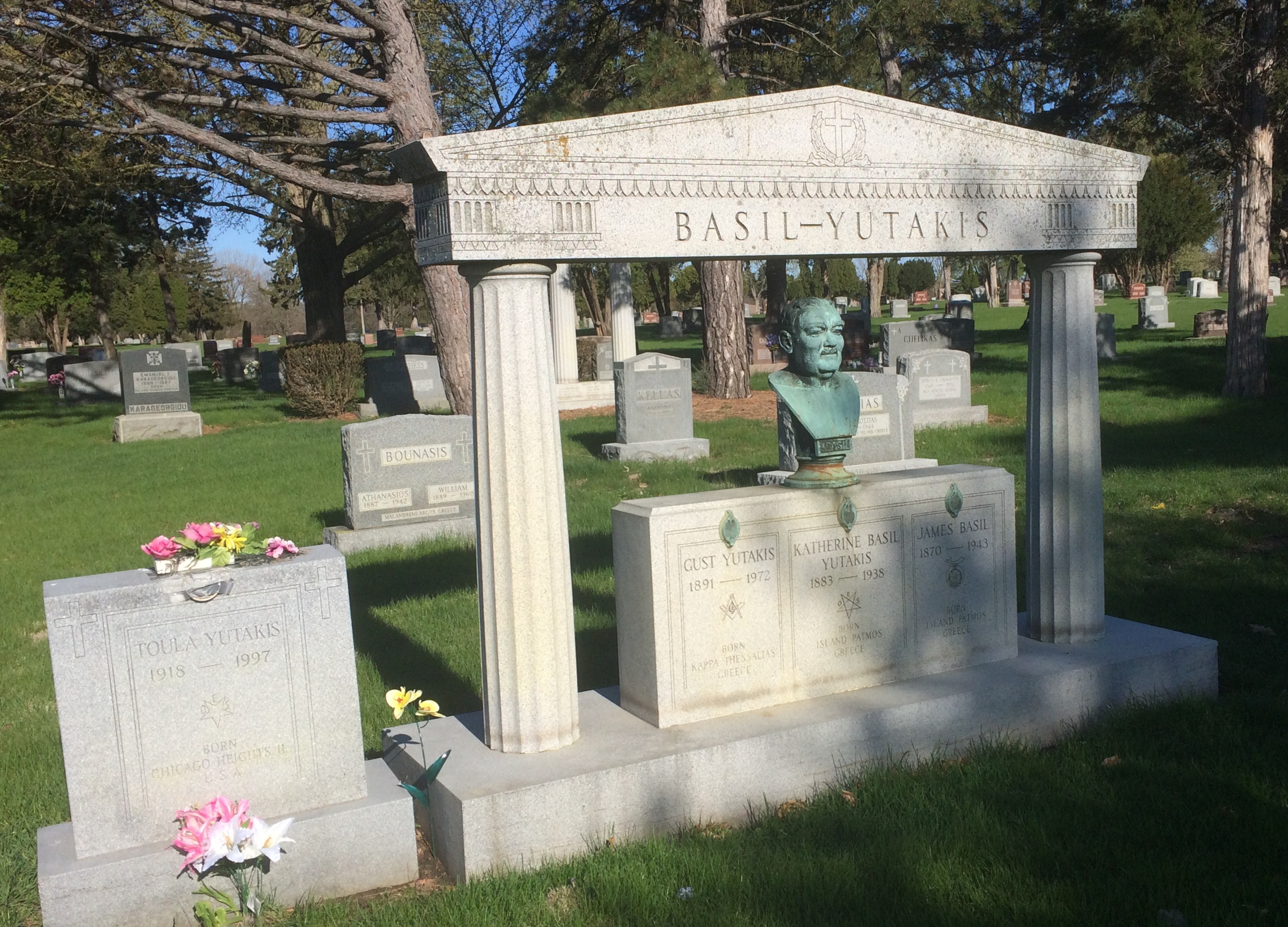
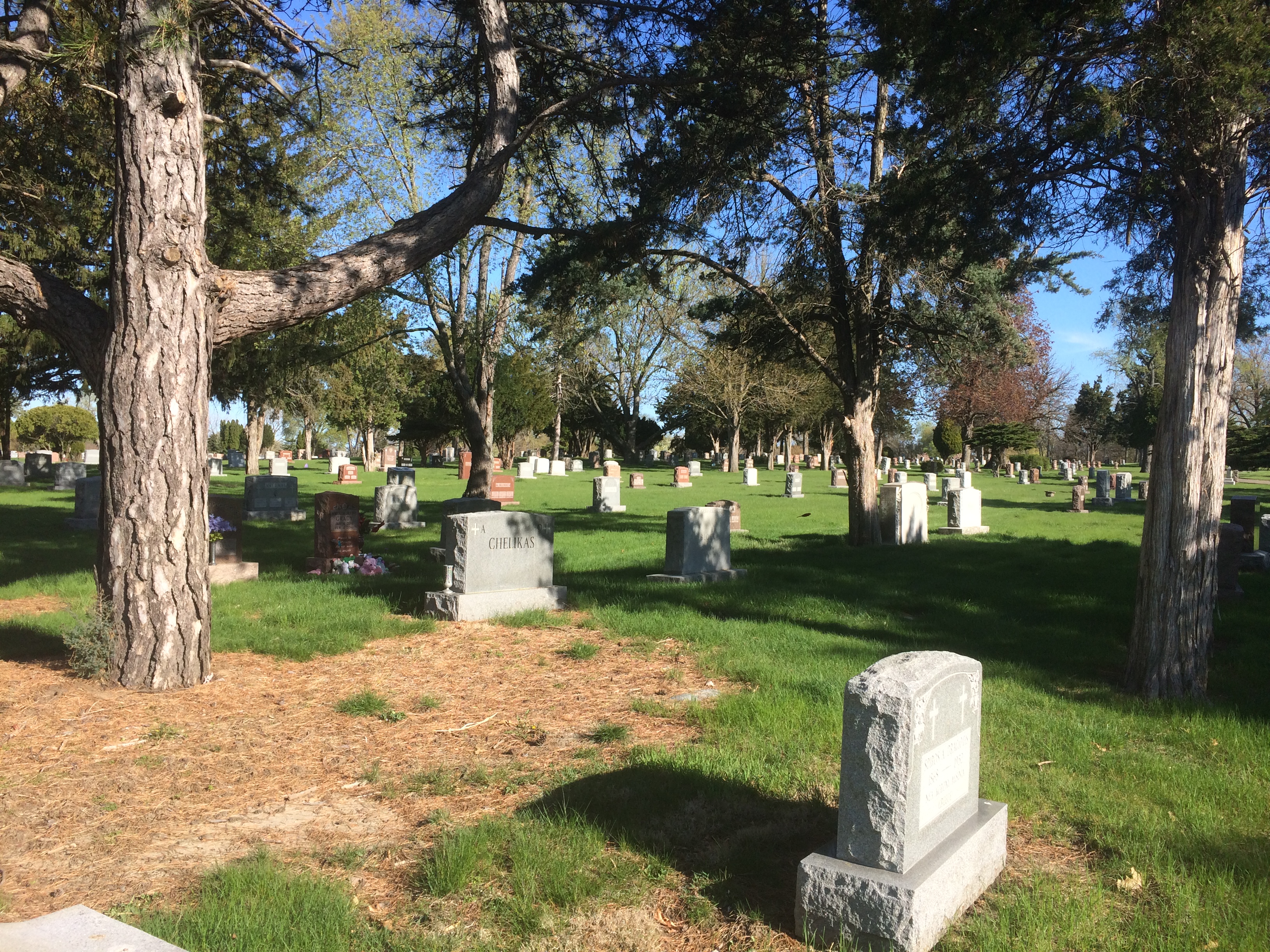
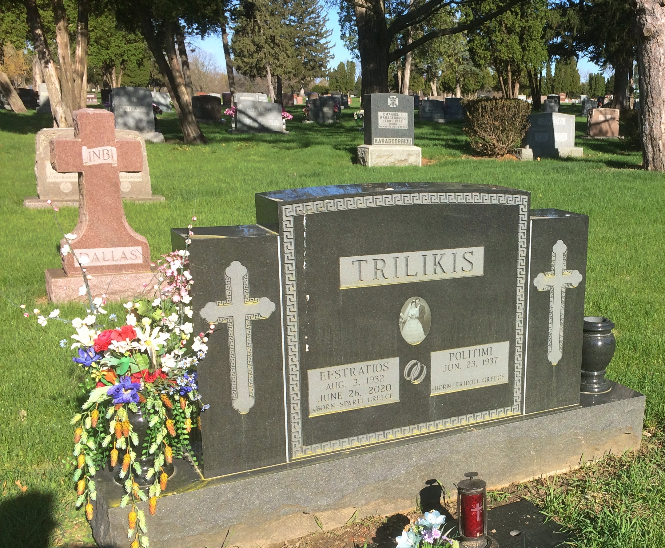
Parkview is pleasant enough, but not nearly as picturesque as Springdale. Still, I found an interesting but probably informal section where a good many Greeks or people of Greek ancestry are buried.
Parkview Cemetery Greek section Parkview Cemetery Greek section Parkview Cemetery Greek section

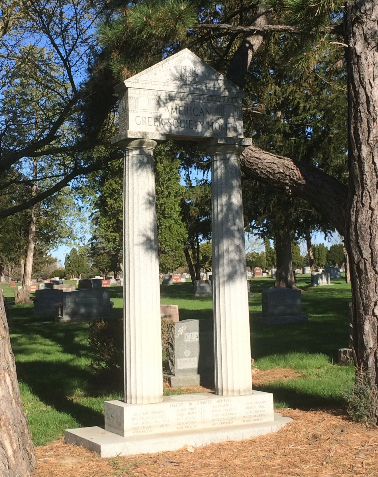
This structure says, 1931 American Greek Society Homer on top. Below it says, Erected by Charter Members, with a list of names of a distinctly Hellenic cast.
Greek American memorial Peoria

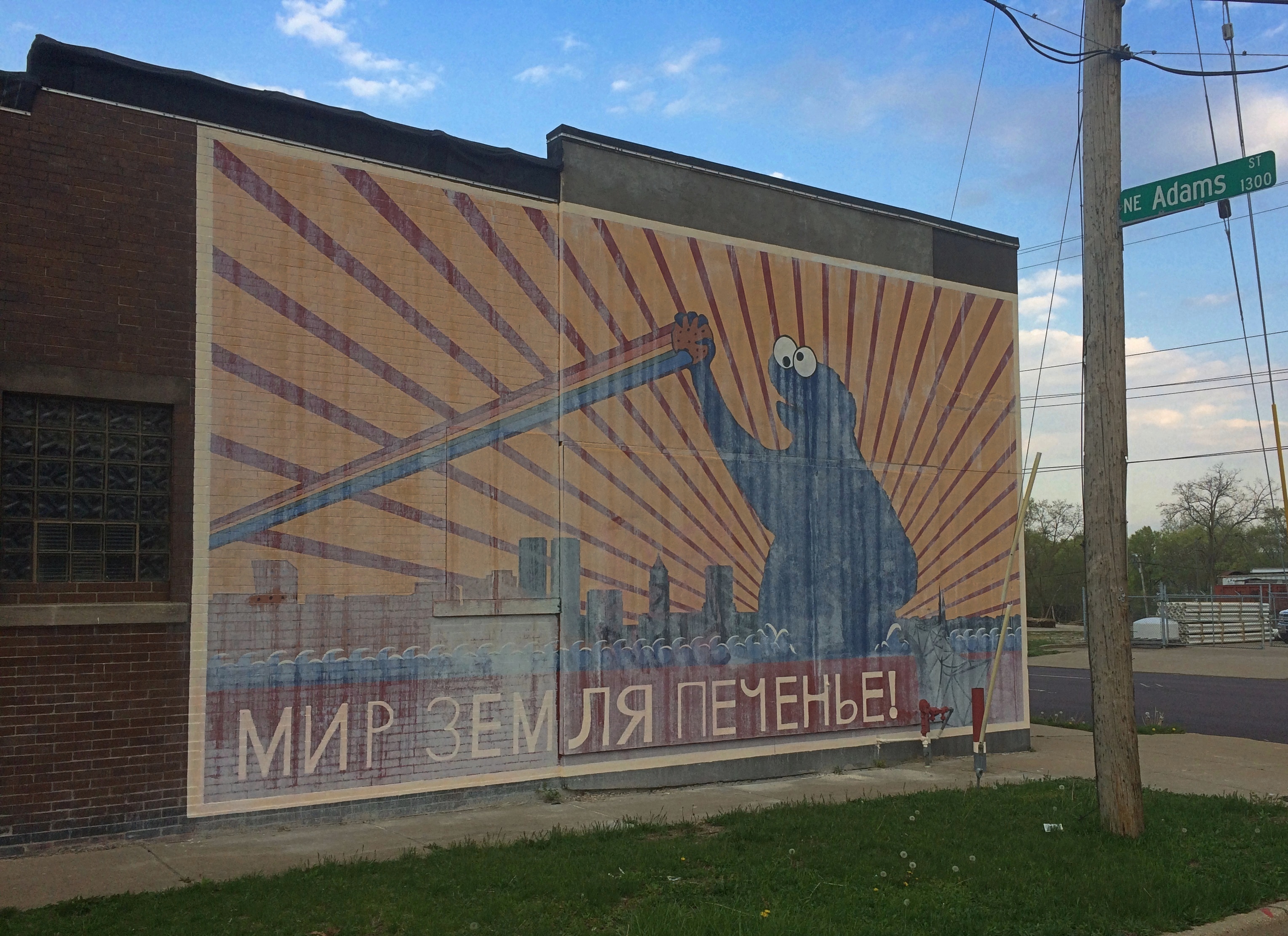
The afternoon we arrived in Peoria, we were driving along Adams Street not far from downtown when suddenly we saw the famed (well, 15 minutes) Cookie Monster mural. Imagine my delight. I had to stop to take pictures of that.
Bolshevik Cookie Monster Mural, Peoria

The mural got national attention late last year. As reported, the story was that a mysterious man (Fake Nate) paid an artist (Joshua Hawkins) to do the mural, claiming he was the building’s owner. The real owner (Real Nate) came back from a Thanksgiving trip to find the mural, and expressed outrage. The artist said he’d been tricked, too. Then Real Nate painted over the mural. Fake Nate’s identity and motive — and there must have been a strong one, since Hawkins reported being paid “a lot” in cash for the work — remained elusive.

It’s an odd story. But soon I’d forgotten that the small building, which is absolutely nondescript in every other way, was in Peoria. When I saw the mural, I remembered.
But wait — wasn’t it painted over? Whitewashed is more like it, since spring rains had clearly removed most of the covering, rendering Bolshevik Cookie Monster visible again.

As I stood across the street taking pictures, a stubby, wrinkled, gray-haired man got out of his car not far away and tried to enter a small bar on my side of the street. He found it closed.

“It’s closed,” he said to me, heading back toward his car.

“What’s the deal with that?” I asked, pointing toward the mural.

“It’s some kind of joke,” he said, and related a bit of the reported story. But then he expressed skepticism that it really happened that way. Rather, he suspected, the artist and the property owner cooked up the story to help sell the building — which, I read later, the owner did not long ago — and help get the artist some attention, too.

That’s certainly plausible. There’s no doubt that the artist is capitalizing on it. If it didn’t involve paying $35 ($25 for the item, $10 for shipping), I’d consider buying a t-shirt with the mural on it, as offered at the artist’s web site along with other merch. (That’s too much for any t-shirt.)

Maybe, maybe not. Doesn’t matter. It’s an inspired bit of whimsy. Мир, земля, печенье (Peace, Land, Cookies) is a play on the Bolshevik slogan, Мир, земля, хлеб (Peace, Land, Bread), and there is a touch of early red propaganda poster to the thing.

If the new building owner, and the city of Peoria, has any sense, they’ll keep the mural. Restore it, in fact. Besides being funny, at least to some of us, it’s a distinct thing to be found there and absolutely nowhere else.

Downtown Peoria

On the Sunday morning we were in Peoria, I popped out for a look around as my family still slept, as my wont. We were staying in East Peoria, so downtown Peoria was just across the Murray Baker Bridge. Soon I made my way to Main Street, which features buildings short —

Downtown Peoria. Main Street

— and tall, at least for Peoria, such as the Commerce Bank Building.Downtown Peoria. Main Street

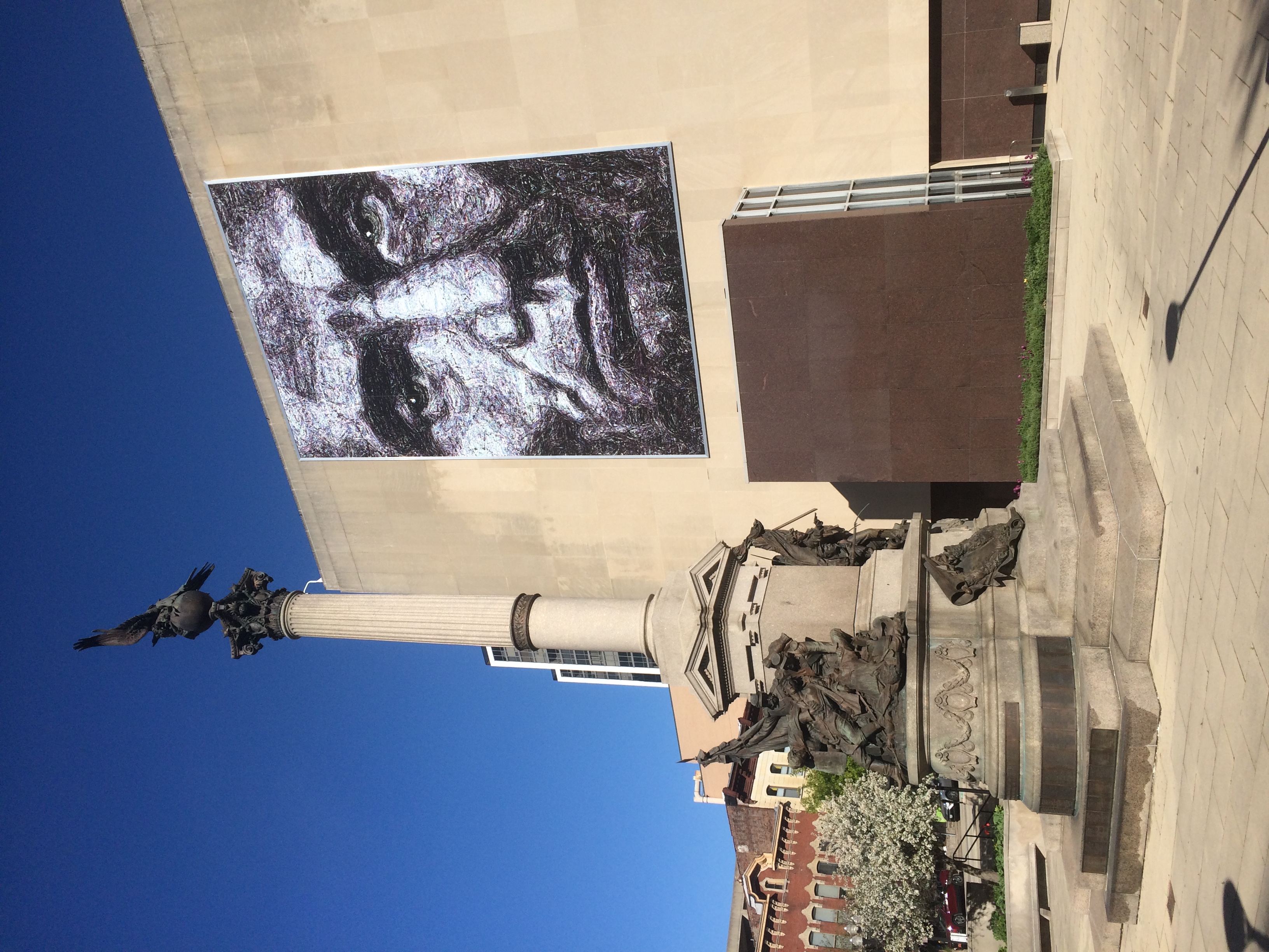
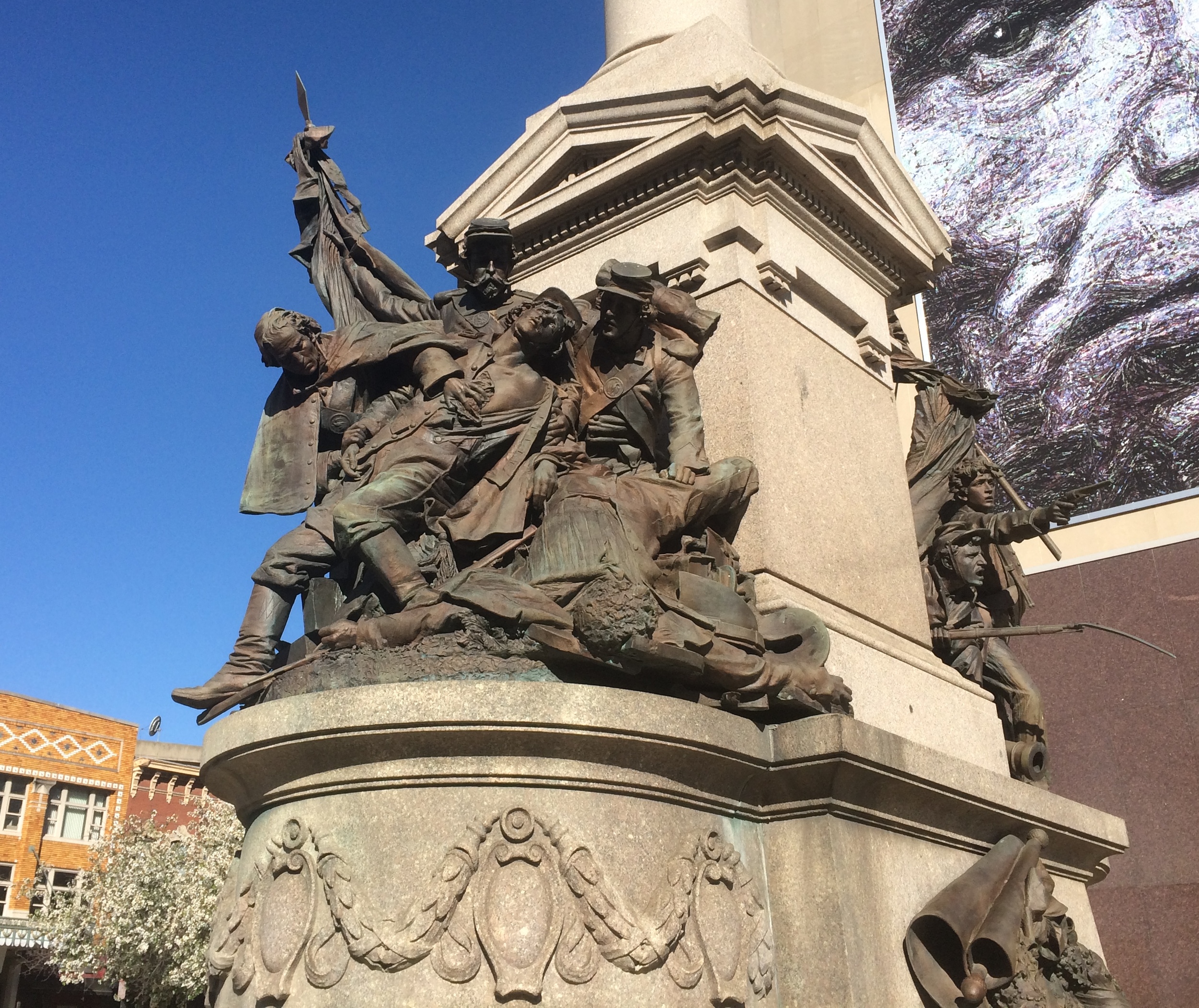
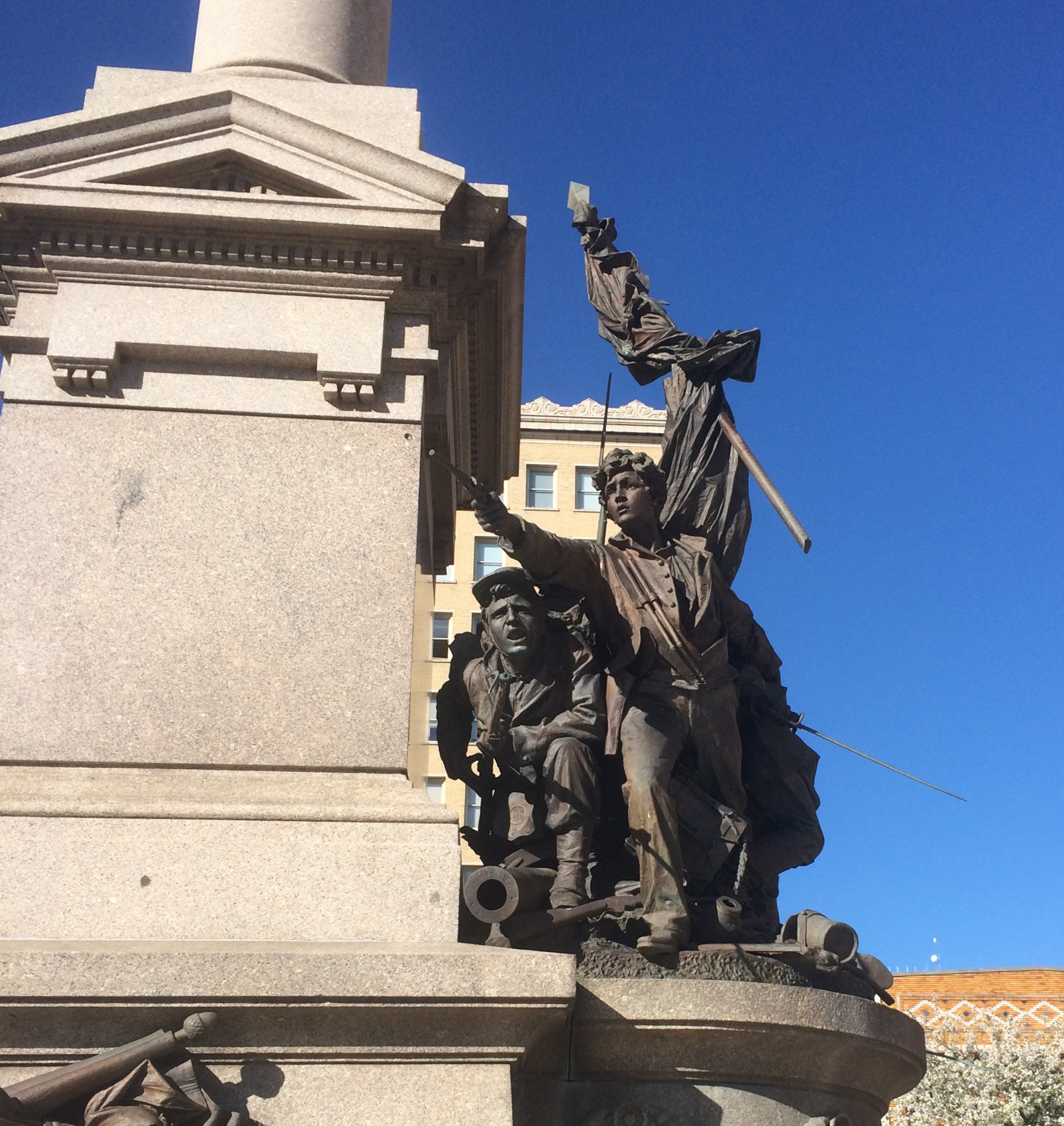
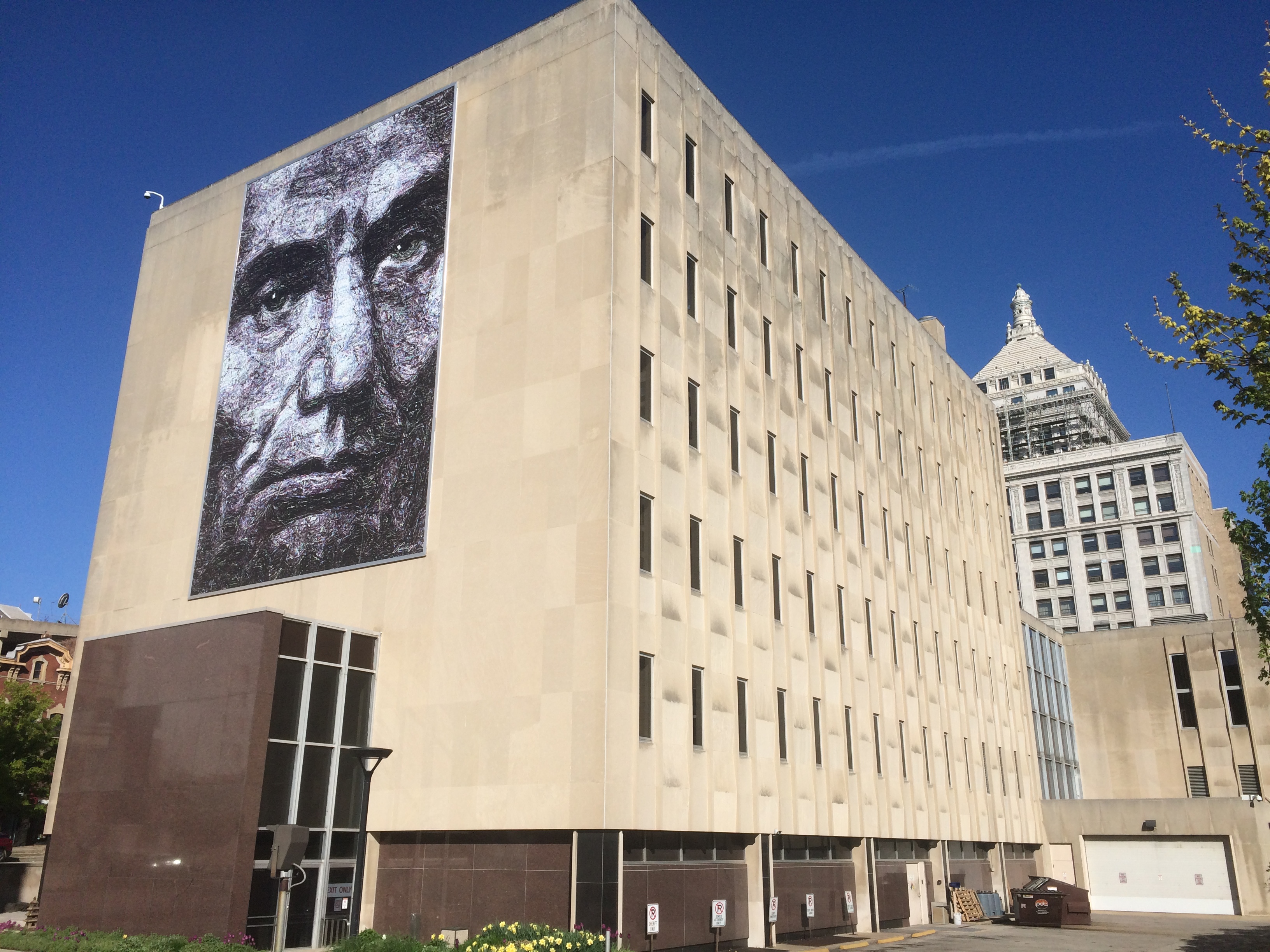
On Main Street, I mostly focused on Courthouse Square, where there’s a sizable old memorial, the Soldiers and Sailors Monument, along with a sizable new mural, “Abraham Blue,” which is perched on the side of the Peoria County Courthouse.Downtown Peoria. Main Street, Soldiers and Sailors

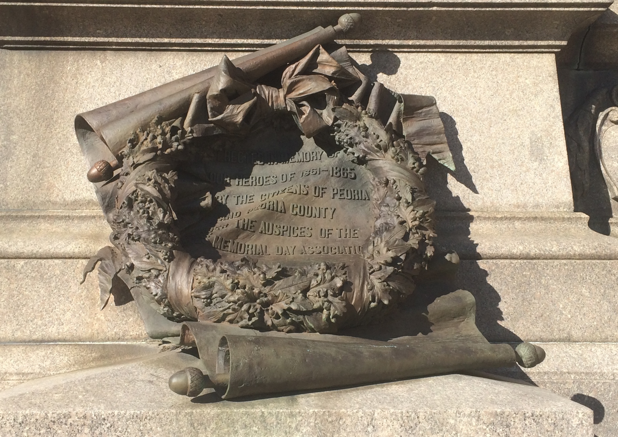
First, the Soldiers and Sailors Monument. Impressive bronze.Downtown Peoria. Main Street, Soldiers and Sailors Downtown Peoria. Main Street, Soldiers and Sailors Downtown Peoria. Main Street, Soldiers and Sailors

The memorial has been there since 1899, a project of the Ladies Memorial Day Association. A plaque nearby quotes the president of that organization, one Lucie B. Tyng, who said it would the work would “last for all time, and tell our children and children’s children our loving gratitude to these brave men who took their lives in their hands and went forth to vindicate and sustain our Government in its hour of peril.”

The association tapped Fritz Triebel, a native Peorian artist resident in Rome, to create the monument. He also did the intricate bronzes at the Mississippi State War Memorial Monument in Vicksburg. That’s the spirit of sectional reconciliation at work, by golly. Or maybe a commission was a commission for Triebel.

As for “Abraham Blue,” the Journal Star reported before it was hung on the courthouse in 2018 that “the Lincoln portrait was created by Doug Leunig several years ago as part of a work that captured the likenesses of the famous Americans that adorn the nation’s currency.

” ‘It’s called “Abraham Blue” because it’s tinted blue. That symbolizes the fact that Lincoln suffered from depression but was able to overcome that problem to be a great president,’ said Leunig.”

It adds quite a presence to Courthouse Square. And to the courthouse itself, a brutalist box if there ever were one.
Downtown Peoria. Main Street, Abraham Blue

Further wandering in downtown Peoria took me to City Hall, designed by Reeves and Baillee and dating from 1897. No boxes for them; Le Corbusier was still in short pants in those days.Peoria City Hall

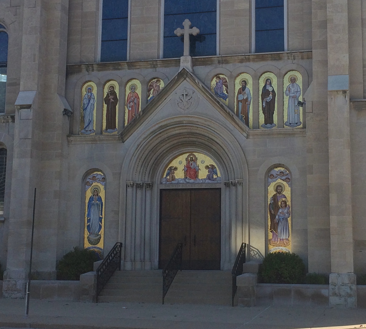
Down the block from City Hall is Sacred Heart Catholic Church, dating from 1905. Closed. I was too early for it to be open for mass. Sacred Heart Catholic Church

Sacred Heart Catholic Church

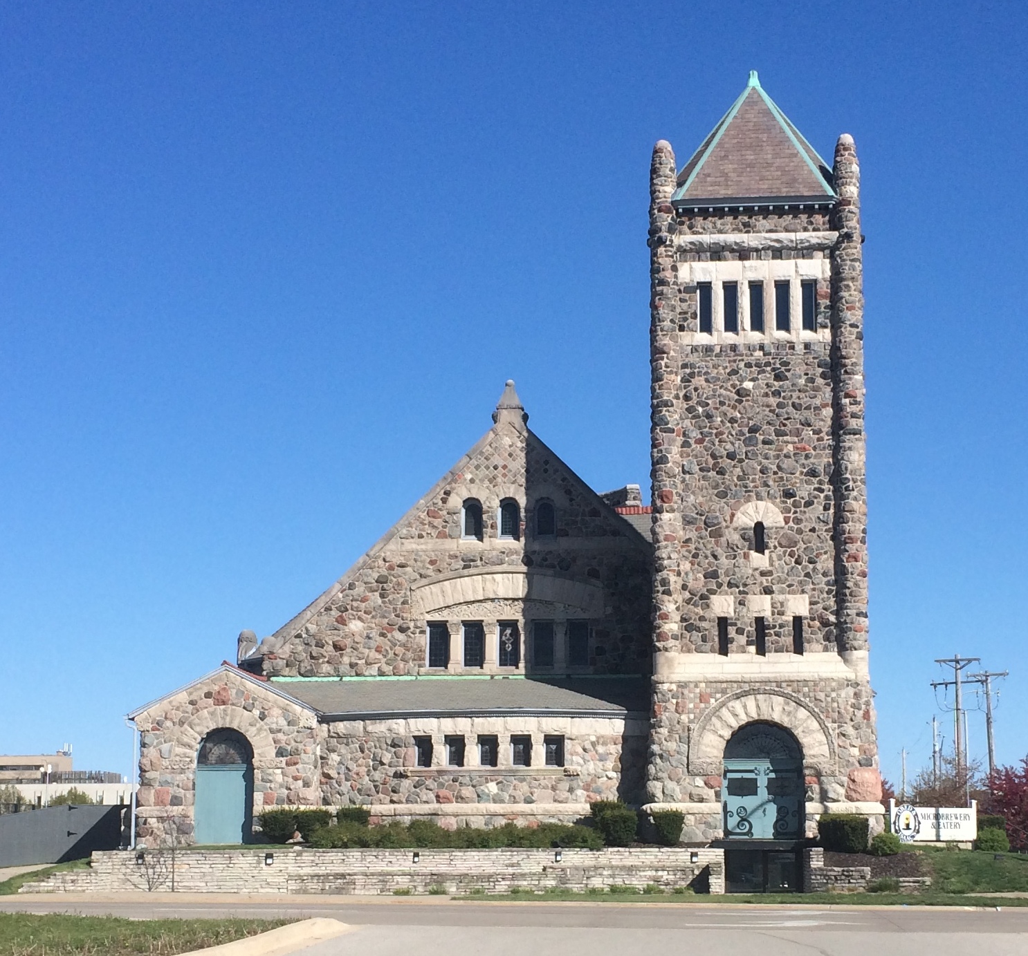
Elsewhere, there’s a former church — I haven’t found out what kind yet — that’s now Obed & Issac’s Microbrewery & Eatery. Looks like a nice adaptive reuse.Obed & Issac's Microbrewery & Eatery

We didn’t eat in any restaurants on this little trip. But it won’t be long now.

A Couple of Hours in Freeport

The week after I returned from Dallas was second-dose vaccination week for all of us in our house. When I set things up in late March, the only first-shot appointments were at far-flung pharmacies in northern Illinois, meaning the boosters would be at the same places. By the time I got back, I had the sense that I could have rejiggered things to get shots closer to home. But I didn’t. I still wanted to go to those places.

Such as Freeport, Illinois, the only town of any size between Rockford and Galena, and actually much bigger than the latter (23,700 vs. 3,100). When driving into Freeport, I saw a sign advertising a Wrigley Field replica, or miniature, or something. It wasn’t hard to find after our vaccination was done.

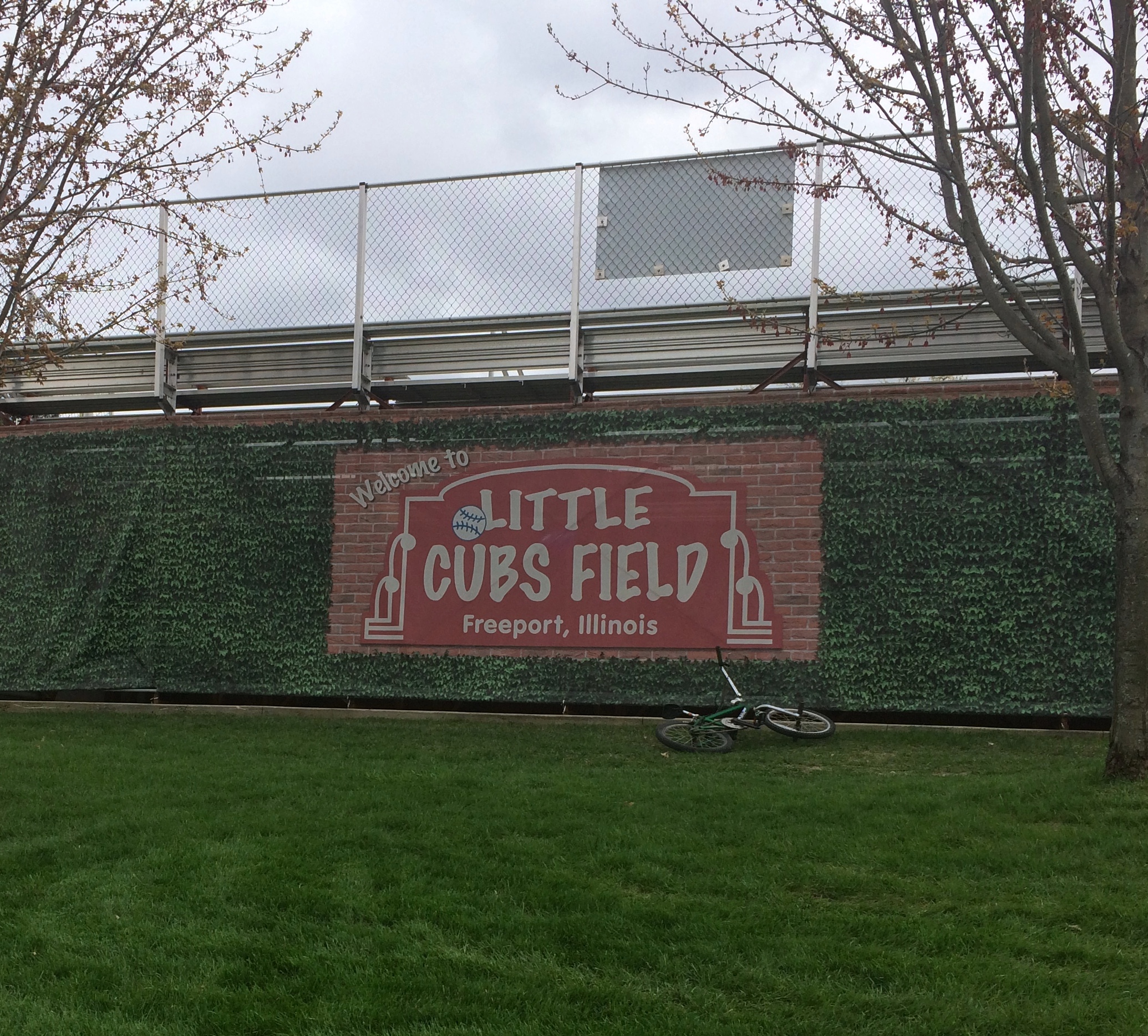
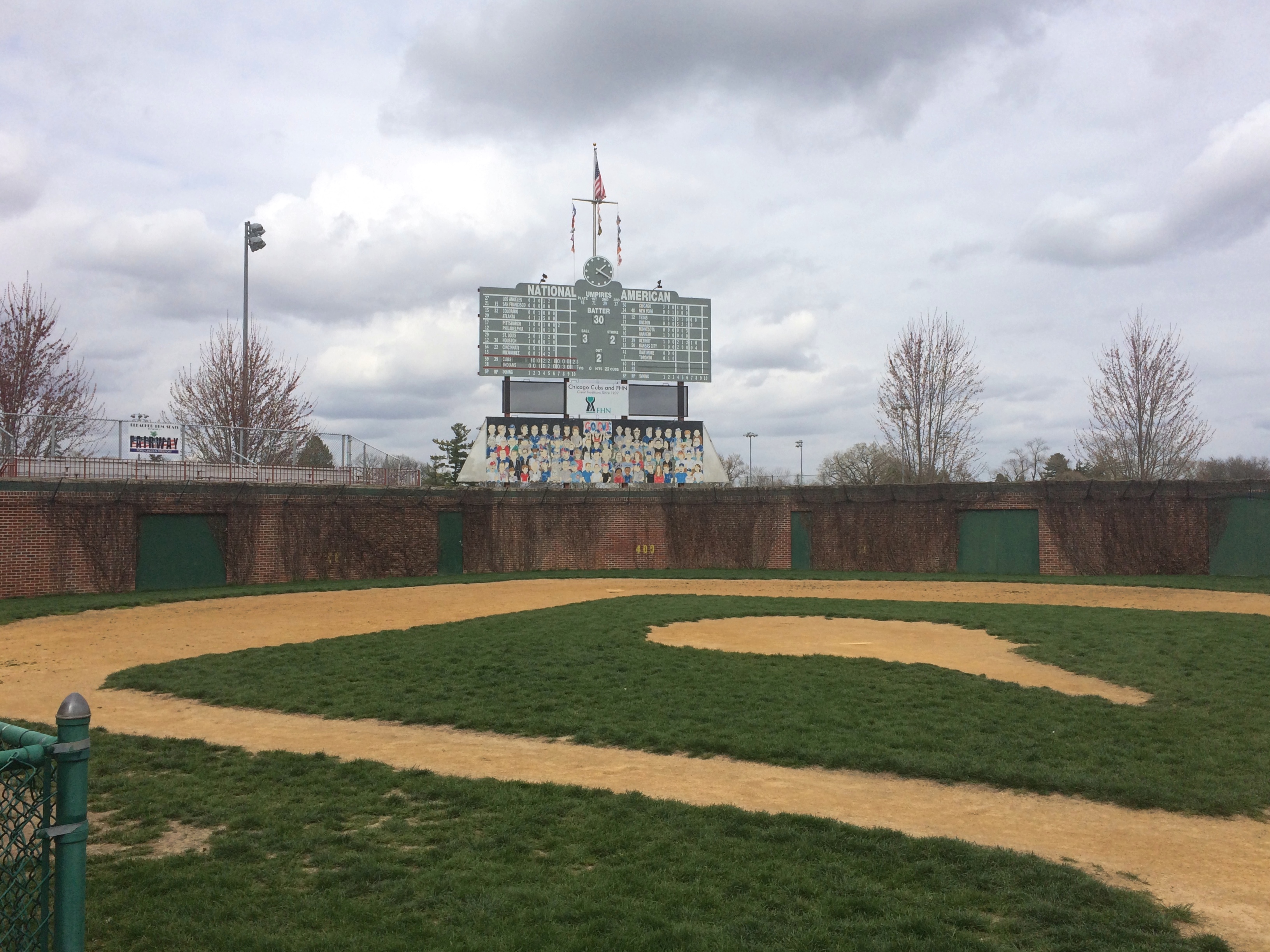
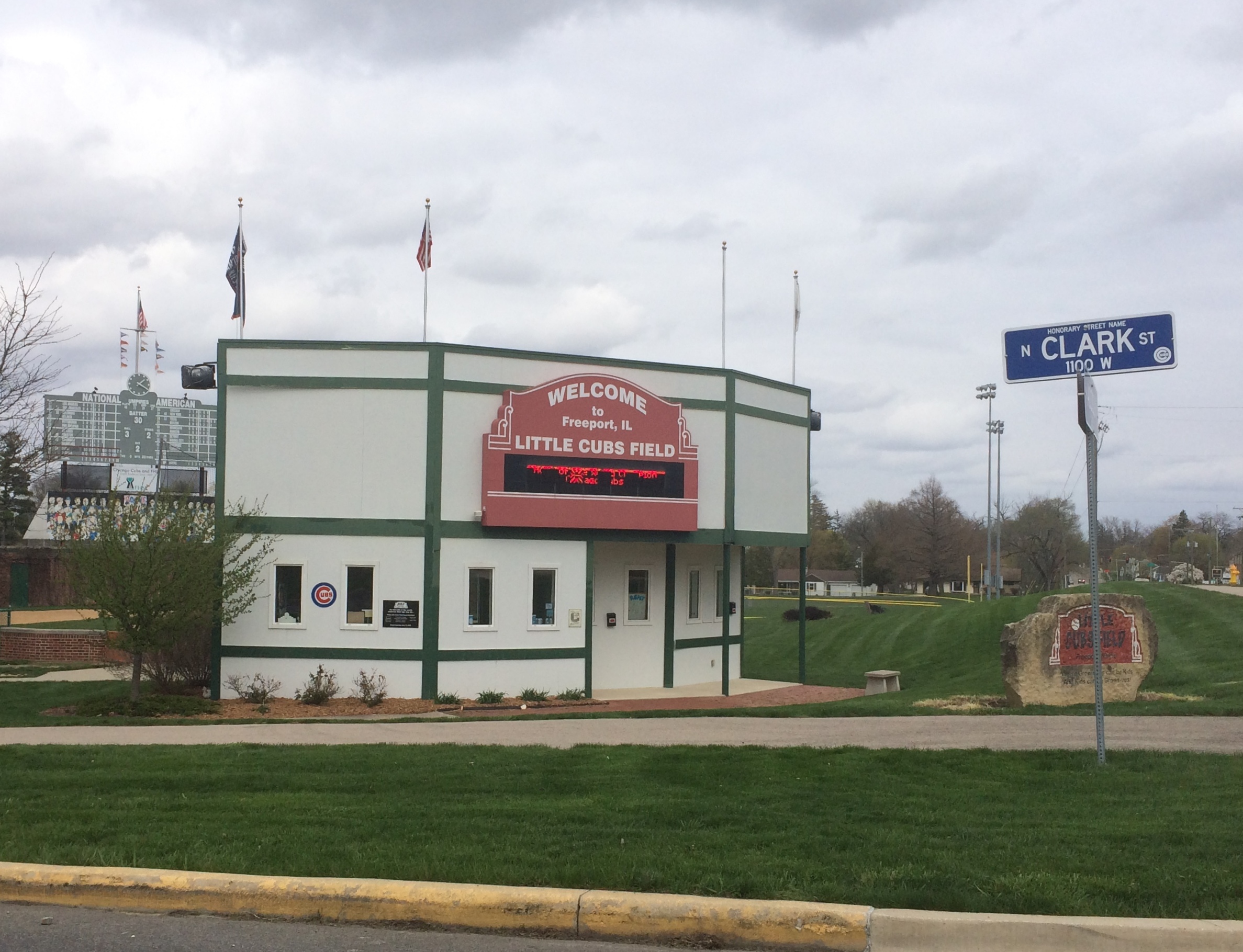
Little Cubs Field, it’s called, which is used for Little League, T-ball and other events, and completed in 2008 by serious Cubs fans.
Little Cubs Field Freeport

The bicycle in that picture belonged to one of about a half-dozen boys, all maybe about 10 years old, who were hanging out at Little Cubs Field when I arrived and started taking pictures.

“Are you a tourist?” one of them asked me.

“Yes, I’m just passing through,” I said.

“They always take pictures,” another of the boys said to yet another, not me. The first boy then asked where I was from, and I simplified matters by telling him Chicago. I got the sense that he felt that was quite a distant location. A reasonable thing to think at 10.

Off they went, and I took some more pictures.Little Cubs Field Freeport Little Cubs Field Freeport Little Cubs Field Freeport

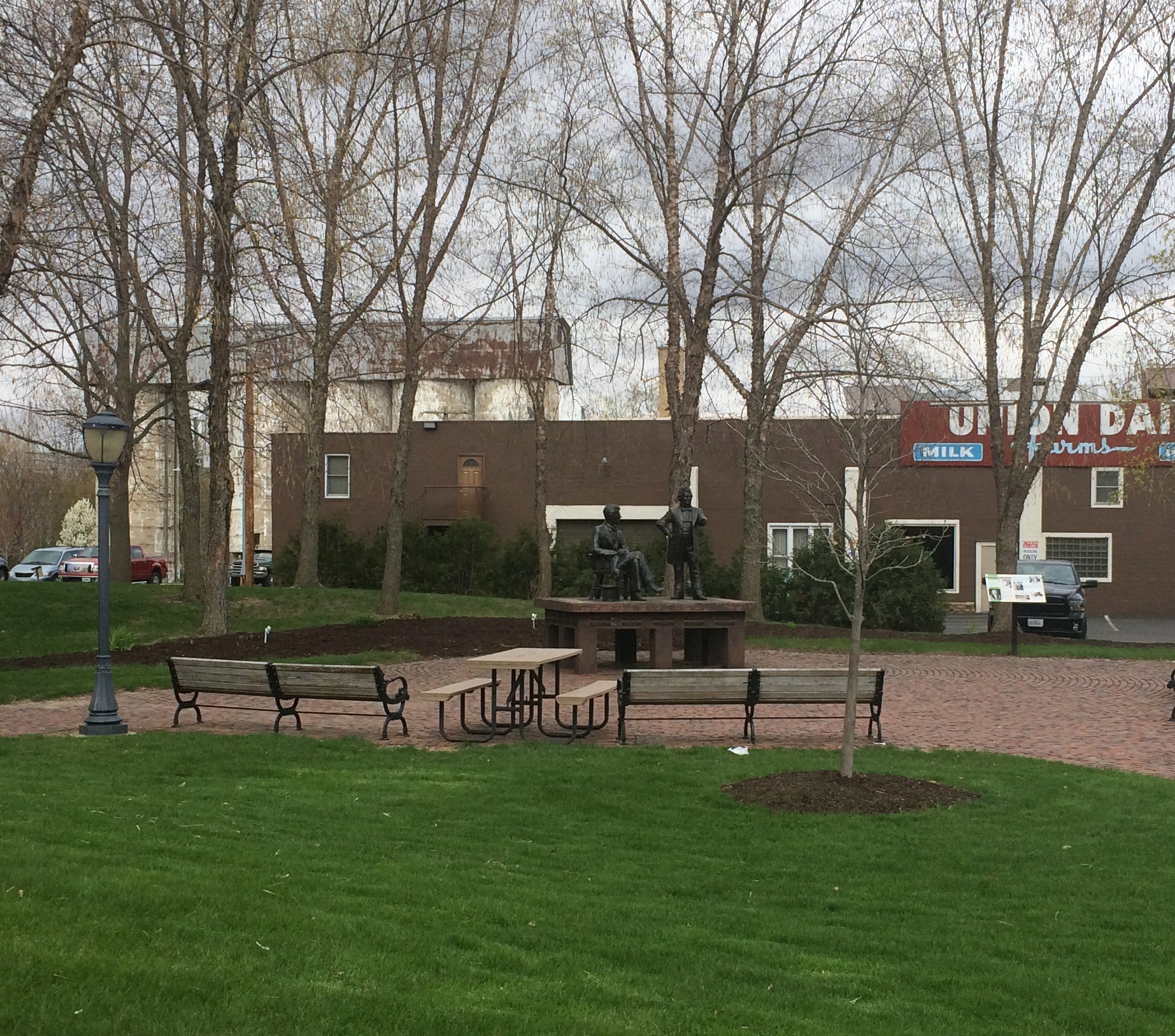
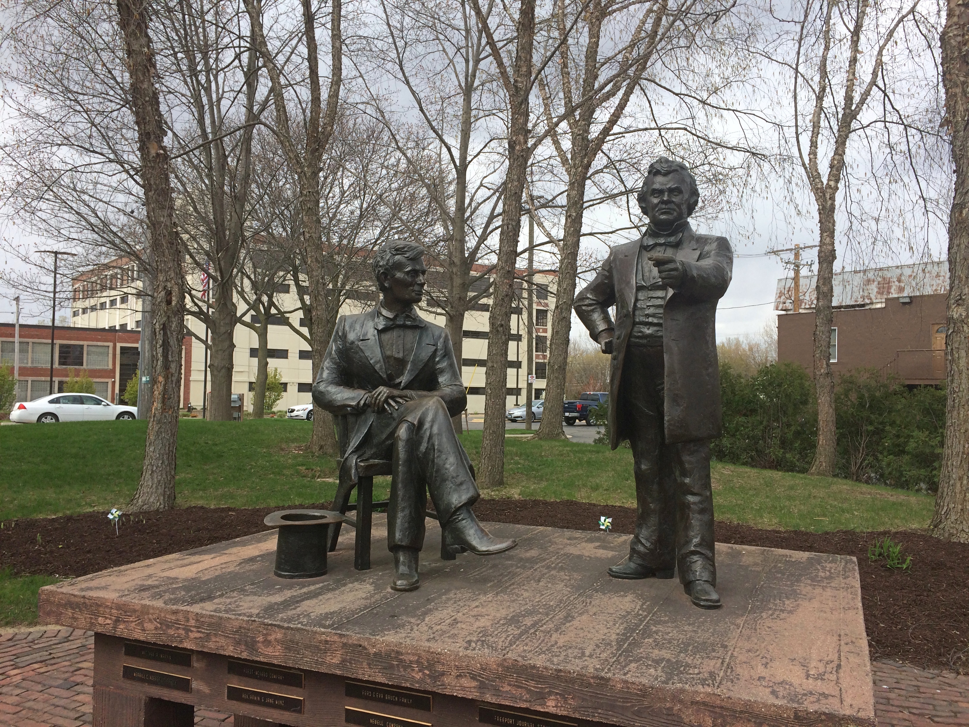
A short drive away, in Freeport’s small downtown, is its Lincoln-Douglas memorial. I couldn’t very well pass that up.Lincoln-Douglas Freeport

Lincoln-Douglas Freeport

Every place they had a debate has a memorial now. This was the first of the statues to memorialize one of the events, unveiled in 1992, but hardly the last. Chicago sculptor Lily Tolpo (d. 2016) did the bronzes. Both she and her husband Carl did Lincolns.

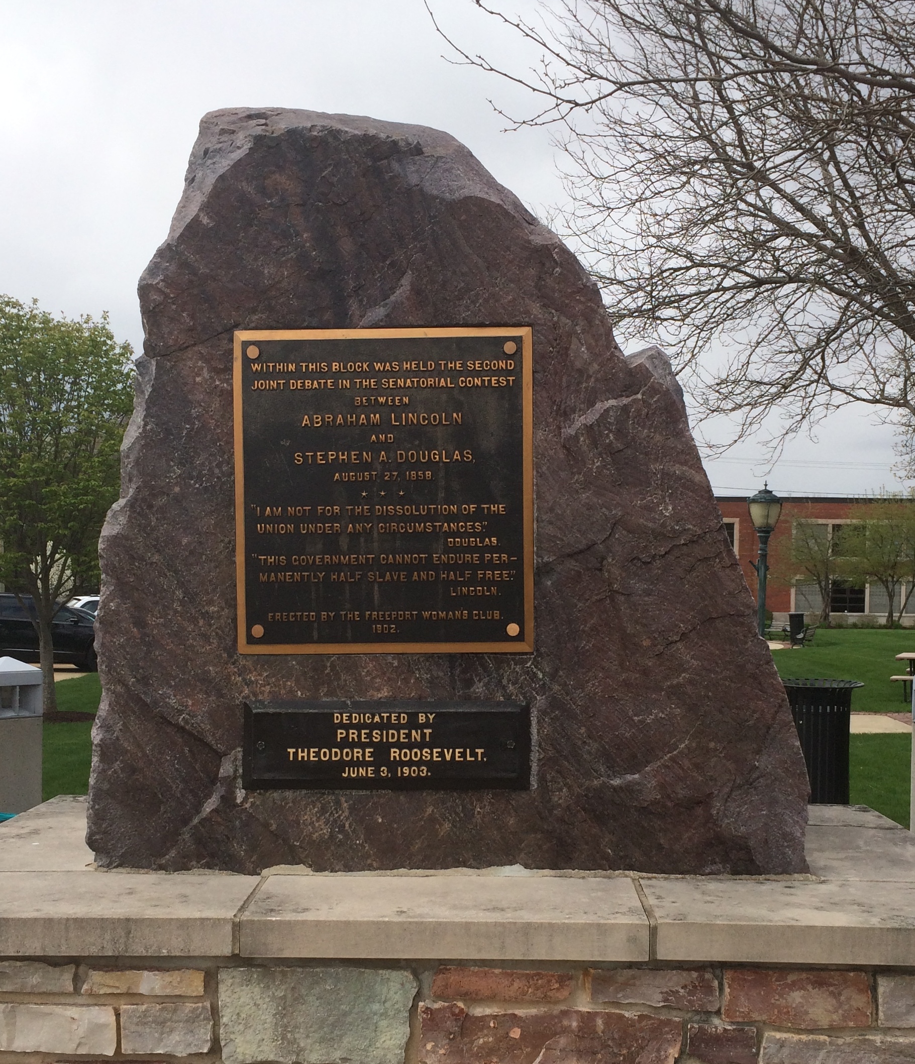
The memorial also featured a plaque on a rock.
Lincoln-Douglas Freeport TR Rock
Not just any plaque, but one dedicated by TR in 1903. A president, I believe, who understood the gravitas of the office he held. Probably felt it in his bones. Not all of his successors have.

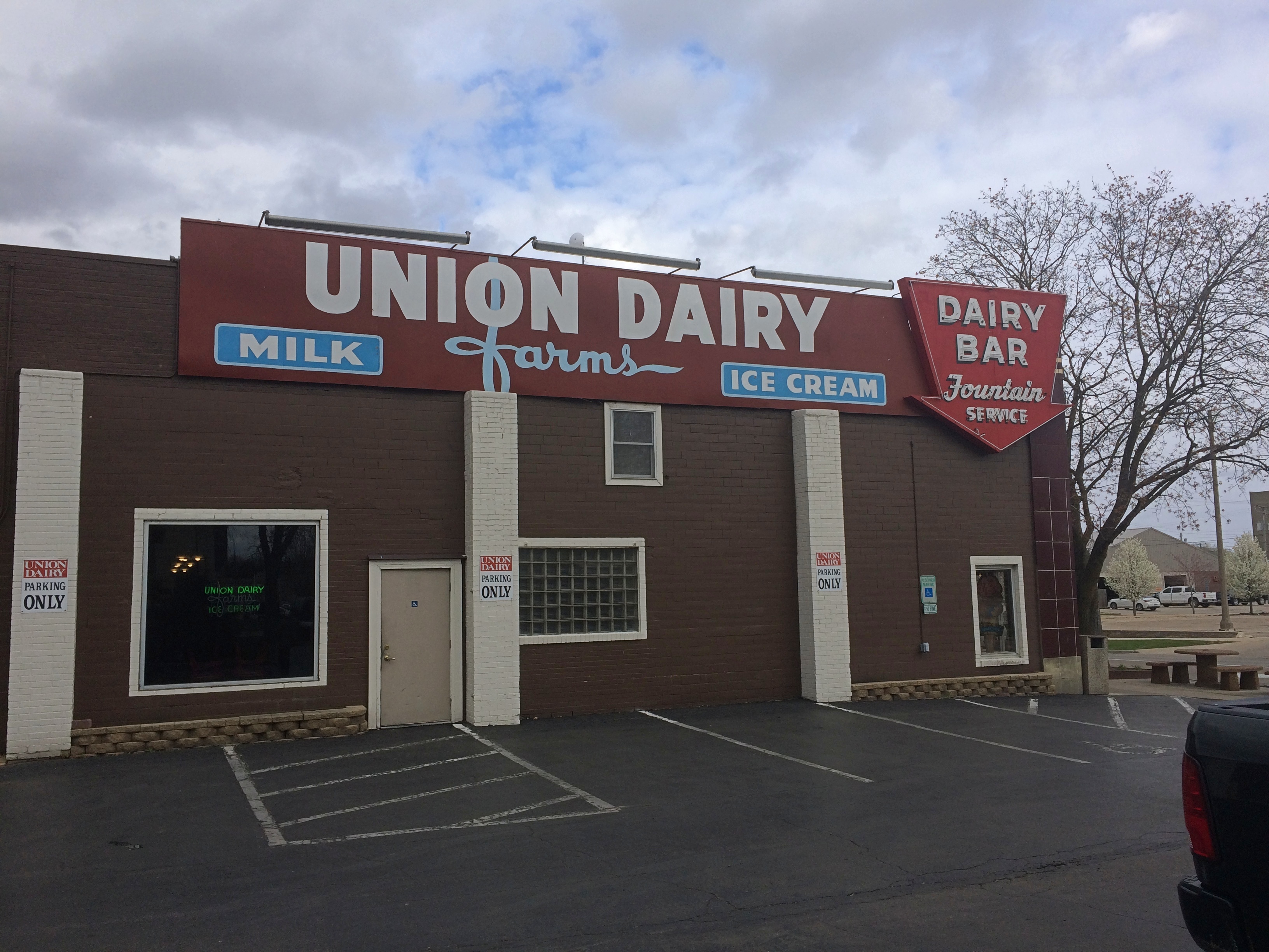
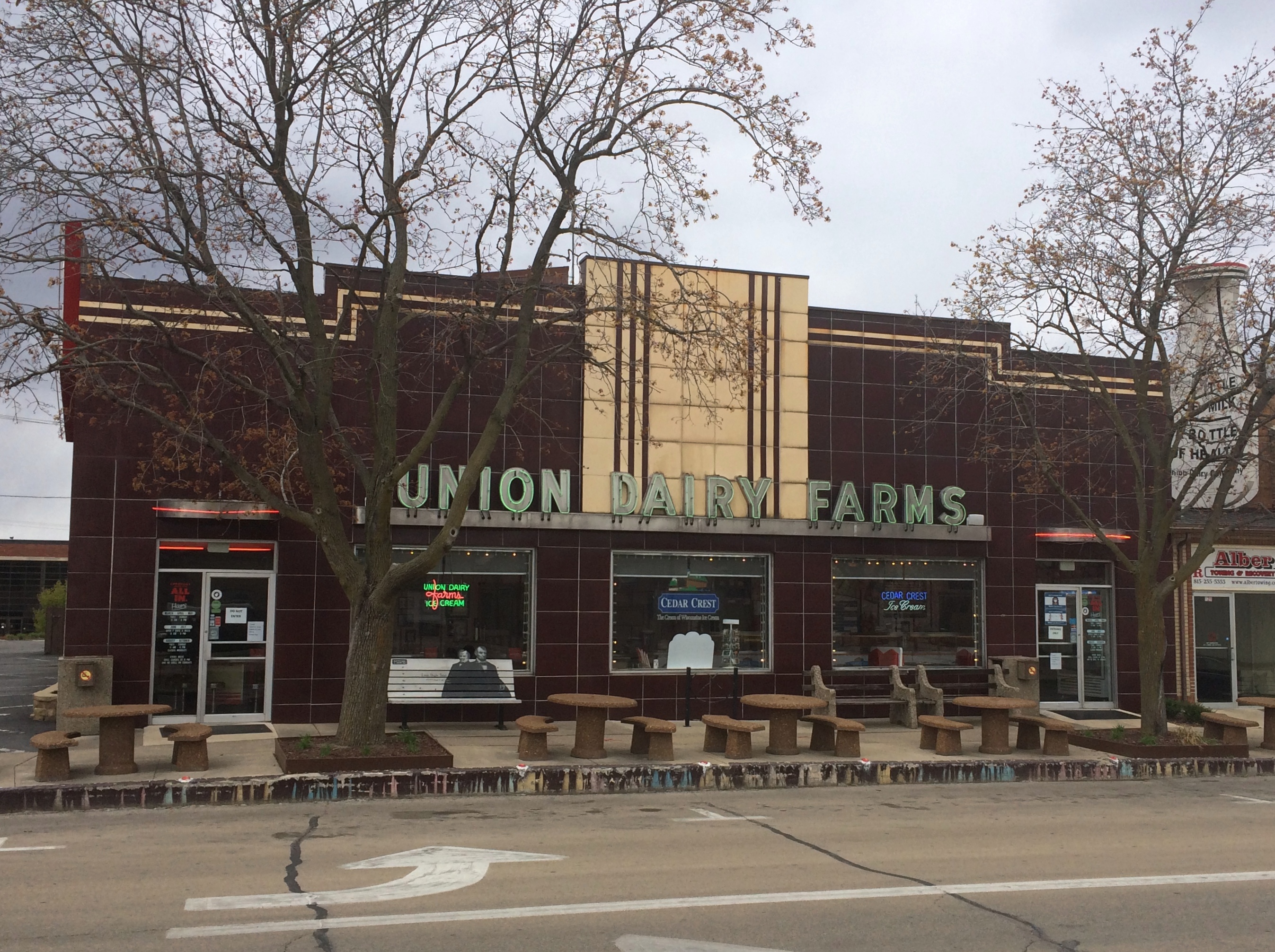
We were about to leave, but couldn’t help noticing an ice cream shop next door to the memorial.Union Dairy Farms Freeport Union Dairy Farms Freeport

The Union Dairy Farms, founded in 1914 and serving ice cream since 1934. We couldn’t pass that up, either, figuring it had to be good. Was it ever.

Boneyards Along the Way

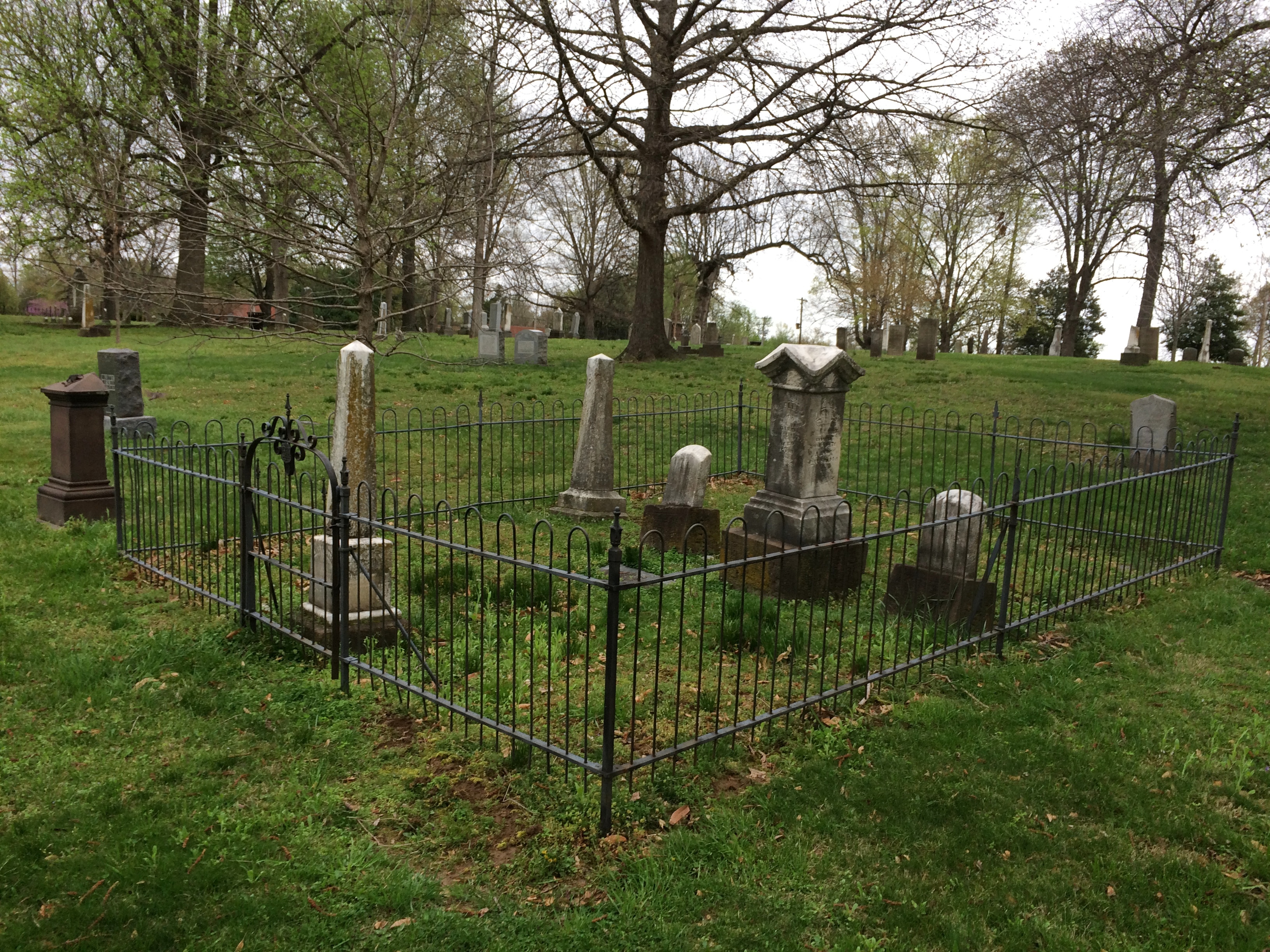
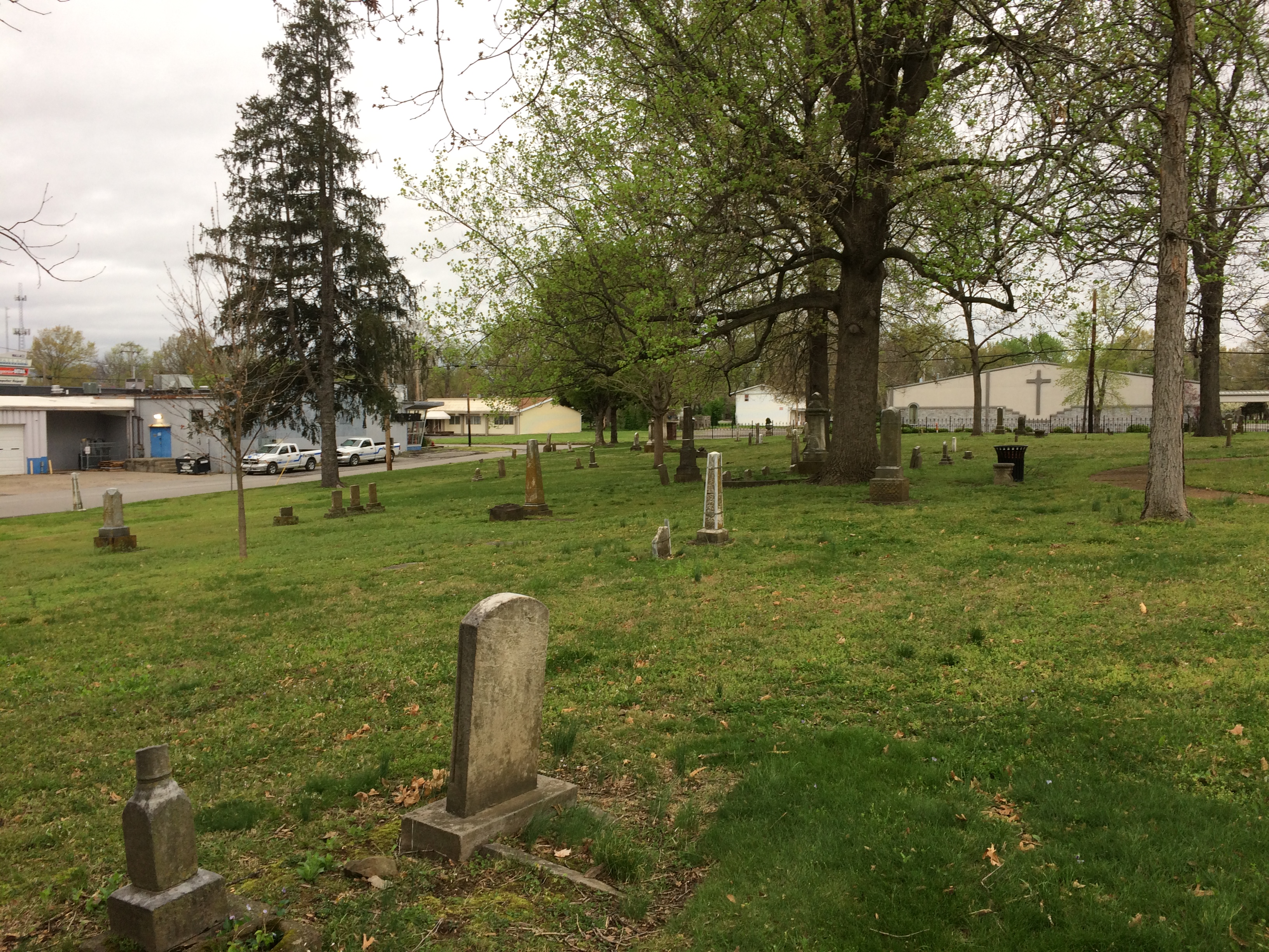
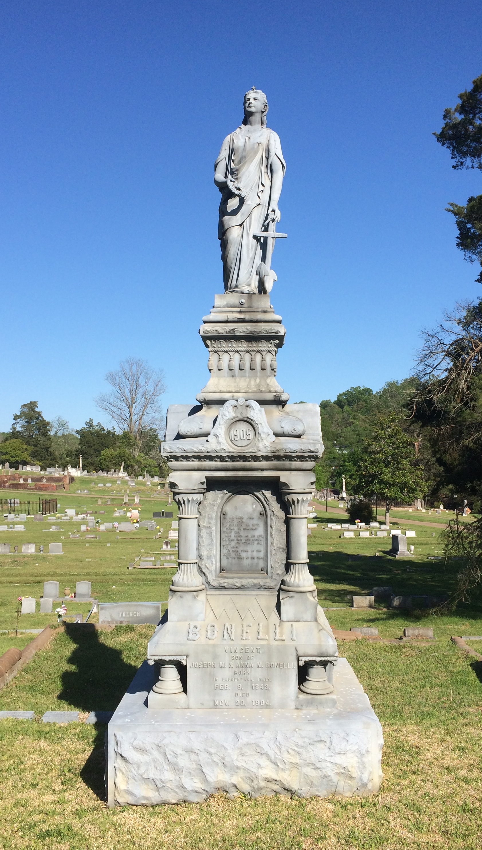
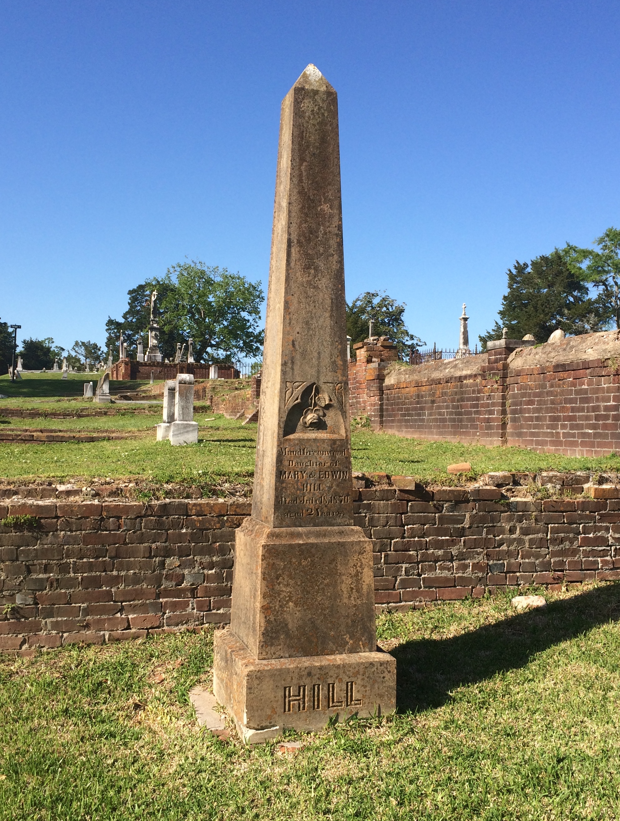
On the second day of my recent trip, as I was leaving Carbondale, Illinois, I spotted the small but pretty (and unimaginatively named) Woodlawn Cemetery. Founded in 1854, it’s two years older than the city. Everything was wet from the heavy rain the night before. Woodlawn Cemetery, Carbondale Woodlawn Cemetery, Carbondale Woodlawn Cemetery, Carbondale
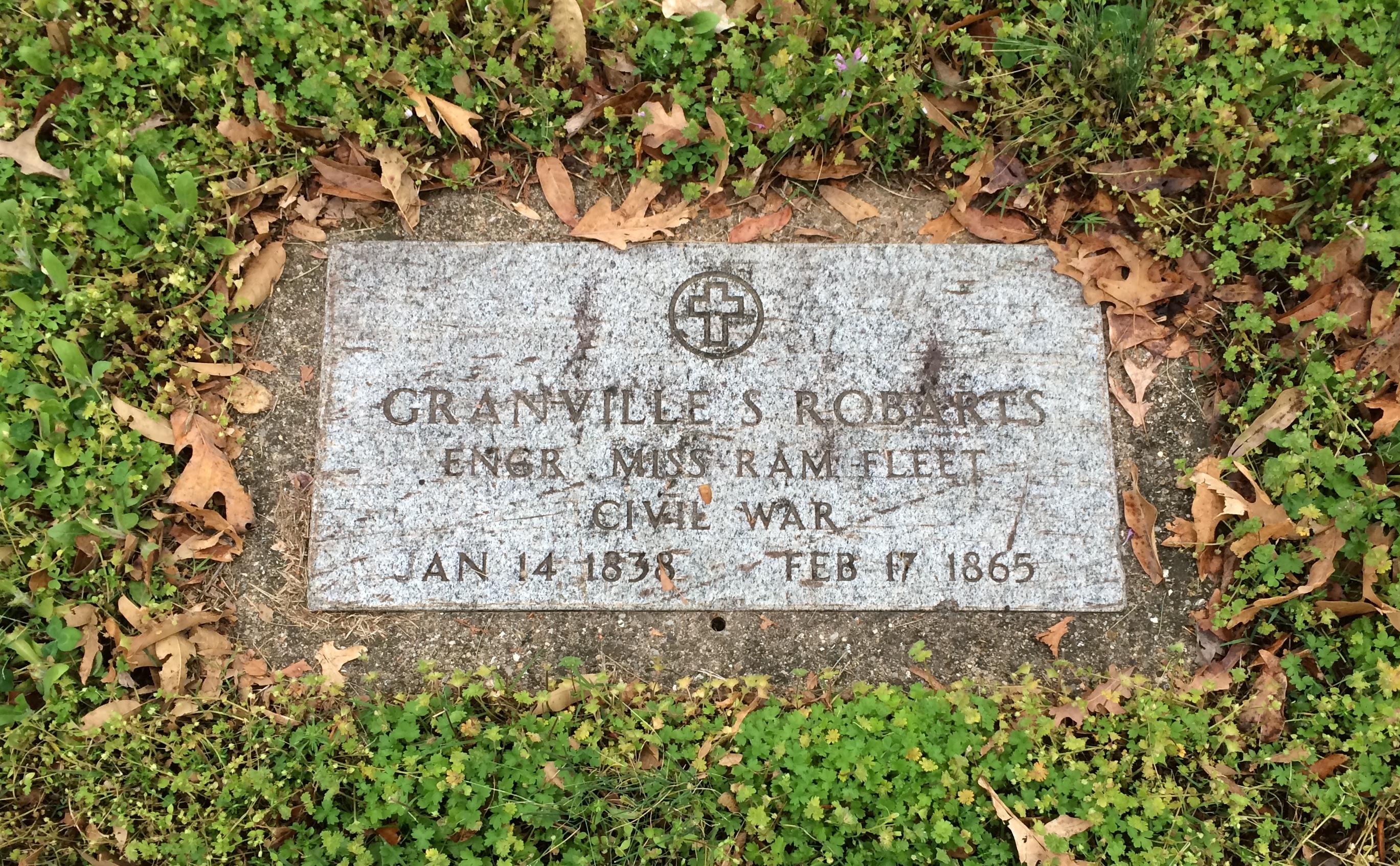
There are a number of Civil War graves.Woodlawn Cemetery, Carbondale Woodlawn Cemetery, Carbondale

“In April, 1866, three Carbondale-area Civil War veterans… proposed that the community… gather on the last Sunday of April to honor their fallen comrades and neighbors, by cleaning and decorating their graves,” says the cemetery’s nomination for the National Register of Historic Places.

“On the appointed day, April 29, more than 200 veterans plus approximately 4,000 area citizens gathered at Woodlawn Cemetery… Gen. John A. Logan addressed the assemblage.”

Evidently, this and later commemorations deeply impressed Logan, who on May 5, 1868, issued GAR General Order No. 11.

The 30th day of May, 1868 is designated for the purpose of strewing with flowers or otherwise decorating the graves of comrades who died in defense of their country during the late rebellion, and whose bodies now lie in almost every city, village, and hamlet churchyard in the land…

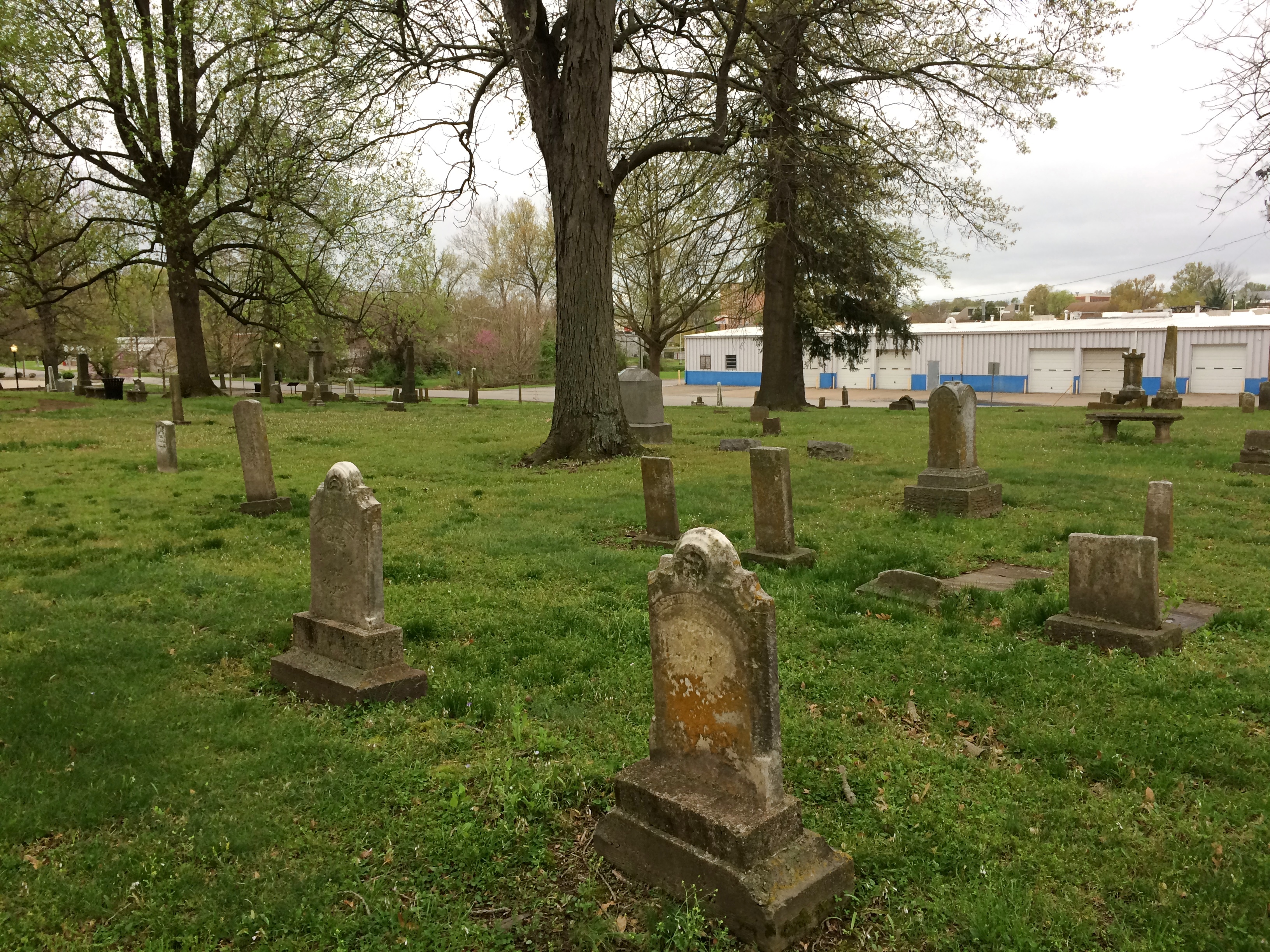
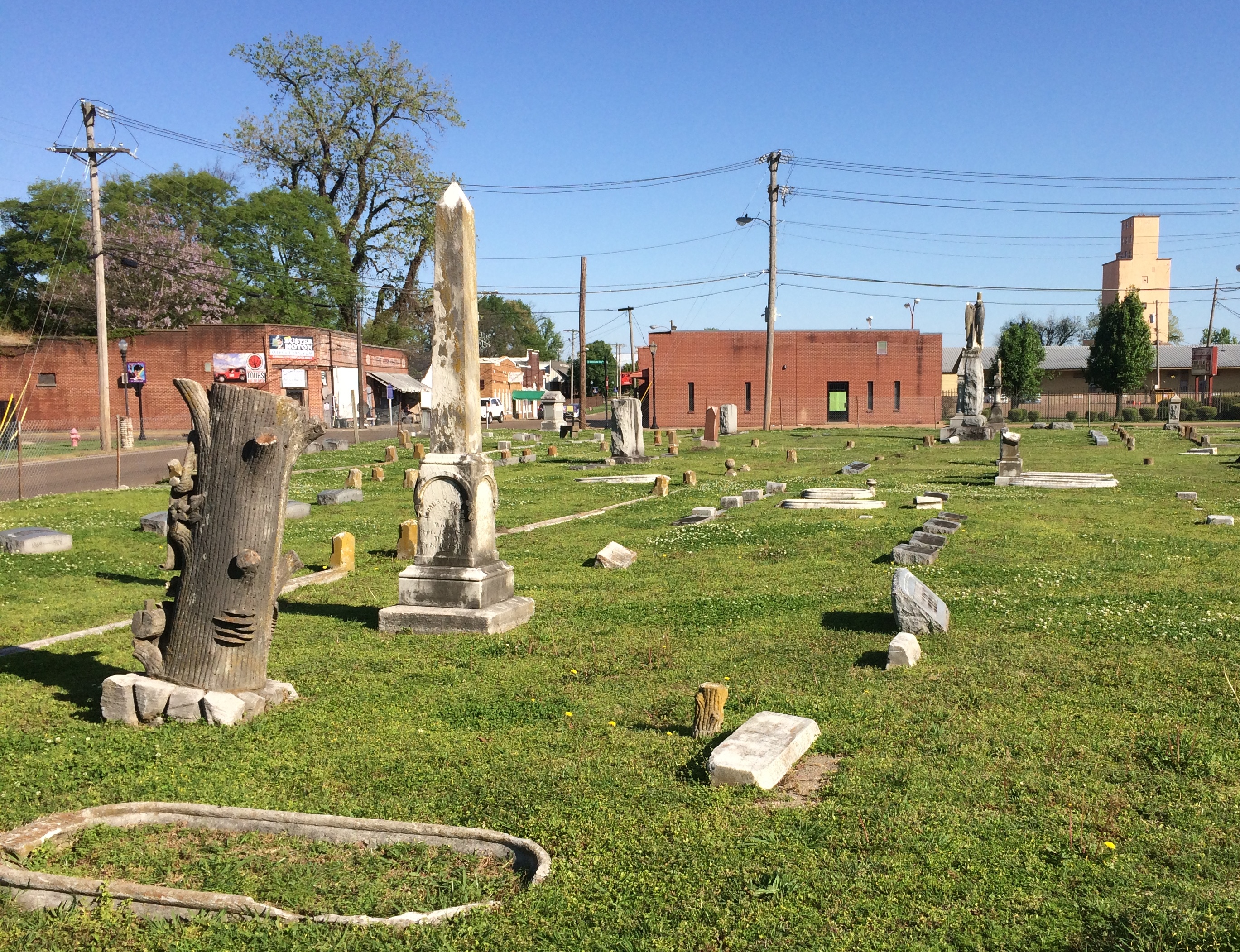
While visiting Clarksdale, Mississippi, I spent a few minutes at Heavenly Rest Cemetery.

 Heavenly Rest Cemetery Clarksdale

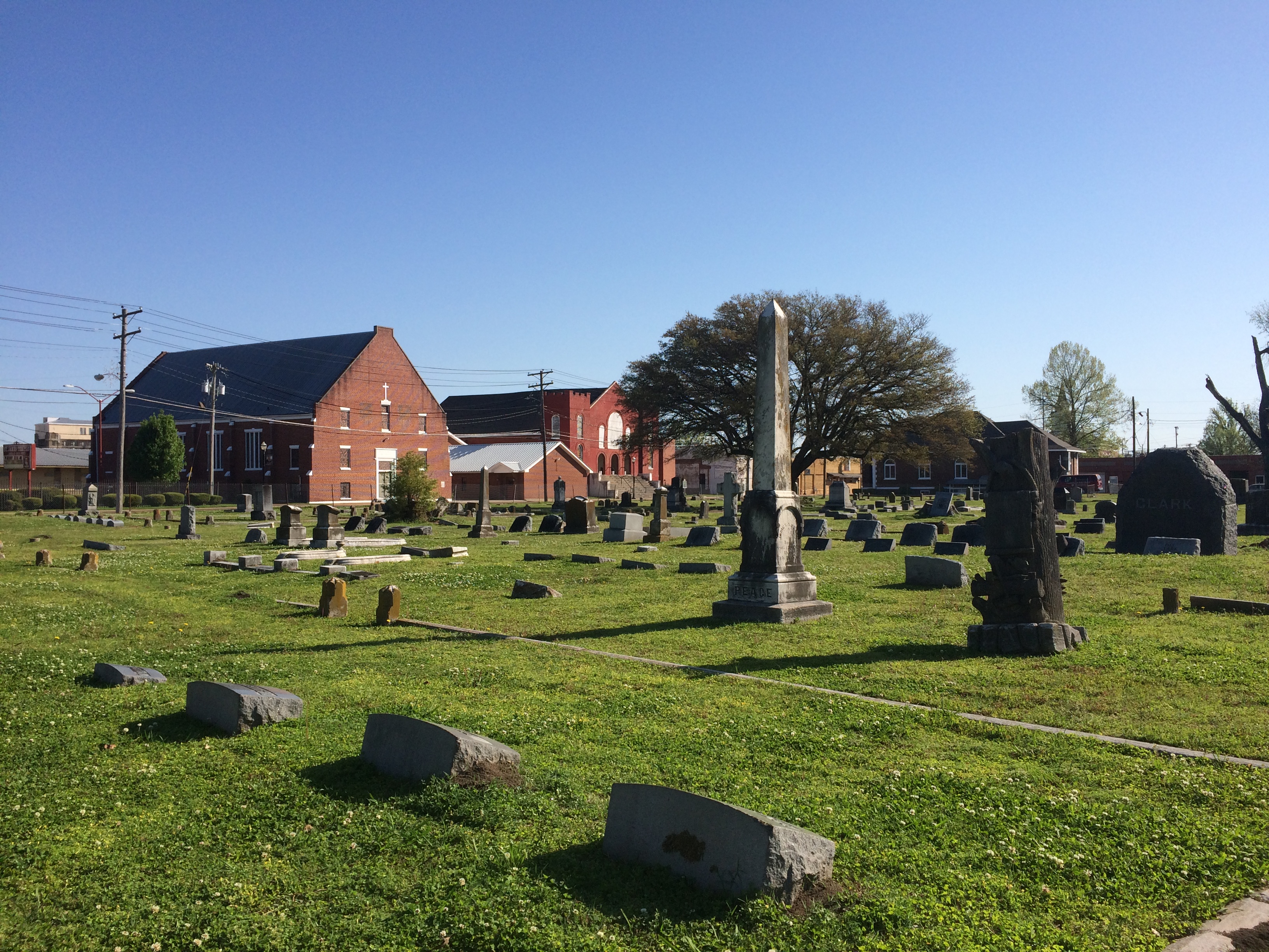
In the background are two buildings of First Baptist Missionary Baptist Church (1918), historic in its own right.

 Heavenly Rest Cemetery Clarksdale

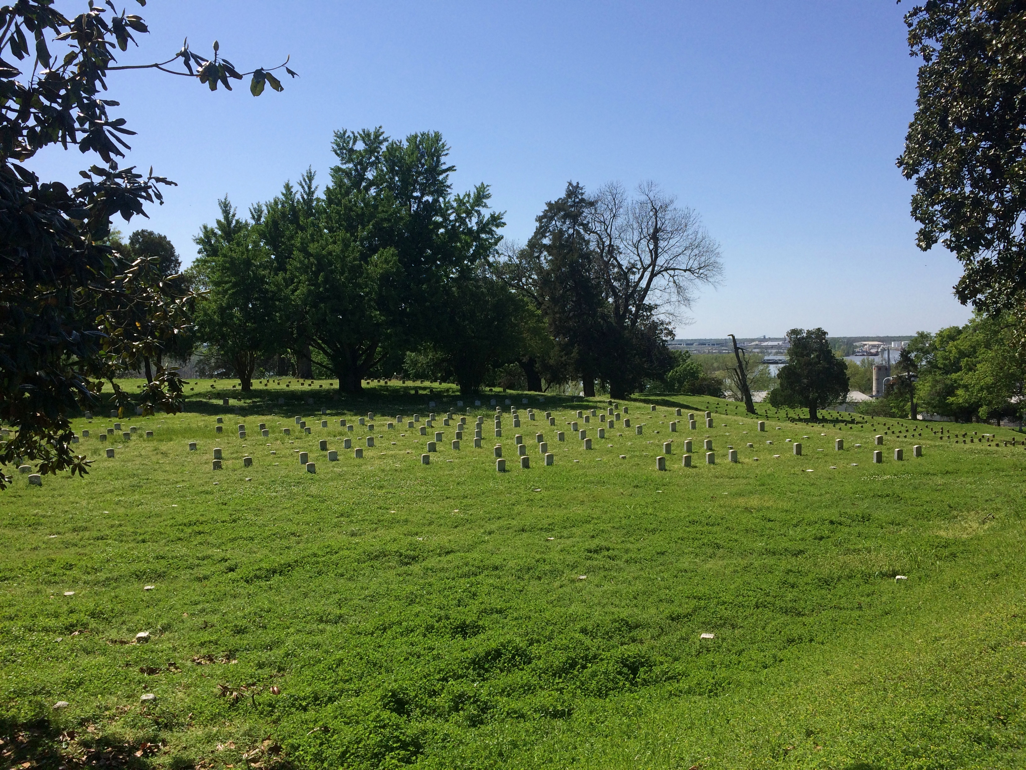
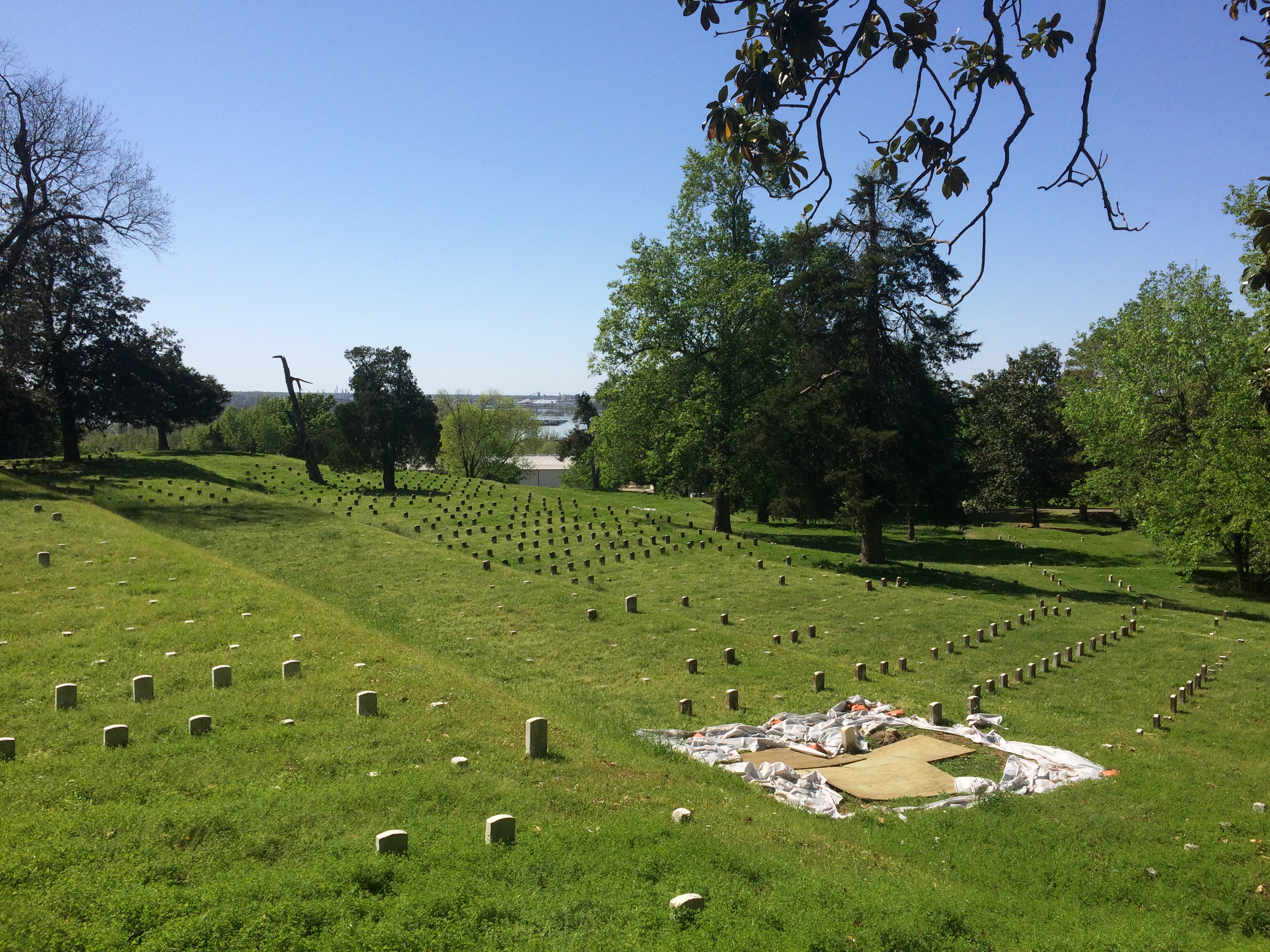
At Vicksburg National Military Park is the 116-acre Vicksburg National Cemetery, which holds the remains of 17,000 Union soldiers, a higher concentration than any other cemetery, according to the NPS.

Vicksburg National Cemetery Vicksburg National Cemetery Vicksburg National Cemetery

“After the creation of Vicksburg National Cemetery [in 1866], extensive efforts were made by the War Department to locate the remains of Union soldiers originally buried throughout the southeast in the areas occupied by Federal forces during the campaign and siege of Vicksburg — namely, Arkansas, Louisiana, and Mississippi. However, by the time of these re-interments many of the wooden markers had been lost to the elements, and identification of many of the soldiers was rendered impossible.
“Nationwide, 54% of the number re-interred were classified as ‘unknown.’ At Vicksburg National Cemetery, 75% of the Civil War dead are listed as unknowns…”

The cemetery is closed to burials now, but after the Civil War a number of later servicemen were buried there, including the curious story of Flight Sgt. Edgar Horace Hawter of the Royal Australian Air Force, re-interred there in 1949 from New Guinea.
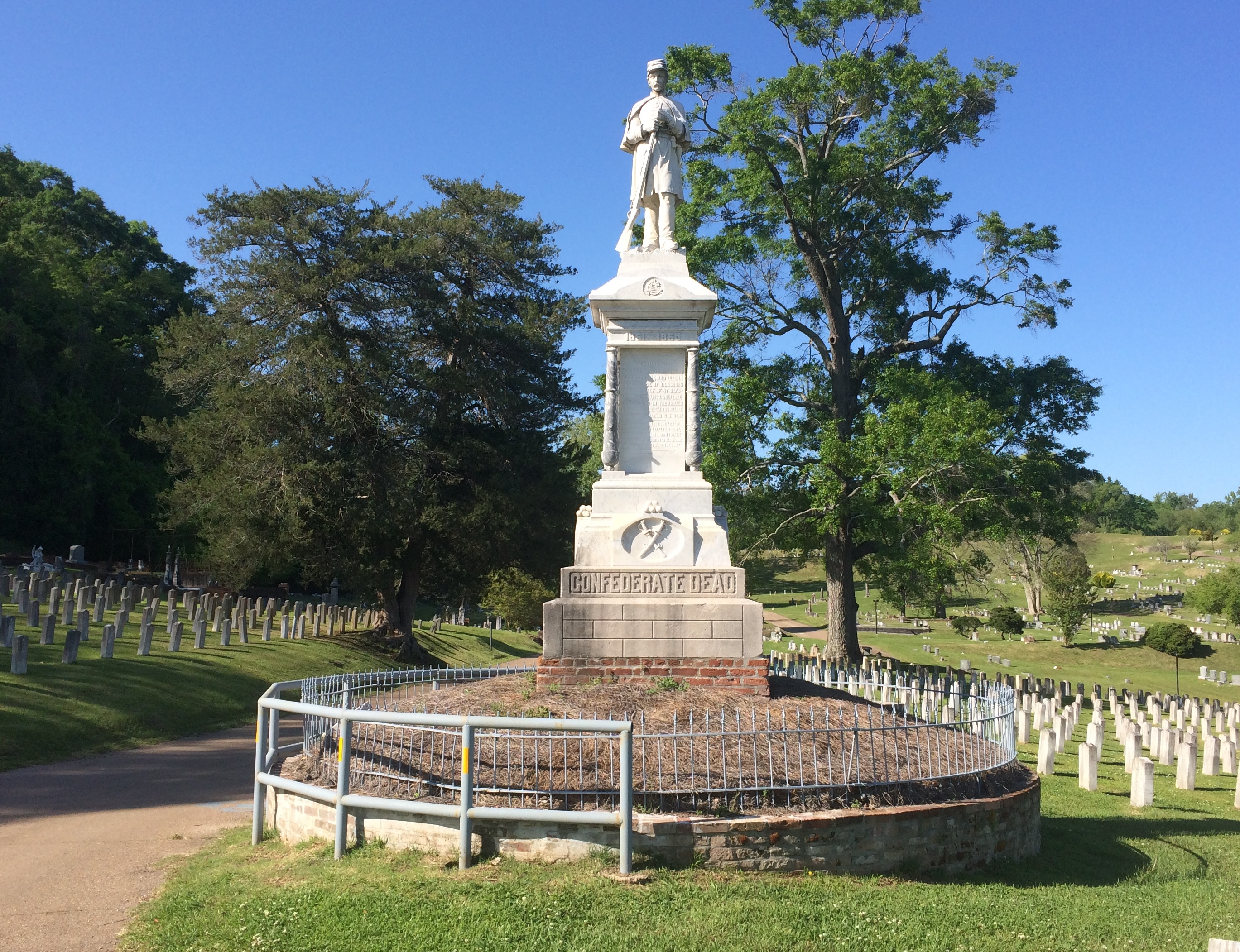
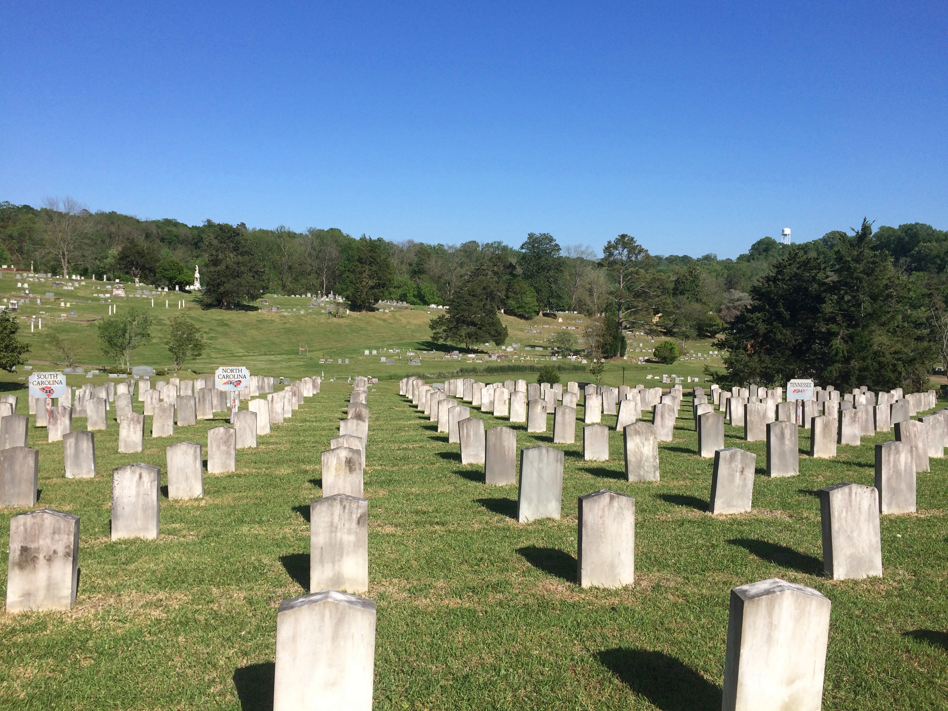
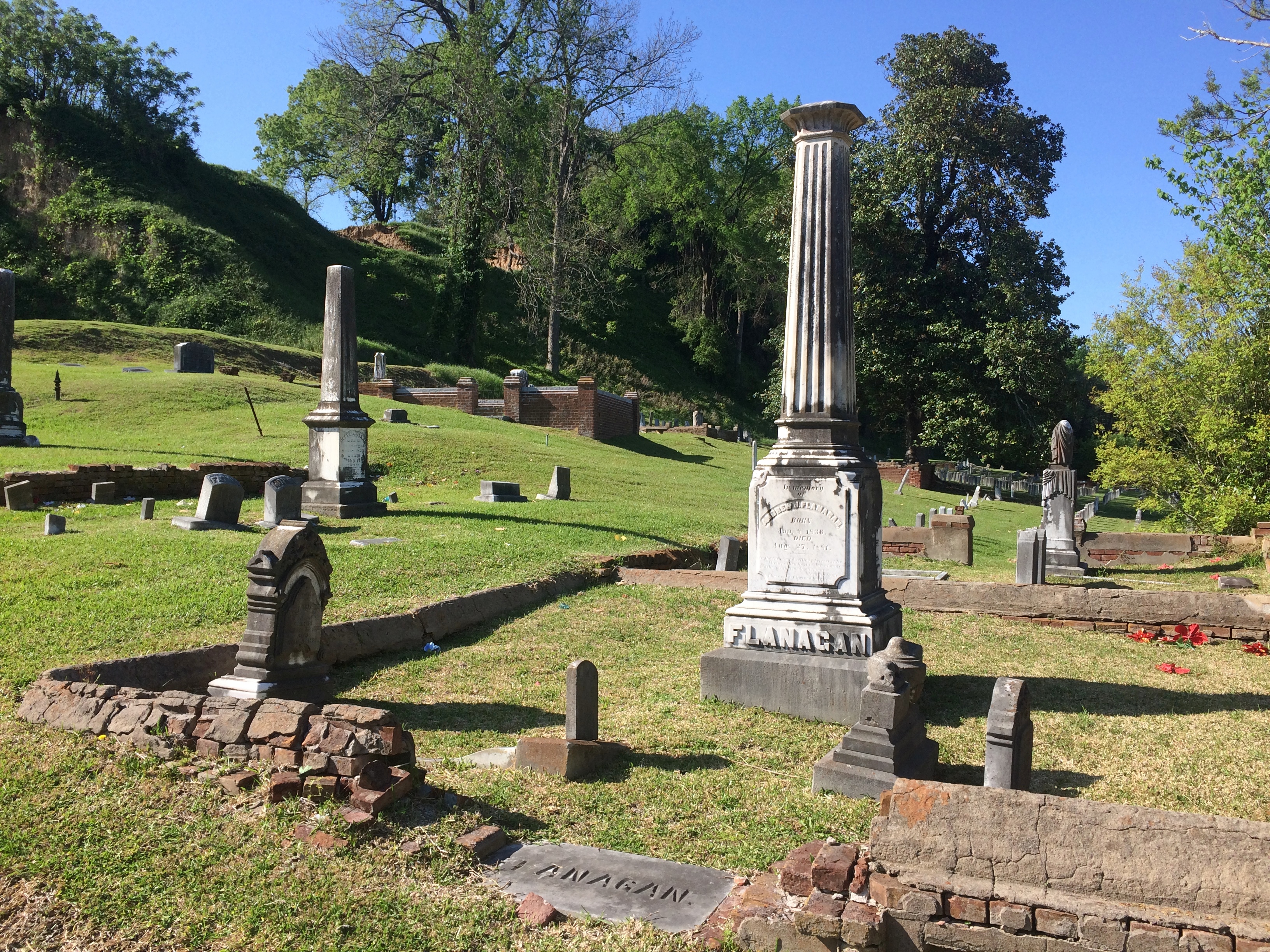
“Confederate dead from the Vicksburg campaign originally buried behind Confederate lines have now been re-interred in the Vicksburg City Cemetery (Cedar Hill Cemetery), in an area called Soldiers’ Rest,” the NPS says. “Approximately 5,000 Confederates have been re-interred there, of which 1,600 are identified.”

Cedar Hill Cemetery wasn’t hard to find.

Cedar Hill Cemetery Soldiers' Rest Cedar Hill Cemetery Soldiers' Rest

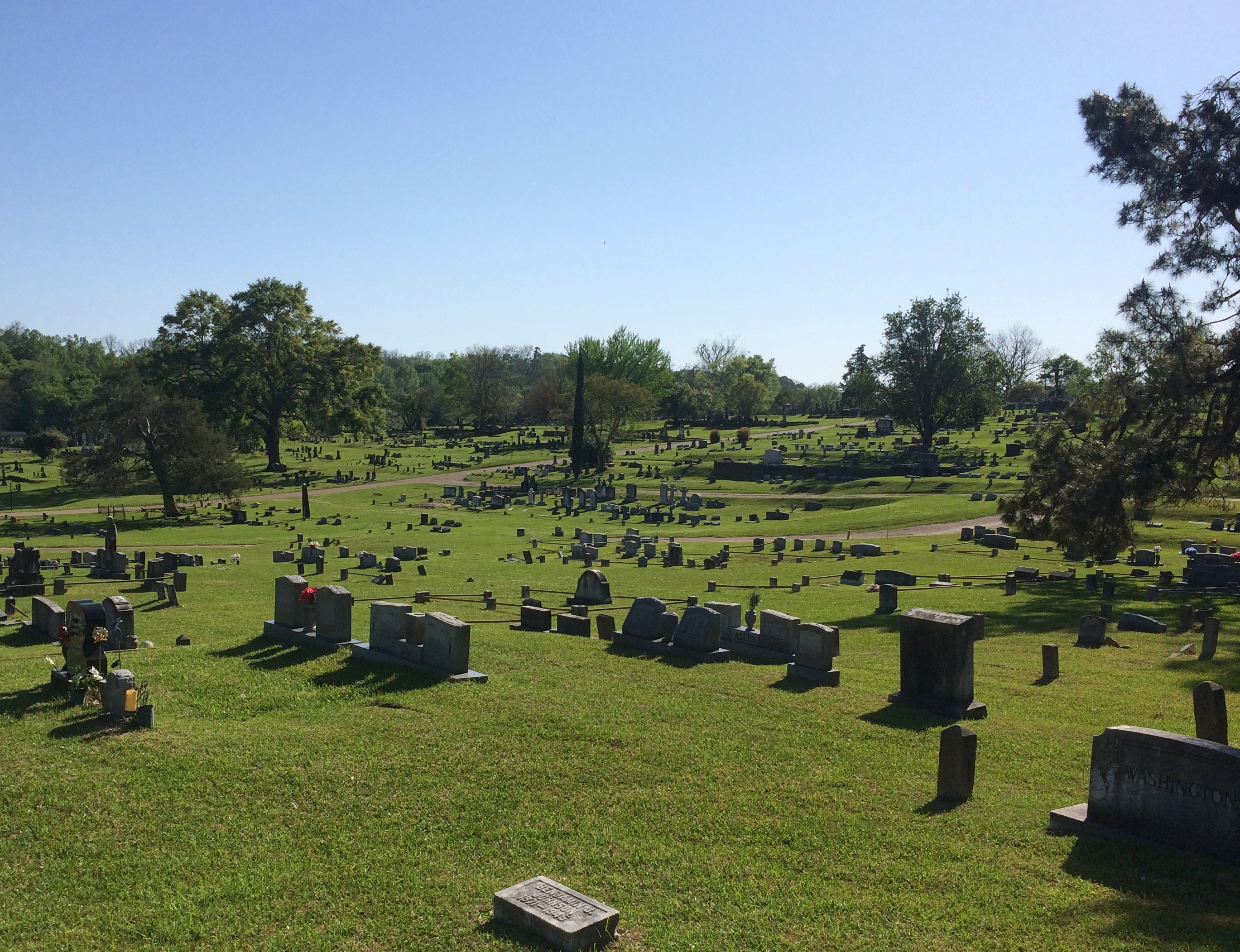
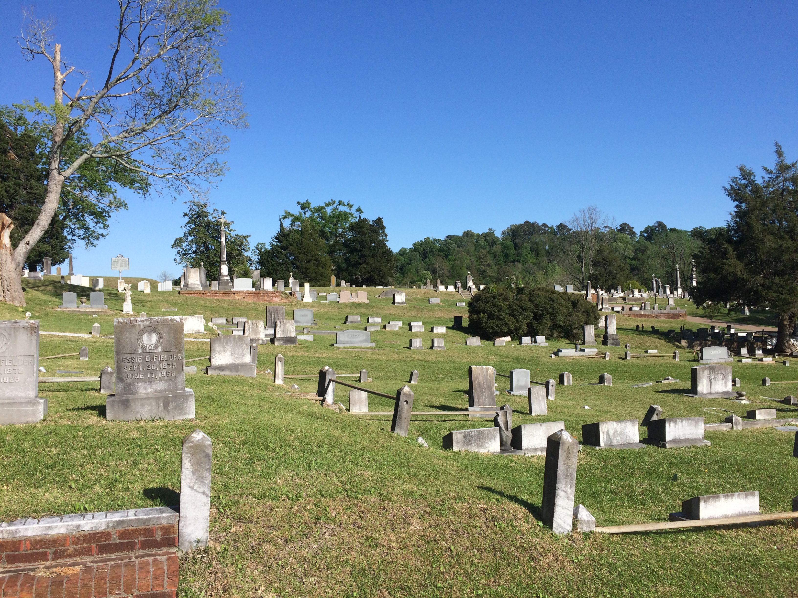
Most of the cemetery isn’t Soldiers’ Rest.

Cedar Hill Cemetery Vicksburg Cedar Hill Cemetery Vicksburg Cedar Hill Cemetery Vicksburg Cedar Hill Cemetery Vicksburg

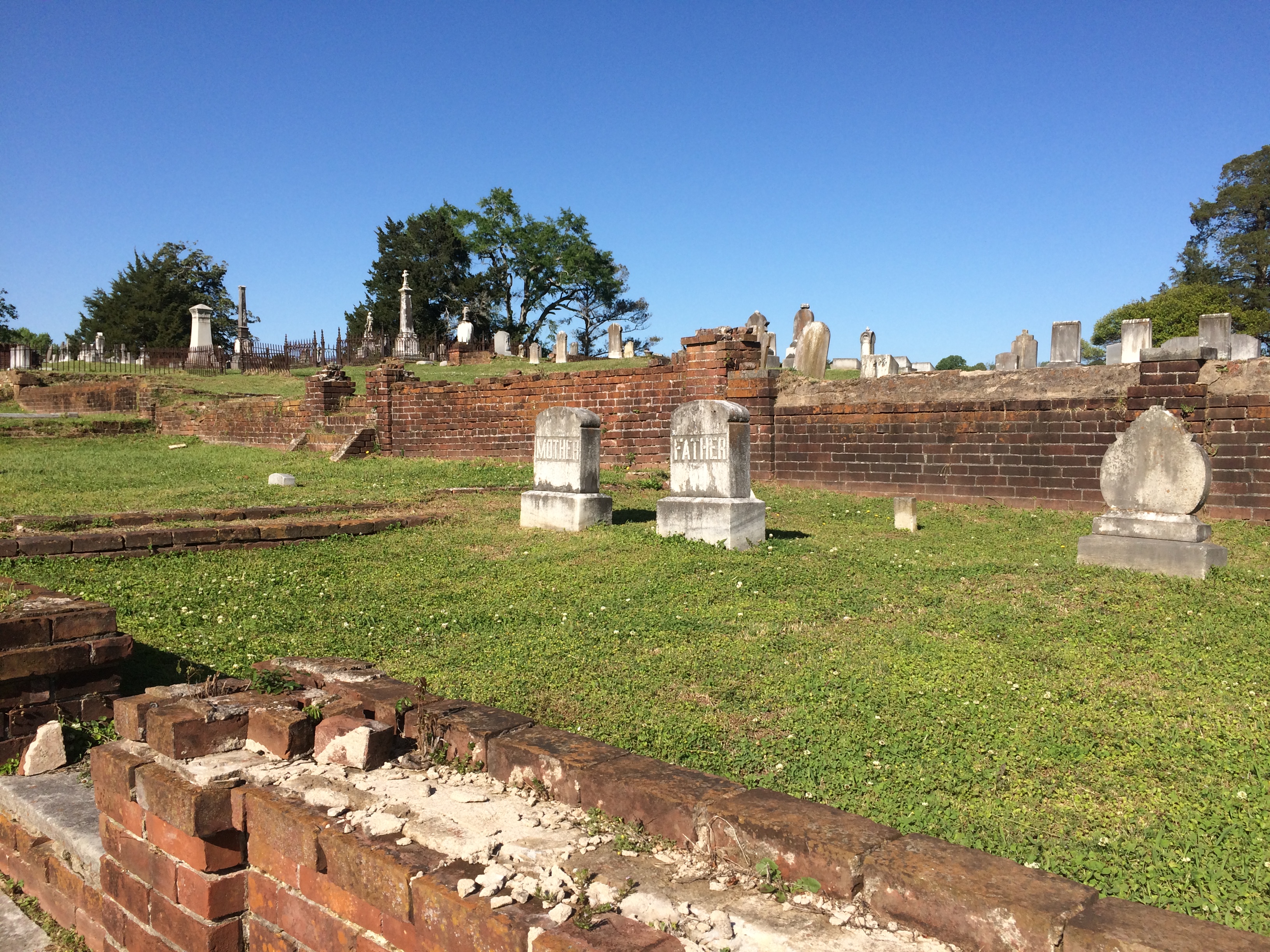
Most of the stones are modest, but there are a few larger ones.

Cedar Hill Cemetery Vicksburg Cedar Hill Cemetery Vicksburg

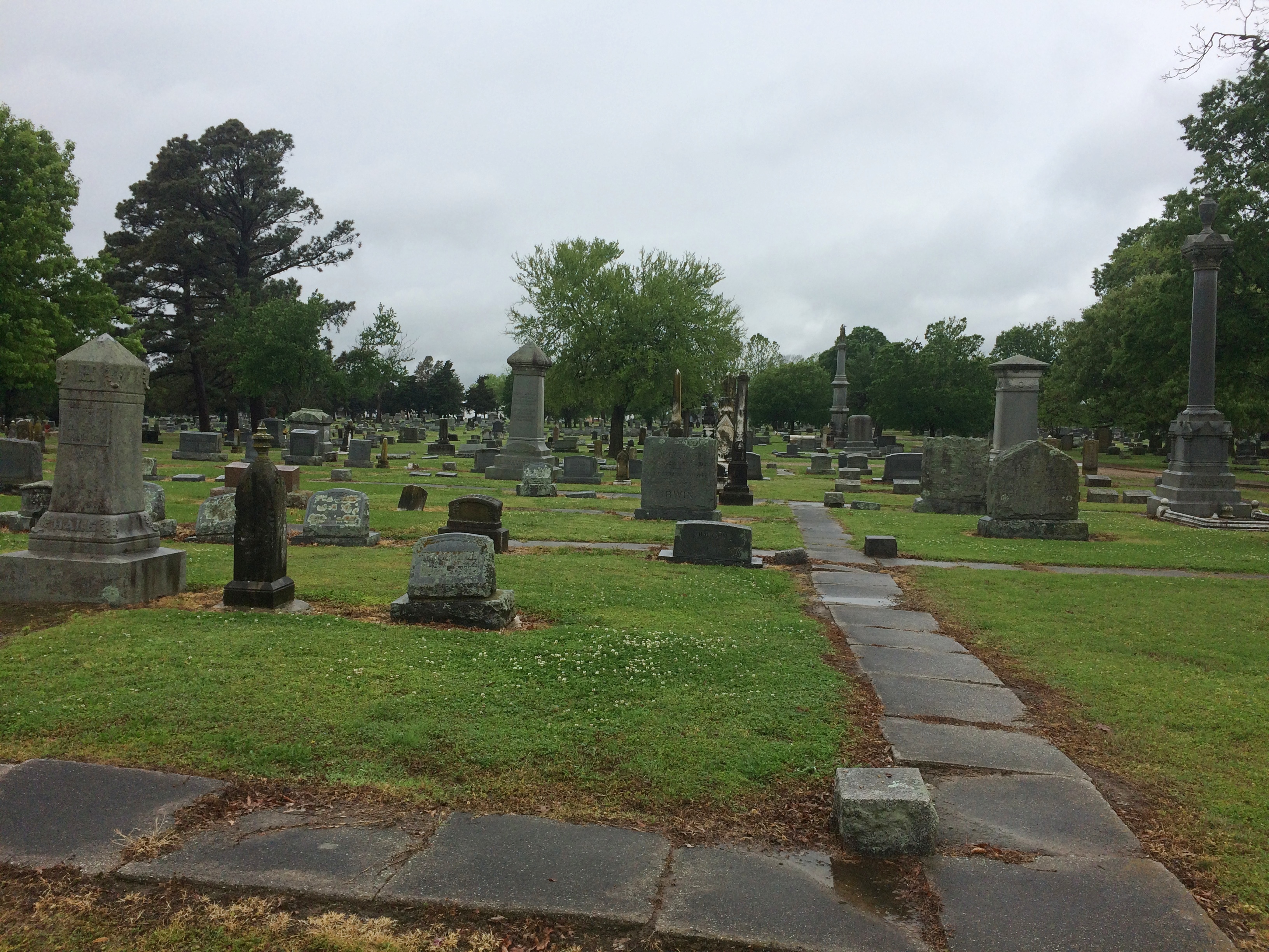
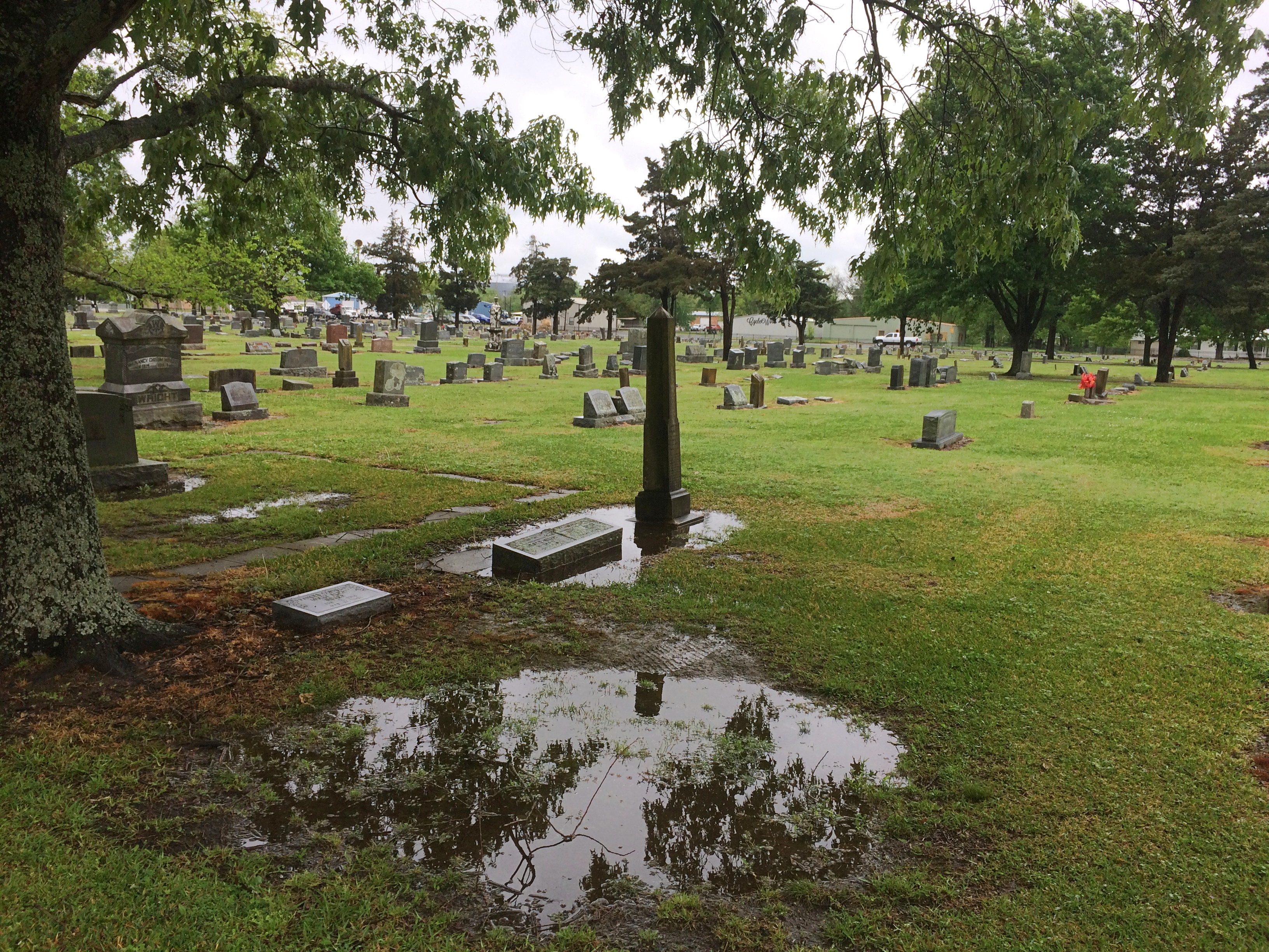
Evergreen Cemetery in Paris, Texas, was green enough, and wet with recent rain when I arrived there on April 16.

Evergreen Cemetery, Paris, Texas Evergreen Cemetery, Paris, Texas

As a veteran of the Texas Revolution, Dr. Patrick W. Birmingham (1808-1867) rates a Texas flag.
Evergreen Cemetery, Paris, Texas
Another plaque told me that Jesus in Cowboy Boots was part of a memorial at Evergreen, but maddingly it didn’t offer any direction about where such a thing would be found. So I did what we moderns do, and did a Google Image search for that term. I got an image easily.

Turned out I was practically standing next to it.

Evergreen Cemetery, Paris, Texas - Jesus in Cowboy Boots Evergreen Cemetery, Paris, Texas - Jesus in Cowboy Boots

It was a little hard to make out at first, but yes, it does look like that figure is wearing boots rather than, say, sandals. It’s not clear it’s actually a depiction of Jesus, but as Atlas Obscura points out, the name has stuck.

Fort Smith National Historic Site

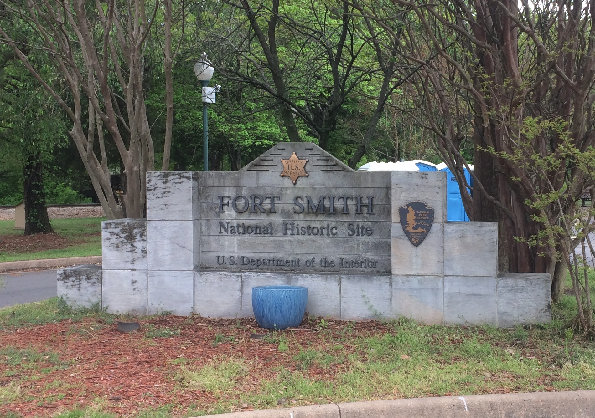
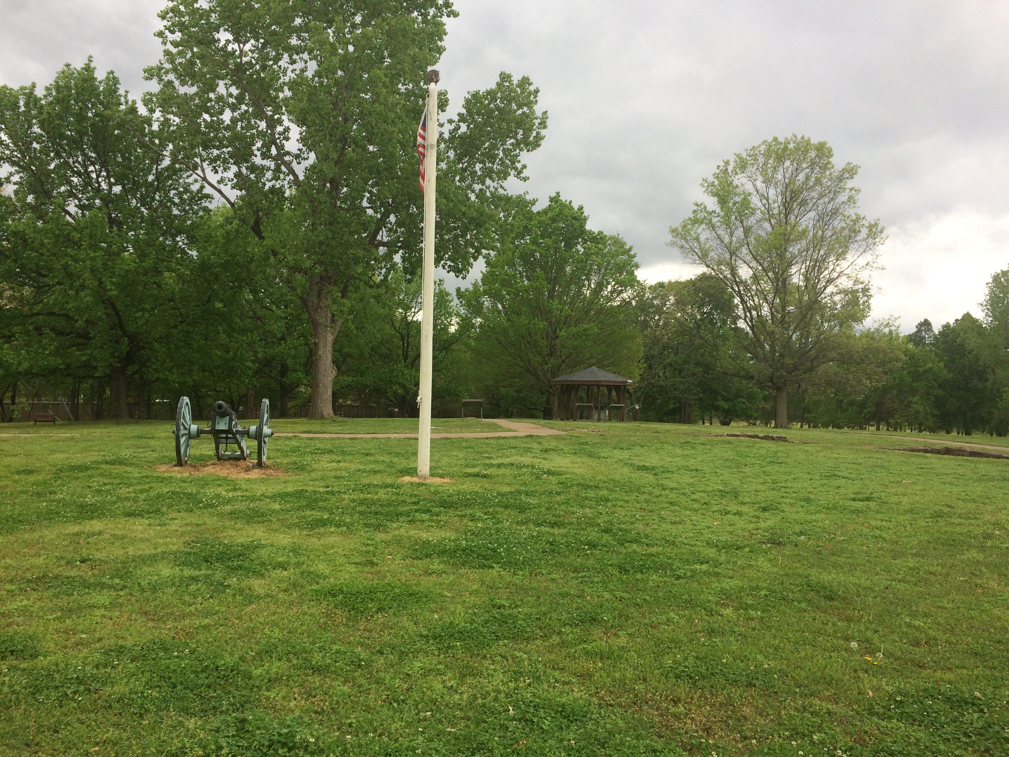
As historic sites go, Fort Smith National Historic Site is definitely worth a look, with its main building (former barracks-courthouse-jail), reconstructed gallows, site of a first fort, outline of the second fort’s former walls, parkland and walking paths, and a nice view of the Arkansas River.Fort Smith National Historic Site

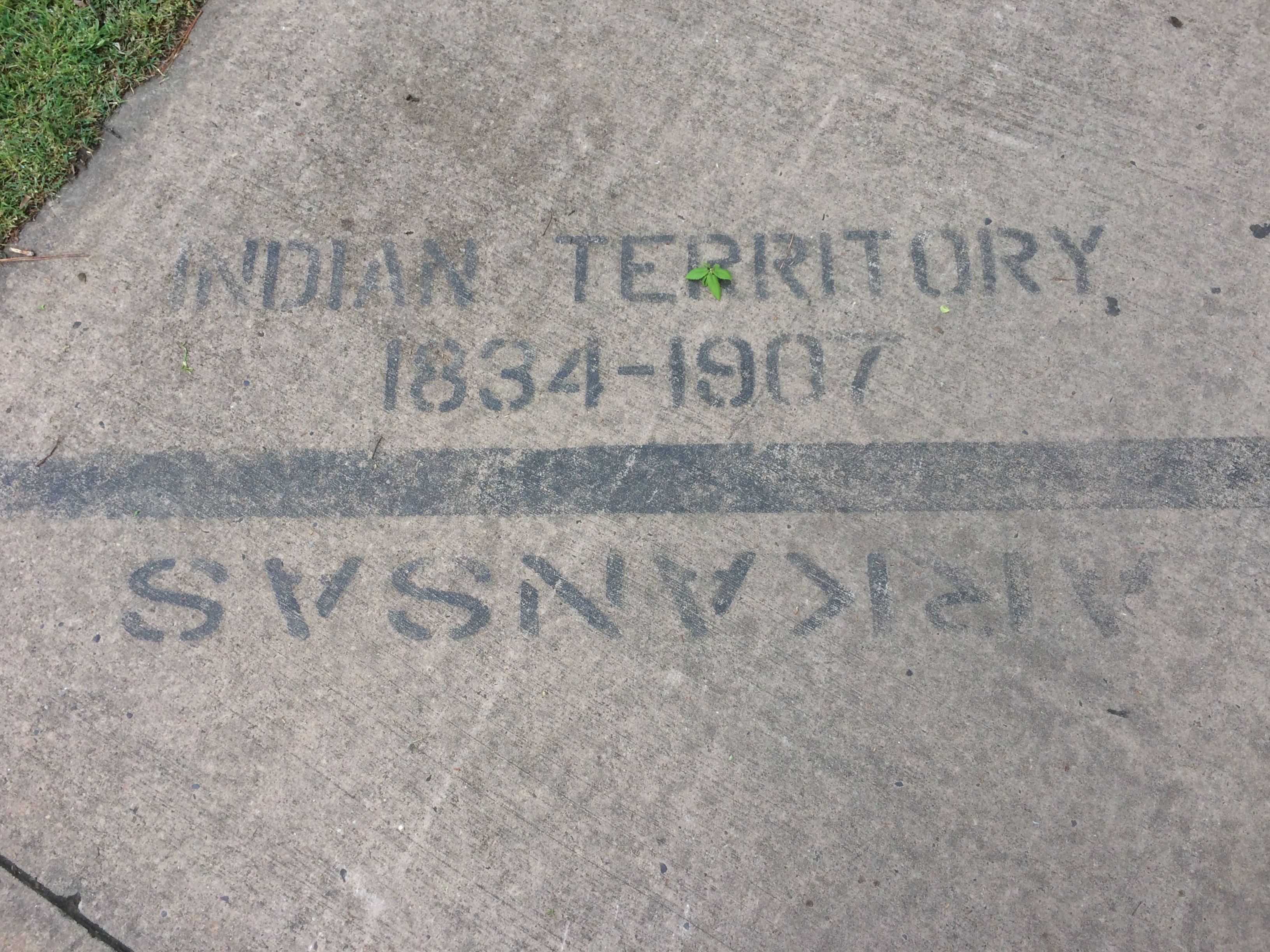
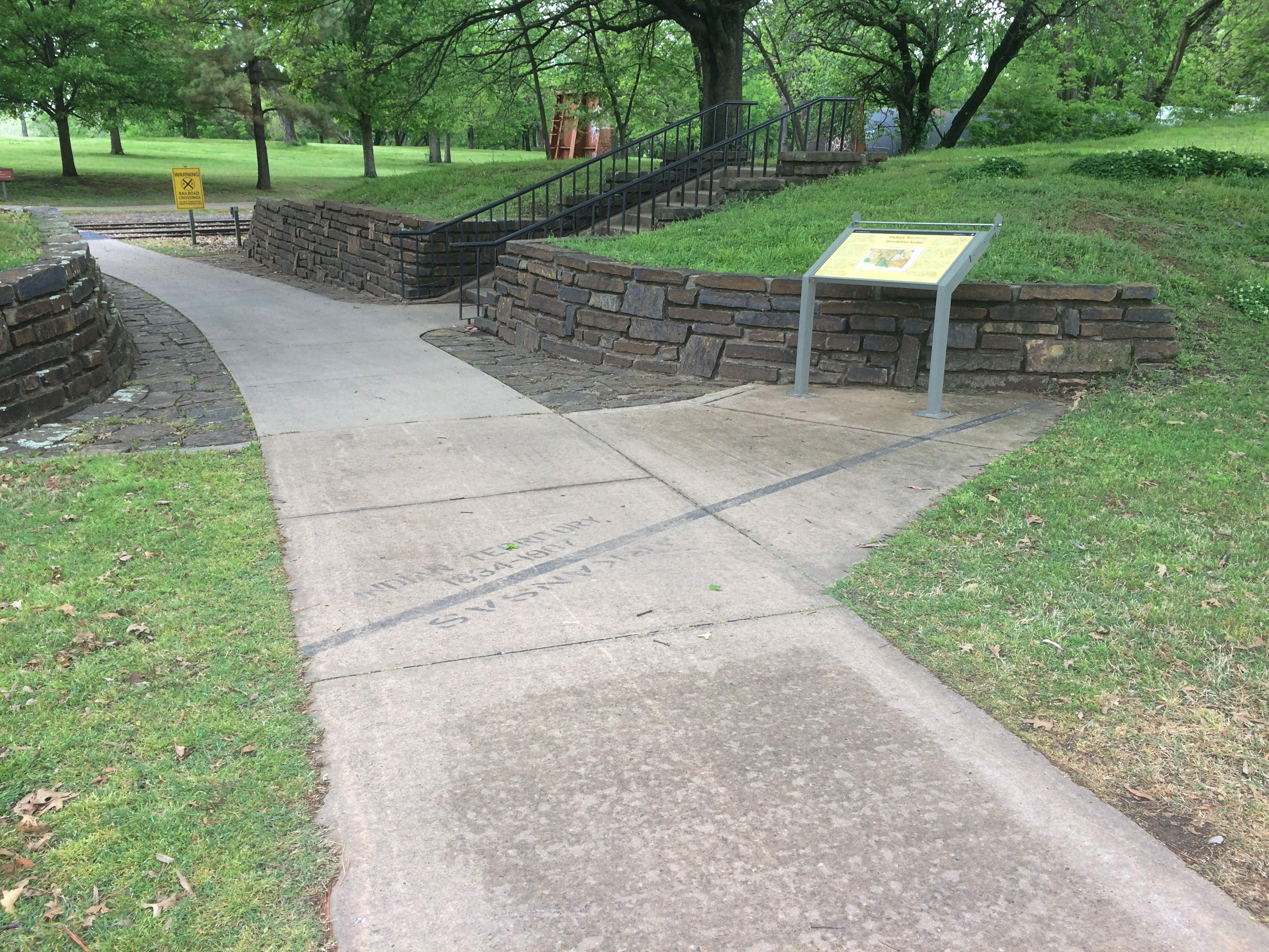
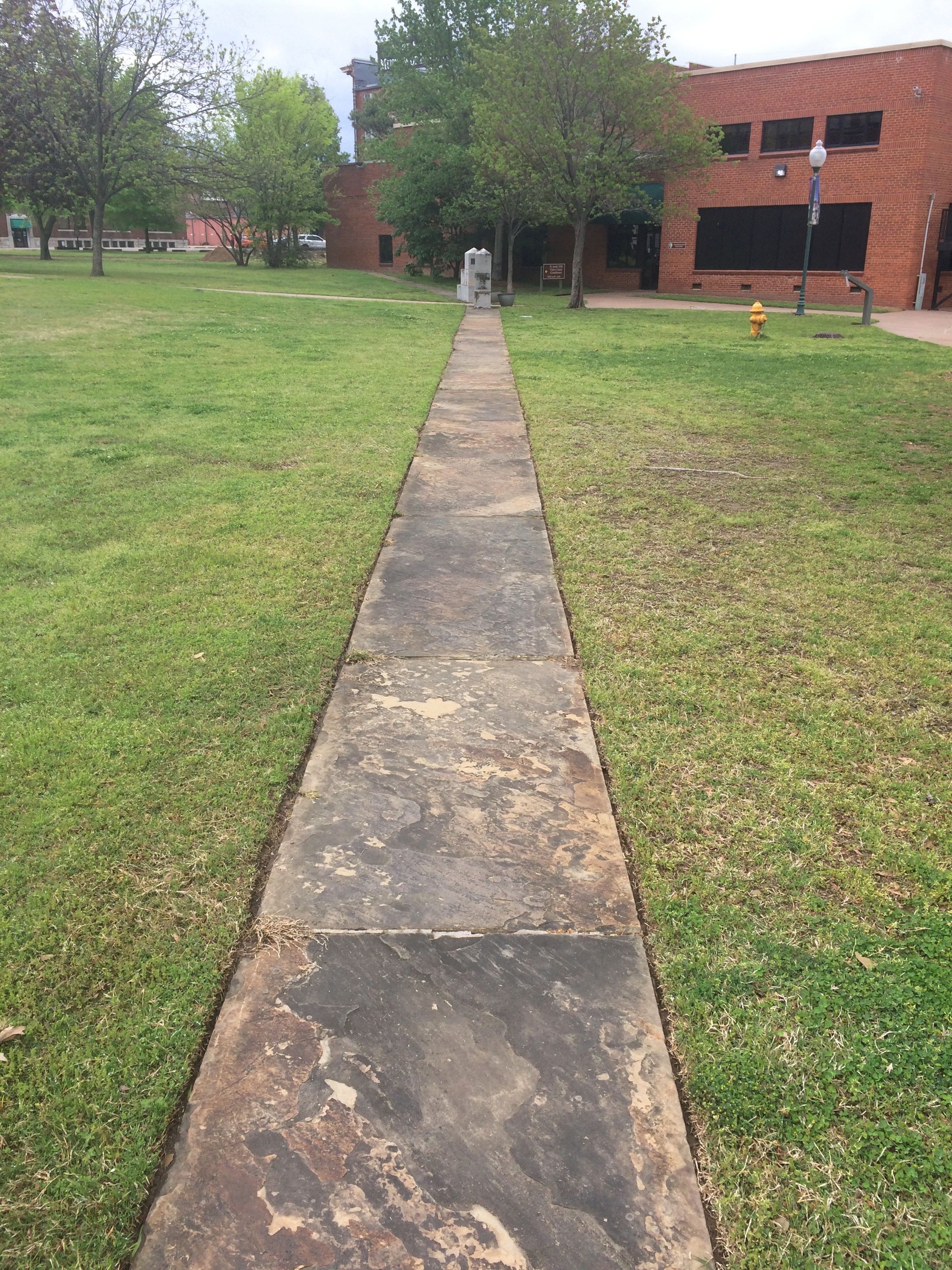
But what really caught my attention during my visit on April 17 was painted on one of the sidewalks.Fort Smith National Historic Site Fort Smith National Historic Site

“The line on the sidewalk behind you represents the 1834 boundary between Indian Territory and Arkansas,” the sign nearby simply says. “Indian Territory was defined as the unsettled land west of the Mississippi River not including states or previously organized territories.”

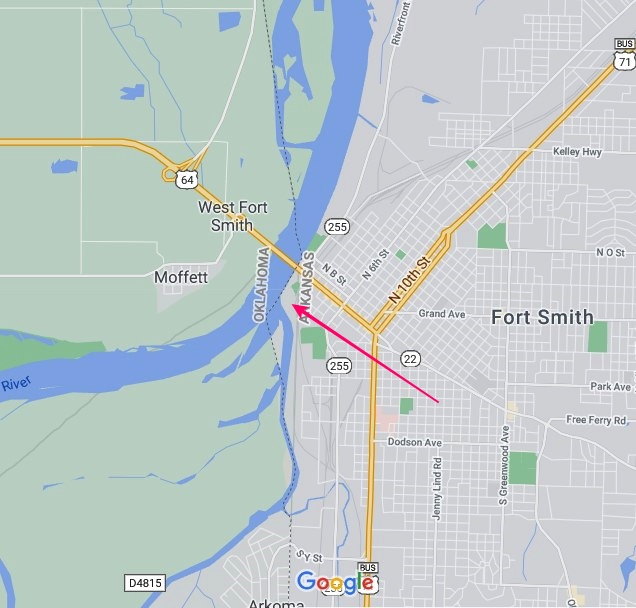
I should note that the line on the sidewalk isn’t the current border between Arkansas and Oklahoma. But it’s pretty close — at that point the line is on the eastern bank of the Arkansas River, at least according to Google Maps (not quite an infallible source).

The pink arrow points to about where the painted line is. As you can see, the modern border zags a bit to the west at that point, so that all of the land of the historic site — and the city of Fort Smith, for that matter — is in Arkansas.

At some point, that line must have been straight and a slice of land east of Arkansas-Poteau confluence was Indian Territory, if the sidewalk line is correct. This Encyclopedia of Arkansas article seems to deal with a border adjustment in the area, in the context of the Choctaw Nation-Arkansas border, which was the subject of decades of dispute.

But the article says the strip was “two miles wide and twelve miles long,” and the Fort Smith slice looks nowhere near that large, so I don’t know how the above border adjustment was made. Some Arkansas or Choctaw historian might, but I’m going to leave it at that.

The fort was originally established in 1817 to patrol the neighboring Indian Territory and named for the otherwise little-remembered Gen. Thomas Smith. The U.S. Army abandoned the first fort in 1824, but by that time a town had grown up near the fort. The Army built a second fort in 1838 that it occupied, except for a short Confederate period, until 1871.

The site of the first fort, entirely forgotten and not re-discovered until 1958.
Fort Smith National Historic Site

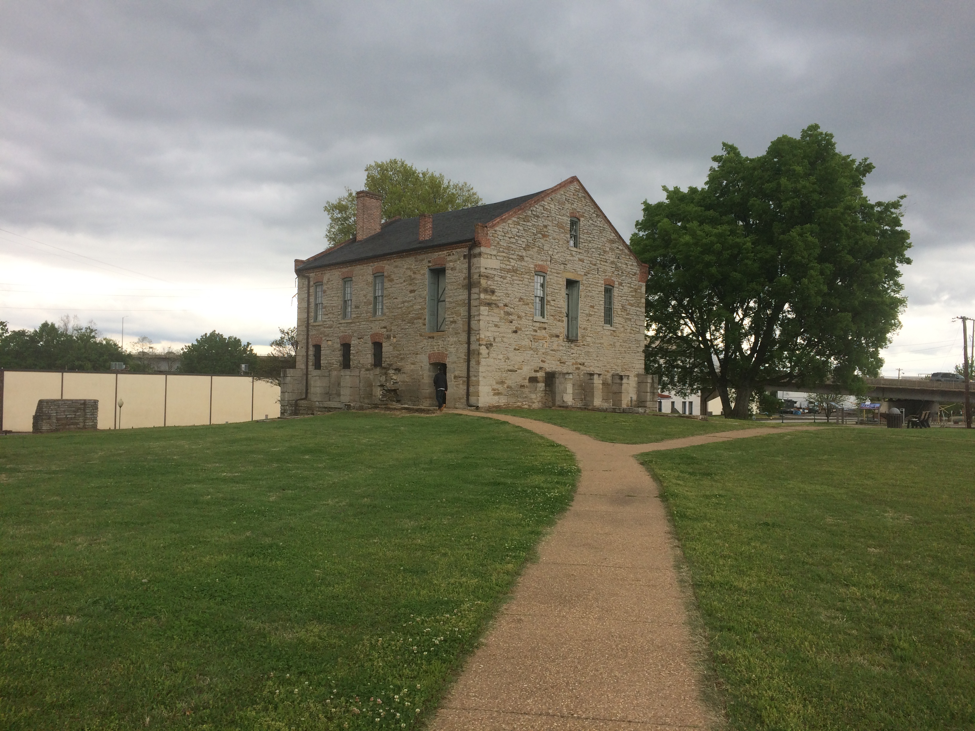
During the Army period, the handsome main building of the second fort served as a barracks. Late in the 19th century, it was a federal courthouse and jail. Now it’s a museum. Closed when I visited, unfortunately.

Also handsome: the Historic Commissary Building. It too was closed.Also handsome: the Historic Commissary Building. It too was closed.

Flat stones that mark where the second fort wall used to be. A sign pointed out that most later U.S. Army forts didn’t bother with walls.
Fort Smith National Historic Site

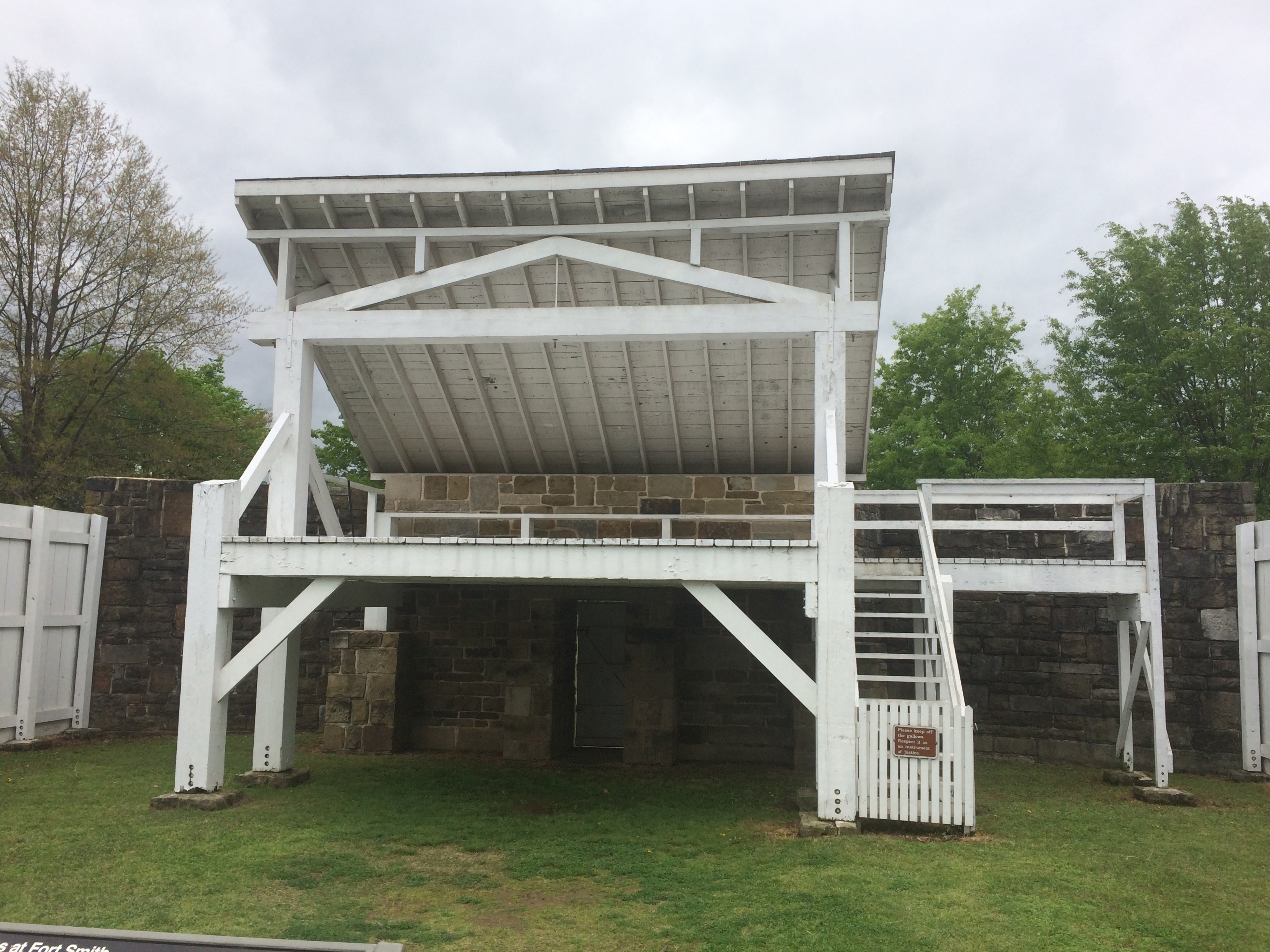
Another prime attraction — maybe the prime attraction — is the rebuilt gallows.
Fort Smith National Historic Site

“With the largest criminal jurisdiction of any federal court at the time, the Western District of Arkansas handled an extraordinary number of murder and rape cases,” a sign in front of the gallows says. “When a jury found defendants guilty in these capital cases, federal law mandated the death penalty. In Fort Smith, that meant an execution by hanging on a ‘crude and unsightly’ gallows.”

A separate sign lists everyone hanged at Fort Smith during the years (1873-96) that federal executions took place on the site, 87 men all together. The famed Judge Isaac C. Parker sentenced 160 people (156 men, four women) to death in that court, 79 of whom were eventually hanged. “George Maledon, known as the Prince of Hangmen, served as executioner at over half of the Fort Smith hangings,” the sign also noted.

Main Street, Van Buren, Arkansas

I spent the night of April 16 in Alma, Arkansas, a part of greater Fort Smith, and the next morning I decided to see Fort Smith National Historic Site, so I headed into town via U.S. 71 Business. My breakfast was in a sack in the seat next to me, so I was also looking for a place to stop and eat. Sometimes small parks are just the place, either to eat in the car away from traffic whizzing by, or to find an outdoor table.

I saw a small sign that said PARK –> , so I turned right off the main road. Soon I found myself at the intersection of 6th and Main Street, main artery of the picturesque Van Buren Historic District. I parked on Main and ate my breakfast, and naturally got out for a walk after that.Van Bureau Main Street

Van Bureau Main Street
Except for Fort Smith itself, Van Buren is the largest place in the Fort Smith MSA, with about 23,600 residents, founded on the Arkansas River well over a century and a half ago. Van Buren, Arkansas

Much more recently, the river got pretty angry.

Though a bit chilly that Saturday, the weather was comfortable enough for a walk on Main Street, mostly sporting buildings of a certain vintage.Van Buren Main Street Van Buren Main Street Van Buren Main Street

Older buildings, but with distinctly contemporary uses, including the likes of Rethreadz Boutique, The Vault 1905 Sports Grill, Sophisticuts, Corner Gifts, The Vault, and Red Hot Realty.Van Buren Main Street Van Buren Main Street Van Buren Main Street

At Main and 4th is the Crawford County Courthouse, dating from 1842 and as such, according to Wiki anyway, the oldest operating courthouse west of the Mississippi.

Crawford County Arkansas Courthouse
It wouldn’t be much of a Southern courthouse without its Confederate memorial, dating from 1899.Crawford County Arkansas Courthouse

A detail from the base. Something you don’t see too often.
Crawford County Arkansas Courthouse

Something you see even less at courthouses, North or South: a Greek goddess, namely Hebe, goddess of youth and youthful joy.Crawford County Arkansas Courthouse Hebe Crawford County Arkansas Courthouse Hebe

The original was a 1908 gold-painted iron statue, according to a sign on site. This 2003 bronze is a replacement for the original, which now resides in the Crawford County Museum.

Off to one side of the courthouse is the Albert Pike Schoolhouse, thought to be one of the oldest extant buildings in Arkansas, built ca. 1820 and later relocated to its current spot.
 Albert Pike Schoolhouse

Another memorial on the grounds. I’d never heard of Cyrus Alder before; now I have.

Cyrus Alder memorial
Finally, I spotted some interesting walls in the vicinity of the courthouse. Such as what looks to be a palimpsest ghost sign wall.
Van Buren ghost wall

In an alley across the street from the courthouse, this. It’s fairly new, as you’d think. Streetview of May 2018 has a blank wall there.Van Buren You Are Here mural Van Buren You Are Here mural

My knee-jerk reaction: izzat so? I never did find the park that I thought might be a good place for breakfast. I did much better, enjoying a bit of serendipity on the road, since I had no inkling of Van Buren, Arkansas before I found myself there.