Covenant Presbyterian Church, Bucktown

In Bucktown on Sunday I visited two churches during my late-morning walk. The first was Covenant Presbyterian Church.

Covenant Presbyterian Church, Chicago
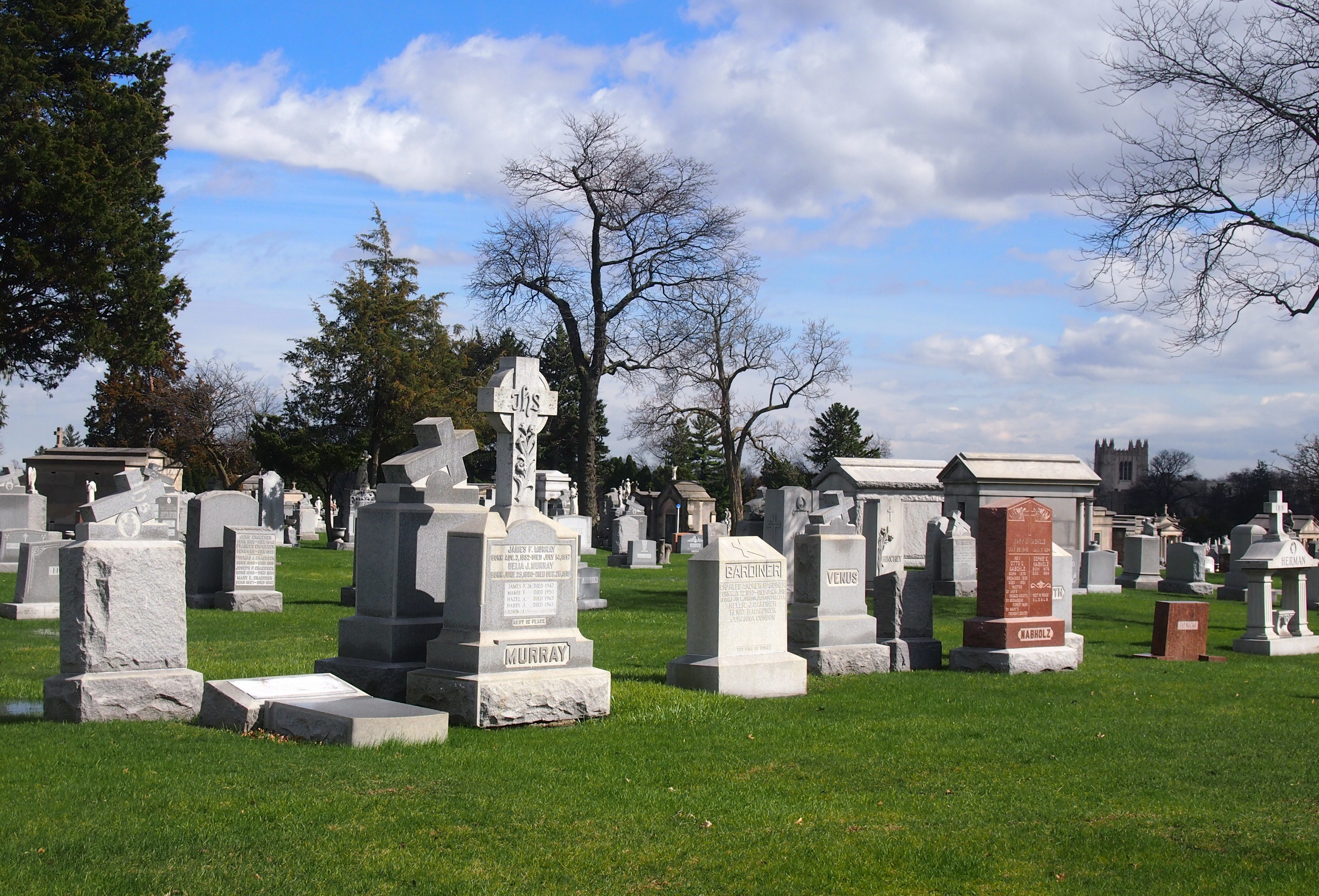
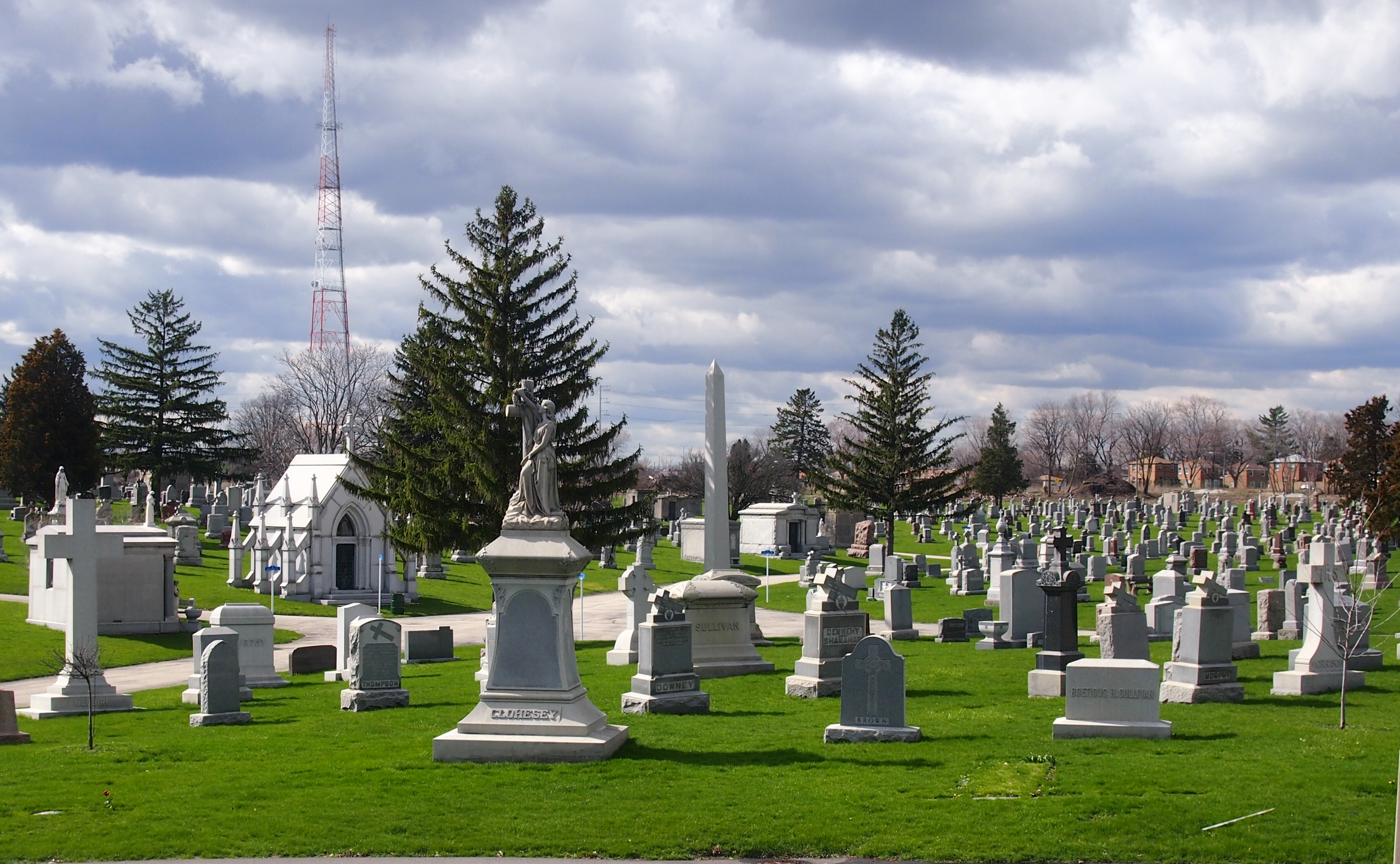
This is no ordinary large church. It has quite a back story, because the church building used to be the Cathedral of All Saints of the Polish National Catholic Church in Chicago. I’ve visited that organization’s cemetery, out near O’Hare.

So not precisely Catholic, but pretty close. I am informed that the Polish National Catholic Church is not in full communion with Rome, and hasn’t been since it was formed in the late 19th century. Neither is the separate but similar-sounding Polish Catholic Church, but that church is a member of the Old Catholic Union of Utrecht. The Polish National Catholic Church used to be communion with Utrecht, but isn’t any more — that happened only in the last 10 years or so. Rather, it’s with the Union of Scranton, which also counts the Nordic Catholic Church as a member. Need a scorecard to keep up with the schisms.

Now that that’s cleared up, the following is about what’s now Covenant Presbyterian Church, located at 2012 W. Dickens Ave. The text  is from an interesting blog, which I’ll take as solid enough information. The story starts in 1890s Polish Chicago.

“Overwhelmed by the numbers of new immigrants pouring into Bucktown, the Polish-American pastor of St. Hedwig’s brought in Fr. Anthony Kozlowski, a fiery, European-educated young Polish priest to help minister to the parishioners, few of whom spoke English. St. Hedwig’s was under the administration of the Resurrectionists, an order of priests of mostly Polish extraction. …

“Many of the younger immigrants were suspicious of the order, thinking that it was being pressured by the Irish hierarchy that otherwise ran the American church, and the Chicago church in particular.

“Details are thin, but in early 1895, Kozlowski led a revolt against the Resurrectionist pastor, Thaddeus Barzynski, and his brother Joseph Barzynski, that eventually resulted in two-thirds of the St. Hedwig’s congregation quitting the church and following Kozlowski away from governance by the Pope. [They objected to much of Vatican I, it seems.]

“The revolt went critical on February 7, 1895. Kozlowski’s hotheads broke into the St. Hedwig’s rectory, where the Barzynskis had barricaded themselves, and assaulted the priests. The police were called, and found a crowd of 3,000 immigrants milling around the church. When the officers attempted to disperse the crowd, several protesters threw powdered red pepper in their faces. Dozens were injured in the ensuing brawl, and Chicago’s (Irish) Roman Catholic archbishop shut down St. Hedwig’s for several months.

“By that time, the 1,000 or so immigrants who objected to Papal rule had bought land a few blocks away and began built their own church, All Saints Cathedral.”

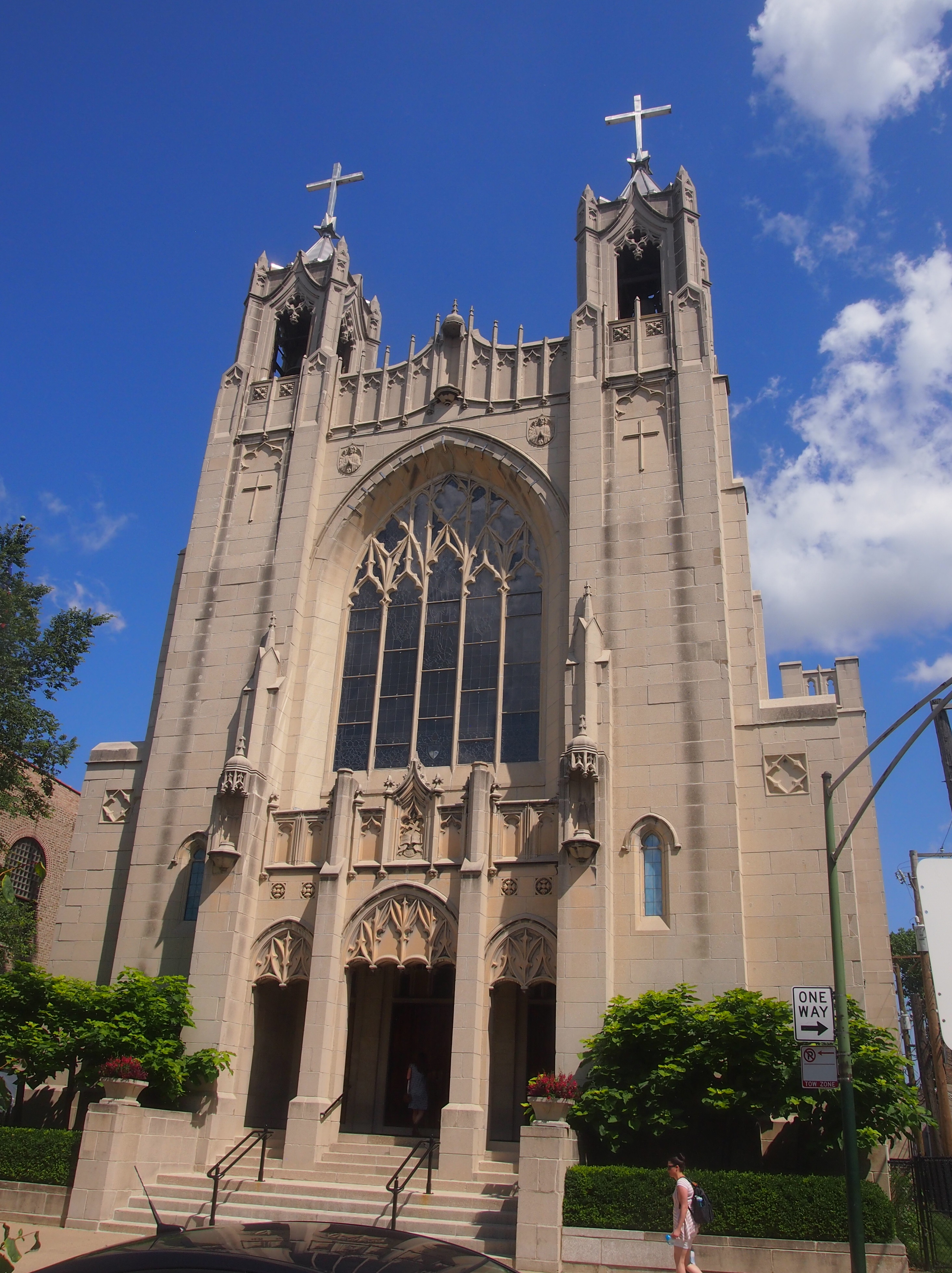
It took quite a while. Eventually, the congregation tapped John G. Steinbach to design the church. Its cornerstone was laid in 1931, and the church served the breakaway parish for the next 62 years, until the building became too expensive to maintain and was sold to Covenant Presbyterian Church.

“Covenant Presbyterian’s white imitation cement stone and neo-Gothic features distinguish it from other Polish Cathedral-style churches designed by Steinbach and his partner, Henry Worthmann,” writes Amy Korte in Chicago Architecture.

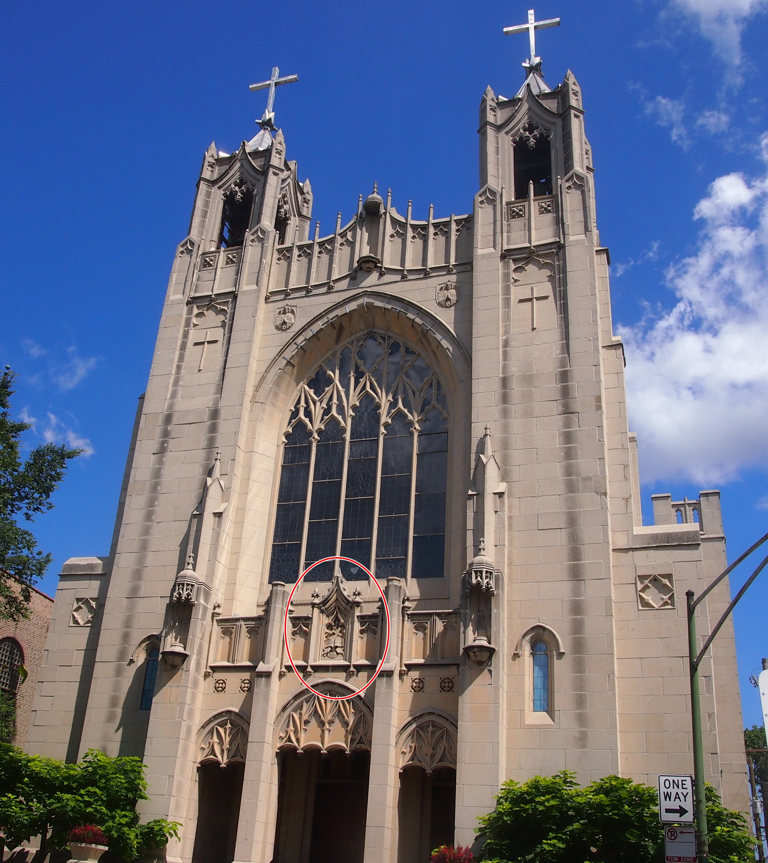
“A carving above the main entrance depicts a book, the sun, a cross, and a palm. Together, these images comprise the emblem of the Polish National Catholic Church, the denomination with which All Saints had affiliated itself. Below these symbols lies the Polish inscription ‘Prawda, Praca, Walka,’ an abbreviation of the denomination’s motto, ‘With truth, work and struggle, we will succeed.’ ”

I noticed that feature, but eager to get out of the sun, I didn’t take any pictures. The inscriptions are here.

Covenant Presbyterian Church, Bucktown

I sat at the back of the church for a short spell, taking my seat just as a pair of baptisms were taking place — two baby girls. A delightful thing to chance across, even if you don’t know the families.

Ironwood Public Art, Except For the World’s Tallest Indian

Yesterday, the Space Weather Prediction Center, a branch of NOAA, had this to say: “A watch has been issued for likely G2 (Moderate) geomagnetic storm conditions on 16 Jul and early on 17 Jul.” Thus the Aurora Borealis might thus just be visible at my latitude, according to the map. So at about 11:45 pm on July 16, I went outside and looked north. No dice.

But I’m glad the Space Weather Prediction Center is a real thing. It’s something we (humankind) should have in the 21st century.

Ironwood, pop. somewhat less than 6,000, is Michigan’s westernmost town, on the east bank of the Montreal River, which flows into Lake Superior not far away and is the border with Wisconsin. On the morning of Sunday, July 2, we stopped there to look for coffee for Yuriko.

We were unsuccessful in that, but we had a few moments to look around. Unfortunately, we didn’t see the World’s Tallest Indian. That’s what I get for not looking up what’s to see in a town before I go.

I did see the Ironwood Area Historical Society and the Historic Depot Museum. Being Sunday morning, it was closed, but it looked like a fine old depot, dating from the 1890s.
Ironwood, Michigan DepotThe Ironwood Area Historical Society says, “Its architecture is true to its Richardson Romaneque origins. The exterior is baked-red brick above and a heavy base of Lake Superior sandstone from the brownstone quarries located on the mainland and Apostle Islands near Bayfield in Northern Wisconsin. The Ironwood depot is a stunning structure with three tapering roof lines, including an unusual hipped, cross dormer and a signature finial cupola reflecting flanged rail wheels crowning the pinnacle.”

On the grounds is a statue — a carving, really, made from a tree trunk — of what appear to be three workingmen from the Ironwood past, one a miner, another a lumberman. Not sure about the third, but certainly some kind of hard 19th-century job.

Ironwood Depot Park tree carving

Ironwood Depot Park tree carvingI didn’t see any information about who carved the thing, or whether it has a title. It wasn’t created from an old tree that grew on the site, even though it looks like that. I know because if you check Google StreetView for that short stretch of S. Suffolk St., there’s no tree at all there, nor a carving. Google came by in September 2008. Guess even information behemoths can’t be everywhere on a regular basis.

At the intersection of S. Suffolk and E. McLeod Ave., a few blocks from the depot and the wooden workers, there’s a small building. According to Google’s nine-year-old information, its wall facing McLeod is long and painted white.

Not any more.
Miners Mural, Ironwood, MichiganA remarkable mural. I was thoughtless not to take a longer look at it. A mural of Ironwood miners, back when Ironwood miners dug into the earth looking for iron. A detail:
Miners Mural, Ironwood, MichiganRoadside America says: “Artists Kelly Meredith and Sue Martinsen spent over four years researching and painting the mural, which depicts over 100 real miners. It was unveiled on June 16, 2012, and proved so popular as a photo-op that in 2013 the city created a car-free zone in front of the mural. A booklet available in Ironwood provides biographies of each of the miners.”

Sixth St., Calumet, Michigan

From Houghton-Hancock and the Quincy Mine, the town of Calumet isn’t far north on the Keweenaw Peninsula. I was half-expecting something like Houghton, mainly because I didn’t do much research beforehand. None, really. But I’ve owned a postcard depicting the Calumet Theater for a long time, and I knew I wanted to see that.

So we did. It’s a fine old building. Wish it had been open for a look-see inside.

Calumet Theater, Michigan

Copper fortunes built the Calumet. A local architect named Charles K. Shand designed it. The historical marker next to it says, in part: “One of the first municipal theaters in America, the Calumet opened on March 20, 1900, ‘the greatest social event ever known in copperdom’s metropolis.’ The theater contained a magnificent stage and elegant interior decorations, including an electrified copper chandelier.”

The theater’s web site says: “The Theatre opened… with a touring Broadway production of Reginald DeKoven’s The Highwaymen. In the ensuing years, the Theatre’s marquee read like a Who’s Who of American Theatre: Madame Helena Modjeska, Lillian Russell, John Phillip Sousa, Sarah Bernhardt, Douglas Fairbanks, Sr., Lon Chaney, Sr., Jason Robards, Sr., James O’Neill, William S. Hart, Frank Morgan, Wallace and Noah Beery.

“With the decline of copper mining and the local economy, and the advent of motion pictures, stage productions became less common in the late 1920s. From the depression through the late 1950s, it was almost exclusively a movie theatre…

“The auditorium was renovated for the village’s centennial in 1975, and the exterior was restored in 1988-89. The technical and code improvements and backstage reconstruction have just been completed.” These days, the theater holds 50 to 60 events a year, including plays, movies and concerts.

The theater is on Sixth St. in Calumet. The street hasn’t evolved into a day-trippers shopping district, but it does have some other interesting buildings, dating from copper times, from the looks of them.

Calumet, MichiganCalumet, Michigan Sixth StreetCalumet, Michigan Sixth Street

The buildings of Sixth St. also sport a few ghost signs.Ghost Sign, Calumet MichiganVertin’s Department Store (since 1885, headquarters for Lee overalls, union made). The store turns out to have been located in the building pictured above, between the Sixth St. streetscape and the Michigan House Cafe & Red Jacket Brewing Co. This is an example of the kind of thing I learn from a trip after I’ve gotten home. I didn’t know what I was looking at when I stood across the street from the former Vertin’s on the afternoon of July 1. Now I do.

The Vertins were Slovenian immigrants to copper country in the 1870s, and rather than mine themselves, they enterprisingly sold goods to miners and their families. Remarkably, the store endured until the 1980s. More about them is in this article in Copper Country Explorer.

This ghost sign has advertised, through many UP summers and hard winters, for a widely available product: Pillsbury Best flour.

Calumet, Michigan Ghost Sign Pillsbury

Slute’s Saloon has been a saloon, though not under that name, and as the sign says, since 1890. Curiously enough, a descendant of the Vertins is one of the partners in the business, at least according to this 2010 article. A look inside is here.

After I got home, I learned that George Gipp was from nearby Larium, Mich. — where you can find the George Gipp Recreation Area & Ice Arena — and is buried in Calumet. Dang. That would have been something to know beforehand, but you can never really prepare for going somewhere new. Still, I’d have looked for the Gipper’s grave had I known. It isn’t everyone who can inspire motivational speeches down the decades.

Houghton & The Quincy Mine, Keweenaw

Who could look at a map of the Upper Peninsula, taking a solid gaze at the UP’s UP, namely the Keweenaw Peninsula, and not think I want to go there. Probably a lot of people would not think that. But I do.

So on July 1, unfortunately a bit late in the afternoon, we approached Keweenaw via M-26 (a part of the Lake Superior Circle Tour). Aside from a gas station in South Range, first stop was Houghton, a town with a pleasant main street — Shelden Street — that tries to capture the tourist trade, but isn’t a full-blown, Gatlinburg-class tourist trap. Yet it is an old street formerly given over to ordinary commerce, then repurposed over time to feature restaurants, gift shops, boutiques and so on.

Shelden Street isn’t the most frenetic example of that kind of street that I’ve seen — that might be in Banff Ave. in Banff in July — but it was busy enough. Red brick and red sandstone structures line the street, including the handsome Douglass House Hotel, which is an apartment building these days.

Across the street and down a block or so, tucked away in a pedestrian passage leading to parking off Shelden Street, was a wonderful mural map of the Keweenaw Peninsula. I can’t find an image of it online, but whoever did it was a first-rate map muralist. The artist managed to straddle the line between creating an actuate map with too much detail and a map illustrated by small images (like in a tourist brochure), which often doesn’t have enough detail.

Houghton is separated from the town of Hancock by Portage Lake, which is part of the canal cutting through the peninsula. The Portage Lift Bridge, with its unusual look, connects the towns. It’s the fourth bridge on the site.

“This… bridge would have double decks with the upper deck carrying four lanes of traffic while its lower deck supported rail traffic,” Keweenaw Free Guide says. “Its lift section – the largest and heaviest in the world – could be raised 32 feet to allow the passage of modern ore carriers below it. Construction on the new bridge began in 1959 and was finished by the following summer. The old steel bridge was demolished.”

We crossed the bridge — driving, though walking across would have been an excellent thing to do — and went into Hancock, whose traffic was bollixed by road construction. As we drove slowly along, however, I was able to see the campus of Finlandia University.

Founded in 1896 as Suomi College, “Finlandia is one of 26 U.S. colleges and universities affiliated with the Evangelical Lutheran Church in America, and the only private institution of higher learning in Michigan’s Upper Peninsula,” the school’s web site says. “It is the only remaining university in North America founded by Finnish immigrants.”

Note also that the web site is honest enough to depict students in the snow. The University of Hawaii, it’s not.

Just north of Hancock is the Quincy Mine. Driving by on US 41, you can’t really miss it.
Quincy Mine, MichiganThat’s only the largest of the complex’s surface structures. There are other buildings.
Quincy Mine, MichiganAs well as picturesque ruins.

Quincy Mine, MichiganQuincy Mine, MichiganQuincy Mine, MichiganEngines, probably for ore-hauling trains. Or maybe they brought coal to power the mine. Or both.
These days, the relics are part of the Keweenaw National Historical Park. Once upon a time, Quincy Mine was the most successful copper mine on the peninsula, which is saying something, since Keweenaw was the site of a copper rush beginning in the 1840s and had a lot of active mines for a while (unsurprisingly, Indians dug for copper there for centuries before that).

The National Park Service says: “1840. Douglass Houghton, state geologist of Michigan, publishes a report on the geology of the Upper Peninsula and describes the Keweenaw’s copper deposits. Despite his appeal for caution, a land rush would soon start as investors, miners and entrepreneurs attempt to acquire copper-rich real estate.

“1856. The Quincy Mining Company begins work on the profitable Pewabic lode. Quincy soon becomes an important copper mine, and earns the nickname ‘Old Reliable’ for its nearly constant profits.

“1861: Demand for brass buttons, copper canteens and munitions increases. Despite the need, copper production at many older and profitable mines in the region actually decreases as new, speculative mines open, causing labor shortages.”

Later, telephones and electric wiring spurred more demand for copper, and the Quincy Mine remained in production until the Depression, despite competition from mines in Montana and elsewhere. Quincy’s last gasp as a mining concern was World War II. Remember, copper was in such short supply then that pennies were made of steel in 1943.

Now Quincy is a tourist attraction. You can take a tour down in the mine, at least at the levels that aren’t flooded. We didn’t get there in time to do that, but we were able to look around the ruins and the small museum inside one of the intact buildings. If I come this way again, I’ll time things to see the depths of the Quincy Mine.

The Last Gasp of the Federal Works Agency

Not something you see everyday: a plaque marking a project by the Federal Works Agency. But there it was last weekend for me to see, at the Chicago subway station of the CTA Blue Line (O’Hare-Forest Park).

Federal Works Agency plaque, Chicago StationThe Federal Works Agency only lasted until 1949, but it’s a safe assumption that the subway construction project started under its aegis in the late ’40s, so it was thought fitting to use the name even in 1950. The agency had been created as a part of a major federal government reorganization in 1939, authorized by Congress and overseen by the executive branch.

To quote President Roosevelt, in his message to Congress on the Reorganization Act of 1939: “[The FWA will include] the Bureau of Public Roads, now in the Department of Agriculture; the Public Buildings Branch of the Procurement Division, now in the Treasury Department, and the Branch of Buildings Management of the National Park Service… now in the Department of the Interior; the United States Housing Authority, now in the Department of the Interior; the Federal Emergency Administration of Public Works; and the Works Progress Administration, except the functions of the National Youth Administration.”

Various additions and subtractions were made to that list until 1949, when the FWA’s remaining functions were parceled out to other agencies, as well as the newly created General Services Administration. As federal bureaucracies go, the FWA had a fruit-fly lifespan.

With a 10-year run, there couldn’t be that many FWA plaques. Certainly not as many as the GSA — nearly 70 years now — or even the WPA or the CCC, which also had short runs, but were really busy in their heydays. So maybe in the hobby of plaque-spotting the FWA is a nice find.

If there is such a hobby. Surely someone looks for plaques in a more enthusiastic or systematic way than I do. And is Blue Plaque-spotting a thing in the UK, or does this Spectator article merely refer to casually walking by them?

Flag Day, Such As It Is

It occurred to me today, before I went out on some errands and for no particular reason, that it was Flag Day. So I decided to take note driving along whether there seemed to be more American flags than usual flying in my slice of the northwestern suburbs. The answer: not that I could tell.

Adam Goodheart, writing in 2011 in the former NYT blog Disunion, wrote about the origin of the day, which falls on the anniversary of the adoption of the flag by the Second Continental Congress: “It was destined, eventually, to become the runty stepchild among American national holidays. One hundred and fifty years after its original creation, no one ever hosts a Flag Day cookout or sends a Flag Day greeting card. Nobody gets to take a long weekend from the office. Even the most customer-hungry car dealers don’t advertise Flag Day sales.

“…exactly 150 years ago after it was first celebrated [in Hartford, Conn.], almost no one seems to have noticed the anniversary. Google searches for ‘sesquicentennial of Flag Day’ and similar phrases yield exactly zero hits.”

The day might not have endured as much more than text on calendars, but reverence for the flag has very much endured. I didn’t see no U.S. flags during my drive today, just flags where they usually are, which is a lot of places.

“Before 1861, the American flag had served mostly as a military ensign or a convenient marking of American territory, flown from forts, embassies and ships, and displayed on special occasions like the Fourth of July,” wrote Goodheart. “But after the Southern states began to secede — and the Union garrison at Fort Sumter took its stand as a lone bastion of resistance — the Stars and Stripes began to fly, as it still does today, from houses, from storefronts, from churches; above village greens and college quadrangles.”

(And at Ft. Sumter to this day.)

Ft Sumter 2017“The adulation of the national banner hardly diminished during the years that followed… As for Flag Day, it seems to have remained a largely local observance during the Civil War and Reconstruction years, despite occasional efforts in Congress… to have it declared a national holiday. Official federal recognition came only in 1916.

“The holiday’s popularity seems to have crested in the period of the two world wars and the early cold war. Then, for the 1960s generation, it became more or less the epitome of square: a vaguely embarrassing grade-school memory to be filed alongside duck-and-cover drills and mandatory prayers.

“Flag Day never regained much of its former cachet in the decades that followed. And yet, holiday or no holiday, this June 14 — as on all other days of the year — the American flag remains as ubiquitous and as venerated as the most pious citizen of Hartford could have wished in 1861.”

Bellefontaine Cemetery and Arboretum, St. Louis

You might call Bellefontaine Cemetery and Arboretum in St. Louis a Mount Auburn-class cemetery, since it dates from the 19th century as a solid example of the rural cemetery movement. Mount Auburn in Boston is the first of the class, dating from 1831. Others are Green-Wood in Brooklyn, Laurel Hill in Philadelphia and Woodland in Dayton, all of which are now surrounded by their respective cities, as Bellefontaine is.

It is a good class. More people ought to visit these places. But as usual, when we were at Bellefontaine on May 26, the only other living souls around were groundskeepers.

The good people of St. Louis got around to founding Bellefontaine in 1849, well outside the existing city, spurred in part by a severe cholera epidemic that year. The further away those bodies were, the better, since the dead helped create the miasma that vexed the living with the likes of cholera. Sure, that wasn’t true, but it must have made intuitive sense in the days before germ theory, and it gave us a roundly beautiful public space.

Bellefontaine Cemetery and Arboretum

Bellefontaine Cemetery and ArboretumBellefontaine Cemetery and ArboretumBellefontaine Cemetery and ArboretumBellefontaine’s web site has a well-written short history of the place, including its founding, the splashy dedication event in 1850, the work of long-time grounds superintendent Almerin Hotchkiss (1816-1903; he still resides at Bellefontaine), and a paragraph about post-Victorian cemetery aesthetics, something I didn’t realize.

“Nearly 50 years after its founding, Bellefontaine was inspired to modernize. Spring Grove Cemetery in Cincinnati and the burgeoning landscape-lawn cemetery design movement ushered in a new aesthetic that replaced ornate and elaborate Victorian fences and hedges with open, cross-lawn views.

“Bellefontaine followed suit by removing hedges, fences, elaborate plantings, and stone copings. Open, cross-lawn views became the more common aesthetic of the cemetery, bringing Bellefontaine in line with modern ideas about cemetery design. The changes also made Bellefontaine appear more open and park-like, creating a more integrated landscape composition than the earlier delineation of individual lots with distinctly defined spaces.”

The cemetery sports a fair amount of funerary art, such as the Hilts memorial, whose angel has spent many years out in the elements.
Bellefontaine Cemetery and ArboretumThis memorial says it remembers the “nobelest, dearest, gentlest and most unselfish of women, Ottilie Stephan, wife of Henry Hiemenz Jr.” (1858-1897). Well, let’s hope so.
Bellefontaine Cemetery and ArboretumBellefontaine is also known for its mausoleums. Such as one for Ellis Wainwright and family.
Bellefontaine Cemetery and Arboretum, Ellis Wainwright“In 1891, St. Louis millionaire and brewer Ellis Wainwright commissioned architect Louis Sullivan to design a tomb for his wife who had died suddenly of peritonitis,” the cemetery tells us. “Sullivan had recently completed the Wainwright Building in St. Louis, which is considered to be the beginning of modern skyscraper design. The mausoleum is a domed cube with simple carved decorations in Sullivan’s signature stylized plant patterns. The mausoleum’s double doors are bronze grills framed by delicate stone carvings. Sullivan’s draftsman for the project was Frank Lloyd Wright.”

The Tate mausoleum is a little different.
Bellefontaine Cemetery and Arboretum, Tate tomb“This Egyptian Revival mausoleum, designed by Eames and Young, was built in 1907 by Frank N. Tate, who at the time controlled most of the theater property in St. Louis. He also owned theaters in Chicago and Buffalo, New York…. The mausoleum has an entry flanked by columns with palm capitals. An Egyptian winged disc is flanked by serpents above the entry, and a pair of granite sphinxes guard the front.”

The Old Gasconade River Bridge

On I-44 in south central Missouri, there’s a point at which you cross the Gasconade River, which rises in the Ozarks and ultimately flows to the Missouri River. It hardly seems like a bridge, so effortless is the crossing.

Transportation disaster enthusiasts, or maybe just train wreck buffs, know the Gasconade River as the site of the Gasconade Bridge Train Disaster of 1855. A train from St. Louis bound for Jefferson City broke the railroad bridge it was traveling across, precipitating the engine and some of the cars into the river, killing 31 and seriously injuring many others at a time when the state of medical science meant that you were pretty much on your own when it came to recovery.

The accident was nowhere near where I-44 crosses the river, but rather near the town of Gasconade in Gasconade County, between St. Louis and Jeff City. Hope there’s some kind of memorial to the event around there, but I can’t find any evidence of one.

A few years ago, Ramona Lehman, co-owner of the Munger Moss Motel, told me about the old bridge across the Gasconade, just south of the modern I-44 bridge, which is only about 10 miles from the motel. She even sells postcards depicting the bridge at the motel front desk, proceeds of which go toward preserving the bridge. I’ve bought a few over the years.

The old bridge dates from the 1920s, and carried U.S. 66 traffic across the river for many years. After that highway became nostalgia fodder, the bridge continued to carry local traffic for many more years.

In late 2014, the Missouri Department of Transportation closed the old bridge as unsafe. What with the new bridge and all, the department had probably opted for deferred maintenance on the old one for a long time. Get off the Interstate west of the old bridge, and take the access road — Historic 66, that is — and pretty soon you’ll find yourself at the inaccessible bridge, as we did late on the morning of May 26.

The Gasconade River Bridge, Route 66The Gasconade River Bridge, Route 66Not especially impressive from that vantage. The best way to look at the old bridge was from underneath. A patch of land near the river and under the bridge was surprisingly accessible.

The Gasconade River Bridge, Route 66

The Gasconade River Bridge, Route 66I was motivated to see the structure as more than a passing blur out of the corner of my eye. The next time I come this way, it might be gone. The good people who live near it want the bridge preserved, but it isn’t clear that’s going to happen. As usual, it comes down to money.

MoDOT recently issued a press release that included the following: “The majority of public comments stemming from a Dec. 14, 2016, public meeting held in Lebanon supported constructing a new bridge near I-44 and leaving the current facility, located on historic Route 66, intact. However, MoDOT has indicated all along that liability issues and limited funds would require the department to remove the bridge unless an outside entity stepped forward to take ownership of and maintain the bridge.

“The current bridge will remain in place as the agency works through the requirements of Section 106 of the National Historic Preservation Act. The act requires federal agencies and the recipients of federal funds, such as MoDOT, to consider the effects of projects on properties eligible for listing on the National Register of Historic Places, such as the Gasconade River Bridge.”

Thus the fate of the bridge is uncertain. That meant seeing the bridge was a carpe diem situation, so I did.

The USS Batfish

A park in Muskogee, Okla., might seem an odd place to find a submarine, but that’s where the USS Batfish makes its home as a museum ship.

USS Batfish

Note the walkway leading to the top of the vessel. That’s the access point for visitors, as Lilly and I were on the afternoon of May 13.
USS BatfishNote also the water around the hull of the Batfish. I suspect that was because of a rainy spring, not a permanent feature. Soon we stood on top of the Batfish. I’d never stood on a submarine before. The fencing was clearly added for the safety of tourists. I’ll bet that during active service, either you maintained your footing or you didn’t.
USS BatfishI walked onto the sub thinking that was it, a look at the outside. Then we noted that both hatches, one forward, the other aft, were open. You can go inside.

The interior is well maintained, well lighted, and pretty much like crawling around in a cave made of steel. On display were such features as glowing torpedo tubes.
USS Batfish - torpedo tubesTo make your way through the vessel, you pass through a series of hatches like this. I assume they’re watertight. Submarines clearly aren’t meant for fat men.
USS BatfishI didn’t feel claustrophobic, exactly, just boxed in. It’s difficult to imagine the fortitude necessary to spend months at a time in such a steel box, with sudden drowning all too real a possibility.

Plenty of narrow corridors.
USS BatfishAnd limited comforts.
USS BatfishUSS BatfishI understand that the food was generally better on subs than the ordinary run of ships, as one way to compensate for other discomforts. I hope that was true.

A forest of pipes.
USS BatfishAnd controls. Many, many controls and dials.
USS BatfishUSS BatfishUSS BatfishAs a warship, the Batfish had a good run, completing seven war patrols from late 1943 to the end of the war. She clearly took the cinematic Patton at his word, making some other poor dumb bastards die for their country. Most notably by sinking three Japanese subs in a 76-hour period in February 1945.

After the war, the vessel hung on until 1969, when it was struck from the Naval Vessel Registry. Apparently Oklahoma submarine vets, aided by state politicos, managed to obtain it for display from the Navy in the early ’70s, though the task of getting to its current site in Muskogee, near the Arkansas River, was a long and tedious process, as described here.

There’s also a small museum in a building near the submarine, and not far from the sub, a poignant display with plaques honoring each U.S. submarine, WWII and other eras, that didn’t return. On eternal patrol, as the submariners put it.

Mount Carmel Cemetery, Hillside

Demographic note: a lot more people reside in Mount Carmel Cemetery in west suburban Hillside, Ill., than in the village itself. The cemetery has about 226,000 permanent residents, while the village has only about 8,100 (living) people. But the advantage goes to the living, of course. For instance, they can vote in Cook County elections; most of the dead people can’t.

I’ve known about Mount Carmel for years, but only got around to visiting last week, on a cool and partly cloudy afternoon. The cemetery is thick with upright stones —

Mount Carmel Cemetery, Hillside ILMount Carmel Cemetery, Hillside IL… funerary art —

Mount Carmel Cemetery, Hillside ILMount Carmel Cemetery, Hillside… and mausoleums. In fact, there are a lot of family mausoleums there, about 400, including these three.
Mount Carmel Cemetery, Hillside ILAt Mount Carmel, one learns that the Lord is a Cubs fan.
Mount Carmel Cemetery, Hillside ILOn a hillock in the middle of the cemetery is the Bishops’ Chapel, or Bishops’ Mausoleum, but in full the Mausoleum and Chapel of the Archbishops of Chicago, complete with Gabriel blowing his horn.
Mount Carmel Cemetery, Hillside IL bishops' mausoleum and chapelInside are the remains of seven bishops, archbishops and auxiliary bishops of Chicago, mostly recently Joseph Cardinal Bernardin, who was entombed in 1996. I remember in the fall of ’96 seeing his funeral procession cross the Michigan Ave. Bridge from an office window in 35 E. Wacker, where I worked. Presumably they were headed for Mount Carmel.

The book Mount Carmel and Queen of Heaven Cemeteries by Jenny Floro-Khalaf and Cynthia Savaglio gives quite a lot of detail about the Bishops’ Mausoleum, which was completed in 1912. The cemetery itself was established with the new-born century in 1901, long before the Eisenhower Expressway ran to its north, and probably when Roosevelt Road to the south — not yet called that, but 12th St. in the city at least — was very rudimentary indeed.

“[The chapel] was the brainchild of Chicago’s second archbishop, James Quigley, who oversaw its construction,” Floro-Khalaf and Savaglio write. “He engaged a local architect, William J. Brinkmann, who came up with the simple, Romanesque style that embodies the building’s outline. However, in keeping with the aesthetic tastes of his predecessor, Patrick Feehan, Quigley engaged one of the most famous architects of the day, Aristide Leonori, who designed the building’s breathtaking interior… Leonari executed a design reminiscent of Rome in marble and mosaic.”

A locked door was as close as I got to the breathtaking interior, for which I blame wankers who would do harm to it. But over the door, you’re reminded that Quigley built the place.

Many Italian names dot the cemtery’s landscape. Benedetto, Bernardo, DeVito, DiGiovanni, Felicetti, Gazzolo, Genna, Mazzitelli, Salerno, Serritello, Truppa, Perazzo, Porcaro, Porzio, and Viviano were among those I saw, though there was a fair number of Irish names and others mixed in.

One name I didn’t see was Capone. If I’d done any research beforehand, I would have known where to look for Al Capone. The cemetery doesn’t guide visitors to his grave, unlike the signs posted to direct you to the Wright Bros. at the Woodland Cemetery in Dayton or the Hunley crews in Magnolia Cemetery in Charleston. Maybe some other time.

Other mafioso are buried in Mount Carmel, though not as well known as Capone any more. But their stories are no less lurid. Such as Joseph “Hop Toad” Giunta, who ran afoul of Capone in a particularly bloody way, or so the story goes. I didn’t see his grave, either.

Find a Grave says, “He was a high ranking member of the Capone gang who formed a secret alliance with Al Capone enemy Joe Aiello. Giunta planned to kill Capone and take over his operations, and enlisted the help of Capone triggermen John Scalise and Albert Anselmi with the promise of higher positions when Giunta was in power.

“Capone found out about the plan and invited Giunta, Scalise and Anselmi to a dinner party. During dinner Capone brought out an Indian club he’d received as a gift and proceeded to beat the three men to near death. Capone then allegedly finished the job with gunshots…”