Tokyo Skytree & Senso-ji

I’ve been seeing ads recently for a fine-looking daypack (carryon pack, the ad calls), since the bots surely know that I just did such things as take airplanes to far-flung destinations, use a credit card overseas and bought the likes of an e-sim. The daypack’s array of pockets and their layout seem useful, too. Then there’s the price: $300. No.

As if to try to answer my immediate objection, soon a new ad for the same item appeared: “Why would you buy a $300 pack?” it asks. I don’t stick around for the answer. I have a fine daypack already. More than one, in fact, were pressed into service during the RTW ’25. One went on my back into the airplane, the other, empty, was waiting in the checked bag for light duty during the trip.

For all the years I spent in Japan, Tokyo didn’t represent much of that time. All together I spent maybe a week there, including a delightful visit in November 1993: young marrieds out on a long weekend. Wish I could remember the name of the minshuku where we stayed, somewhere in the sprawl of Tokyo. I close my eyes and I can see its tidy lobby, paper walls, delicate prints, narrow dark stairs, tatami underfoot. Our hosts were most hospitable, from a long line of inn keepers, I think. On the wall was a framed drawing of a banjo by Pete Seeger, along with his signature. Some decades earlier, he had stayed there.

This time we stayed in a guest room at the residence of Kyoko and her husband and two nearly grown children not far from the University of Tokyo, and had a pleasant visit. Good to see old friends, wherever they are. Yuriko and Kyoko go way back. Kyoko spent time in Texas, Corsicana specifically, and we traveled with her to Arizona in ’97. After Lilly was born, she came to Chicago to help out for several weeks.

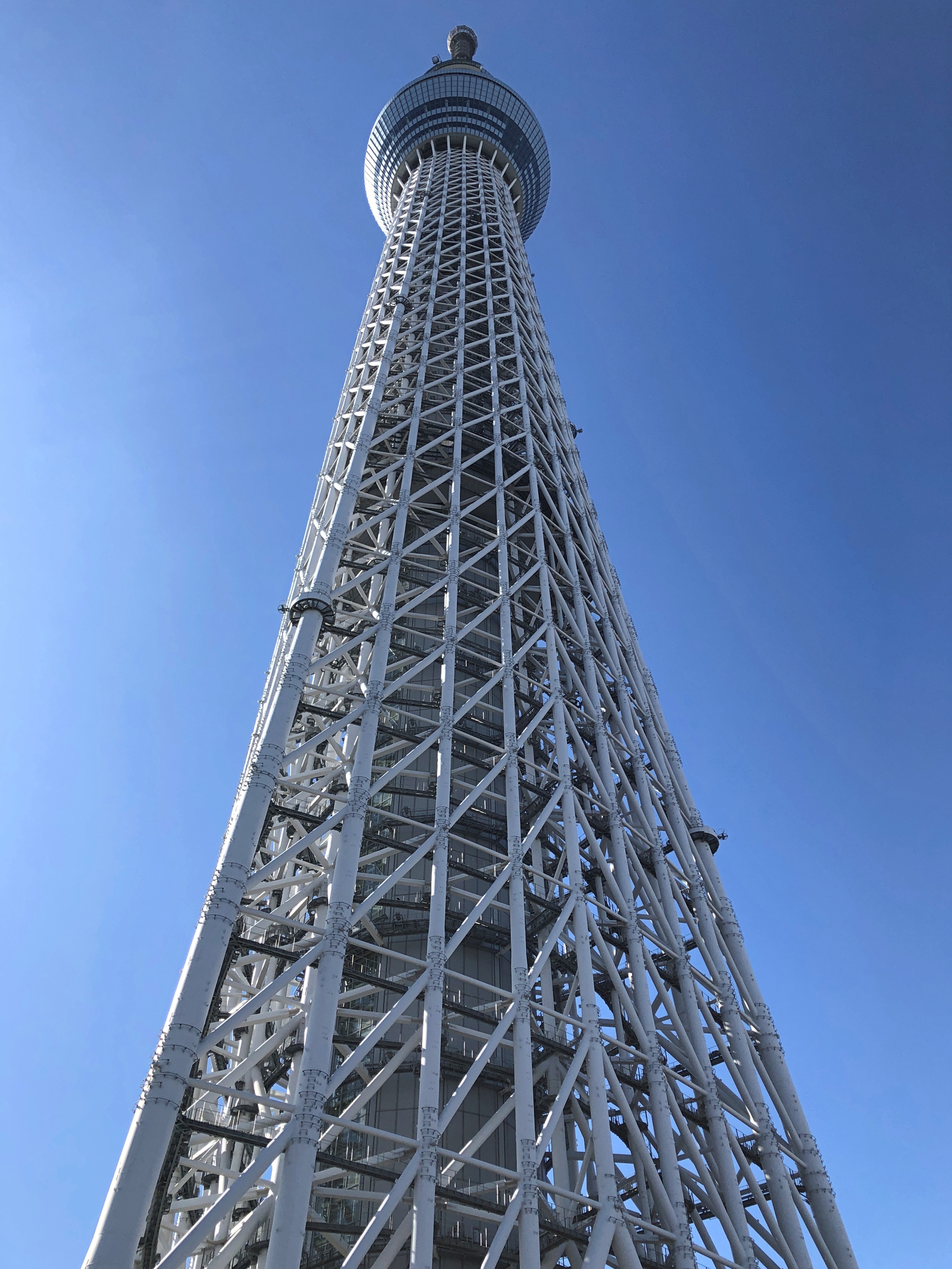
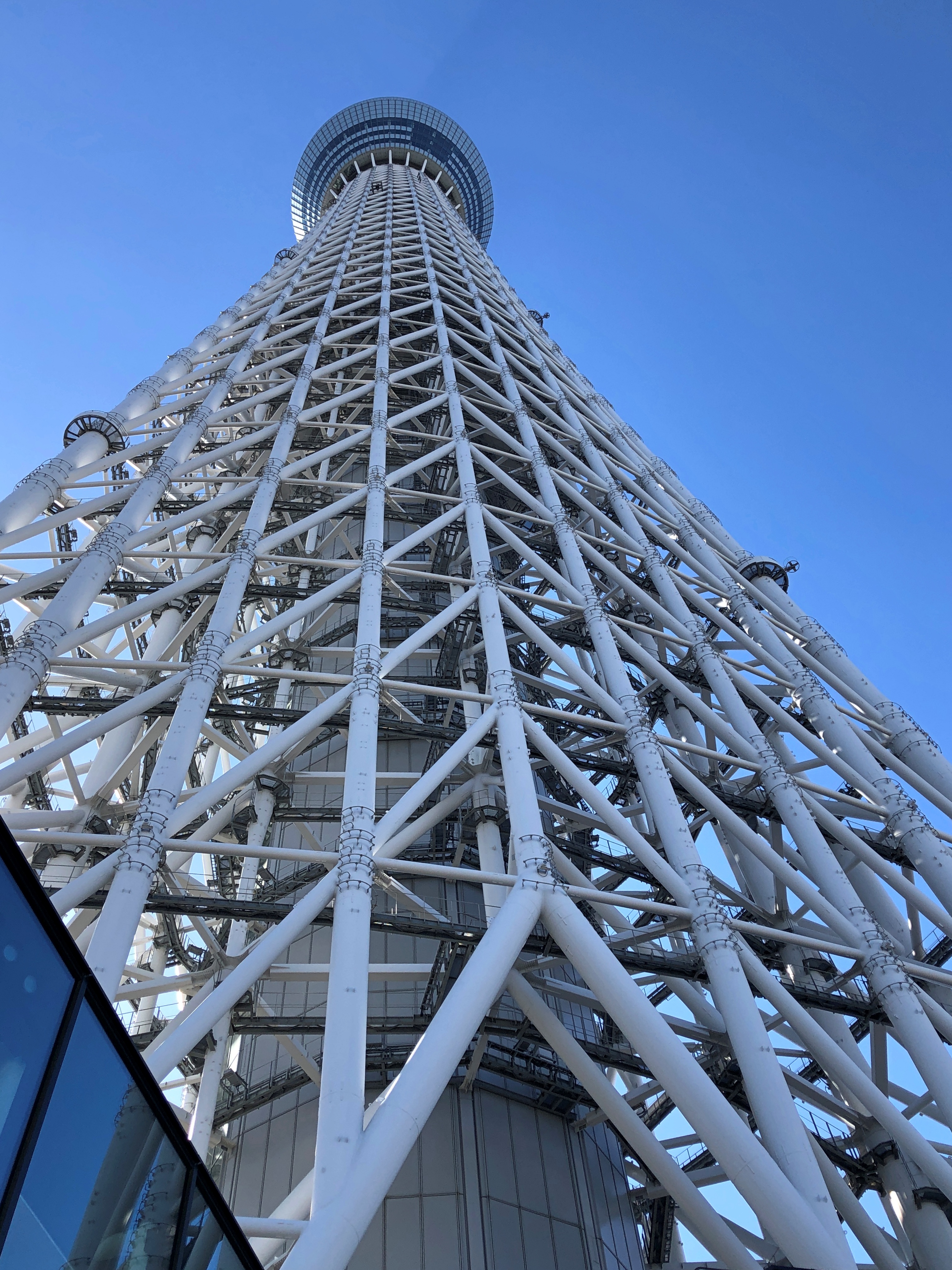
One thing we missed in the early ’90s was Tokyo Skytree, rising 2,080 feet over Sumida Ward, and for good reason: the tower was completed only in 2012 as a TV tower and a tourist attraction. We arrived in the afternoon of February 14.Tokyo Skytree Tokyo Skytree Tokyo Skytree

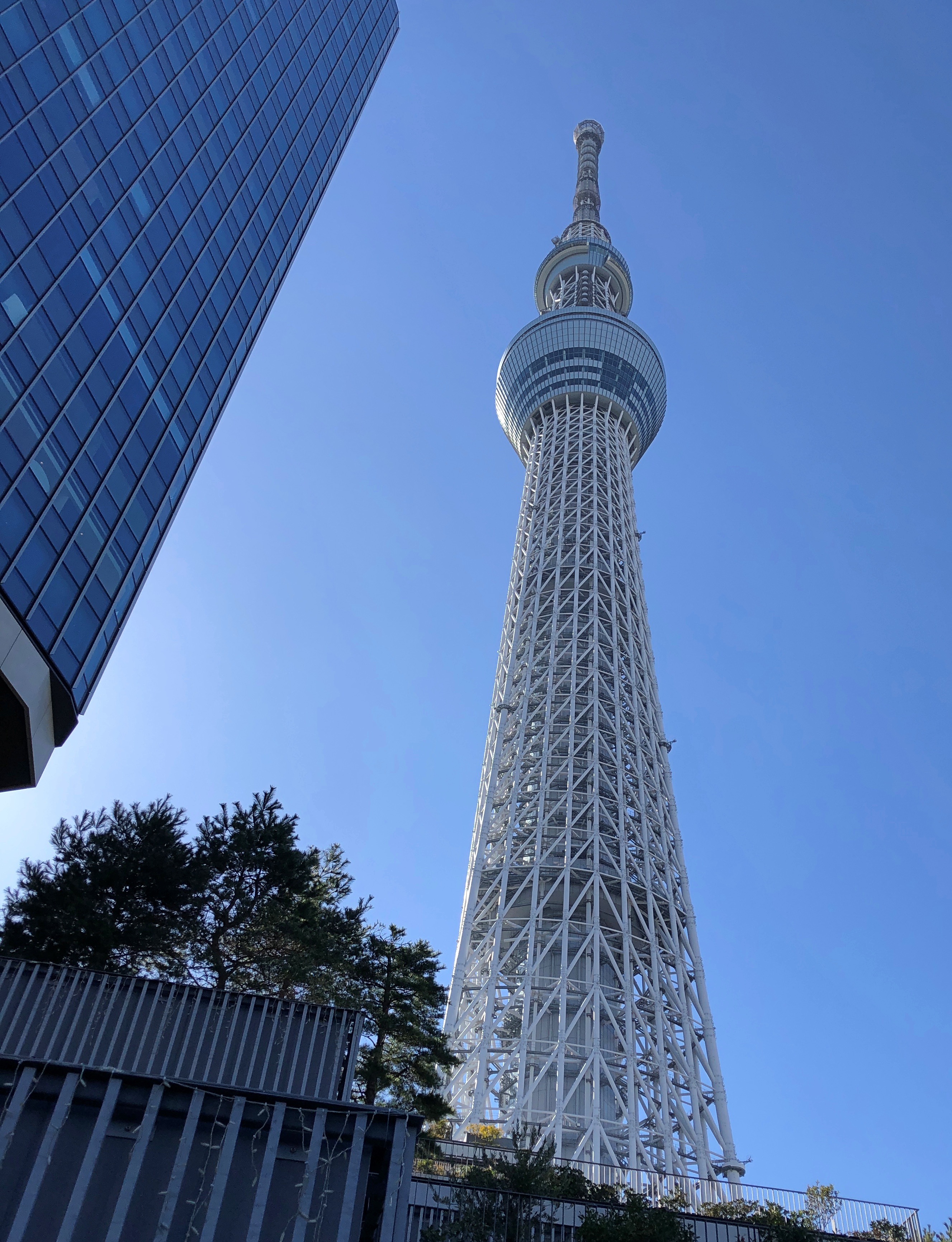
Who has the wherewithal to build such things in the early 21st century? In Japan, anyway, railroad companies do, in this case Tobu Railway Co. Ltd., a Kanto regional line that offers some sweet destinations, including the mountain resort of Nikko and the hot springs around Kinugawa Onsen, both of which I only know by reputation. Naturally, Japanese RR companies are never just that, and in this case while transport remains a core business, the conglomerate also includes entertainment venues, hotels, a commercial real estate and construction arm, and retail operations, especially department stores at major terminals.

Judging by my previous and recent experience at the department stores owned by regional RRs, the department store not only isn’t dying in Japan, it flourishes. They are serving a much more dense population, of course, and one that travels by train, but there’s also that matter of stocking goods people want to buy, including basements full of exceptionally good food. The stores’ bustle is something American department stores can only dream about in their dying reverie.

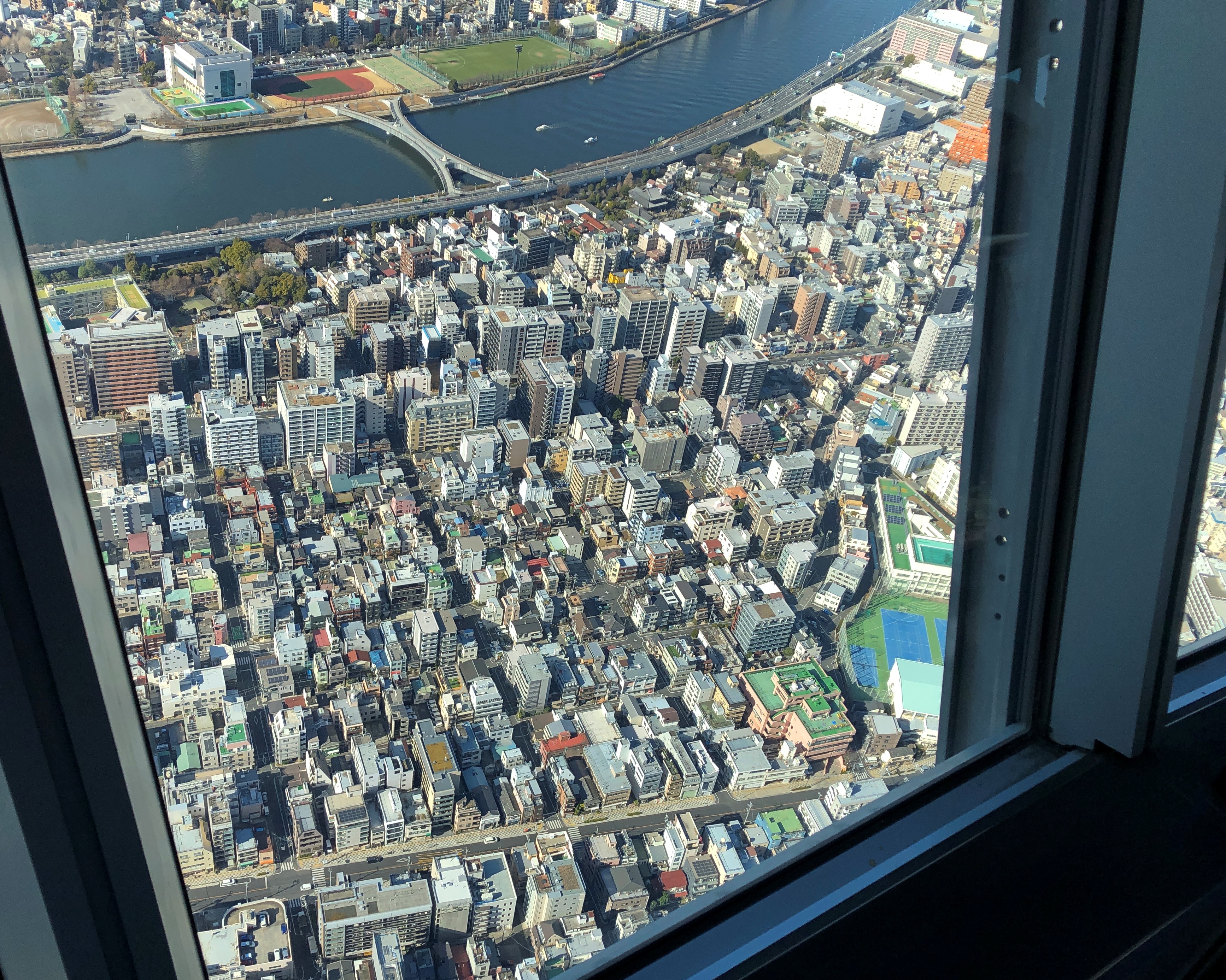
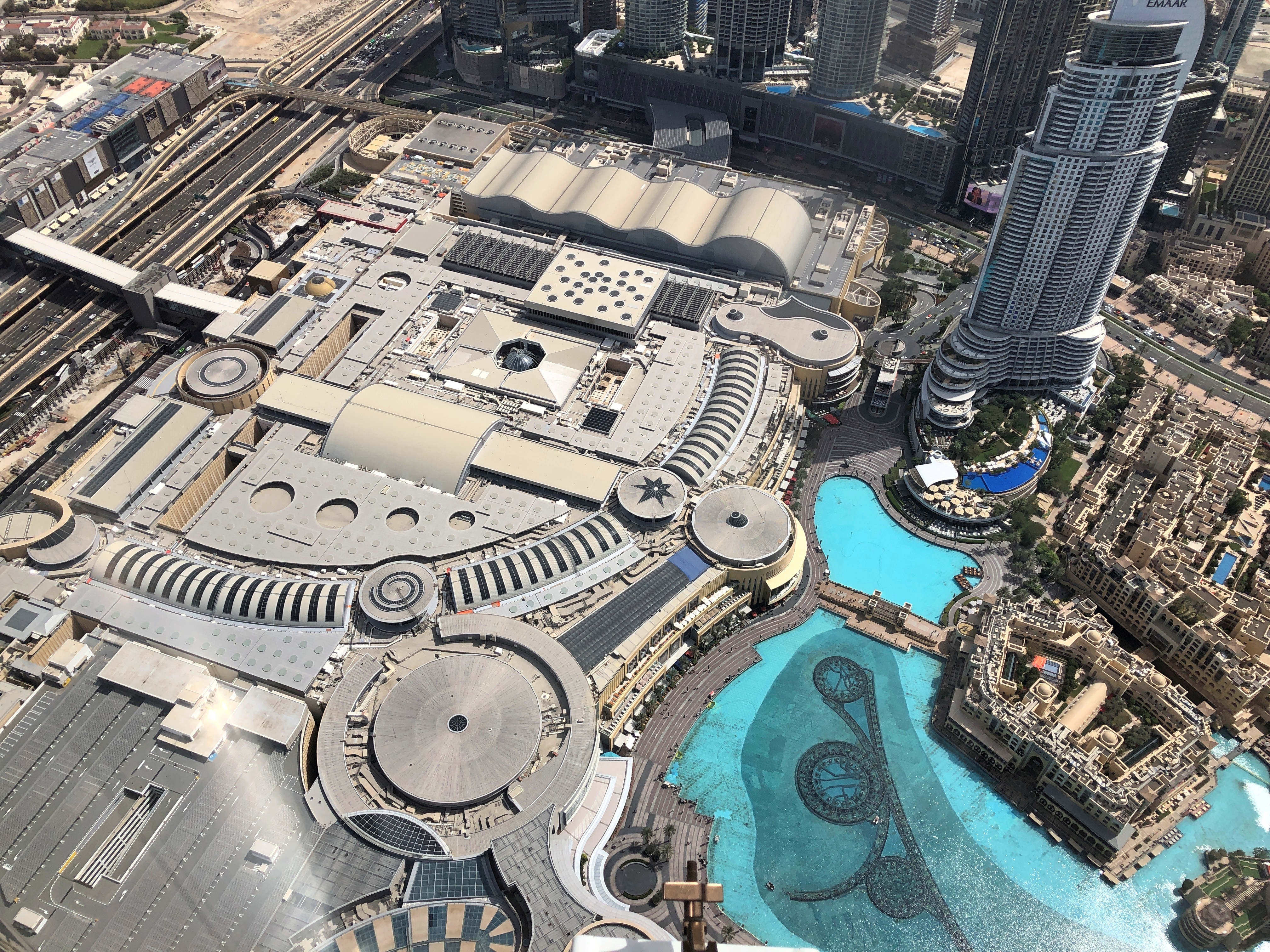
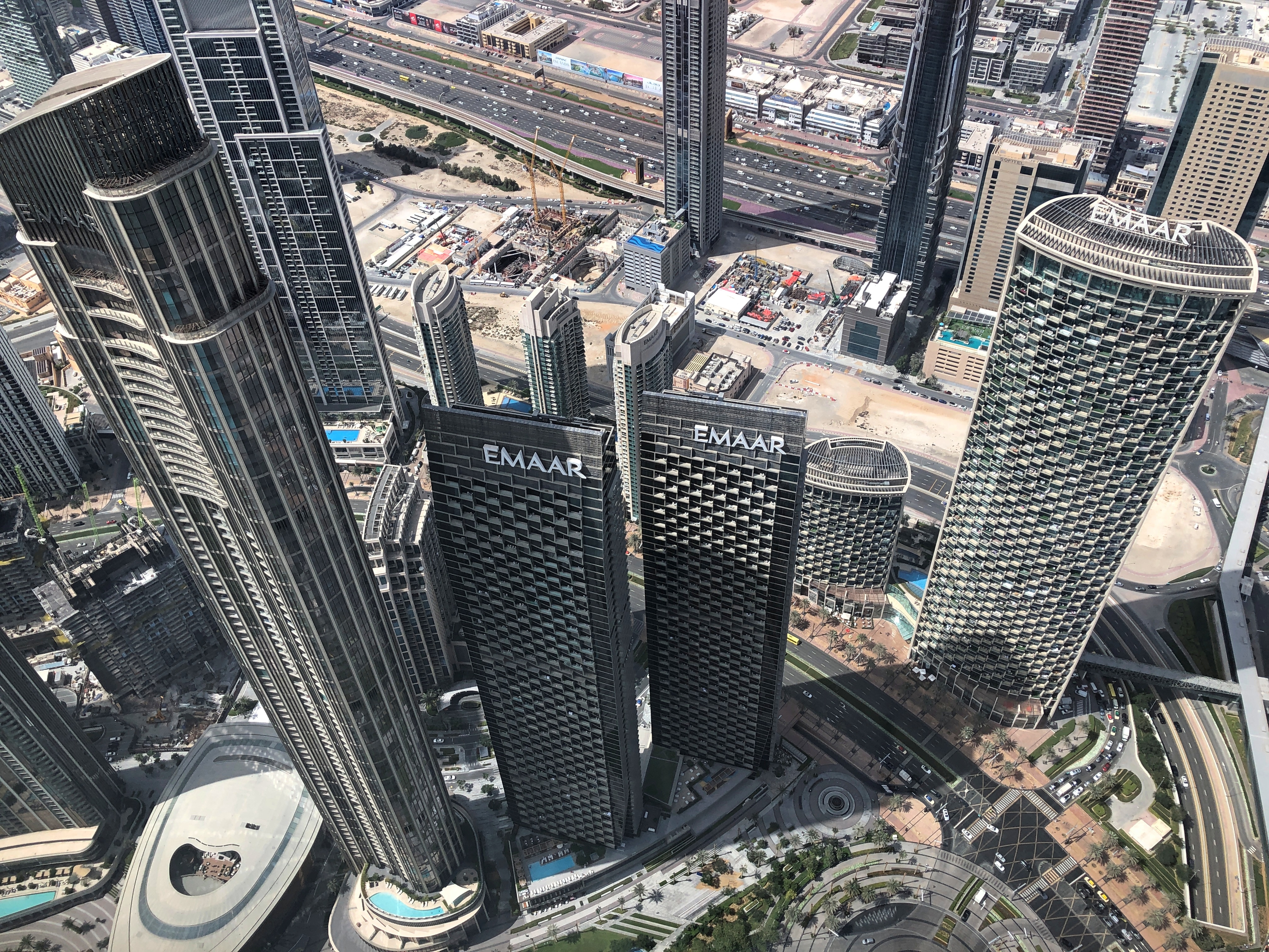
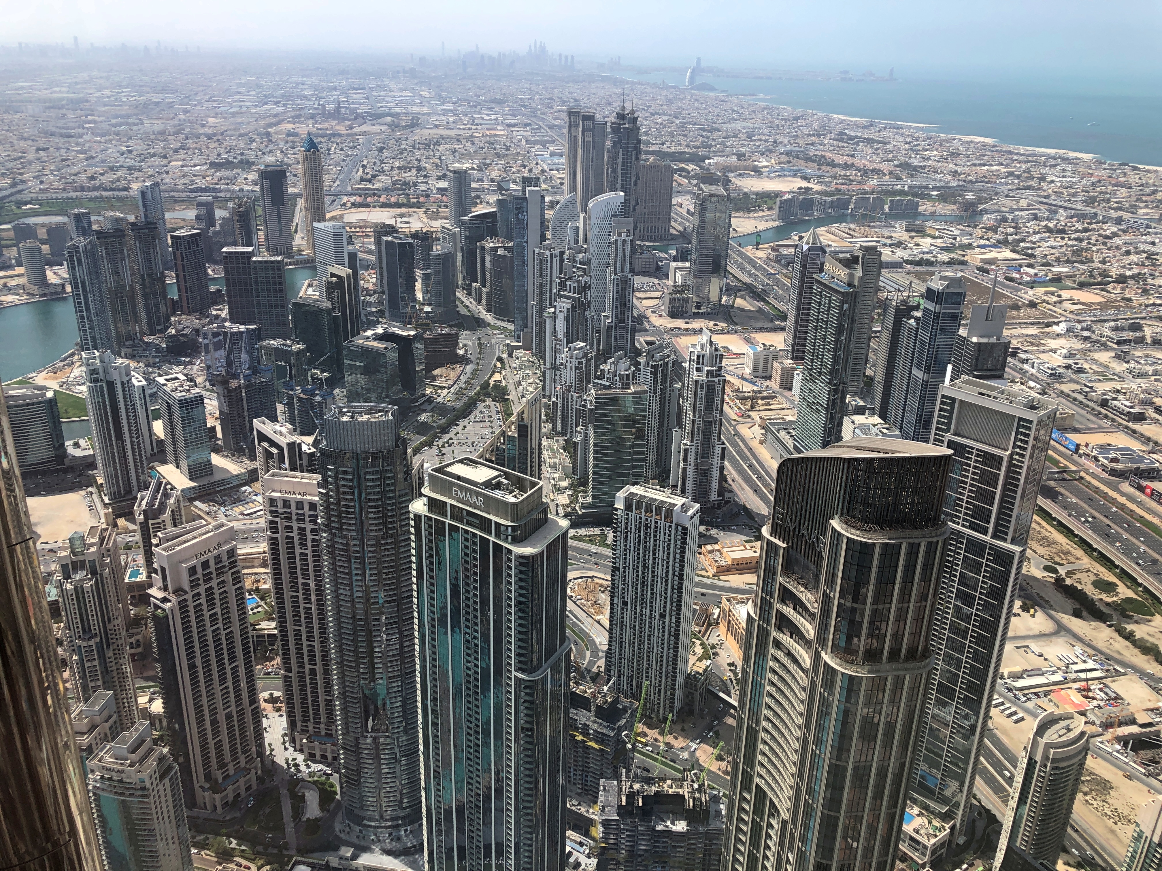
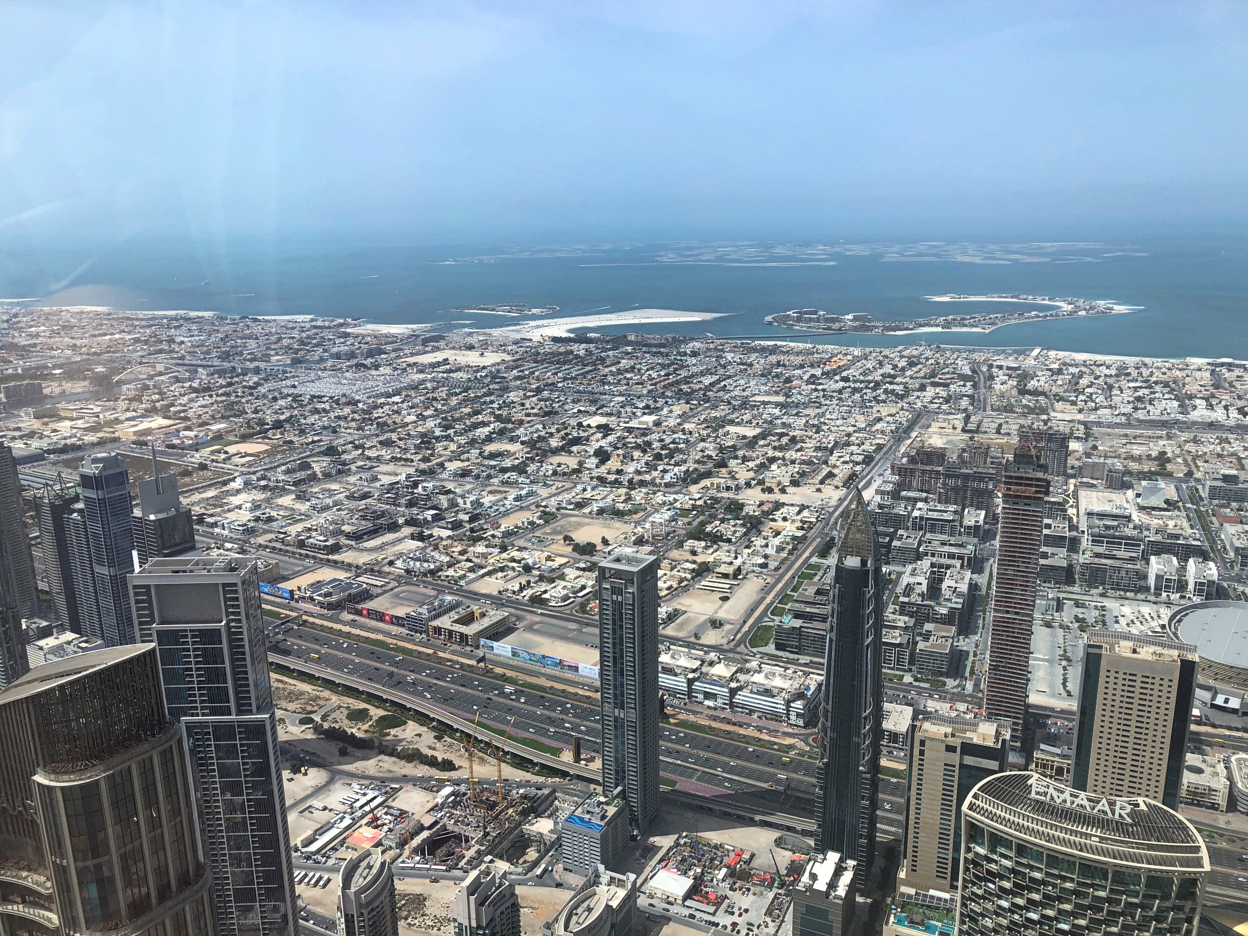
Up in the Tokyo Skytree bulb are a couple of tourist observation decks. The combo ticket, while expensive, isn’t outrageously more than just visiting the lower deck, so we opted for access to the deck at 350 meters and the narrower one at 450 meters, one after the other. It turned out to be easier to take good pictures from the lower level.

Busy, but not sardine-can busy.Tokyo Skytree

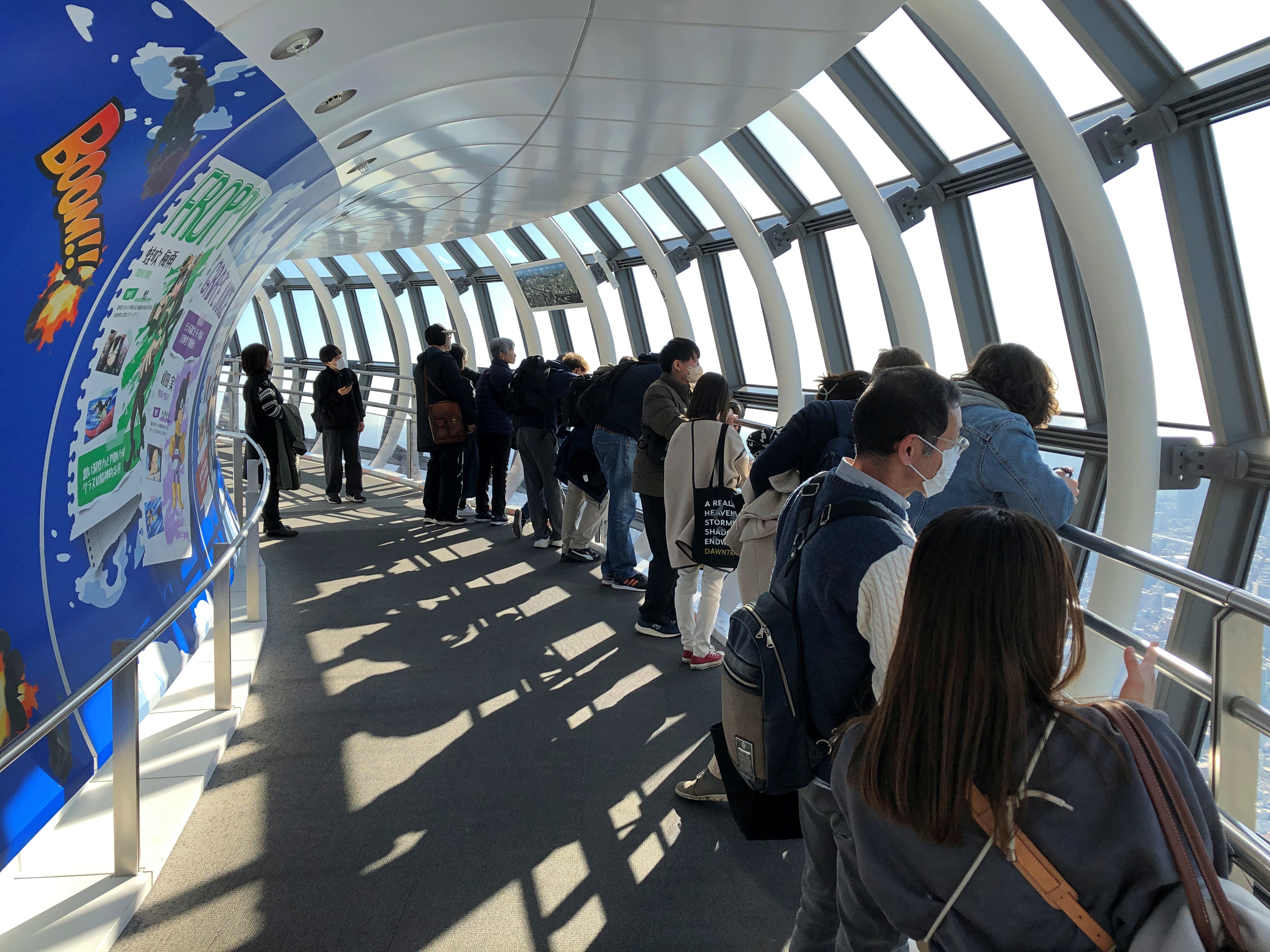
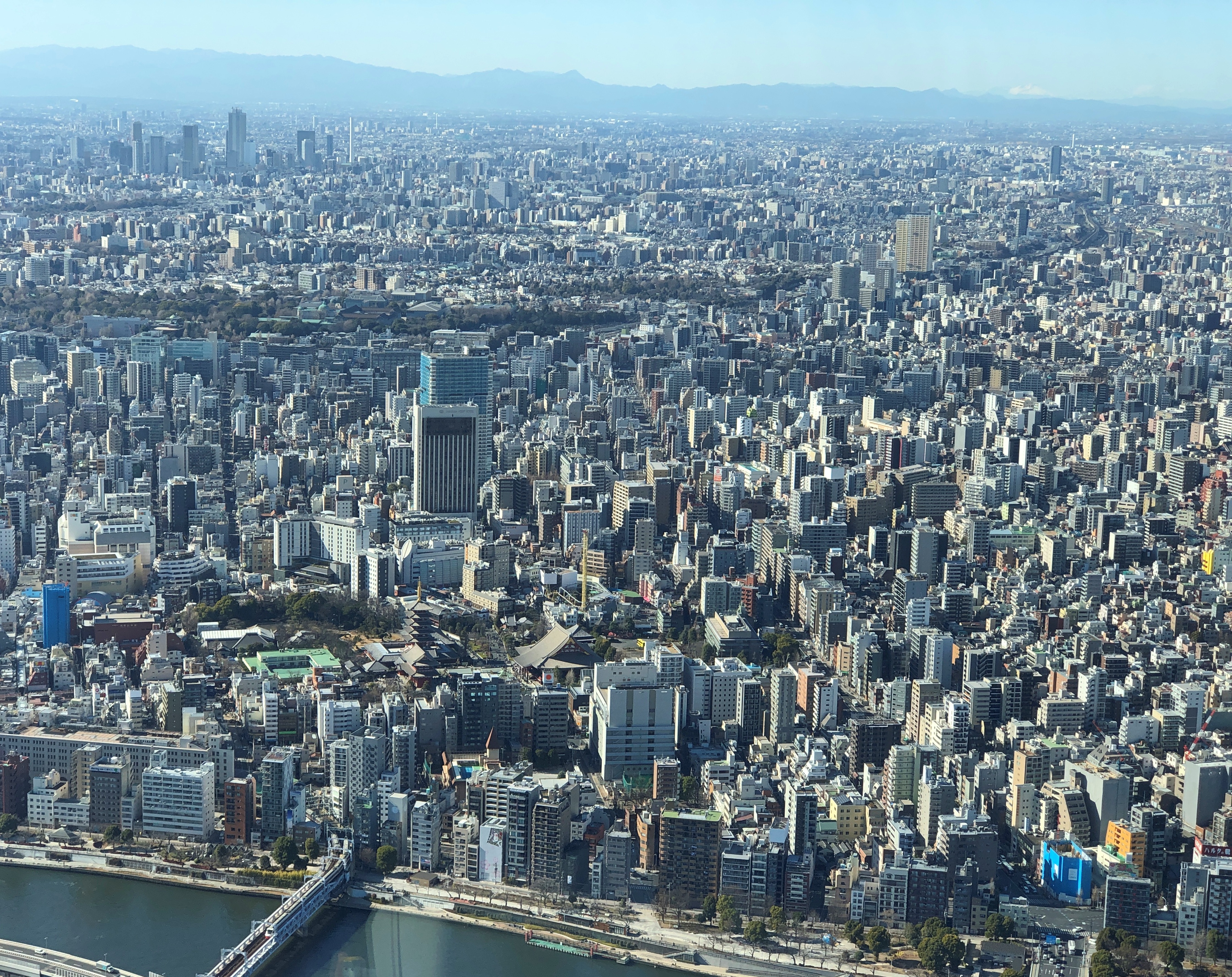
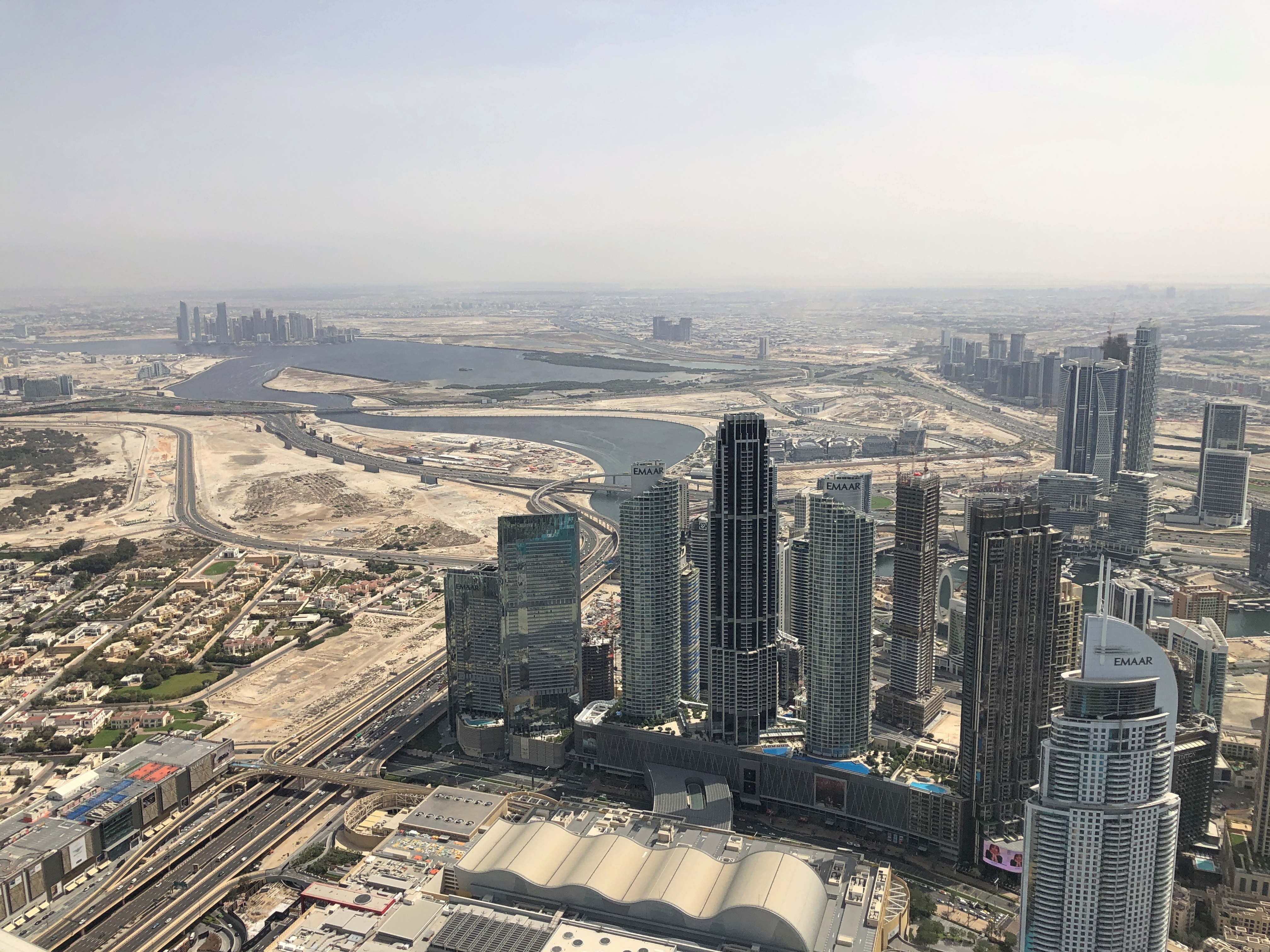
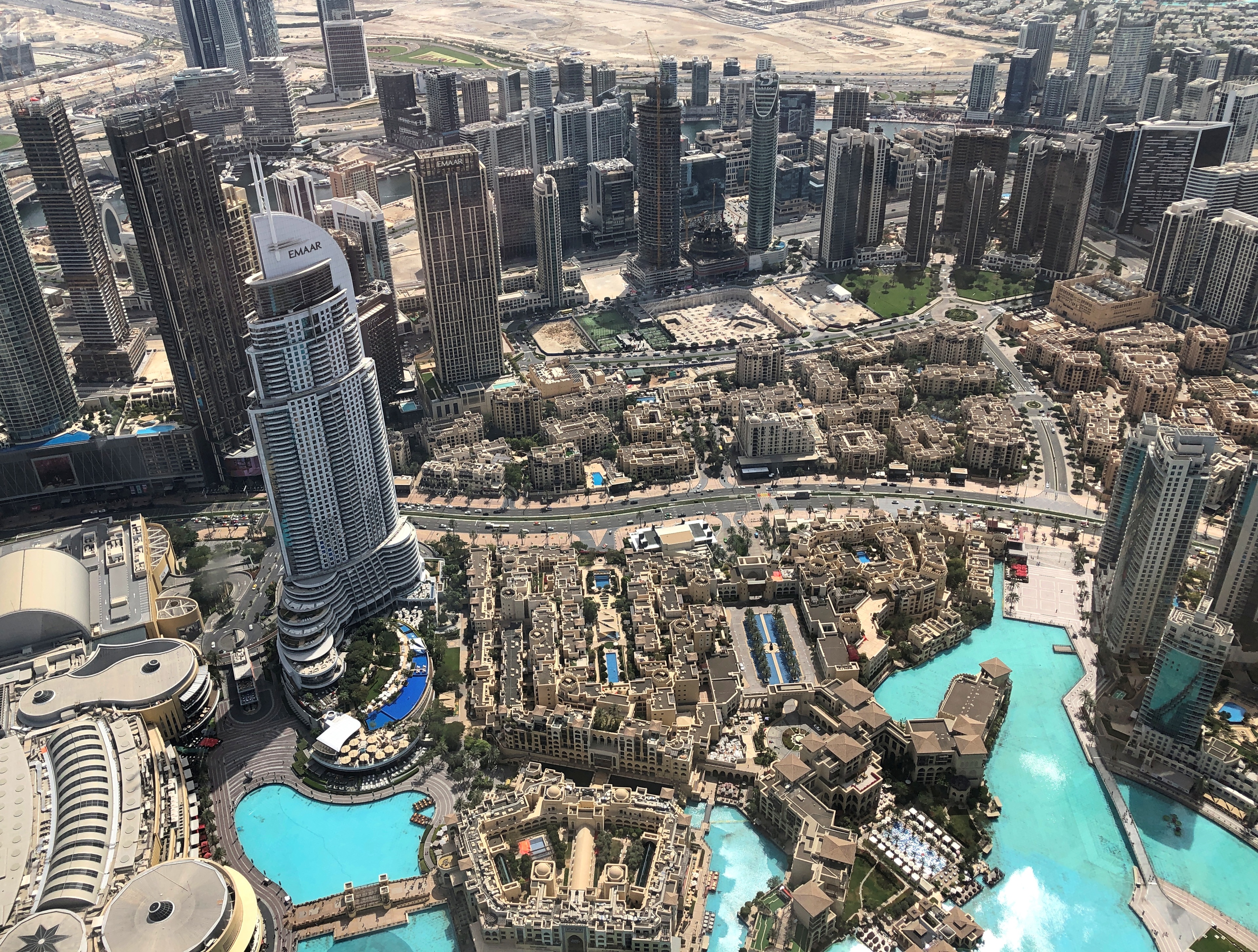
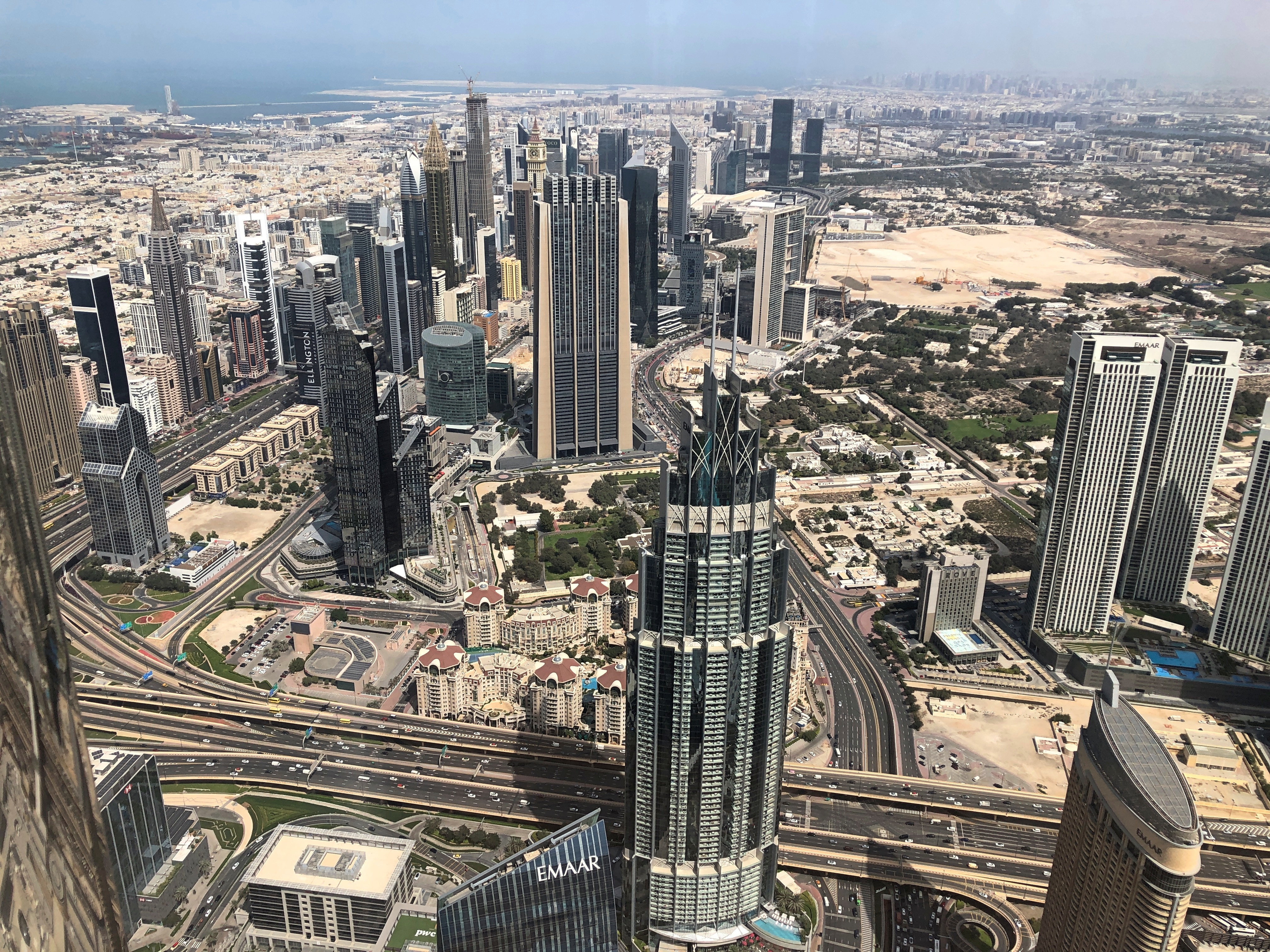
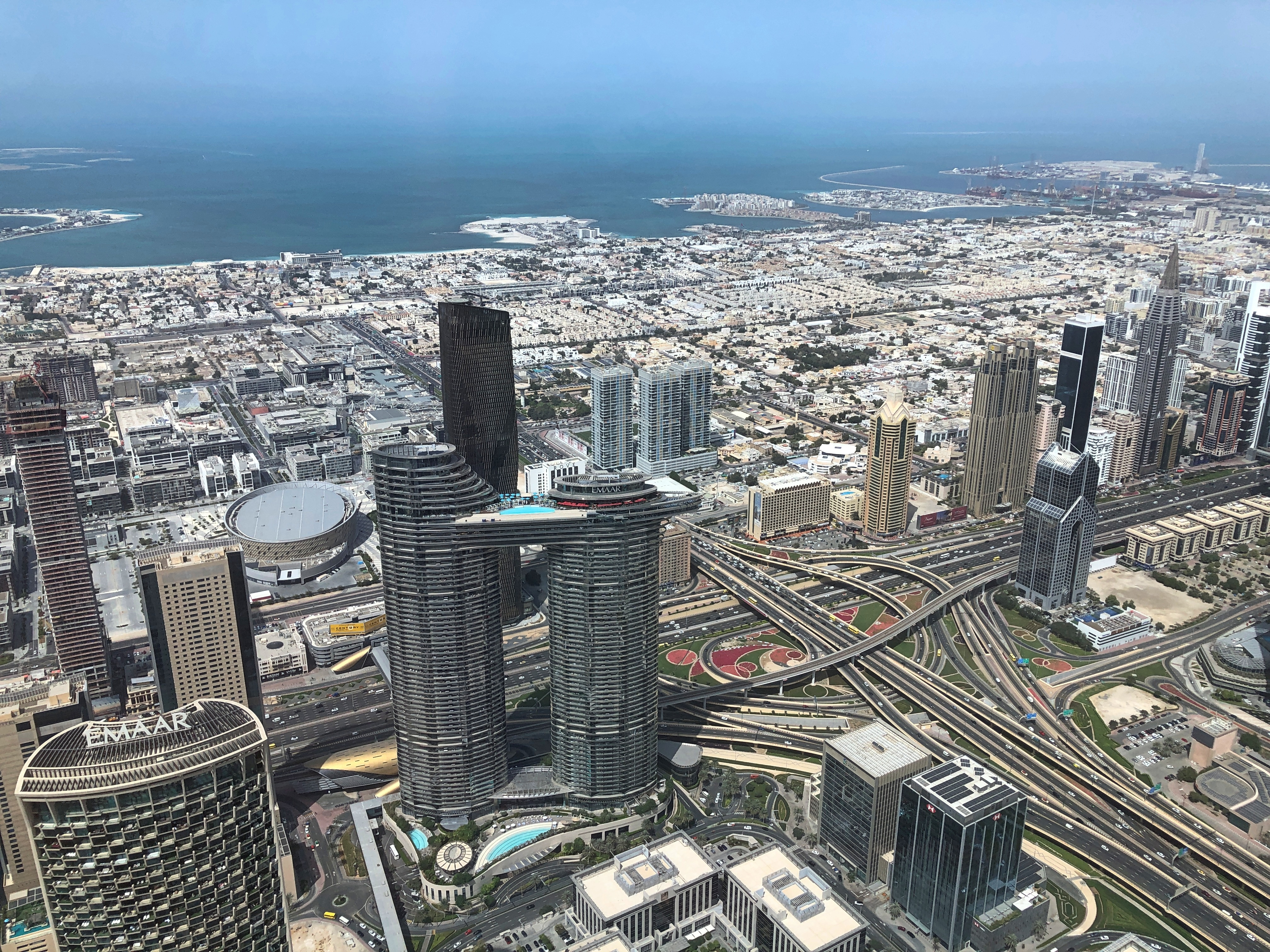
Now those are some views, showing just how dense metro Tokyo is.Tokyo Skytree Tokyo Skytree Tokyo Skytree

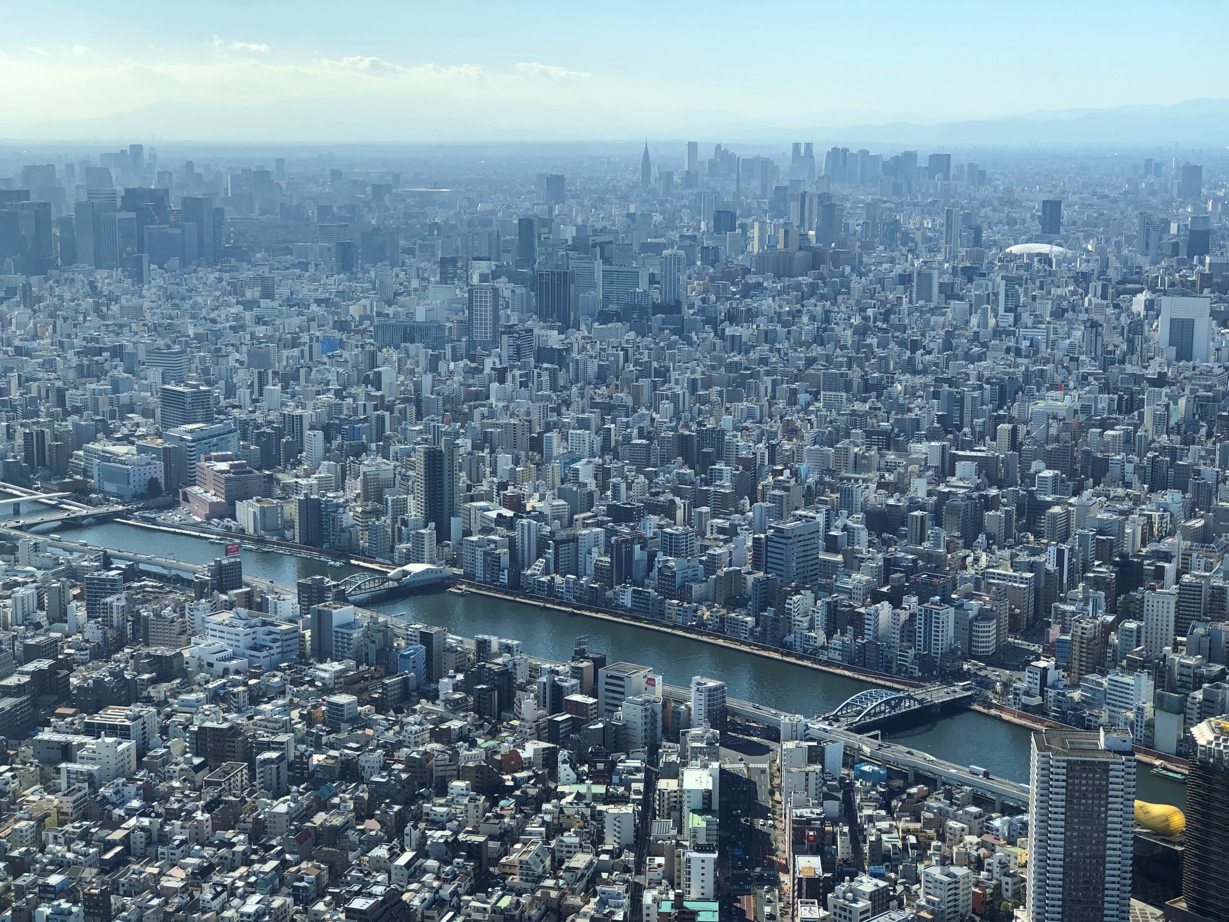
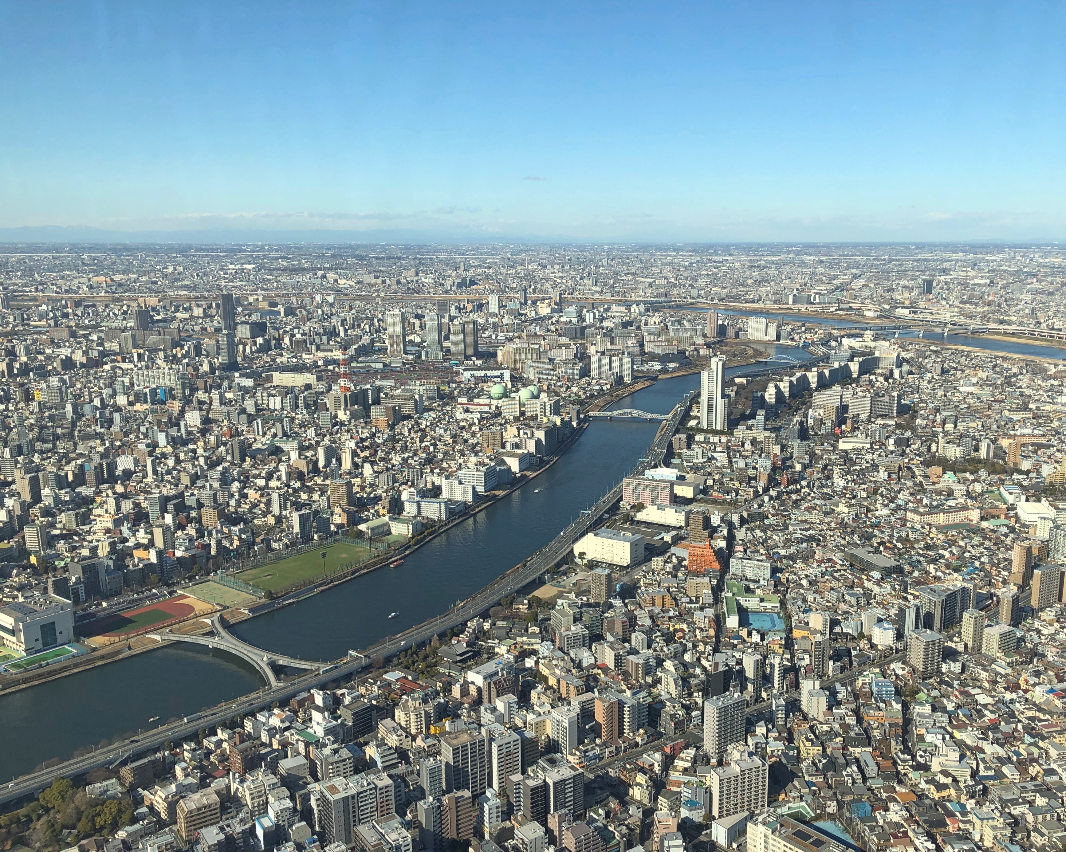
Below is the Sumida River, which wasn’t always so densely populated.

Night on the Sumida River – Kobayashi Kiyochika, 1881

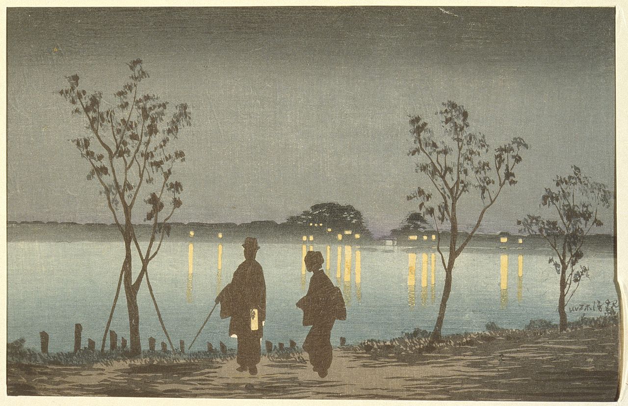
“Night on the Sumida River” by Kobayashi Kiyochika, 1881

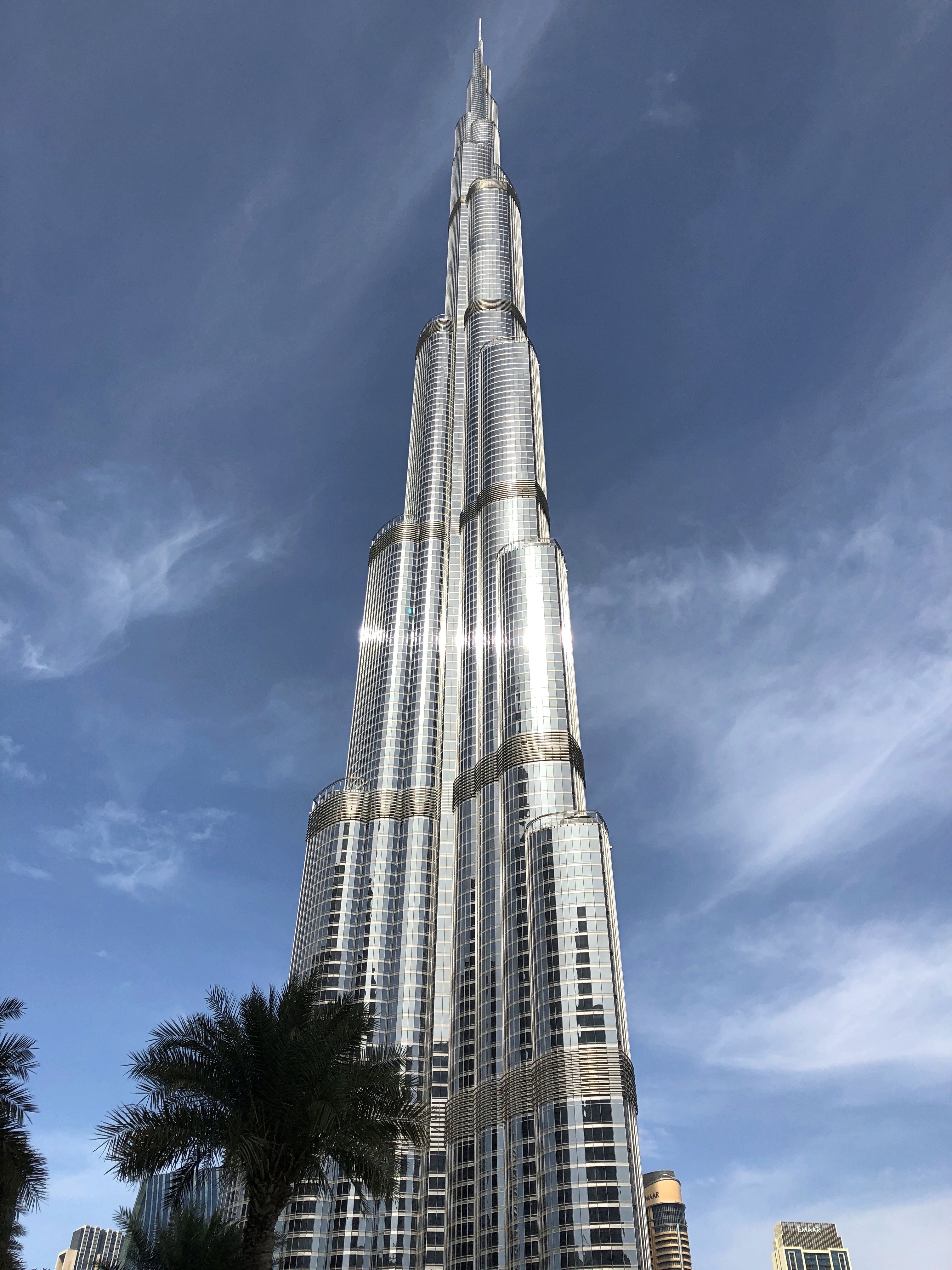
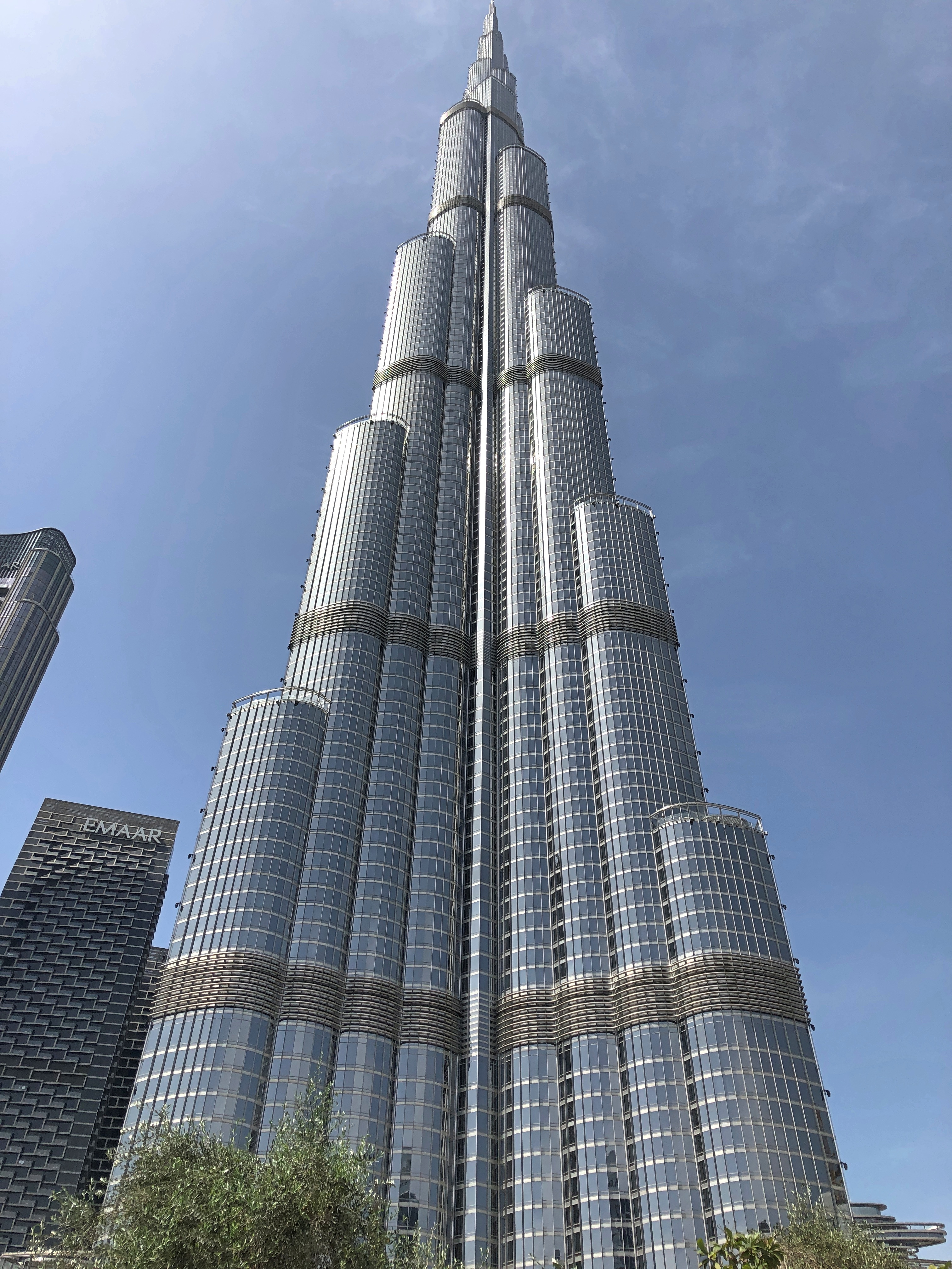
Three hundred fifty meters high? That’s well and good, but nothing as impressive as more than a thousand feet: 1,150, to be almost exact.Tokyo Skytree Tokyo Skytree

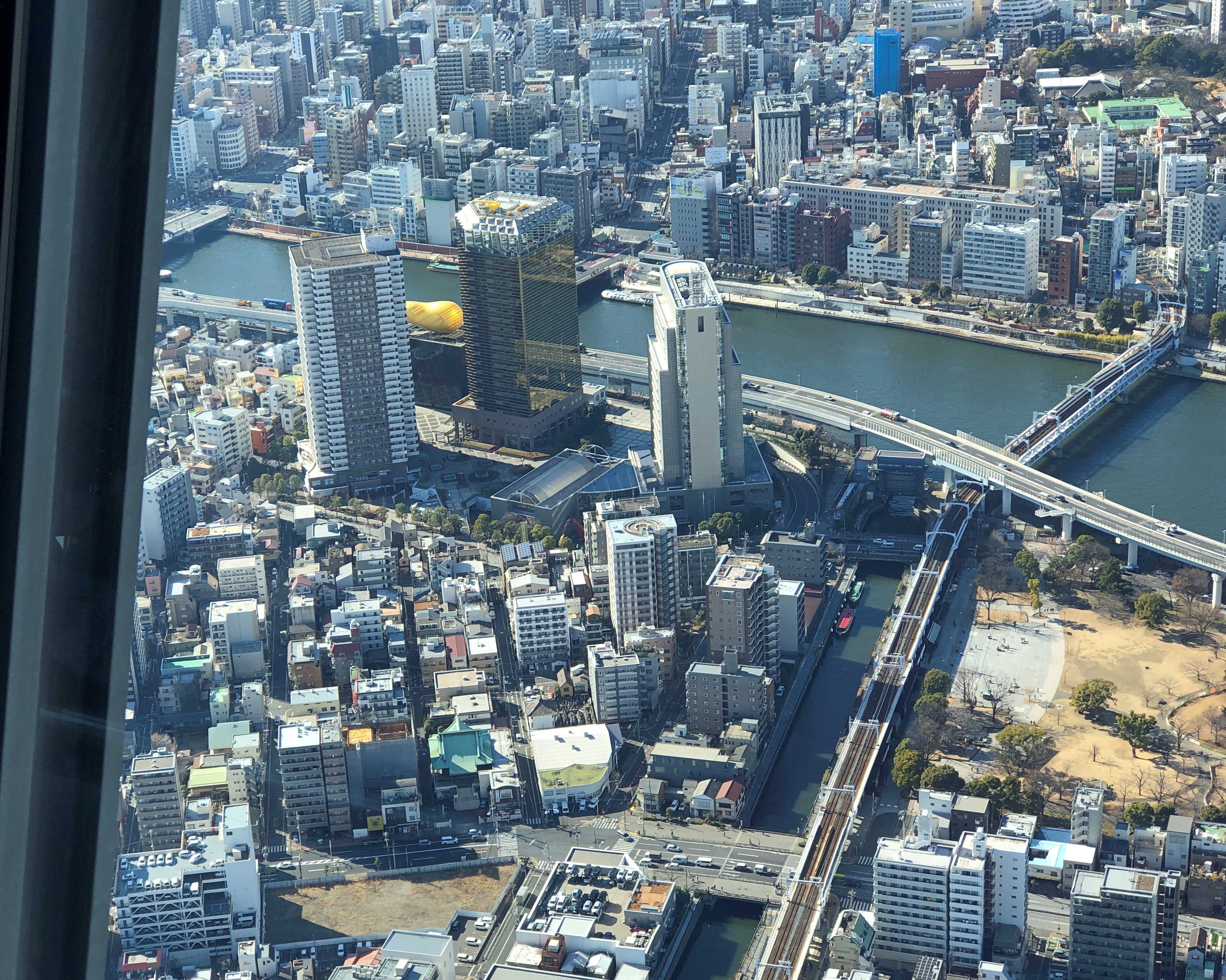
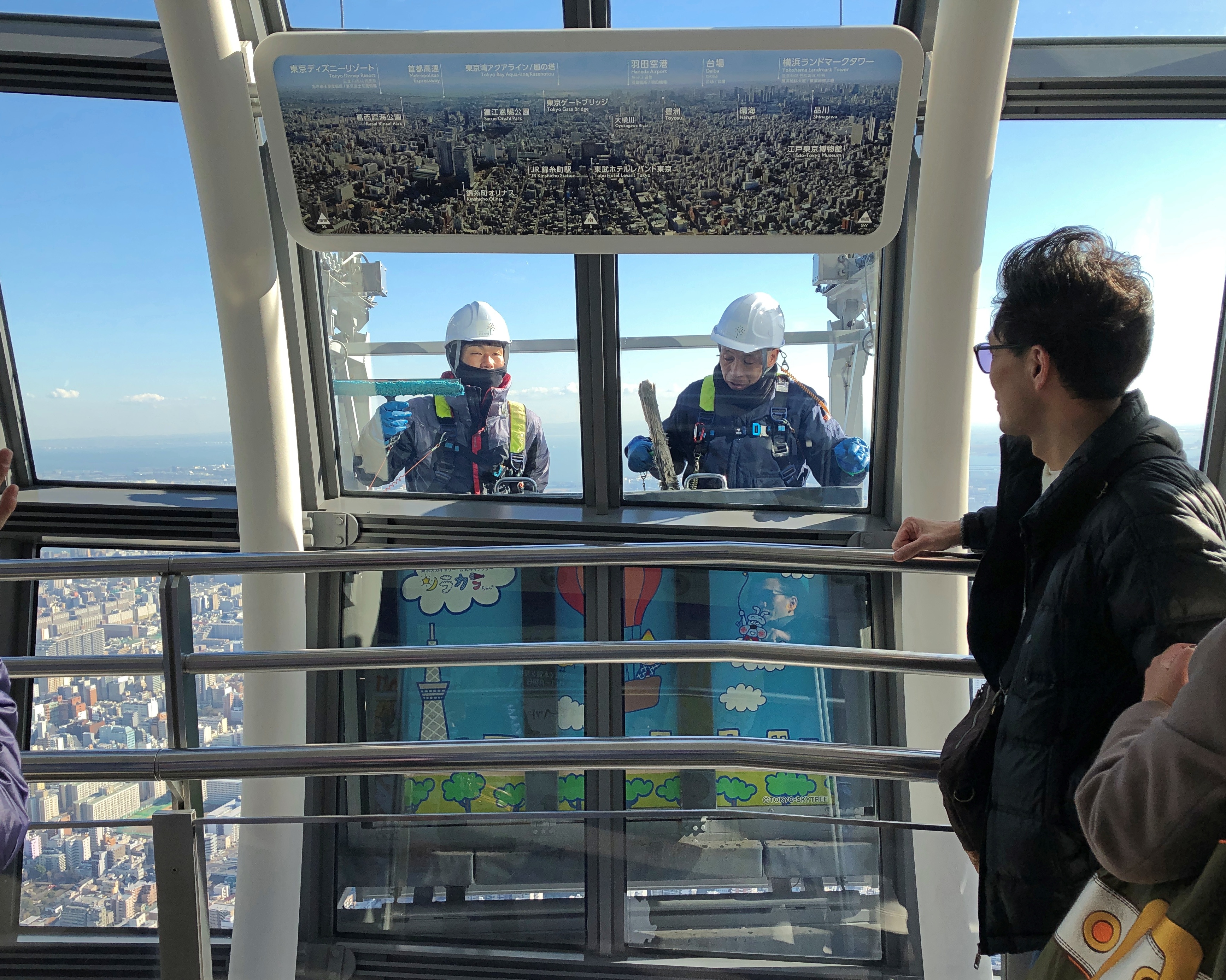
Window washers came by as we looked out at 350 meters. Hanging, as far as I could tell, by two wires attached to their car, and not their persons. They seemed pretty blasé about that, but anyone who felt otherwise (like me) would be in the wrong line of work.Tokyo Skytree window washers Tokyo Skytree window washers

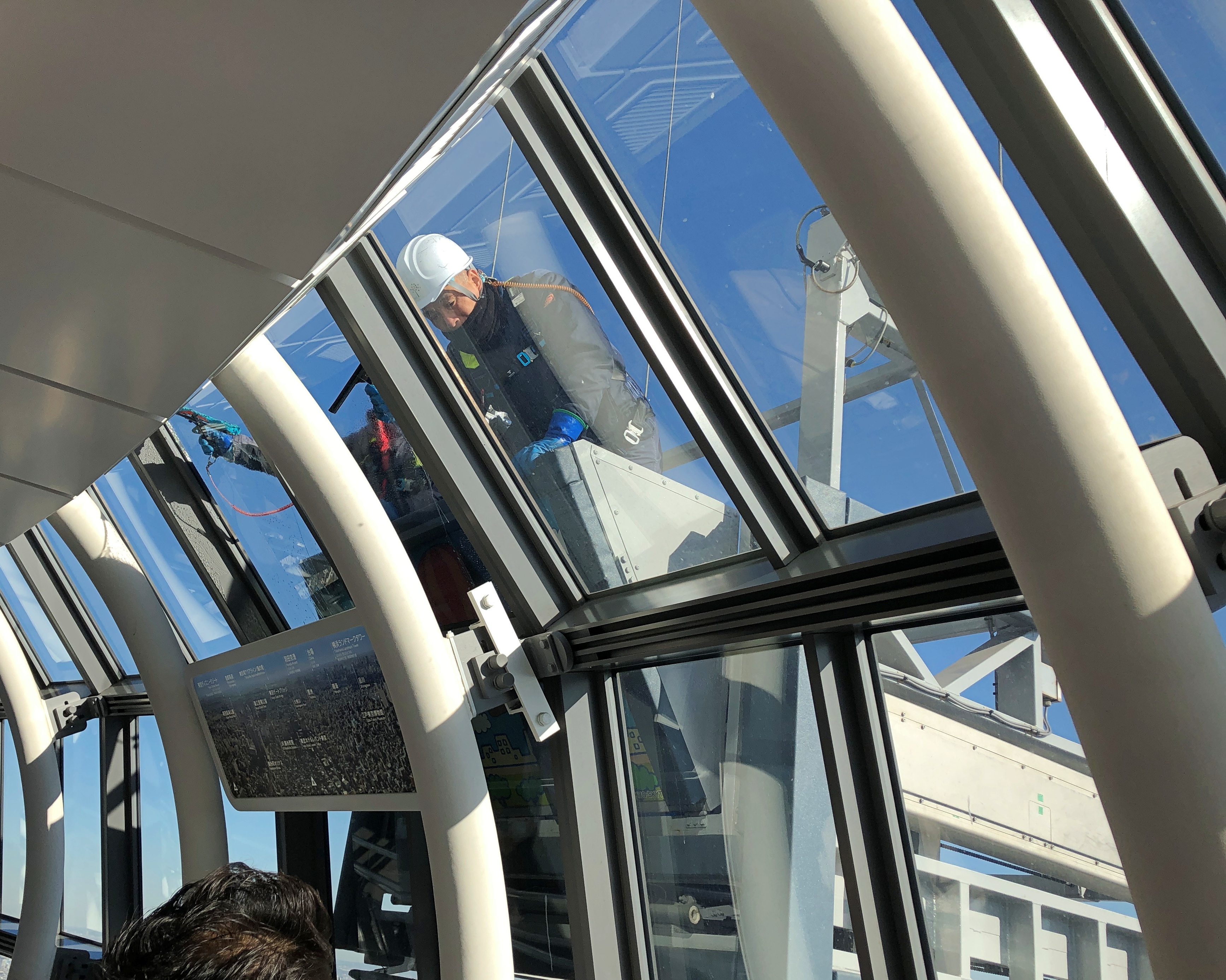
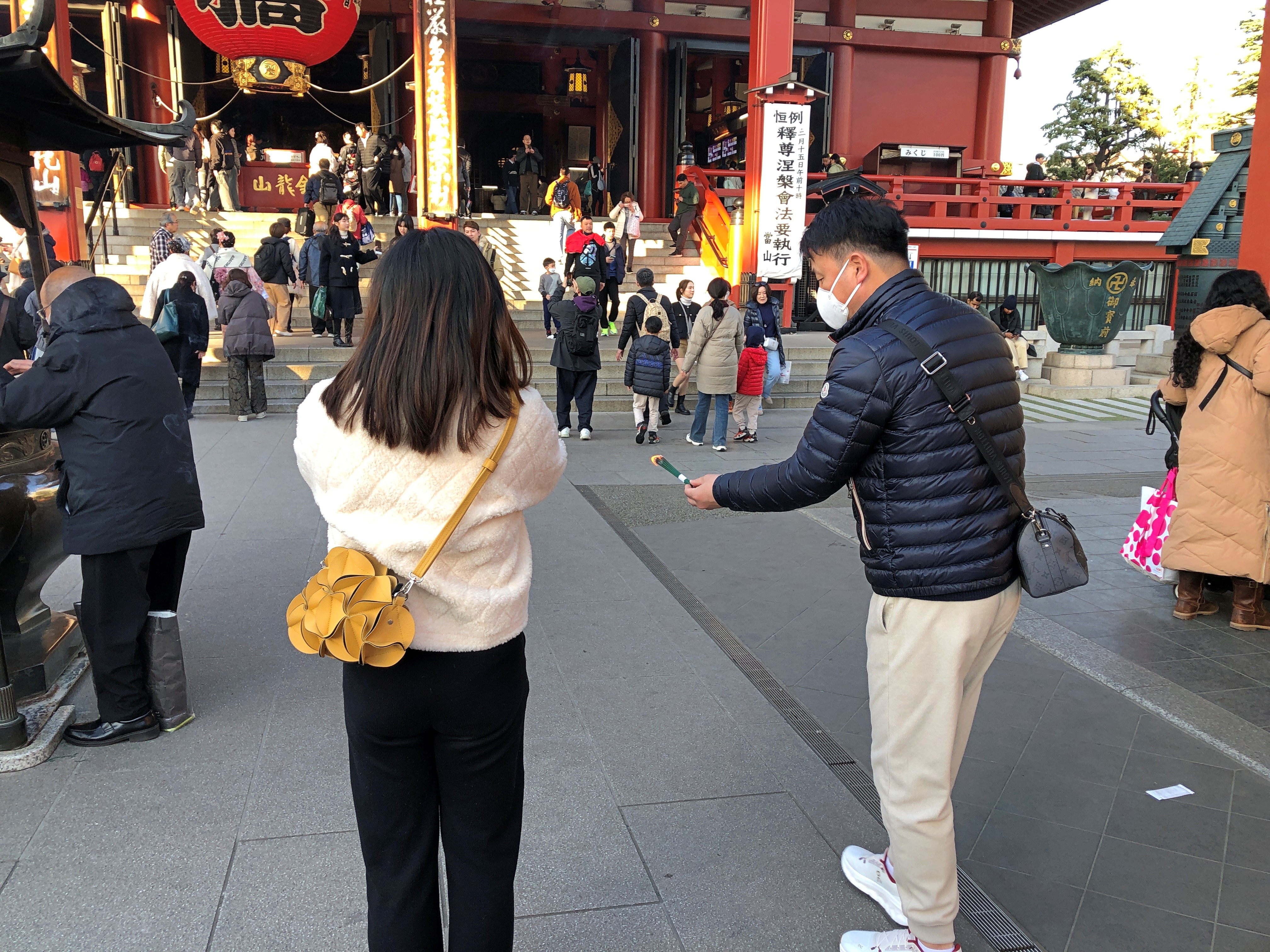
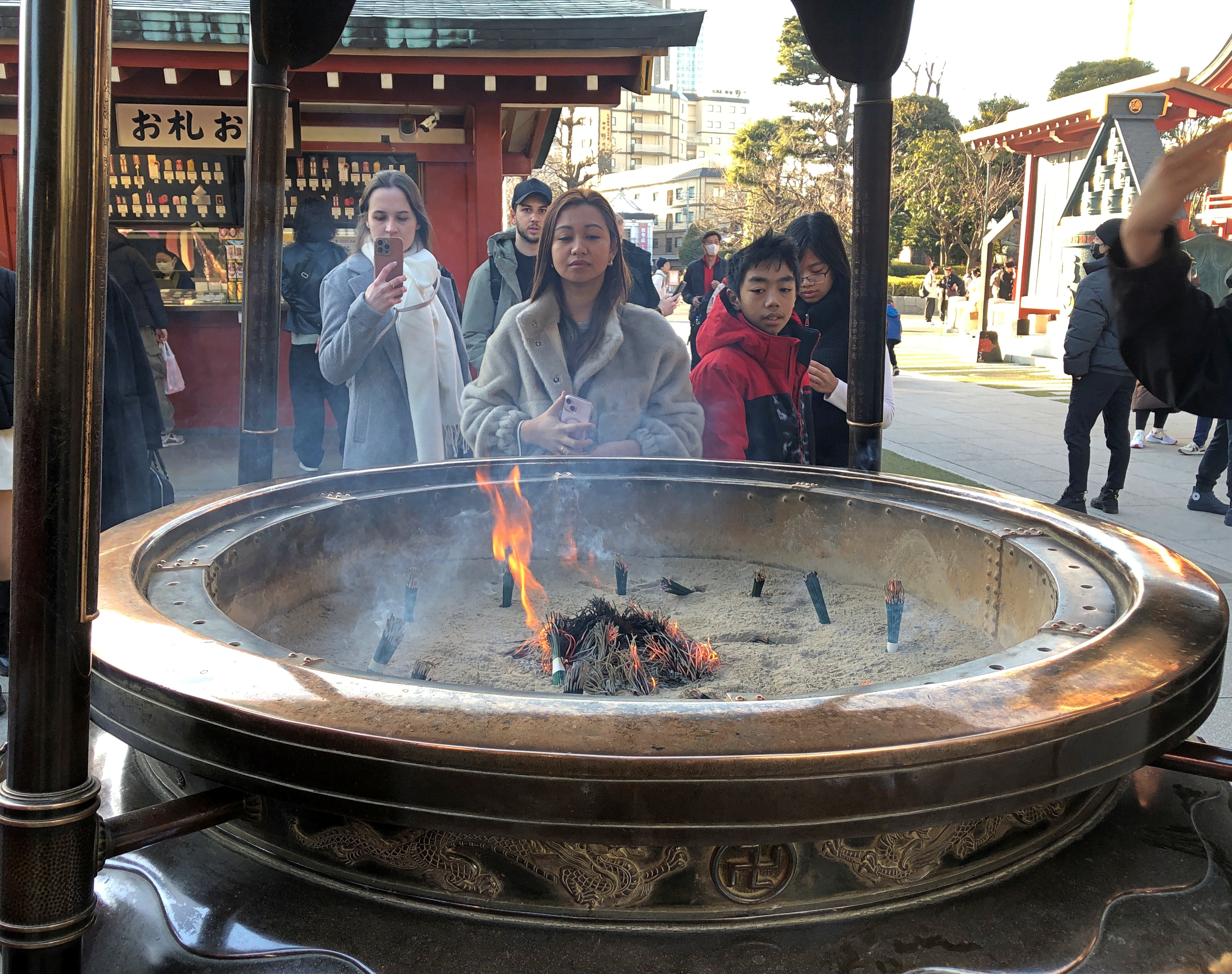
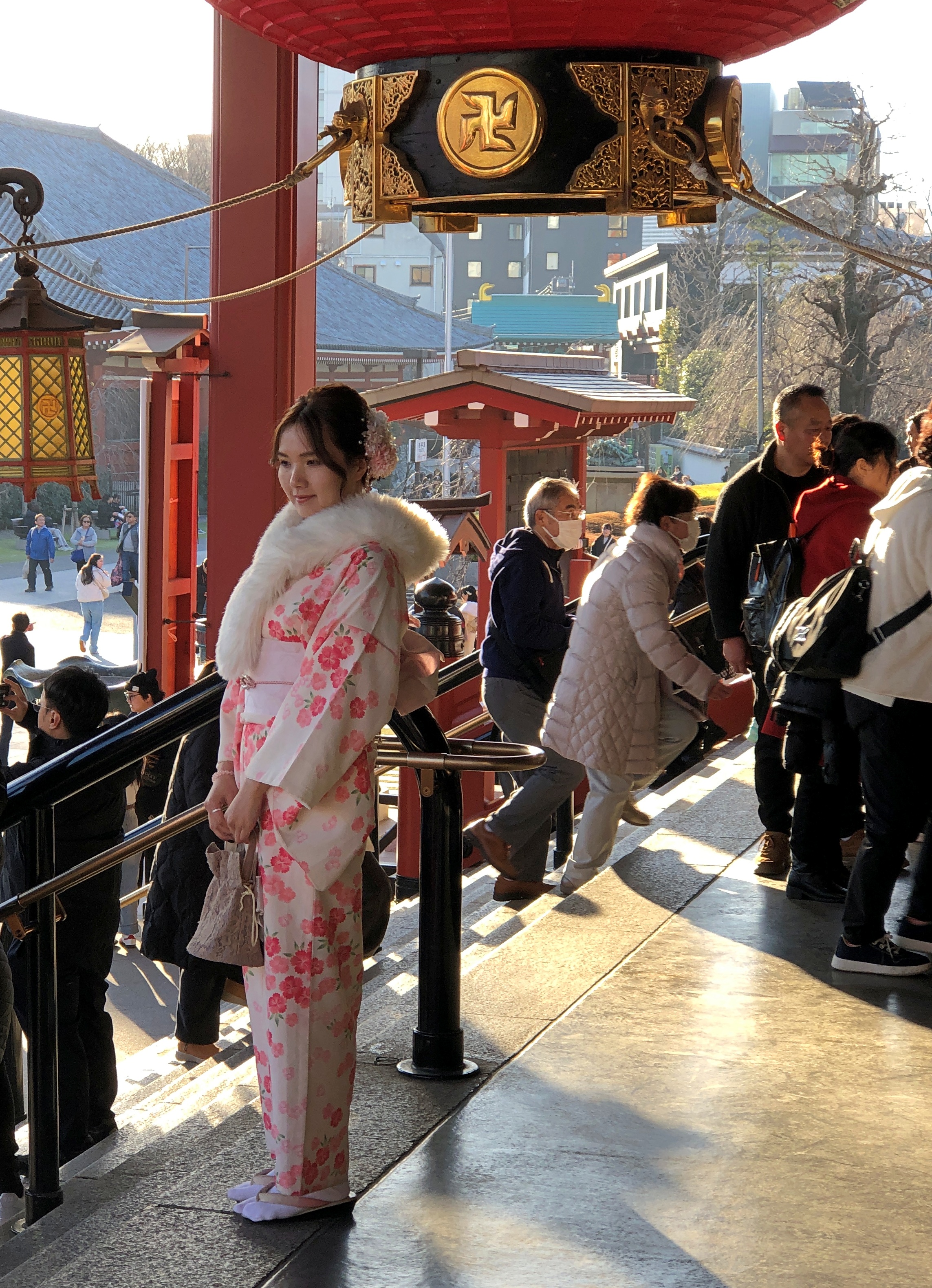
On the other side of the river, and visible from the tower, is Senso-ji temple, in the Asakusa neighborhood. We still had some afternoon light after visiting Skytree, so we decided to go to the temple, a short train ride and a longer walk away. A long pedestrian street (Nakamise-dōri) goes through Asakusa to the temple grounds.
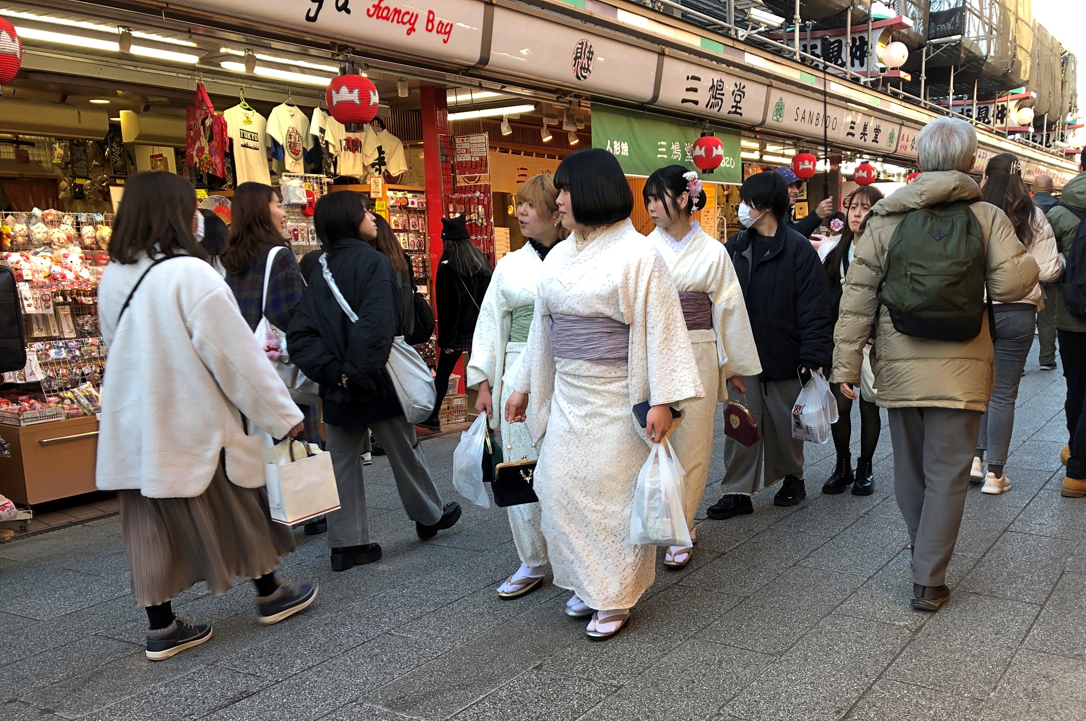
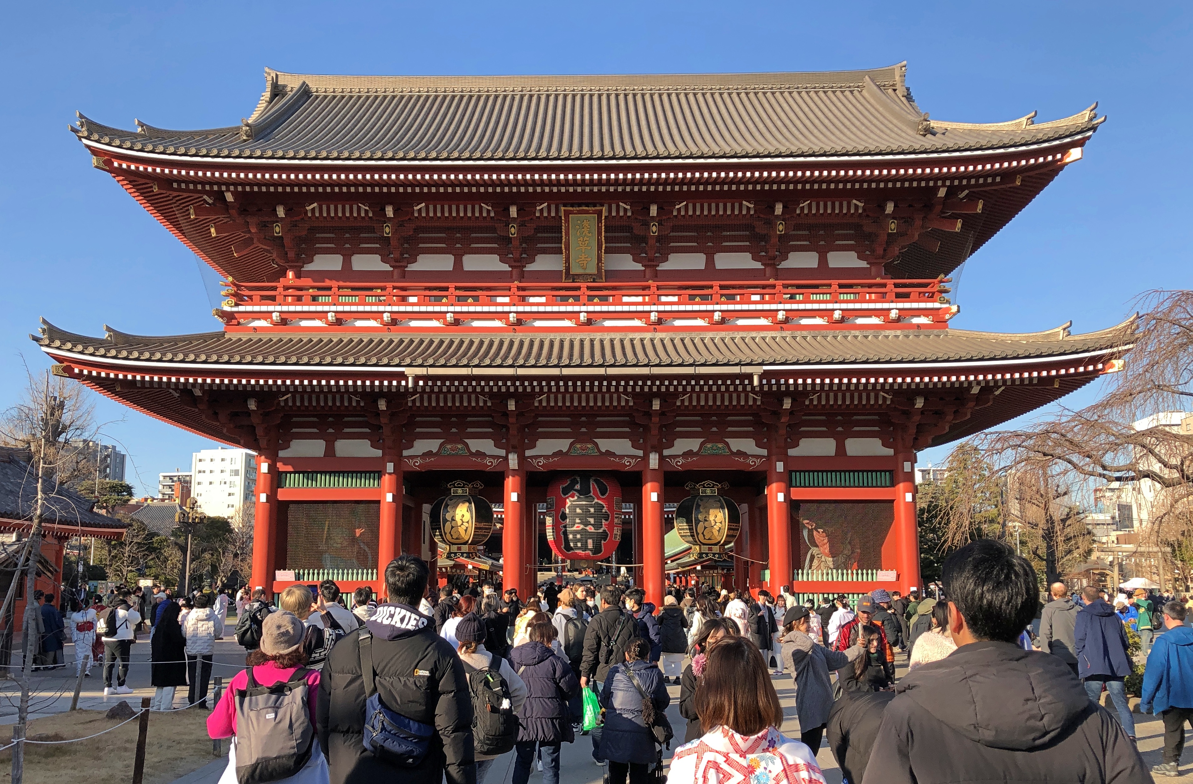
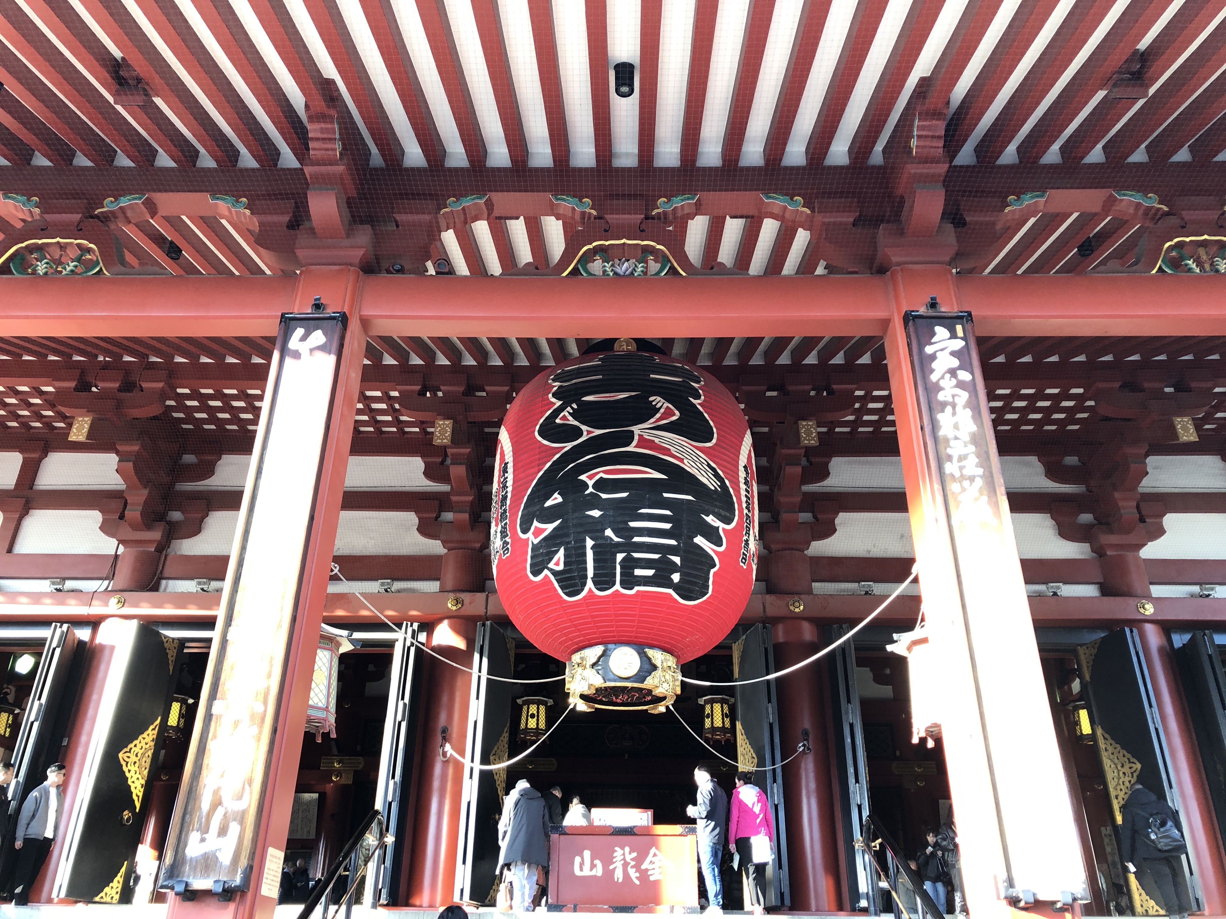
Nakamise-dōri

Hōzōmon gate.Senso-ji temple, Tokyo Senso-ji temple, Tokyo

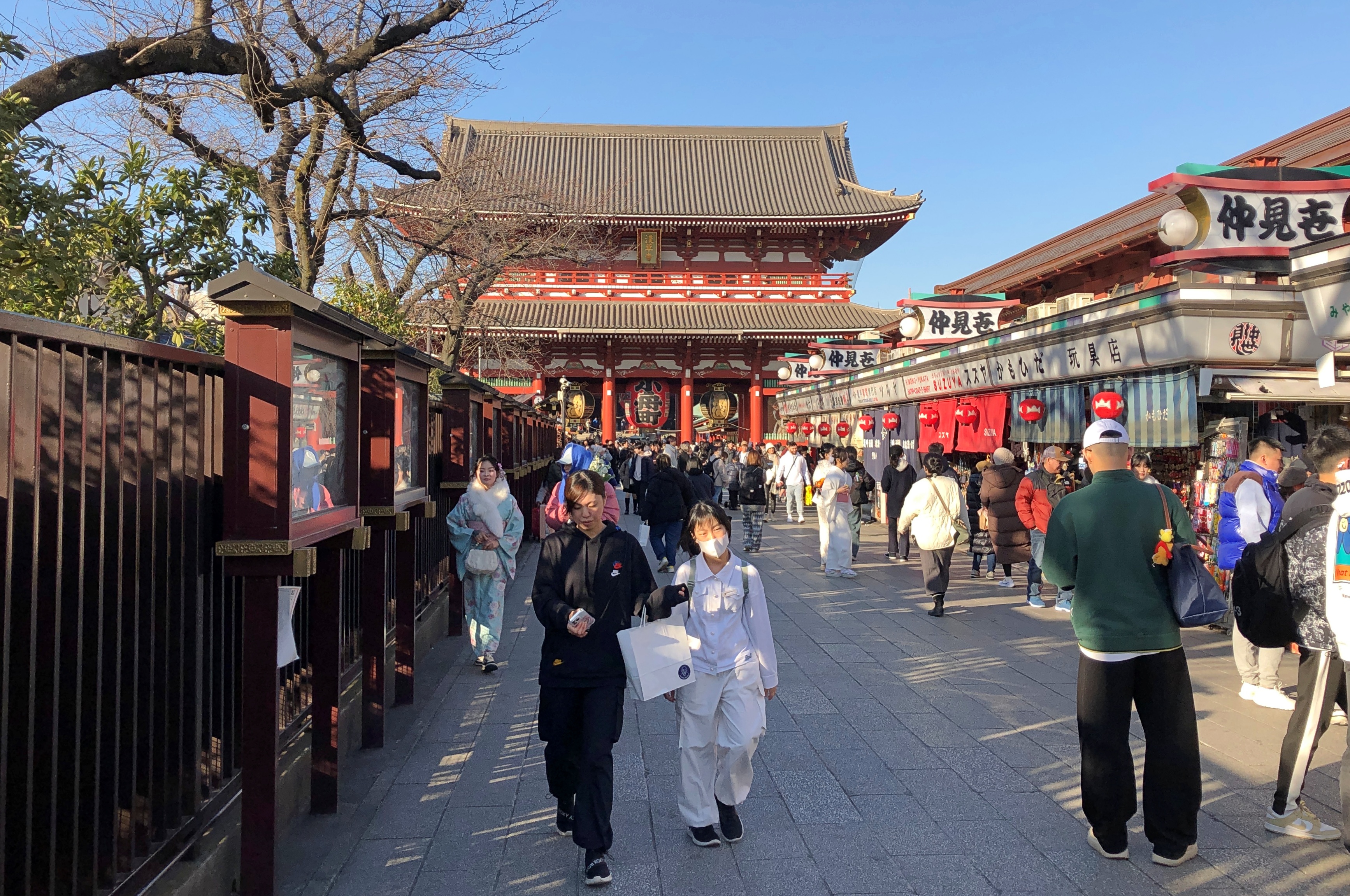
The temple’s other gate is known as Kaminarimon, and if I’d known about its noteworthiness, we’d have backtracked a bit to see it. Apparently we entered the Nakamise-dōri at the middle, and so missed Kaminarimon (and it took me a while to figure that out just today). Ah, well.

There has been a Buddhist temple on the site since our 7th century, with the usual history of fires and rebuilding down the centuries, including the most recent cycle in the 20th century. The early 1945 air raids destroyed the temple, but rebuilding was complete by the 1970s. Said to be one of the most-visited religious sites in the world, the temple has the advantage in that regard of being square within the world’s most populous metro.Senso-ji temple, Tokyo

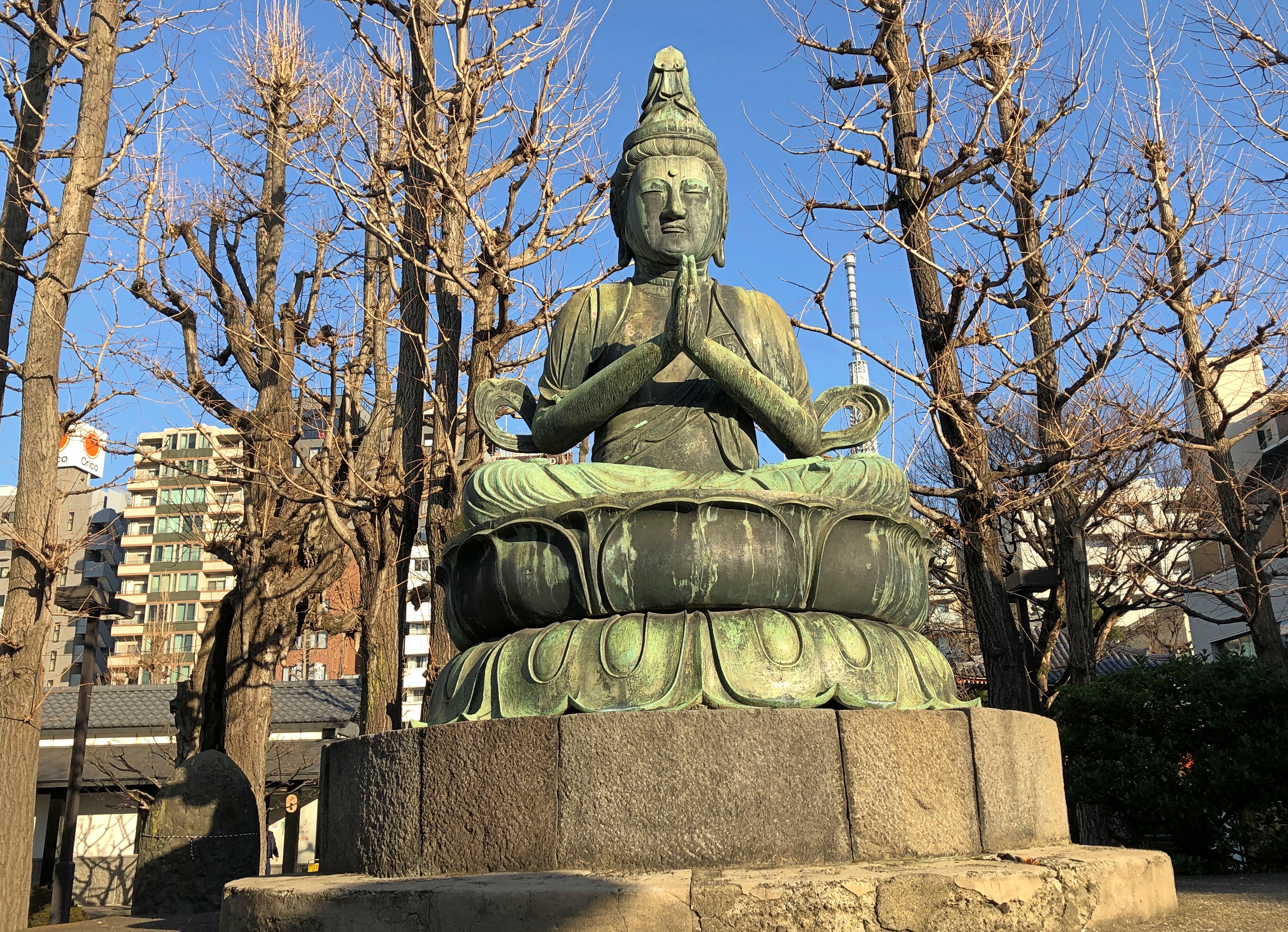
The temple is dedicated to Kannon, the bodhisattva of compassion, which might also help explain its popularity. Who doesn’t need some compassion sometimes? Kannon is popular when it comes temple dedications, with Shitennō-ji, Kiyomizu-dera and Sanjūsangen-dō also dedicated to Kannon, all in the Kansai region, and all of which I visited at one time or another.
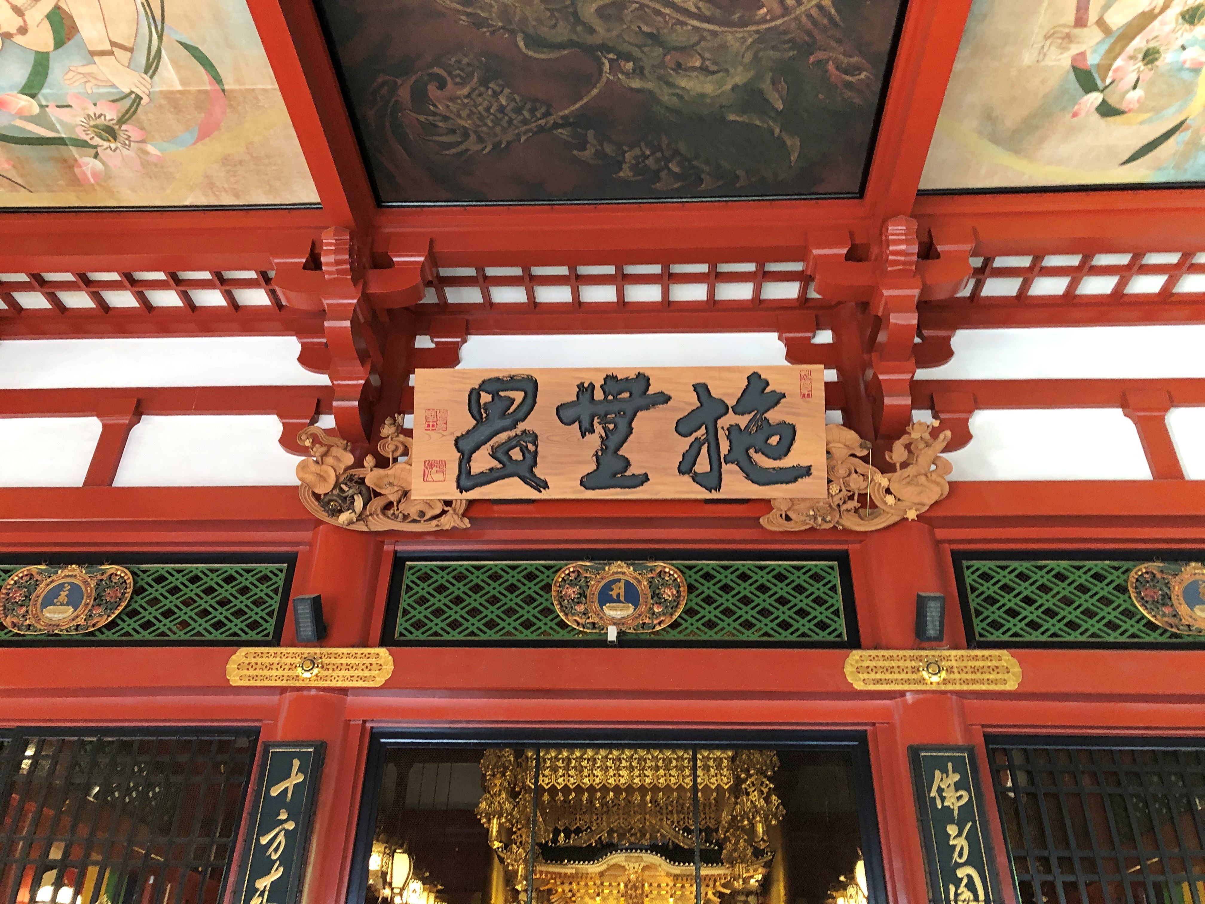
The Main Hall.Senso-ji temple, Tokyo Senso-ji temple, Tokyo Senso-ji temple, Tokyo Senso-ji temple, Tokyo

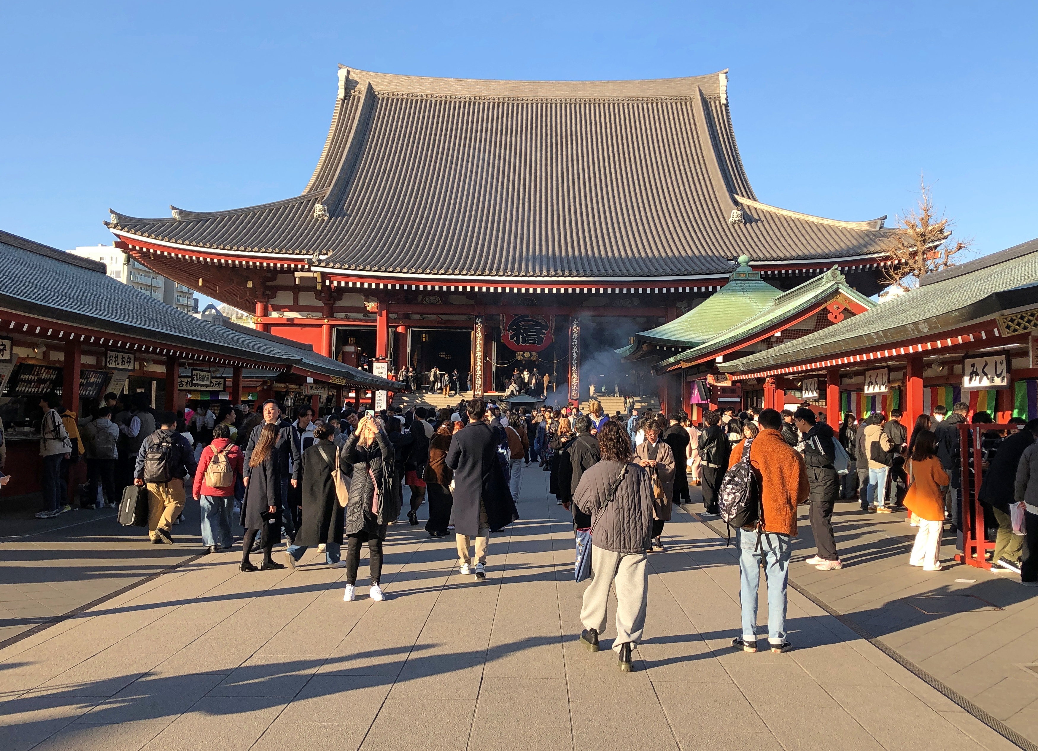
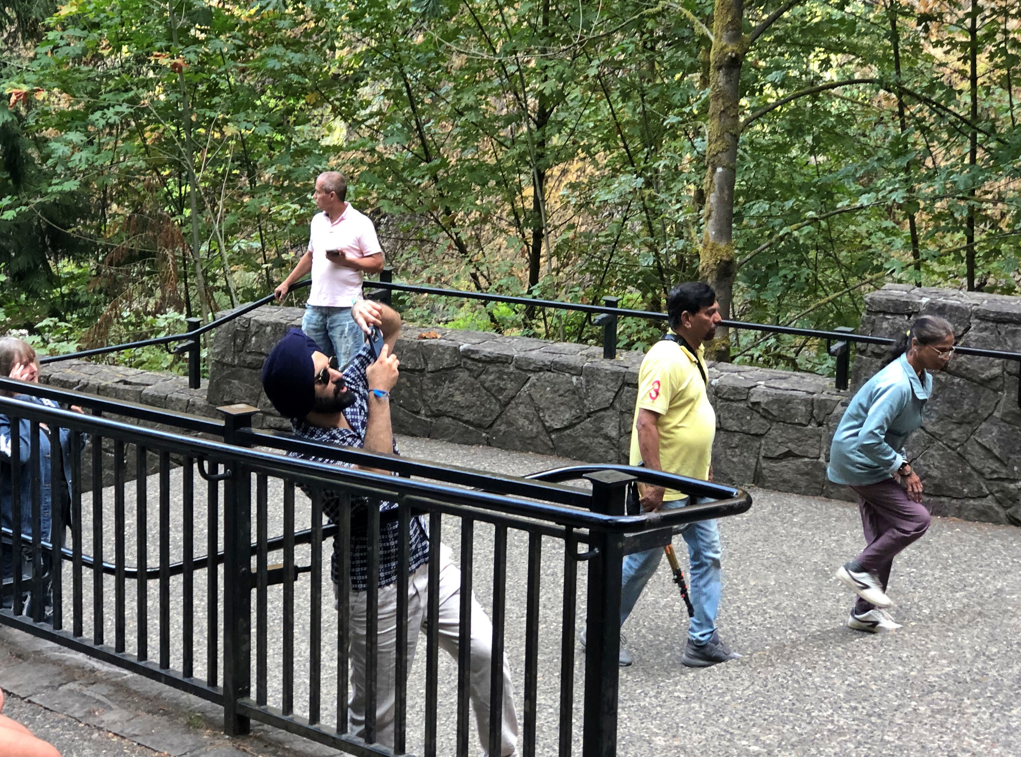
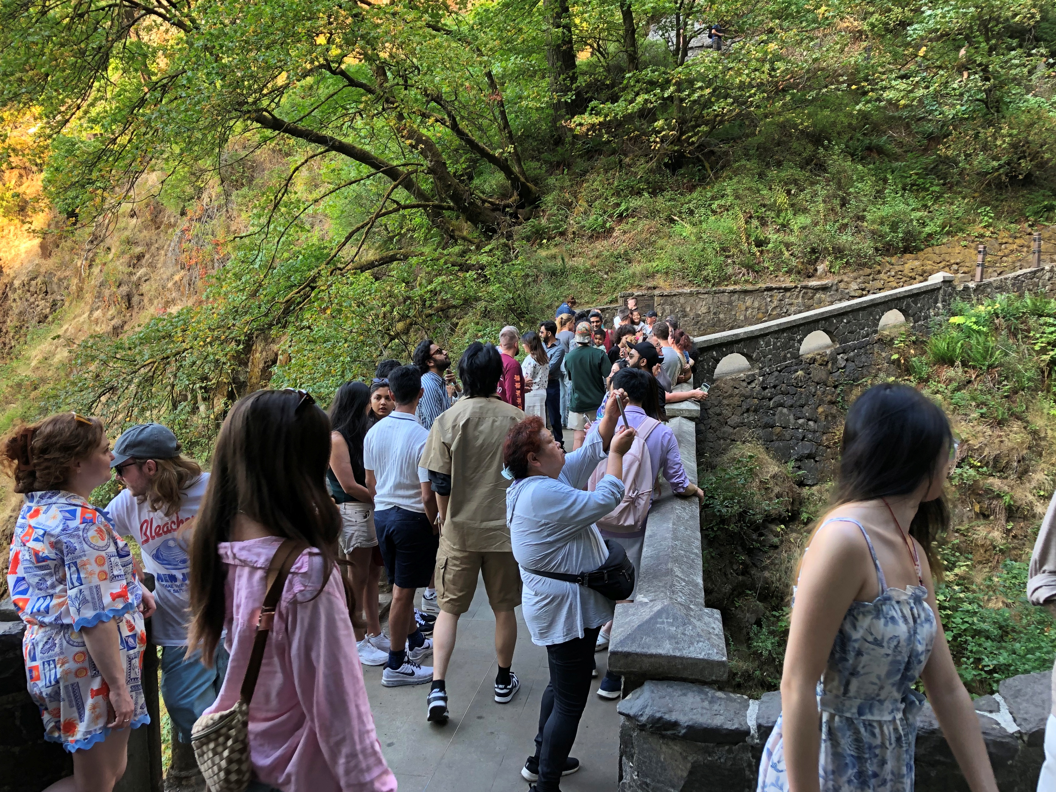
No shortage of visitors.Senso-ji temple Senso-ji temple, Tokyo Senso-ji temple, Tokyo Senso-ji temple, Tokyo

Not a bad afternoon in Tokyo, visiting popular structures from the 21st and 7th centuries, respectively, and being fully alive in the present.

The Burj Khalifa

If it weren’t too much trouble, I’d rummage through my paper archives – paper agglomeration – and dig up a roundtable interview I did in the early 2000s for the magazine I edited at the time. A number of local, meaning Chicago, architects gathered in a meeting room and I recorded their conversation, publishing an edited version. One of the participants was Adrian Smith.

That came to mind in the shadow of the Buji Khalifa in Dubai on the last day of February.Burj Kalifa Burj Kalifa Burj Kalifa

As an architect with HOK, Smith designed the Burj Khalifa (burj = tower). One day I will dig up the interview, to see whether he mentioned it. I’m not sure of the timing, but HOK might have been in discussions for the commission at that very moment, since construction started in 2004. Regardless, quite a thing. A signal achievement for Smith, whatever you think of very tall buildings, and not just for its height, but for its elegant stacking effect.

Dubai is eager to point out that the Buji Khalifa is currently the tallest manmade structure in the world (2,722 feet), taller than any poser in East Asia or obscure TV tower in North Dakota or behind the former Iron Curtain. For casual visitors, two observation decks are advertised, and no doubt there are even more expensive, unadvertised options, including for the rarefied few, going to the very top.

The ordinary tourist deck is at a lower level (floors 124-125) than the one at a significant premium (floor 148), which offers welcome refreshments (coffee and dates), access to a lounge and – mostly importantly – no waiting around in line to get in.

The Burj Khalifa is popular. You will wait in line if you pick the ordinary deck — about 45 minutes in my case — and you’ll see a spot of overselling on the way.Burj Kalifa Burj Kalifa

It wasn’t the waiting itself that was irritating, but the fact I always sensed that the elevators were going to be around the next corner, only to be wrong a half-dozen times. But I’m being churlish. All that grouchiness vanished as soon as I got on the elevator — which was a straight shot up to the deck, no changing cars necessary — and especially as soon as I reached the view.

Looking down at the Dubai Mall, and the massive nearby fountain, which erupts periodically with a height of its own.Dubai

Behind the Dubai Mall (from my vantage).

Next to the Dubai Mall.Dubai

I started losing track of directions. Dubai spreads out in a number of them.Dubai Dubai Dubai

Emaar being a major real estate developer in the region, controlled by this fellow, autocrat of Dubai.Dubai Dubai

Burj Khalifa, opened in 2010, was one of its projects, along with the Dubai Mall. To judge by how often the name Emaar appears on large buildings in Dubai, I’d guess it and legions of guest workers built most of modern Dubai as well.

Open House Chicago ’24

Open House, which in some places is Doors Open, is a wonderful event. The concept is simple: at designated places around town, you can go in and look around during specified hours on a particular weekend for no charge. I’ve been attending Chicago’s most years since 2013.

More American cities ought to do it. Worldwide, almost 60 cities do so under the Open House banner, with only four U.S. cities participating: Chicago, Miami, New York, and San Diego. Others are Doors Open: Baltimore, Buffalo, Milwaukee, Minneapolis, Pittsburgh, and the state of Rhode Island, which is only a little larger than a metropolitan area. Note the many missing from both lists, such as Atlanta, Boston, Dallas, Denver, Los Angeles, Nashville, Philadelphia, San Francisco, Seattle – and I could add more among large and mid-sized cities.

We were thinking of visiting New York this year for its event, which was a week ago, but ultimately decided on the Bruce Peninsula for our October trip. Maybe next year. As it happened, Chicago was the same weekend as New York, October 19 and 20, and since we were back from Canada by then, we went ahead with another Chicago Open House.Open House Chicago 2024

We focused on downtown this year, mostly because I didn’t feel like driving to any other neighborhood, and Metra takes you right to Union Station. Steps away – as real estate listings tend to put it – is the Sears Tower (I’m not calling it anything else). The blue wavy feature is fairly new.Open House Chicago 2024

The ground level of the tower has been redeveloped since the last time I was there, adding a large food hall. Do-Rite Donuts & Chicken looked really tempting, but no. Some other time.

The open part of the Sears Tower for Open House Chicago was the Metropolitan Club, up on the 67th floor. I’d been there before a couple of times, for business lunches in the early 2000s.Open House Chicago 2024

Nice views, but no one was giving away views from the Skydeck up on the 103th floor. Tickets to that are timed, and sell for $32 or more, a fact that irritates me. I remember visiting in 1987 for $3.50, which is the equivalent of a little less than $10 now. Sure, there’s now a glass box jutting out that stands between you and eternity when you admire the vista from that perch. Add a few dollars for that, but that isn’t enough to justify the gouge.

Never mind, we also visited the Chicago Board of Trade Building and the Wintrust Bank Building, both near the intersection of Jackson and LaSalle, as we made our way eastward. Both are marvels of design and familiar — but you can always see something new. After lunch we spent a good long time at the Fine Arts Building on Michigan Ave. Also familiar, but so many details to engage your attention, if you let it. All 10 floors were open, and we rode the manually operated elevator up to the 10th floor and made our way down the stairs.

That was it. Fewer places than in most years because, it seems, word of Open House Chicago has finally gotten around, and each place we visited had a line to get in. So did Symphony Center, which we didn’t want to wait for. If I remember right in 2013, that wasn’t the case, when everyone I mentioned the event to had never heard of it, and you could walk right in each sight.

Bruce Peninsula National Park: The Sand

Clambering around on rocks, even the kind that don’t require any technical skills, takes energy, so lunch was the next order of business after our hike along the shore of Georgian Bay last Wednesday. We spotted a food truck outside the park, on Ontario 6, called the Hungry Hiker. That seemed fitting.Hungry Hiker, Tobermory

It had a Bigfoot theme. That seemed odd.Hungry Hiker, Tobermory

During our travels in the U.S. West, especially Montana-Idaho-Washington state, we noticed many roadside Bigfoot depictions, including this one in metro Seattle, in front of a place in Edmonds where we had lunch one day.Bigfoot, Edmunds, Wash.

The Hungry Hiker Bigfoot was the only one we saw in Canada. Whimsy on the part of the owner, maybe, which also included some of the menu items, such as the Sweaty Yeti, a chicken sandwich with a sweet glaze. We ordered one, but not The Big Foot, which was a foot-long hot dog. Sasquatch theme or not, the Hungry Hiker’s food was satisfying.

Next stop: Singing Sands Beach at Bruce Peninsula NP. The park includes more than one section, with the beach on the other side of the peninsula, facing Lake Huron proper.Singing Sands Beach, Bruce Peninsula NP

Nice. A big, almost empty beach. In mid-summer, it’s probably overrun. In October, there were only a few people and a frolicking dog.Singing Sands Beach, Bruce Peninsula NP

Behind the beach, a fen.Singing Sands Beach, Bruce Peninsula NP Singing Sands Beach, Bruce Peninsula NP

I don’t know a fen from a bog or a marsh, even though I’ve seen a fen, but that’s what the sign said. It also informed us that resident in the area is the Massasauga rattlesnake (Sistrurus catenatus), “Ontario’s only venomous snake.”

I didn’t know Ontario had any venomous snakes either, much less a rattler. We were further assured that they are small (not a good thing) and shy (better), so they are likely to avoid you. Also, they are endangered, so gardeners in, say, suburban Toronto aren’t at much risk. Canada ≠ Australia, despite some historic similarities. As we tromped along, none were to be heard.

A short trail wandered into the trees near the beach, past a couple of creeks meeting Lake Huron.Singing Sands Beach, Bruce Peninsula NP Singing Sands Beach, Bruce Peninsula NP

The trail was a loop, returning by way of grasslands and more beach, which was a little rocky at that point.Singing Sands Beach, Bruce Peninsula NP Singing Sands Beach, Bruce Peninsula NP Singing Sands Beach, Bruce Peninsula NP

We still had some afternoon left – a warmish day in October isn’t to be wasted – so we went to the BPNP visitor center, back on the Georgian Bay side, to climb the observation tower.Bruce Peninsula NP Bruce Peninsula NP

Nice views, though not as much fall color as we’d expected. I could feel the tower shake just a little in the wind, which wasn’t a pleasant sensation. I’m still up for climbing towers for the vistas, but find myself a bit more unnerved by the experience than I used to be.Bruce Peninsula NP Bruce Peninsula NP

We still weren’t quite done. We drove the short way to Big Tub Harbour, which isn’t part of the national park, but rather part of the town of Tobermory.Big Tub Harbour, Ontario

The thing to see there is the lighthouse.Big Tub Harbour, Ontario Big Tub Harbour, Ontario

Still a working light, so no climbing, unlike others. Not as storied as the Lighthouse of Alexandria or even the Eddystone Light, but good enough on a windy afternoon in Ontario.

Grand Teton National Park

Time for a fall break, though it hasn’t been much like fall lately. Cool nights, but warm and almost hot days. This weekend, the nights weren’t even that cool. On Saturday evening we sat on the deck and ate our pizza dinner. The wind was a bit brisk, and willing to carry away unanchored napkins, but other than that it was a wonderful time for dining al fresco. Here in October.

Back to posting on October 13 or so. Or maybe October 15, to honor Italian Food Day, as Ann calls it. Still technically a holiday in most states.

For a North American mountain range, the Tetons are pups, with current scientific assessment putting their age at 6 million to 9 million years. The likes of the Sierra Nevada and the Cascades come in between 40 million and 45 million years old; the Sierra Madre at 60 million years; the Great Smoky Mountains from 200 million to 300 million, just to cite North American examples.Grand Teton National Park

The Tetons’ ongoing formation has something to do with one plate subducting under another and vast crack in the Earth. I don’t have a deep understanding of geology, but I can get a sense of a slow motion crash – really slow motion, from a human perspective – and enormous volumes of rock being pushed upward.

The wider geology of this part of the West is just as strange and interesting. Deep down under the crust is a hot spot, an imponderable heat bulge that brought volcanism to the surface in Idaho and later Wyoming, as the big North American plate passed over the spot over the last few million years. An eruption of the Yellowstone Caldera is due. Could be tomorrow, could be 1,000 or 10,000 years from now, I understand.

Then there’s the matter, very recent on a geological scale, of the freezing and thawing of ice ages, creator and destroyer of ancient lakes in the area, as illustrated by the unstable ice dams on the Columbia and the cubic miles of water unleased on the gorge not only once, but many times.

Geologically speaking, this part of North America’s having a rumble. What’s really remarkable is that we humans, with our firefly lifespans, have figured all that out. Mostly in my lifetime. You can’t tell that just looking at the grandeur. But knowing all that adds to the view.

Day one. Our first day at the park was driving and some hiking.Grand Teton National Park Grand Teton National Park Grand Teton National Park

Jenny Lake. A scenic drive skirts its shore.Grand Teton National Park Grand Teton National Park

A roadside view of the mountains, but also a river.Grand Teton National Park

The trees line the Snake River. I had little appreciation for the Snake before taking this trip and looking at fine maps like this, which not only details the mighty Columbia but the serpentine Snake, though both of them wind around. We saw the Snake at Grand Teton NP near its origin, but also crossed it where it forms the Oregon-Idaho border, and at Idaho Falls.

Our second day was hiking and some driving.Grand Teton National Park Grand Teton National Park

The trail to Taggert Lake.Grand Teton National Park Grand Teton National Park Grand Teton National Park

When we passed these boulders, the thought popped into my head: What’s the difference, really, between these chunks of rock in the foreground and the peaks in the background? Just mass.Grand Teton National Park

The lake. Wow.Grand Teton National Park Grand Teton National Park

Not a solitary experience.Grand Teton National Park Grand Teton National Park Grand Teton National Park

Father and daughter, I assume. They spent quite a while looking at the many tadpole-like fish in the shallows.

More solitary away from the lake, on the long looping trail back to the parking lot.Grand Teton National Park Grand Teton National Park Grand Teton National Park

We did make the nodding acquaintance of a family. Probably grandparents and their two university-aged grandsons (or maybe one with a friend), probably from a metro in the Northeast. The grandmother, maybe 10 years my senior, looked particularly exhausted by the trail, grayish hair frazzled, face a little pink.

We passed them, though they passed us later as we relaxed in a shady spot. Later, we passed them again as they rested, the grandsons clearly worried about grandma, though I don’t think she was in any real danger, unless she had a health problem I didn’t know about. Still, she was making the effort at however many thousands of feet we were in elevation, with its thinner air.

Again I ask – and always wonder – what is it about mountains? I don’t have the urge to climb, but I do want to get close enough to see their majesty.Grand Teton National Park Grand Teton National Park Grand Teton National Park Grand Teton National Park

Once the hiking is over —Victor, Idaho

Waiting are the comforts of a rented room. Ahh.

The Columbia River Gorge

A happy birthday to Jimmy Carter, president of my adolescence, who some years ago outlasted every other holder of that high office, now reaching 100. I can’t presume to know the secret of his longevity, but can speculate that lasting long enough to vote against you-know-who might have been an inspiration to hang on.

While reading about President Carter today, I came across the conclusion of a speech at the dedication of the Carter Presidential Library in Atlanta on October 1, 1986.

I must tell you, Mr. President, that your countrymen have vivid memories of your time in the White House still. They see you working in the Oval Office at your desk with an air of intense concentration, repairing to a quiet place to receive the latest word on the hostages you did so much to free, or studying in your hideaway office for the meeting at Camp David that would mark such a breakthrough for peace in the Middle East. Others will speak today, Mr. President, of all phases of your political career and your policies. For myself, I can pay you no higher honor than to say simply this: You gave of yourself to this country, gracing the White House with your passion and intellect and commitment. And now you have become a permanent part of that grand old house, so rich in tradition, that belongs to us all. For that, Mr. President, I thank you, and your country thanks you.

Who said that? Ronald Reagan.

A month ago today we headed east from Portland on US 30, which soon becomes the Historic Columbia River Highway, beginning at the sizable town of Troutdale, an intriguing place that seems to count as exurban Portland. As highways go, the road is antediluvian, first surveyed in the 1910s, partly following a 19th-century wagon route. Old, but well maintained, it’s a smooth drive in our time, though fairly busy.

The highway’s engineer, Samuel C. Lancaster, got himself a plaque along the way, which calls the road a highway of “poetry and drama.” He collaborated with business tycoon and good roads promoter Sam Hill to get the road built.Columbia River Gorge

That is, he left a legacy of vistas. One could do a lot worse.

At Chanticleer Point.Columbia River Gorge

Further east is Crown Point, a promontory more than 700 feet high, with an even more sweeping view of the mighty Columbia. The builders of the highway knew this too, and included an observation tower: Vista House.Columbia River Gorge Columbia River Gorge

Designed by Edgar M. Lazarus and completed in 1918. Elegant stonework, and an expensive development, I’ve read. I’d say worth it, for providing more than a century of vistas.Columbia River Gorge Columbia River Gorge

Inside Vista House is a small museum, gift shop, and an information kiosk where we got helpful information from the person at the desk. She said that the highway (US 30) was closed for construction a few miles to the east, and that if we wanted to visit Multnomah Falls, we’d need to backtrack a few miles and then take I-84, the modern road that also passes through the Columbia River Gorge.

That we did.Columbia River Gorge

To see the falls, at least on September 1, you needed to book a slot, and we did that as well. Tall falls near a highway draws a crowd, though that isn’t apparent at a distance.Multnomah Falls

If you edit just so, that isn’t apparent closer up either.Multnomah Falls Multnomah Falls

But on a visit to the falls, which drop 635 feet in two plunges, you won’t be alone.Multnomah Falls Multnomah Falls Multnomah Falls

A stone footbridge 100 feet above the lower pool is the place to climb to and point your camera.Multnomah Falls

“Formed by the cataclysmic Missoula Floods beginning 15,000 years ago and fed mainly by underground springs, Multnomah Falls drops… in two major tiers down basalt cliffs,” says the office of the Oregon Secretary of State. “It ranks as the tallest waterfall in Oregon and is one of the most visited tourism sites in the state.”

Two million visits a year, to quantify that statement. As I’ve noticed in a fair number of other places, that’s not much of an issue, since the crowd is in a pretty good mood.

Missoula Floods?

“After millennia of relative calm, the colossal Missoula Floods crashed through the [Columbia River] gorge several times between 12,000 and 18,000 years ago,” wrote science writer Richard Hill in the Oregonian. “The source of the floods was the 2,000-foot-deep, 200-mile-wide Glacial Lake Missoula. Until the last ice age started to thaw, an ice sheet at the mouth of the Clark Fork River in northern Idaho and Montana blocked it.

“But slowly, melted water cut a channel into or under the ice, collapsing the dam and unleashing the lake’s 500 cubic miles of water. It sped into the narrower confines of the gorge at 75 mph and submerged Crown Point. The ice dam repeatedly would reform, and the flood process would start again.

“Recent studies… found evidence of at least 25 massive floods. They calculated the largest flood discharged roughly 2.6 billion gallons a second — about 2,000 times larger than the Columbia’s 1996 flood.”

1996 flood?

Another one of those things I’m sure I heard about, but memory of it has evaporated as surely as the flood waters. Epic, the Oregonian calls it.

Going-to-the-Sun Road

No point in burying the lead. Going-to-the-Sun Road in Glacier NP is famed for its splendid mountain scenery, and for good reason.  Going to the Sun Road Going to the Sun Road Going to the Sun Road Going to the Sun Road

The road is also an epic feat of civil engineering. With its large pullouts for auto tourism, it dates from what you might call the golden age of road building in national parks, which was spurred by the prospect of auto tourism. Beginning about 100 years ago, that is, and a key factor in making Glacier a tourist magnet over the years.

Nearly or over 3 million visitors have visited each year since 2016, except for 2020. In 2022, Glacier was tenth-most visited of the 63 national parks.

On August 24, we drove westward on the two-lane Going-to-the-Sun Road, which winds across Glacier for 50 miles or so. Hard to believe that such a poetic name is government sanctioned, but so it is, named for the nearby Going-to-the-Sun Mountain, which in turn had been named that by the remarkable, and mostly forgotten, James Willard Schultz. Apparently he took it upon himself to name features in the future Glacier National Park long before it was a park, which it became in 1910, with President Taft’s signature on the bill.

The eastern entrance to the road has a visitor center, which flies two flags of nearby nations, along with the Stars and Stripes.

The less familiar one is the Blackfeet Nation.

The Blackfeet Reservation, at 1.5 million acres, is half again as large as Glacier NP, which comes in at about a million acres. The reservation is due east of the park, and in fact they share a border on the eastern side of the park. Indeed, much of the park was part of the reservation until the tribe was obliged to cede the land in the 1890s.

Another digression: “The Chief Mountain Hotshots are a Native American elite firefighting crew based out of the Blackfeet Indian Reservation located at Browning, MT with Glacier National Park as their backyard,” the Bureau of Indian Affairs says.

“The Chief Mountain Hotshots are a highly trained self-sufficient hotshot crew working in wildland firefighting. On average, the Crew works 15-20 large fire incidents and travels 10,000-20,000 miles a year.” More about the hotshots is here.

All good to know, but I’m glad there were no wildfires in the vicinity for them to fight. As the road passes along the north shore of cold-water Saint Mary Lake — Going to the Sun Road

— clearly there has been some wildfire.

The road rises from the lake, elevation 4,484 feet, toward the Continental Divide at Logan Pass, elevation 6,646 feet.Going to the Sun Road Going to the Sun Road Going to the Sun RoadGoing to the Sun Road

Logan Pass is the kind of place we would stop, but there was no available parking. This pic was taken by a photographer named Ken Thomas, who thoughtfully put it in the public domain.

No trucks or RVs allowed on the road, since they wouldn’t fit in some (many) places. That doesn’t keep drivers off the road, however. During the warm months when it’s open, Going-to-the-Sun is a busy place.

Even so, much of it still has that classic mountain appeal of low traffic.Going to the Sun Road

Except when there are knots of traffic. Just a few.Going to the Sun Road

Mountain scenery has a broad appeal.Going to the Sun Road Going to the Sun Road Going to the Sun Road

Toward the east end of the park, the road parallels McDonald Creek for a number of miles before it connects with Lake McDonald, the larger of the park’s two major lakes, and the lower, at 3,153 feet elevation. Some of the creek has more of a river look.Going to the Sun Road

Closer to the lake, the creek is rocky.Going to the Sun Road Going to the Sun Road Going to the Sun Road

The water is bound for the Flathead River, a tributary of the mighty Columbia. We stopped at a wooden bridge across the creek.Going to the Sun Road

Pedestrians can cross, but a sign warns that horse traffic has the right of way.Going to the Sun Road

Not something you see too often. I assume that’s horses with riders, as part of a horse-riding trail, though maybe wild horses might have the right of way too. Like bears or moose, they’re large and might insist.

Glacier National Park

“Did you see the weather forecast for today?” the young-faced NPS ranger said to us at the Many Glacier entrance station of Glacier National Park on August 23. Skies were clear that morning and the air had the makings of a warm day, but I confessed that we hadn’t. That was a bit of carelessness, considering that we were planning to take a hike. I think he wanted to tell us that, but thought better of it.

“There might be a thunderstorm this afternoon,” he continued politely. “Or not. Weather’s unpredictable here.”

I thanked him and we went on our way. What to do with that information, anyway? Cower somewhere dry? No. The hike was on.Glacier National Park

Another way to refer to Glacier is Waterton-Glacier International Peace Park, since the much smaller Waterton Lakes NP, a Parks Canada unit, is just north of Glacier on the other side of the Canadian border. Single park, my foot. You still need a passport to go to Waterton, at least if you drive, and I assume you pay separate admission. Still, the road to Waterton has a cool name: Chief Mountain International Highway (Montana 17 and then Alberta 6).

The part of Glacier NP we first visited was about 20 miles south of the border, and I think the closest we came to Canada on this trip. We had our passports, in case we wanted to go. It’s good to have options. But we didn’t have the energy for the rigmarole of two border crossings.

A short drive from the Many Glacier entrance is the Many Glacier Hotel.Glacier National Park

The hotel has views. Looking out on Swiftcurrent Lake.Glacier National Park Glacier National Park

Many Glacier Hotel dates from the 1910s, the handsome sort of place railroads were building at the time. Swiss style, to go with the notion of Glacier NP as the Switzerland of America. These days it is priced as a luxury property, only open in the summer. This year, it closed just this week. During the winter, I suppose, management hires a fellow like Jack Torrance as a caretaker. Well, maybe not quite like him.

A trail starts the hotel and goes around Swiftcurrent Lake, as well as the adjoining Josephine Lake, making connections with harder trails that lead into the mountains. Packing water, hats, walking sticks, plastic ponchos, and bear spray obtained at a big-box retailer in Helena, we headed off to do a circuit around Josephine Lake. To get there, you hike around the southern edge of Swiftcurrent.Glacier National Park Glacier National Park

It ended up being about a four-mile walk, with views of the mountains.Glacier National Park Glacier National Park

Anyone with a smartphone can now do homages to Ansel Adams. Pretty good ones, too.Glacier National Park

There are still glaciers in Glacier NP, but they are receding. One forecast of their total disappearance is by 2030.Glacier National Park

Views of the water.Glacier National Park Glacier National Park Glacier National Park

Møøse!A moose bit my sister once

Toward the end of the walk around Lake Josephine, we spotted bears frolicking in the water, too. At just the right distance. That is, pretty far away, especially because it was a mother and two cubs.

Eventually, the trail leads back to the hotel. We were fairly tired by then, so it was a good thing to see.Many Glacier Hotel

After the hike was over, we saw bison.

On my plate at one of the hotel restaurants. A nice buffalo burger, if a little expensive. You know what they say about room for all of God’s creatures, except that I didn’t have any mashed potatoes with that meal. Next to the French fries, then.

Remember the weather forecast? During our hike, and the meal afterward, skies were clear and temps warm. We needed those hats and that water. As we were leaving Many Glacier Hotel, however, we noticed dark clouds massing to the north. A moisture invasion from Alberta-British Columbia.

By the time we (almost) got back to our campground outside the St. Mary entrance to the park, the thunderstorm had arrived. Rain and then a few minutes of hail. I pulled over under a tree that offered some protection, but luckily the hailstones weren’t as big as in Wyoming, and didn’t even put any dints in the roof of the car.

Badlands National Park ’24

A little over 19 years ago, we visited Badlands National Park, which is easily accessible from I-90. Our visit ended up being short.

Lilly wasn’t impressed. Could have been the heat. Must of been pushing 100 F. pretty hard. Also, the austere beauty might have been lost on a seven-year-old.

On the afternoon of August 19 this year, conditions were dry and warm at Badlands, but not oppressively hot. This time we spent a few hours longer.Badlands National Park

At the entrance, I also made an investment in my future travels. One that has already paid off: an America the Beautiful National Parks and Federal Recreational Lands Pass, of the Senior Lifetime variety. You need to be 62 or older to get one, but if you are, the NPS employee at the entrance station can issue you one on the spot. If I can keep track of the physical card – which is exactly the same size and composition as a credit card – I can use for admission to NPS units until I go to that jurisdiction beyond federal oversight, namely the Great Beyond.

All for $80. Considering that vehicular admission to this particular park is ordinarily $30, I was already on my way to my money’s worth. Later on just this trip, we used the pass for admission to Glacier National Park (ordinarily $35), Olympic National Park ($30), Craters of the Moon National Monument ($20), Grand Teton National Park ($35) and Yellowstone National Park ($35). A good deal. You’d think the government was encouraging old people to travel.

I don’t need the encouragement.Badlands National Park
Badlands National Park

“For hundreds of years, the Lakota people have called this area mako sica, which literally translates to ‘bad lands,’ the NPS notes. “When early French fur trappers passed through this area, they called the area les mauvaises terres a traveser (‘bad lands to travel across’). Since the French trappers spent time with the Lakota, it is likely that the French name is derived directly from the Lakota one. Badlands National Park Badlands National Park

“The Badlands presents many challenges to easy travel,” the NPS publication notes wryly. (Government pubs get to be wry?)

Except, of course, for the road that dips into the park and runs through the North Unit. Other parts of the park, which extends to the southwest away from the reach of paved roads, look remote indeed.Badlands National Park

“When it rains in the Badlands, the wet clay becomes slick and sticky, making it very difficult to cross. The jagged canyons and buttes that cover the landscape also make it hard to navigate. The winters are cold and windy, the summers are hot and dry, and the few water sources that exist are normally muddy and unsafe to drink. These factors make the land difficult to survive in, and evidence of early human activity in the Badlands points to seasonal hunting rather than permanent habitation.

‘In 1922, when Badlands was first proposed as a national park, the suggested name was Wonderland National Park!”Badlands National Park Badlands National Park Badlands National Park Badlands National Park

One more detail. A little more bad in the badlands. Badlands National Park

No buboes so far, so I figure we’ve avoided the plague for now. But I can’t say I wasn’t warned. In case you’re curious: The three most endemic countries for plague are the Democratic Republic of the Congo, Madagascar, and Peru, according to WHO. Not South Dakota, at least not yet.

South Dakota Dash ’24

The first day of the trip was a slog from Illinois through Wisconsin and most of southern Minnesota. The second day, August 19, we woke up in Luverne, Minnesota and went to bed in Sundance, Wyoming. Less of a slog, mainly because we stopped a few places in South Dakota along I-90.South Dakota flag

First of all, Sioux Falls. How can you stop in Sioux Falls and not see the falls?Sioux Falls Falls Park Sioux Falls Falls Park

Hard to believe, if you crop things right, you’re in a city of around 200,000. Sioux quartzite, it’s called.Falls Park, Sioux Falls

Once a hub of water-power industries — the ruins of a mill are on the grounds — these days the falls travel through the municipal Falls Park. Sioux Falls has thoughtfully erected an observation tower on top of a rise in the park, for better views.Sioux Falls Falls Park

Naturally, we went to the top, for the view of the falls, downtown Sioux Falls, and – off in a different direction – a major Smithfield meat processing plant. Sioux Falls isn’t just about credit card HQs, the result of a race-to-the-bottom concerning usury laws. It still has industry, too.Sioux Falls Falls Park

Before leaving town, we sought out the Cathedral of St. Joseph, a work by Emmanuel Louis Masqueray (d. 1917), another of those famed architects mostly lost to time. Among other things, he was chief of design at the 1904 St. Louis world’s fair (one of the four fonts of the modern world).Sioux Falls Cathedral St. Joseph Sioux Falls Cathedral St. Joseph

It was open. Not all city churches can say that on a Monday.Sioux Falls Cathedral St. Joseph Sioux Falls Cathedral St. Joseph

Nice. Westward on I-90, at one of the rest stops, we found a much smaller religious structure, though elegant in its simplicity.wayside chapel, South Dakota wayside chapel, South Dakota


It too was open.wayside chapel, South Dakota

Lunch that day was in the burg of Kennebec, SD (pop. 281), which happened to have a place, Benji’s Diner, with a distinctive ag-town vibe, and serious meat on the menu.

It’s a little hard to tell, but there’s beef under that sea of gravy, and I found it mighty filling. Signs on the highway promote the SD beef industry and beef eating on principle, and they get no argument from me.

We took a look around town. When I saw this, I concluded that every town, no matter how small, has one of these murals as a little expression of civic pride. Seems that way, anyway.Kennebec, SD

Kennebec is the Lyman County seat. Lyman County Courthouse, Kennebec South Dakota Kennebec South Dakota Kennebec South Dakota

The built environment isn’t just buildings.Kennebec South Dakota Kennebec South Dakota

Despite our large lunch, we managed to stay awake for the drive to Wall, SD, stopping for a few minutes at Wall Drug and then Badlands National Park, where we spent a few hours. That decision factored heavily into what happened next in Wyoming, more about which later. Enough to say that by the end of the day, we were in Sundance, Wyo.

But we weren’t done with South Dakota. For reasons I won’t bore anyone with, especially myself, we had to backtrack the next day to take care of a minor issue with the car, so it wouldn’t be major later on. For that, we went to Rapid City, which we had bypassed the day before. I’m glad we got to go, because the mechanical issue didn’t actually take long to deal with, which left us with time to see a bronze James K. Polk.Rapid City presidents

Plus U.S. Grant, Franklin Roosevelt, and Calvin Coolidge, among other U.S. presidents at street corners in downtown Rapid City that I managed to see.Rapid City presidents Rapid City presidents Rapid City presidents

“When a local man noticed people interacting with a temporarily placed statue of President Lincoln outside the Hotel Alex Johnson [in downtown Rapid City], an idea sparked. This man was Don Perdue, and he came up with the idea to put a president on every corner in Downtown Rapid City,” explains Visit Rapid City.

“It took a lot of convincing, a lot of fundraising, and hours of research before it started. In 1999, Perdue proposed the idea to the city as a way to honor the legacy of the American Presidency. The project was approved and in 2000 the first four presidents were unveiled: George Washington, John Adams, Ronald Reagan and George H.W. Bush… Over the next ten years, a group of local artists worked to create and place all 40 of the remaining statues.”

I didn’t have time to see all of them. Or the inclination. It was in the low 90s F. that day, so I only wanted to spend a few minutes seeking them out, while Yuriko more rationally waited in our air conditioned car.

She was willing to get out and look at Rapid City’s older attraction a few minutes later, however: Dinosaur Park. I later checked with my brother Jim. He said he does indeed remember, a little, our family’s visit to the park in 1960, before I was born.Dinosaur Park, Rapid City

There’s a good view of Rapid City from atop the park’s hill.Dinosaur Park, Rapid City

But you’re up there to look at wire-mesh-frame dinosaurs with concrete skins, originally dating from the 1930s but obviously maintained into our time and (maybe?) tinkered with a little to more closely match current thinking about dinosaurs.Dinosaur Park, Rapid City Dinosaur Park, Rapid City Dinosaur Park, Rapid City

Even better, I learned that the park was originally a WPA project, consciously designed to draw tourists to Rapid City with something distinctive. Of all the various WPA projects one can encounter, this has to be unique among the lot.