Red Bird

And just who was Red Bird? An early 19th-century warrior of the Winnebago, or as they call themselves, the Ho-Chunk. To my ear at least, that double naming works out well, since Winnebago is a fine name for the major lake in Wisconsin, and Ho-Chunk is a fine name for the tribe’s 21st-century casinos, which are in Wisconsin Dells and other places (and which advertise a fair bit in the metro Chicago market).

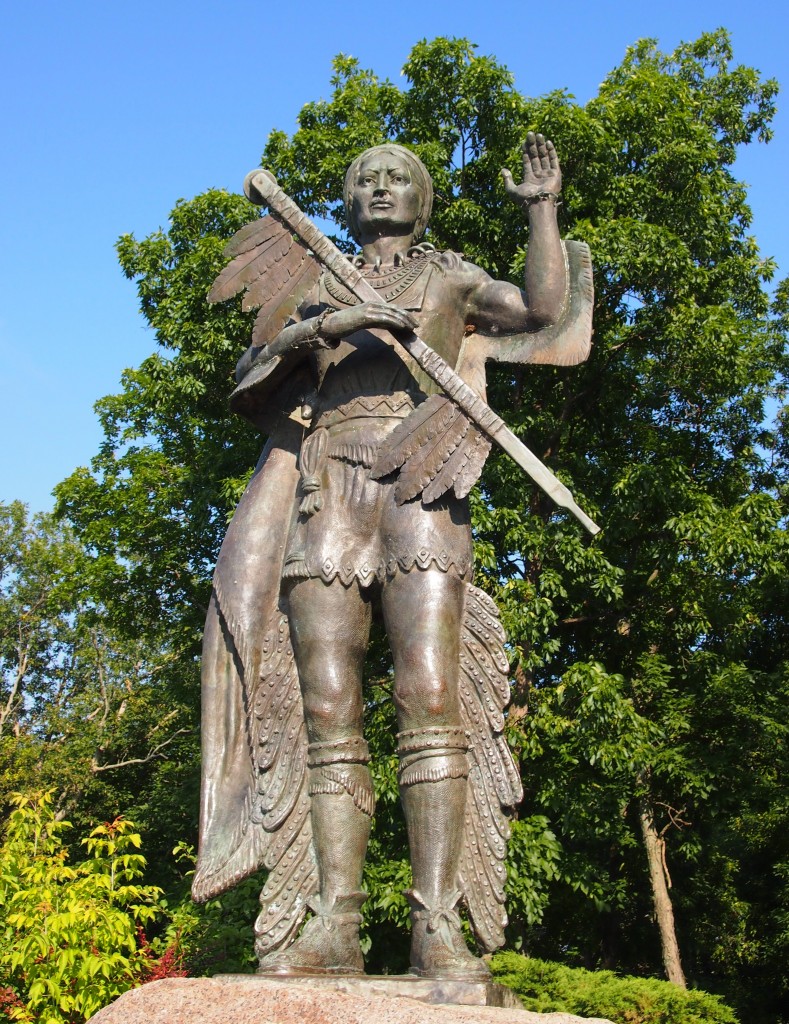
There’s a large statue of Red Bird facing Lake Winnebago at High Cliff State Park.
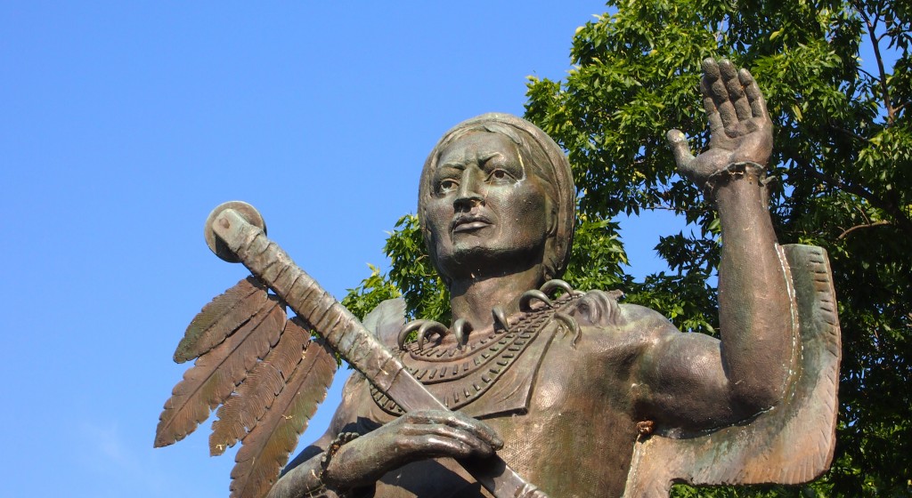
Its plaque says the statue was “designed by Adolphe E. Seebach” and “executed by Sculpture House, New York.” Seebach was apparently a Wisconsin sculptor who died in 1969, but a cursory look for him doesn’t uncover much more.

The Banta Company Foundation paid for the work; information on Banta isn’t hard to find. It was a large printing company based in Menasha, one of the Fox Cities, in business for over a century until R.R. Donnelley swallowed it in 2006. Why the company foundation decided to sponsor a statue of Red Bird in 1961—the date on the plaque—I couldn’t say. But there he stands, supposedly depicted as he was in 1827.

The Wisconsin Historical Society says of Red Bird: “Wrongly informed that the U.S. had executed two of their warriors, and thinking other tribes would support them due to widespread white incursions on Indian land, a party of Ho-Chunk from LaCrosse [including Red Bird] attacked settlers near Prairie du Chien in the last week of June, 1827. They killed two men and assaulted a child before returning to their village. On June 30th, a keelboat passing that village was attacked because the Ho-Chunk believed it was the same one whose crew had recently abducted and raped several Indian women.

“In response, the U.S. Army moved troops up from St. Louis, local militia units were hastily formed, and a total of ca. 600 soldiers assembled at Prairie du Chien. Another 100 militia were gathered at Green Bay, where 125 Menominee, Oneida and Stockbridge warriors joined in support of them. In late August these two forces converged from different directions on the assembled Ho-Chunk near Portage. On Sept. 2, 1827, Ho-Chunk tribal leaders surrendered the warrior Red Bird and five others, and further bloodshed was avoided. Red Bird died in prison and the other warriors were tried, sentenced to death, but ultimately pardoned.”

Elsewhere I’ve read that Red Bird dressed in his best finery to surrender – which is how he’s depicted in the statue – and expected to be put to death immediately, as he might have been by another tribe. To his bewilderment, he was chucked in prison, the sort of place in which you might die of dysentery, rather than experience a warrior’s death.
High Cliff Graffiti

On the northeastern shore of Lake Winnebago–the largest inland lake in Wisconsin–is High Cliff State Park, whose name ought to be a clue that it offers vistas of the lake. But it’s more than any old cliff. The Wisconsin DNR says that “the park gets its name from the limestone cliff of the Niagara Escarpment, which parallels the eastern shore of Lake Winnebago.”

It wasn’t the first time on this trip we’d seen the escarpment. County Road B in up the Door Peninsula has views of cliffs. According to Door County Coastal Byway, “Door County’s Green Bay side has the true escarpment, with exposed dolomite rock 200-250 feet high. At the base of these rock faces are remnants of the chunks of stone that fall from the cliffs to form ‘talus.’ ”

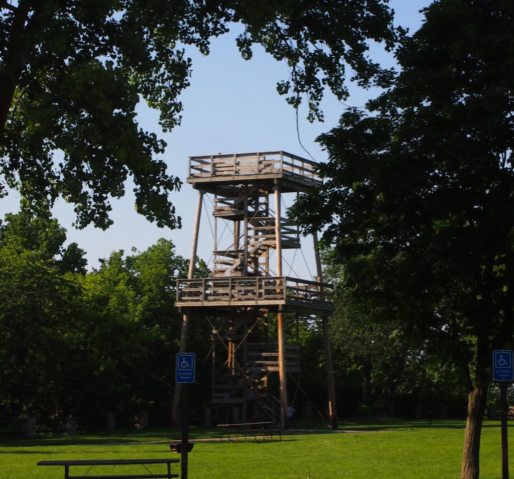
I wouldn’t know talus if I stubbed my toe on it, but the cliffs were evident, especially at George K. Pinney County Park, just off County Road B. At High Cliff State Park, the vantage is from on top of the cliffs, though trees block the view in some places. Maybe that’s why a wooden observation tower rises above the trees.

A plaque on the tower says, “THIS TOWER is dedicated to WILLIAM M. WRIGHT, spirited leader and longtime friend of High Cliff State Park. Built in 1984 with private funds from Kimberly-Clark Foundation Inc. and High Cliff State Park Association Inc.”

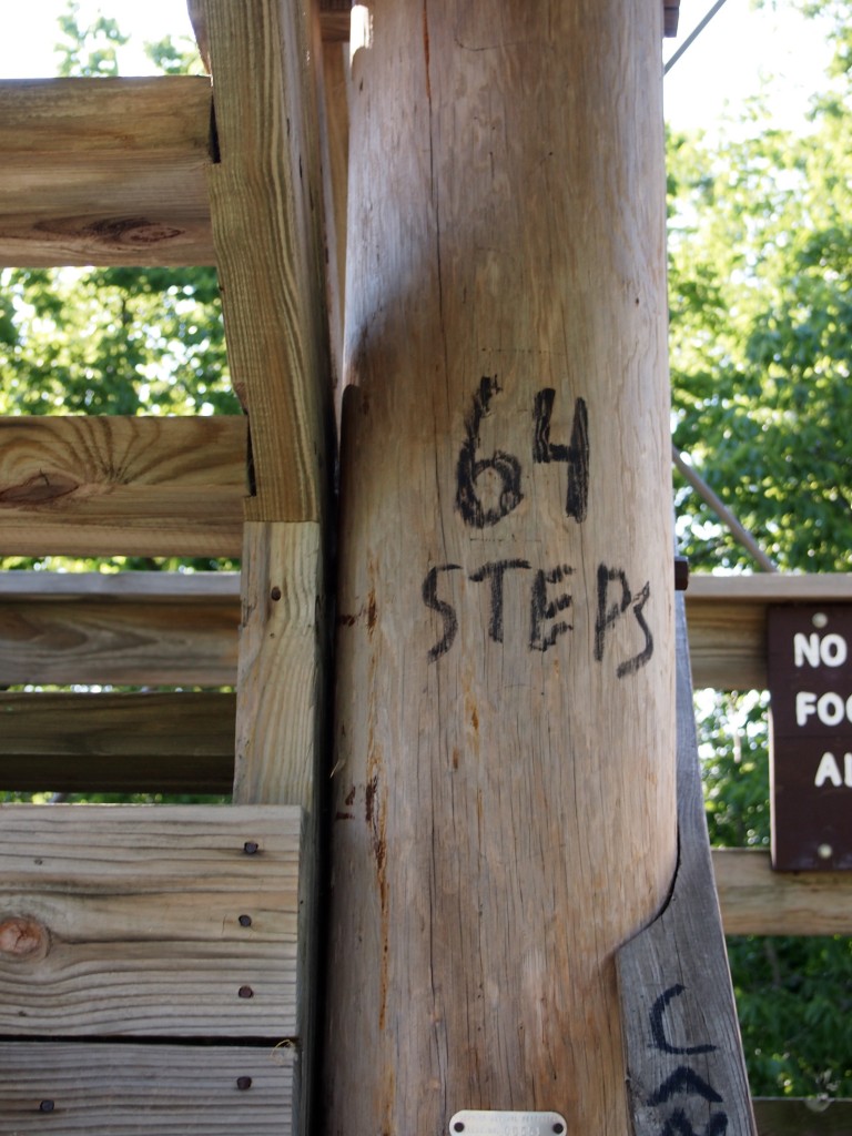
The plaque doesn’t tell you how many steps it takes to get to the top. An unusually helpful graffito at the bottom tells you that it’s 64 all together.

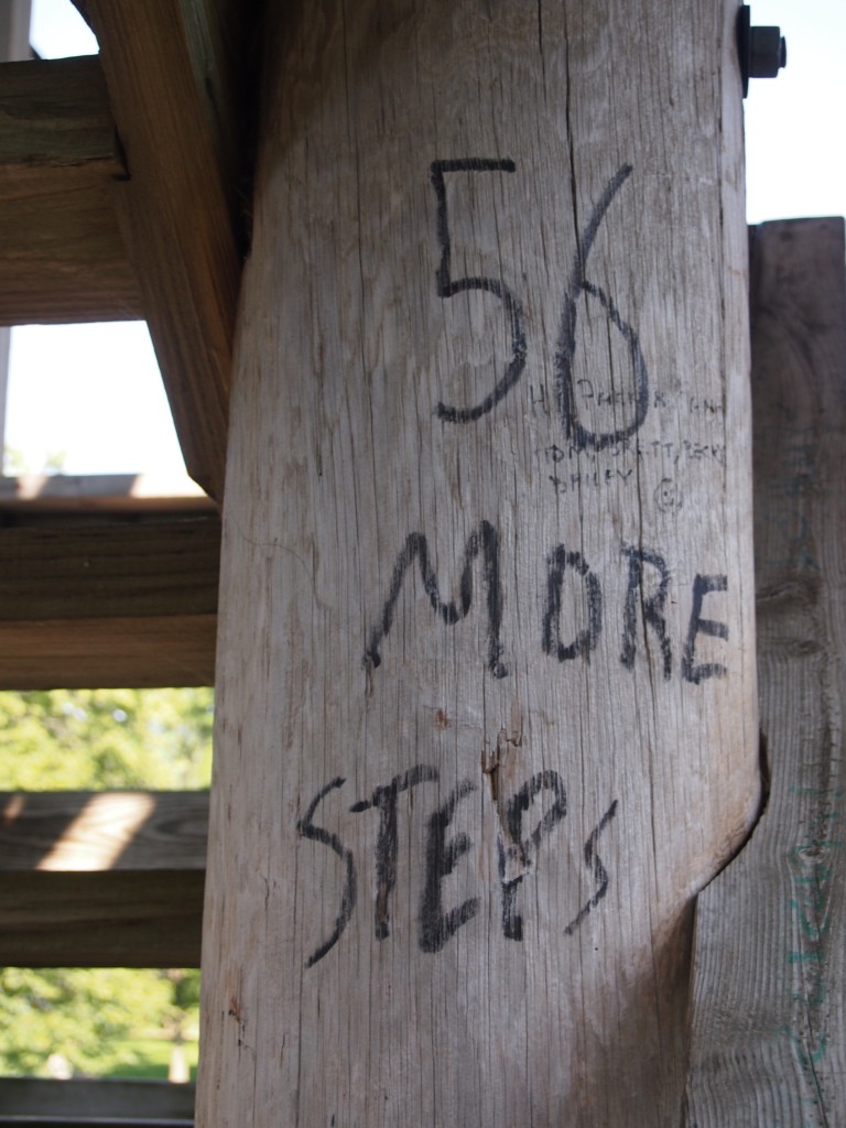
And it is. Eight flights of eight steps each. As you ascend, the helpful graffiti continues all of the way up.

Until you reach the top. You’re rewarded for climbing 64 steps with a broad view of northern Lake Winnebago, which isn’t so large than you can’t see the opposite shore, where Appleton, Neenah, and the other Fox Cities are located.

The Gardens of the Fox Cities

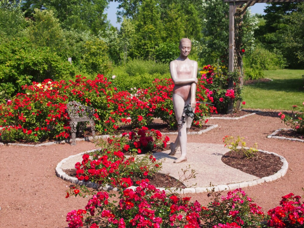
The Gardens of the Fox Cities in Appleton, Wis., consists of a series of formal plantings, such as the rose garden, which also includes a statue called “Reflections of Love,” by a local sculptor named Dallas Anderson. In the full flush of early July, it’s a gorgeous, but hot, setting. We visited fairly early in the morning – early for us on non-work days, ca. 10 a.m. – but even so, the heat was on.

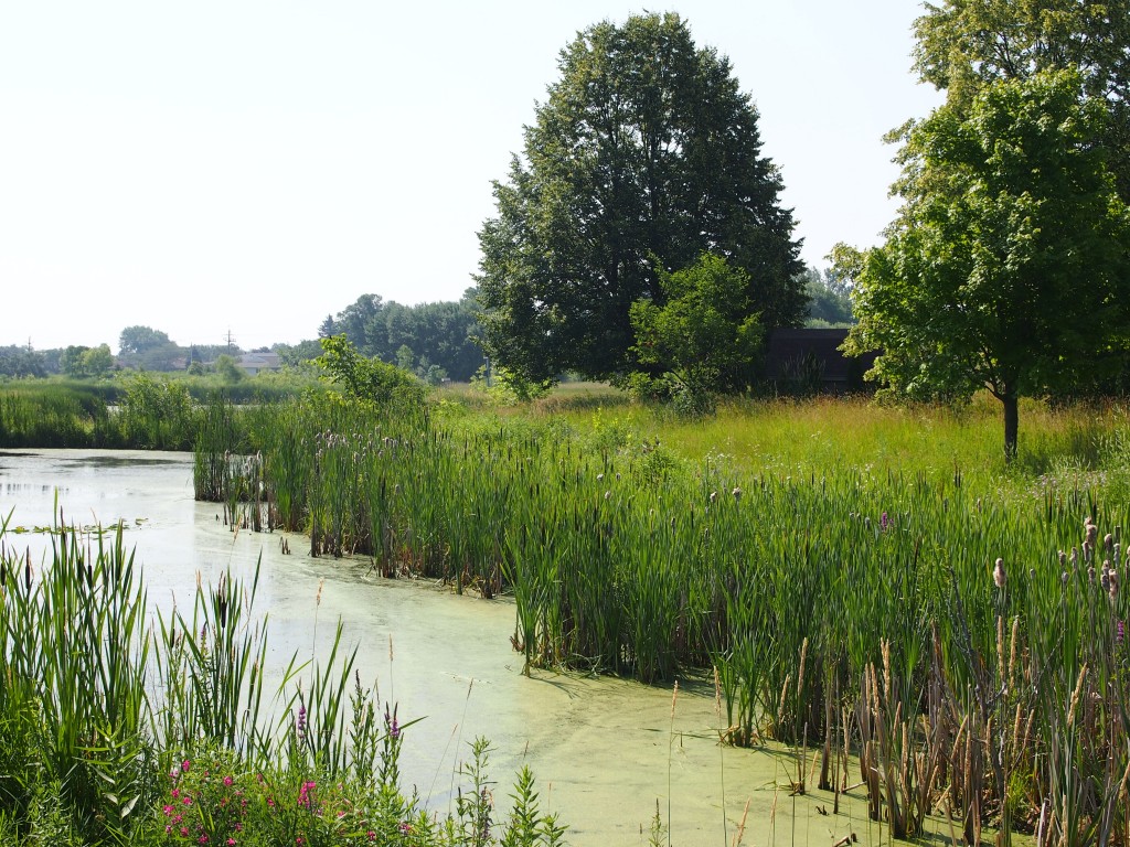
The gardens are either part of the large and mostly rec-oriented Appleton Memorial Park, or right next to that park, with no visible border. Turns out that the gardens also include wilder sections. Frame your shot just right and it’s a little hard to imagine that about 360,000 people live in the surrounding metro area.

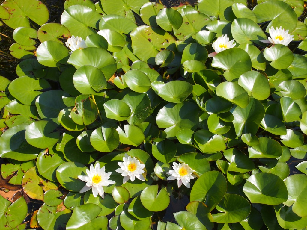
Look carefully, though, and there’s a house and a telephone pole in the distance. The gardens’ water features, some of them, luxuriated in lily pads.

The gardens also included a plant I’d never heard of – though there are many of those – called Lamb’s Ear (Stachys byzantina), which is native to Turkey and Iran. It’s an incredibly smooth plant, much like felt.

A Short Visit to Brussels

Southern Door County, the part below the Sturgeon Bay Ship Canal, isn’t the Door of tourist lore. But we discovered one of its charms all the same. Wisconsin 57 is the main road from the city of Green Bay to the town of Sturgeon Bay, and consulting the invaluable guidebook Moon Wisconsin, I noticed a town called Brussels just off the highway. “Brussels and surrounding towns… constitute the country’s largest Belgian-American settlement,” Moon asserts. “The architecture of the region is so well preserved that 100 buildings make up Wisconsin’s first rural National Historic Landmark.”

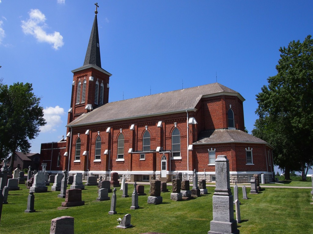
I had to take a look at that. We headed from 57 up County Highway C, and from that vantage, I have to say, it’s easy to miss most of those historic structures. Until you get to the junction of Highway C and Cemetery Road, that is, where you’ll find the St. Francis and St. Mary Parish Church. The setting is distinctly rural, complete with the odor of cow manure.

ST FRANCIS CHURCH is carved over the main entrance, but I understand that another congregation, St. Mary’s, joined St. Francis at one time. Not surprising, considering the way rural populations have dwindled in recent decades. My family thought I was stopping to see the adjacent cemetery, which looked interesting enough, but I really wanted to see whether the church was open. To my surprise, it was. I had to pry everyone else out of the car to come see the interior, which has some nice stained glass.

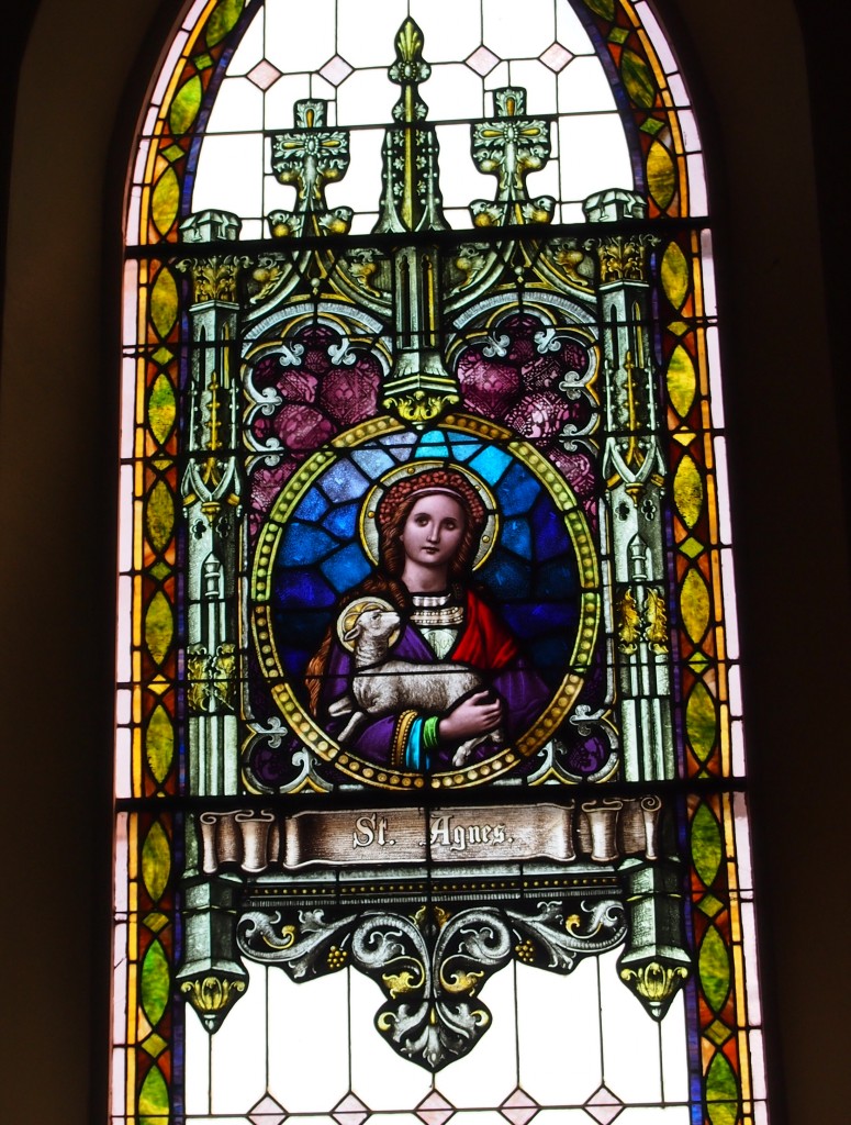
One side was well-lit by the sun, so I took some pics of saints. Because who doesn’t like stained-glass saints? Such as Agnes, patron of chastity, gardeners (?), girls, engaged couples, rape victims, and virgins.

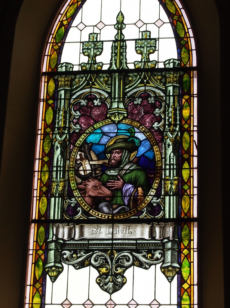
Or Hubert, patron of hunters, mathematicians, opticians, and metalworkers.

I also discovered, on further inspection, that the Francis of the church name is Francis Xavier, missionary to Asia, though why the Belgians who built the church chose him, I couldn’t say.

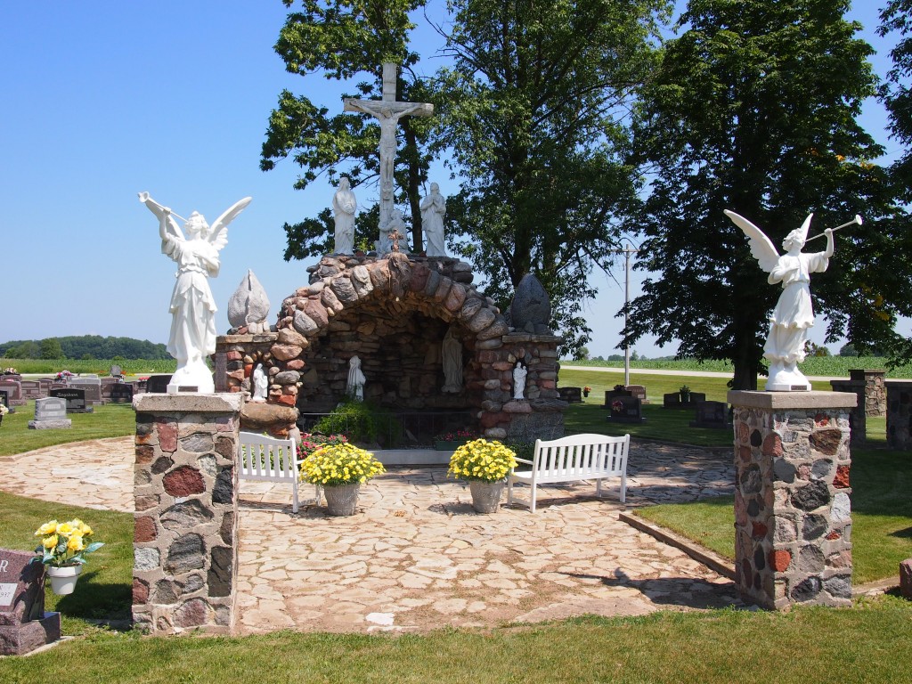
Everyone was waiting for me in the car as I looked around the cemetery, so I didn’t have long. Besides gravestones, it also featured a small grotto.

The light wasn’t quite right, but I say when you run across a grotto, take a picture if you can.

Return to Cana

Leaving Sturgeon Bay, we headed up the Green Bay side of the peninsula on County Highway B, which later merges into County G and takes you into Egg Harbor. It’s a pleasant, two-lane highway, with bayside property on one side, mostly waterfront houses, and less-developed land – sometimes rising bluffs – on the other. All of it was lush. It’s been a rainy year in Wisconsin, too. I was expecting more traffic, this being the high season in Door, but most of the time no one was visible ahead or behind.

Until we got to Egg Harbor, that is. It might be quaint not to have any streetlights in your town, but Egg Harbor needs one at the juncture of County G and Wisconsin 42, the main road through town. The town seemed to be even more touristed than Sturgeon Bay, but with less space to put people. I asked if anyone wanted to get out and look around, but no one did, citing the early-afternoon heat.

We pressed on across the peninsula, via County Highway E, which passes mostly through farmland. The road also comes within sight of Kangaroo Lake, the peninsula’s largest inland lake. Kangaroo? I wondered. That’s the kind of name that makes me wonder. Maybe one of the pioneers of Door County imported kangaroos to see if they could be raised for meat. That failed, but some escaped, and their descendents live around the lake. They’re wily and hard to spot, in case you were wondering.

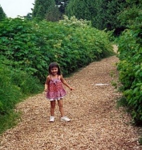
On the Lake Michigan side of the peninsula, we made a return visit to the Cana Island lighthouse. Most of us were back, anyway. Ann didn’t exist the last time we were there, almost exactly 12 years ago. Lilly of course didn’t remember being there, but in 2001, I took her picture wandering down the path to the lighthouse.

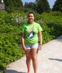
So I decided to do the same this time around, in roughly the same place along the path leading to the light. As I occasionally tell people I meet with small children, if you keep feeding them, they get bigger.

The grounds and the light are pretty much as I remember them. In his remarkable web site specializing on lighthouses of the western Great Lakes, Terry Pepper writes of the lighthouse: “Cana Island is somewhat a misnomer, since it is only an island when the lake levels are high. The majority of the time, there is an exposed rocky sinew of land which connects to the mainland.

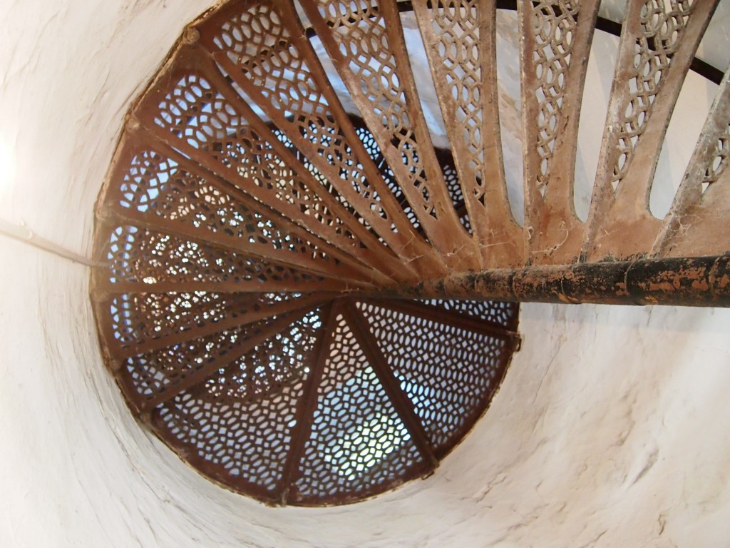
“Congress appropriated funds for construction the spring of 1869 and a crew immediately undertook the task of clearing a three-acre station site. Leveling a rock foundation, a buff-colored cream city brick tower began to take shape. Eighteen feet in diameter at the base, the tower rose 65 feet, gently tapering to a diameter of 16 feet at its uppermost… Spiraling within the tower is a gracefully spiraling set of cast iron stairs, with 102 stairs.

“The cast-iron lantern atop the tower was likely prefabricated at the Milwaukee Lighthouse Depot and transported to the site by Lighthouse tender. Equipped with a Third Order Fresnel lens with the focal center of the lens situated approximately 75 feet above the tower bottom, the lens boasted a focal plane of 82 feet above mean lake level.” (Visible for 16 miles, according to the docent, and lighting the waters near Door to this day.)

Ann wanted to climb to the top of the tower, which was open by extra admission. The top was accessible via the aforementioned 102 steps.

Her mother and sister didn’t want to go up, so I went with her. Before we went, and even after we’d climbed to the top, I was certain that we hadn’t gone up last time, probably because it was closed. But now I’m not so sure. You’d think I’d remember climbing a spiral of narrow cast-iron steps and taking in a sweeping view of the greens of the peninsula and the blues of Lake Michigan, with a constant wind blowing in my face, but maybe not. Memory’s a trickster.

Sturgeon Bay Sturgeons

First stop in Door County on July 5: the town of Sturgeon Bay, county seat and tourist magnet during the summer.  Wisconsin 57 connects the city of Green Bay with the town, which straddles the Sturgeon Bay Ship Canal.

The canal, which started as a bit of Victorian engineering – it was completed in 1881 – means that ships out of the city of Green Bay don’t have to go all the way around the Door Peninsula to get to Milwaukee or Chicago. It also cuts Door County in two, making part of it a large island, though no one seems to think of it that way.

Sturgeon Bay was a fairly busy place on the day after the Fourth of July, but not so crowded that we couldn’t find a convenient parking space and, at about noon, a place to eat without waiting for a table. At the corner of Third and Louisiana streets is the Inn at Cedar Crossing, which I thought was a fanciful name for the restaurant where we had lunch, but it turns out there’s a bed and breakfast upstairs, and Third used to be called Cedar. Whatever the story, the place serves a satisfying lunch.

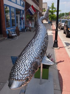
Third is one of the town’s main streets, featuring a mix of tourist businesses and everyday-need retailers. Also along the street are sturgeon statues. They’re part of “Sturgeon Around the Bay,” one of the many descendants of CowParade, which the city of Chicago helped popularize in 1999.

This particular one is called “Bon Appetit,” created by Chonda Hoschbach and Cori Rosen.  I looked at it for a minute before I realized it was made mostly of stainless-steel spoons, with some forks thrown in. According to the plaque that comes with the fish, the works will be auctioned on September 21, just as the tourist season is winding down. The beneficiary will be the Sturgeon Bay Visitor Center.

Looking for Tail-Gunner Joe

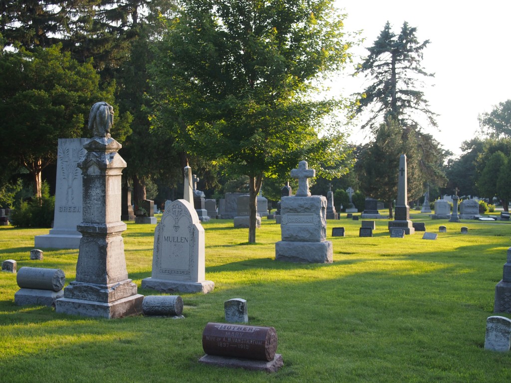
A funny thing happened to me yesterday, late in the afternoon, as I scoured through St. Mary’s Cemetery in Appleton, Wisconsin, looking for a particular tombstone. I wasn’t having any luck finding it. But I did enjoy the graveyard’s handsome grounds, which are near the Fox River.

On Independence Day, we’d set out for northeastern Wisconsin – to see Appleton and the other Fox River cities, plus take a jaunt up to Door County.  I enjoyed parts of Appleton last year without my family, and I thought they’d like some of the places I’d been. As for Door County, we paid a visit in 2001, but it was too short and we’d long wanted to go again. This visit was also too short – I figure we’d need a week to do Door right.

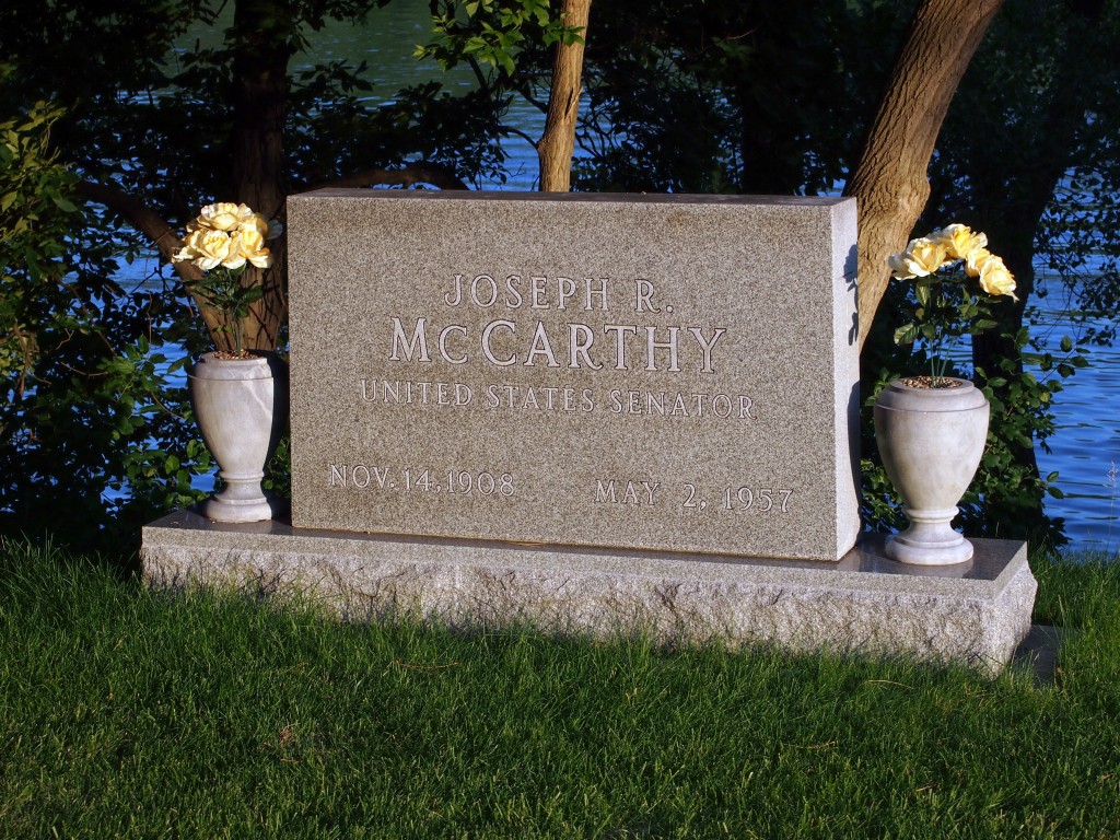
Yesterday was our last day, and I headed out for St. Mary’s Cemetery by myself, since no one else cares to visit cemeteries. Specifically, I wanted to see the place’s most famous – infamous – resident, Sen. Joseph McCarthy. I couldn’t find him for a while. Find-a-Grave wasn’t exact enough. There were other McCarthys – even other Joseph McCarthys, since the cemetery is well populated with Irish names – but the Senator was elusive.

Then I spotted a man and his small daughter riding through the cemetery on something like one of those drivable carts you see at grocery stores. Eventually, they came fairly close to me, and I had to ask, since we were the only (living) people in the cemetery, and no guide signs or other clues pointed the way.

“Excuse me, do you know where Joseph McCarthy is buried? You know, the Senator.” Even in Appleton – he was from nearby Grand Chute – I can’t assume anything.

The man, about 10 years younger than me and with close-cropped reddish hair, looked at me for a moment. “We’re not supposed to tell people that,” he said. “He was my great-uncle.”

“Oh.”

“But I will tell you he’s at one of the corners, near the river.” And then they started on their way again. I guess he decided I didn’t want to harm the memorial, which of course was true. I just wanted a picture. Soon I found the stone and took one.

What are the odds of running into a grand-nephew of Joe McCarthy? (Assuming he wasn’t kidding about that.) I checked, and McCarthy was from a family of seven children, so in Appleton, the odds wouldn’t be that bad.