Down in Oklahoma

Received a collection of postcards from my brother Jay recently, who picked them up at an estate sale, where occasionally one finds such things.

One of them featured some period-specific doggerel about Oklahoma, with 7-24-40 written on the edge, which no doubt was when the card was new. It wouldn’t have been the only gag postcard of roughly that vintage. The card was printed by Curt Teich (it says Curteich on the card), as so many were, on behalf of Mid-Continent News Co. of Oklahoma City. No copyright date.

Nothing like a wild-and-woolly oil patch, eh? That’s the vibe, of course, but some specifics are a little hazy. The populace is “boost”? As in, prone to steal? And what was it about wearing dresses to their knees for big girls and wee ones? A sideways comment on Oklahoman female morality? Also: “whist out” in the morning? The context is clear enough, but that’s a turn of phrase that seems lost to time.

Letters, 1969

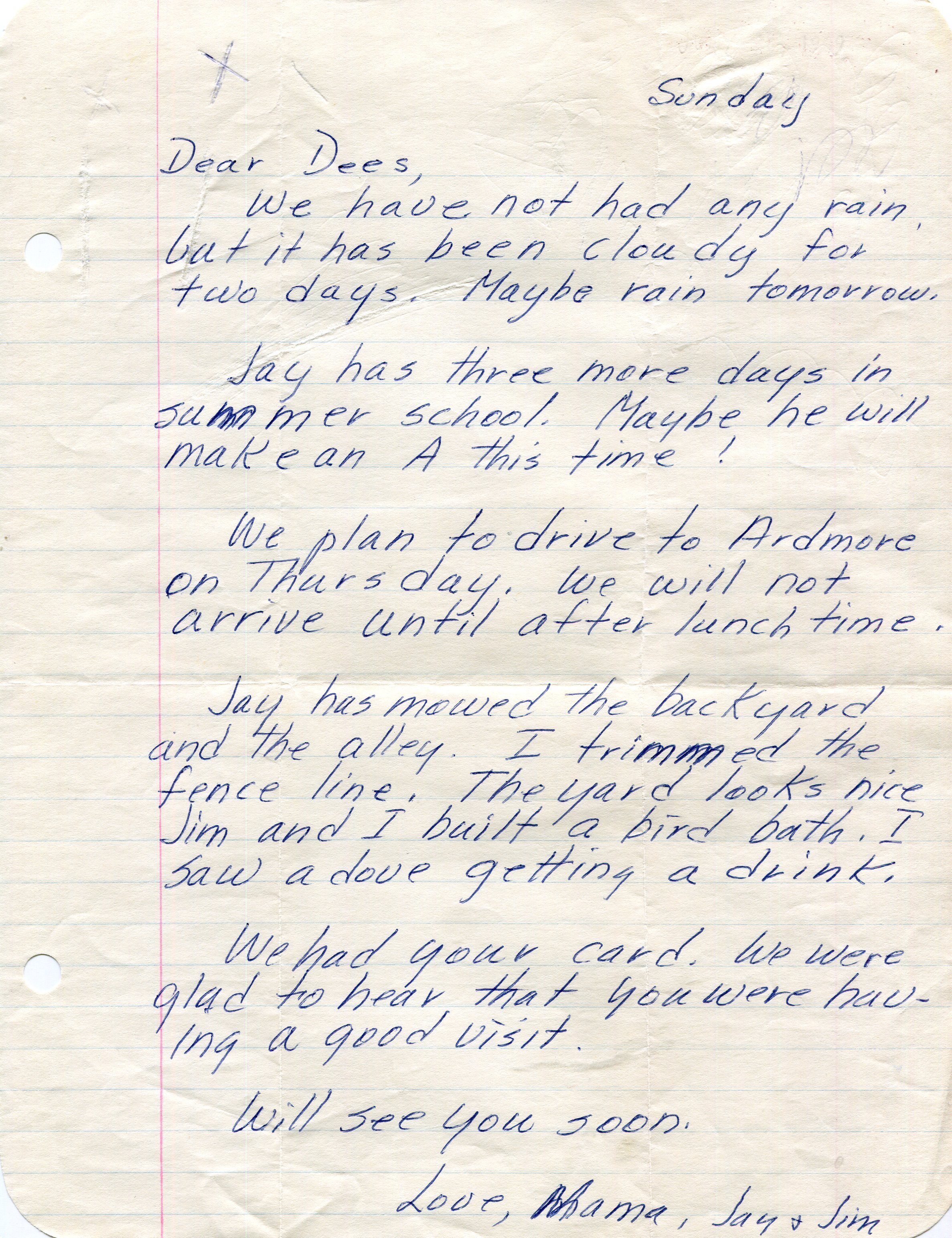
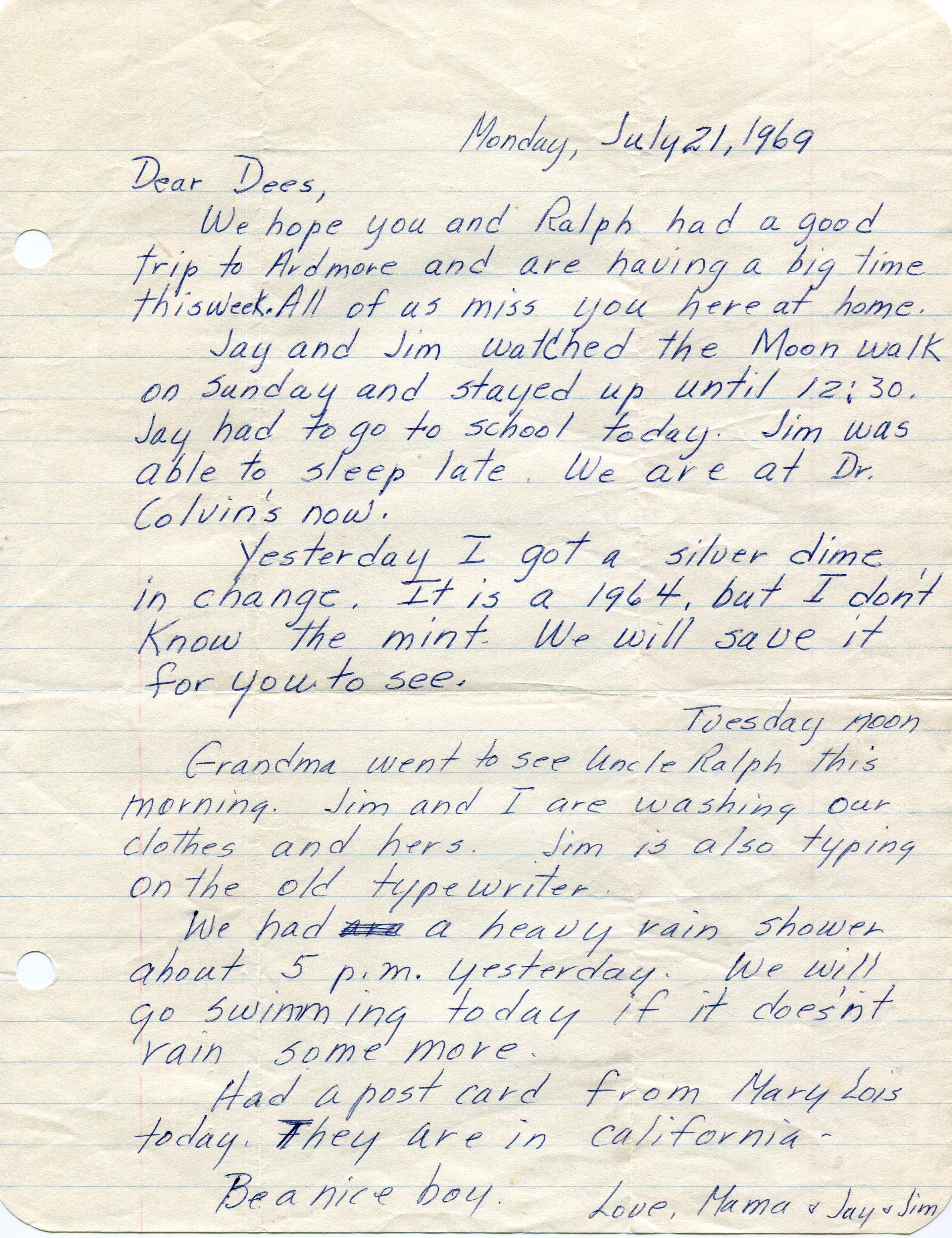
The great volume of paper letters from my mother to me didn’t begin until I went away to VU, but there were a few before that, such as when I visited my aunt and uncle and cousin around the time of a certain historic event 55 years ago now.

Considering how old it is, the letter is in pretty good shape. Only slightly yellowed.

I believe Sue and Ken and Ralph had come to visit us in San Antonio in mid-July, and I went back with them for a visit to their home in Ardmore, Oklahoma, that happened to coincide with Apollo 11 landing on the Moon.

I’m positive we were driving to Ardmore on the 20th, because I remember hearing about the impending landing on the radio, and a discussion in the car about whether it would happen by the time we got to their house. I might have been eight, but I knew what was going on. I had watched the launch and was following the mission closely. As it happened, “Tranquility Base here, the Eagle as landed” moment was not long after we arrived at their house.

Moon walk or no, life on Earth goes on. My mother wrote another letter on July 27.

My mother said they were coming to pick me up on the 31st, as I’m sure happened. From there we took a driving loop around the South – from Oklahoma through Arkansas and Tennessee, reaching the northwest corner of Georgia before turning back and heading through Alabama, Mississippi and Louisiana before returning to Texas.

The Great Southern Loop, I called it retroactively. Maybe 20 years later. Or the Great Southern Loop of ’69 even later, to differentiate it from the Southern Solo Loop of ’09 or the more recent ones of ’19 and ‘21. It’s hard to keep track sometimes.

Talimena National Scenic Byway & The Former Heavener Runestone State Park

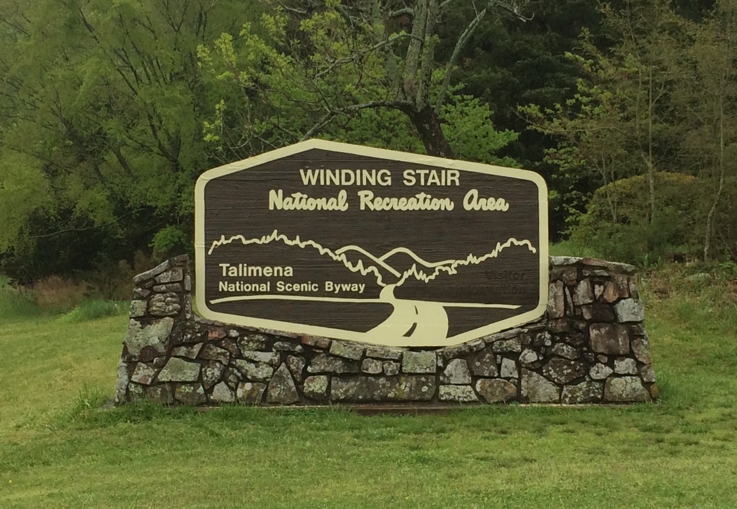
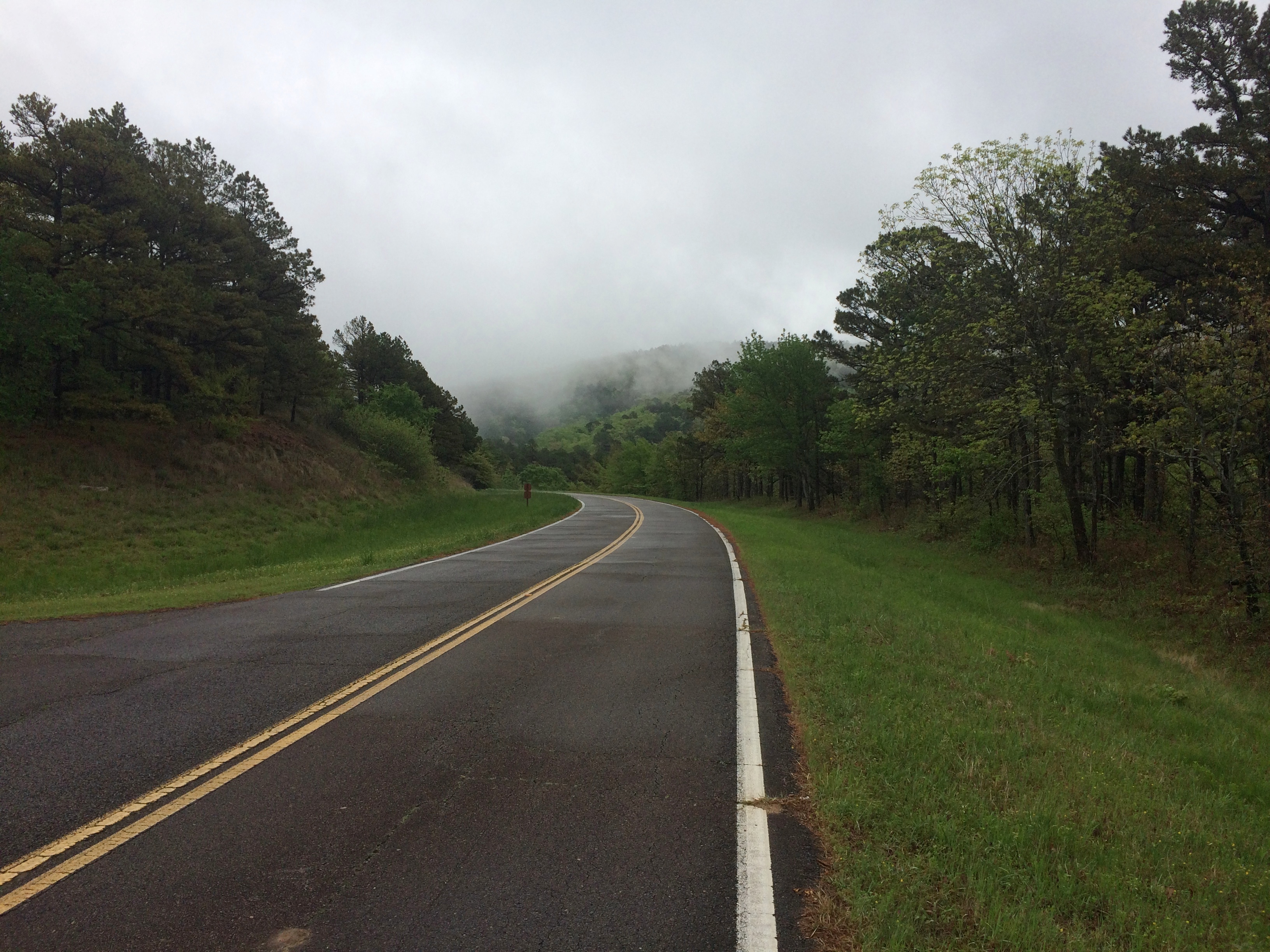
Oklahoma isn’t known as much of a nanny state. So in retrospect it’s no surprise that the U.S. 271 entrance to Talimena National Scenic Byway, which is a two-lane road through the Winding Stair National Recreation Area, was wide open on April 16, a gloomy, drizzly day with the mountains shrouded in clouds.

Talimena National Scenic Byway

Some other jurisdiction might have put up barricades to protect drivers from their own foolish impulse to drive the road no matter what, but Oklahoma doesn’t roll that way.
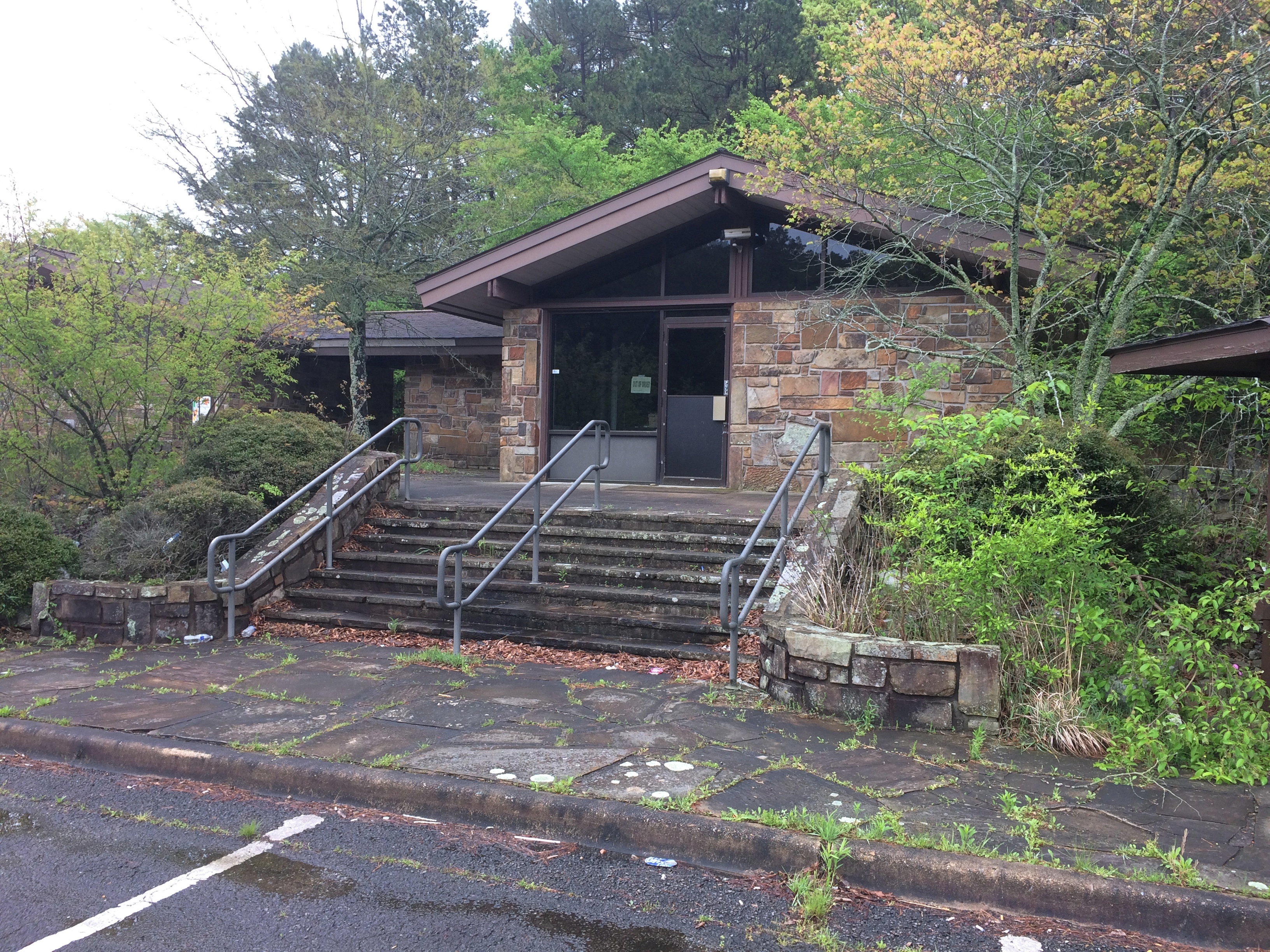
Besides, the facility at the entrance was abandoned. I did see signs for a recreation area headquarters in the nearest town, Talihina, so I supposed the rangers or rangers-equivalent moved there.
Talimena National Scenic Byway

I was eager to drive the byway for two reasons. One, it’s a national scenic byway. In my experience, that generally means some good driving on the offing. Some car-commercial driving.

Also, the poetry of that name: Winding Stair Mountains. Even if they really are fairly small mountains, that’s a name and a place on the map that has intrigued me for a long time.

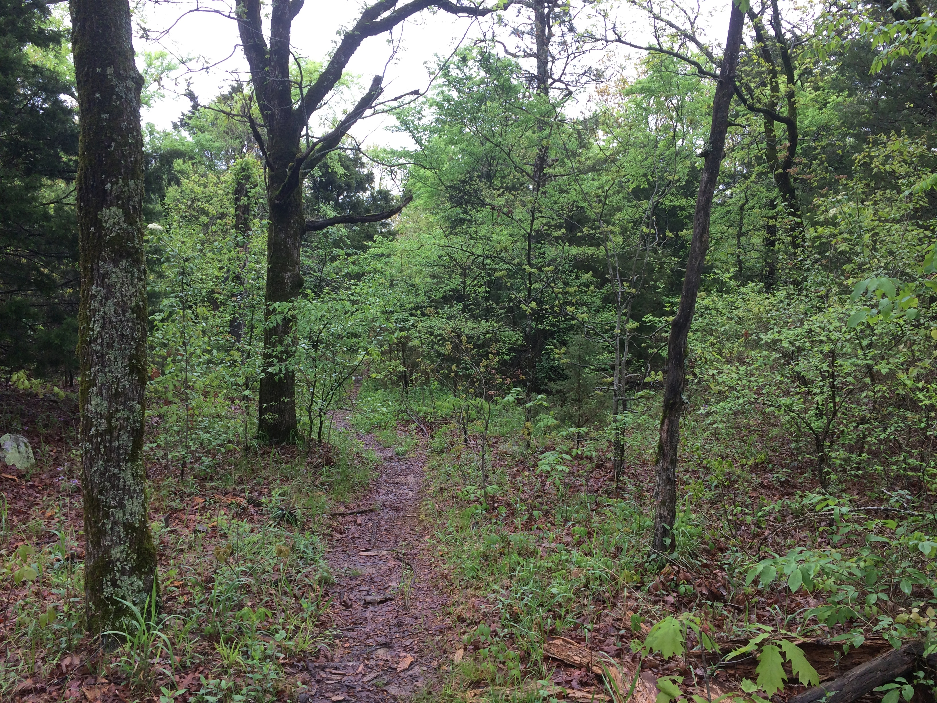
I stopped at an historic marker a short ways from the entrance that told me that the Ft. Smith-Ft. Towson Military Road once crossed the Winding Stair Mountains at that point, but it wasn’t the basis of the modern road, part of Oklahoma State Highway 1, which was completed only in 1969. I took a short walk in the nearby forest. The road also traverses a western section of Ouachita National Forest.
Talimena National Scenic Byway

Then I took a look at the road ahead.
Talimena National Scenic Byway
I wasn’t discouraged. I figured there might be patches of fog to drive through. Also, I’d seen two cars enter the road ahead of me.

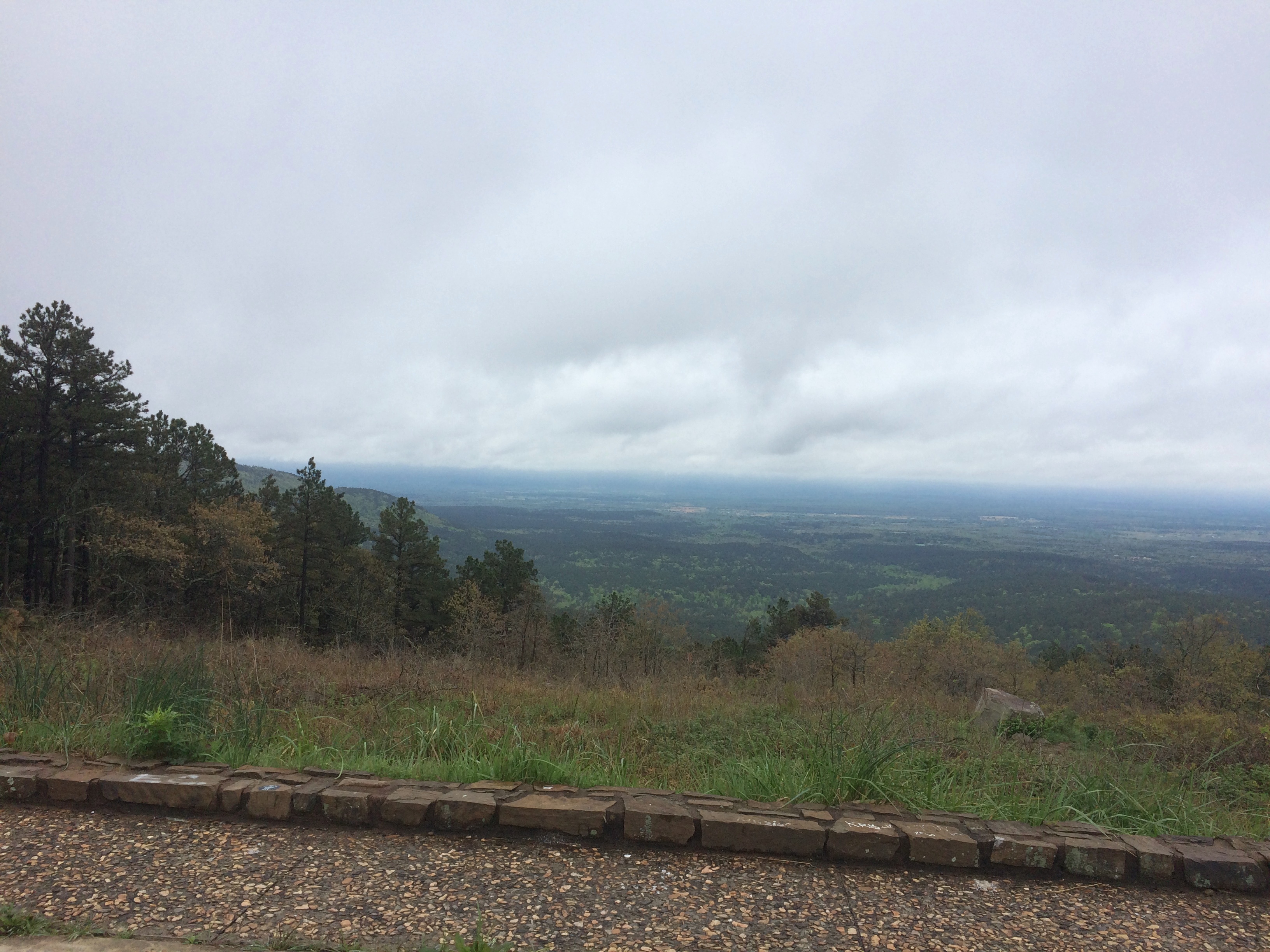
The first few miles were gorgeous indeed, with places to stop that looked like this.
Talimena National Scenic Byway

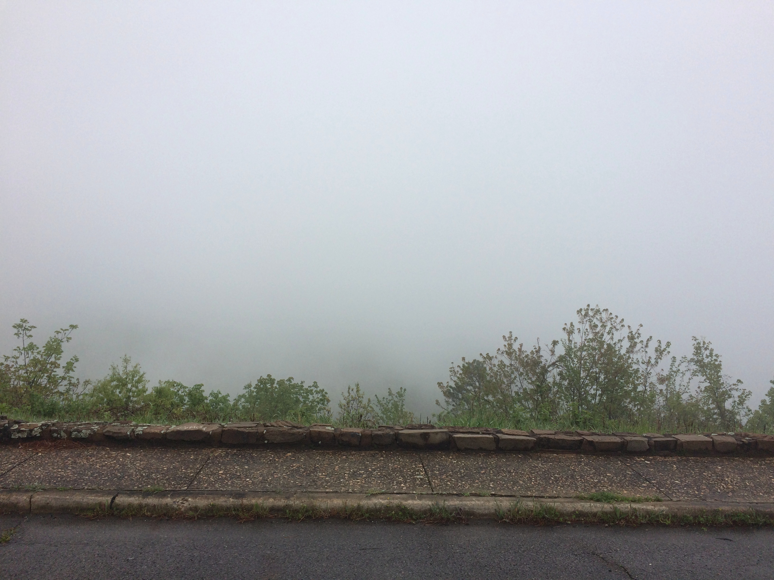
Pretty soon, though, the fog turned thick. I took it slow, about 30 mph, but even so the hazard of the drive was top of mind. I could see maybe 10 feet ahead, on a road that wound around and climbed and dropped — with steep drops into ditches sometimes off one or the other shoulder.

Mostly, I knew that if something appeared in the road ahead of me, such as an animal or worse, a stopped car, I might easily hit it. I don’t think I was risking death or even injury myself that much, just highly inconvenient damage to my car and maybe legal problems.

Now the views off to the side of the pullouts in the road looked more like this.
Talimena National Scenic Byway

Yet the way — only about 12 miles on the section I wanted to drive — wasn’t entirely foggy. Sometimes I’d see the fog thin out ahead of me, suddenly, and even more suddenly, clear away completely. The beauty of the surroundings was suddenly clear as well, passing through a contoured forest of wet pine, oak, flowering dogwood and more.

As it happened, I encountered no one else on the road during my drive, neither cars nor motorcycles nor deer, and then headed north on U.S. 59. Take that route and before long you pass through Heavener, Oklahoma, where you see signs for Heavener Runestone Park. Or, and I think not all of the signs have been changed, Heavener Runestone State Park. Even the likes of Atlas Obscura still calls it a state park.

The place hasn’t been a state park for 10 years. Supposedly recession-era budget cuts are to blame, but I suspect that the park had embarrassed the state long enough, maybe since its founding in 1970.

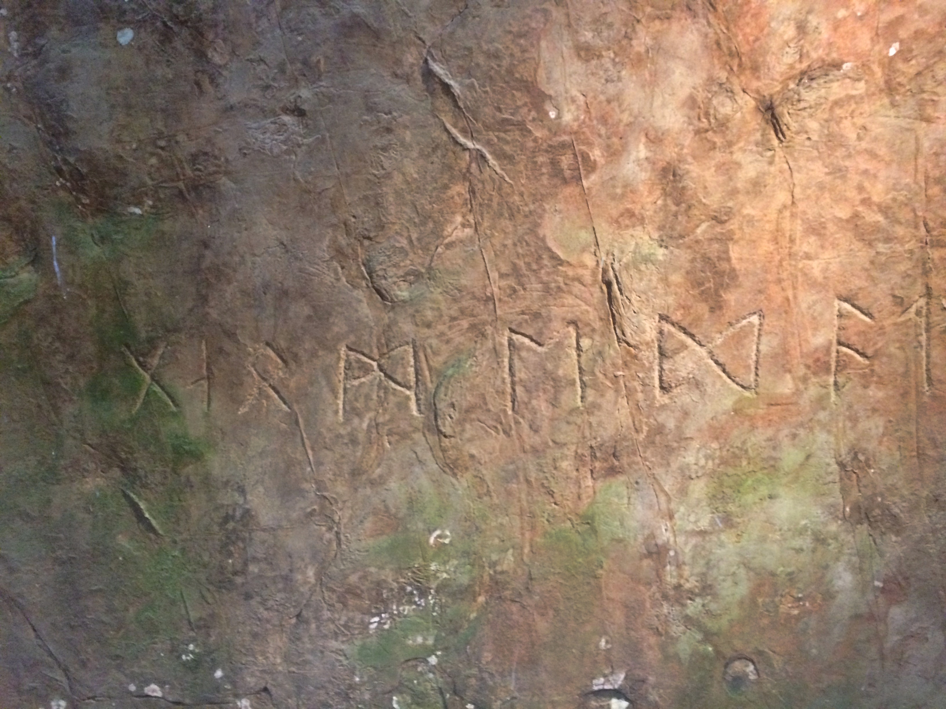
At some point in the past, someone carved runes into a sandstone boulder near Heavener. A local woman, one Gloria Farley, did her own research in the 1950s and determined that Norsemen had shown up in the future Oklahoma during the golden age of Vikings getting around (ca. 1,000 years ago), carved the runes, and then went on their way. Without leaving any other trace.

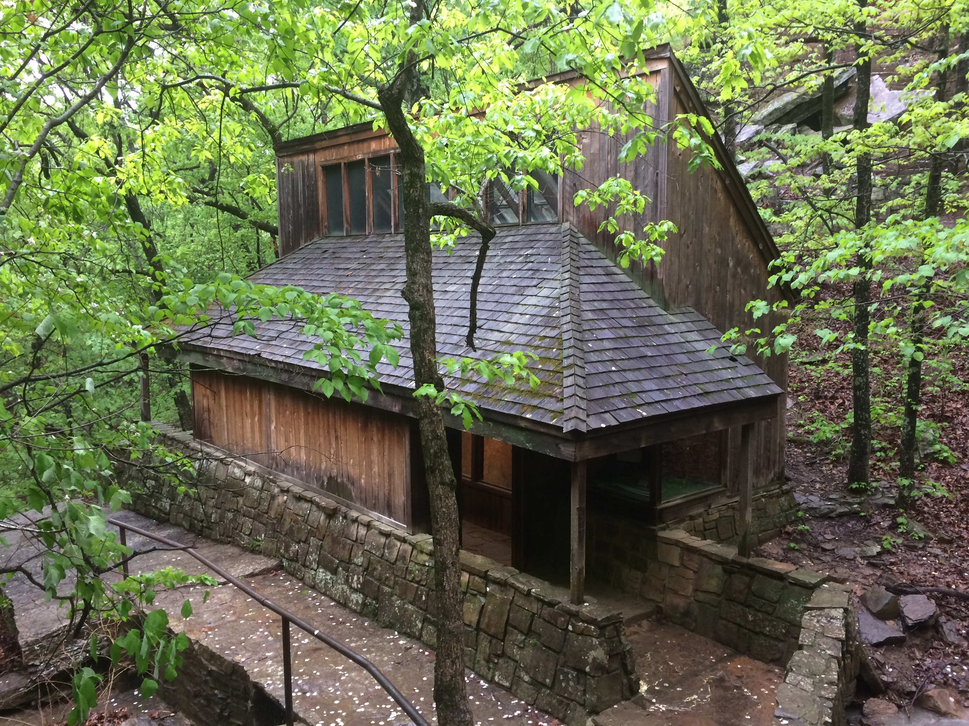
Apparently Gloria had friends in state government, and so 55 acres were made into a state park, its centerpiece being the rock, with a shelter built to protect it from the elements and vandals.Heavener Runestone Park

The boulder and its runes are behind glass inside.
Heavener Runestone Park
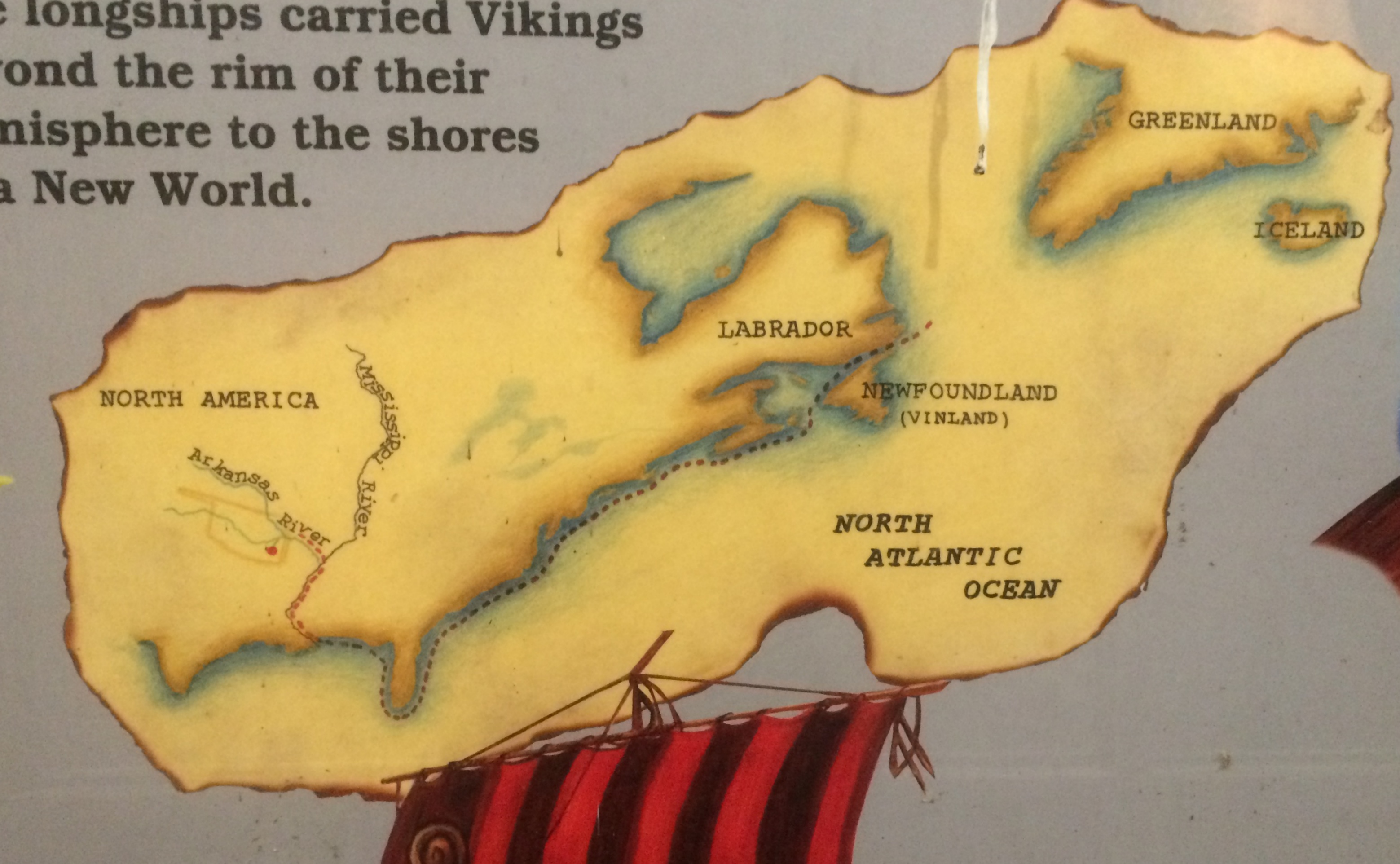
Signs near the glass case carry on the fantasy that Vikings visited Oklahoma.
Heavener Runestone Park

These days the park belongs to the town of Heavener and is overseen by a nonprofit. I did my little bit to support it, since there is no admission, by buying some postcards in the shop. (Also to support the manufacture of postcards in general.)

I don’t care that the place was founded on a fairly obvious hoax, maybe done by an Scandinavian immigrant in the 19th century with a peculiar sense of humor. In fact, that makes it more interesting, just as the faux Lincoln family log cabin does the Lincoln Birthplace National Historical Park.

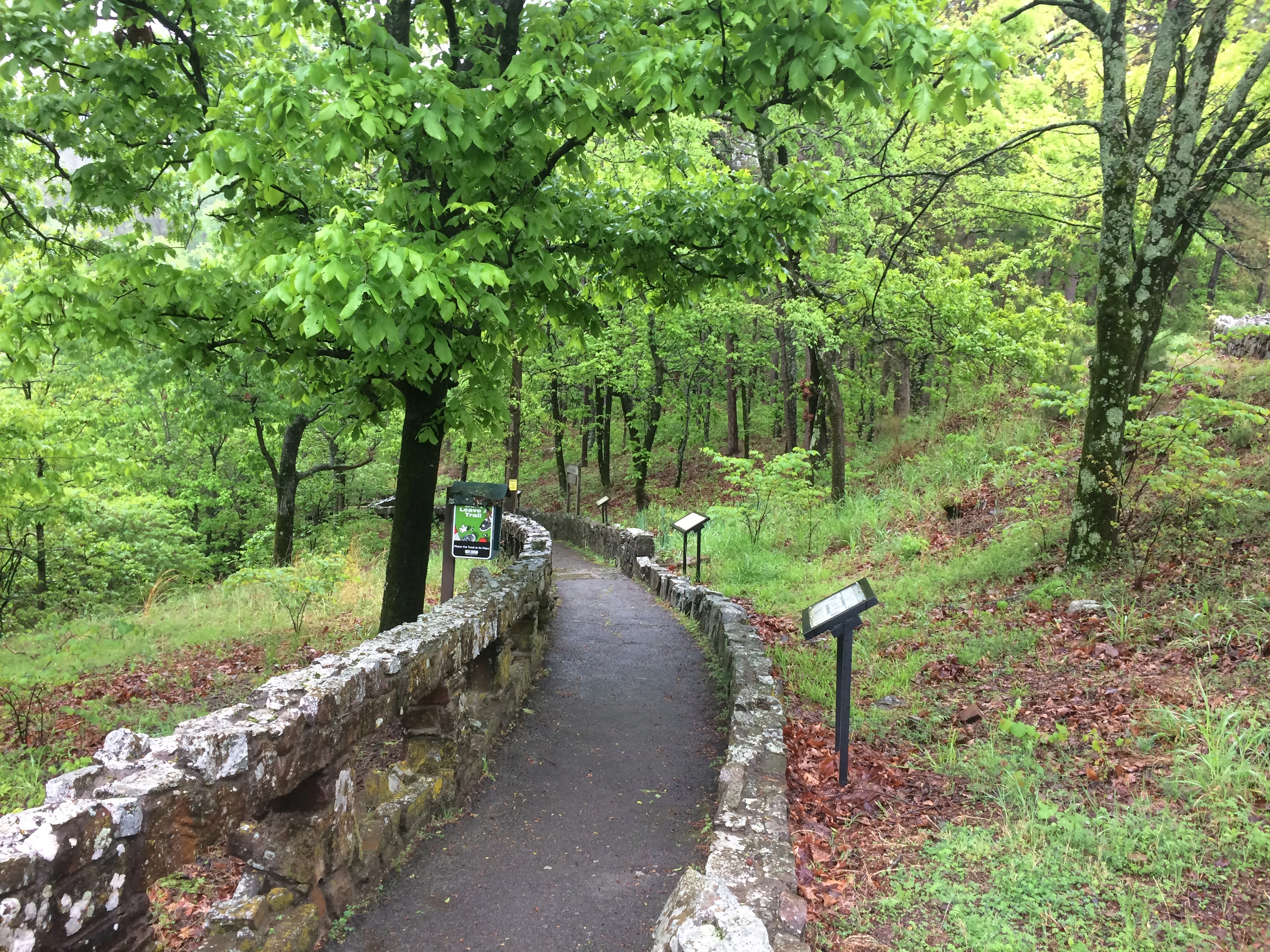
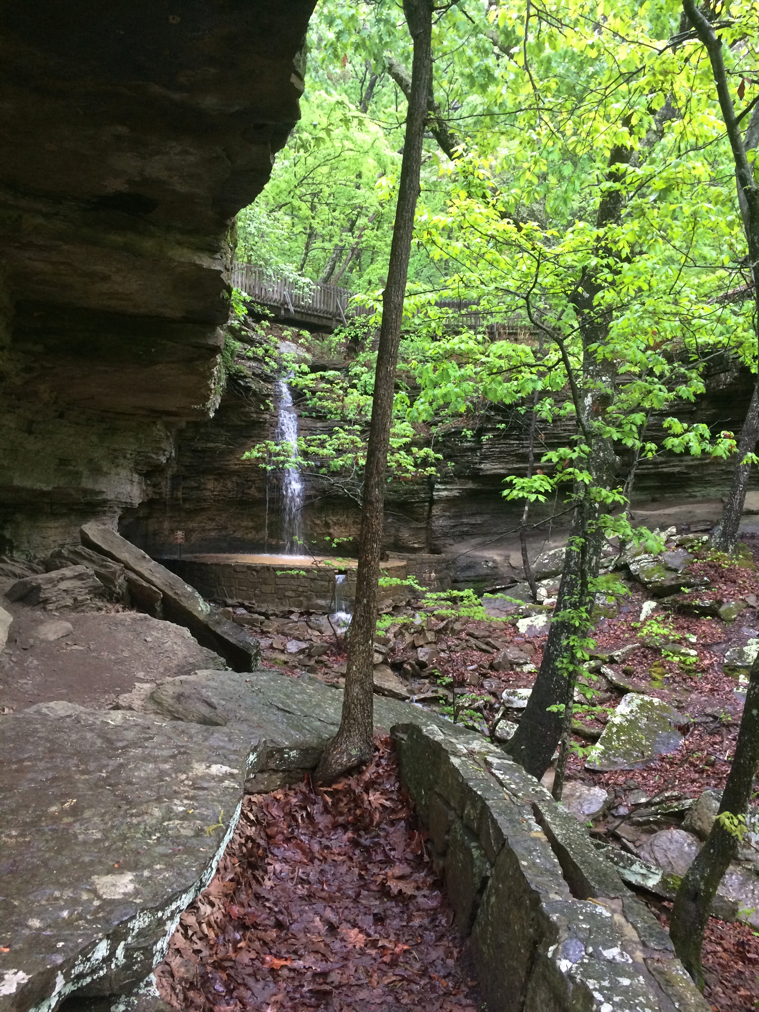
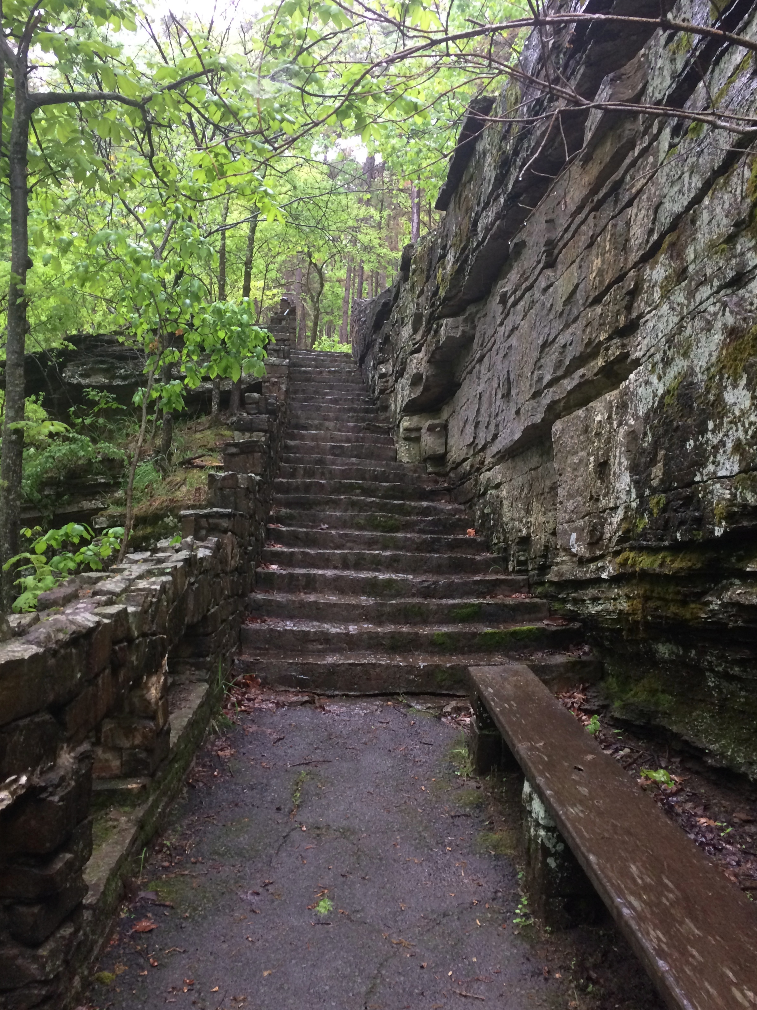
Besides, the loop to and from the Heavener Runestone, a path along the side of Poteau Mountain, is a good walk, even if wet with recent rain when I was there.Heavener Runestone Park Heavener Runestone Park Heavener Runestone Park Heavener Runestone Park

It’ll never be a World Heritage Site, unless some wickedly serious paradigm shift happens, but even so the non-state park preserves, in a pleasant green spot, an eccentric vision.

The Newberry Library Map Mural

I’ve read that the first floor of the Newberry Library on the Near North Side of Chicago is newly renovated, and it did have a newly polished look when Ann and I were there on Saturday. But it’s been a while since I’ve been inside the library, so I don’t really remember what it used to look like.

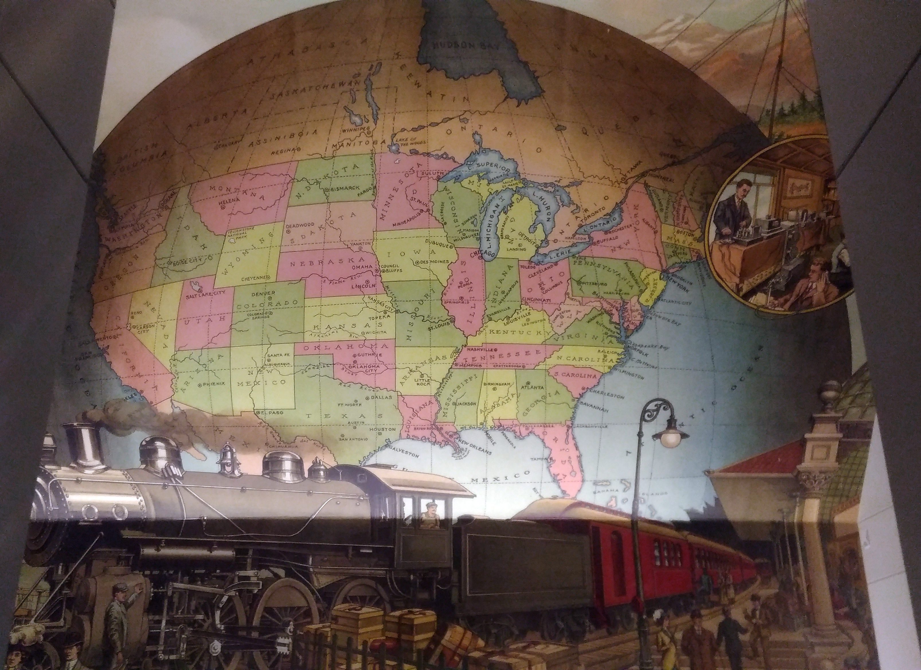
I’m sure that I’d never seen this intriguing mural before, which is above the landing between the first and second floors near a back entrance to the building.
A map mural. Even better, an historic map mural, along with a train at a station under the map and what looks like a telephone and telegraph office in a balloon off to the side.

The mural looks new, so either it is, or maybe an older image was expertly refurbished. I didn’t see any signs or plaques nearby to tell me which, or who the artist is, and the library web site doesn’t seem to say, so for now I’ll let the matter rest. It’s always good to find a map mural.

My guess is that the map depicts the nation ca. 1900 — united by rail, telegraph and the still fairly new telephone, with a new century of progress to look forward to. Or possibly 1887, when the Newberry was founded, or 1893, when the current building opened.

Though not cartographically precise (West Virginia looks especially mashed), the map’s close enough to evoke the United States of the period. One detail I noticed was that South Dakota’s towns were Deadwood and Yankton, even though the territorial capital moved to Bismarck in 1883 (presumably Al Swearengen would then refer to those “c—suckers from Bismarck” rather than Yankton).

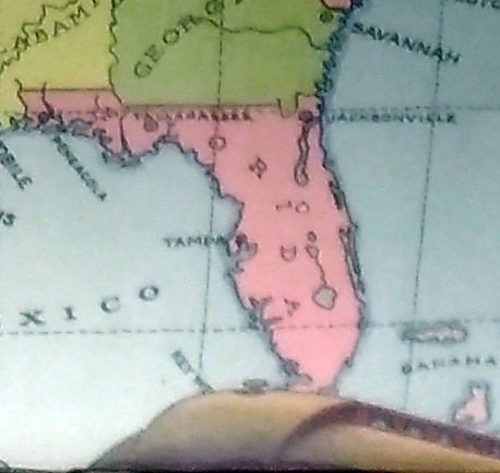
Also, note the pre-land boom, pre-drain the Everglades, pre-Disney, pre-Florida Man Florida.
A little fuzzy, but it’s clear that there’s no Miami and no Orlando.

Also, the states depicted were not quite all states at the beginning of the 20th century. Arizona, New Mexico and what became Oklahoma were still territories.

That would be my only quibble: before it became a state, Oklahoma was actually two territories, the Oklahoma Territory and the Indian Territory. The Indians of the Indian Territory wanted to be admitted as the state of Sequoyah, but Congress wasn’t having it, and so the two territories were joined to form the modern state in 1907.

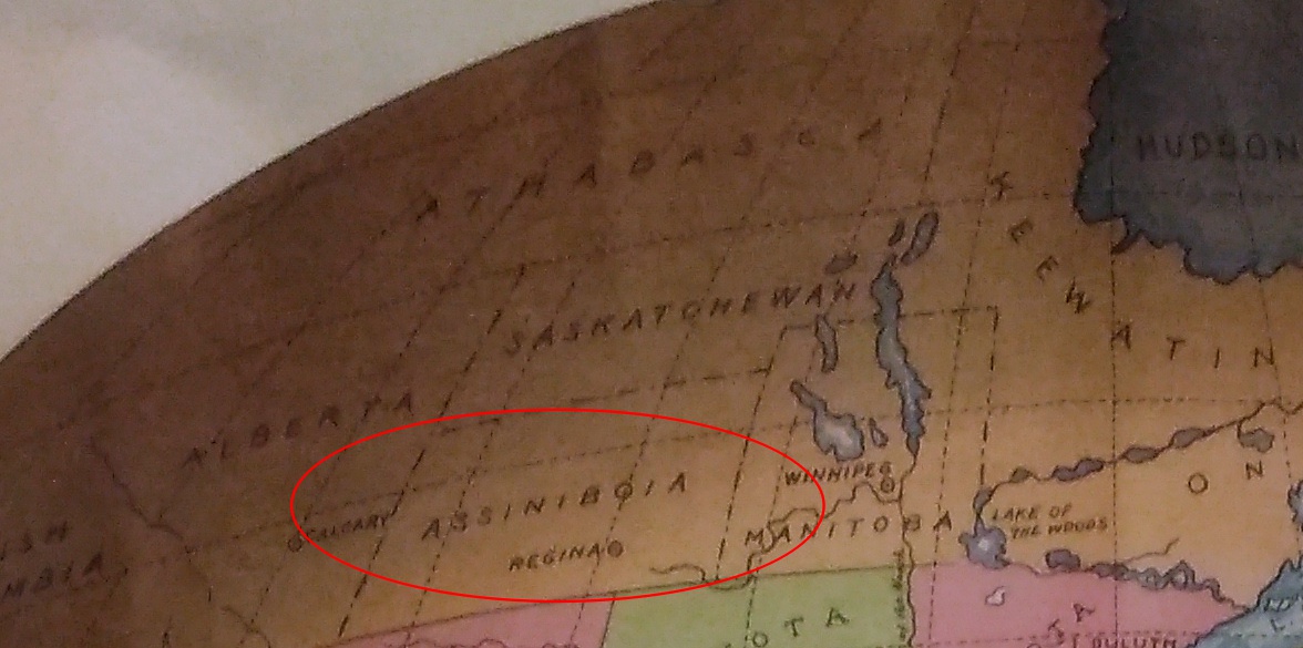
How do I know that the map doesn’t depict borders sometime after 1907? Because of the depiction of Canada.
The wonderfully named Assiniboia was a district of the NW Territories, as were Saskatchewan and Athabasca, all before 1905 (Keewatin was a separate territory before 1905, then became a district of the NWT). A major reorg of prairie Canada was done in ’05, making it look mostly like it does now.

So the map depicts pre-1905 Canada, but post-1907 Oklahoma. Ah, well. It’s small quibble about such a fine example of a mural.

Thursday Stew

Back again on Tuesday, May 29. Memorial Day is pretty close to Decoration Day this year, but not quite. The next time they will coincide will be 2022.

I finally got around to looking at the professional photographer’s pictures from my nephew’s wedding last month. Quite a selection. She was really busy.

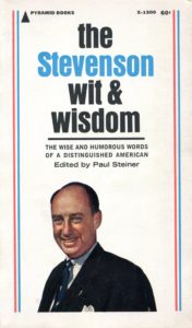
File this book under relics of the midcentury, subfile: things unlikely to inspire a period TV show on cable, unlike Madison Avenue, Pan Am, Camelot, etc.

I found it at my mother’s house and, considering my interest in U.S. presidents and candidates for that office, borrowed it for a bit. It’s a first edition, with Pyramid Publications putting it out in August 1965. In other words, just as soon as possible after Adlai Stevenson died.

I’m sorry to report that, after reading a fair sample of the book, wit is pretty thinly represented. Maybe he had some wit about him in person that didn’t translate into print. More likely, Oscar Wilde, he was not. But I can sense some wisdom in the pages.

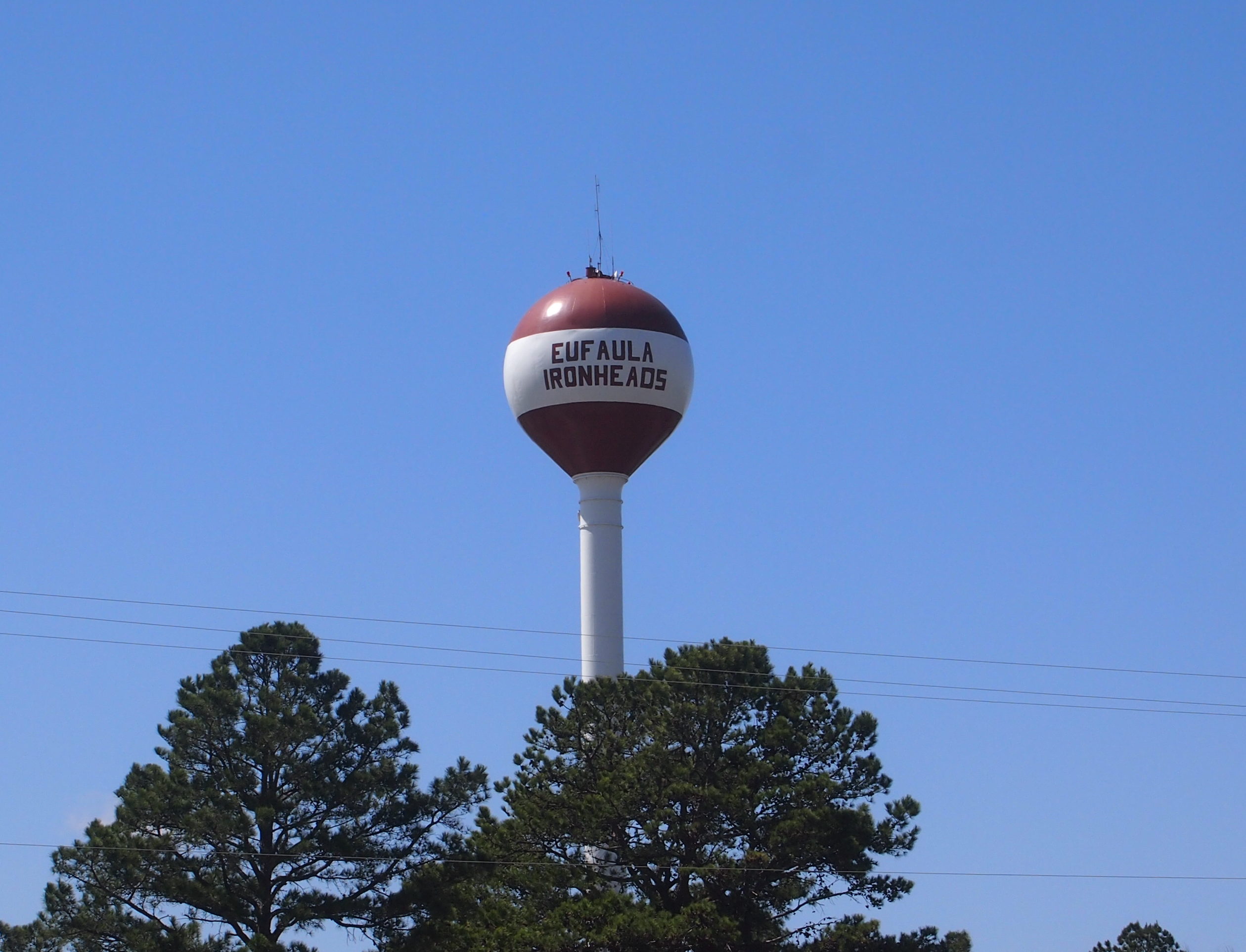
What’s the mascot of Eufaula High School in Eufaula, Oklahoma, a town of about 2,800?

The Ironheads. I drove through Eufaula last month and happened to be stopped at a place where I could appreciate the water tower.

Merriam-Webster offers two definitions: 1) a white stork (Mycteria americana) with black wing flight feathers and tail that frequents wooded swamps from the southeastern U.S. to Argentina — called also wood ibis; 2) a stupid person. I bet the school was thinking of the first definition.

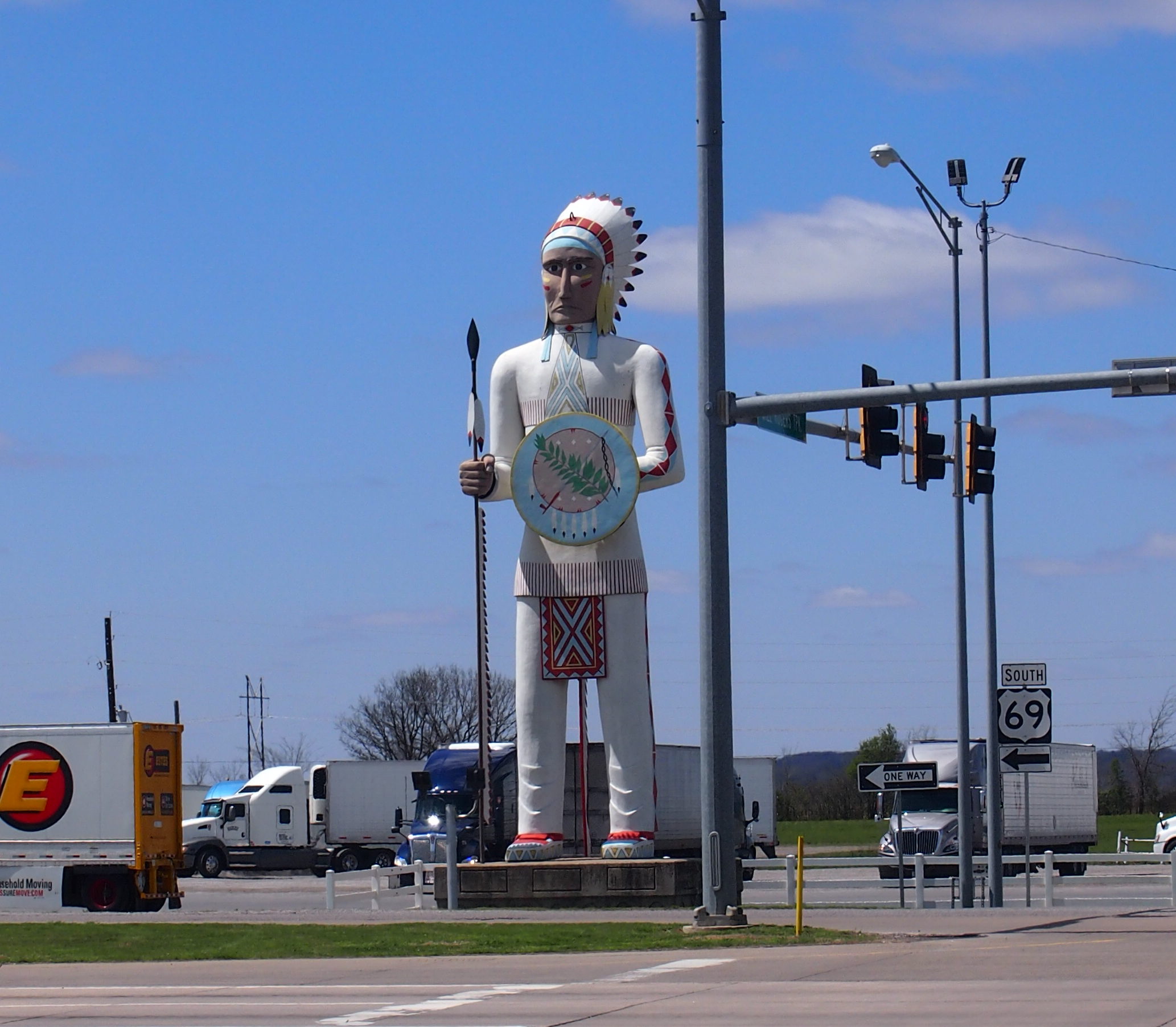
Also in Oklahoma, just off of the Will Rogers Turnpike at Big Cabin.
All the usually wordy Roadside America has to say about the statue: “Standing Brave is over 50 feet tall, and guards an Indian tax-free cigarette store.”

Two Entertainers Who Died in Unfortunate Air Crashes

I asked Ann about both Buddy Holly and Will Rogers not long ago. She was unfamiliar with them. That only goes to show a generational difference. As far as I’m concerned, both are visible threads in the American cultural fabric, people I always remember hearing about. But the tapestry is very large and changing, so every generation sees different threads.

While driving from Marathon, Texas, to Amarillo, I passed through Lubbock, a city I’d had scant experience with before. Maybe none, I’m not sure. So I took a short look around. If I’d had more time, I might have strolled around the campus of Texas Tech or visited the American Wind Power Museum or the Prairie Dog Town at Mackenzie Park.

But I only wanted to spend a few hours in town, so I made my way to the Buddy Holly Center.
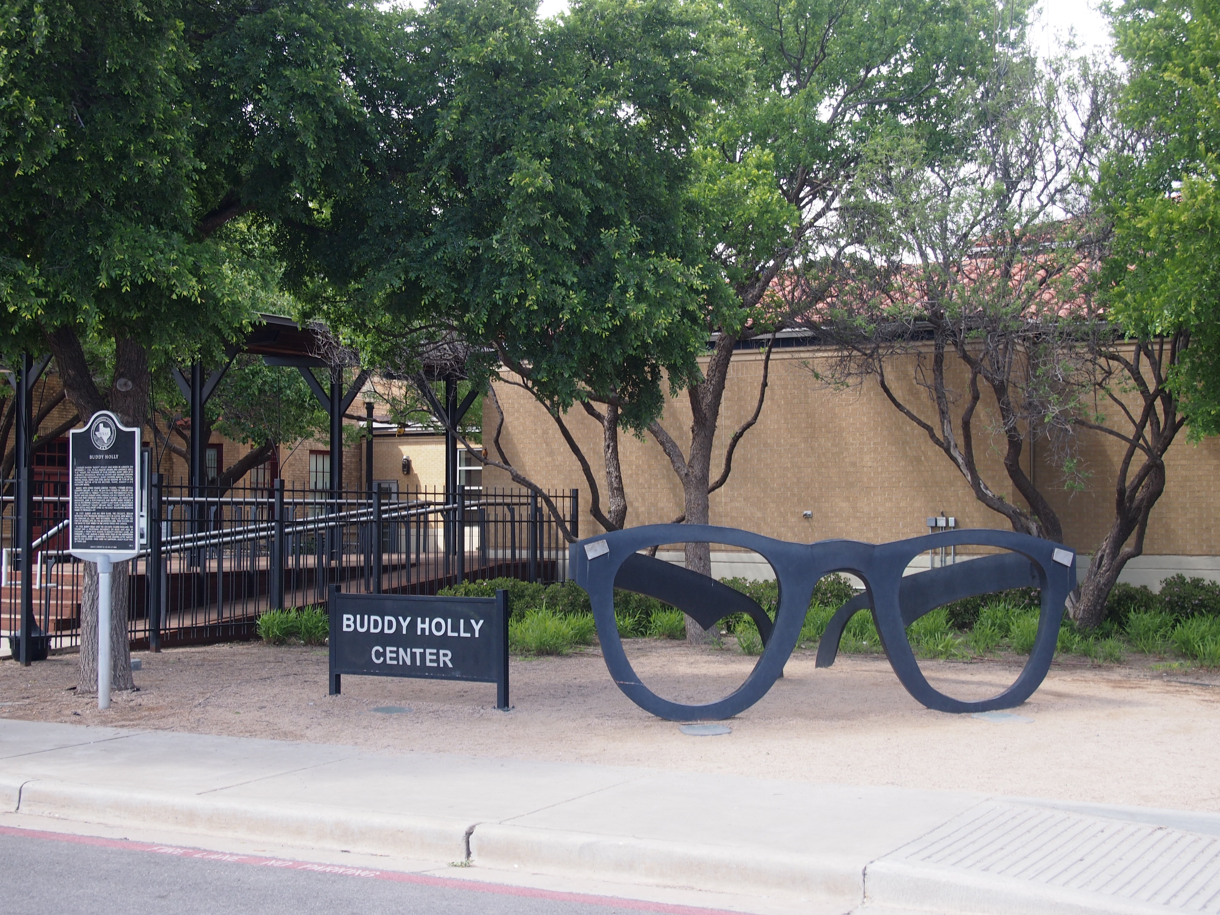
The center, which is at 1801 Crickets Ave., and a block from Buddy Holly Ave., is a performing and visual arts venue that also includes a small museum dedicated to the rock ‘n’ roll pioneer from Lubbock whose surname was actually spelled Holley. The museum takes up two rooms. Really one and a half, since one room is more about other famous musicians and entertainers visiting the center, such as Sir Paul McCartney, who played a concert there in 2014 (and who, last I heard, owns the rights to Holly’s songs).

Still, I will say that the main exhibit room, which is guitar-shaped, was packed with items and full of things to read. Buddy Holly might have died at 22, and only worked for a few years as an up-and-coming professional musician, but he was busy. He wrote songs, made records, toured constantly, appeared a few times on TV, and somehow found time to get married. Clearly he’d found something he was good at — this new music genre — and went after it with great energy, creating a remarkable output in a short time.

On display are photographs, letters, post cards, tour itineraries, including one for the Winter Dance Party, recording equipment, a microphone, business cards, contracts, performing outfits, furniture, Buddy’s childhood record collection (all 45s), and his Fender Stratocaster, which is the last one he ever played. There’s a lengthy timeline posted on the wall detailing Holly’s life and career, and other one about the evolution of rock ‘n’ roll.

Also on display, oddly enough, are the horn-rimmed glasses he was wearing when he died. Apparently they were in an evidence locker in Cerro Gordo County, Iowa, until 1980. The 750-pound giant glasses outside the center were fashioned in 2002 by a local artist, Steve Teeters, who died a few years ago.

No photography allowed in the museum. The clerk who sold me my ticket, and signs in the display room, were clear on that point. Something about copyright. No doubt the RIAA would release flying monkeys to snatch the camera away from anyone foolish enough to take pictures, and bill him $10,000 per image besides.

You can, however, take all the exterior shots you want, including across the street at an eight-and-a-half foot bronze of Buddy and his Fender Stratocaster, created in 1980 by San Angelo-born sculptor Grant Speed, well before the Buddy Holly Center opened in 1999.  The statue was moved from elsewhere in Lubbock only a few years ago, and now fronts a wall with various plaques honoring 30 years of inductees on the West Texas Walk of Fame.
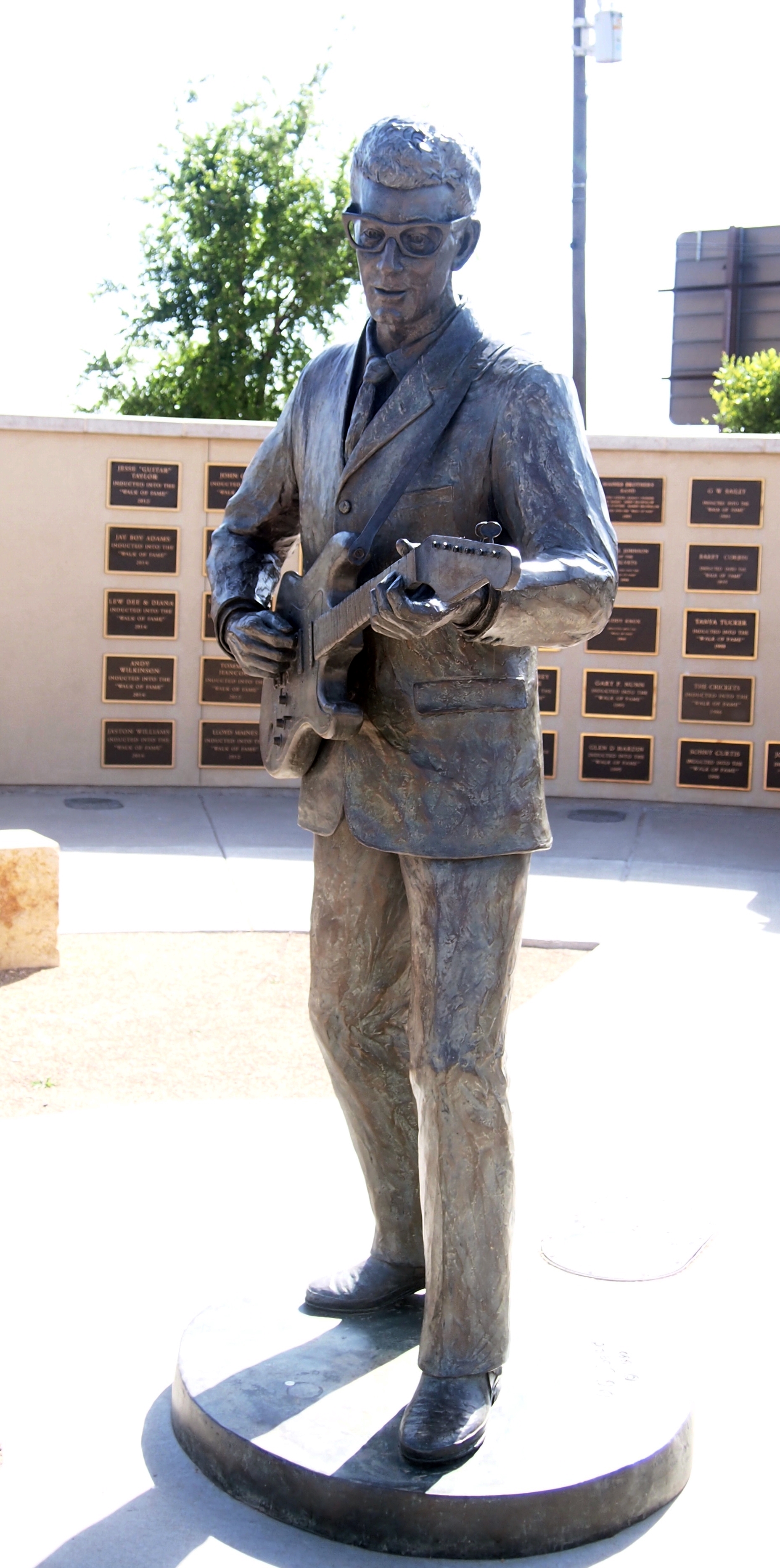
I recognized only a handful of names on the wall besides Holly, such as Waylon Jennings, Mac Davis, Tanya Tucker, Roy Orbison (who lived in Wink when he was young) and Dan Blocker, whose alma mater, Sul Ross State University, I drove by in Alpine.

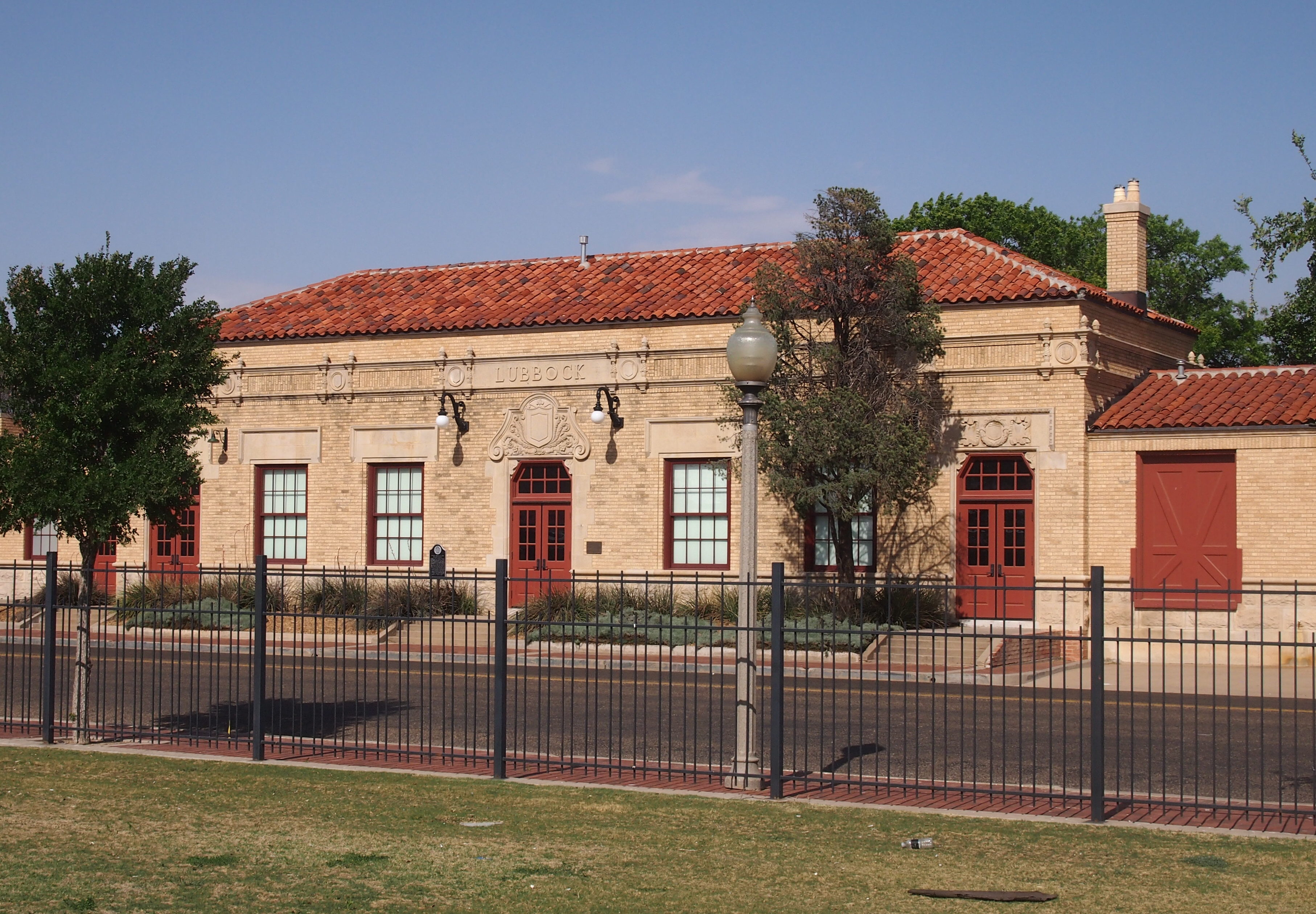
The Buddy Holly Center is an adaptive reuse. Long ago, the building was a handsome depot for the Fort Worth and Denver South Plains Railway Co., dating from the 1920s.
En route from Amarillo to Lebanon, Missouri, I made a stopover in Claremont, Oklahoma, not far from Tulsa, to visit the Will Rogers Memorial Museum. Strictly speaking, I’d been there before sometime as a child. But I had no memory of it.

Will Rogers, on the other hand, I’ve always seem to have known about. That’s remarkable for an entertainer who wasn’t actually of my parents’ time — my mother wasn’t quite 10 when he died — but rather of my grandparents’ time. I knew enough about him to go see James Whitmore do his fine impression of Rogers live, including a rope trick or two, on one of the Vanderbilt stages in the summer of 1984 .

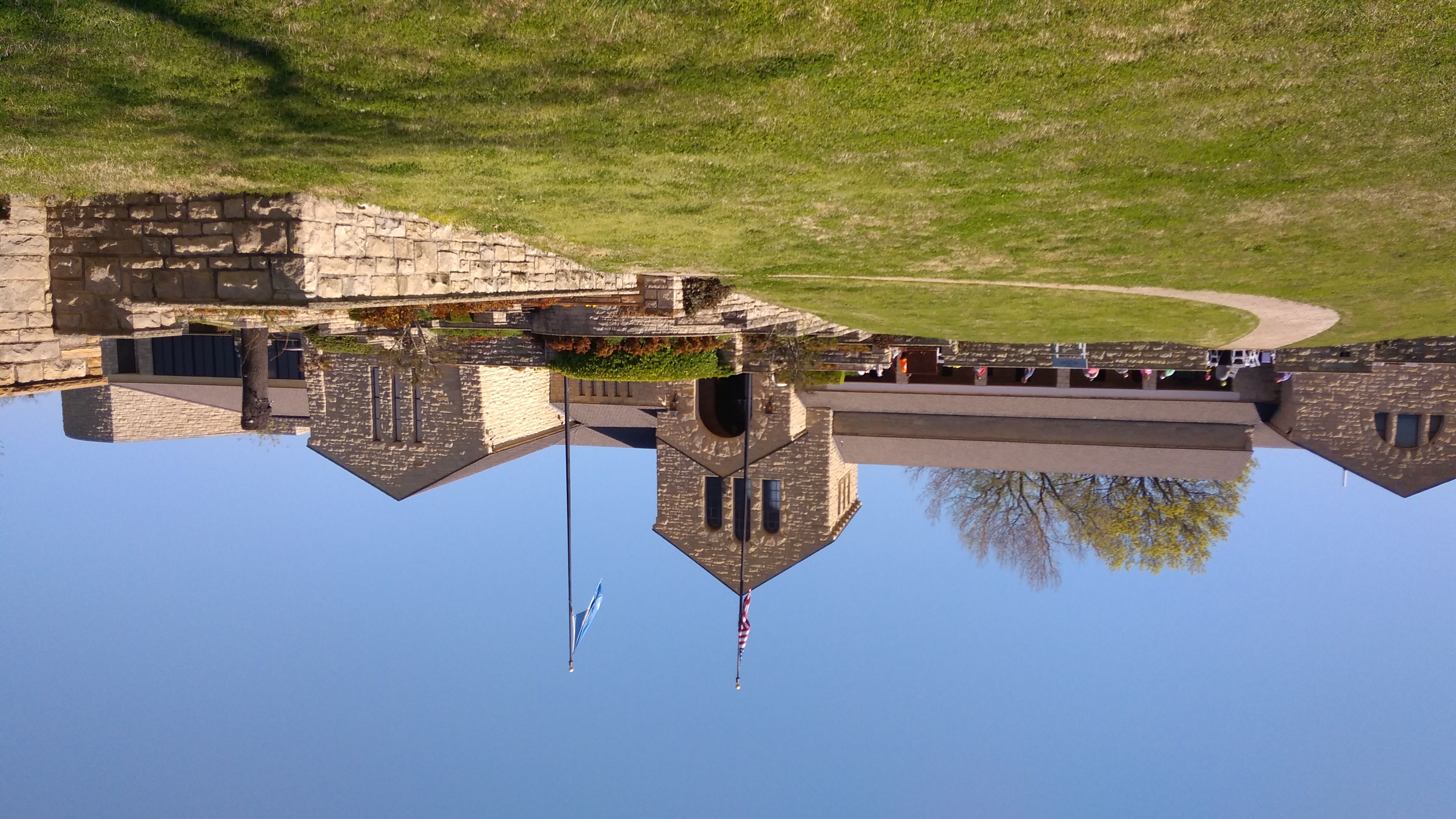
Here’s the view of the museum from the back. John Duncan Forsyth designed the original 15,000-square-foot limestone building, though there was an addition in the 1980s.
Will Rogers has a good many more exhibits than Buddy Holly, as you’d expect, considering that Rogers’ career in entertainment lasted quite a bit longer, beginning with wild west shows when that was still a thing, and moving on to all the media available in the first decades of the 20th century: vaudeville, movies, radio, and newspapers. No doubt if Rogers had lived on into the 1950s — he was only 55 when he died — we’d remember an early TV program called The Will Rogers Show.

Before I went to the museum, I had only the vaguest notion of Rogers’ early life in the Oklahoma Territory. I imagined that his origins were quite modest. Probably he was happy to have people think that, but in fact his father, Clem Rogers, was quite prosperous. The museum hints that Clem considered his son something of a ne’er-do-well, slumming as a cowboy and lassoist.

The last laugh was on Clem, who died before his son got into movies or on the radio. Ultimately, Will Rogers built himself a 31-room ranch house in California, which (per Wiki) “includes 11 baths and seven fireplaces, is surrounded by a stable, corrals, riding ring, roping arena, golf course, polo field — and riding and hiking trails that give visitors views of the ranch and the surrounding countryside — 186 acres.”

When the nation loves you, you can afford such digs. Here’s what President Roosevelt said over the radio in 1938 to dedicate the memorial in Claremore: “This afternoon we pay grateful homage to the memory of a man who helped the nation to smile. And after all, I doubt if there is among us a more useful citizen than the one who holds the secret of banishing gloom, of making tears give way to laughter, of supplanting desolation and despair with hope and courage. For hope and courage always go with a light heart.

“There was something infectious about his humor. His appeal went straight to the heart of the nation. Above all things, in a time grown too solemn and somber he brought his countrymen back to a sense of proportion.”

Rogers, his wife, three of his children and one of his grandchildren are interred on the grounds.
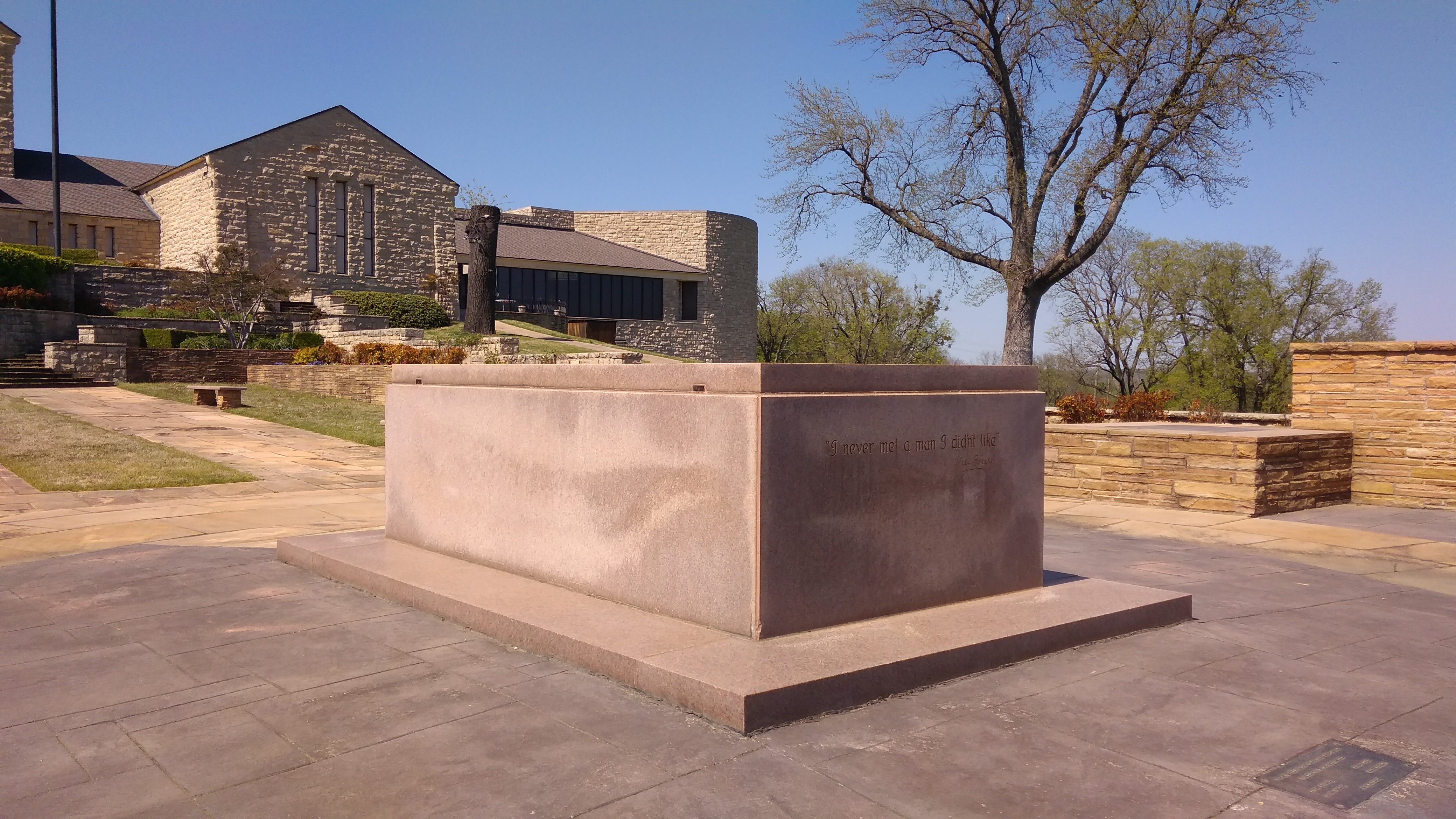
Naturally, there’s an equestrian statue of Rogers on the grounds.
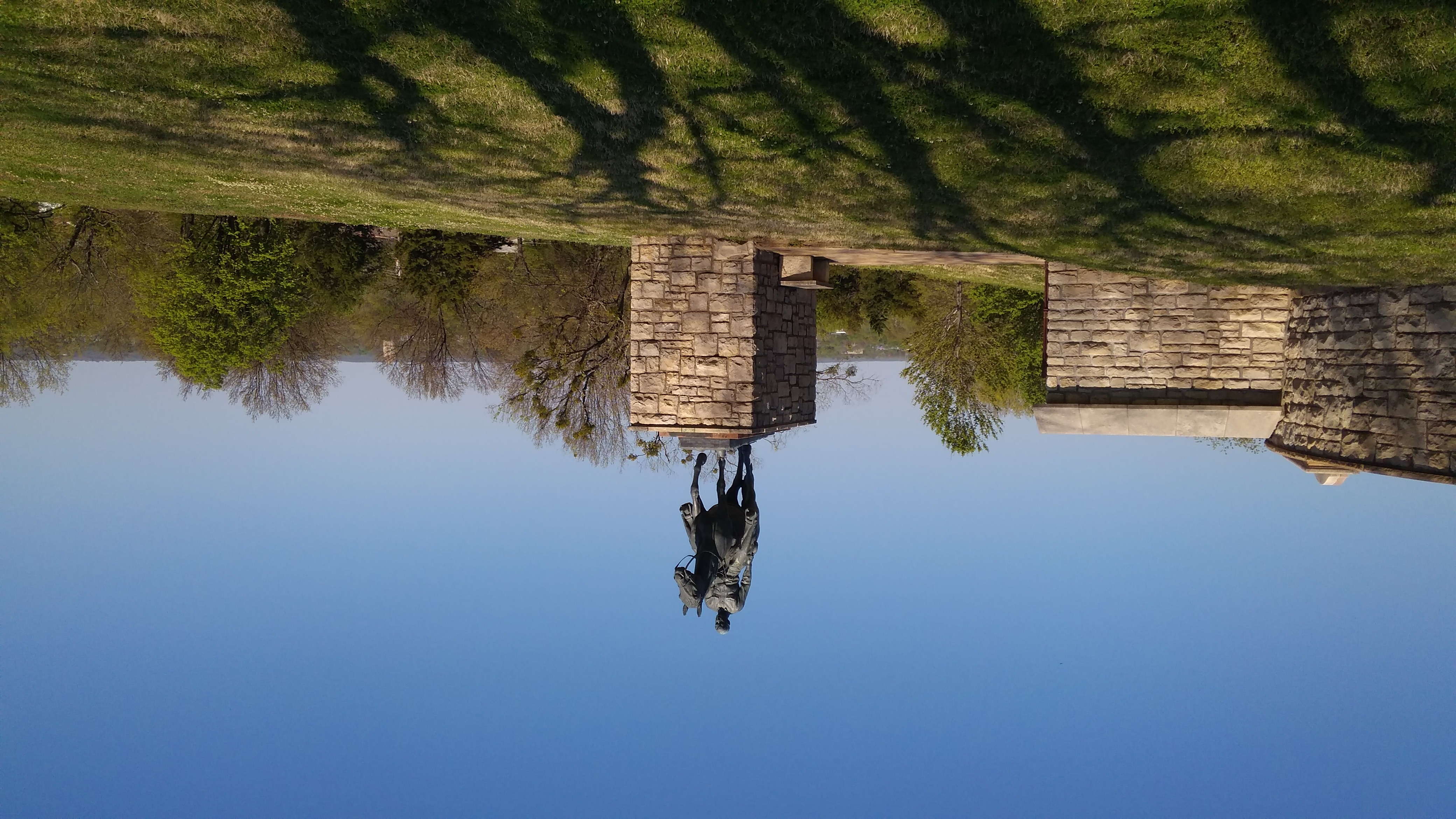
It’s now near the tomb. To judge from the ca. 1970 picture I posted a few years ago, the statue has been moved from wherever it was then. The view from the back of the museum:
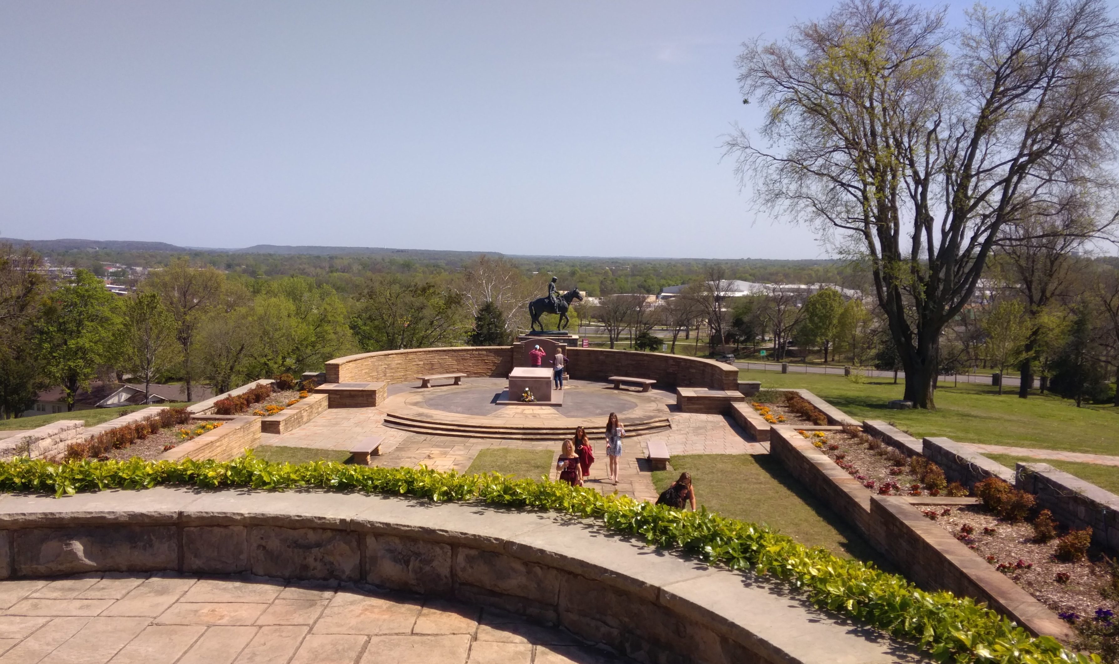
I didn’t take too many pictures inside the museum, but I make an image of a painting I liked.
It’s by an artist named John Hammer, who lives in Claremore. (More about him here.) I knew his style at once, since about a year ago I saw an edition of Travel Buddy — a coupon book you get at rest stops — that had a painting of his on the cover, a portrait of another Okie of renown, Woody Guthrie.

I picked it up because it was so different that anything you might see on a publication like that. I kept it because I really liked it.

The Trans-Pecos & Llano Estacado

Back on April 14, I headed for Texas by car. I spent most of following two weeks in that state, arriving home today. Along the way, I drove 3,691 miles and change.

The main event was the wedding of my nephew Dees and his betrothed Eden on April 21 at Hummingbird House, a gorgeous outdoor wedding venue just south of Austin in the full flush of a Texas spring. An actual warm and green spring, unlike the cold and still brown spring I left in Illinois.

Rain had been predicted for the day, as it often is this time of the year, and there was an indoor pavilion just for that circumstance, but the Texas spring accommodated the bride and groom and wedding party and all the guests by not raining. If fact, the sun came out just before the ceremony, which was picturesque as could be.

I was remiss in taking pictures of Dees and Eden or anyone else, except for a few shots of my family.They’d flown to Austin the day before the wedding, in time for the rehearsal dinner, which was a pizza party in Dees and Eden’s back yard. The logistics of my family getting to Austin were a little involved, but everything worked out.

As for me, I’d spent most of the week before the wedding with my brother Jay in Dallas, arriving in Austin the Thursday before the wedding. The morning after the wedding, a week ago now, Yuriko, Lilly and Ann and I drove to San Antonio, where we all visited my mother and brother Jim. They flew back home that evening, leaving me to drive back to Illinois.

I wanted to return a different way than I’d came, especially since I had the week off from work (the week before the wedding was a work week). So I didn’t pick the most direct route home.

Namely, I drove west from San Antonio to Marathon, Texas, a town of a few hundred people in West Texas whose main distinction is its proximity to Big Bend National Park, which I visited last Tuesday. There are many impressive things to see there, but I was most astonished by the cliffs on the Rio Grande that form Santa Elena Canyon.

The next day I went to the Trans-Pecos towns of Alpine, Marfa and especially Fort Davis. Not far from Fort Davis is the McDonald Observatory, which I’ve had a mind to visit for years. It was cloudy and misty and a little cold when I got there, but that doesn’t matter when you’re looking at impressive telescopes. In Fort Davis itself, I visited the Fort Davis National Historic Site.

The next day, I drove north, through Midland-Odessa and Lubbock and finally to Amarillo, a shift in scenery from the desert of the Trans-Pecos to the high plains of the Llano Estacado. Along the way I made a few stops: the Presidential Archives and Leadership Library in Midland and the Buddy Holly Center in Lubbock.

While in Amarillo, a city I had not seen since a brief visit in 1979, I took the opportunity on Friday to see Palo Duro Canyon State Park, which is about 30 minutes outside of town. It’s a great unknown among natural areas in Texas and, for that matter, the United States.

I had enough time that day after visiting Palo Duro — the days are getting longer — to drop by and see the Cadillac Ranch, famed oddball tourist attraction, which is on the western outskirts of town.

This weekend was a long drive home: Amarillo to Lebanon, Missouri, on Saturday (I’d stopped in Lebanon the first day out, on the way to Dallas), and Lebanon to home in metro Chicago today. Tiring, but I did squeeze in two more sites. In Claremore, Okla., on Saturday, I saw the Will Rogers Museum. Not bad for an entertainer who’s been dead more than 80 years.

Today I stopped just outside St. Louis and took a walk around the Cahokia Mounds State Historic Site. Not bad for a culture that’s been gone for about 800 years.

Twelve Pictures ’17

Back to posting on January 2, 2018, or so. Like last year, I’m going to wind up the year with a leftover picture from each month. This time, for no special reason, no people, just places and things.

Champaign, Ill., January 2017Charlotte, NC, February 2017

Kankakee, Ill., March 2017

Rockford, Ill., April 2017

Muskogee, Okla., May 2017

Naperville, Ill., June 2017

Barrington Hills, Ill., July 2017

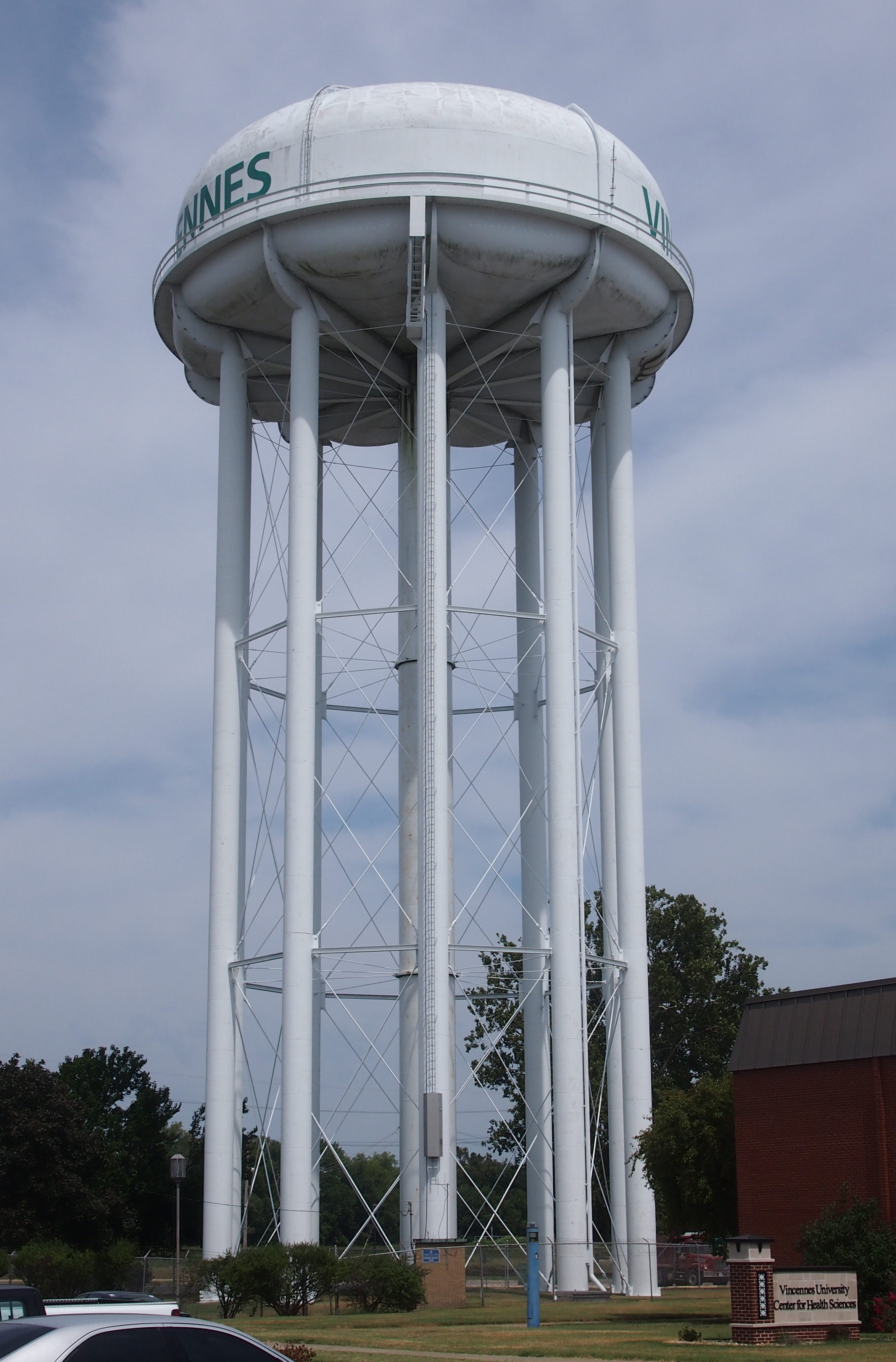
Vincennes, Ind., August 2017

Denver, September 2017Evanston, Ill., October 2017Chicago, November 2017

Birmingham, Ala., December 2017

Merry Christmas and Happy New Year to all.

The USS Batfish

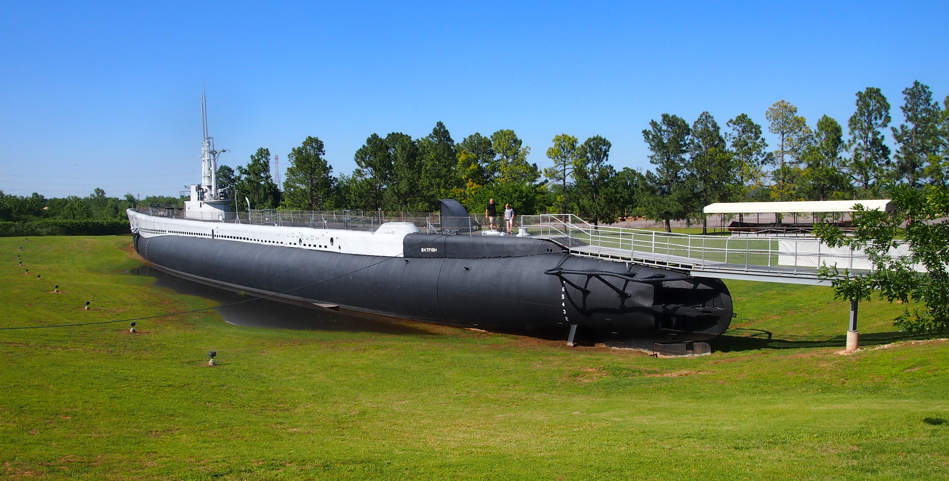
A park in Muskogee, Okla., might seem an odd place to find a submarine, but that’s where the USS Batfish makes its home as a museum ship.

USS Batfish

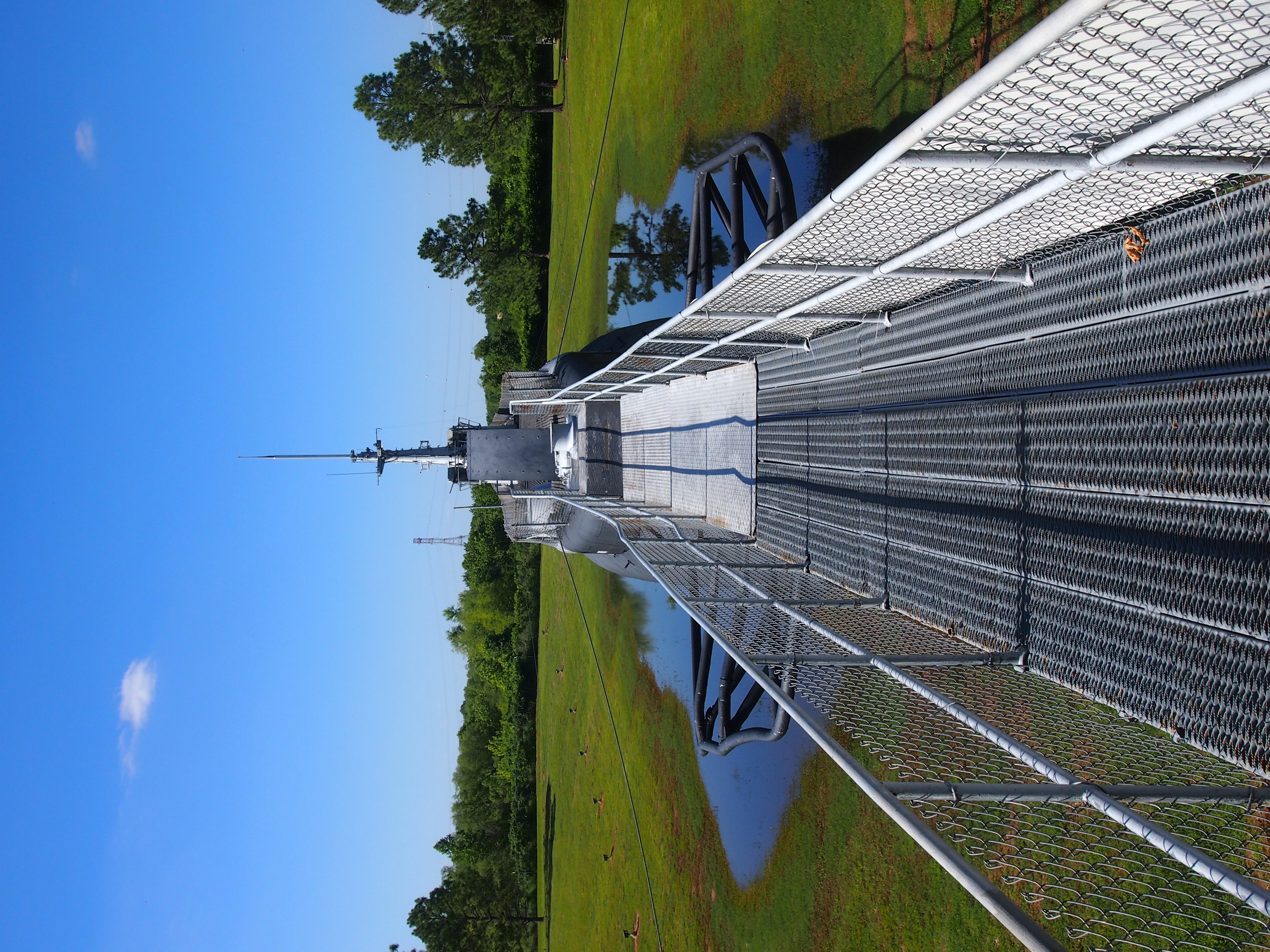
Note the walkway leading to the top of the vessel. That’s the access point for visitors, as Lilly and I were on the afternoon of May 13.
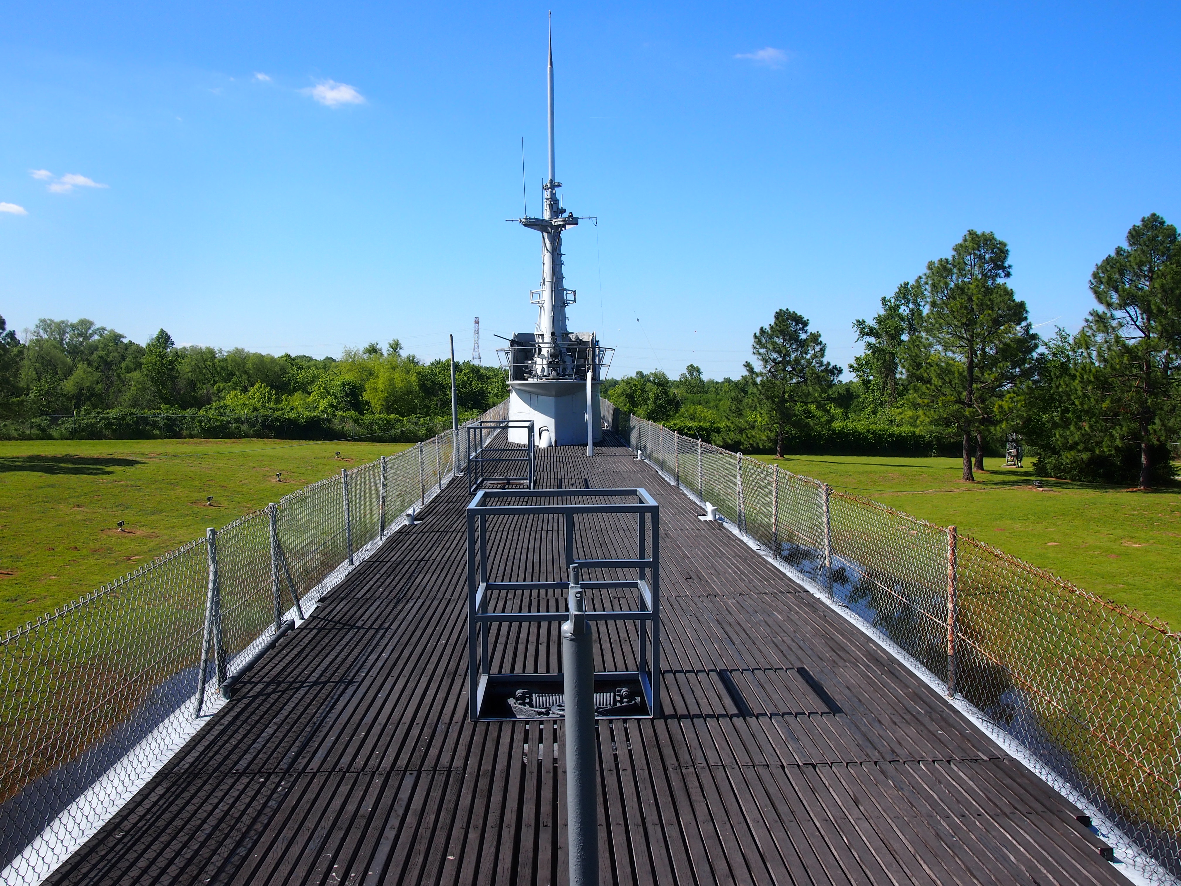
USS BatfishNote also the water around the hull of the Batfish. I suspect that was because of a rainy spring, not a permanent feature. Soon we stood on top of the Batfish. I’d never stood on a submarine before. The fencing was clearly added for the safety of tourists. I’ll bet that during active service, either you maintained your footing or you didn’t.
USS BatfishI walked onto the sub thinking that was it, a look at the outside. Then we noted that both hatches, one forward, the other aft, were open. You can go inside.

The interior is well maintained, well lighted, and pretty much like crawling around in a cave made of steel. On display were such features as glowing torpedo tubes.
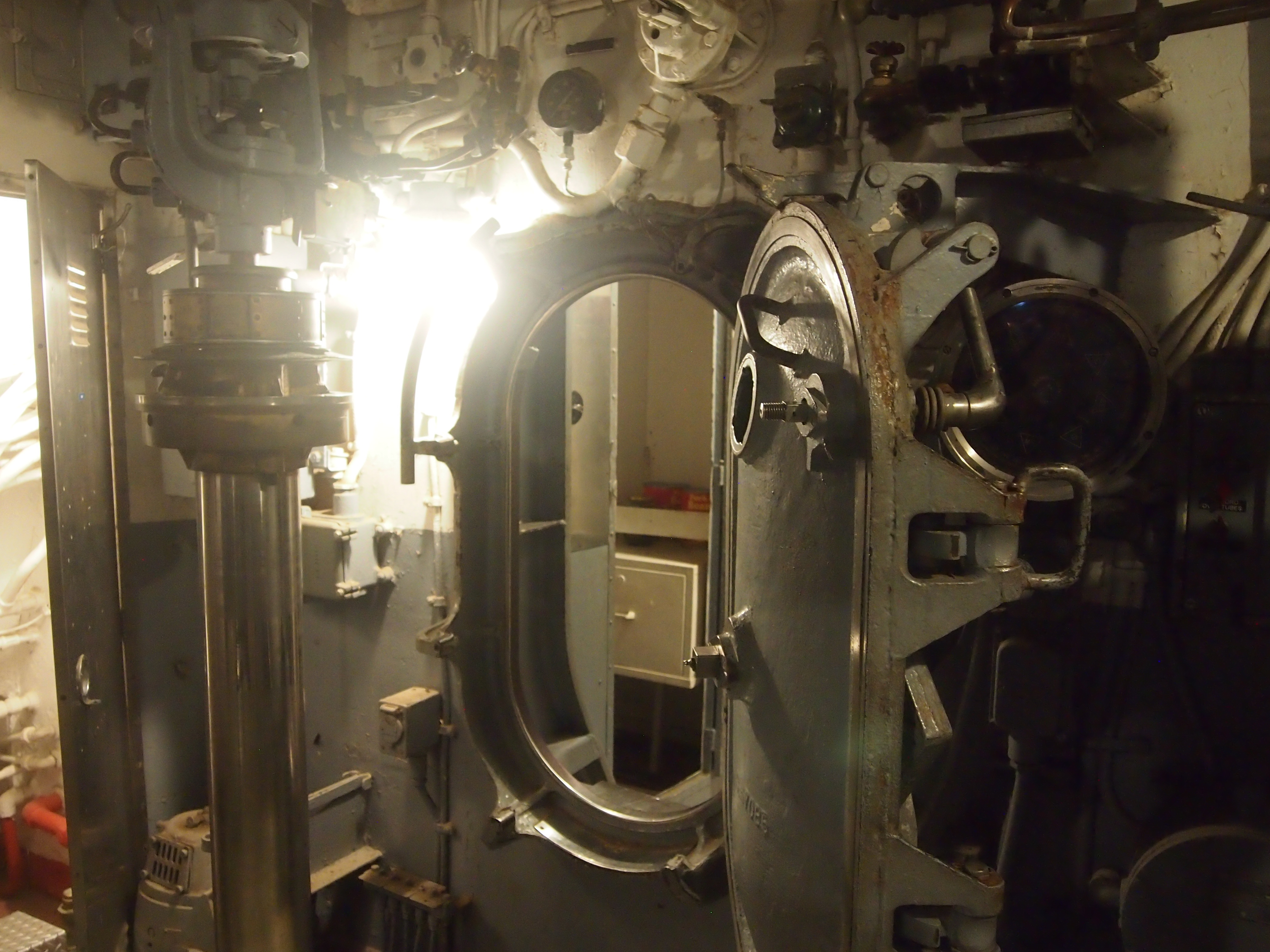
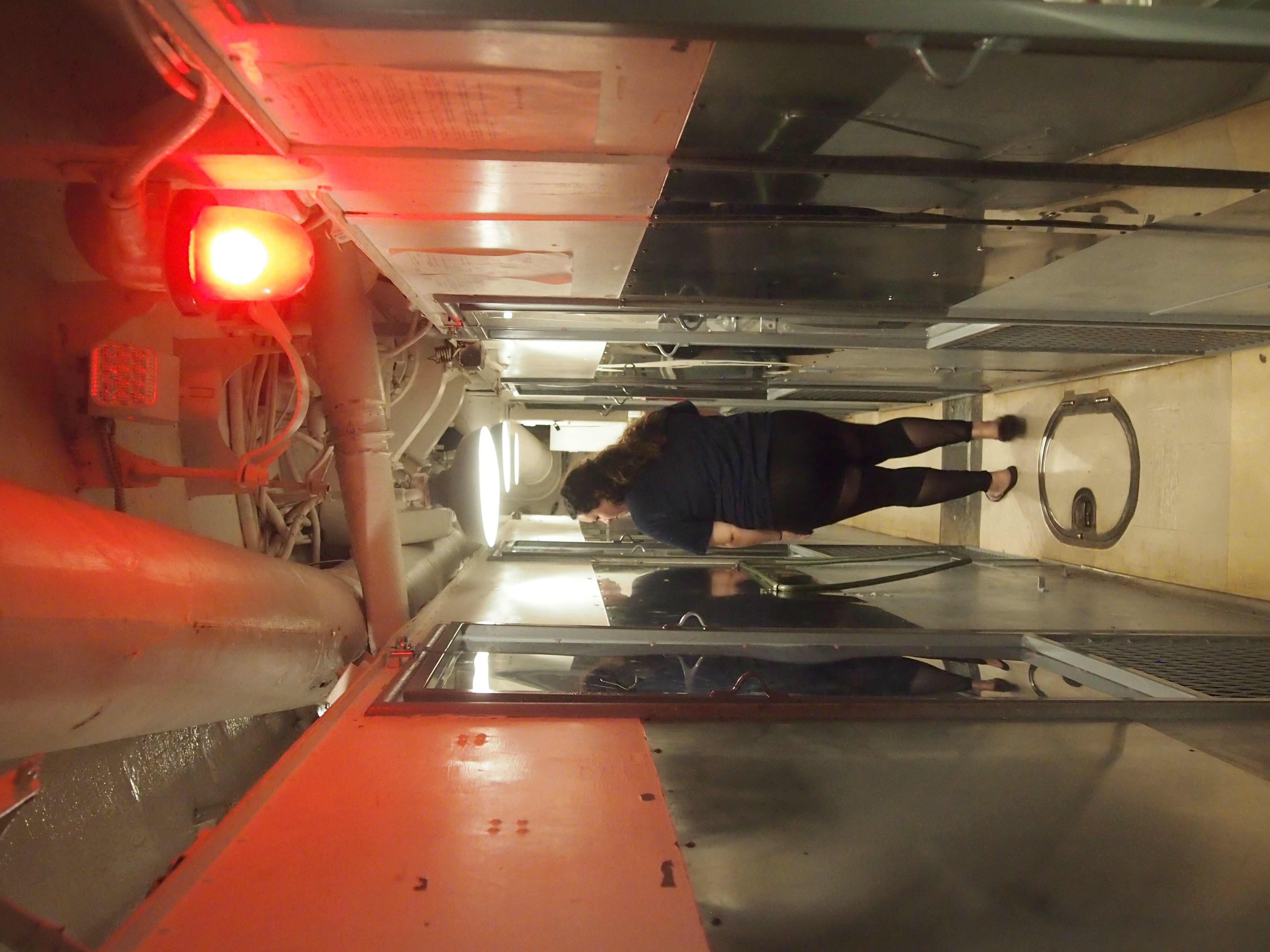
USS Batfish - torpedo tubesTo make your way through the vessel, you pass through a series of hatches like this. I assume they’re watertight. Submarines clearly aren’t meant for fat men.
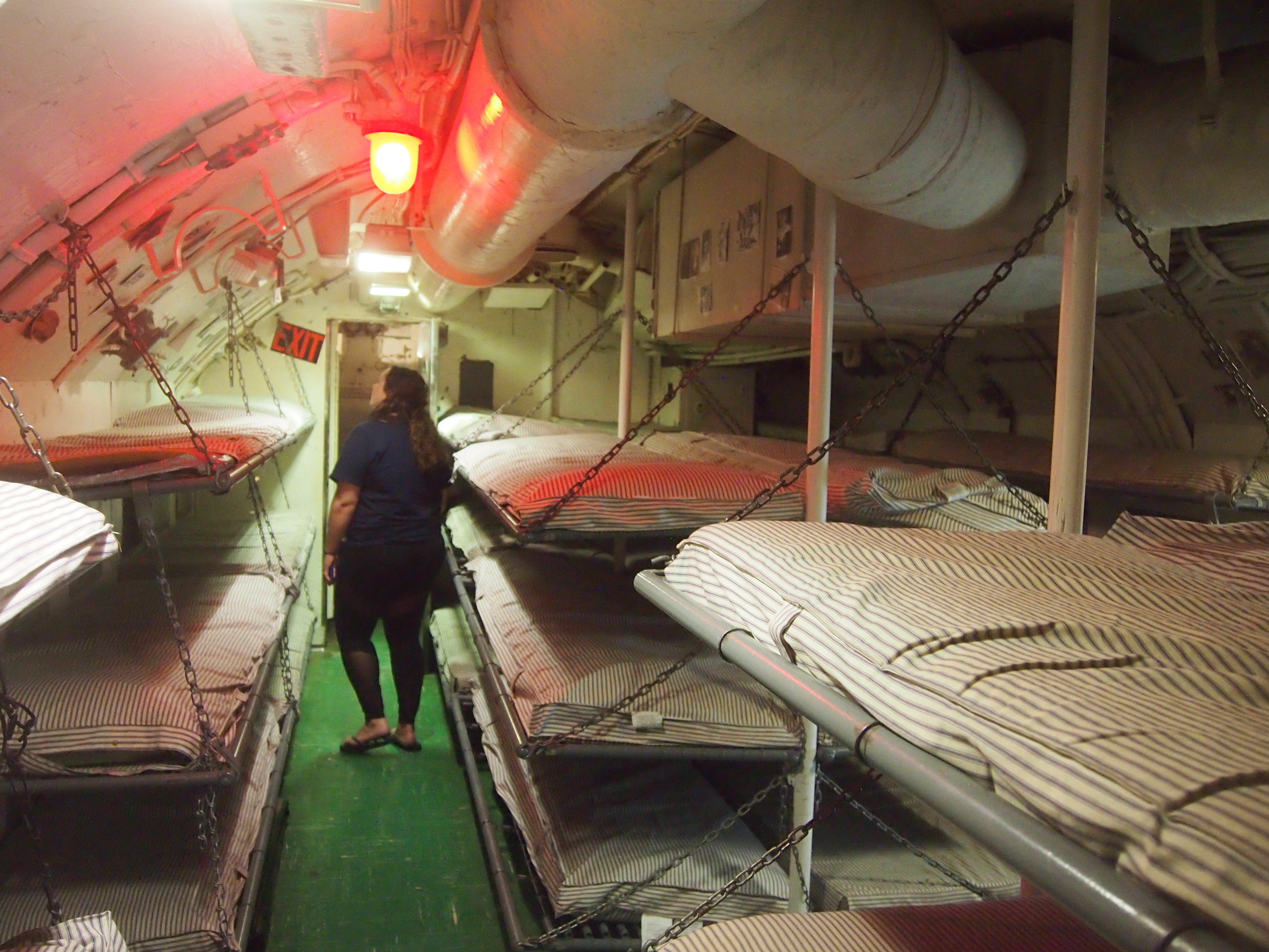
USS BatfishI didn’t feel claustrophobic, exactly, just boxed in. It’s difficult to imagine the fortitude necessary to spend months at a time in such a steel box, with sudden drowning all too real a possibility.

Plenty of narrow corridors.
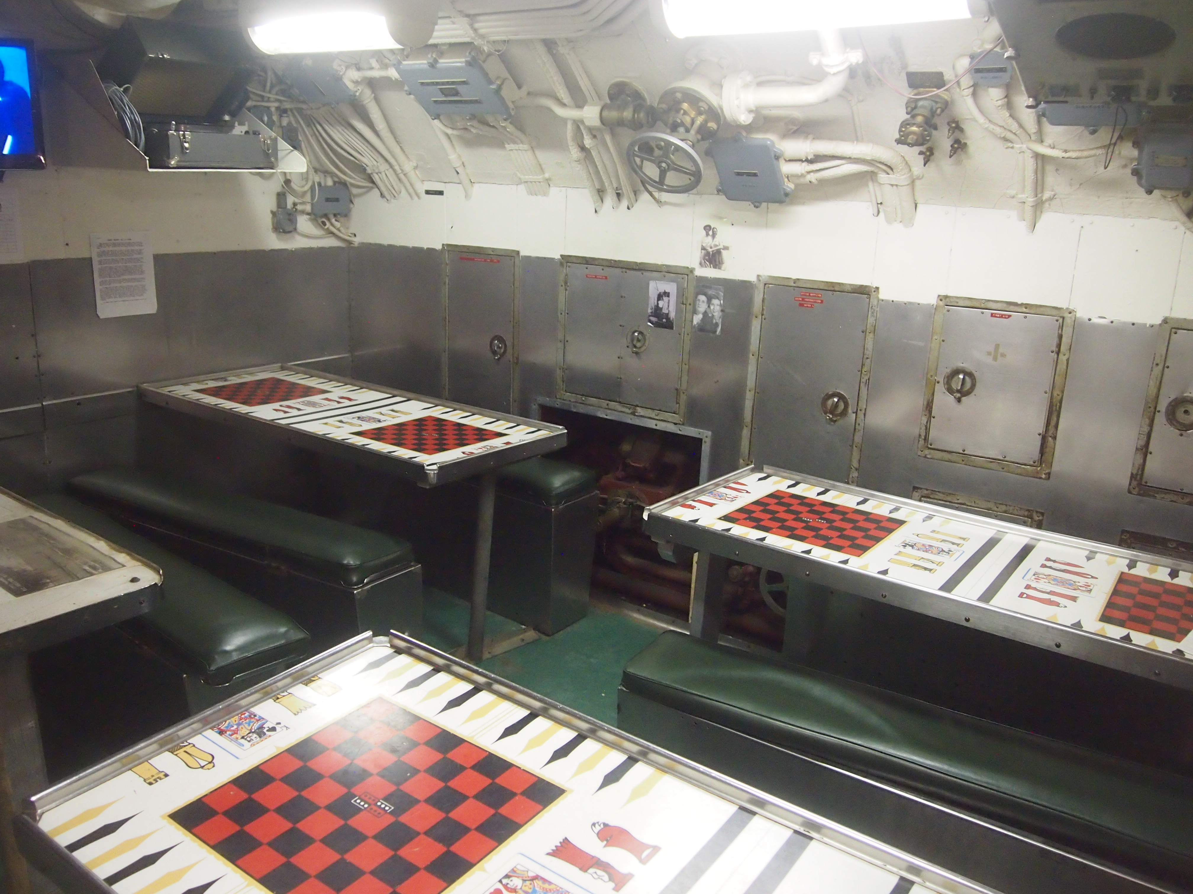
USS BatfishAnd limited comforts.
USS BatfishUSS BatfishI understand that the food was generally better on subs than the ordinary run of ships, as one way to compensate for other discomforts. I hope that was true.

A forest of pipes.
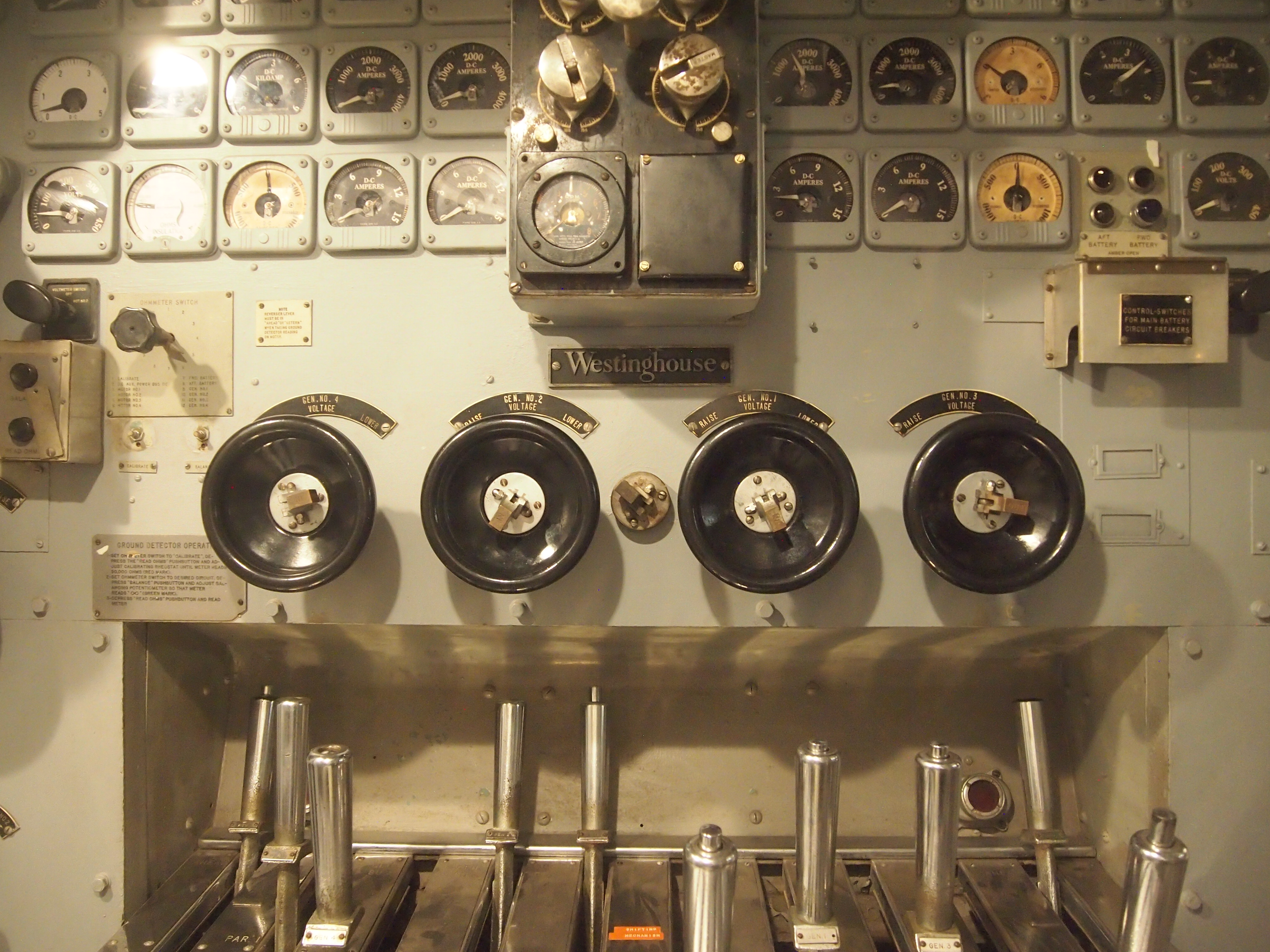
USS BatfishAnd controls. Many, many controls and dials.
USS BatfishUSS BatfishUSS BatfishAs a warship, the Batfish had a good run, completing seven war patrols from late 1943 to the end of the war. She clearly took the cinematic Patton at his word, making some other poor dumb bastards die for their country. Most notably by sinking three Japanese subs in a 76-hour period in February 1945.

After the war, the vessel hung on until 1969, when it was struck from the Naval Vessel Registry. Apparently Oklahoma submarine vets, aided by state politicos, managed to obtain it for display from the Navy in the early ’70s, though the task of getting to its current site in Muskogee, near the Arkansas River, was a long and tedious process, as described here.

There’s also a small museum in a building near the submarine, and not far from the sub, a poignant display with plaques honoring each U.S. submarine, WWII and other eras, that didn’t return. On eternal patrol, as the submariners put it.

GTT 2017

This month Lilly and I visited Texas for a couple of weeks, beginning when I picked her up on May 12 in Champaign, at the end of her exams at UIUC, and ending with our return to metro Chicago on May 26. Unlike last summer, we mostly took direct routes, there and back. All together, we drove just a shade over 2611 miles through only four states, but ranging from about 42 degrees North to 29 degrees North.

Mostly we spent time with family: her grandmother and uncles and cousins, in San Antonio and Dallas, most of whom she hasn’t seen recently. She also met little cousin Neil for the first time.

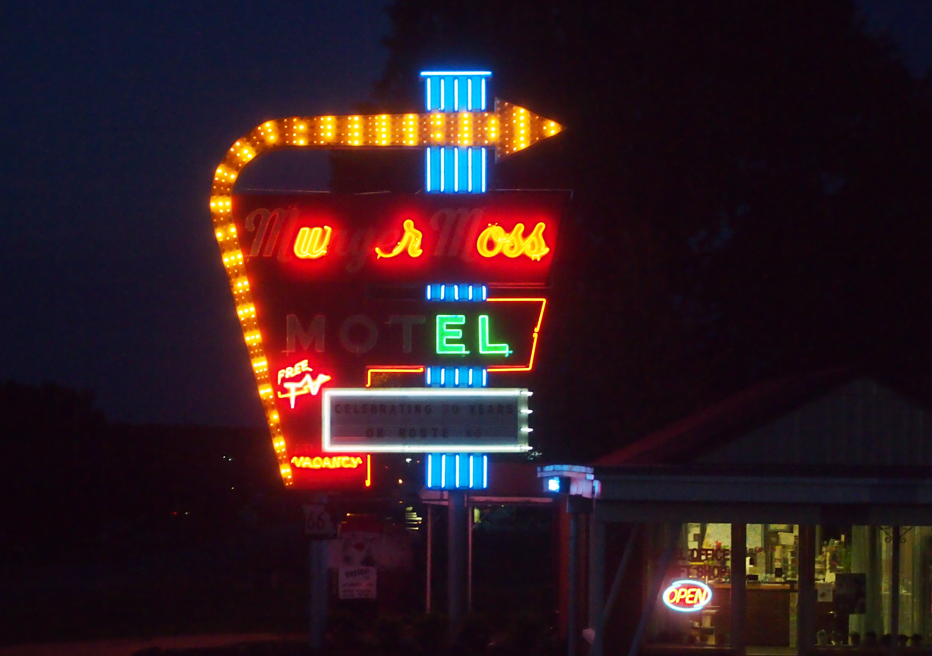
From Champaign, we headed to Effingham, where we passed the giant cross, visible from the highway, but did not stop for it, and then headed west to St. Louis. By evening, we’d made it to Lebanon, Mo., and the Munger Moss Motel, which has had a few more neon burnouts since Ann and I stopped there last year.
Munger Moss sign 2017The second day, we went to Dallas by way of Springfield, Mo., where we stopped to stroll in the Mizumoto Japanese Stroll Garden, a part of the Springfield Botanical Gardens. Later that day, we stopped in Muskogee, Okla., and took a look at the USS Batfish, a WWII-vintage submarine incongruously perched on land and functioning as a museum.

On Sunday, May 14, we proceeded to San Antonio, with my brother Jay joining us. We stopped for a delightful lunch in Austin with Tom Jones that afternoon at Trudy’s, a local brand. Tom was already an old friend of mine when I was Lilly’s age.

Circumstances forced us to scrub our plans to drive to Big Bend National Park for a long weekend beginning on the 18th. While in San Antonio, Lilly went to North Star Mall one day by Uber, and on another day Jay and Lilly and my nephew Dees went to the Witte Museum and then the Sunken Gardens (formally, the Japanese Tea Garden). On Saturday, May 20, we to returned to Jay’s house Dallas via U.S. 281 until north of Austin, picking up I-35 near Killeen, because there’s no reason to go through Austin unless you’re going to Austin.

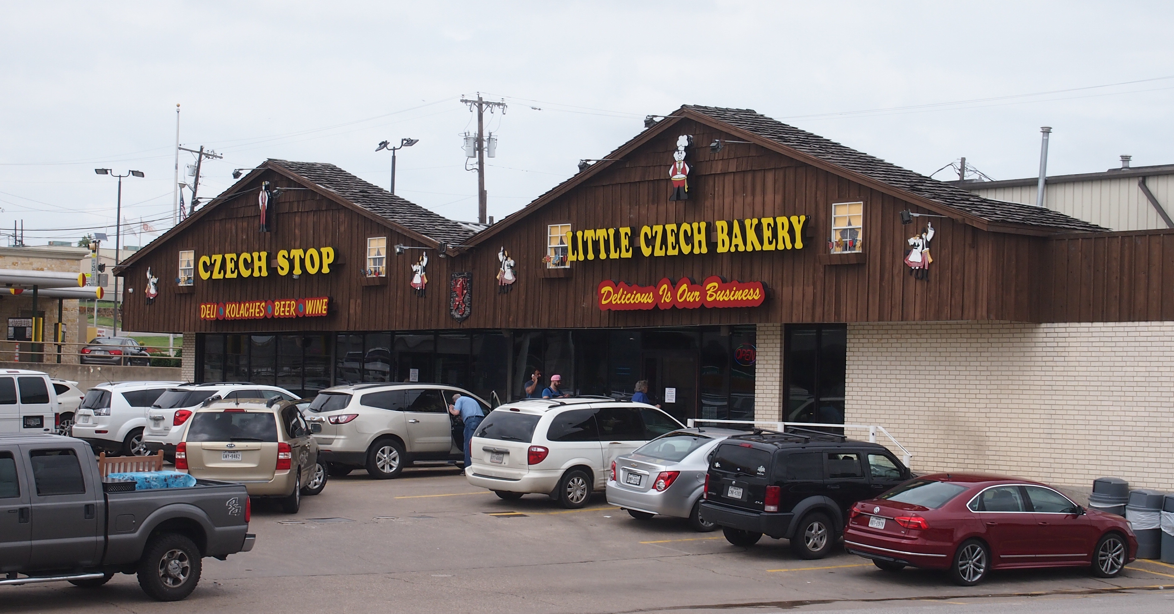
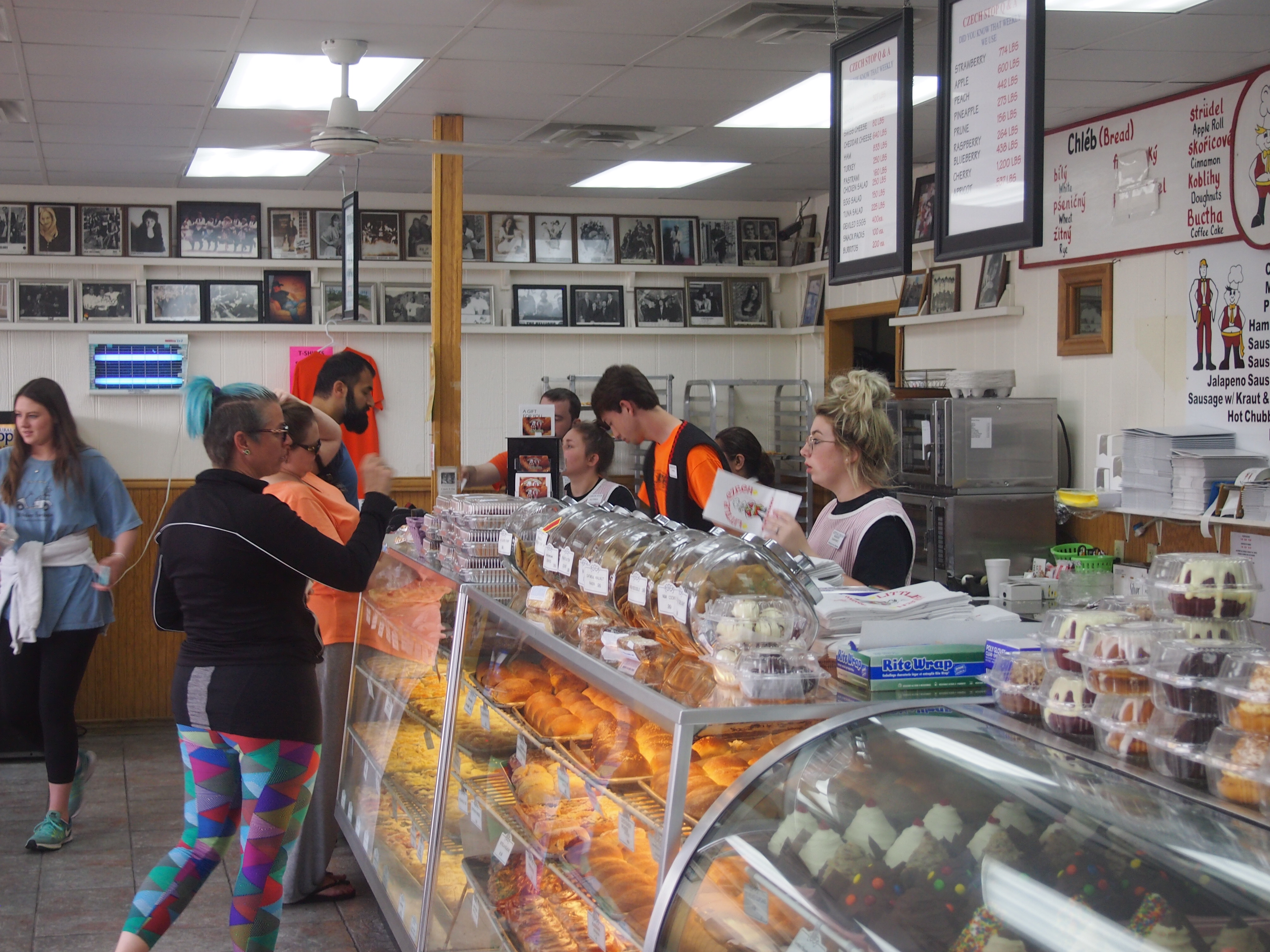
In West, Texas, — which is in Central Texas — we bought some kolaches at the Little Czech Bakery, which is next to the Czech Stop. Been there a number of times since I wrote this.
Czech Stop, West, Texas 2017The line wasn’t quite as long as usual. Good thing.
Czech Stop, West, Texas 2017Czech Stop, West, Texas 2017One day in Dallas we visited the Dallas Arboretum and Botanic Gardens, as lovely a garden as I’ve seen in quite a while. Despite its location on White Rock Lake, close to Jay’s house, I’d never been. Another day I dropped Lilly off at North Park Mall, known for its collection of artwork, and visited the next-door Sparkman-Hillcrest Cemetery, or in full, the Sparkman-Hillcrest Memorial Park Cemetery. A first-rate bit of landscaping.

We headed back for home beginning on May 25, driving from Dallas back to the Munger Moss for one more night (getting room 67; the first time we got 66). The next day we passed through St. Louis en route to the Chicago area and home.

On the last leg of the trip I was determined to stop a few places. First, we saw the abandoned Gasconade River Bridge, which counts as a Route 66 sight, though it could have been along any old road and still be just as fine. In St. Louis we visited the Cathedral Basilica of St. Louis, one of my favorite churches in North America, and then the wooded, hilly Bellefontaine Cemetery north of downtown, which is in the same league as Green-Wood in Brooklyn or Woodland in Dayton. First rate, that is.