Alaska 3, Nenana & Warren Gamaliel Harding

One way to get from Fairbanks to the entrance of Denali NP is to ride the Alaska Railroad. In fact, that was the original route for tourism into the interior of Alaska, though I suspect from the 1920s to the early ’70s, most people came up from the port of Seward to access the grandeur of McKinley NP, as it was then known.

I considered taking the train down from Fairbanks myself — the wonderfully named Denali Star. That would have been a cool ride. But the pandemic bollixed up its schedule. Last year, the passenger trains didn’t run. This year, at least as I planned things back in April, service was more limited than it had been before 2020, such that I couldn’t make the train work for me logistically.

That’s how, on July 28, I came to be in a rental car heading west and then south from Fairbanks on the route Alaska 3. I picked the car up at the airport in Fairbanks at noon that day. Along with the other documents, the rental company gave me a list of proscribed roads.

Mostly gravel roads. During my ride on the Dalton Highway the day before, the driver told us that if you look closely, you’ll notice that a lot of cars and trucks in Alaska have cracked windshields. Insurance typically doesn’t cover that kind of damage, since gravel roads tend to dish it out too regularly.

The list is interesting for another reason, in that it gives names instead of route numbers. Most Alaska highways, it seems, are known by their names rather than numbers. I asked the bus driver on the Dalton whether that road had a number, and he had to think before he told me. It’s Alaska 11, but no one calls it that, and I didn’t see any signs along the way using the number.
In Fairbanks and a little ways south, I also drove on Alaska 2, but the signs called it the Steese Highway (not to worry, I was well south of Mile Post 81).

Later I learned that Alaska 2, the Steese, is the Alaskan portion of the Alaska Highway. I smile at the thought that I’ve driven on the Alaska Highway, even if only about 12 miles of it between Fairbanks and the town of North Pole.

As for the road between Fairbanks and Denali NP, its name is the George Parks Highway, named for a mining engineer and governor of the Alaska Territory in the 1920s and ’30s. Remarkably, he lived to see his name attached to the road, since he died at age 100 in 1984.

I didn’t see too many signs calling it the Parks Highway, though. Mostly I saw the Alaska 3 signs, featuring the state name, the number, and the Big Dipper and Polaris, arrayed as they are in the northern sky and the Alaska flag. An excellent design, one that made me think, damn — I’m in Alaska. For miles at a time, those were the only signs I saw. The road the was remarkably free of most the signage you might see elsewhere: directional signs, mileage signs, billboards and so on.

Alaska 3 was mostly a two-lane shot through the boreal forest. The terrain between Fairbanks and Denali NP, which runs about 125 miles, follows the Tanana River, and then passes by the Minto Flats and the Tanana Flats, so it isn’t a mountainous crossing. I suppose that facilitated the road’s construction, completed only 50 years ago.

That isn’t a long drive, certainly not for someone who learned to drive in Texas. But it was mesmerizing in a way that few roads are. Traffic was light, so my eyes were able to wander sometimes from the road ahead to the forested expanse on either side.

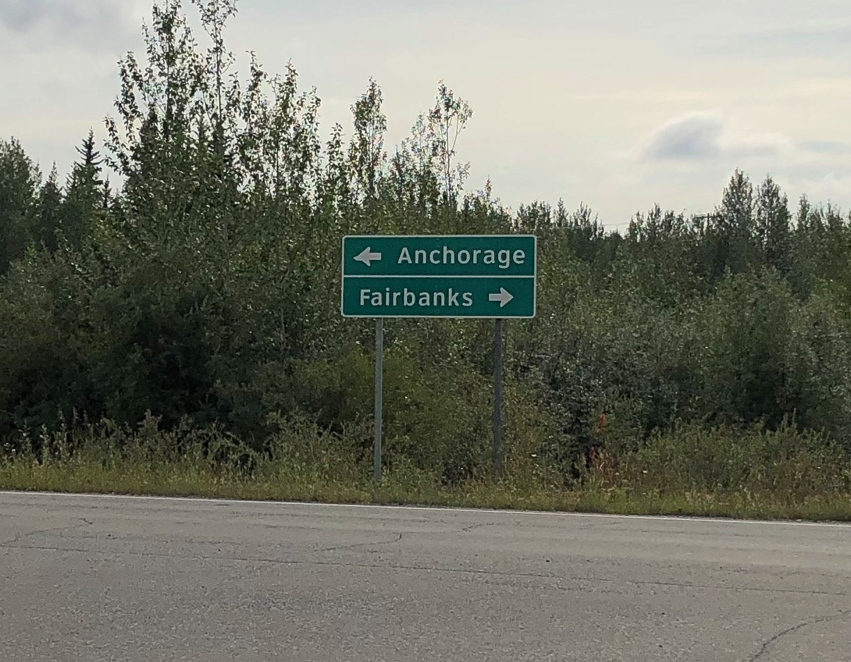
The were a few directional signs. My favorite.

Alaska 3

That was at an intersection with Alaska 3 in the town of Nenana, the only settlement of any size (pop. 341) between suburban Fairbanks and the tourist town of Healy, just north of the entrance to Denali NP.

The road crosses the Tanana River at the town of Nenana, very near where the Nenana River — which I would see later, near the national park — joins the Tanana, on its way to the Yukon River.Nenana, Alaska
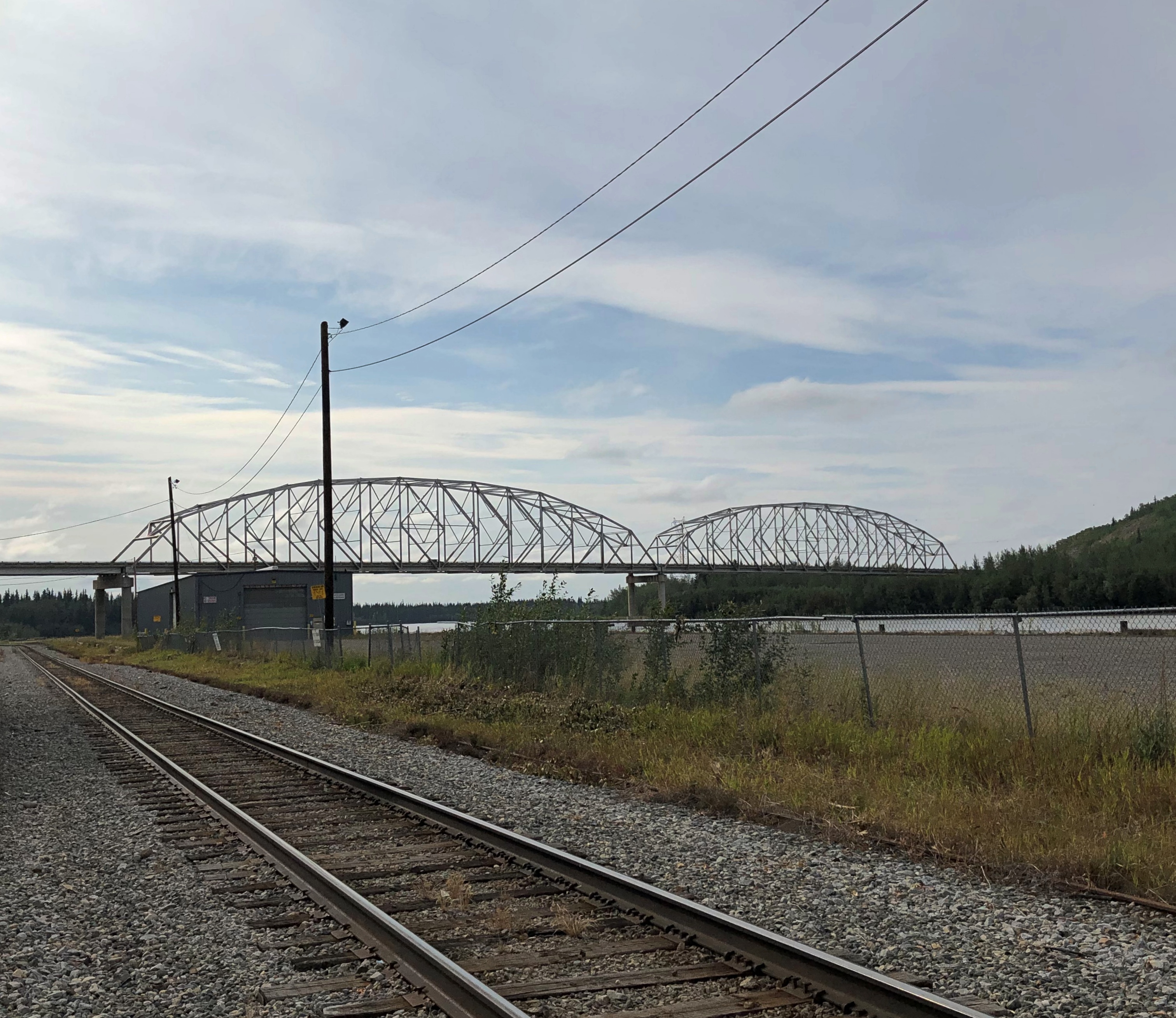
The other bridge in the town of Nenana (across the Tanana River) is the Mears Memorial Bridge, which takes the railroad across the river. More about that shortly.

Nenana seemed like a good place to look around. Near the highway is a cluster of tourist and memorial structures, including a boat out of water, the Taku Chief.Nenana, Alaska Taku Chief
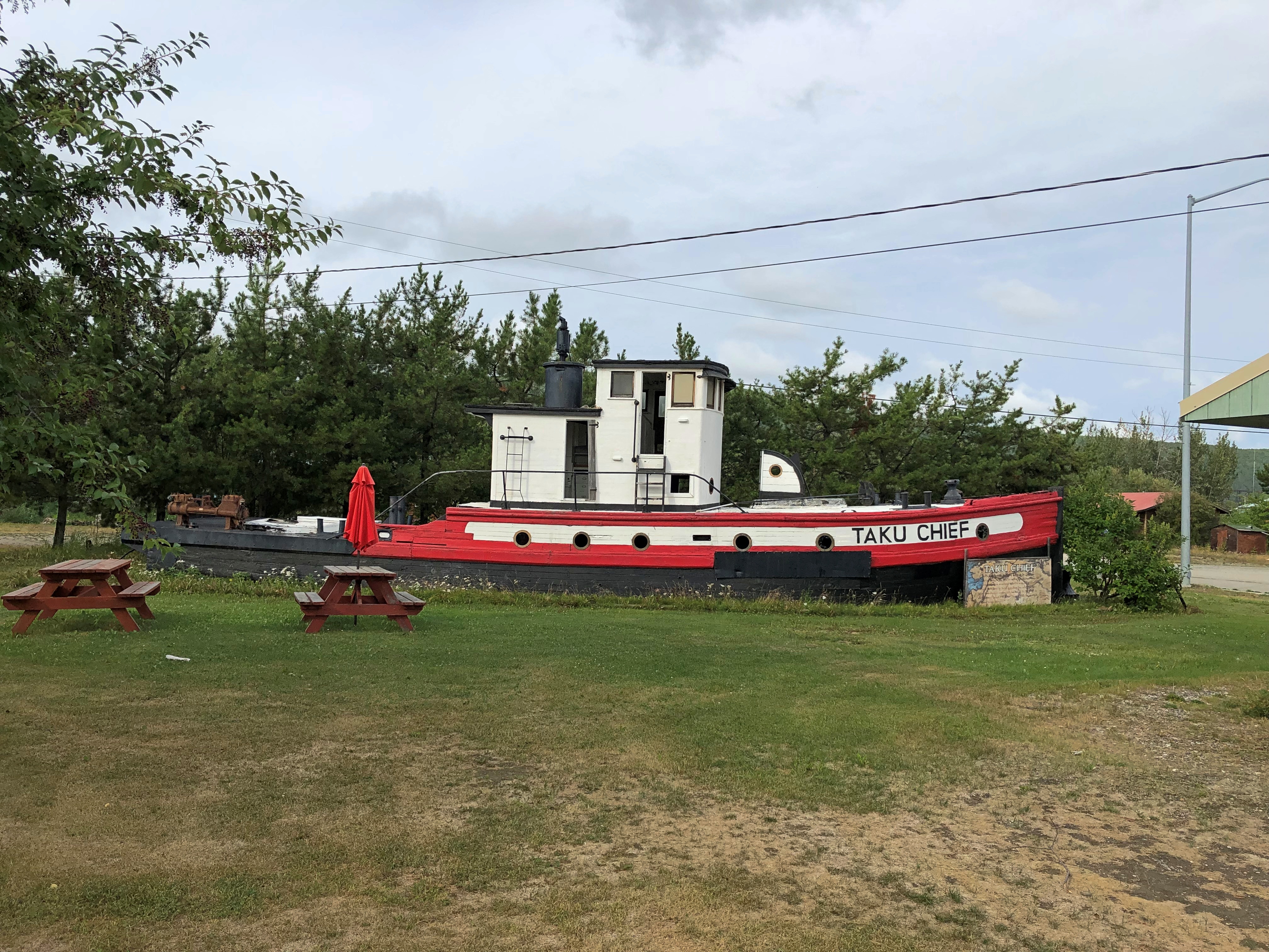
The nearby sign says: “The last commercial wooden tug to ply the Yukon and Tanana River Basins, the Taku began her career in 1938 in Southeast Alaska. After 7 years in service she was requisitioned by the CAA for use on the rivers of the Interior. In 1956, she joined the fleet of Yutana Barge Lines, and after a colorful history, the sandbars and sweepers finally took their toll. On July 18, 1978, she was condemned. She rests in her last port, Nenana, a tribute to the heartbeat of Alaska transportation.”

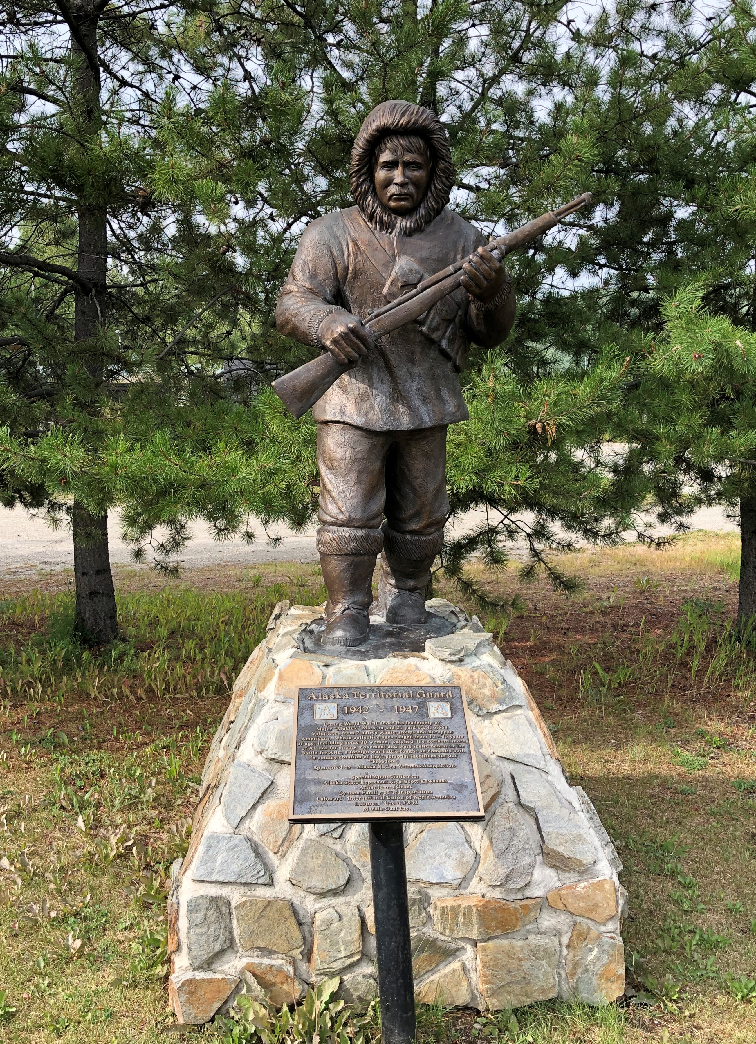
Near the ship is another casting of the James Grant work memorializing the Alaska Territorial Guard, 1942-47.Nenana, Alaska - Alaska Territorial Guard, 1942-47
The town’s main street (besides the highway) is A Street, with a scattering of houses, buildings, abandoned buildings and empty lots. The pandemic might have done in this business; or maybe it closed before then.

Tenana, Alaska

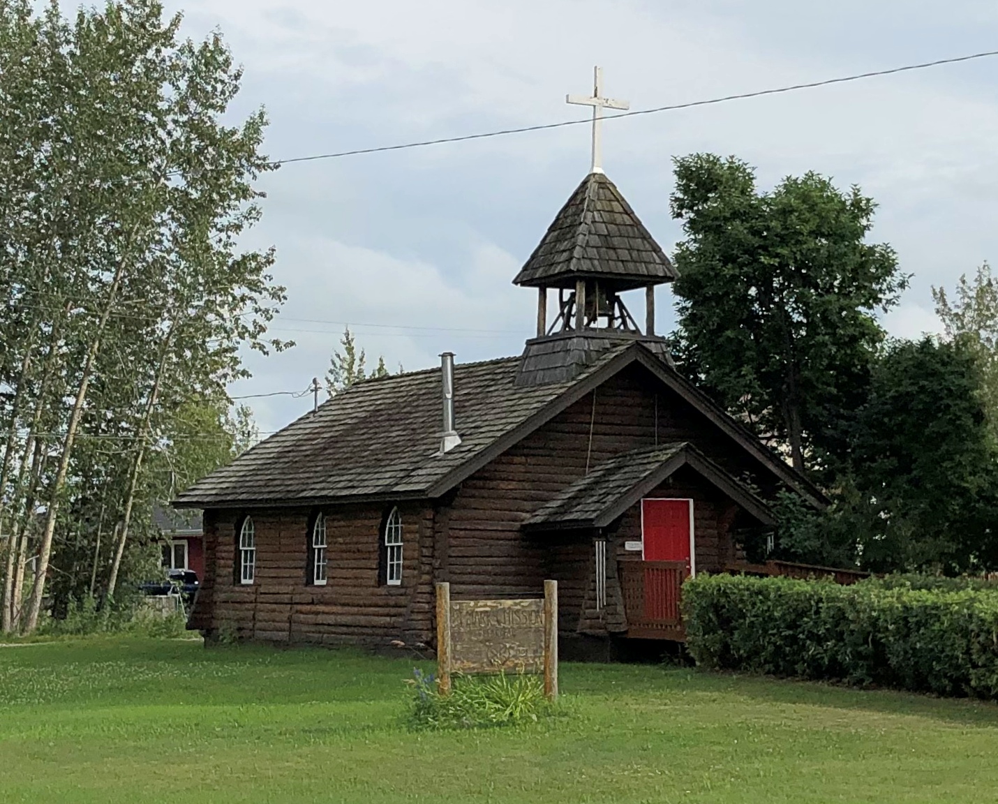
St. Mark’s Mission church.

Tenana, Alaska - St. Mark's

“The Episcopal Church, continuing work done by Episcopal and Anglican missionaries along the Yukon River, envisioned a series of missions throughout the Tanana basin to serve its Native population,” Sketches of Alaska says. “Eventually four missions were established: St. Barnabas at Chena Native Village, Luke’s at Salcha, St. Timothy’s at Tanacross (near Tok), and St. Mark’s at Nenana…

“The picturesque church is similar in design to other Episcopal mission churches throughout Interior Alaska — a log structure with gable front and bell tower. The 22-foot by 28-foot building is constructed of logs squared on three sides, with the bottom courses of logs flaring outwards. Gothic arched windows contain stained glass, and the building is topped by a shake roof.”

At A Street and Front Street near the Tanana River is a curious tower.Nenana, Alaska - tripod
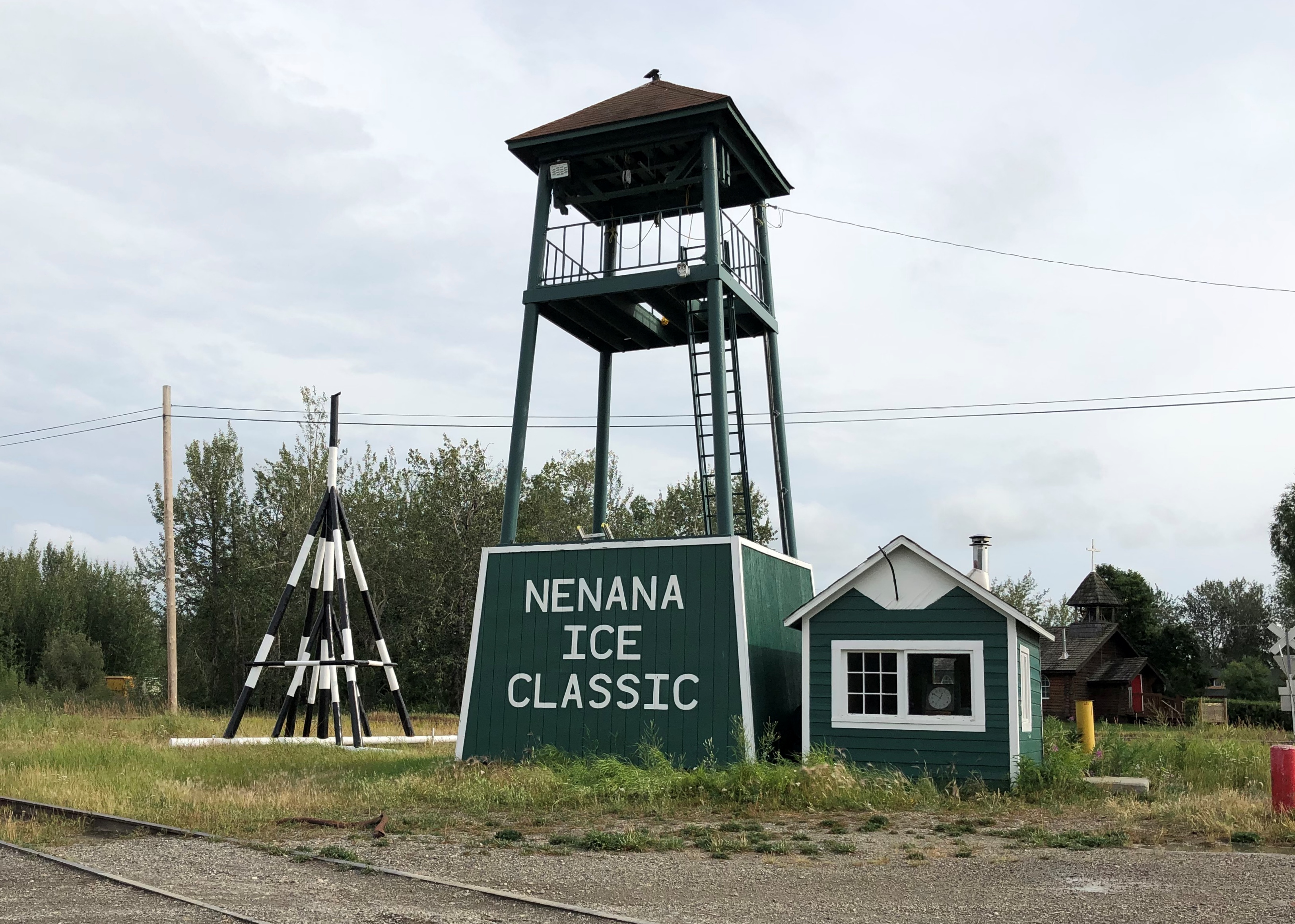
I didn’t look that up till I got home. I’d assumed it was some kind of winter sporting event, but no. Wiki: “The Nenana Ice Classic is an annual ice pool contest held in Nenana, Alaska. It is an event in which individuals attempt to guess the exact time the Tanana River ice will break up at Nenana.

“The ‘tripod,’ which actually has four supports, is planted on the river ice between the highway and railroad bridges in Nenana, 300 ft from the shore… A line is attached to the top of the tripod and once that end is anchored the other end is taken to the Ice Classic tower nearby on the banks of the river. Attached there to the clock inside the tower, when the ice goes out and moves the tripod 100 feet the line breaks and stops the clock.”

The pool is no small potatoes. According to the pool web site, the prize money in 2021 totaled $233,591. The clock stopped on April 30 at 12:50 pm and the prize was split among 12 winners. The rest of the funds generated by the pool go to local charities.

The Wiki photo of the tripod looked awfully familiar. Then I remember that I’d seen the tripod, standing next to the tower (and there was another one near the Taku Chief). There was nothing to explain what they were. Tourist photographer that I am, I took a picture of one of them anyway.
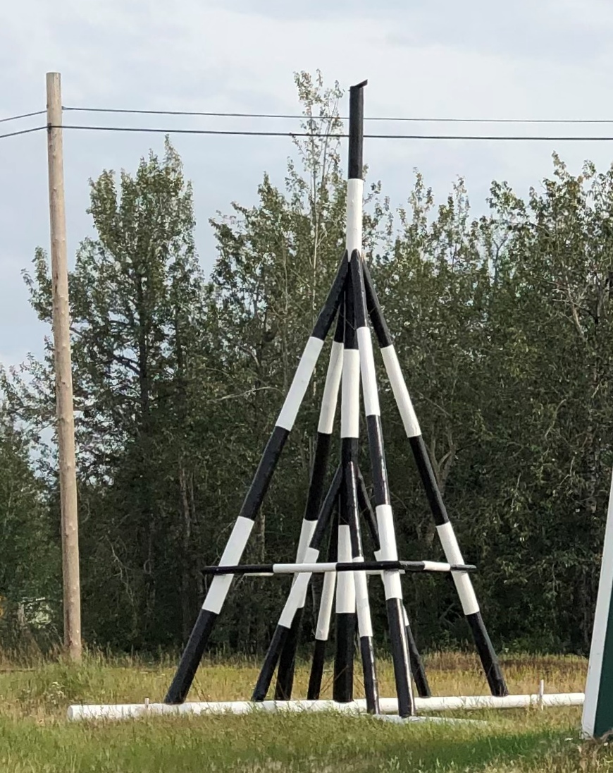
Nenana, Alaska - tripod
Finding out what it was produced a bit of mild amazement, here during the post-trip writeup. What a fun thing to learn about, like the Sopchoppy Worm Gruntin’ Festival. How often do we look at things on the road, or near home for that matter, without the slightest idea what they are?

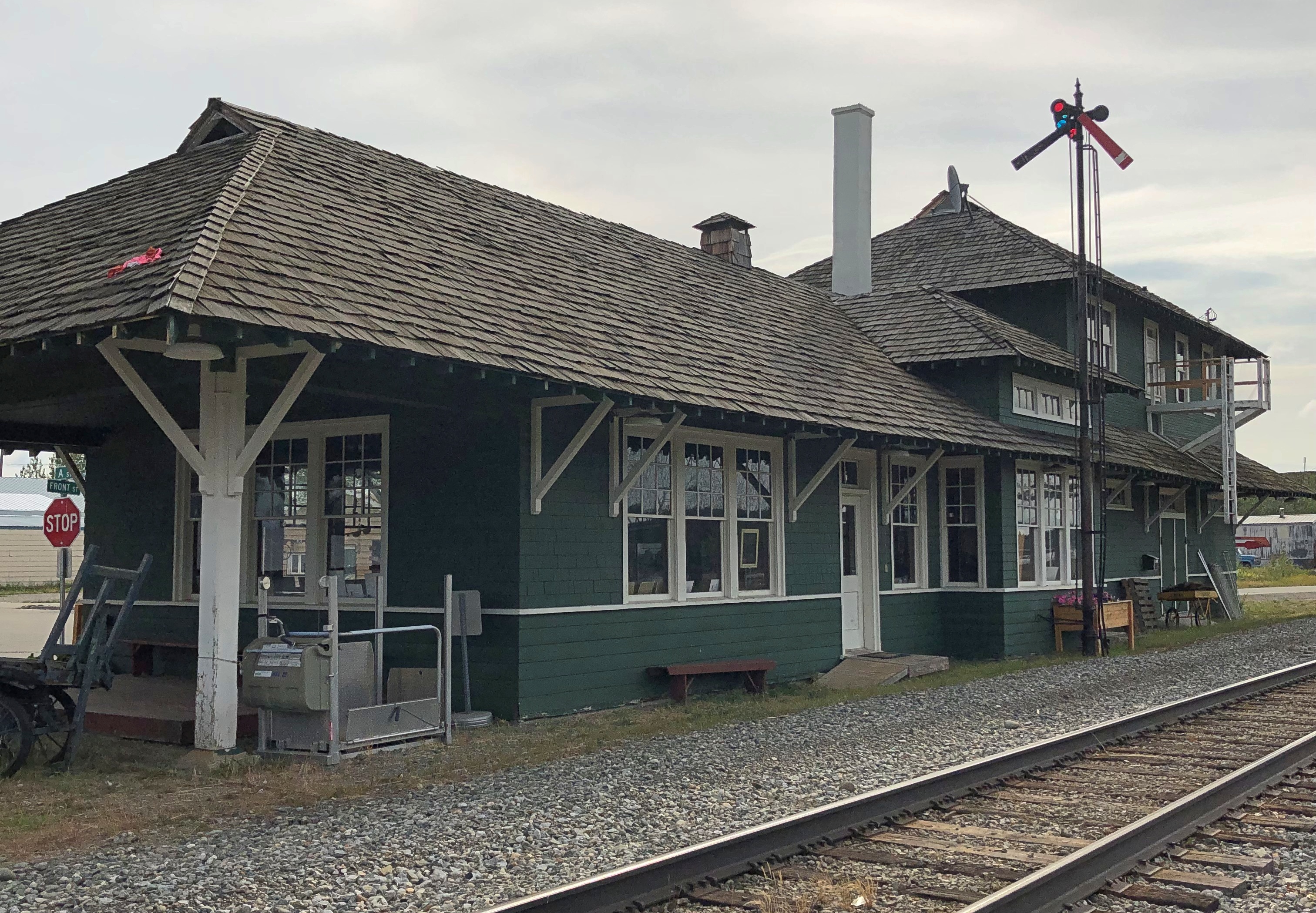
At the meeting of A Street and Front is the handsome Nenana depot, which still seems to be a stop on the Alaska Railroad, but it’s also the State of Alaska Railroad Museum. It was closed when I got there.Nenana, Alaska - depot
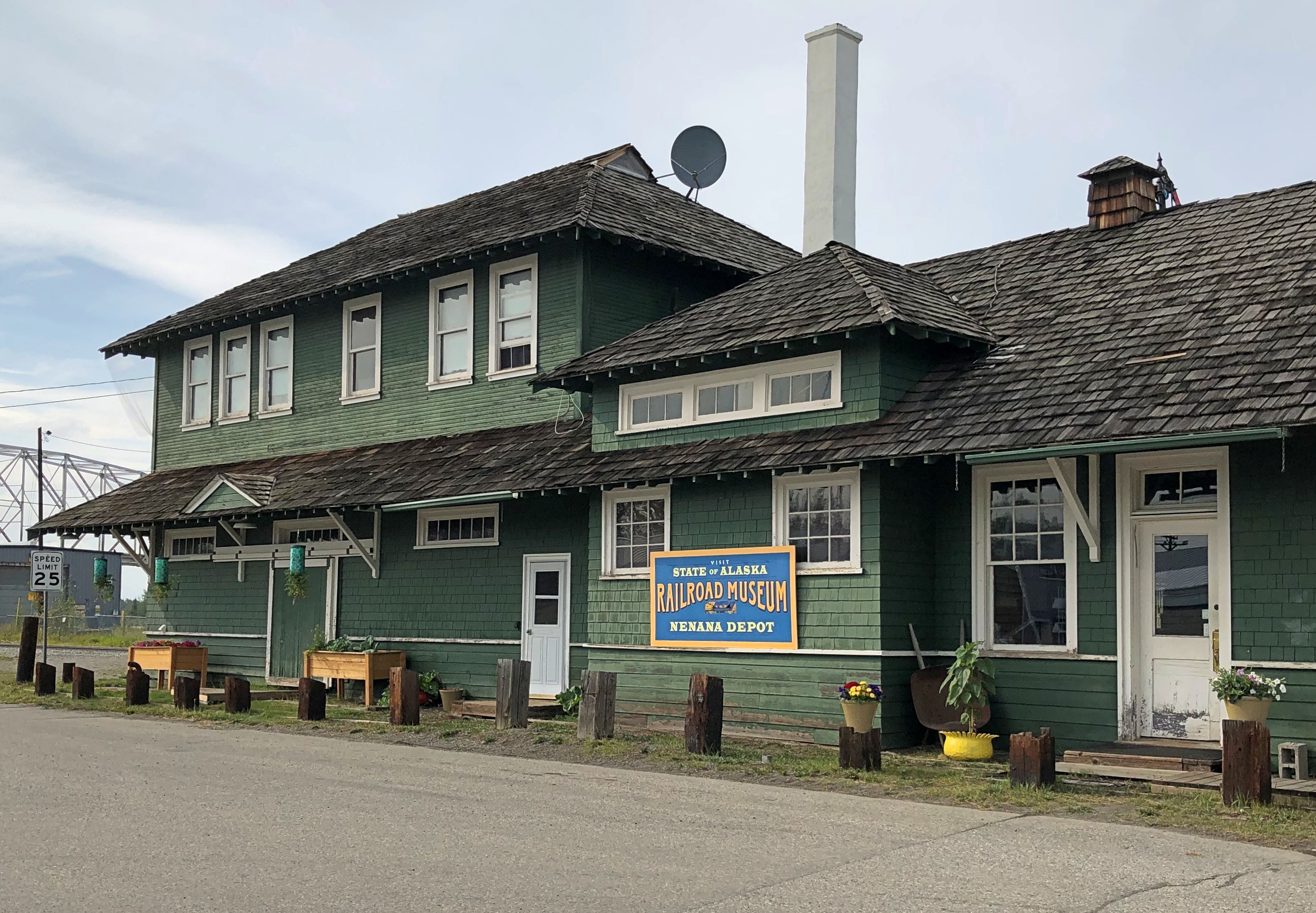
Nenana, Alaska - depot

Next to the depot is a plaque and, I assume, the same golden (colored) spike that Warren G. Harding pounded on July 15, 1923, to mark the completion of the railroad. The last part completed was the Mears Memorial Bridge.Nenana, Alaska - Warren Harding golden spike
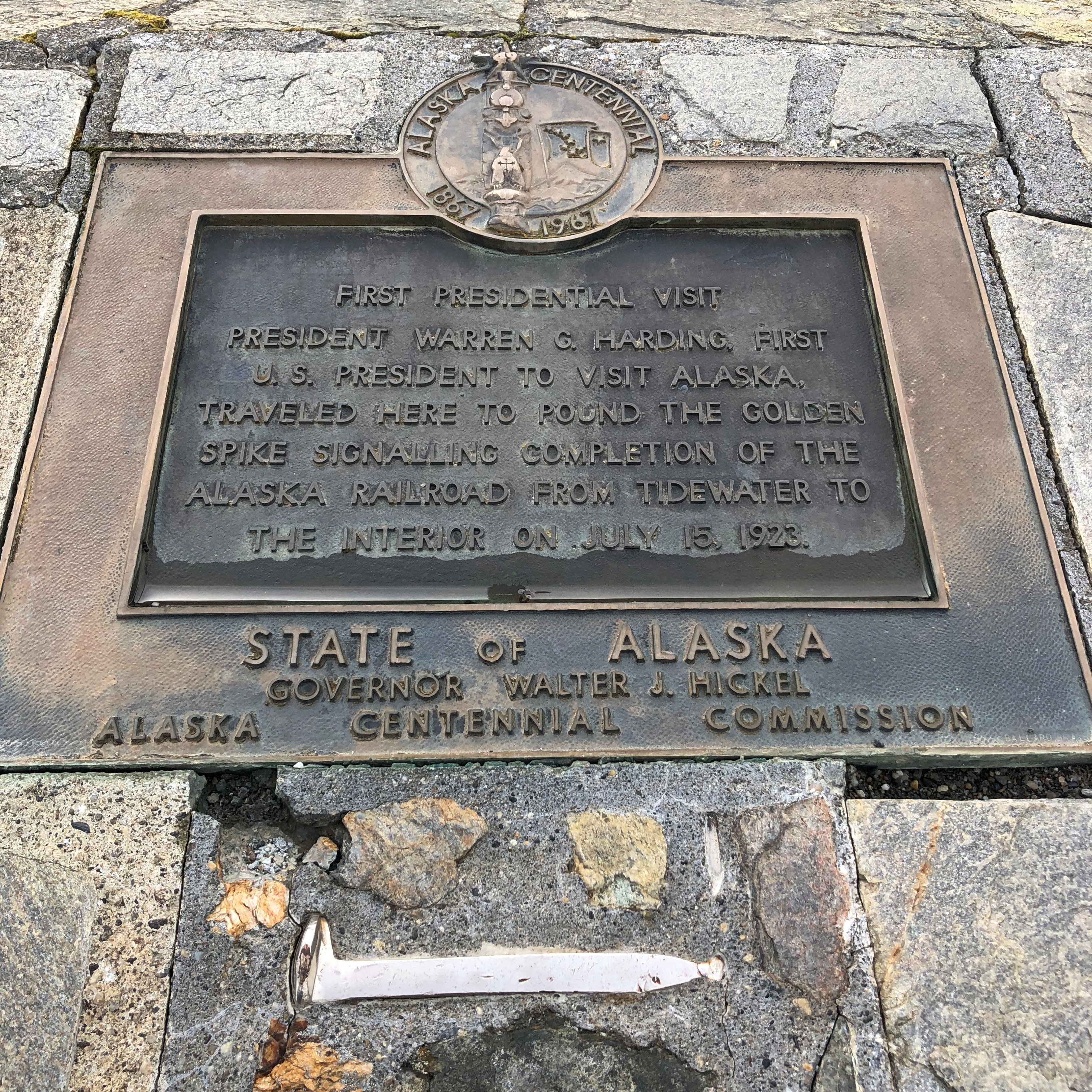
The Anchorage Daily News published an article a few years ago about presidential visits to Alaska. “The most ambitious trip to Alaska, by far, was Harding’s,” the article says. “He departed from Seattle on July 5, 1923, and returned to Vancouver, British Columbia, on July 16, 1923. During his tour he spoke in Metlakatla, Ketchikan, Juneau, Skagway, Valdez, Seward, Anchorage, Nenana and Fairbanks, among other stops.”
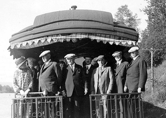
President_Harding_in_Alaska_on_Presidential_Train
At that moment, he was running out of days, though neither he nor the nation knew it. President Harding died in San Francisco on August 2, 1923, not long after his visit to Alaska.
Boscobel & Fennimore

Road trips aren’t just about the destination, but sights and oddities along the way. Recently in southwestern Wisconsin, for instance, we stopped in Boscobel, looking for takeout. We found it at Udder Brothers Creamery. How could we pass up a place with a giant cow? Also, a giant wild turkey?

Note that the turkey not only proclaims Boscobel as Wisconsin’s Turkey Hunting Capital, but as Birthplace of the Gideon Bible as well. We wanted to be on our way, so we didn’t investigate that further at the time.

But now I know: “The birthplace of the Gideons was the Central House Hotel on September 14, 1898, in Boscobel, Wisconsin,” says Wisconsin Historical Markers. “Traveling salesmen John H. Nicholson of Janesville, Wisconsin, and Samuel E. Hill of Beloit, Wisconsin, shared a room in the crowded hotel because of a lumberman’s convention.

“In Room 19, the men discovered that they were both Christians; they talked about starting a Christian traveling men’s association. The following May the two salesmen, joined by a third, William J. Knights, rekindled that idea, and on July 1, 1899, founded the Gideons.”

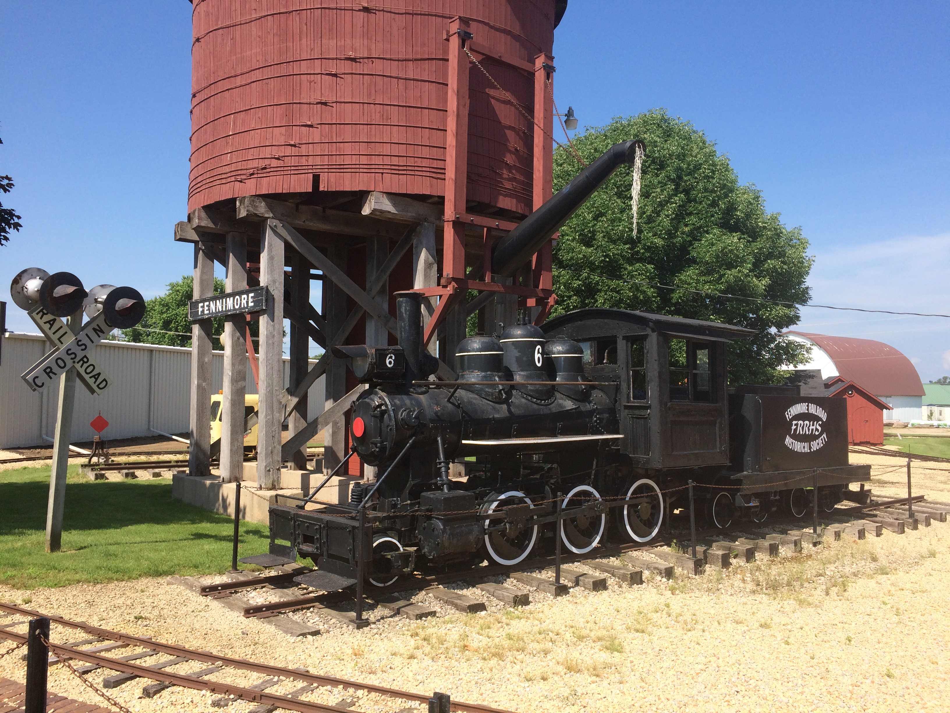
Dang. I should have at least found the plaque. Down the road from Boscobel is Fennimore, another Badger State burg we passed through. Hunger wasn’t the main consideration there, so we spent a little more time, especially at a small park featuring The Dinky.
Fennimore, Wisconsin train
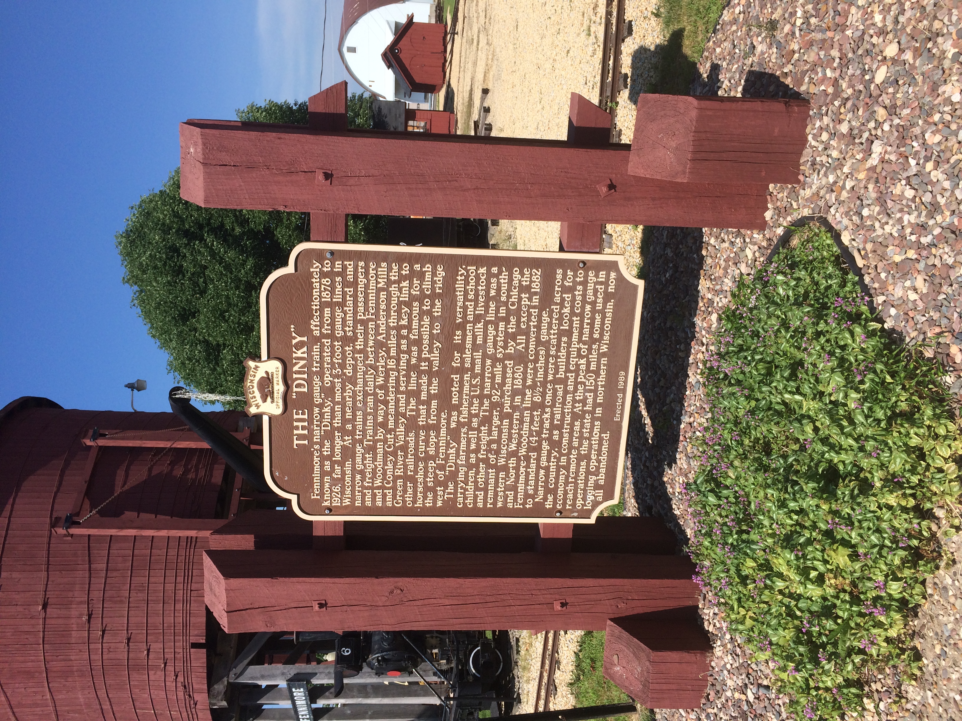
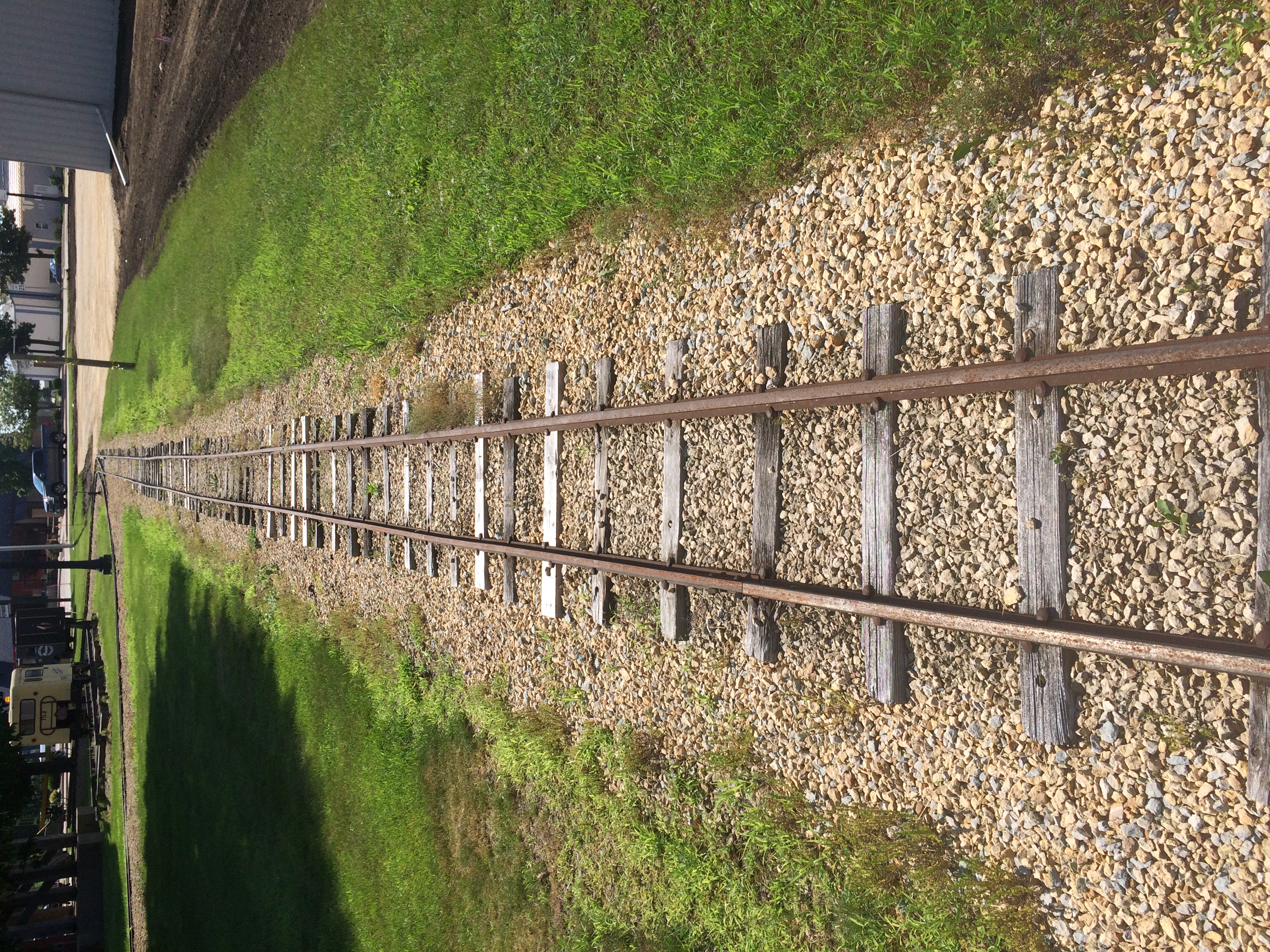
It’s a narrow-gauge (3-ft.) locomotive in operation from 1878 to 1926. “Trains ran daily between Fennimore and Woodman by way of Werley, Anderson Mills and Conley Cut, meandering 16 miles through the Green River Valley,” its historical marker says.
Fennimore, Wisconsin train
“At the peak of narrow gauge operations, the state had 150 miles, some used in logging operations in northern Wisconsin, now all abandoned.”
Fennimore, Wisconsin train
Narrow gauge, for sure.

The Branson Scenic Railway

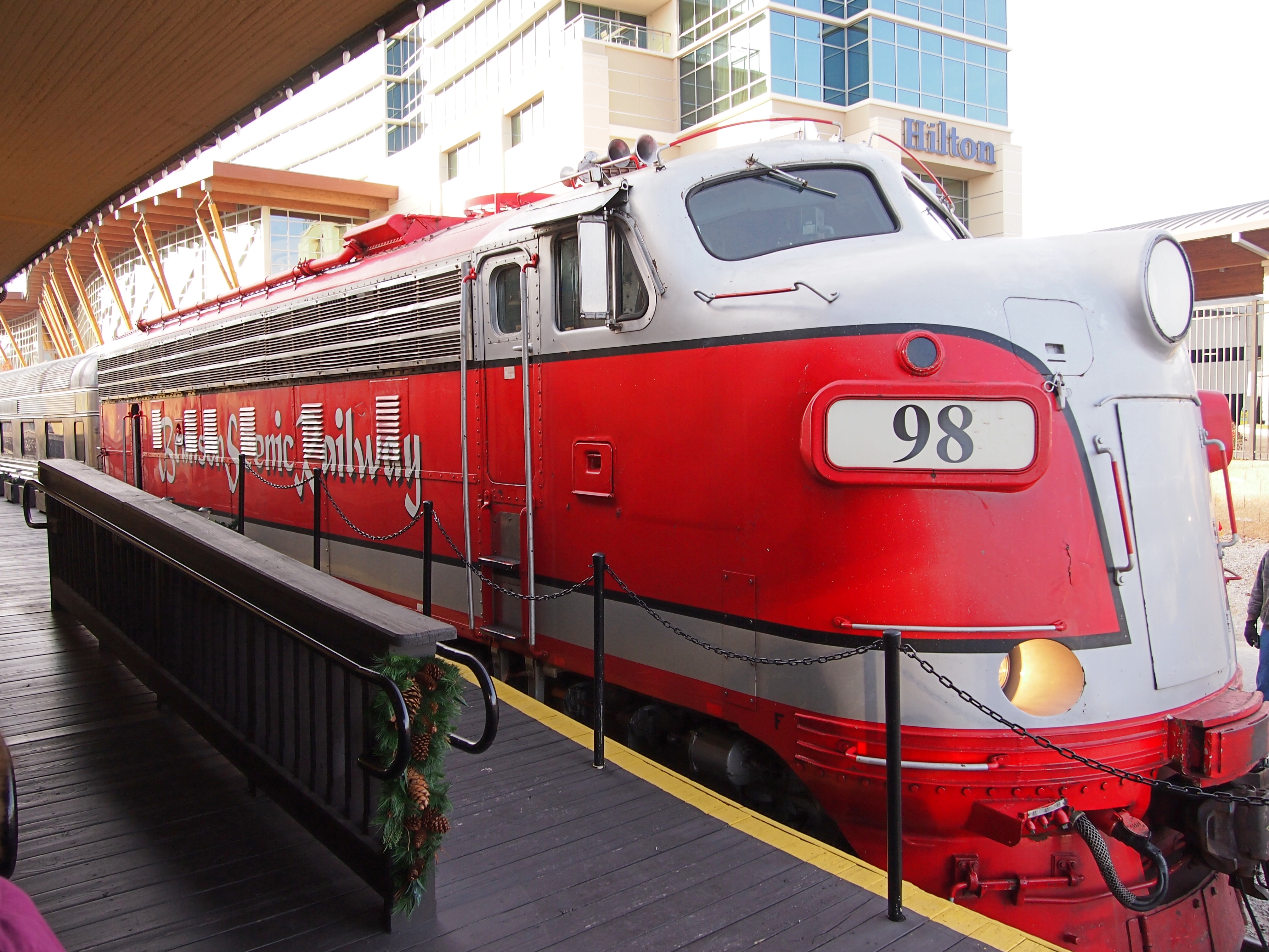
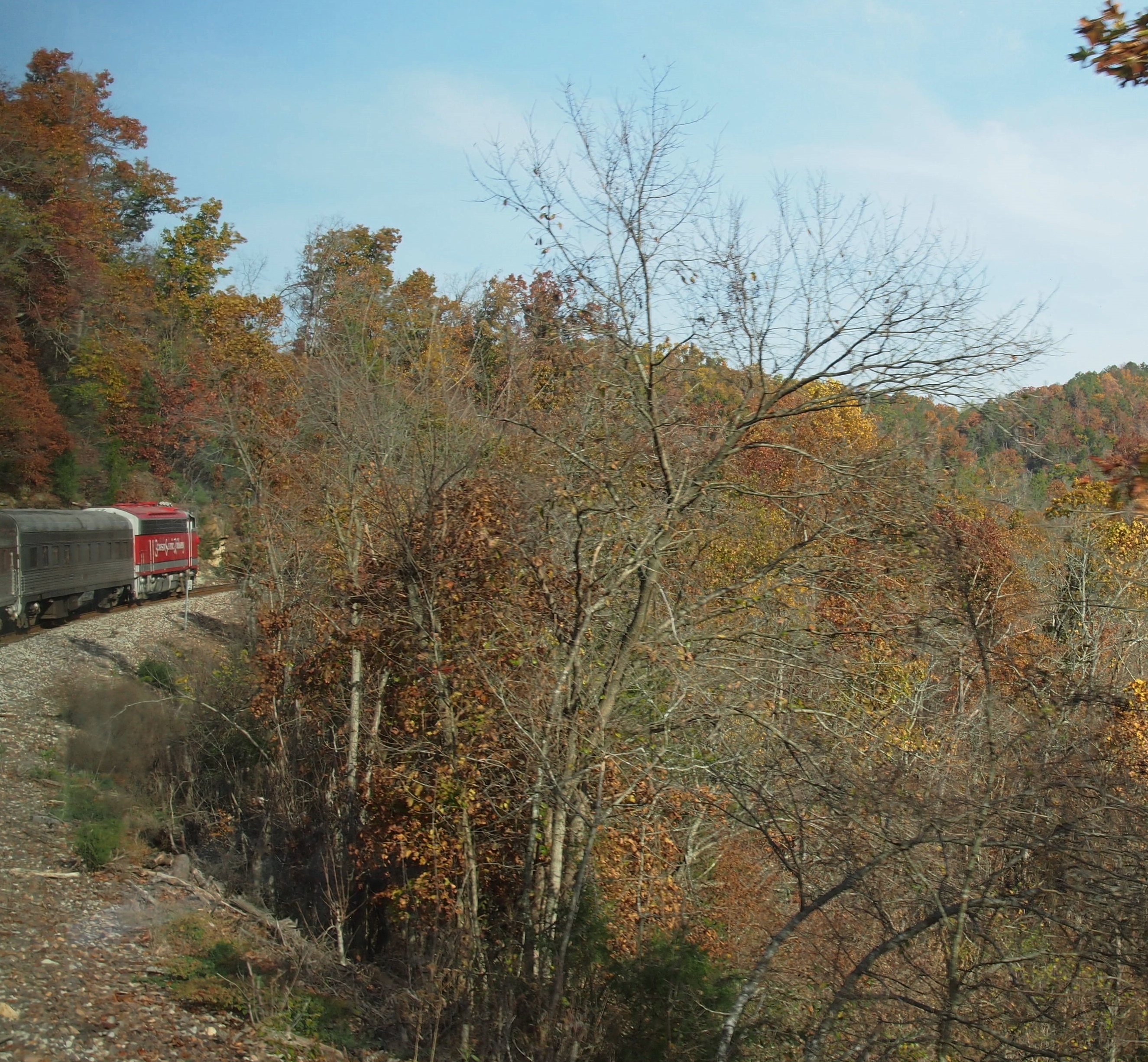
During my visit to Branson in November 2012, I took an excursion on the Branson Scenic Railway. Nothing like hopping aboard a pleasure train pulled by mid-century locomotives.
Branson Scenic RailwaySpecifically, according to the railroad’s web site, “BSRX 98, Locomotive, 1951 EMD F9PH, rebuilt 1981, has HEP (Formerly B&O, then MARC #83).” I looked up HEP, at least: head-end power. Nice to know that the locomotive has hep.

The web site further explains: “Traveling on a working commercial railroad line, the train’s direction of travel… is determined by the Missouri and Northern Arkansas Railroad just prior to departure. At that time, the train will go either north or south. The northern route goes as far as Galena, Missouri, to the James River Valley; and the southern route extends into Arkansas to the Barren Fork Trestle.”

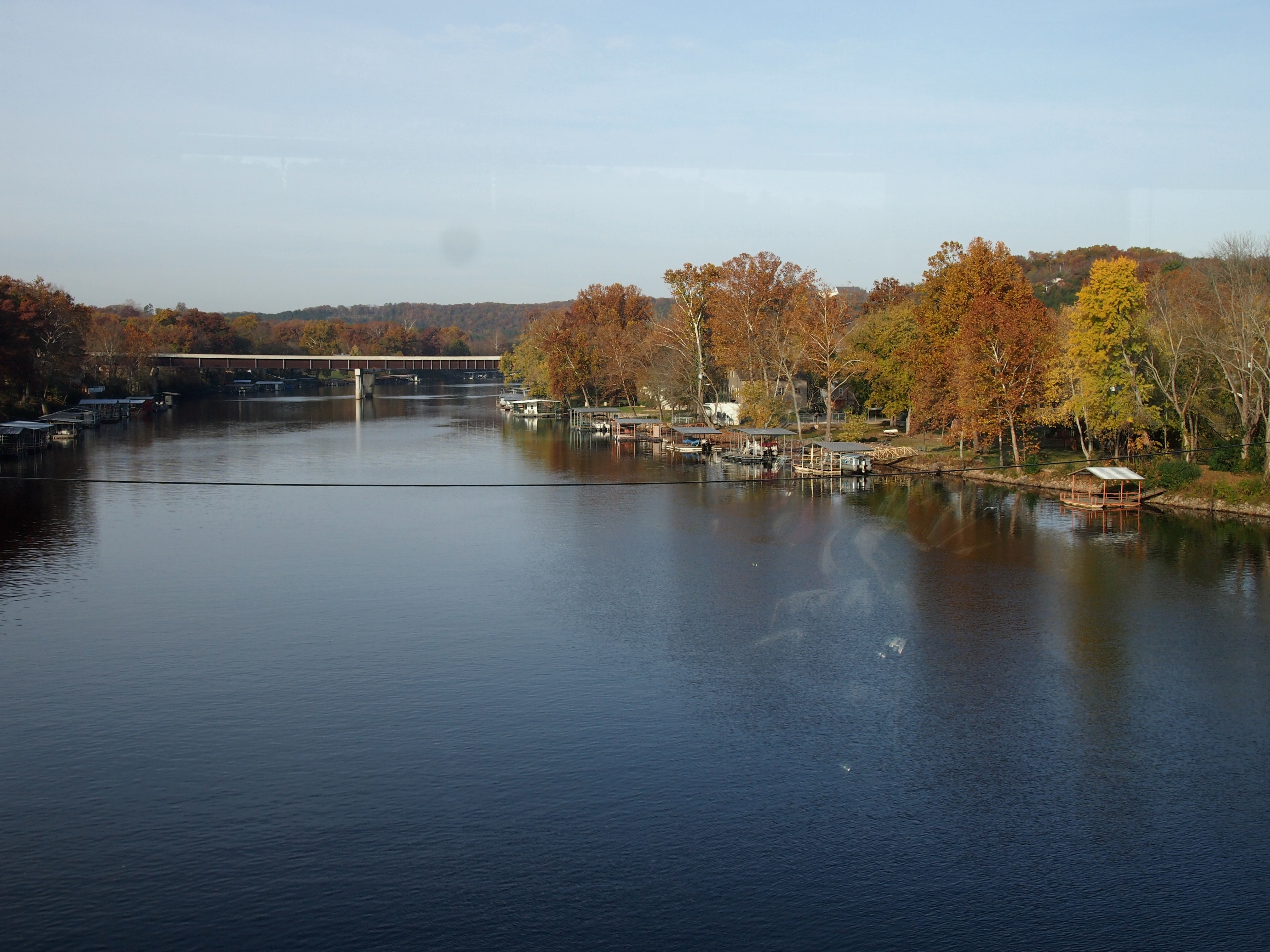
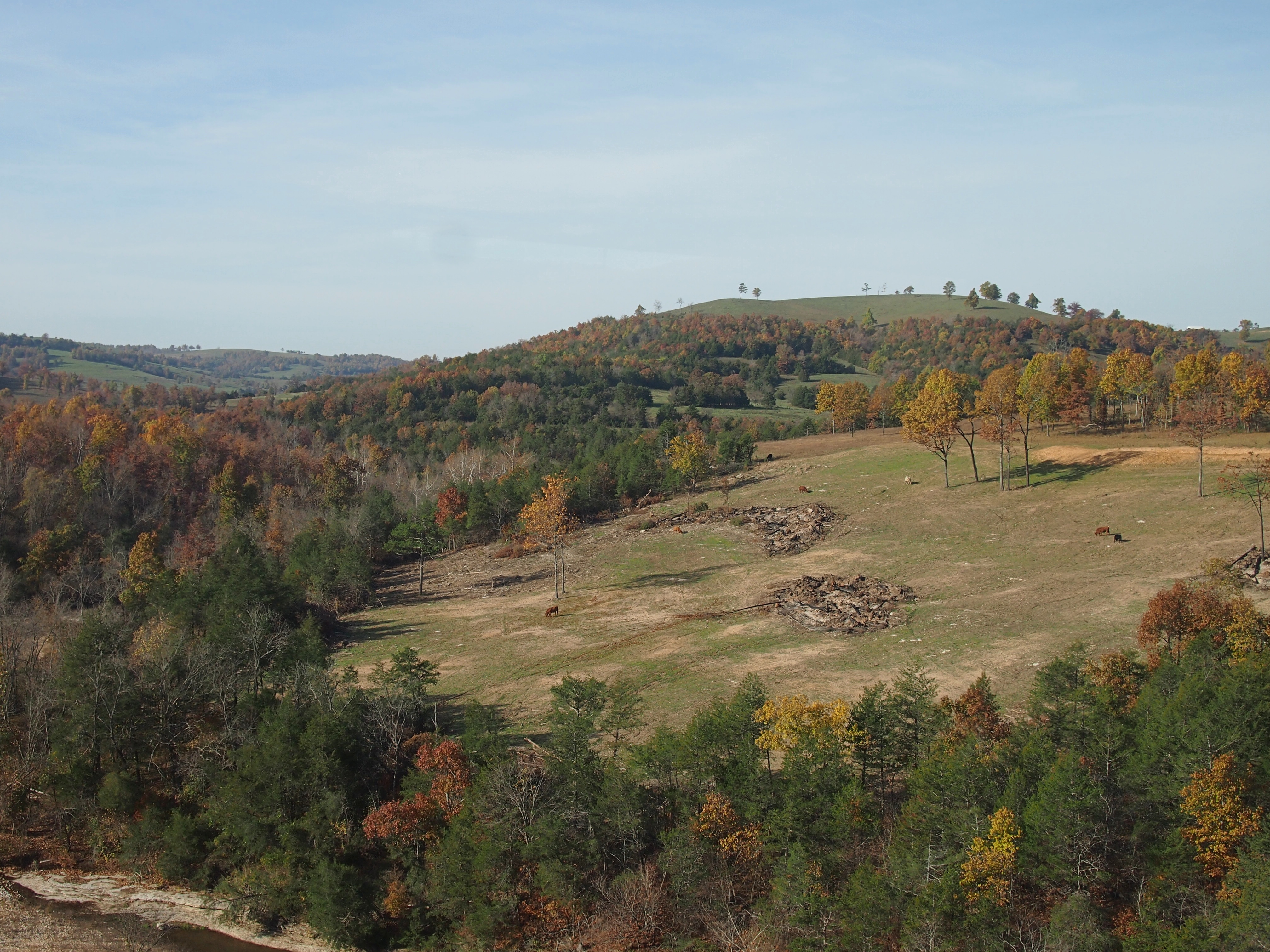
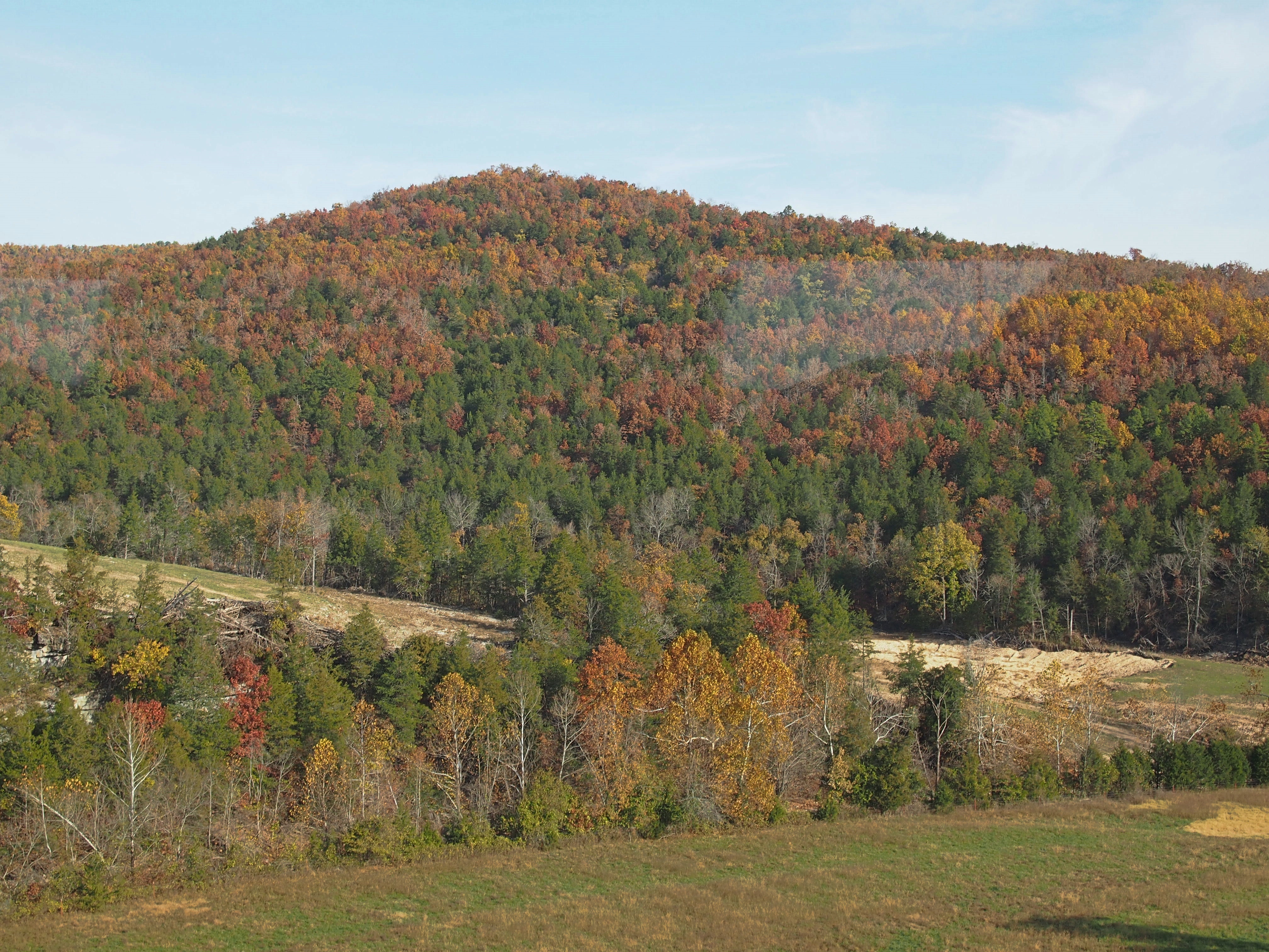
We went south into Arkansas, which isn’t actually that far from Branson, across water and through hills and woods and tunnels, just as the leaves were turning nicely.Near Branson Mo

Near Branson MoNear Branson MoNear Branson Mo“The construction of the White River Railway in the early 1900s made the area accessible for tourists and is largely responsible for the development of Branson and the Ozarks as a tourism destination… The route crosses the White River in Branson, now Lake Taneycomo, and then runs along side of it after taking a fifty-mile short cut over the Ozark Mountains.

“This was part of the Missouri Pacific Railroad between Kansas City, Missouri, and Little Rock, Arkansas. It became a part of the Union Pacific after the UP bought the MOPAC. The Missouri and Northern Arkansas Railroad now operates the line.

“In 1993, the Branson Scenic Railway was formed, and through a lease arrangement with the MNA, runs excursions through this historic route March through December.”

A train through the Alps it isn’t, but it’s scenic all the same.

Thursday Sundries

I’m glad to report that Jimmy Carter has become the oldest person ever to be President of the United States, at 94 years, 172 days, topping George H.W. Bush. For many years, life expectancy was such that no one bested John Adams, who died at 90 in 1826. Finally Ronald Reagan lived longer than Adams in 2001. Since then, so have the elder Bush, Ford and Carter.

I’m not glad to report that we’ve been getting a raft of calls from an “800 Service” lately, asking me to contact “Apple Support Advisor” for unspecified but ominous reasons. Ah, spring is coming, and that must be the season for phishing.

Turns out it isn’t even a new scam, but this one didn’t say anything about iCloud.

Email subject line recently from a news outlet that has my address: “Meet R. Kelly’s lawyer.”

I don’t think so. Some years ago, I introduced my daughters to the concept of the List of Things I Don’t Care About. A lot celebrities are on the list. More are added all the time, mostly without me being conscious of it. R. Kelly’s been there a long time, but since his recent legal problems, he’s on the list with a bullet.

Here’s something I’d never heard of until the Internet offered it to me completely by chance, despite the fact that it happened in Texas, near a place that I drive by often when I visit that state: the Crash at Crush.

“On September 15, 1896, more than 40,000 people flocked to this spot to witness one of the most spectacular publicity stunts of the nineteenth century — a planned train wreck,” the Texas State Historical Association tells us.

“The man behind this unusual event was William George Crush, passenger agent for the Missouri, Kansas and Texas Railroad… As the arena for his spectacle, Crush selected a shallow valley just north of Waco, conveniently located close to Katy’s Waco-Dallas track.

“In early September 500 workmen laid four miles of track for the collision run and constructed a grandstand for ‘honored guests,’ three speaker’s stands, two telegraph offices, a stand for reporters, and a bandstand. A restaurant was set up in a borrowed Ringling Brothers circus tent, and a huge carnival midway with dozens of medicine shows, game booths, and lemonade and soft-drink stands was built.

“At 5:00 P.M. engines No. 999 and 1001 squared off at opposite ends of the four-mile track. Crush appeared riding a white horse and trotted to the center of the track. He raised his white hat and after a pause whipped it sharply down. A great cheer went up from the crowd as they pressed forward for a better view.

“The locomotives jumped forward, and with whistles shrieking roared toward each other. Then, in a thunderous, grinding crash, the trains collided. The two locomotives rose up at their meeting and erupted in steam and smoke.

“Almost simultaneously, both boilers exploded, filling the air with pieces of flying metal. Spectators turned and ran in blind panic. Two young men and a woman were killed. At least six other people were injured seriously by the flying debris.”

Say what you want about the 19th century, they knew how to stage a spectacle. A dangerous spectacle, but it must have been quite a sight.

The article doesn’t say, but I assume the conductors had some way of keeping the throttles open after they themselves left the engines before they gathered too much speed.

Another thing I didn’t know (there are so many): Scott Joplin named one of his pieces, “Great Crush Collision March,” after the event. Guess it counts as one of the lesser-known railroad wreck songs, unlike the more famous “The Wreck of the Old 97.”

St. Paul Square, Sunset Station & the SP 794

Four years ago, I wrote: “One fine thing about South Texas in February is that it isn’t northern Illinois in February.” Then I called northern Illinois “septentrional,” to use a 10-dollar word that ought to be used at least occasionally.

Anyway, it can be cold in San Antonio in February, but just as often it’s pleasantly cool — good temps for a walk.

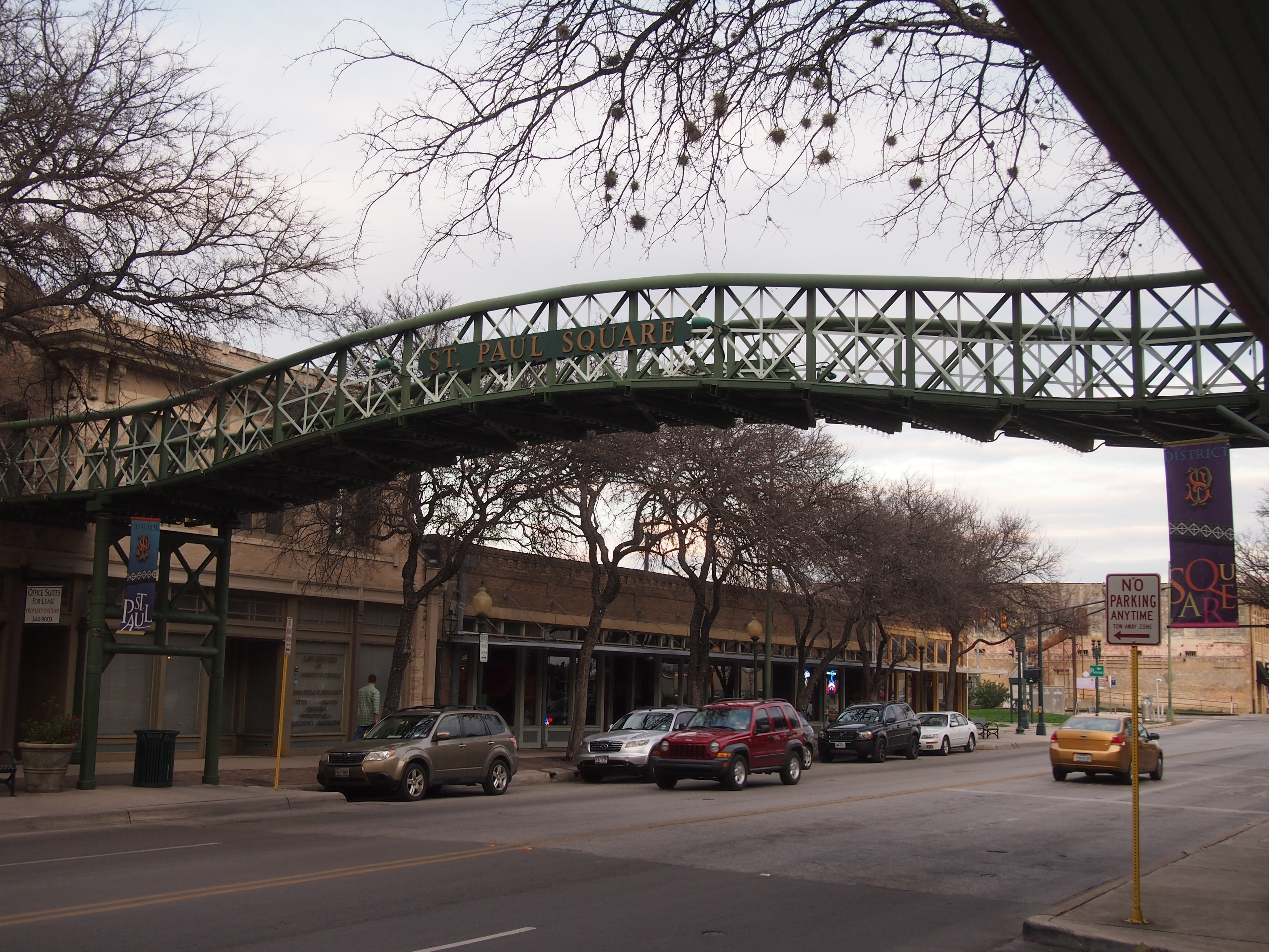
Four years ago I visited San Antonio’s Eastside Cemeteries Historic District. I also took a look at the nearby St. Paul Square, an area that flourished in pre-Interstate years because of its proximity to San Antonio’s main passenger train station.
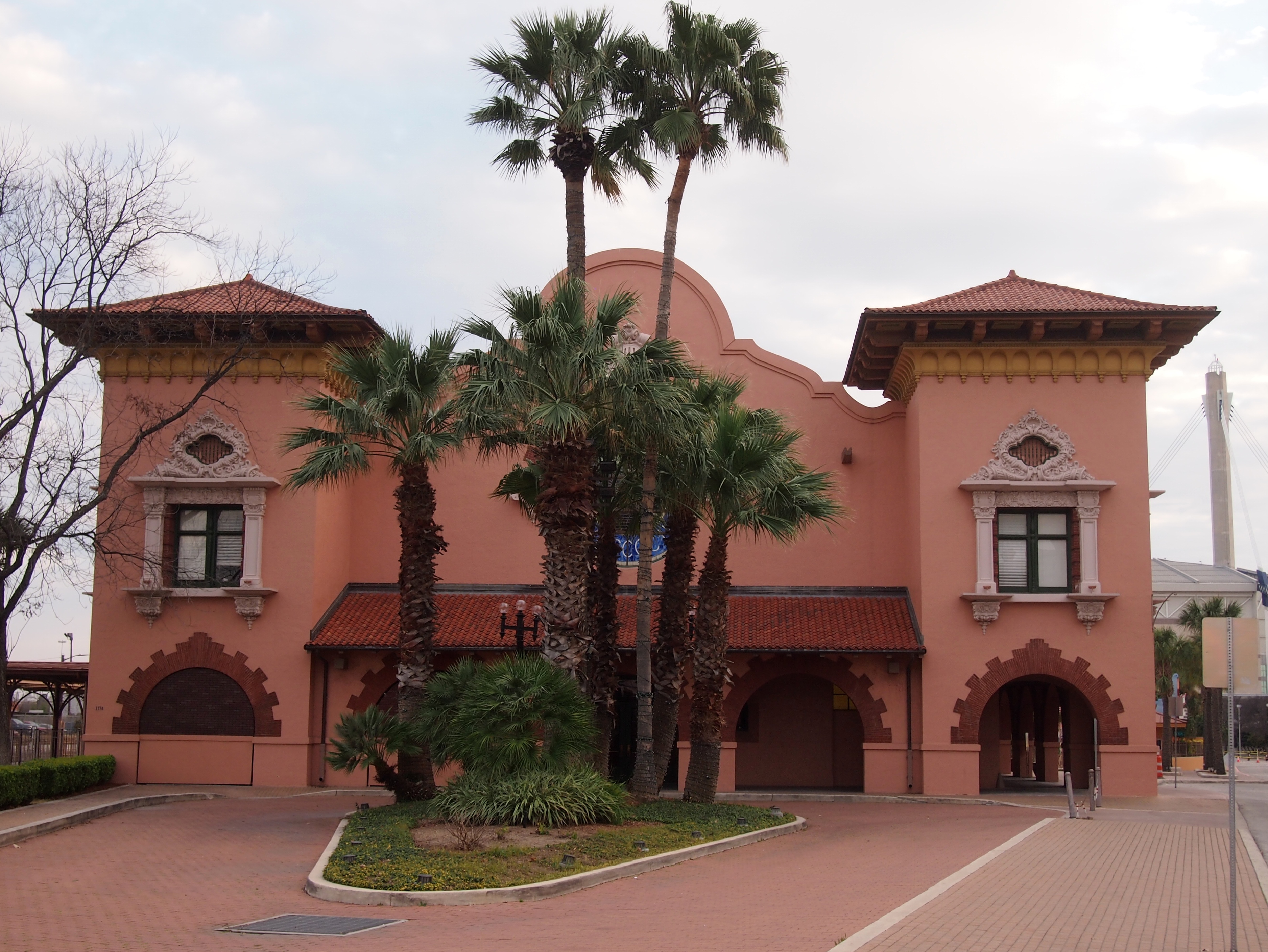
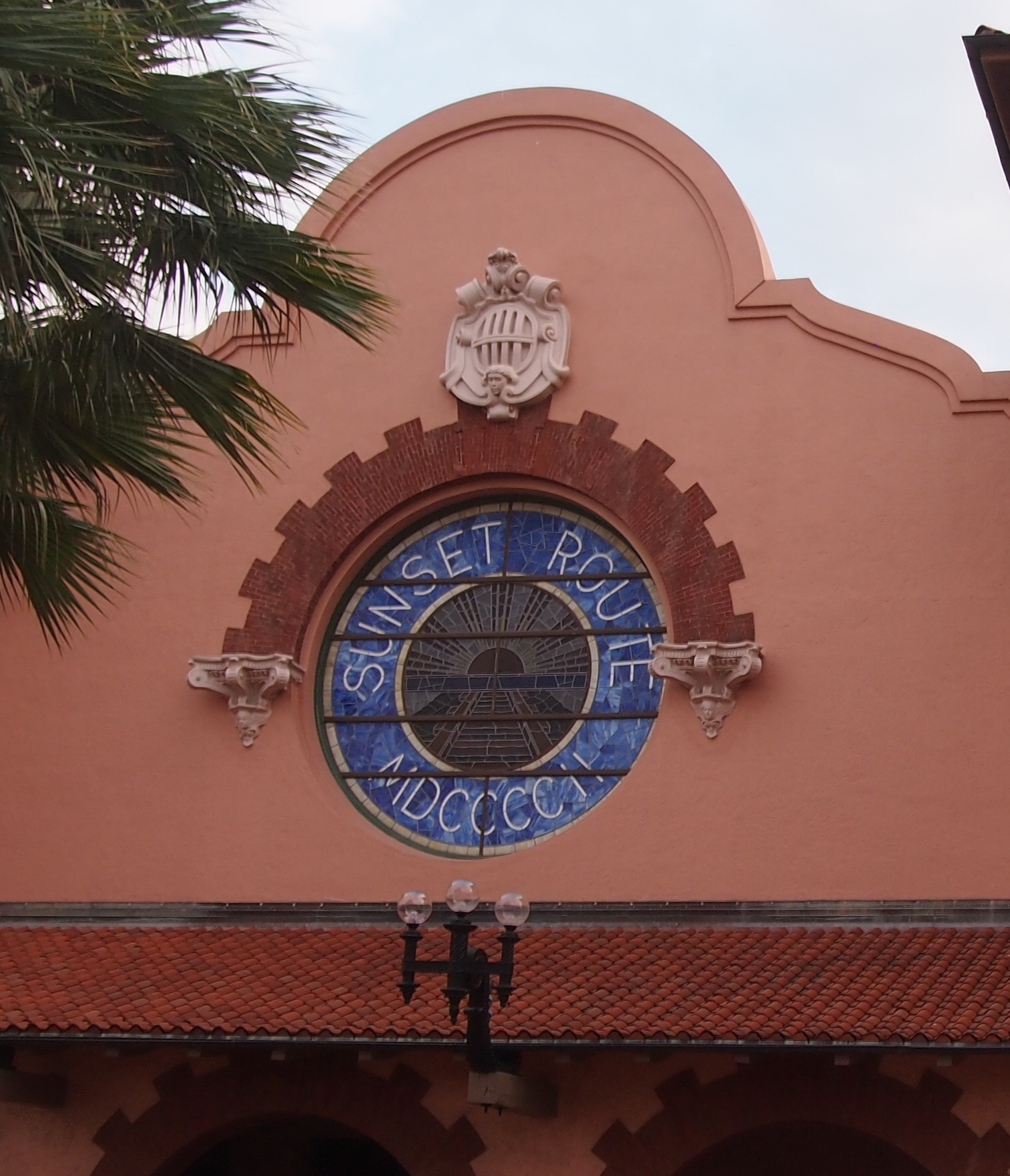
The area has enjoyed some recent revival as a retail and entertainment center. The aforementioned train station is Sunset Station, vintage 1902 and redeveloped in the 1990s as an entertainment complex.

The last time I’d been at the station was when it was still a station, 25 years earlier. I caught an Amtrak train — the only train still using the station in 1990 — that took me to Los Angeles, where I changed trains for San Francisco.

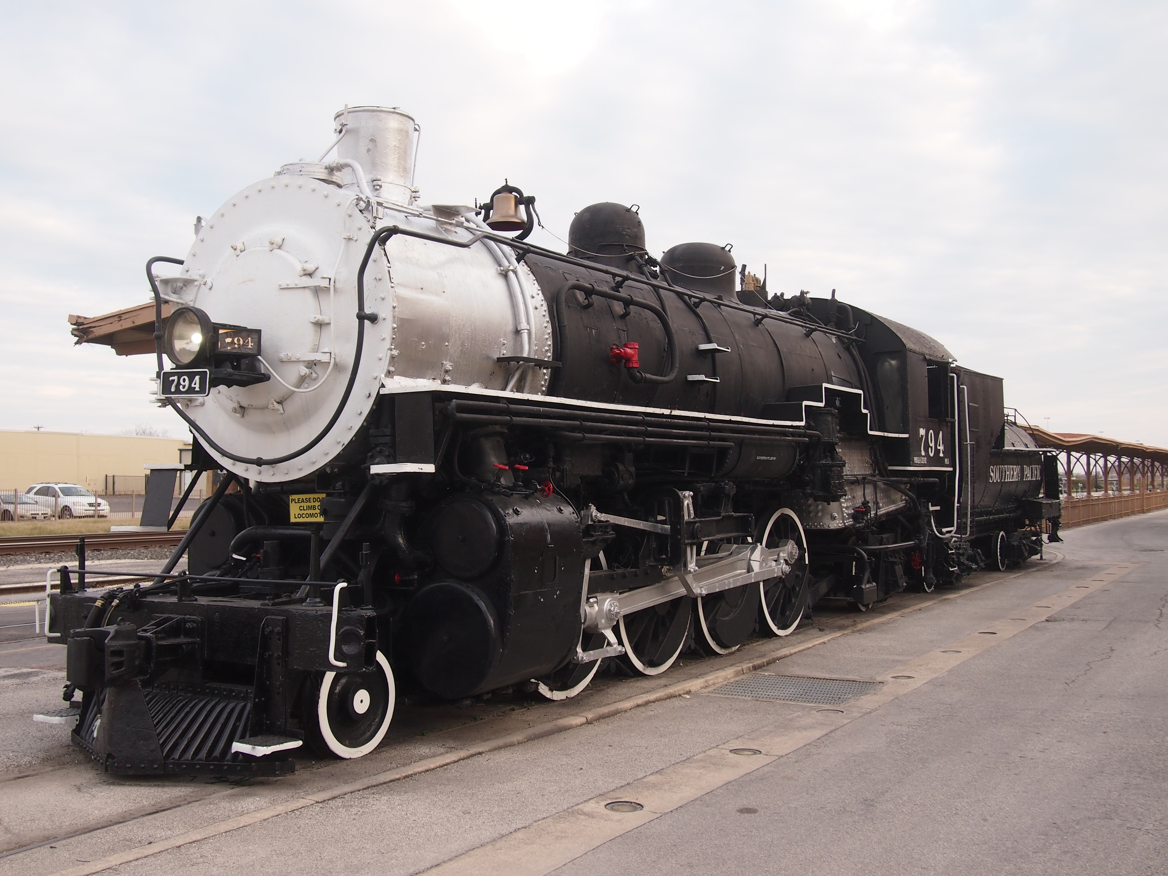
Next to the renovated station: Southern Pacific 794.

“She was built in 1916 by the Brooks Locomotive Works in Dunkirk, NY, for the Texas and New Orleans (T&NO) Railroad, which was a subsidiary of the Southern Pacific Railroad,” says the San Antonio Railroad Heritage Museum. “She was transported to Texas as parts and was assembled in Texas, and then was operated for forty years while being based in San Antonio. 794 was used for freight service as well as passenger service.”

With steam obsolete by the 1950s, the SP donated a fair number of locomotives to various entities, including the San Antonio Chamber of Commerce in the case of the 794. From 1957 to 1999 the locomotive stood in Maverick Park just north of downtown on Broadway. Then it was moved to Sunset Station.

Since Broadway was the way we usually went downtown, by car or bus, I saw it often. Then I noticed, probably during an early 2000s visit, that the 794 was gone. Maverick Park still looks strangely empty without it, 20 years later.

Denver Union Station and Larimer Square

Hot dry days here in northern Illinois around the equinox. Seems like September making up for the cool August, and the wet spring, but in any case it can’t last. It’s like walking on a shallow ledge far away from shore. Without warning the water’s going to get deep, just as you got used to ambling along only getting your feet wet. The cold will come just like that.

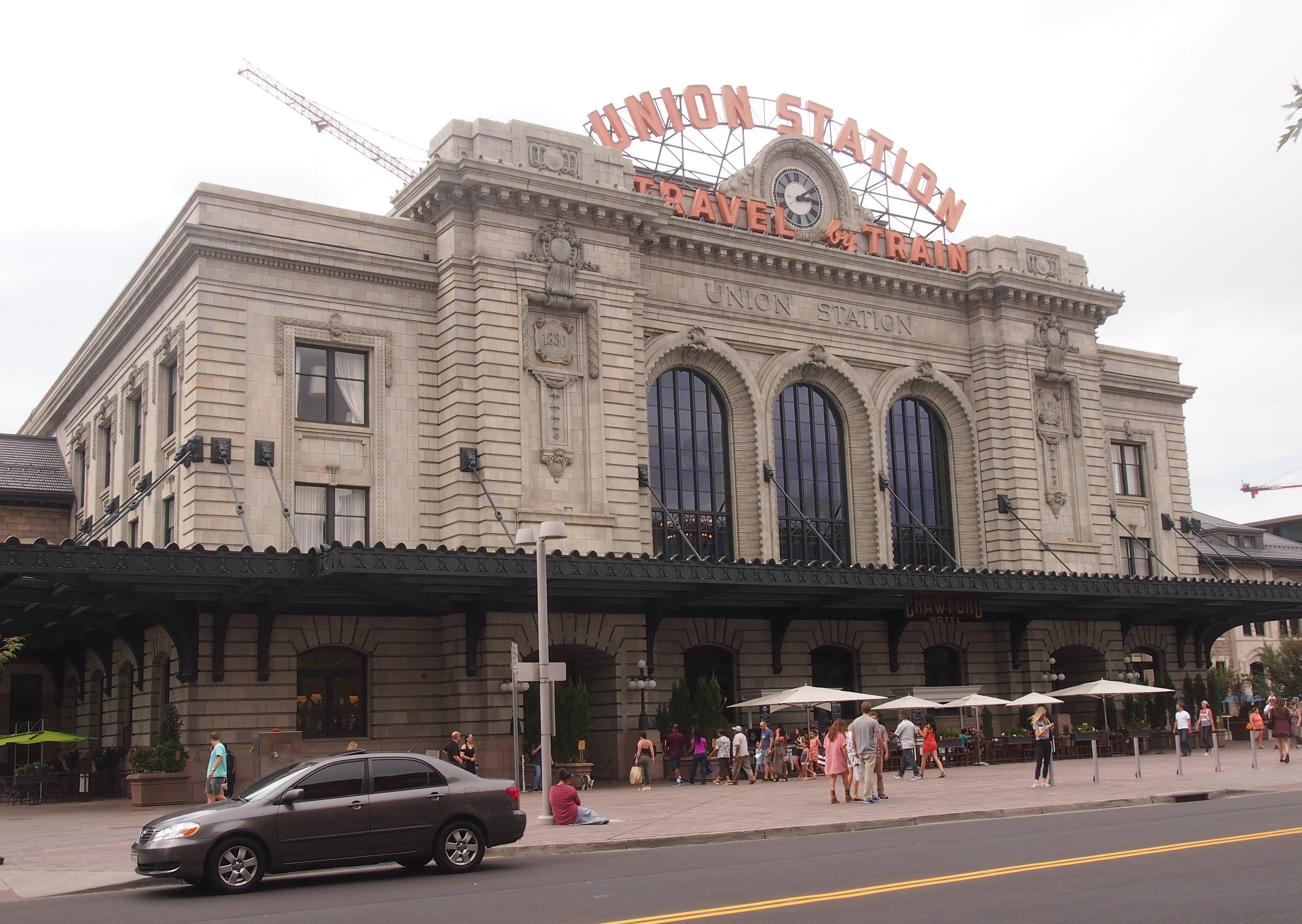
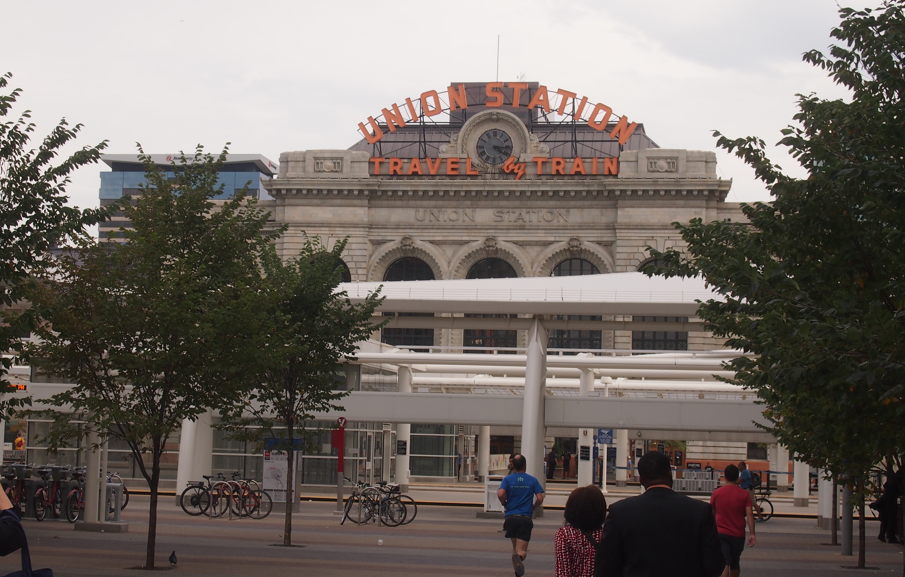
This is what Denver Union Station looks like, from across Wynkoop St. toward the grand entrance, in the early years of the 21st century. That is, earlier this month.
Denver Union StationIt’s easy to get sentimental about trains (this song does so too, but remarkably also addresses the evil done with trains at times). It’s especially easy to get sentimental in the presence of a refurbished structure from the golden age of American railroading.

In the late 19th century, a number of railroads serving Denver collaborated to erect Union Station. A fire and some rebuilding put it in its 20th century form by 1914. The years passed and countless thousands of people passed through the station at the edge of the Rockies.

By the latter years of the century, the place was run down, as passenger train service became a shadow of its former self. In our time — the 2010s — the ad hoc Union Station Alliance revived the place. Kudos to all those Denver companies in the Alliance: Urban Neighborhoods Inc., Sage Hospitality, Larimer Associates, REGen, and McWhinney.

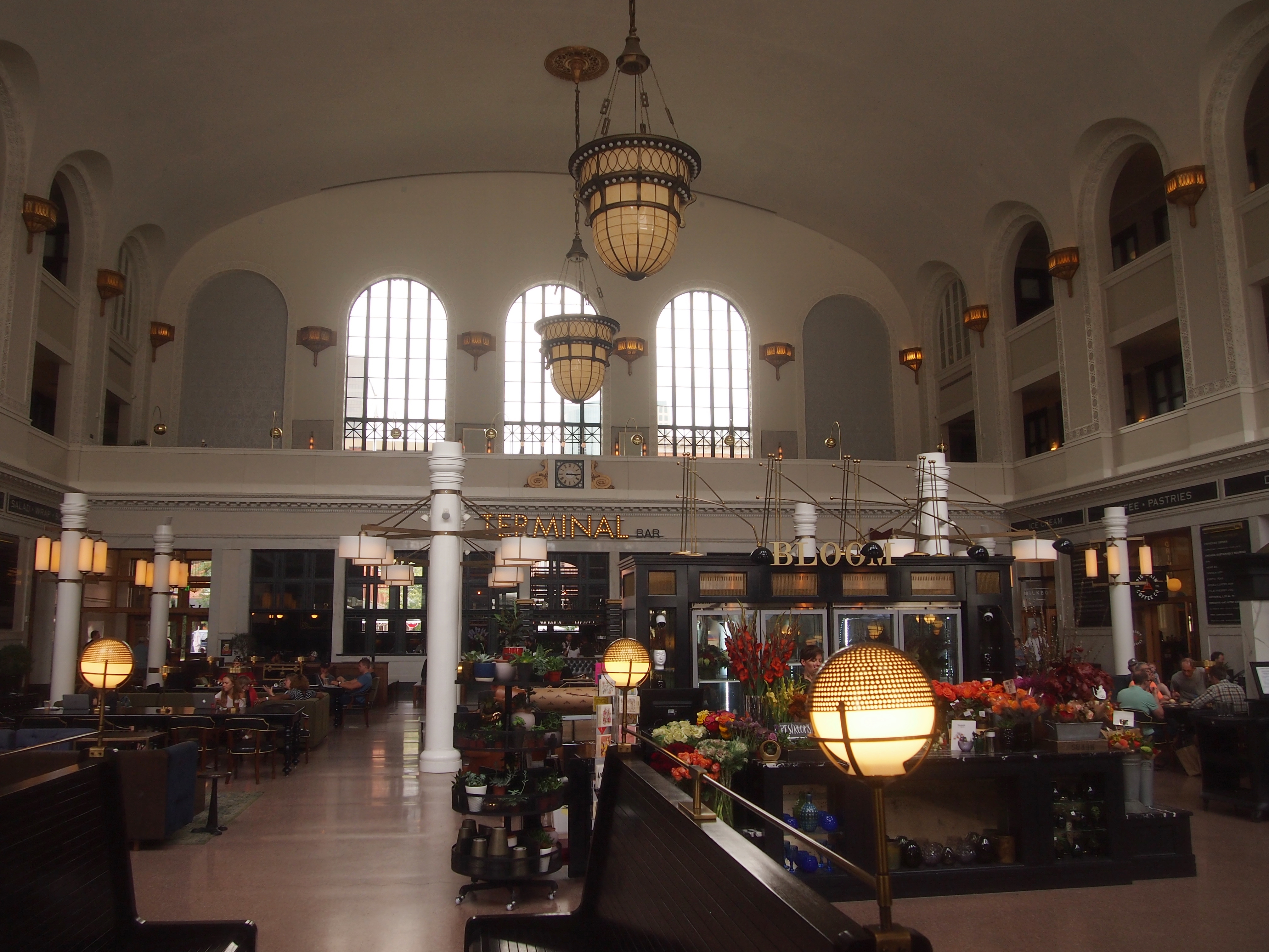
As befitting more recent times, the station is now more than a transit nexus, though it’s still that, with Amtrak serving the station, as well as light rail, commuter rail and buses. Modern Union Station also includes the 112-room Crawford Hotel and 22,000 square feet of ground-floor shops and restaurants.

The 12,000-square-foot Great Hall serves as the hotel lobby, public space, and train waiting room. And as a place for me to rest during my walkabout in downtown Denver.
Denver Union StationBut I didn’t rest too long. I wanted to see the other side.

Denver Union Station

The shed in front (or behind) the main structure is where three RTD light rail lines converge. Directly underground is the bus station. A good idea: less aesthetic buses are underground, better-looking (and cooler) light rail runs at ground level, easy to see. Note also that there are places to lock up bicycles. Multimodal for sure.

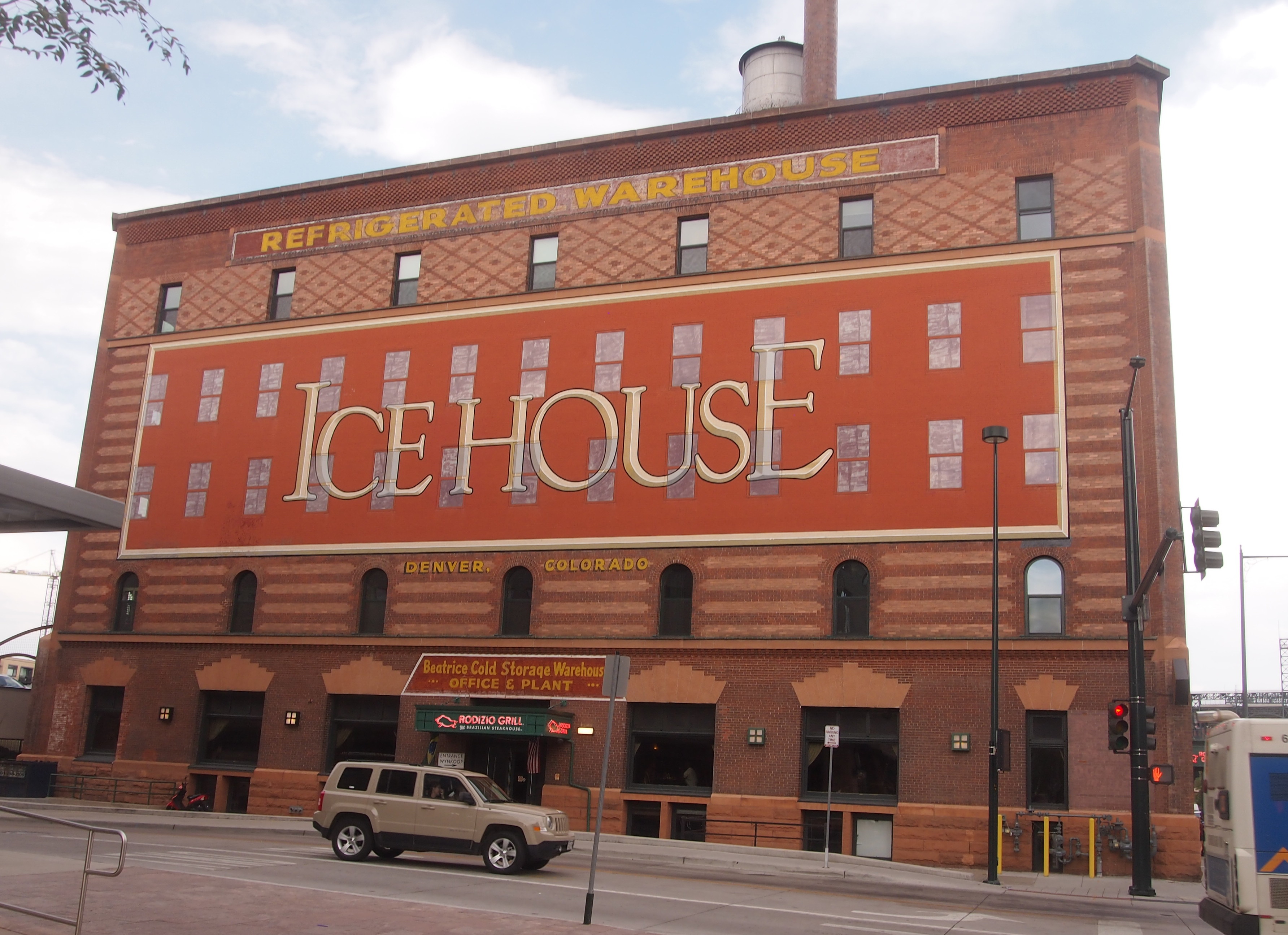
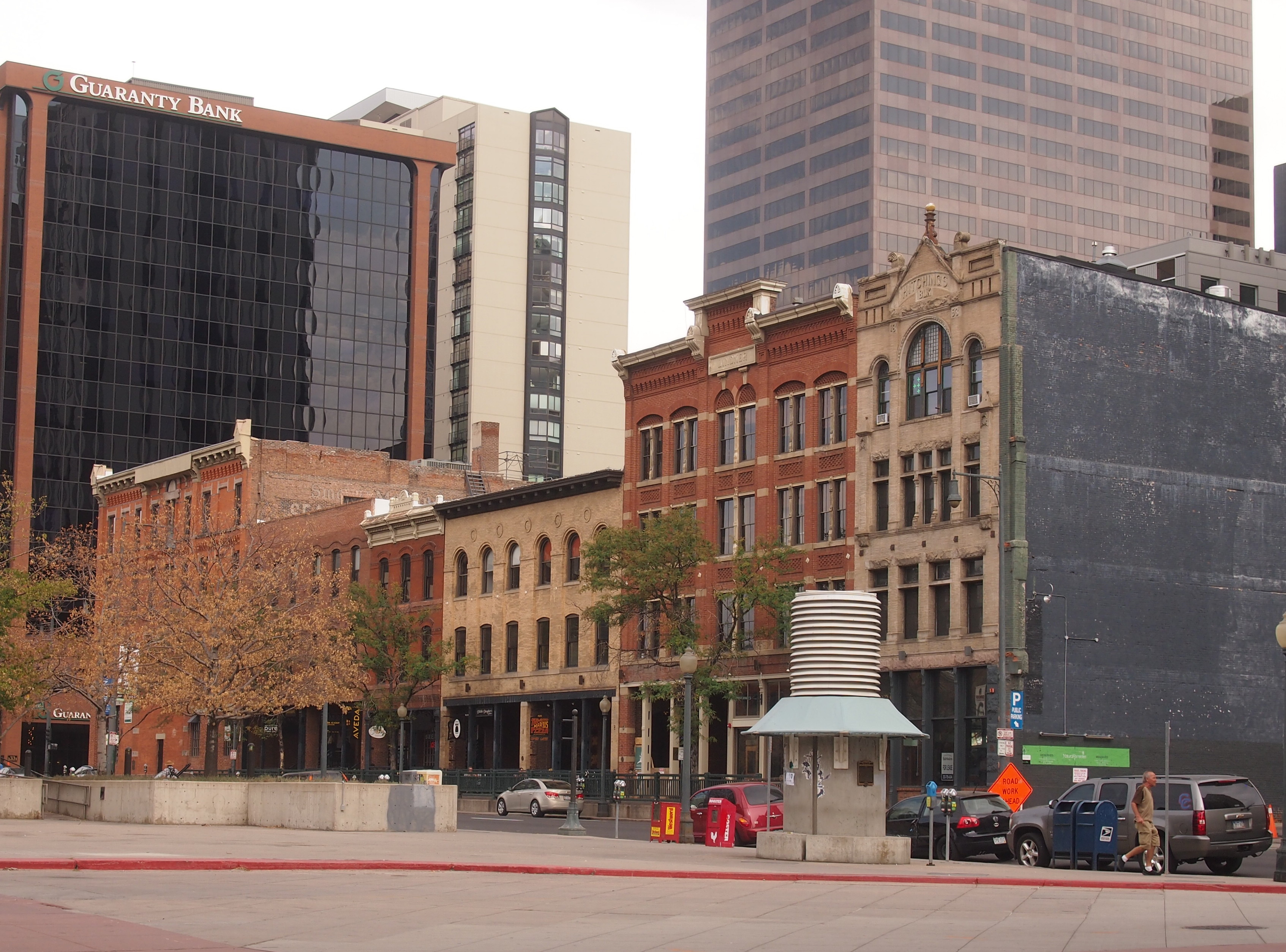
From Union Station I wandered through parts of Lower Downtown — known to the real estate industry as LoDo — passing other redevelopment projects.

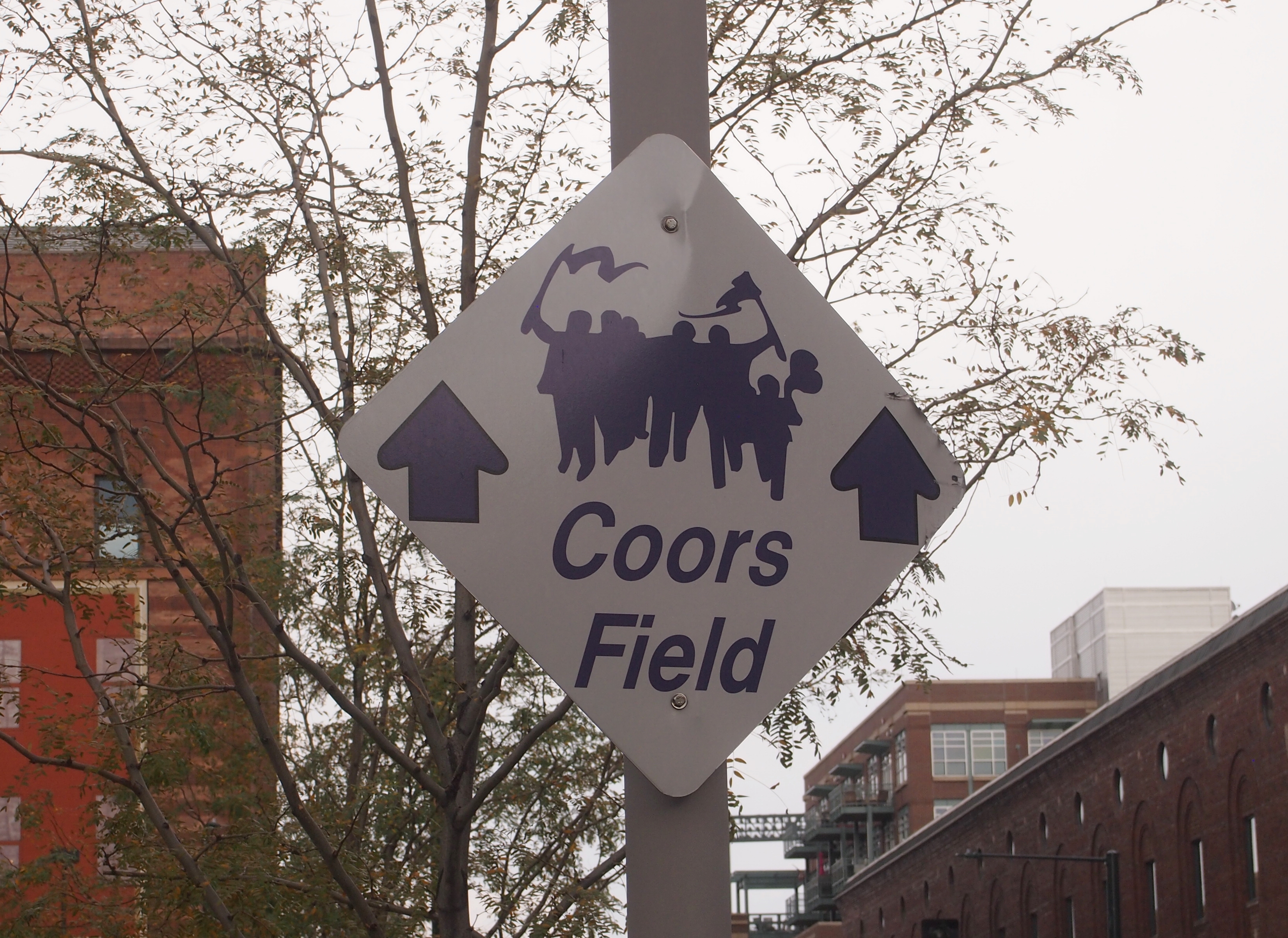
LoDo Denver 2017 Ice HouseDenver 2017But I didn’t go as far as Coors Field.
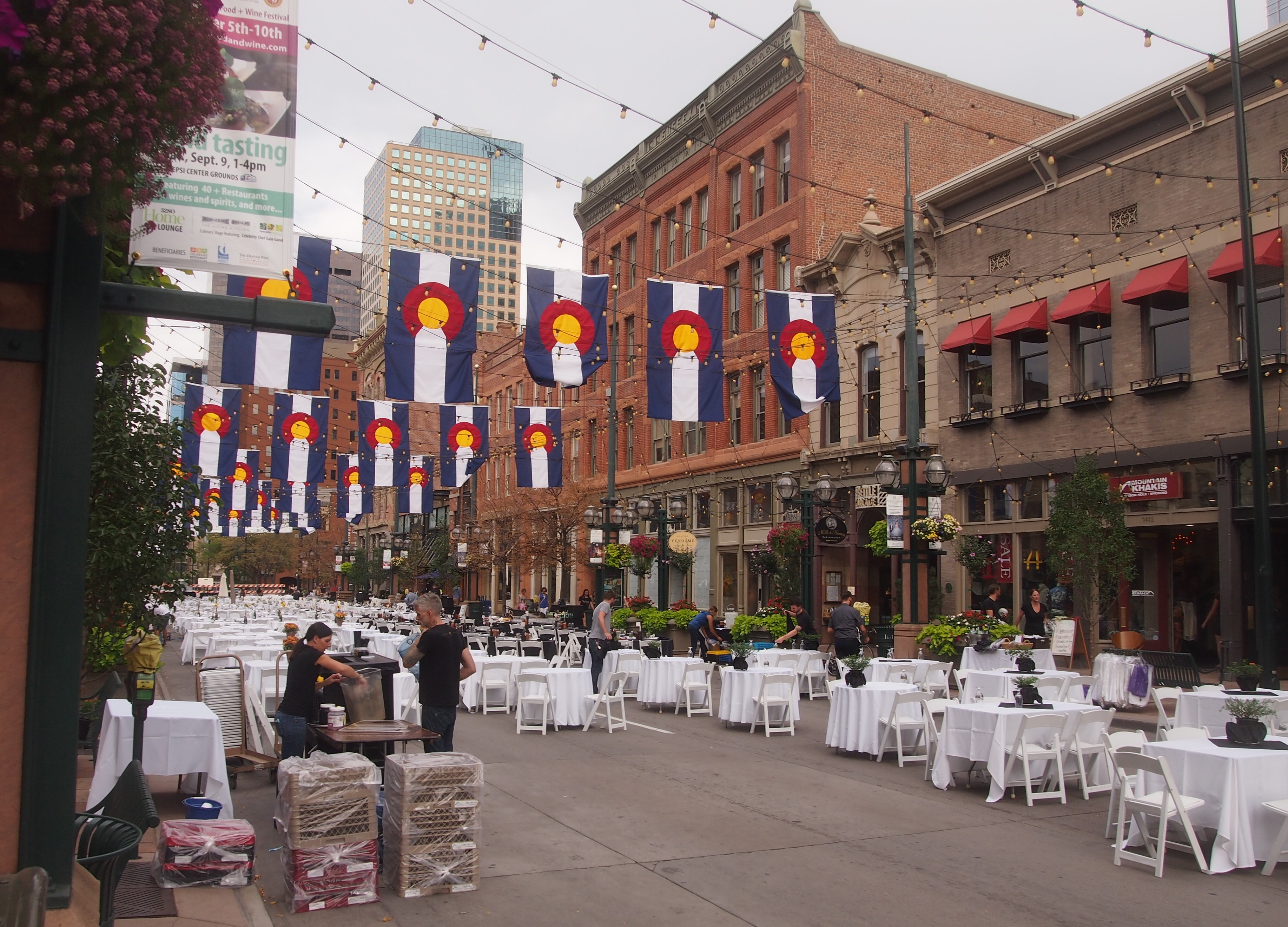
LoDo Denver 2017Before long I came to Larimer Square. The heart of the square, the 1400 block of Larimer St., was temporarily blocked off; a gastronomic event was slated for later in the evening, under lights and Colorado flags.

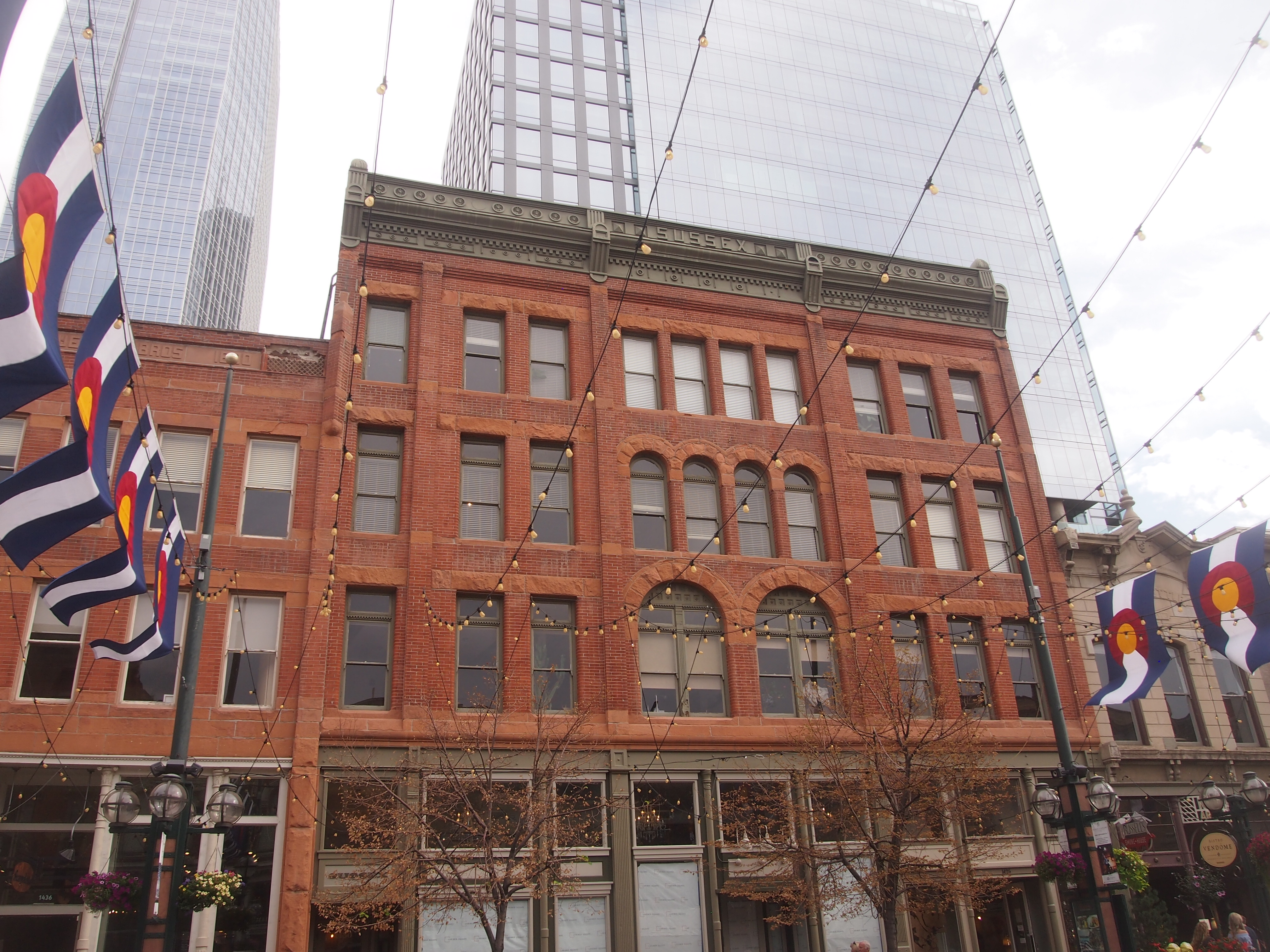
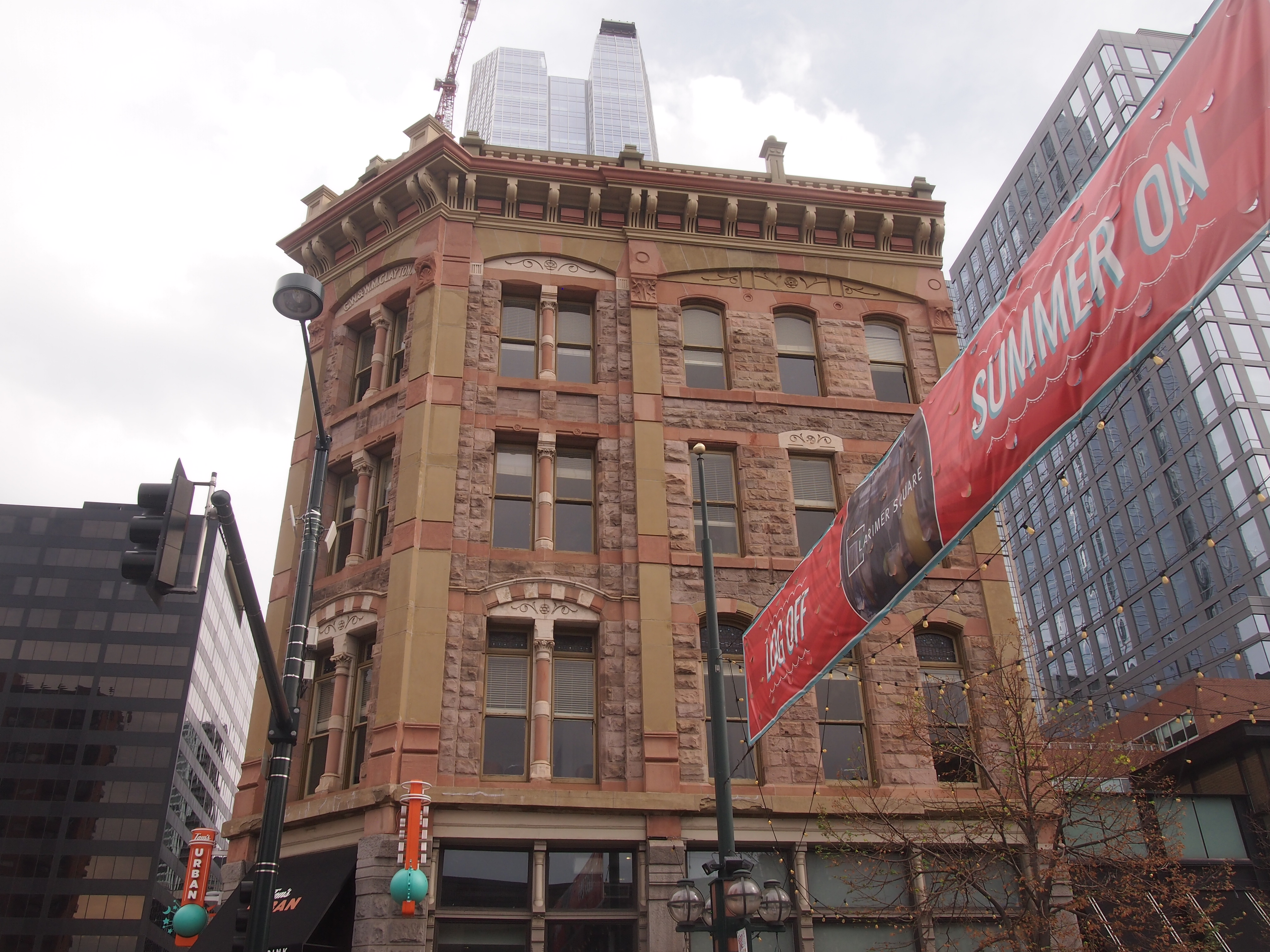
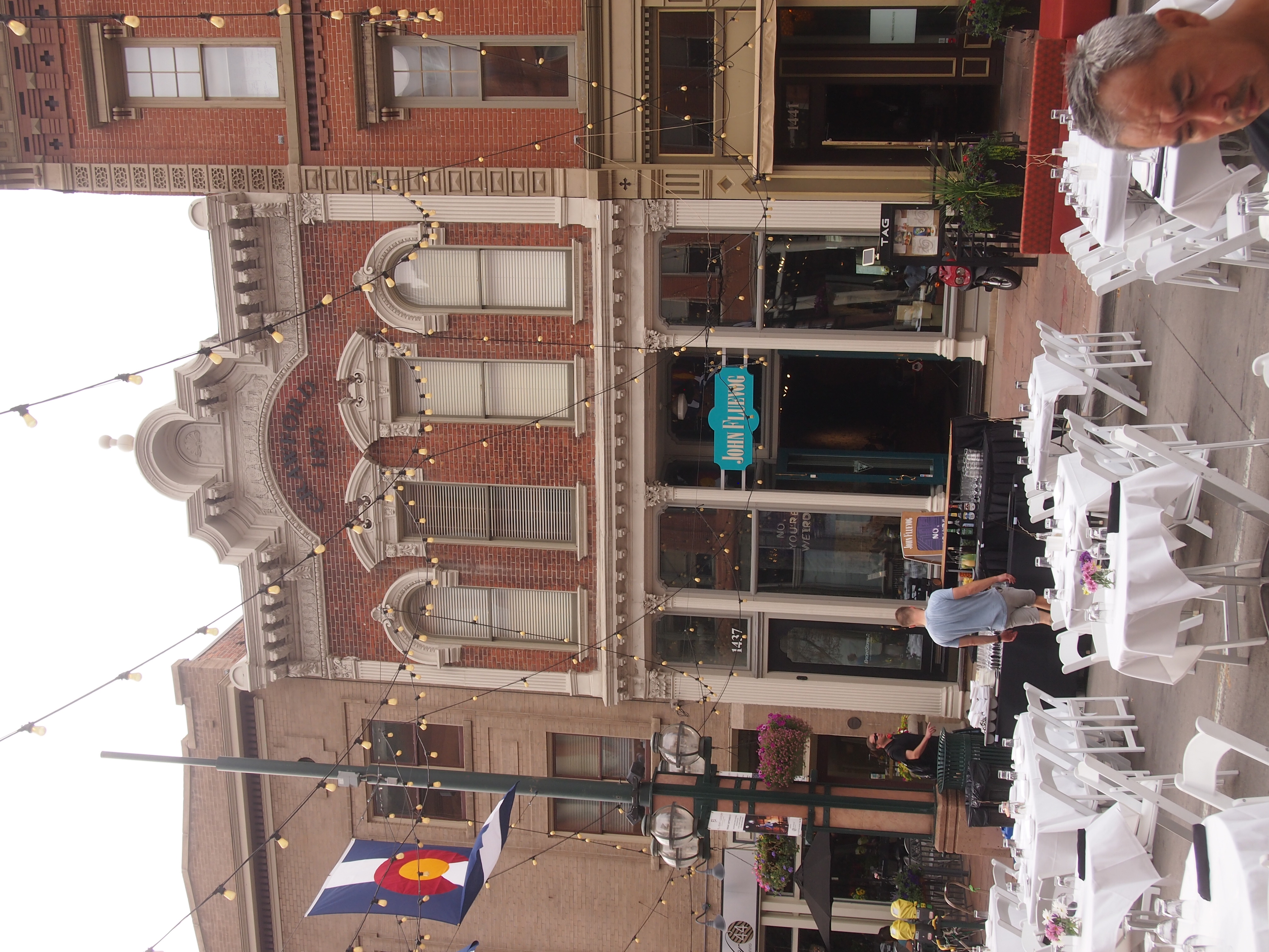
Larimer Square 2017Larimer Square 2017This stretch of Larimer St. is historic as it gets in Denver: the oldest commercial block in the city, laid out by land speculator and Denver City founder William Larimer Jr. in the late 1850s. He was also instrumental in establishing the Colorado Territory (until 1861, Denver City and environs were in the western part of the Kansas Territory).

For much of the 20th century, the neighborhood was a skid row, and by the mid-60s, that rapacious destroyer of interesting historic neighborhoods, Urban Renewal, threatened to raze the area. Fortunately the efforts of citizens, especially Dana Crawford, saved the block — and a lot more of old Denver. Crowford’s still at work.

In The Past and Future City: How Historic Preservation is Reviving America’s Communities (2016), Stephanie Meeks and Kevin C. Murphy write:

“True to the time, the original proposal to turn Larimer Square and its environs around, as conceived by the Denver Urban Renewal Authority, was a massive 117-acre project called Skyline that threatened to raze thirty blocks of the historic downtown. Dana Crawford had another vision for Larimer Square.

” ‘Downtown Denver was pretty much intact from its Victorian boom days and it reminded me a lot of Boston,’ said Crawford. So, even as Jane Jacobs was going toe-to-toe with Robert Moses for the future of Lower Manhattan, Crawford… with her friends and neighbors, began buying older buildings in the blighted area, often for little more than the price of the land they sat on.”

Much more effort followed, but that was the beginning of modern Larimer Square — a superb example of adaptive reuse of historic buildings, ongoing for five decades now, and currently owned by Larimer Associates, who carries on the revitalization.

Larimer Square 2017

Larimer Square 2017Larimer Square 2017I enjoyed just walking around, looking at the buildings. The fact that the street was about to be given over to an event added to the sensation.

The Old Gasconade River Bridge

On I-44 in south central Missouri, there’s a point at which you cross the Gasconade River, which rises in the Ozarks and ultimately flows to the Missouri River. It hardly seems like a bridge, so effortless is the crossing.

Transportation disaster enthusiasts, or maybe just train wreck buffs, know the Gasconade River as the site of the Gasconade Bridge Train Disaster of 1855. A train from St. Louis bound for Jefferson City broke the railroad bridge it was traveling across, precipitating the engine and some of the cars into the river, killing 31 and seriously injuring many others at a time when the state of medical science meant that you were pretty much on your own when it came to recovery.

The accident was nowhere near where I-44 crosses the river, but rather near the town of Gasconade in Gasconade County, between St. Louis and Jeff City. Hope there’s some kind of memorial to the event around there, but I can’t find any evidence of one.

A few years ago, Ramona Lehman, co-owner of the Munger Moss Motel, told me about the old bridge across the Gasconade, just south of the modern I-44 bridge, which is only about 10 miles from the motel. She even sells postcards depicting the bridge at the motel front desk, proceeds of which go toward preserving the bridge. I’ve bought a few over the years.

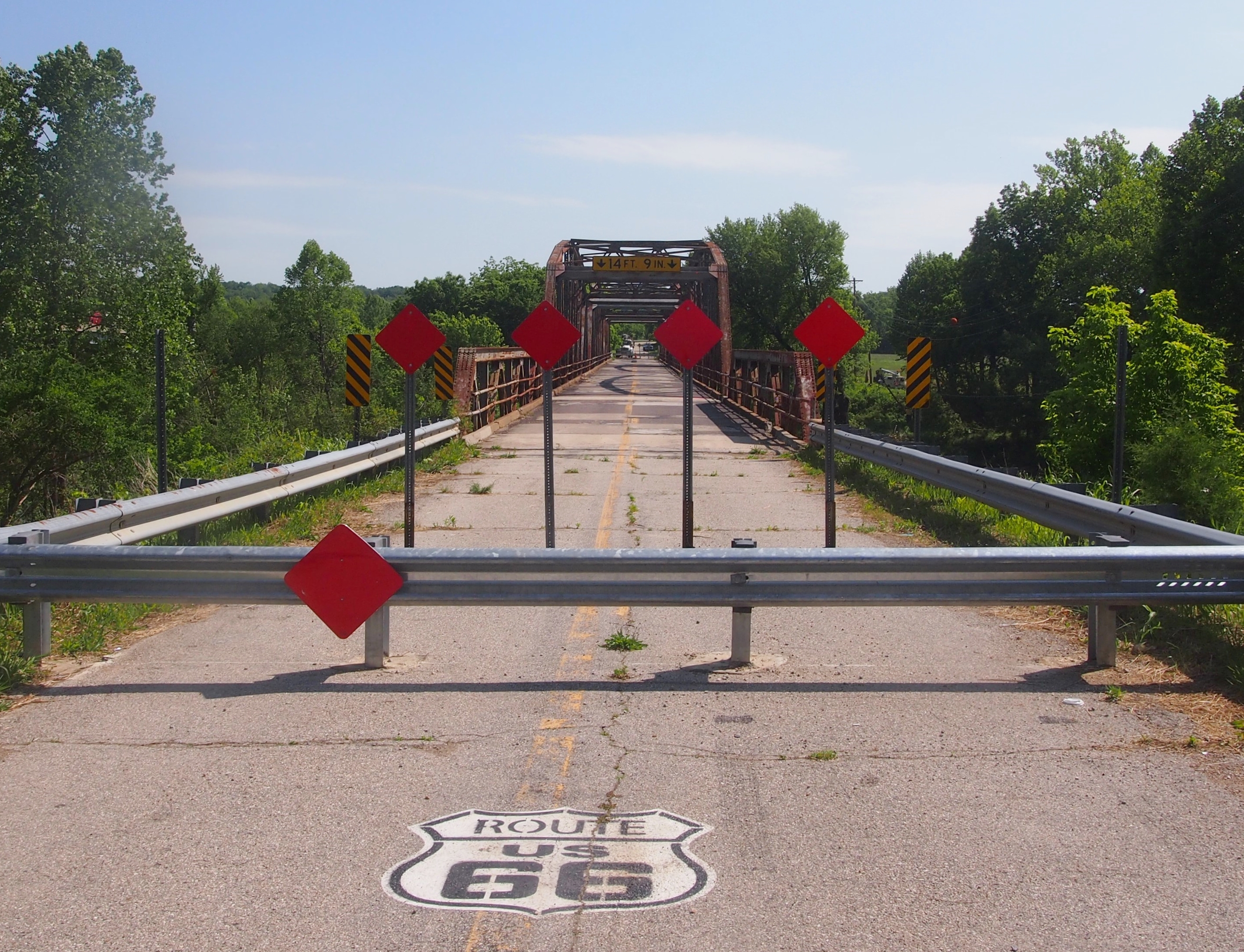
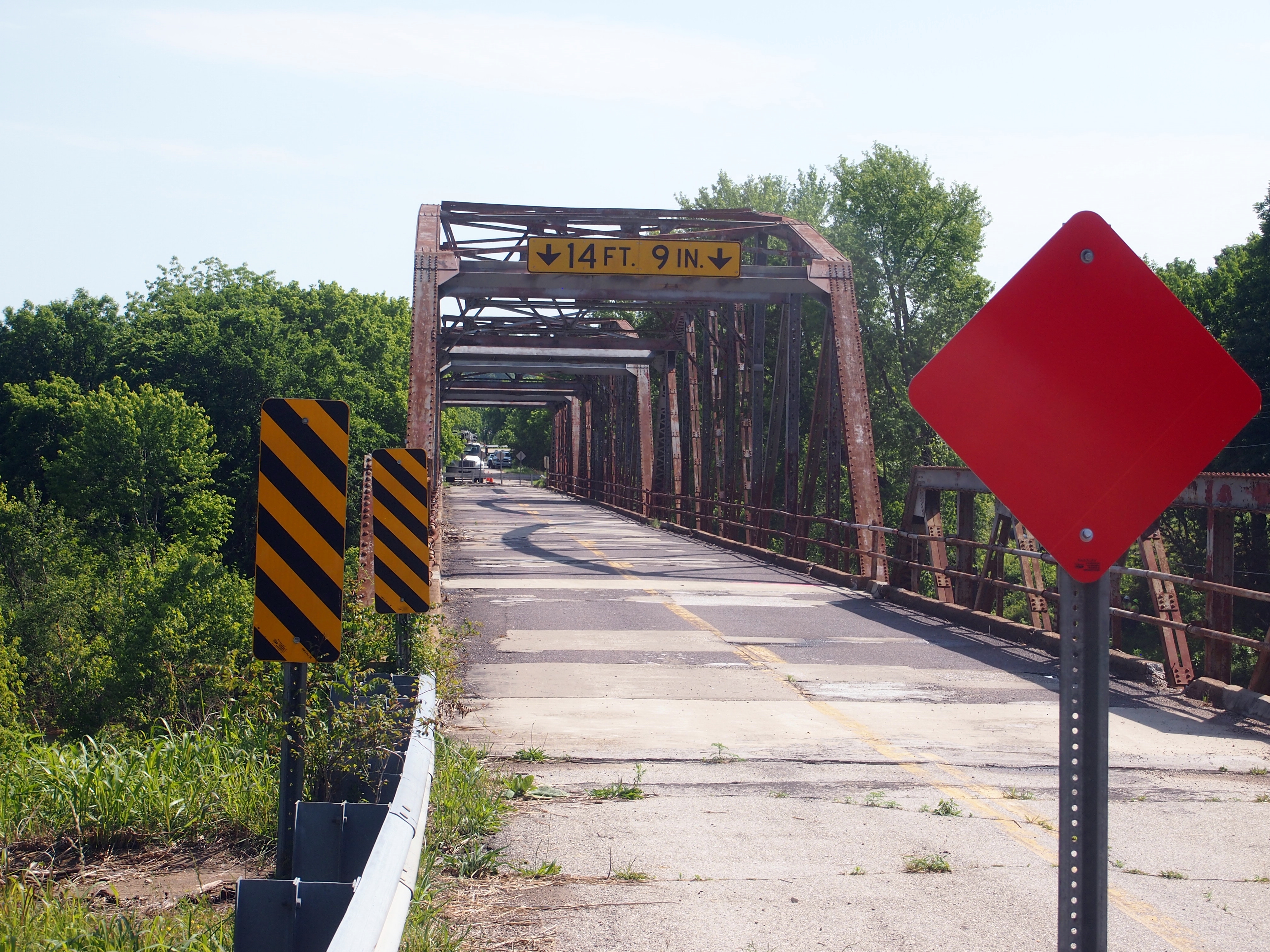
The old bridge dates from the 1920s, and carried U.S. 66 traffic across the river for many years. After that highway became nostalgia fodder, the bridge continued to carry local traffic for many more years.

In late 2014, the Missouri Department of Transportation closed the old bridge as unsafe. What with the new bridge and all, the department had probably opted for deferred maintenance on the old one for a long time. Get off the Interstate west of the old bridge, and take the access road — Historic 66, that is — and pretty soon you’ll find yourself at the inaccessible bridge, as we did late on the morning of May 26.

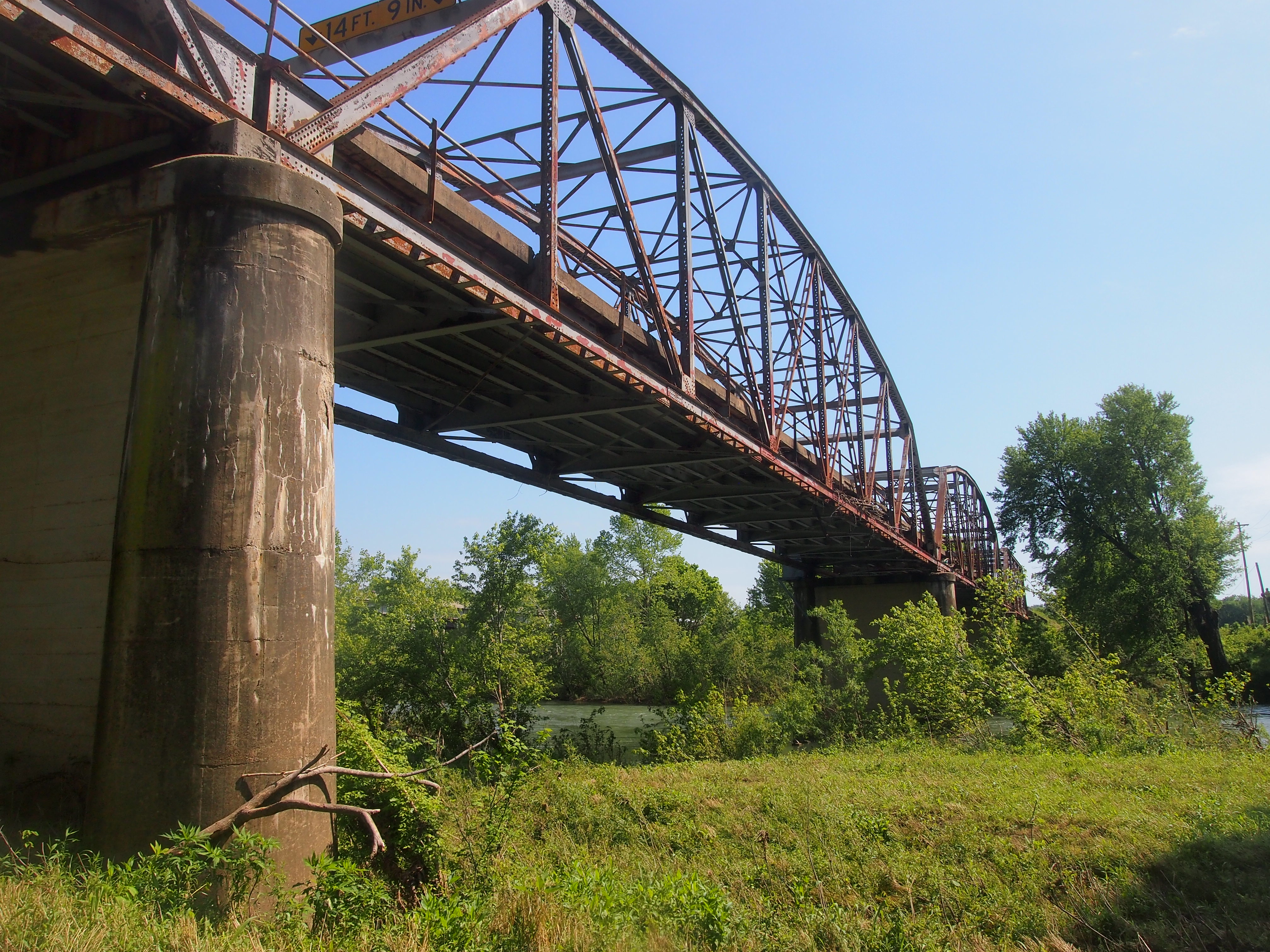
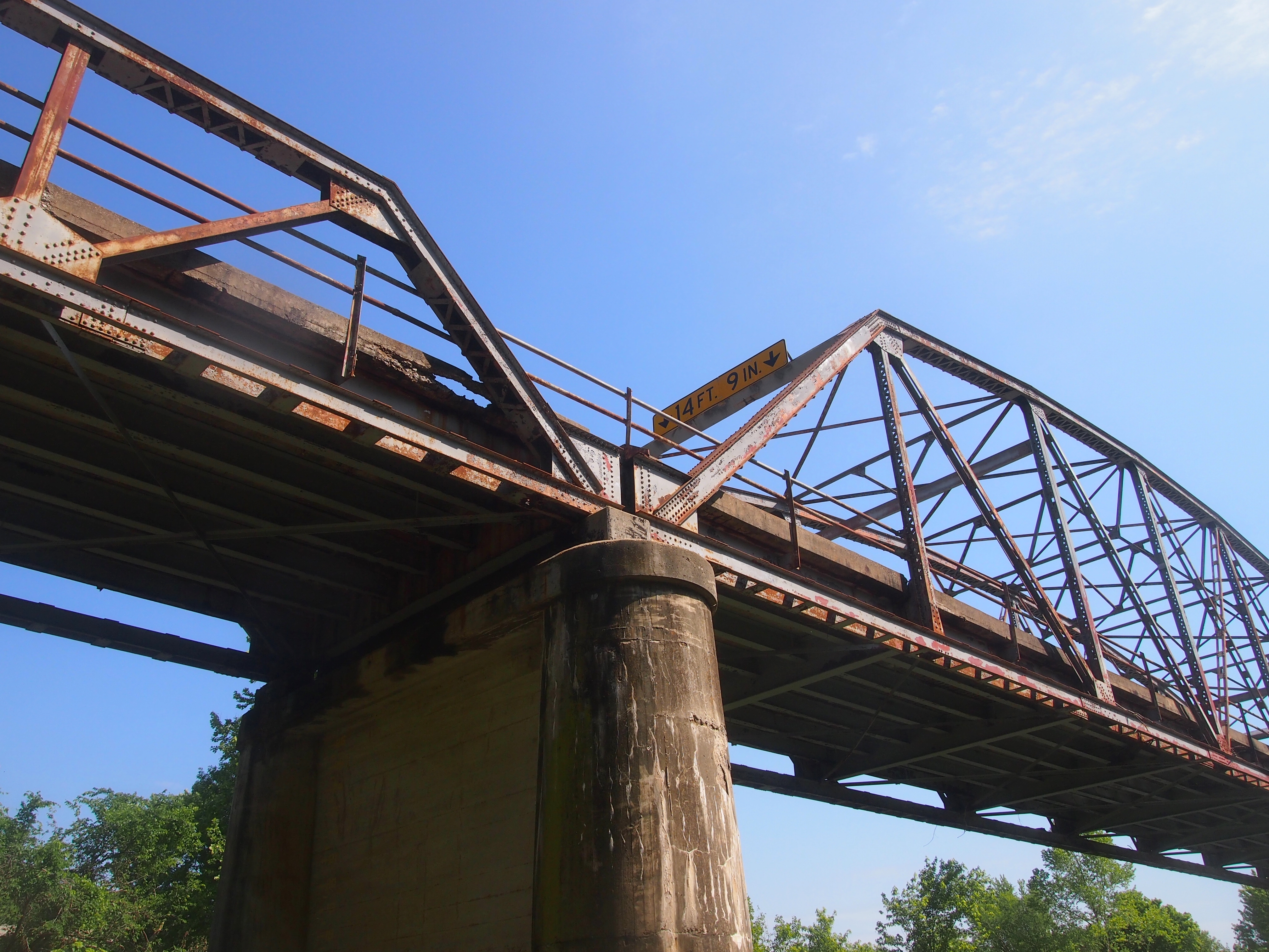
The Gasconade River Bridge, Route 66The Gasconade River Bridge, Route 66Not especially impressive from that vantage. The best way to look at the old bridge was from underneath. A patch of land near the river and under the bridge was surprisingly accessible.

The Gasconade River Bridge, Route 66

The Gasconade River Bridge, Route 66I was motivated to see the structure as more than a passing blur out of the corner of my eye. The next time I come this way, it might be gone. The good people who live near it want the bridge preserved, but it isn’t clear that’s going to happen. As usual, it comes down to money.

MoDOT recently issued a press release that included the following: “The majority of public comments stemming from a Dec. 14, 2016, public meeting held in Lebanon supported constructing a new bridge near I-44 and leaving the current facility, located on historic Route 66, intact. However, MoDOT has indicated all along that liability issues and limited funds would require the department to remove the bridge unless an outside entity stepped forward to take ownership of and maintain the bridge.

“The current bridge will remain in place as the agency works through the requirements of Section 106 of the National Historic Preservation Act. The act requires federal agencies and the recipients of federal funds, such as MoDOT, to consider the effects of projects on properties eligible for listing on the National Register of Historic Places, such as the Gasconade River Bridge.”

Thus the fate of the bridge is uncertain. That meant seeing the bridge was a carpe diem situation, so I did.

The DuPage Society of Model Engineers’ Labor of Love, in the Basement

In the basement of the DuPage County Historical Museum is something you don’t see in too many local museums. Or too many places, though the Museum of Science and Industry in Chicago has an enormous one: a model railroad display. The DuPage County model railroad isn’t as large as Science and Industry’s, but it’s plenty big enough: over 2,000 feet of HO track and train cars, and seemingly countless model buildings and vehicles and trees and people and animals, all visible at closer and further range behind a series of windows.

The DuPage Society of Model Engineers created the display 50 years ago as a clear labor of love, and it was ready for the public to see when the museum opened in 1967. I read that a model of this size and complexity isn’t ever really complete, so I imagine there have been a lot of changes over the years as enthusiasts come and go. Members of the society are on hand on the 3rd and 5th Saturdays of the month to oversee its operation, so we got to see three middle-aged gentlemen operating the display, including replacing one of the trains on the track when it derailed.

Supposedly the display highlights some of DuPage County’s railroads and landmarks, but it’s really a blend of actual places (such as the Adams Library) and more fanciful re-creations of the American landscape between about 1900 and 1950. Three HO scale trains were running, one freight train and two interurbans. One of the interurbans featured a sleek art deco engine and cars, something like the Pioneer Zephyr, though not quite the same (the actual Pioneer Zephyr, long since retired, is at Science and Industry).

“That an Amtrak train?” Yuriko asked.

“No, Amtrak doesn’t have that much style,” I answered.

We also saw, in no particular order, train yards, train sheds, a roundabout, water tanks, depots, stations, small factories, storage sheds, bridges, stores, houses, churches, cars, trucks, signs, horses, dogs, cats and tiny figures of people doing innumerable things: walking, riding bikes and motorcycles, working, playing, lying around, even hang gliding. There was a biker gang and a haunted house in the style of 1313 Mockingbird Ln. If I’d looked longer, I wouldn’t be surprised if there were hobos.

The detail was incredible. Beside many of the tracks were extra ties or random pieces of lumber. The coal yards seemed to sport little lumps of coal. Inside a sewing machine shop were two customers and a sewing machine with the minuscule letters SINGER on it. As I mentioned, most of the display evokes the first half of the 20th century, so horse and buggies were in one place, and chrome-heavy cars another. The billboard and window ads were mostly period as well. My own favorite: a sign for Carter’s Little Liver Pills.

America’s Best Train, Toy & Hobby Shop

As expected, today was frigid, near zero to begin with, and not much warmer as the day ground on. As the Monday holiday for the birthday of Martin Luther King Jr., it’s the sort of day on which school is closed and the mail doesn’t come, but otherwise there was work to be done.

There aren’t many stores like America’s Best Train, Toy & Hobby Shop in Itasca, Illinois, any more. It’s an independent hobby shop, largely but not completely devoted to model trains, with its merchandise stacked floor-almost-to-ceiling along a number of narrow aisles. Tight enough to put off the claustrophobic, no matter how much they like model trains or train toys. The store has new and used model train cars, track, and accessories of all kinds and in various scales, a room devoted to Thomas the Tank Engine toys, Playmobil, Chuggington Station — I’d never heard of that — Lego sets, plastic model kits, and a lot more.

The store has a Maplewood Drive address, but it’s visible from Irving Park Road. I’d driven by it countless times over the years, occasionally thinking, I should take a look. But I never did until Saturday. Lilly, Ann, and I had gone to a music store in Itasca to get some sheet music that Lilly needed, but the store didn’t have it. That was annoying, so I decided to make the best of it by visiting America’s Best Train, Toy & Hobby Shop, which happened to be across the street.

I like model trains — I had an HO scale model at one time, a fairly simple layout — but I was more taken with the shop’s stacks and stacks of plastic model kits. I built some of those as a lad, mostly airplanes, but also a Saturn V. (We also had a kit for the Mayflower than was entirely beyond my talents.) I didn’t spend a lot of time looking at America’s Best Train, Toy & Hobby Shop’s model kits, but my impression is that most were airplanes of one kind or another. I didn’t see an Apollo or Gemini or Mercury or even a Space Shuttle.

There were a few fictional spaceships, such as an original series Enterprise. No surprise there. A original series or remake Galactica would have been cool, but I didn’t see those. I did see an Eagle. As in the Space: 1999 spaceships. The kit looked like it dated from the 1970s and had never been opened, and the price was high. Can there be a collectors’ market for unbuilt models? That would be strange if so.

I asked the fellow behind the counter, who probably knows everything about model trains, whether the shop had any railroad postcards. He looked puzzled. For a moment, I might as well have said, “It’s crackers to slip a rozzer the dropsy in snide.” Guess no one had ever asked about that. Thinking on it, he then directed me to one of the aisles and said there might be some cards somewhere around there. One box tucked away on the aisle had a collection of unmarked black-and-white photos of trains — mid-20th century from the looks of them — and several more boxes contained old model RR hobbyist magazines.

But no postcards that I could find. I can’t fault the store for that; it’s too tangential. Even so, it was popular subject for postcards.

The High Line

As a public, linear park in Manhattan, and driver of real estate values in its vicinity, the High Line is so new that it didn’t exist in its current form the last time I was in town in the mid-2000s. It was a derelict elevated railroad line then, but the movement to make it a park was well under way, mostly the efforts of citizens inspired by the similar park in Paris with its suitable French name, Promenade Plantée. (There’s also a linear park in development in Chicago, the Bloomingdale Line, and other places; the idea is catching on.)

More about the effort to transform the old line into the High Line is here. I didn’t know, until I read about it, that construction of the original elevated rail line was done as a safety measure, approved in 1929. It replaced a previous ground-level rail line that had been chugging through the West Side of Manhattan for decades. Turns out that running a freight train at ground level through a crowded metropolis isn’t a very good idea. The train’s path was nicknamed Death Avenue.

On the afternoon of October 10, after visiting the September 11 Memorial and Museum, I was fairly tired, but still determined to walk at least some of the High Line. I made my way to the 14th St. entrance and as soon as I was up on the line, I got my second wind. Walking most of the route, to the 30th St. entrance, didn’t tire me further. I went as far as the work on the Hudson Yards Redevelopment project, which the brand-new section of the High Line curves around beginning at 30th, but it was getting dark by then, and I decided not to go any further. The High Line is best seen in the light, better yet in the twilight.

This is the view near the 14th St. entrance, looking north.

High Line, Oct 2014Note the amenities. A plank walkway, plantings on either side, and — sometimes most importantly — places to rest. Not a lot of backless benches, either, but wooden chairs with their backs at a permanently comfortable angle. Not so comfortable you’re likely to fall asleep, but a great place to rest. Sometimes I did. Just a little further north, the High Line passes through the Chelsea Market, where various food vendors are arrayed.

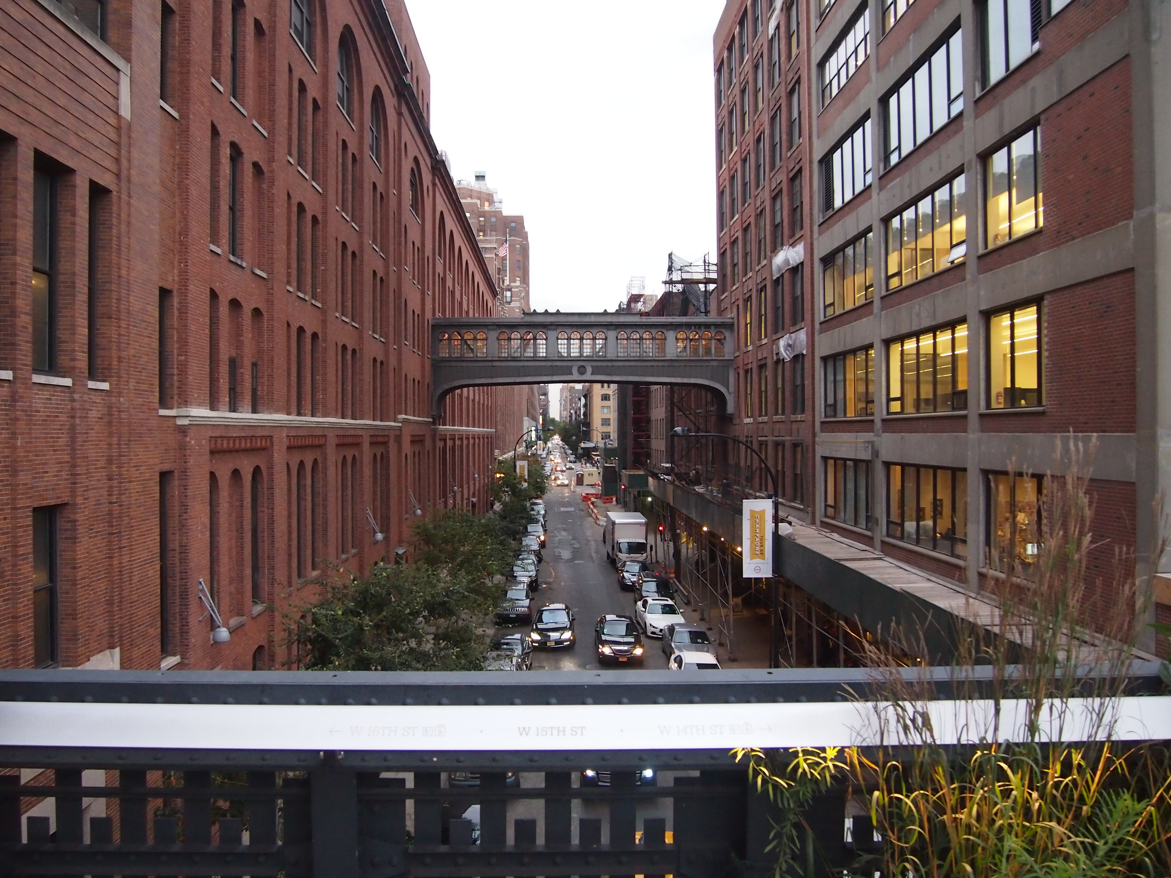
The line also offers some good views of the city below. This is 15th St., looking west.

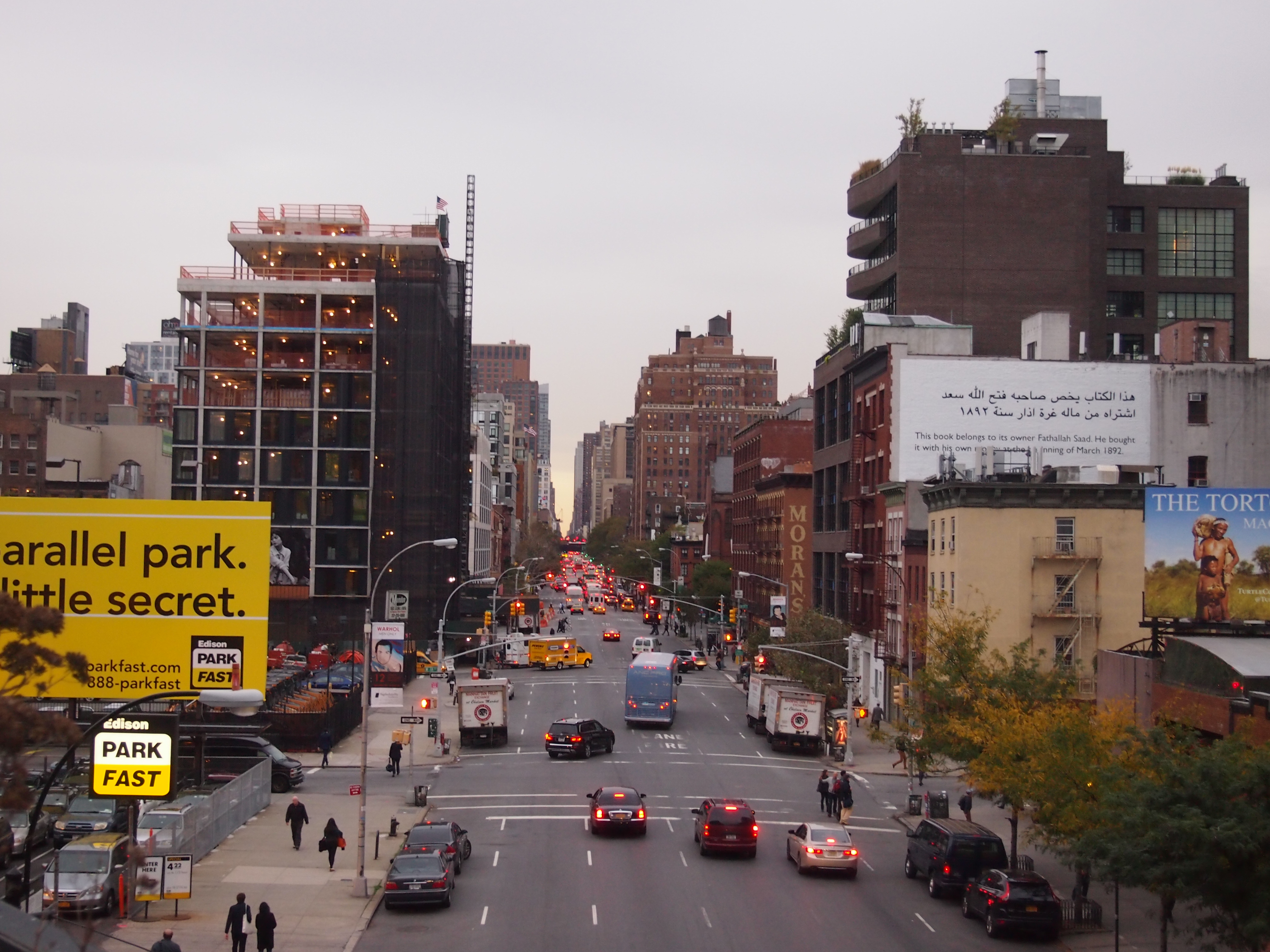
High Line, Oct 2014This is Tenth Ave., looking north.

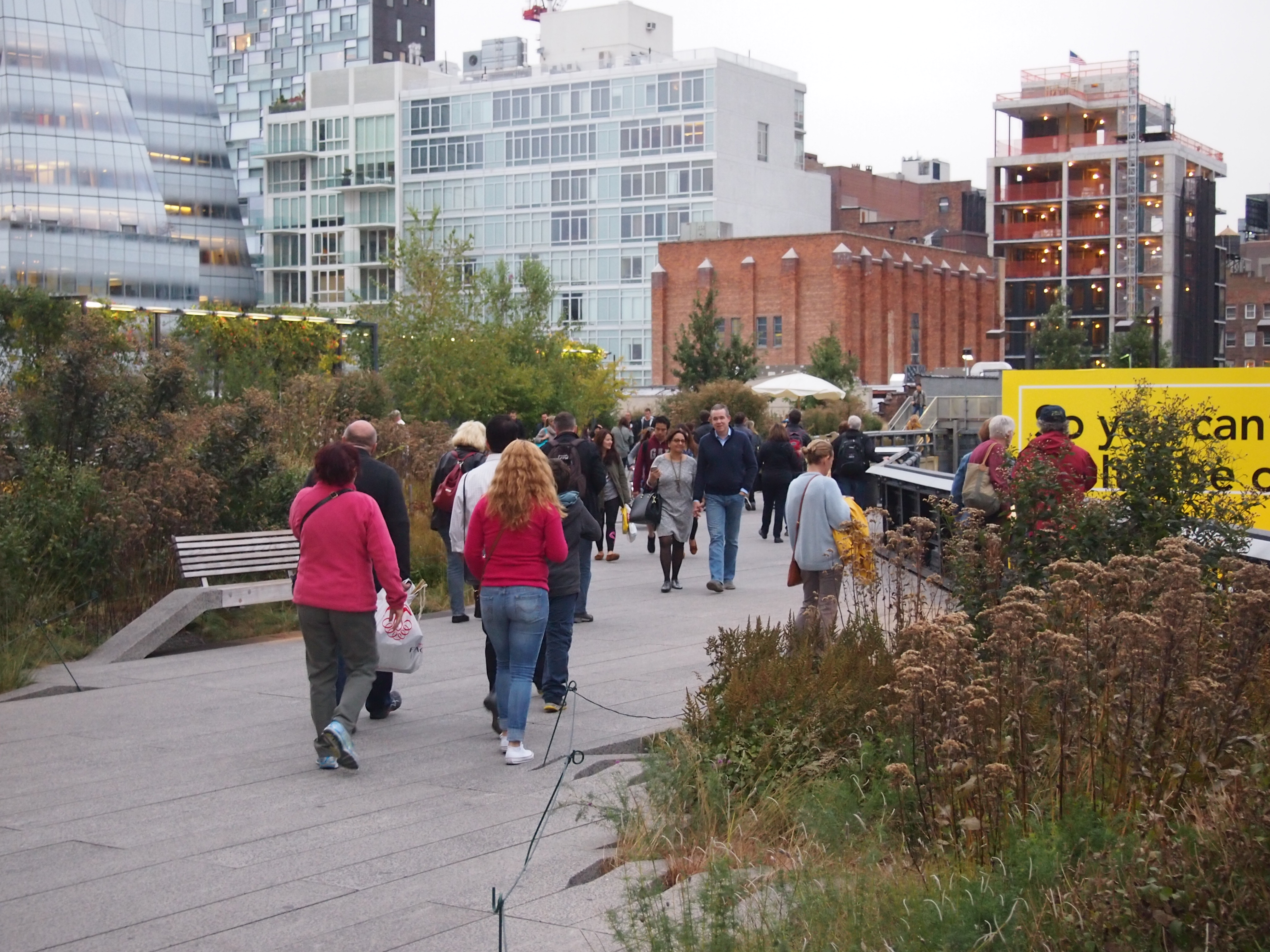
High Line, Oct 2014On a pleasant fall afternoon, the High Line is a popular place.

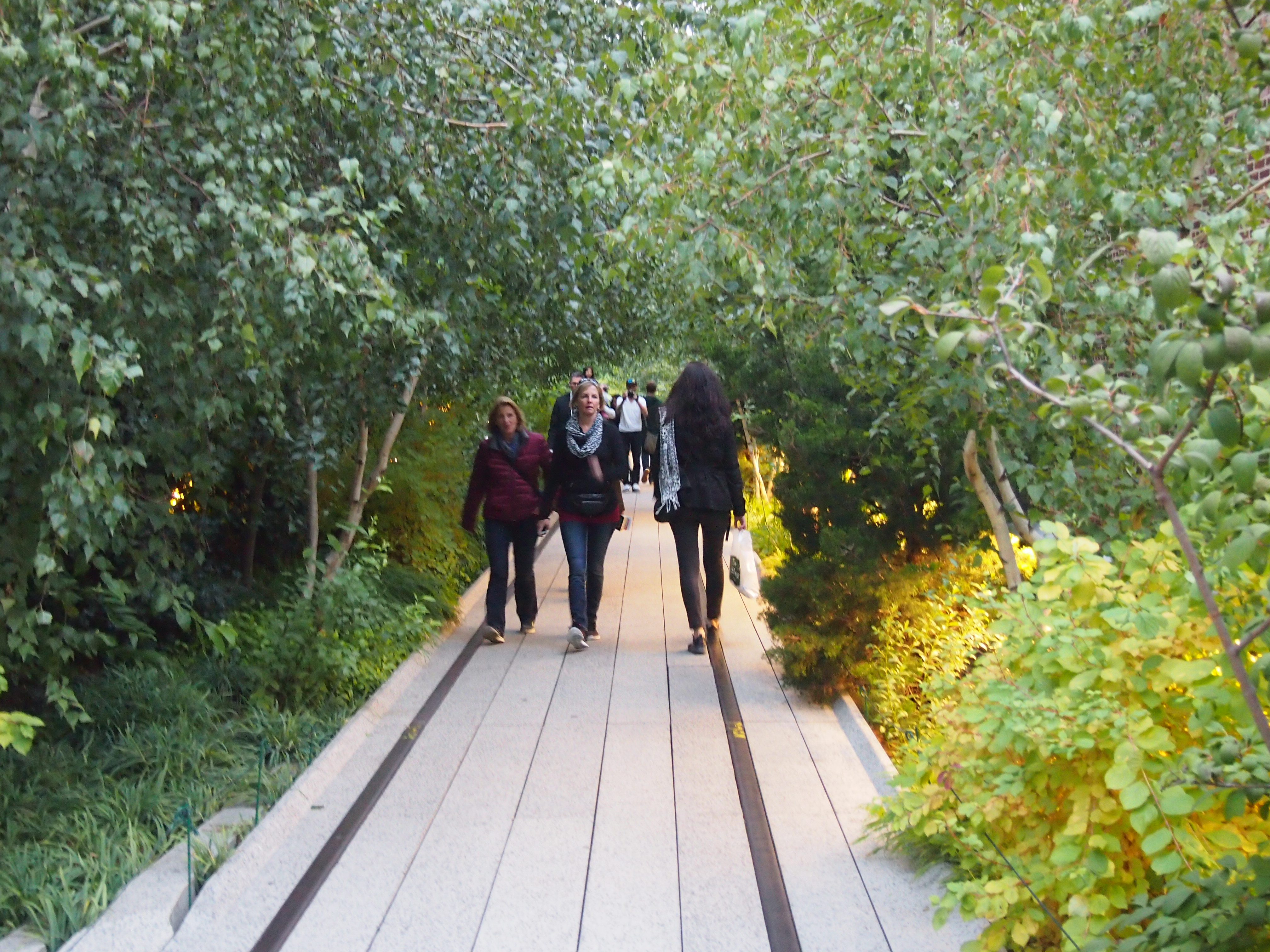
High Line, Oct 2014Further north, there’s even a green tunnel, at least during the warm months.

High Line, Oct 2014At this point, rail lines are embedded in the planks. Must be left over from when the train tracks ran this way. They appear at your feet fairly often, but not always. Sometimes they course through the plantings.

New buildings have sprouted along the line.

High Line, Oct 2014I was amused to see just how many advertisements for nearby buildings bragged about being near the High Line. Once upon a time, property owners in the area wanted the elevated tracks dismantled, never imaging that they’d drive value growth for nearby properties someday.